Halton Holegate

Civil Parish in Lincolnshire East Lindsey

England

Halton Holegate

St Andrew's Church, Main Road, Little Steeping Grade II* Listed parish church from mid 14th century with renovations and alterations in the 15th century, 1638 and 1701. Restored 19th and 20th century. The tower is 15th century, patched up with brick in the 18th century. It was built by the then priest Thomas de Redying between 1318 and 1353 and replaced an Anglo Saxon church reputedly under the supervision of Bishop Chad, who was later canonised. In 1606 Revd Stubbs was prosecuted by his parishioners when the roof and walls of the chancel collapsed. In 1635 the nave roof needed restoration and the new timbers used lasted well into the 20th century. The external nave wall has a datestone of 1638 thought to be the date of extensive restoration of the church, including use of red brick.  Almost in ruin, Revd Edward Steer became rector in 1859 and with the village carpenter carried out repairs. Then in 1912 his ideas, stored in the parish chest, were used for a complete renovation. It has 3 bells, 15th century by Robert Merston, by Henry Oldfield 1594 and by John Taylor 1874.
St Andrew's Church, Main Road, Little Steeping Credit: Jo and Steve Turner

Halton Holegate is a civil parish located in the county of Lincolnshire, England. Situated in the East Lindsey district, the parish covers an area of approximately 9 square kilometers and is home to a small population of around 500 inhabitants.

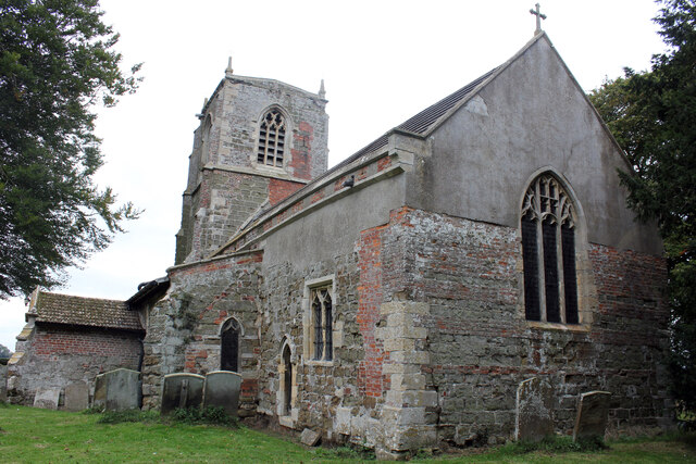
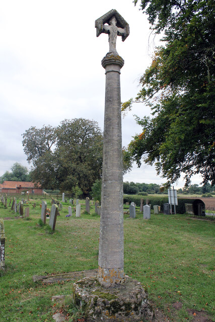
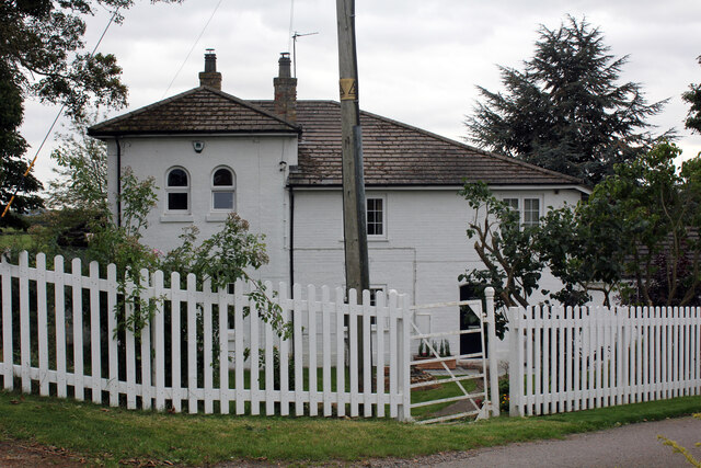
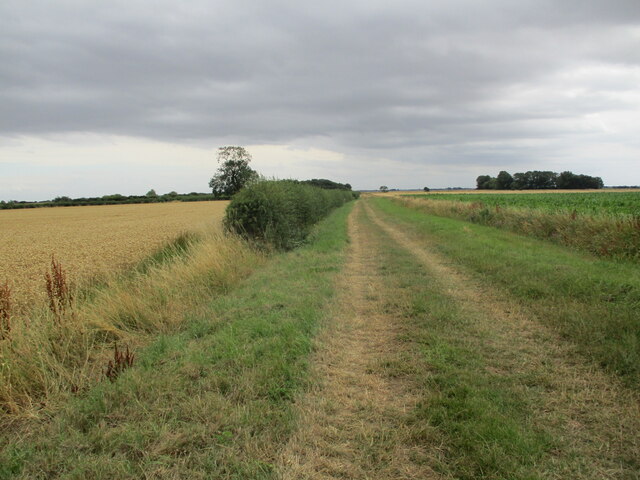
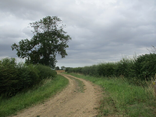
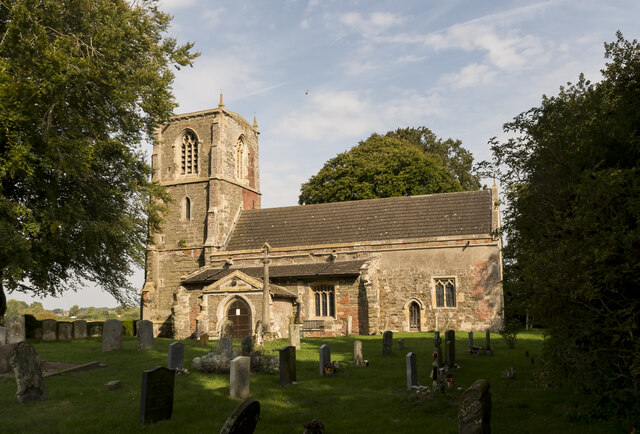
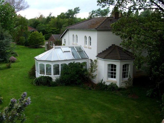
The village of Halton Holegate is the main settlement within the parish. It is a rural community characterized by its picturesque countryside, rolling hills, and open fields. The village itself has a charming and peaceful atmosphere, with a mix of traditional stone cottages and more modern residential properties.

The community is served by a few local amenities, including a village hall that hosts various social events and gatherings. There is also a small primary school, providing education for local children.

Agriculture plays a significant role in the local economy, with many residents involved in farming and related industries. The surrounding fields are often used for the cultivation of crops and rearing of livestock.

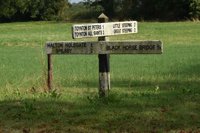
Halton Holegate is well-connected to nearby towns and villages via road networks, making it easily accessible for commuters and visitors alike. It is located approximately 7 miles south of the market town of Spilsby and around 10 miles north of the coastal town of Skegness.

Overall, Halton Holegate offers a peaceful and idyllic setting for those seeking a rural lifestyle, with its beautiful countryside, close-knit community, and convenient location within Lincolnshire.

If you have any feedback on the listing, please let us know in the comments section below.

Halton Holegate Images

Images are sourced within 2km of 53.151614/0.121733 or Grid Reference TF4163. Thanks to Geograph Open Source API. All images are credited.

St Andrew's Church, Main Road, Little Steeping Grade II* Listed parish church from mid 14th century with renovations and alterations in the 15th century, 1638 and 1701. Restored 19th and 20th century. The tower is 15th century, patched up with brick in the 18th century. It was built by the then priest Thomas de Redying between 1318 and 1353 and replaced an Anglo Saxon church reputedly under the supervision of Bishop Chad, who was later canonised. In 1606 Revd Stubbs was prosecuted by his parishioners when the roof and walls of the chancel collapsed. In 1635 the nave roof needed restoration and the new timbers used lasted well into the 20th century. The external nave wall has a datestone of 1638 thought to be the date of extensive restoration of the church, including use of red brick.  Almost in ruin, Revd Edward Steer became rector in 1859 and with the village carpenter carried out repairs. Then in 1912 his ideas, stored in the parish chest, were used for a complete renovation. It has 3 bells, 15th century by Robert Merston, by Henry Oldfield 1594 and by John Taylor 1874.
St Andrew's Church, Main Road, Little Steeping
Grade II* Listed parish church from mid 14th century with renovations and alterations in the 15th century, 1638 and 1701. Restored 19th and 20th century. The tower is 15th century, patched up with brick in the 18th century. It was built by the then priest Thomas de Redying between 1318 and 1353 and replaced an Anglo Saxon church reputedly under the supervision of Bishop Chad, who was later canonised. In 1606 Revd Stubbs was prosecuted by his parishioners when the roof and walls of the chancel collapsed. In 1635 the nave roof needed restoration and the new timbers used lasted well into the 20th century. The external nave wall has a datestone of 1638 thought to be the date of extensive restoration of the church, including use of red brick. Almost in ruin, Revd Edward Steer became rector in 1859 and with the village carpenter carried out repairs. Then in 1912 his ideas, stored in the parish chest, were used for a complete renovation. It has 3 bells, 15th century by Robert Merston, by Henry Oldfield 1594 and by John Taylor 1874.
Cross, St Andrew's Church, Main Road, Little Steeping Grade II Listed and Scheduled Monument. The 3.8m high cross is medieval in origin with the upper part dating from a late 19th or early 20th century restoration but with a medieval moulded knop of the Virgin and a Saint. The listing dates it to the 15th century.
Cross, St Andrew's Church, Main Road, Little Steeping
Grade II Listed and Scheduled Monument. The 3.8m high cross is medieval in origin with the upper part dating from a late 19th or early 20th century restoration but with a medieval moulded knop of the Virgin and a Saint. The listing dates it to the 15th century.
The Old Rectory, Northorpe Road, Halton Holegate Grade II Listed former rectory. Early 18th century altered in the early and mid 19th century. A large house with 4 reception rooms and ballroom. Above 4 or 5 bedrooms and 5 attic rooms.
The Old Rectory, Northorpe Road, Halton Holegate
Grade II Listed former rectory. Early 18th century altered in the early and mid 19th century. A large house with 4 reception rooms and ballroom. Above 4 or 5 bedrooms and 5 attic rooms.
St Andrew's Church, Firsby Road, Halton Holegate Grade II* Listed Parish church dating back to the 14th and 15th centuries. A church is mentioned in the Domesday Book 1080-1086 but the present church was built in the late 14th century. The porch was rebuilt in 1831 by Colonel Maddison of Partney Hall. Following damage in a bad storm in 1846 it was considerably rebuilt and improved under the direction of Rector Thomas Hardwicke Rawnsley. His son Drummond carried out further restoration and the tower was rebuilt 1866 by J. Fowler described in contemporary reports as 'Part of the tower was taken down and rebuilt with enlarged buttresses from designs by Mr. Street. Old tower was higher than the present one'. The crenellations were probably added at this time, not being shown in a 1790 sketch. Rev Thomas W Sale commissioned the rebuilding of the Chantry chapel, now the vestry, in 1894-5. It has a Sanctus and 6 other bells. Sanctus plus three 1717 by Henry Penn, one 1791 by Thomas Osborn, two 1867 by John Taylor & Co. Pictures show National Lottery funded restoration in 2015 and in December 2020 £25k was awarded for essential repairs from the government’s £1.57 billion COVID-19 Culture Recovery Fund. A wooden bridge over the road from the rectory to the then rectory vegetable garden and the church existed from the 1860s until the 1950s when it fell into disrepair and was demolished.
St Andrew's Church, Firsby Road, Halton Holegate
Grade II* Listed Parish church dating back to the 14th and 15th centuries. A church is mentioned in the Domesday Book 1080-1086 but the present church was built in the late 14th century. The porch was rebuilt in 1831 by Colonel Maddison of Partney Hall. Following damage in a bad storm in 1846 it was considerably rebuilt and improved under the direction of Rector Thomas Hardwicke Rawnsley. His son Drummond carried out further restoration and the tower was rebuilt 1866 by J. Fowler described in contemporary reports as 'Part of the tower was taken down and rebuilt with enlarged buttresses from designs by Mr. Street. Old tower was higher than the present one'. The crenellations were probably added at this time, not being shown in a 1790 sketch. Rev Thomas W Sale commissioned the rebuilding of the Chantry chapel, now the vestry, in 1894-5. It has a Sanctus and 6 other bells. Sanctus plus three 1717 by Henry Penn, one 1791 by Thomas Osborn, two 1867 by John Taylor & Co. Pictures show National Lottery funded restoration in 2015 and in December 2020 £25k was awarded for essential repairs from the government’s £1.57 billion COVID-19 Culture Recovery Fund. A wooden bridge over the road from the rectory to the then rectory vegetable garden and the church existed from the 1860s until the 1950s when it fell into disrepair and was demolished.
Former station buildings, 60 Station Road, Halton Holegate Spilsby & Firsby Railway Company obtained parliamentary permission in 1865 and consequently opened a four mile branch line to Spilsby on 1st May 1868. Halton Holegate was the only intermediate station on the short branch line and never generated much revenue. Operated by them, Great Northern Railway bought out the Spilsby & Firsby Railway Company and ran it from 1st January 1891. The station had a station master's residence, a booking office, a small waiting room, single platform, a loop line with cattle pen and goods shed. Passenger services were suspended for WWII on 10th September 1939 and never resumed but goods continued and finally stopped on 30th November 1958 because the bridge over Steeping River needed a £20k replacement. The Station building was extended and is now a 3 reception 5 bedroom, 2,319 sq ft (216 sq m) home. The goods shed is now 521 sq ft (48 sq m) stables and tack room.
Former station buildings, 60 Station Road, Halton Holegate
Spilsby & Firsby Railway Company obtained parliamentary permission in 1865 and consequently opened a four mile branch line to Spilsby on 1st May 1868. Halton Holegate was the only intermediate station on the short branch line and never generated much revenue. Operated by them, Great Northern Railway bought out the Spilsby & Firsby Railway Company and ran it from 1st January 1891. The station had a station master's residence, a booking office, a small waiting room, single platform, a loop line with cattle pen and goods shed. Passenger services were suspended for WWII on 10th September 1939 and never resumed but goods continued and finally stopped on 30th November 1958 because the bridge over Steeping River needed a £20k replacement. The Station building was extended and is now a 3 reception 5 bedroom, 2,319 sq ft (216 sq m) home. The goods shed is now 521 sq ft (48 sq m) stables and tack room.
Direction Sign – Signpost north of Halton Fenside Located north of Halton Fenside on the northeast side of the crossroads of Fen Road, Toynton Lane, Steeping Road and Halton Fenside, Halton Holgate parish. 4 arms and no finial.

Milestone Society National ID: LI_TF4263
Direction Sign – Signpost north of Halton Fenside
Located north of Halton Fenside on the northeast side of the crossroads of Fen Road, Toynton Lane, Steeping Road and Halton Fenside, Halton Holgate parish. 4 arms and no finial. Milestone Society National ID: LI_TF4263
Grass field at Halton Holegate
Peasgate Lane A bridleway to Halton Holegate.
Peasgate Lane
A bridleway to Halton Holegate.
Earthworks at Toynton St Peter: aerial (1) See: <span class="nowrap"><a title="https://www.heritagegateway.org.uk/Gateway/Results_Single.aspx?uid=MLI85877&resourceID=1006" rel="nofollow ugc noopener" href="https://www.heritagegateway.org.uk/Gateway/Results_Single.aspx?uid=MLI85877&resourceID=1006">Link</a><img style="margin-left:2px;" alt="External link" title="External link - shift click to open in new window" src="https://s1.geograph.org.uk/img/external.png" width="10" height="10"/></span>
Earthworks at Toynton St Peter: aerial (1)
See: LinkExternal link
Earthworks at Toynton St Peter: aerial (2) See: <span class="nowrap"><a title="https://www.heritagegateway.org.uk/Gateway/Results_Single.aspx?uid=MLI85877&resourceID=1006" rel="nofollow ugc noopener" href="https://www.heritagegateway.org.uk/Gateway/Results_Single.aspx?uid=MLI85877&resourceID=1006">Link</a><img style="margin-left:2px;" alt="External link" title="External link - shift click to open in new window" src="https://s1.geograph.org.uk/img/external.png" width="10" height="10"/></span>
Earthworks at Toynton St Peter: aerial (2)
See: LinkExternal link
Earthworks at Toynton St Peter: aerial (3) See: <span class="nowrap"><a title="https://www.heritagegateway.org.uk/Gateway/Results_Single.aspx?uid=MLI85877&resourceID=1006" rel="nofollow ugc noopener" href="https://www.heritagegateway.org.uk/Gateway/Results_Single.aspx?uid=MLI85877&resourceID=1006">Link</a><img style="margin-left:2px;" alt="External link" title="External link - shift click to open in new window" src="https://s1.geograph.org.uk/img/external.png" width="10" height="10"/></span>
Earthworks at Toynton St Peter: aerial (3)
See: LinkExternal link
St Peter's church, Toynton, from the east Largely a rebuilding of 1876 <span class="nowrap"><a title="https://historicengland.org.uk/listing/the-list/list-entry/1146781?section=official-list-entry" rel="nofollow ugc noopener" href="https://historicengland.org.uk/listing/the-list/list-entry/1146781?section=official-list-entry">Link</a><img style="margin-left:2px;" alt="External link" title="External link - shift click to open in new window" src="https://s1.geograph.org.uk/img/external.png" width="10" height="10"/></span>
St Peter's church, Toynton, from the east
Largely a rebuilding of 1876 LinkExternal link
Farm track and footpath near Halton Fenside
Ings Drove, Halton Fenside
Longland's Field, Halton Holgate
St Andrew's church, Little Steeping Southern aspect.
St Andrew's church, Little Steeping
Southern aspect.
Interior, St Andrew's church, Little Steeping Looking east along the nave. There is no chancel arch.
Interior, St Andrew's church, Little Steeping
Looking east along the nave. There is no chancel arch.
Show me another place!

Halton Holegate is located at Grid Ref: TF4163 (Lat: 53.151614, Lng: 0.121733)

Administrative County: Lincolnshire

District: East Lindsey

Police Authority: Lincolnshire

What 3 Words

///croaking.offerings.artichoke. Near Spilsby, Lincolnshire

Nearby Locations

Halton Holegate

Related Wikis

Halton Holegate railway station

Halton Holegate Railway Station is a former station in Halton Holegate, Lincolnshire. It was on a short branch from Firsby to Spilsby. == History of... ==

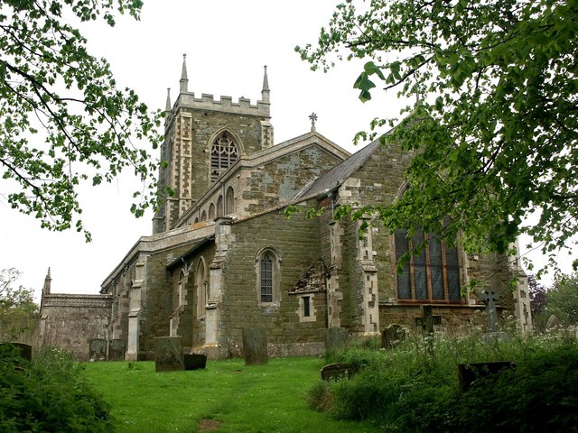
Old All Saints Church, Great Steeping

Old All Saints Church is a redundant Anglican church in the village of Great Steeping, Lincolnshire, England. It is recorded in the National Heritage...

Toynton St Peter

Toynton St Peter is a village and civil parish in the East Lindsey district of Lincolnshire, England, approximately 2 miles (3 km) south from the town...

Halton Holegate

Halton Holegate is a small village in the East Lindsey district of Lincolnshire, England. It is situated 1 mile (1.6 km) east from Spilsby. The village...

Little Steeping

Little Steeping is a village and civil parish in the East Lindsey district of Lincolnshire, England, about 3 miles (5 km) south-east from the town of Spilsby...

Great Steeping

Great Steeping is a village and civil parish in the East Lindsey district of Lincolnshire, England. It is situated approximately 3 miles (5 km) from Spilsby...

Spilsby Rural District

Spilsby was a rural district in Lincolnshire, parts of Lindsey from 1894 to 1974. It was created by the Local Government Act 1894 from the Spilsby rural...

Spilsby railway station

Spilsby railway station was a railway station in the market town of Spilsby, Lincolnshire, England. The station stood on a four mile long branch line between...

Nearby Amenities

Located within 500m of 53.151614,0.121733
Halton Fenside
Is In: Lincolnshire, England, UK
Place: hamlet
Source: NPE
Lat/Long: 53.148148/0.1245704
Bus Stop
Washdike Lane
Bus: yes
Naptan AtcoCode: 270000009437
Naptan Bearing: NW
Naptan CommonName: Washdike Lane
Naptan Indicator: adj
Naptan Landmark: Washdike Lane
Naptan NaptanCode: linjawgm
Naptan Street: Fen Road
Naptan Verified: no
Public Transport: platform
Source: naptan_import
Lat/Long: 53.1558422/0.1196218
Bus Stop
Washdike Lane
Bus: yes
Naptan AtcoCode: 270000009438
Naptan Bearing: SE
Naptan CommonName: Washdike Lane
Naptan Indicator: opp
Naptan Landmark: Washdike Lane
Naptan NaptanCode: linjawgp
Naptan Street: Fen Road
Naptan Verified: no
Public Transport: platform
Source: naptan_import
Lat/Long: 53.1558572/0.1197871
Bus Stop
Toynton Lane Crossroads
Bus: yes
Naptan AtcoCode: 270002701016
Naptan Bearing: E
Naptan CommonName: Toynton Lane Crossroads
Naptan Indicator: adj
Naptan Landmark: Crossroads
Naptan Street: Toynton Lane
Naptan Verified: no
Public Transport: platform
Source: naptan_import
Lat/Long: 53.1504033/0.1226142
Bus Stop
Fenside
Bus: yes
Naptan AtcoCode: 2700LHFC1184
Naptan Bearing: S
Naptan CommonName: Fenside
Naptan Indicator: adj
Naptan Landmark: Toynton Lane Crossroads
Naptan NaptanCode: linajdwt
Naptan Street: Fenside
Naptan Verified: no
Public Transport: platform
Source: naptan_import
Lat/Long: 53.1501363/0.1234684
Cootes Farm
Place: farm
Source: Bing
Lat/Long: 53.1531352/0.1209265
The Grange
Place: farm
Source: Bing
Lat/Long: 53.1549513/0.120513
The Poplars
Place: isolated_dwelling
Source: Bing
Lat/Long: 53.1504458/0.1192883
The data included in this document is from www.openstreetmap.org. The data is made available under ODbL.

Have you been to Halton Holegate?

Leave your review of Halton Holegate below (or comments, questions and feedback).