Halton Gill

Civil Parish in Yorkshire Craven

England

Halton Gill

Dawson Close Ford This ford on Dawson Close, featuring Ian the dog, is taken looking towards Pen-Y-Ghent. A video of the ford can be viewed at:
<span class="nowrap"><a title="https://youtu.be/2ERVqz7uY5Q" rel="nofollow ugc noopener" href="https://youtu.be/2ERVqz7uY5Q">Link</a><img style="margin-left:2px;" alt="External link" title="External link - shift click to open in new window" src="https://s1.geograph.org.uk/img/external.png" width="10" height="10"/></span>
Dawson Close Ford Credit: John Walton

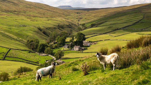
Halton Gill is a small village located in the Craven district of North Yorkshire, England. It is part of the civil parish of Littondale, which is situated in the heart of the Yorkshire Dales National Park. The village is nestled in a valley and surrounded by stunning natural beauty, making it a popular destination for tourists and outdoor enthusiasts.

The village itself consists of a cluster of traditional stone-built houses and farms, giving it a quintessential Yorkshire charm. There is a small primary school, a community hall, and a church, which serves as a focal point for the local community. The nearest town is Skipton, which is approximately 20 miles away.

Halton Gill is renowned for its picturesque countryside and offers visitors a range of outdoor activities. The area is crisscrossed with walking trails, including the famous Pennine Way, which passes through the village. Hiking, cycling, and horseback riding are popular pursuits, allowing visitors to explore the rolling hills, moors, and rivers that characterise the Yorkshire Dales.

In addition to its natural beauty, Halton Gill is also known for its rich history. The village has a strong farming heritage, with agriculture playing a significant role in the local economy. The surrounding area is dotted with ancient monuments and historic sites, providing insight into the region's past.

Overall, Halton Gill is a charming village that offers a peaceful retreat in the heart of the Yorkshire Dales. Its stunning landscapes, outdoor activities, and historical significance make it a must-visit destination for nature lovers and history buffs alike.

If you have any feedback on the listing, please let us know in the comments section below.

Halton Gill Images

Images are sourced within 2km of 54.1748/-2.213217 or Grid Reference SD8675. Thanks to Geograph Open Source API. All images are credited.

Dawson Close Ford This ford on Dawson Close, featuring Ian the dog, is taken looking towards Pen-Y-Ghent. A video of the ford can be viewed at:
<span class="nowrap"><a title="https://youtu.be/2ERVqz7uY5Q" rel="nofollow ugc noopener" href="https://youtu.be/2ERVqz7uY5Q">Link</a><img style="margin-left:2px;" alt="External link" title="External link - shift click to open in new window" src="https://s1.geograph.org.uk/img/external.png" width="10" height="10"/></span>
Dawson Close Ford
This ford on Dawson Close, featuring Ian the dog, is taken looking towards Pen-Y-Ghent. A video of the ford can be viewed at: LinkExternal link
Halton Gill Sheep alongside the River Skirfare seen from Halton Gill Bridge.
Halton Gill
Sheep alongside the River Skirfare seen from Halton Gill Bridge.
Halton Gill Farmer at work above Halton Gill
Halton Gill
Farmer at work above Halton Gill
Pen-y-ghent House Road alongside Pen-y-ghent House.
Pen-y-ghent House
Road alongside Pen-y-ghent House.
Upper Hesledon
Upper Hesledon
Foxup The farm and houses at Foxup with the valley of Foxup Beck cutting through Foxup Moor in the background.  In the far distance, over the horizon, is the distinctive outline of Ingleborough.
Foxup
The farm and houses at Foxup with the valley of Foxup Beck cutting through Foxup Moor in the background. In the far distance, over the horizon, is the distinctive outline of Ingleborough.
Hesleden Burge Sheep sitting in amongst the limestone.
Hesleden Burge
Sheep sitting in amongst the limestone.
Dawson Close View looking across Pen-y-ghent Gill to Dawson Close.
Dawson Close
View looking across Pen-y-ghent Gill to Dawson Close.
Cow Close Small gill, a contributory to Hesleden Gill at Cow Close.
Cow Close
Small gill, a contributory to Hesleden Gill at Cow Close.
Pen-y-ghent House Pen-y-ghent House Farm, set down in the valley of Pen-y-ghent Gill..
Pen-y-ghent House
Pen-y-ghent House Farm, set down in the valley of Pen-y-ghent Gill..
Pen-y-ghent House Farm
Pen-y-ghent Gill from road west of Upper Hesleden
Road east of Upper Hesleden
Slope south of Pen-y-ghent Gill
Steep hill above Halton Gill
Littondale from road south of Hesleden Bergh
Halton Gill Bridge
Halton Gill Bridge
Flight over Littondale The upper part of Littondale near Halton Gill, visible on the right of the picture. In the centre of the picture, virtually on the same level as the camera, is an RAF trainer aircraft with black and yellow wings just starting the turn to the left to continue up Littondale and over Foxup, not visible from here. Note the aircraft shadow on the hillside on this gloriously sunny day.
Flight over Littondale
The upper part of Littondale near Halton Gill, visible on the right of the picture. In the centre of the picture, virtually on the same level as the camera, is an RAF trainer aircraft with black and yellow wings just starting the turn to the left to continue up Littondale and over Foxup, not visible from here. Note the aircraft shadow on the hillside on this gloriously sunny day.
Show me another place!

Halton Gill is located at Grid Ref: SD8675 (Lat: 54.1748, Lng: -2.213217)

Division: West Riding

Administrative County: North Yorkshire

District: Craven

Police Authority: North Yorkshire

What 3 Words

///custodian.replaces.vitals. Near Settle, North Yorkshire

Nearby Locations

Bergh Moss Halton Gill

Related Wikis

Ewecross

The historical area of Ewecross or Ewcross is a district in the West Riding of Yorkshire, England. It included the parishes of Bentham, Clapham, Horton...
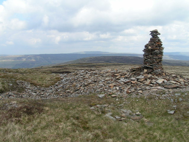
Plover Hill

Plover Hill is an area of moorland lying to the north of Pen-y-ghent in the Yorkshire Dales and connected to it by an unbroken area of high ground. Whilst...

Foxup

Foxup is a hamlet in the Yorkshire Dales in the Craven district of North Yorkshire, England. The hamlet is near Halton Gill and Litton and is 13 miles...

Halton Gill

Halton Gill is a hamlet and civil parish in Littondale in the Yorkshire Dales in North Yorkshire, England. It is situated 2 miles (3.2 km) up Littondale...

Hesleden, North Yorkshire

Hesleden is a hamlet in Littondale in the Yorkshire Dales in England. It lies within the civil parish of Halton Gill in the Craven district of North Yorkshire...

Pen-y-ghent

Pen-y-ghent or Penyghent is a fell in the Yorkshire Dales, England. It is the lowest of Yorkshire's Three Peaks at 2,277 feet (694 m); the other two being...

Fountains Fell

Fountains Fell is a mountain in the Yorkshire Dales, England. The main summit (SD864716) has a height of 668 metres (2,192 ft) and a relative height or...

Fountains Fell Tarn

Fountains Fell Tarn, is an upland lake between the two peaks of Fountains Fell, in North Yorkshire, England. The tarn is close to the Pennine Way, some...

Have you been to Halton Gill?

Leave your review of Halton Gill below (or comments, questions and feedback).