Bromley

Settlement in Hertfordshire East Hertfordshire

England

Bromley

Standon from the air Surrounded by farmland.
Standon from the air Credit: M J Richardson

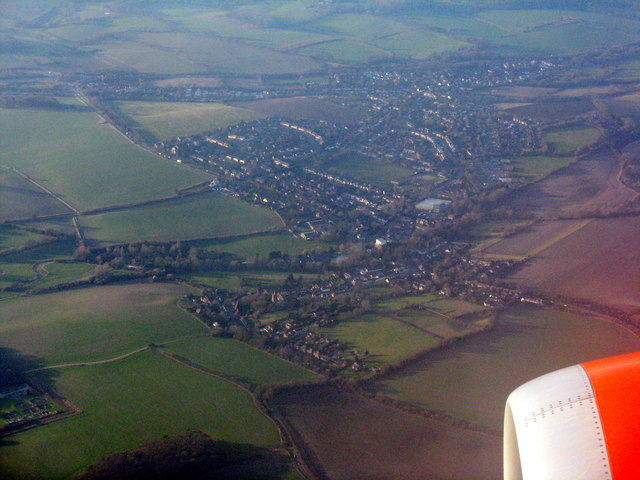
Bromley is a small village located in the county of Hertfordshire, England. Situated in the East Hertfordshire district, it is surrounded by picturesque countryside and offers a peaceful and idyllic setting for residents and visitors alike.

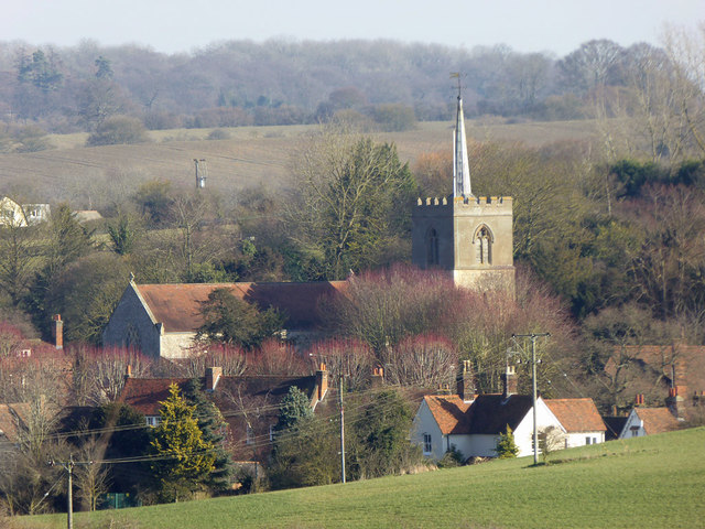
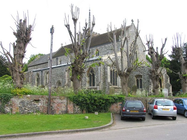
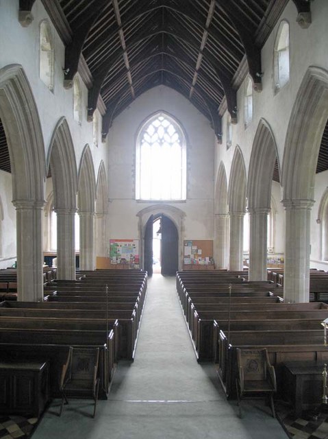
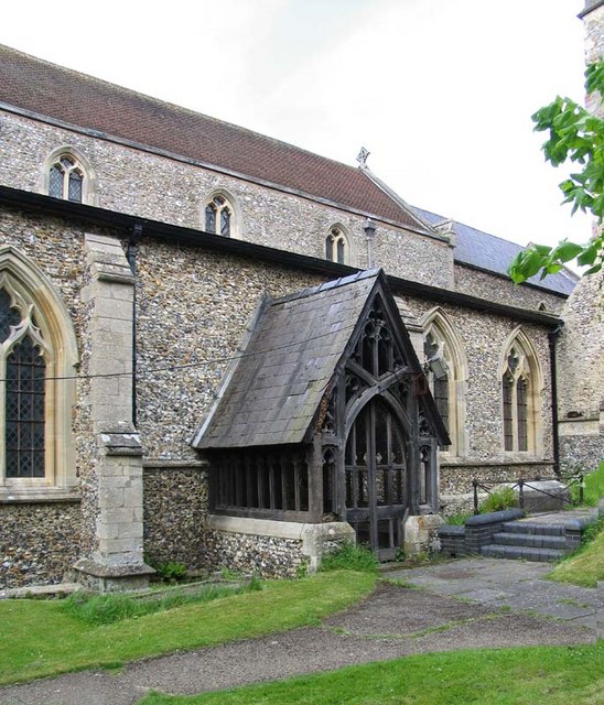
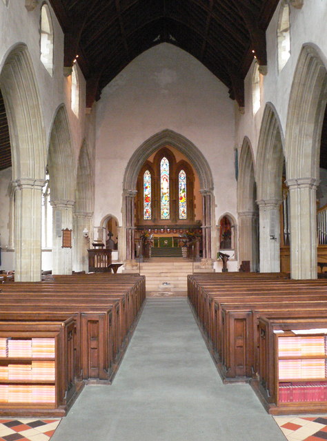
The village boasts a rich history, with evidence of human settlement dating back to the Roman times. Today, it is a thriving community with a population of around 1,500 people. The village is characterized by its charming architecture, including traditional thatched cottages and historic buildings such as the 12th-century St. Mary's Church.

Bromley is well-connected to nearby towns and cities, with easy access to major road networks such as the A10 and A120. The village also benefits from good public transport links, with regular bus services connecting it to surrounding areas.

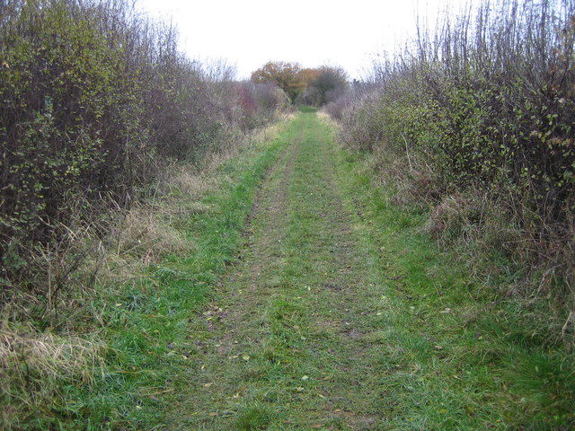
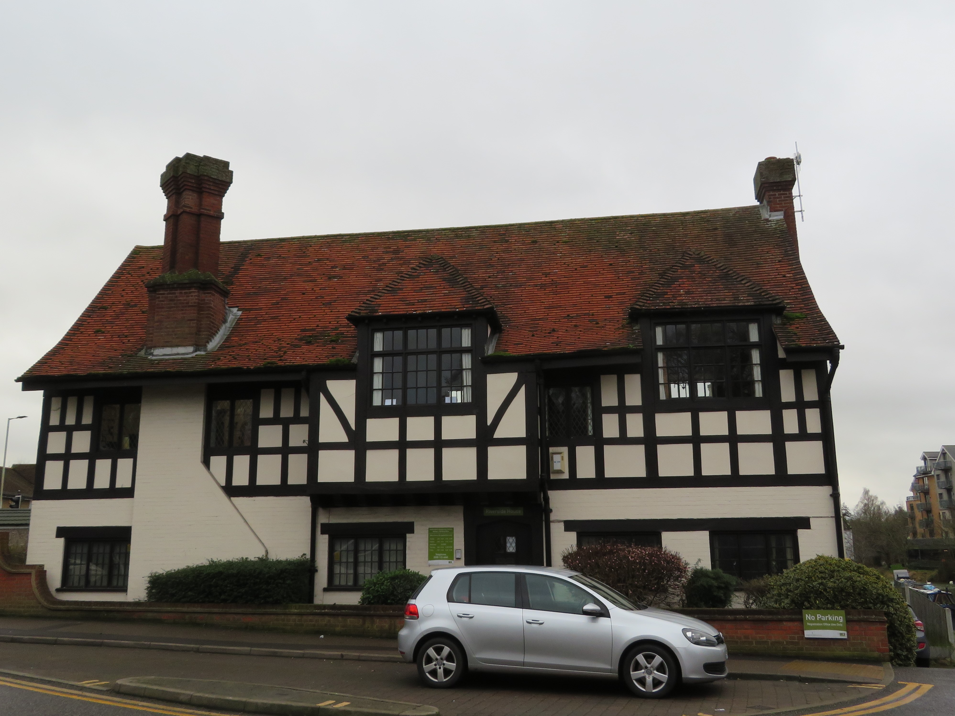
In terms of amenities, Bromley offers a range of facilities to cater to the needs of its residents. These include a village hall, a primary school, a local pub, and several shops and services. The village is also surrounded by beautiful countryside, providing ample opportunities for outdoor activities such as walking, cycling, and horse riding.

For those seeking cultural enrichment, the nearby town of Hertford offers a range of attractions, including museums, art galleries, and historical landmarks. Additionally, Bromley is within easy reach of London, making it an ideal location for commuters who prefer a quieter lifestyle while still having access to the capital's amenities.

Overall, Bromley is a charming village with a rich history, beautiful surroundings, and a strong sense of community. It offers a desirable location for those seeking a peaceful and picturesque place to call home.

If you have any feedback on the listing, please let us know in the comments section below.

Bromley Images

Images are sourced within 2km of 51.873734/0.053325 or Grid Reference TL4121. Thanks to Geograph Open Source API. All images are credited.

Standon from the air Surrounded by farmland.
Standon from the air
Surrounded by farmland.
Standon church St. Mary's is a grade I listed building, mainly 14th and 15th centuries.
Standon church
St. Mary's is a grade I listed building, mainly 14th and 15th centuries.
St Mary, Standon, Herts
St Mary, Standon, Herts - West end
St Mary, Standon, Herts - Porch
St Mary, Standon, Herts - Churchyard
Latchford: Former Buntingford branch railway line The branch line from St Margaret's to Buntingford opened in 1863 and closed in 1965. This is the trackbed between the fields to the east of Latchford.
Latchford: Former Buntingford branch railway line
The branch line from St Margaret's to Buntingford opened in 1863 and closed in 1965. This is the trackbed between the fields to the east of Latchford.
St Mary's Parish Church, Standon Glimpsed from the High Street. The spire is on the bell tower, which is detached from the church.
St Mary's Parish Church, Standon
Glimpsed from the High Street. The spire is on the bell tower, which is detached from the church.
White house on Standon High Street Built in the 17th Century, this house was formerly 3 cottages and is Grade II listed. It has pretty Gothick windows facing the High Street.
White house on Standon High Street
Built in the 17th Century, this house was formerly 3 cottages and is Grade II listed. It has pretty Gothick windows facing the High Street.
St Mary's Parish Church, Standon The bell tower of the church, which stands south-east of the church buildings. <span class="nowrap"><a title="http://www.uicl.co.uk/standon/" rel="nofollow ugc noopener" href="http://www.uicl.co.uk/standon/">Link</a><img style="margin-left:2px;" alt="External link" title="External link - shift click to open in new window" src="https://s1.geograph.org.uk/img/external.png" width="10" height="10"/></span> It was built of flint in the 15th century, but was struck by lightning and rebuilt in 1843.
St Mary's Parish Church, Standon
The bell tower of the church, which stands south-east of the church buildings. LinkExternal link It was built of flint in the 15th century, but was struck by lightning and rebuilt in 1843.
St Mary's Parish Church, Standon Interior of the church looking eastwards towards the altar.
St Mary's Parish Church, Standon
Interior of the church looking eastwards towards the altar.
St Mary's Church, Standon With Saxon origins, the church was greatly altered in Victorian times.
St Mary's Church, Standon
With Saxon origins, the church was greatly altered in Victorian times.
Knight's Court, Standon A manorial courthouse from the 16thC or earlier. It was a school from 1610 to 1980 but has now been converted to 4 dwellings.
Knight's Court, Standon
A manorial courthouse from the 16thC or earlier. It was a school from 1610 to 1980 but has now been converted to 4 dwellings.
Knight's Court, Standon Another view of Knight's Court <a href="https://www.geograph.org.uk/photo/3410166">TL3922 : Knight's Court, Standon</a>
Knight's Court, Standon
Another view of Knight's Court TL3922 : Knight's Court, Standon
Standon Puddingstone This stone looks like a palaeolithic venus figure. Situated opposite the church on the junction of the High Street and Paper Mill Lane, it is garlanded on May Day when the villagers commence a procession and hold their fete in the main street. Next to it is an oak planted to commemorate the coronation of King George V.
Standon Puddingstone
This stone looks like a palaeolithic venus figure. Situated opposite the church on the junction of the High Street and Paper Mill Lane, it is garlanded on May Day when the villagers commence a procession and hold their fete in the main street. Next to it is an oak planted to commemorate the coronation of King George V.
Standon Puddingstone plaque
St Mary's Church, Standon The bell tower stands alone, next to the church.
St Mary's Church, Standon
The bell tower stands alone, next to the church.
Show me another place!

Bromley is located at Grid Ref: TL4121 (Lat: 51.873734, Lng: 0.053325)

Administrative County: Hertfordshire

District: East Hertfordshire

Police Authority: Hertfordshire

What 3 Words

///deputy.pillow.patch. Near Much Hadham, Hertfordshire

Related Wikis

Wellpond Green

Wellpond Green is a hamlet near the A120 road and the town of Bishop's Stortford, in the county of Hertfordshire, England. Wellpond Green contains 4 listed...

Standon, Hertfordshire

Standon is a village and civil parish in Hertfordshire, England. The parish includes the adjoining village of Puckeridge. The village church of St Mary...

Standon Preceptory

Standon Preceptory was a Knights Hospitaller foundation in the parish of Standon, in the county of Hertfordshire, England. It was founded before 1154,...

Braughing Friars

Braughing Friars is a hamlet in Hertfordshire, England. It is in the civil parish of Braughing. == External links == Media related to Braughing Friars...

Standon railway station

Standon railway station served the village of Standon, Hertfordshire, England, from 1863 to 1965 on the Buntingford branch line. == History == The station...

Much Hadham Palace

Much Hadham House is a manor house adjacent to the church in Much Hadham, Hertfordshire, England, formerly belonging to the Bishops of London. It is a...

Much Hadham

Much Hadham, formerly known as Great Hadham, is a village and civil parish in the district of East Hertfordshire, Hertfordshire, England. The parish of...

Hadham Rural District

Hadham Rural District was a rural district in Hertfordshire, England from 1894 to 1935, covering an area in the east of the county. == Evolution == The...

Nearby Amenities

Located within 500m of 51.873734,0.053325
Post Box
Bromley
Brand: Royal Mail
Brand Wikidata: Q638098
Collection Times: Mo-Fr 16:00; Sa 08:45
Colour: red
Operator: Royal Mail
Operator Wikidata: Q638098
Ref: SG11 133
Royal Cypher: EIIR
Royal Cypher Wikidata: Q33102113
Lat/Long: 51.8728025/0.0525818
Material: wood
Power: pole
Lat/Long: 51.869425/0.0518455
Material: wood
Power: pole
Lat/Long: 51.8700425/0.0493377
Material: wood
Power: pole
Lat/Long: 51.8697279/0.0505715
Bromley
Place: hamlet
Lat/Long: 51.8749253/0.0558798
Material: wood
Power: pole
Lat/Long: 51.8725215/0.0545738
Barrier: kissing_gate
Foot: yes
Lat/Long: 51.8731019/0.0530091
Barrier: kissing_gate
Foot: yes
Lat/Long: 51.8736226/0.0550721
Barrier: stile
Material: wood
Step Count: 1
Stile: stepover
Lat/Long: 51.8738288/0.0579771
Barrier: stile
Foot: yes
Material: wood
Step Count: 2
Stile: stepover
Lat/Long: 51.8741227/0.0554347
Barrier: stile
Foot: yes
Material: wood
Step Count: 1
Stile: stepover
Lat/Long: 51.8741498/0.0574348
Material: wood
Power: pole
Lat/Long: 51.8717138/0.0561898
Material: wood
Power: pole
Lat/Long: 51.8721345/0.0552725
Material: wood
Power: pole
Lat/Long: 51.8705544/0.0551974
Material: wood
Power: pole
Lat/Long: 51.8695014/0.0540331
Material: wood
Power: pole
Lat/Long: 51.8699497/0.0548062
Material: wood
Power: pole
Lat/Long: 51.8753558/0.0594243
Material: wood
Power: pole
Lat/Long: 51.8744302/0.0591575
Material: wood
Power: pole
Lat/Long: 51.8735335/0.0587404
Material: wood
Power: pole
Lat/Long: 51.8729083/0.0579384
Material: wood
Power: pole
Lat/Long: 51.8721971/0.0568615
The data included in this document is from www.openstreetmap.org. The data is made available under ODbL.

Have you been to Bromley?

Leave your review of Bromley below (or comments, questions and feedback).