Hackington

Civil Parish in Kent Canterbury

England

Hackington

Orchard View, Sweechgate This view shows <a href="https://www.geograph.org.uk/photo/5665411">TR1661 : Orchard View, Sweechgate</a>, when the site was under construction
Orchard View, Sweechgate Credit: John Baker

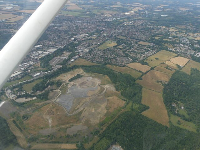
Hackington is a civil parish located in the county of Kent, England. Situated just outside the city of Canterbury, it covers an area of approximately 4.5 square miles. The parish is mainly rural, characterized by rolling hills, farmland, and scattered residential properties.

The population of Hackington is relatively small, with around 1,000 residents. The area is known for its tranquil and picturesque surroundings, making it an attractive place to live for those seeking a peaceful countryside lifestyle.

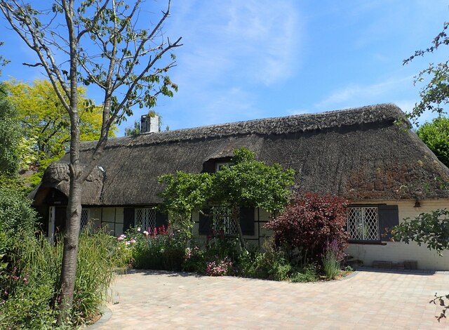
Historically, Hackington is significant as it was once a separate village, but over time it has become more closely associated with the nearby city of Canterbury. The parish is home to several notable landmarks, including the Church of St. Stephen, which dates back to the 12th century and is a Grade II listed building.

Residents of Hackington enjoy easy access to the amenities and services provided by Canterbury, such as schools, shops, and healthcare facilities. The city also offers a range of cultural and recreational opportunities, including museums, theaters, and a vibrant nightlife.

Transportation links in Hackington are well-developed, with regular bus services connecting the parish to Canterbury and other nearby towns and villages. The A2 road runs through the parish, providing convenient access to London and other major cities.

Overall, Hackington offers a harmonious blend of rural charm and proximity to urban conveniences, making it an appealing place to reside.

If you have any feedback on the listing, please let us know in the comments section below.
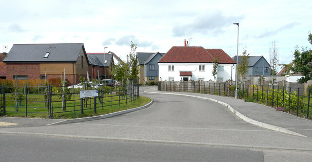
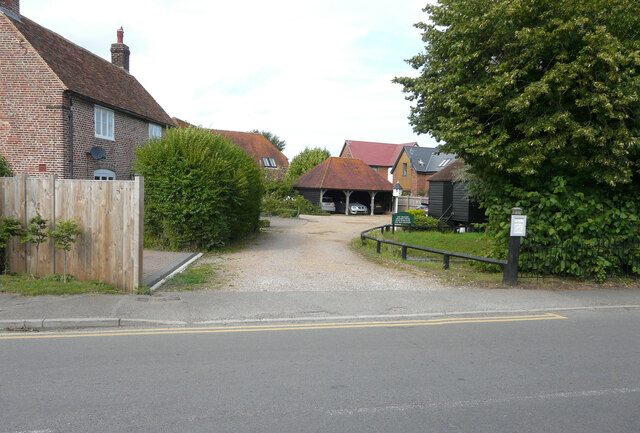
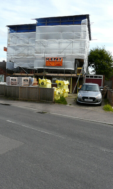
Hackington Images

Images are sourced within 2km of 51.3089/1.081374 or Grid Reference TR1461. Thanks to Geograph Open Source API. All images are credited.

Orchard View, Sweechgate This view shows <a href="https://www.geograph.org.uk/photo/5665411">TR1661 : Orchard View, Sweechgate</a>, when the site was under construction
Orchard View, Sweechgate
This view shows TR1661 : Orchard View, Sweechgate, when the site was under construction
Close, Sweechgate The green noticeboard directs visitors to The Granary, Orchard House, Pond Bungalow and The Old Granary.
Close, Sweechgate
The green noticeboard directs visitors to The Granary, Orchard House, Pond Bungalow and The Old Granary.
83, Sweechgate Prior approval has been granted by Canterbury City Council under application number CA/21/00230 for an “application under the prior approval process for first floor extension with a maximum height of no more than 3.5 metres, where the existing dwelling house consists of one storey”.
83, Sweechgate
Prior approval has been granted by Canterbury City Council under application number CA/21/00230 for an “application under the prior approval process for first floor extension with a maximum height of no more than 3.5 metres, where the existing dwelling house consists of one storey”.
Broad Oak (Canterbury) Village Sign Village sign
Broad Oak (Canterbury) Village Sign
Village sign
Barton Down, NE of Canterbury: aerial 2022
Thatched cottage at Broad Oak This is seen from Shalloak Road by  the turning to Chapel Lane.
Thatched cottage at Broad Oak
This is seen from Shalloak Road by the turning to Chapel Lane.
Broad Oak Chapel The chapel was opened in 1867, and was licensed for marriage ceremonies in the 1940s as part of the Countess of Huntingdon Connexion - see <span class="nowrap"><a title="www.historyfiles.co.uk/ChurchesBritain/SouthEast/Kent_Canterbury11.htm" rel="nofollow ugc noopener" href="http://www.historyfiles.co.uk/ChurchesBritain/SouthEast/Kent_Canterbury11.htm">Link</a><img style="margin-left:2px;" alt="External link" title="External link - shift click to open in new window" src="https://s1.geograph.org.uk/img/external.png" width="10" height="10"/></span>

For more about the Countess of Huntingdon Connexion see <span class="nowrap"><a title="https://en.wikipedia.org/wiki/Countess_of_Huntingdon%27s_Connexion" rel="nofollow ugc noopener" href="https://en.wikipedia.org/wiki/Countess_of_Huntingdon%27s_Connexion">Link</a><img style="margin-left:2px;" alt="External link" title="External link - shift click to open in new window" src="https://s1.geograph.org.uk/img/external.png" width="10" height="10"/></span>
Broad Oak Chapel
The chapel was opened in 1867, and was licensed for marriage ceremonies in the 1940s as part of the Countess of Huntingdon Connexion - see LinkExternal link For more about the Countess of Huntingdon Connexion see LinkExternal link
University of Kent at Canterbury A road on the northern side of the campus site.
University of Kent at Canterbury
A road on the northern side of the campus site.
The Royal Oak - now closed There were two public houses in Broad Oak - the Royal Oak and the Golden Lion. The Royal Oak has been closed now for some little time and the garden is now very overgrown.

Update: as of June 2018 it has been converted into a house and is surrounded by a development of new houses - see Street View image <span class="nowrap"><a title="https://www.google.co.uk/maps/@51.3112924,1.1093765,3a,41.7y,6.94h,84.28t/data=!3m7!1e1!3m5!1sHW3gaodU_oaGB4gPSxpx5w!2e0!6shttps:%2F%2Fstreetviewpixels-pa.googleapis.com%2Fv1%2Fthumbnail%3Fpanoid%3DHW3gaodU_oaGB4gPSxpx5w%26cb_client%3Dmaps_sv.tactile.gps%26w%3D203%26h%3D100%26yaw%3D227.63286%26pitch%3D0%26thumbfov%3D100!7i16384!8i8192" rel="nofollow ugc noopener" href="https://www.google.co.uk/maps/@51.3112924,1.1093765,3a,41.7y,6.94h,84.28t/data=!3m7!1e1!3m5!1sHW3gaodU_oaGB4gPSxpx5w!2e0!6shttps:%2F%2Fstreetviewpixels-pa.googleapis.com%2Fv1%2Fthumbnail%3Fpanoid%3DHW3gaodU_oaGB4gPSxpx5w%26cb_client%3Dmaps_sv.tactile.gps%26w%3D203%26h%3D100%26yaw%3D227.63286%26pitch%3D0%26thumbfov%3D100!7i16384!8i8192">Link</a><img style="margin-left:2px;" alt="External link" title="External link - shift click to open in new window" src="https://s1.geograph.org.uk/img/external.png" width="10" height="10"/></span>
The Royal Oak - now closed
There were two public houses in Broad Oak - the Royal Oak and the Golden Lion. The Royal Oak has been closed now for some little time and the garden is now very overgrown. Update: as of June 2018 it has been converted into a house and is surrounded by a development of new houses - see Street View image LinkExternal link
The former Royal Oak at Broad Oak There were two public houses in Broad Oak - the Royal Oak and the Golden Lion. The Royal Oak has been closed for some little time and the garden is now very overgrown.

Update: as of June 2018 it has been converted into a house and is surrounded by a development of new houses - see Street View image <span class="nowrap"><a title="https://www.google.co.uk/maps/@51.3112924,1.1093765,3a,41.7y,6.94h,84.28t/data=!3m7!1e1!3m5!1sHW3gaodU_oaGB4gPSxpx5w!2e0!6shttps:%2F%2Fstreetviewpixels-pa.googleapis.com%2Fv1%2Fthumbnail%3Fpanoid%3DHW3gaodU_oaGB4gPSxpx5w%26cb_client%3Dmaps_sv.tactile.gps%26w%3D203%26h%3D100%26yaw%3D227.63286%26pitch%3D0%26thumbfov%3D100!7i16384!8i8192" rel="nofollow ugc noopener" href="https://www.google.co.uk/maps/@51.3112924,1.1093765,3a,41.7y,6.94h,84.28t/data=!3m7!1e1!3m5!1sHW3gaodU_oaGB4gPSxpx5w!2e0!6shttps:%2F%2Fstreetviewpixels-pa.googleapis.com%2Fv1%2Fthumbnail%3Fpanoid%3DHW3gaodU_oaGB4gPSxpx5w%26cb_client%3Dmaps_sv.tactile.gps%26w%3D203%26h%3D100%26yaw%3D227.63286%26pitch%3D0%26thumbfov%3D100!7i16384!8i8192">Link</a><img style="margin-left:2px;" alt="External link" title="External link - shift click to open in new window" src="https://s1.geograph.org.uk/img/external.png" width="10" height="10"/></span>
The former Royal Oak at Broad Oak
There were two public houses in Broad Oak - the Royal Oak and the Golden Lion. The Royal Oak has been closed for some little time and the garden is now very overgrown. Update: as of June 2018 it has been converted into a house and is surrounded by a development of new houses - see Street View image LinkExternal link
A closed pub - The Royal Oak at Broad Oak There were two public houses in Broad Oak - the Royal Oak and the Golden Lion. The Royal Oak has been closed for some little time and the garden is now very overgrown. It is seen here across Sweechgate.

Update: as of June 2018 it has been converted into a house and is surrounded by a development of new houses - see Street View image <span class="nowrap"><a title="https://www.google.co.uk/maps/@51.3112924,1.1093765,3a,41.7y,6.94h,84.28t/data=!3m7!1e1!3m5!1sHW3gaodU_oaGB4gPSxpx5w!2e0!6shttps:%2F%2Fstreetviewpixels-pa.googleapis.com%2Fv1%2Fthumbnail%3Fpanoid%3DHW3gaodU_oaGB4gPSxpx5w%26cb_client%3Dmaps_sv.tactile.gps%26w%3D203%26h%3D100%26yaw%3D227.63286%26pitch%3D0%26thumbfov%3D100!7i16384!8i8192" rel="nofollow ugc noopener" href="https://www.google.co.uk/maps/@51.3112924,1.1093765,3a,41.7y,6.94h,84.28t/data=!3m7!1e1!3m5!1sHW3gaodU_oaGB4gPSxpx5w!2e0!6shttps:%2F%2Fstreetviewpixels-pa.googleapis.com%2Fv1%2Fthumbnail%3Fpanoid%3DHW3gaodU_oaGB4gPSxpx5w%26cb_client%3Dmaps_sv.tactile.gps%26w%3D203%26h%3D100%26yaw%3D227.63286%26pitch%3D0%26thumbfov%3D100!7i16384!8i8192">Link</a><img style="margin-left:2px;" alt="External link" title="External link - shift click to open in new window" src="https://s1.geograph.org.uk/img/external.png" width="10" height="10"/></span>
A closed pub - The Royal Oak at Broad Oak
There were two public houses in Broad Oak - the Royal Oak and the Golden Lion. The Royal Oak has been closed for some little time and the garden is now very overgrown. It is seen here across Sweechgate. Update: as of June 2018 it has been converted into a house and is surrounded by a development of new houses - see Street View image LinkExternal link
The Golden Lion at Broad Oak There were two public houses in Broad Oak - the Royal Oak and the Golden Lion. The Royal Oak has been closed for some little time and only the Golden Lion remains. See also <a title="https://www.geograph.org.uk/photo/5072855" href="https://www.geograph.org.uk/photo/5072855">Link</a>
The Golden Lion at Broad Oak
There were two public houses in Broad Oak - the Royal Oak and the Golden Lion. The Royal Oak has been closed for some little time and only the Golden Lion remains. See also Link
Orchard View, Sweechgate Planning permission was granted by Canterbury City Council under application numbers CA//16/00554 & CA//16/00555 for the “erection of 13 residential dwellings, change of use of listed public house to a single residential dwelling and associated landscaping works”. The location was named as the Royal Oak Caravan Park. 

Bill Boaden’s image of <a href="https://www.geograph.org.uk/photo/3069006">TR1661 : The Royal Oak, Broad Oak</a> shows it when it was a thriving concern.
Orchard View, Sweechgate
Planning permission was granted by Canterbury City Council under application numbers CA//16/00554 & CA//16/00555 for the “erection of 13 residential dwellings, change of use of listed public house to a single residential dwelling and associated landscaping works”. The location was named as the Royal Oak Caravan Park. Bill Boaden’s image of TR1661 : The Royal Oak, Broad Oak shows it when it was a thriving concern.
Smiths Amusements, 112, Shalloak Road As well as providing the name of the business, the board on the gate reads: we attend fetes, galas, carnivals, fairs, donkey derbys [derbies] etc (also available for hire).
Smiths Amusements, 112, Shalloak Road
As well as providing the name of the business, the board on the gate reads: we attend fetes, galas, carnivals, fairs, donkey derbys [derbies] etc (also available for hire).
Derelict house by a track The track serves as an access to the house beyond and also as a public footpath.
Derelict house by a track
The track serves as an access to the house beyond and also as a public footpath.
Works access BM11, Shalloak Road One of three temporary access points to the Richborough Connection Project <span class="nowrap"><a title="http://richboroughconnection.co.uk/" rel="nofollow ugc noopener" href="http://richboroughconnection.co.uk/">Link</a><img style="margin-left:2px;" alt="External link" title="External link - shift click to open in new window" src="https://s1.geograph.org.uk/img/external.png" width="10" height="10"/></span> which is a proposed 400kV electricity transmission connection between Richborough and Canterbury in Kent to connect the proposed new UK to Belgium interconnector (known as the Nemo Link)
<span class="nowrap"><a title="https://infrastructure.planninginspectorate.gov.uk/projects/south-east/richborough-connection-project/" rel="nofollow ugc noopener" href="https://infrastructure.planninginspectorate.gov.uk/projects/south-east/richborough-connection-project/">Link</a><img style="margin-left:2px;" alt="External link" title="External link - shift click to open in new window" src="https://s1.geograph.org.uk/img/external.png" width="10" height="10"/></span>
Works access BM11, Shalloak Road
One of three temporary access points to the Richborough Connection Project LinkExternal link which is a proposed 400kV electricity transmission connection between Richborough and Canterbury in Kent to connect the proposed new UK to Belgium interconnector (known as the Nemo Link) LinkExternal link
Temporary access entrance, Shalloak Road This is one of three temporary access points to the Richborough Connection Project <span class="nowrap"><a title="http://richboroughconnection.co.uk/" rel="nofollow ugc noopener" href="http://richboroughconnection.co.uk/">Link</a><img style="margin-left:2px;" alt="External link" title="External link - shift click to open in new window" src="https://s1.geograph.org.uk/img/external.png" width="10" height="10"/></span> which is a proposed 400kV electricity transmission connection between Richborough and Canterbury in Kent to connect the proposed new UK to Belgium interconnector (known as the Nemo Link)
<span class="nowrap"><a title="https://infrastructure.planninginspectorate.gov.uk/projects/south-east/richborough-connection-project/" rel="nofollow ugc noopener" href="https://infrastructure.planninginspectorate.gov.uk/projects/south-east/richborough-connection-project/">Link</a><img style="margin-left:2px;" alt="External link" title="External link - shift click to open in new window" src="https://s1.geograph.org.uk/img/external.png" width="10" height="10"/></span> 

Its location may be seen in this image of <a href="https://www.geograph.org.uk/photo/5761108">TR1660 : Works access BM11, Shalloak Road</a>.
Temporary access entrance, Shalloak Road
This is one of three temporary access points to the Richborough Connection Project LinkExternal link which is a proposed 400kV electricity transmission connection between Richborough and Canterbury in Kent to connect the proposed new UK to Belgium interconnector (known as the Nemo Link) LinkExternal link Its location may be seen in this image of TR1660 : Works access BM11, Shalloak Road.
View from a footpath through Goose Farm A temporary road has been laid to enable heavy machinery to gain access to the Richborough Connection Project <span class="nowrap"><a title="http://richboroughconnection.co.uk/" rel="nofollow ugc noopener" href="http://richboroughconnection.co.uk/">Link</a><img style="margin-left:2px;" alt="External link" title="External link - shift click to open in new window" src="https://s1.geograph.org.uk/img/external.png" width="10" height="10"/></span> This is a proposed 400kV electricity transmission connection between Richborough and Canterbury in Kent to connect the proposed new UK to Belgium interconnector (known as the Nemo Link)
<span class="nowrap"><a title="https://infrastructure.planninginspectorate.gov.uk/projects/south-east/richborough-connection-project/" rel="nofollow ugc noopener" href="https://infrastructure.planninginspectorate.gov.uk/projects/south-east/richborough-connection-project/">Link</a><img style="margin-left:2px;" alt="External link" title="External link - shift click to open in new window" src="https://s1.geograph.org.uk/img/external.png" width="10" height="10"/></span>

This <a href="https://www.geograph.org.uk/photo/5761137">TR1661 : View from a footpath through Goose Farm</a> is looking north-northwest.
View from a footpath through Goose Farm
A temporary road has been laid to enable heavy machinery to gain access to the Richborough Connection Project LinkExternal link This is a proposed 400kV electricity transmission connection between Richborough and Canterbury in Kent to connect the proposed new UK to Belgium interconnector (known as the Nemo Link) LinkExternal link This TR1661 : View from a footpath through Goose Farm is looking north-northwest.
Show me another place!

Hackington is located at Grid Ref: TR1461 (Lat: 51.3089, Lng: 1.081374)

Administrative County: Kent

District: Canterbury

Police Authority: Kent

What 3 Words

///gender.thousands.proves. Near Blean, Kent

Related Wikis

Hackington

Hackington is an area of Canterbury in Kent, England, also known (especially historically) as St Stephen's, incorporating the northern part of the city...

Tyler Hill, Kent

Tyler Hill is a small village on the northern outskirts of Canterbury, Kent in England. The population is included in the civil parish of Hackington. Its...

Tyler Hill Meadow

Tyler Hill Meadow is a 0.8-hectare (2.0-acre) Local Nature Reserve in Hackington, north of Canterbury in Kent. It is owned by Hackington Parish Council...

British Cartoon Archive

The British Cartoon Archive (BCA) is a department of the University of Kent, at Canterbury in Kent, England, and holds the national collection of political...

Hales Place

The residential area known as Hales Place is part of the civil parish of Hackington, and lies to the north of the city of Canterbury in Kent, England....
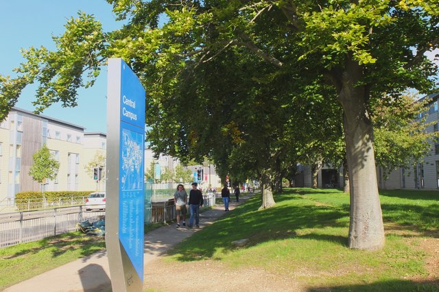
University of Kent

The University of Kent (formerly the University of Kent at Canterbury, abbreviated as UKC) is a semi-collegiate public research university based in Kent...

CSR 97.4FM

Canterbury Student Radio (CSR FM) is a membership based student and community radio station based in Canterbury, England. It is currently funded by Kent...

Kent Business School

Kent Business School (KBS) is the business school of the University of Kent. Although there are two business schools known as KBS, generally people seem...

Nearby Amenities

Located within 500m of 51.3089,1.081374
Power: tower
Source: Bing
Lat/Long: 51.3123493/1.0852738
Barrier: stile
Foot: yes
Lat/Long: 51.3070872/1.0859316
The data included in this document is from www.openstreetmap.org. The data is made available under ODbL.

Have you been to Hackington?

Leave your review of Hackington below (or comments, questions and feedback).