Great Waldingfield

Civil Parish in Suffolk Babergh

England

Great Waldingfield

Narrow footpath, Acton
Narrow footpath, Acton Credit: Roger Jones

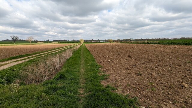
Great Waldingfield is a civil parish located in the county of Suffolk, England. It is situated approximately 2 miles southwest of the market town of Sudbury and covers an area of around 4 square miles. The parish is mainly rural in nature, with a small population of around 800 residents.

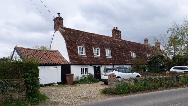
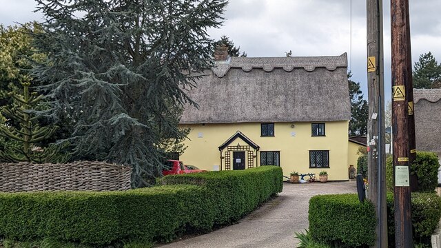
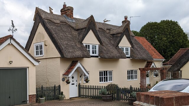
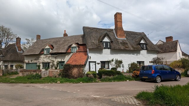
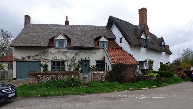
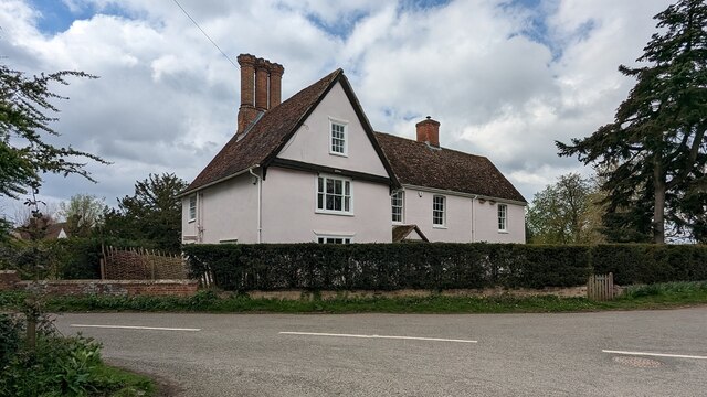
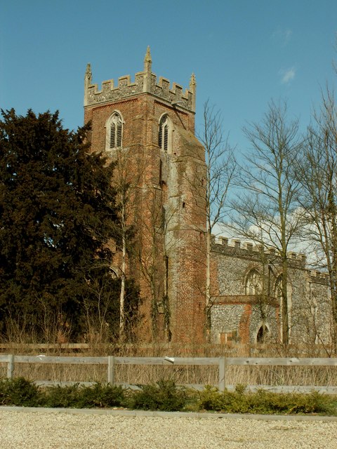
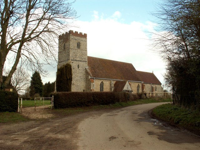
The village of Great Waldingfield is known for its picturesque setting, surrounded by the rolling countryside of Suffolk. It features a charming mix of traditional thatched cottages and more modern houses. The centerpiece of the village is the 14th-century St. Lawrence Church, which is a Grade I listed building and a prominent landmark in the area.

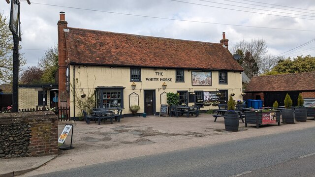
The parish is well-connected to nearby towns and cities, with Sudbury providing a range of amenities including shops, schools, and healthcare facilities. The village itself has a local pub, The Swan, which serves as a social hub for residents.

Great Waldingfield is also known for its strong sense of community, with several local events and activities taking place throughout the year. These include the annual village fete, which attracts visitors from the surrounding area, as well as regular community gatherings and clubs.

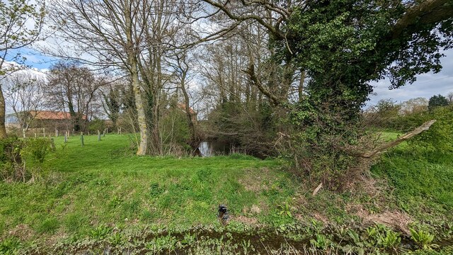
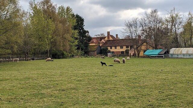
The surrounding countryside offers ample opportunities for outdoor activities such as walking, cycling, and horse riding. The area is also home to several nature reserves, providing habitats for a variety of wildlife.

Overall, Great Waldingfield offers a peaceful and idyllic rural lifestyle, with its close-knit community and beautiful surroundings making it an attractive place to live.

If you have any feedback on the listing, please let us know in the comments section below.

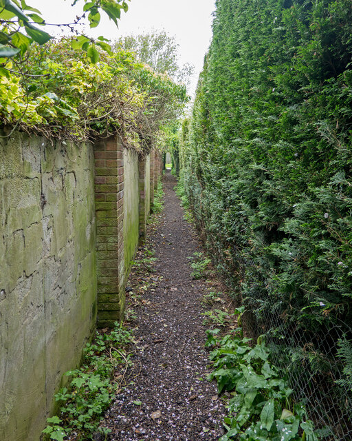
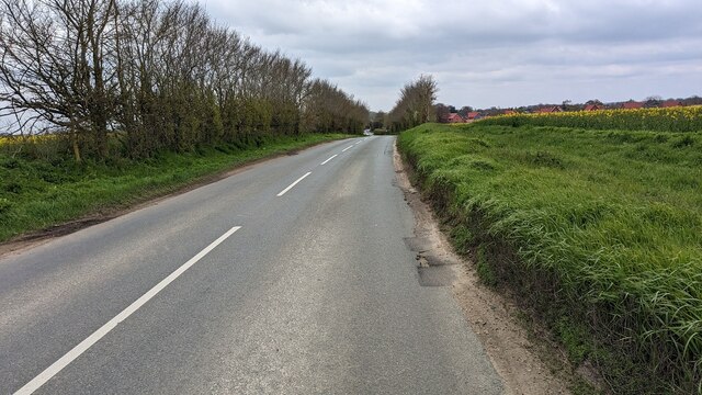
Great Waldingfield Images

Images are sourced within 2km of 52.061136/0.781843 or Grid Reference TL9043. Thanks to Geograph Open Source API. All images are credited.

Narrow footpath, Acton
Valley Road Originally a Roman road.
Valley Road
Originally a Roman road.
The White Horse Inn <span class="nowrap"><a title="https://historicengland.org.uk/listing/the-list/list-entry/1285257?section=official-list-entry" rel="nofollow ugc noopener" href="https://historicengland.org.uk/listing/the-list/list-entry/1285257?section=official-list-entry">Link</a><img style="margin-left:2px;" alt="External link" title="External link - shift click to open in new window" src="https://s1.geograph.org.uk/img/external.png" width="10" height="10"/></span>
The White Horse Inn
1 - 3 Valley Road, Great Waldingfield <span class="nowrap"><a title="https://historicengland.org.uk/listing/the-list/list-entry/1351733?section=official-list-entry" rel="nofollow ugc noopener" href="https://historicengland.org.uk/listing/the-list/list-entry/1351733?section=official-list-entry">Link</a><img style="margin-left:2px;" alt="External link" title="External link - shift click to open in new window" src="https://s1.geograph.org.uk/img/external.png" width="10" height="10"/></span>
1 - 3 Valley Road, Great Waldingfield
High Thatch, Great Waldingfield <span class="nowrap"><a title="https://historicengland.org.uk/listing/the-list/list-entry/1351788?section=official-list-entry" rel="nofollow ugc noopener" href="https://historicengland.org.uk/listing/the-list/list-entry/1351788?section=official-list-entry">Link</a><img style="margin-left:2px;" alt="External link" title="External link - shift click to open in new window" src="https://s1.geograph.org.uk/img/external.png" width="10" height="10"/></span>
High Thatch, Great Waldingfield
Jasmine Cottage, Great Waldingfield <span class="nowrap"><a title="https://historicengland.org.uk/listing/the-list/list-entry/1036641?section=official-list-entry" rel="nofollow ugc noopener" href="https://historicengland.org.uk/listing/the-list/list-entry/1036641?section=official-list-entry">Link</a><img style="margin-left:2px;" alt="External link" title="External link - shift click to open in new window" src="https://s1.geograph.org.uk/img/external.png" width="10" height="10"/></span>
Jasmine Cottage, Great Waldingfield
Owl, Lawrence and Little Thatch Cottages <span class="nowrap"><a title="https://historicengland.org.uk/listing/the-list/list-entry/1036603?section=official-list-entry" rel="nofollow ugc noopener" href="https://historicengland.org.uk/listing/the-list/list-entry/1036603?section=official-list-entry">Link</a><img style="margin-left:2px;" alt="External link" title="External link - shift click to open in new window" src="https://s1.geograph.org.uk/img/external.png" width="10" height="10"/></span> and <span class="nowrap"><a title="https://historicengland.org.uk/listing/the-list/list-entry/1351810?section=official-list-entry" rel="nofollow ugc noopener" href="https://historicengland.org.uk/listing/the-list/list-entry/1351810?section=official-list-entry">Link</a><img style="margin-left:2px;" alt="External link" title="External link - shift click to open in new window" src="https://s1.geograph.org.uk/img/external.png" width="10" height="10"/></span>
Owl, Lawrence and Little Thatch Cottages
LinkExternal link and LinkExternal link
Owl Cottage, Great Waldingfield <span class="nowrap"><a title="https://historicengland.org.uk/listing/the-list/list-entry/1036603?section=official-list-entry" rel="nofollow ugc noopener" href="https://historicengland.org.uk/listing/the-list/list-entry/1036603?section=official-list-entry">Link</a><img style="margin-left:2px;" alt="External link" title="External link - shift click to open in new window" src="https://s1.geograph.org.uk/img/external.png" width="10" height="10"/></span>
Owl Cottage, Great Waldingfield
Church Gate, Great Waldingfield <span class="nowrap"><a title="https://historicengland.org.uk/listing/the-list/list-entry/1351772?section=official-list-entry" rel="nofollow ugc noopener" href="https://historicengland.org.uk/listing/the-list/list-entry/1351772?section=official-list-entry">Link</a><img style="margin-left:2px;" alt="External link" title="External link - shift click to open in new window" src="https://s1.geograph.org.uk/img/external.png" width="10" height="10"/></span>
Church Gate, Great Waldingfield
Hostlers (formerly White Horse Inn) <span class="nowrap"><a title="https://historicengland.org.uk/listing/the-list/list-entry/1036573?section=official-list-entry" rel="nofollow ugc noopener" href="https://historicengland.org.uk/listing/the-list/list-entry/1036573?section=official-list-entry">Link</a><img style="margin-left:2px;" alt="External link" title="External link - shift click to open in new window" src="https://s1.geograph.org.uk/img/external.png" width="10" height="10"/></span>
Hostlers (formerly White Horse Inn)
The Swan Inn <span class="nowrap"><a title="https://historicengland.org.uk/listing/the-list/list-entry/1181644?section=official-list-entry" rel="nofollow ugc noopener" href="https://historicengland.org.uk/listing/the-list/list-entry/1181644?section=official-list-entry">Link</a><img style="margin-left:2px;" alt="External link" title="External link - shift click to open in new window" src="https://s1.geograph.org.uk/img/external.png" width="10" height="10"/></span>
The Swan Inn
Font and 15th Century Parish Chest in Church of St Lawrence, Little Waldingfield <span class="nowrap"><a title="https://historicengland.org.uk/listing/the-list/list-entry/1181618?section=official-list-entry" rel="nofollow ugc noopener" href="https://historicengland.org.uk/listing/the-list/list-entry/1181618?section=official-list-entry">Link</a><img style="margin-left:2px;" alt="External link" title="External link - shift click to open in new window" src="https://s1.geograph.org.uk/img/external.png" width="10" height="10"/></span>
Font and 15th Century Parish Chest in Church of St Lawrence, Little Waldingfield
13th Century Parish Chest in Church of St Lawrence, Little Waldingfield <span class="nowrap"><a title="https://historicengland.org.uk/listing/the-list/list-entry/1181618?section=official-list-entry" rel="nofollow ugc noopener" href="https://historicengland.org.uk/listing/the-list/list-entry/1181618?section=official-list-entry">Link</a><img style="margin-left:2px;" alt="External link" title="External link - shift click to open in new window" src="https://s1.geograph.org.uk/img/external.png" width="10" height="10"/></span>
13th Century Parish Chest in Church of St Lawrence, Little Waldingfield
Looking South from Waldingfield Bridge
Moated Site at Dyer's Green Farm
Footpath to Acton
Footpath to Acton
Babergh Hall <span class="nowrap"><a title="https://historicengland.org.uk/listing/the-list/list-entry/1036634?section=official-list-entry" rel="nofollow ugc noopener" href="https://historicengland.org.uk/listing/the-list/list-entry/1036634?section=official-list-entry">Link</a><img style="margin-left:2px;" alt="External link" title="External link - shift click to open in new window" src="https://s1.geograph.org.uk/img/external.png" width="10" height="10"/></span>
Babergh Hall
Churchside, Little Waldingfield <span class="nowrap"><a title="https://historicengland.org.uk/listing/the-list/list-entry/1036564?section=official-list-entry" rel="nofollow ugc noopener" href="https://historicengland.org.uk/listing/the-list/list-entry/1036564?section=official-list-entry">Link</a><img style="margin-left:2px;" alt="External link" title="External link - shift click to open in new window" src="https://s1.geograph.org.uk/img/external.png" width="10" height="10"/></span>
Churchside, Little Waldingfield
Show me another place!

Great Waldingfield is located at Grid Ref: TL9043 (Lat: 52.061136, Lng: 0.781843)

Administrative County: Suffolk

District: Babergh

Police Authority: Suffolk

What 3 Words

///canyons.able.cushy. Near Great Waldingfield, Suffolk

Related Wikis

Babergh Hundred

Babergh was a hundred of Suffolk, consisting of 71,882 acres (290.90 km2). Its name survives in that of Babergh District, the local government district...

Great Waldingfield

Great Waldingfield is a village and civil parish in the Babergh district of Suffolk, England about two miles (3 km) north-east of Sudbury and two miles...

Acton, Suffolk

Acton is a village and civil parish in the English county of Suffolk. The parish also includes the hamlets of Cuckoo Tye and Newman's Green. == Etymology... ==

Little Waldingfield

Little Waldingfield is a village and civil parish in Suffolk, England. Located two miles from its sister village, Great Waldingfield, it is part of the...

Chilton Hall

Chilton Hall is a Grade II* listed building in Chilton, Suffolk, England. The current building replaced an important moated medieval house.Of the original...

St Mary's Church, Chilton

St Mary's Church is a redundant Church of England parish church in the civil parish of Chilton, Suffolk, England. It is a Grade I listed building, and...

Chilton, Suffolk

Chilton is a civil parish on the eastern outskirts of Sudbury in Suffolk, England. Once a normal village, Chilton today consists of scattered clusters...

All Saints Church, Newton Green

All Saints Church is a partly redundant Anglican church in the village of Newton Green, Suffolk, England. It is recorded in the National Heritage List...

Nearby Amenities

Located within 500m of 52.061136,0.781843
Great Waldingfield
Place: village
Wikidata: Q1544390
Lat/Long: 52.0579711/0.7811684
Power: pole
Lat/Long: 52.0636528/0.7846375
Power: pole
Lat/Long: 52.0630574/0.7854843
Power: pole
Lat/Long: 52.0624105/0.7864426
Power: pole
Lat/Long: 52.0614414/0.7882202
Power: pole
Lat/Long: 52.0644437/0.7832829
Power: pole
Lat/Long: 52.0648428/0.7826687
Power: pole
Lat/Long: 52.0611233/0.7888625
Power: pole
Lat/Long: 52.0618586/0.7873538
Power: pole
Lat/Long: 52.06526/0.7820223
Power: pole
Lat/Long: 52.0646911/0.7846696
Power: pole
Lat/Long: 52.058176/0.7834193
Power: pole
Lat/Long: 52.0592232/0.7836286
Power: pole
Lat/Long: 52.0569767/0.7831566
Power: pole
Lat/Long: 52.0611581/0.7840227
Power: pole
Lat/Long: 52.062042/0.7841883
Power: pole
Lat/Long: 52.0629416/0.7843367
Power: pole
Lat/Long: 52.0638124/0.7845466
G K Argent Tractor Spares
Addr City: Sudbury
Addr Housename: Northfield Farm
Addr Postcode: CO10 0SF
Addr Street: The Street
Craft: agricultural_engines
Phone: +44 7850 774046
Lat/Long: 52.0636946/0.7834491
The Old Rectory Country House
Addr City: Sudbury
Addr Country: GB
Addr Housename: Rectory Manor
Addr Postcode: CO10 0TL
Addr Street: Rectory Road
Fhrs Id: 1394987
Tourism: guest_house
Lat/Long: 52.0591981/0.7882798
Defibrillator
Access: yes
Defibrillator Location: On the front wall of the village hall
Emergency: defibrillator
Fixme: Check precise location
Indoor: no
Operator: Community Heartbeat Trust
Ref: CHT-14-1139
Ref GB The Circuit: 945ACF34-3397-4C66-8E4C-B0060163A6D2
Lat/Long: 52.0605954/0.7781825
Information: guidepost
Tourism: information
Lat/Long: 52.0600745/0.7886437
Telephone
Booth: K6
Covered: booth
Listed Status: Grade II
Phone: +44 1787 379092
Lat/Long: 52.0600767/0.7888144
Post Box
Post Box Mounting: brick_pillar
Post Box Type: wall
Lat/Long: 52.0603635/0.7880158
The data included in this document is from www.openstreetmap.org. The data is made available under ODbL.

Have you been to Great Waldingfield?

Leave your review of Great Waldingfield below (or comments, questions and feedback).