Great Waldingfield

Settlement in Suffolk Babergh

England

Great Waldingfield

Narrow footpath, Acton
Narrow footpath, Acton Credit: Roger Jones

Great Waldingfield is a picturesque village located in the Babergh district of Suffolk, England. Situated approximately three miles southwest of Sudbury, it is nestled within the beautiful countryside of the Suffolk landscape. The village is home to a population of around 1,000 residents.

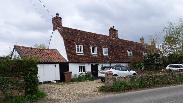
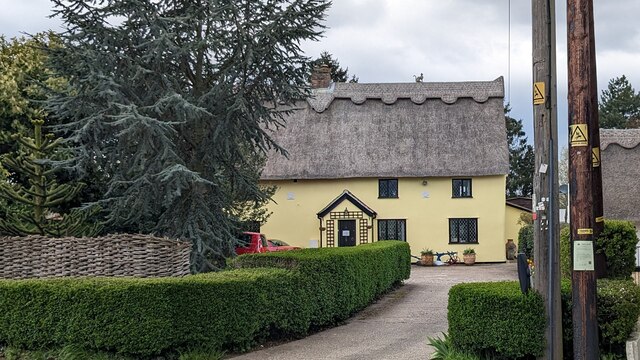
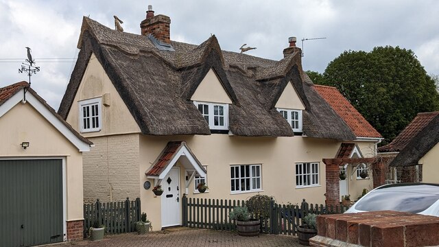
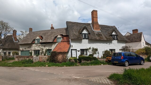
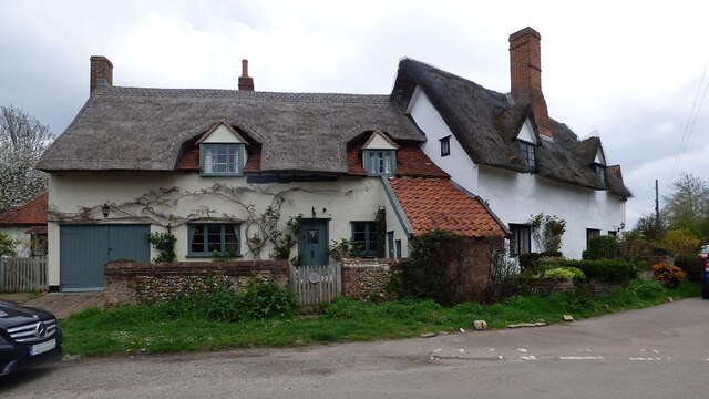
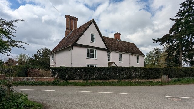
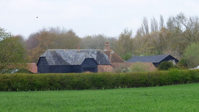
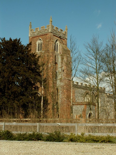
Great Waldingfield exudes a quintessential English charm with its idyllic setting and historic architecture. The village is predominantly made up of traditional thatched cottages, timber-framed houses, and red-brick buildings that date back centuries. The stunning St. Lawrence Church, a Grade I listed building, stands proudly at the heart of the village and serves as a focal point for both locals and visitors.

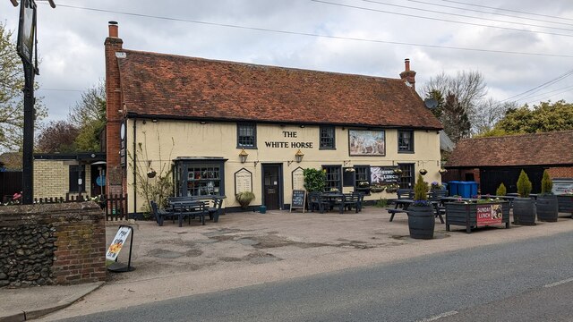
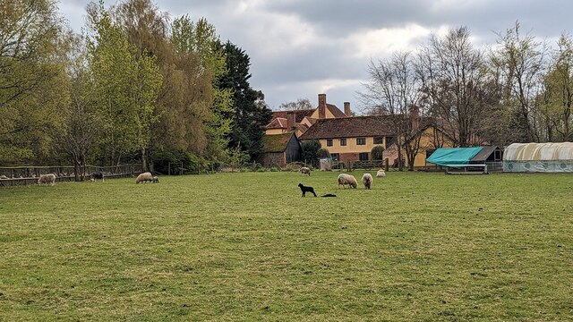
The village boasts a strong sense of community, with various social and recreational activities taking place throughout the year. The Village Hall hosts numerous events, including art exhibitions, craft fairs, and community gatherings. There is also a local pub providing a welcoming atmosphere for residents and visitors alike.

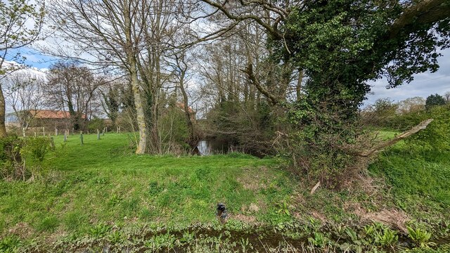
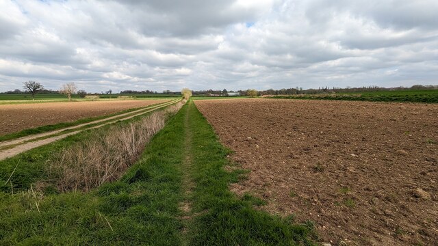
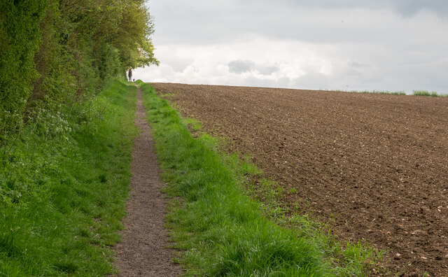
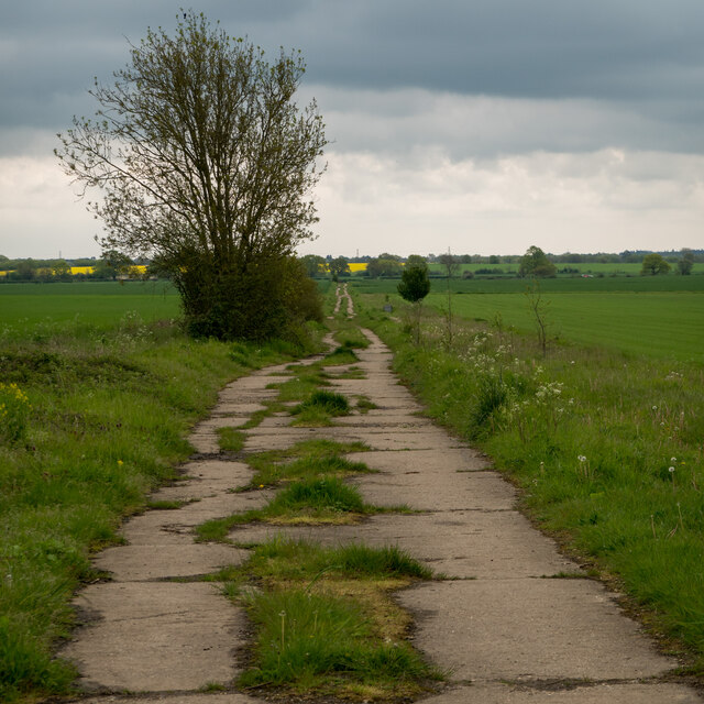
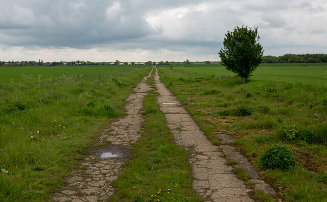
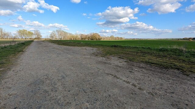
Great Waldingfield is surrounded by vast farmland and rolling hills, offering ample opportunities for outdoor activities such as walking and cycling. The nearby picturesque market town of Sudbury provides additional amenities, including shops, restaurants, and leisure facilities.

Overall, Great Waldingfield encapsulates the timeless charm of rural England, with its historic architecture, strong community spirit, and beautiful natural surroundings. It remains a sought-after destination for those seeking a tranquil and picturesque place to call home.

If you have any feedback on the listing, please let us know in the comments section below.

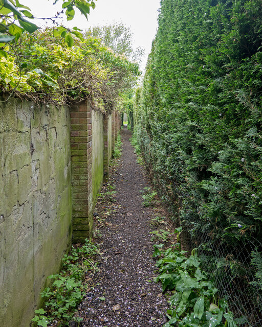
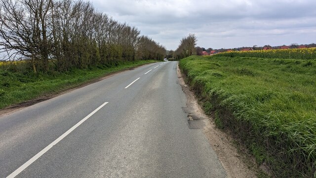
Great Waldingfield Images

Images are sourced within 2km of 52.05811/0.775571 or Grid Reference TL9043. Thanks to Geograph Open Source API. All images are credited.

Narrow footpath, Acton
Valley Road Originally a Roman road.
Valley Road
Originally a Roman road.
The White Horse Inn <span class="nowrap"><a title="https://historicengland.org.uk/listing/the-list/list-entry/1285257?section=official-list-entry" rel="nofollow ugc noopener" href="https://historicengland.org.uk/listing/the-list/list-entry/1285257?section=official-list-entry">Link</a><img style="margin-left:2px;" alt="External link" title="External link - shift click to open in new window" src="https://s1.geograph.org.uk/img/external.png" width="10" height="10"/></span>
The White Horse Inn
1 - 3 Valley Road, Great Waldingfield <span class="nowrap"><a title="https://historicengland.org.uk/listing/the-list/list-entry/1351733?section=official-list-entry" rel="nofollow ugc noopener" href="https://historicengland.org.uk/listing/the-list/list-entry/1351733?section=official-list-entry">Link</a><img style="margin-left:2px;" alt="External link" title="External link - shift click to open in new window" src="https://s1.geograph.org.uk/img/external.png" width="10" height="10"/></span>
1 - 3 Valley Road, Great Waldingfield
High Thatch, Great Waldingfield <span class="nowrap"><a title="https://historicengland.org.uk/listing/the-list/list-entry/1351788?section=official-list-entry" rel="nofollow ugc noopener" href="https://historicengland.org.uk/listing/the-list/list-entry/1351788?section=official-list-entry">Link</a><img style="margin-left:2px;" alt="External link" title="External link - shift click to open in new window" src="https://s1.geograph.org.uk/img/external.png" width="10" height="10"/></span>
High Thatch, Great Waldingfield
Jasmine Cottage, Great Waldingfield <span class="nowrap"><a title="https://historicengland.org.uk/listing/the-list/list-entry/1036641?section=official-list-entry" rel="nofollow ugc noopener" href="https://historicengland.org.uk/listing/the-list/list-entry/1036641?section=official-list-entry">Link</a><img style="margin-left:2px;" alt="External link" title="External link - shift click to open in new window" src="https://s1.geograph.org.uk/img/external.png" width="10" height="10"/></span>
Jasmine Cottage, Great Waldingfield
Owl, Lawrence and Little Thatch Cottages <span class="nowrap"><a title="https://historicengland.org.uk/listing/the-list/list-entry/1036603?section=official-list-entry" rel="nofollow ugc noopener" href="https://historicengland.org.uk/listing/the-list/list-entry/1036603?section=official-list-entry">Link</a><img style="margin-left:2px;" alt="External link" title="External link - shift click to open in new window" src="https://s1.geograph.org.uk/img/external.png" width="10" height="10"/></span> and <span class="nowrap"><a title="https://historicengland.org.uk/listing/the-list/list-entry/1351810?section=official-list-entry" rel="nofollow ugc noopener" href="https://historicengland.org.uk/listing/the-list/list-entry/1351810?section=official-list-entry">Link</a><img style="margin-left:2px;" alt="External link" title="External link - shift click to open in new window" src="https://s1.geograph.org.uk/img/external.png" width="10" height="10"/></span>
Owl, Lawrence and Little Thatch Cottages
LinkExternal link and LinkExternal link
Owl Cottage, Great Waldingfield <span class="nowrap"><a title="https://historicengland.org.uk/listing/the-list/list-entry/1036603?section=official-list-entry" rel="nofollow ugc noopener" href="https://historicengland.org.uk/listing/the-list/list-entry/1036603?section=official-list-entry">Link</a><img style="margin-left:2px;" alt="External link" title="External link - shift click to open in new window" src="https://s1.geograph.org.uk/img/external.png" width="10" height="10"/></span>
Owl Cottage, Great Waldingfield
Church Gate, Great Waldingfield <span class="nowrap"><a title="https://historicengland.org.uk/listing/the-list/list-entry/1351772?section=official-list-entry" rel="nofollow ugc noopener" href="https://historicengland.org.uk/listing/the-list/list-entry/1351772?section=official-list-entry">Link</a><img style="margin-left:2px;" alt="External link" title="External link - shift click to open in new window" src="https://s1.geograph.org.uk/img/external.png" width="10" height="10"/></span>
Church Gate, Great Waldingfield
Looking South from Waldingfield Bridge
Moated Site at Dyer's Green Farm
Footpath to Acton
Footpath to Acton
Babergh Hall <span class="nowrap"><a title="https://historicengland.org.uk/listing/the-list/list-entry/1036634?section=official-list-entry" rel="nofollow ugc noopener" href="https://historicengland.org.uk/listing/the-list/list-entry/1036634?section=official-list-entry">Link</a><img style="margin-left:2px;" alt="External link" title="External link - shift click to open in new window" src="https://s1.geograph.org.uk/img/external.png" width="10" height="10"/></span>
Babergh Hall
Hole Farm
Hole Farm
Footpath on Field Boundary, Acton
Footpath in former Sudbury Airfield, Acton Wikipedia article on Sudbury Airfield:- <span class="nowrap"><a title="https://en.wikipedia.org/wiki/RAF_Sudbury" rel="nofollow ugc noopener" href="https://en.wikipedia.org/wiki/RAF_Sudbury">Link</a><img style="margin-left:2px;" alt="External link" title="External link - shift click to open in new window" src="https://s1.geograph.org.uk/img/external.png" width="10" height="10"/></span>
Footpath in former Sudbury Airfield, Acton
Wikipedia article on Sudbury Airfield:- LinkExternal link
Runway at RAF Sudbury <span class="nowrap"><a title="https://en.wikipedia.org/wiki/RAF_Sudbury" rel="nofollow ugc noopener" href="https://en.wikipedia.org/wiki/RAF_Sudbury">Link</a><img style="margin-left:2px;" alt="External link" title="External link - shift click to open in new window" src="https://s1.geograph.org.uk/img/external.png" width="10" height="10"/></span>
Runway at RAF Sudbury
Show me another place!

Great Waldingfield is located at Grid Ref: TL9043 (Lat: 52.05811, Lng: 0.775571)

Administrative County: Suffolk

District: Babergh

Police Authority: Suffolk

What 3 Words

///tripling.shields.healthier. Near Great Waldingfield, Suffolk

Related Wikis

Great Waldingfield

Great Waldingfield is a village and civil parish in the Babergh district of Suffolk, England about two miles (3 km) north-east of Sudbury and two miles...

Babergh Hundred

Babergh was a hundred of Suffolk, consisting of 71,882 acres (290.90 km2). Its name survives in that of Babergh District, the local government district...

Chilton Hall

Chilton Hall is a Grade II* listed building in Chilton, Suffolk, England. The current building replaced an important moated medieval house.Of the original...

Acton, Suffolk

Acton is a village and civil parish in the English county of Suffolk. The parish also includes the hamlets of Cuckoo Tye and Newman's Green. == Etymology... ==

St Mary's Church, Chilton

St Mary's Church is a redundant Church of England parish church in the civil parish of Chilton, Suffolk, England. It is a Grade I listed building, and...

Chilton, Suffolk

Chilton is a civil parish on the eastern outskirts of Sudbury in Suffolk, England. Once a normal village, Chilton today consists of scattered clusters...

Little Waldingfield

Little Waldingfield is a village and civil parish in Suffolk, England. Located two miles from its sister village, Great Waldingfield, it is part of the...

Melford Rural District

Melford Rural District was a rural district in the county of West Suffolk, England. It was created in 1894, under the Local Government Act 1894 from that...

Nearby Amenities

Located within 500m of 52.05811,0.775571
Great Waldingfield
Place: village
Wikidata: Q1544390
Lat/Long: 52.0579711/0.7811684
Crossing
Crossing: marked
Crossing Island: no
Traffic Calming: table
Lat/Long: 52.0574534/0.7751909
Bus Stop
Bowls & Social Club
Naptan AtcoCode: 390010207
Naptan Bearing: NW
Naptan BusStopType: CUS
Naptan CommonName: Bowls & Social Club
Naptan Indicator: o/s
Naptan Landmark: Bowls & Social Club
Naptan NaptanCode: sufadpdm
Naptan Street: Tentree Road
Naptan Verified: no
Source: naptan_import
Lat/Long: 52.0586898/0.774927
Bus Stop
Bowls & Social Club
Naptan AtcoCode: 390010208
Naptan Bearing: SE
Naptan CommonName: Bowls & Social Club
Naptan Indicator: opp
Naptan Landmark: Bus Shelter
Naptan NaptanCode: sufadpdp
Naptan Street: Tentree Road
Naptan Verified: no
Source: naptan_import
Lat/Long: 52.058713/0.7751886
Bus Stop
Post Office
Naptan AtcoCode: 390010209
Naptan Bearing: N
Naptan CommonName: Post Office
Naptan Indicator: adj
Naptan Landmark: Post Office
Naptan NaptanCode: sufadpdt
Naptan Street: B1071
Naptan Verified: no
Source: naptan_import
Lat/Long: 52.0580865/0.7754877
Bus Stop
Post Office
Naptan AtcoCode: 390010210
Naptan Bearing: S
Naptan BusStopType: CUS
Naptan CommonName: Post Office
Naptan Indicator: opp
Naptan Landmark: Post Office
Naptan NaptanCode: sufadpdw
Naptan Street: B1071
Naptan Verified: no
Source: naptan_import
Lat/Long: 52.0577459/0.7754237
Bantocks Road
Naptan AtcoCode: 390010213
Naptan Bearing: NW
Naptan BusStopType: CUS
Naptan CommonName: Bantocks Road
Naptan Indicator: adj
Naptan Landmark: Bantocks Road
Naptan NaptanCode: sufadpgj
Naptan Street: Folly Road
Naptan Verified: no
Source: naptan_import
Lat/Long: 52.0561402/0.7813169
Bantocks Road
Naptan AtcoCode: 390010214
Naptan Bearing: SE
Naptan BusStopType: CUS
Naptan CommonName: Bantocks Road
Naptan Indicator: opp
Naptan Landmark: Bantocks Road
Naptan NaptanCode: sufadpgm
Naptan Street: Folly Road
Naptan Verified: no
Source: naptan_import
Lat/Long: 52.0562207/0.7813365
Post Office
Great Waldingfield Post Office
Addr Postcode: CO10 0SA
Branch: Great Waldingfield
Brand: Post Office
Brand Wikidata: Q1783168
Check Date: 2020-02-20
Contact Website: https://www.postoffice.co.uk/branch-finder/1431307/great-waldingfield
Ref Pol Id: 2626
Lat/Long: 52.0578202/0.775635
Pub
The White Horse
Addr City: Great Waldingfield
Addr Postcode: CO10 0RW
Addr Street: Lavenham Road
Lat/Long: 52.0537831/0.7740927
Jasmine Cottage B&B
Addr City: Sudbury
Addr Country: GB
Addr Housename: Jasmine Cottage
Addr Postcode: CO10 0RN
Addr Street: Lavenham Road
Fhrs Id: 1404226
Guest House: bed_and_breakfast
Tourism: guest_house
Lat/Long: 52.0545645/0.7744999
Man Made: utility_pole
Lat/Long: 52.0587855/0.7719343
Man Made: utility_pole
Lat/Long: 52.05965/0.772058
Defibrillator
Access: yes
Defibrillator Location: On the front wall of the village hall
Emergency: defibrillator
Fixme: Check precise location
Indoor: no
Operator: Community Heartbeat Trust
Ref: CHT-14-1139
Ref GB The Circuit: 945ACF34-3397-4C66-8E4C-B0060163A6D2
Lat/Long: 52.0605954/0.7781825
Post Box
Mapillary: 843300667855024
Operator: Royal Mail
Operator Wikidata: Q638098
Post Box Mounting: pier
Post Box Type: lamp
Lat/Long: 52.054063/0.7740611
Post Box
Mapillary: 3802428720033528
Operator: Royal Mail
Operator Wikidata: Q638098
Post Box Type: pillar
Lat/Long: 52.0579729/0.7755834
Advertising: board
Lat/Long: 52.057966/0.7755938
The data included in this document is from www.openstreetmap.org. The data is made available under ODbL.

Have you been to Great Waldingfield?

Leave your review of Great Waldingfield below (or comments, questions and feedback).