Great Dunmow

Civil Parish in Essex Uttlesford

England

Great Dunmow

TESCO Great Dunmow
TESCO Great Dunmow Credit: Andrew Tatlow

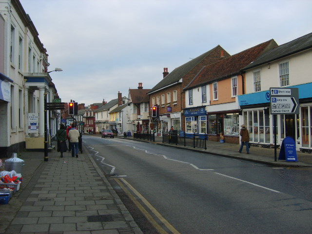
Great Dunmow is a civil parish located in the county of Essex, England. Situated approximately 40 miles northeast of London, the town is known for its rich history, picturesque landscapes, and vibrant community.

The town's origins can be traced back to Roman times, and it has since developed into a charming market town with a population of around 8,500 residents. Great Dunmow is home to a variety of architectural styles, including medieval and Georgian buildings, which add to its unique character.

The town center is a bustling hub of activity, with a range of independent shops, cafes, and restaurants, as well as several traditional pubs. Every Saturday, a lively market takes place, offering a diverse range of goods, from fresh local produce to handmade crafts.

Great Dunmow is surrounded by stunning countryside, making it an ideal location for outdoor enthusiasts. The town is bordered by beautiful rural landscapes, including the Great Dunmow Flitch Way, a former railway line that now serves as a popular walking and cycling route.

The community in Great Dunmow is known for its strong sense of togetherness and active engagement. The town hosts various events and festivals throughout the year, including the renowned Great Dunmow Flitch Trials, a tradition dating back to medieval times, where couples try to prove they have lived in harmony to win a flitch of bacon.

With its historical charm, vibrant community, and natural beauty, Great Dunmow offers a delightful blend of old-world charm and modern living, making it an appealing place to live and visit in Essex.

If you have any feedback on the listing, please let us know in the comments section below.
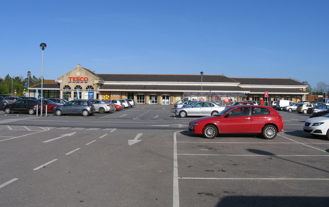
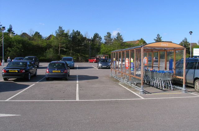
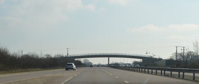
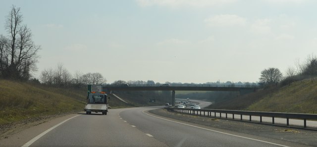
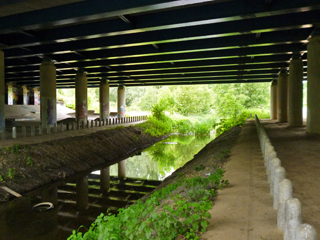
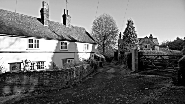
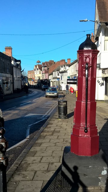
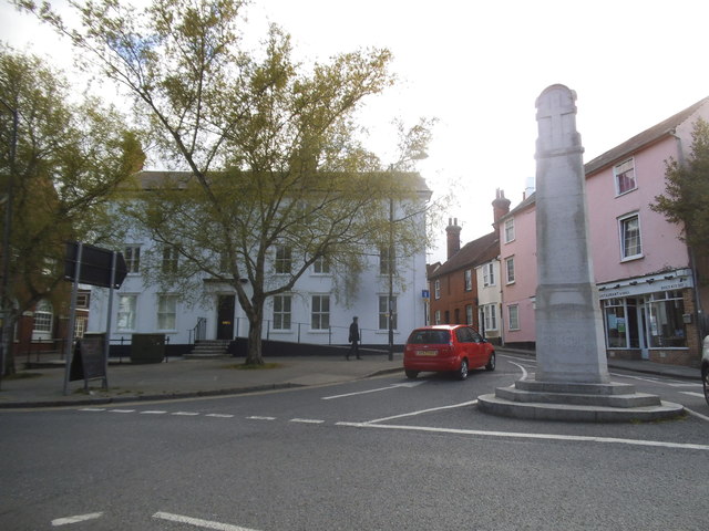
Great Dunmow Images

Images are sourced within 2km of 51.872318/0.36161 or Grid Reference TL6221. Thanks to Geograph Open Source API. All images are credited.

TESCO Great Dunmow
TESCO Great Dunmow
TESCO car park Great Dunmow
Footbridge, A120 The A120 is a trunk road that runs east-west across East Anglia from Harwich to Puckeridge, 63 miles in length. It follows the route of the Roman Road, Stane Street. <span class="nowrap"><a title="http://www.sabre-roads.org.uk/wiki/index.php?title=A120" rel="nofollow ugc noopener" href="http://www.sabre-roads.org.uk/wiki/index.php?title=A120">Link</a><img style="margin-left:2px;" alt="External link" title="External link - shift click to open in new window" src="https://s1.geograph.org.uk/img/external.png" width="10" height="10"/></span>
Footbridge, A120
The A120 is a trunk road that runs east-west across East Anglia from Harwich to Puckeridge, 63 miles in length. It follows the route of the Roman Road, Stane Street. LinkExternal link
Ongar Road Bridge, A120 The A120 is a trunk road that runs east-west across East Anglia from Harwich to Puckeridge, 63 miles in length. It follows the route of the Roman Road, Stane Street. <span class="nowrap"><a title="http://www.sabre-roads.org.uk/wiki/index.php?title=A120" rel="nofollow ugc noopener" href="http://www.sabre-roads.org.uk/wiki/index.php?title=A120">Link</a><img style="margin-left:2px;" alt="External link" title="External link - shift click to open in new window" src="https://s1.geograph.org.uk/img/external.png" width="10" height="10"/></span>
Ongar Road Bridge, A120
The A120 is a trunk road that runs east-west across East Anglia from Harwich to Puckeridge, 63 miles in length. It follows the route of the Roman Road, Stane Street. LinkExternal link
A120, Great Dunmow Bypass The A120 is a trunk road that runs east-west across East Anglia from Harwich to Puckeridge, 63 miles in length. It follows the route of the Roman Road, Stane Street. <span class="nowrap"><a title="http://www.sabre-roads.org.uk/wiki/index.php?title=A120" rel="nofollow ugc noopener" href="http://www.sabre-roads.org.uk/wiki/index.php?title=A120">Link</a><img style="margin-left:2px;" alt="External link" title="External link - shift click to open in new window" src="https://s1.geograph.org.uk/img/external.png" width="10" height="10"/></span>
A120, Great Dunmow Bypass
The A120 is a trunk road that runs east-west across East Anglia from Harwich to Puckeridge, 63 miles in length. It follows the route of the Roman Road, Stane Street. LinkExternal link
New houses, Great Dunmow The recent residential enlargement of Great Dunmow to the north-west spreads further north.
New houses, Great Dunmow
The recent residential enlargement of Great Dunmow to the north-west spreads further north.
Off-roaders' wallow The public byway here is a magnet for off-roaders, who, fortunately for other users, confine their more extreme fun to tracks off the byway, between the byway and the River Chelmer. This is perhaps the most extreme bit I found. It appears to be rather deep.
Off-roaders' wallow
The public byway here is a magnet for off-roaders, who, fortunately for other users, confine their more extreme fun to tracks off the byway, between the byway and the River Chelmer. This is perhaps the most extreme bit I found. It appears to be rather deep.
A120 bridge over River Chelmer Particularly wide, as four lanes of dual carriageway and also two slip roads cross the river. The bridge also crosses a public byway, used by National Cycle Route 16.
A120 bridge over River Chelmer
Particularly wide, as four lanes of dual carriageway and also two slip roads cross the river. The bridge also crosses a public byway, used by National Cycle Route 16.
River Chelmer under A120 A public byway passes to the right of the columns on the right, and the area seems to be popular with off-roaders. The bollards along the river banks are almost certainly to deter attempts to ford the river here.
River Chelmer under A120
A public byway passes to the right of the columns on the right, and the area seems to be popular with off-roaders. The bollards along the river banks are almost certainly to deter attempts to ford the river here.
A120 Chelmer bridge - graffiti As is usual with structures with large expanses of bare concrete, unofficial adornment soon appears.
A120 Chelmer bridge - graffiti
As is usual with structures with large expanses of bare concrete, unofficial adornment soon appears.
A120 Chelmer bridge - graffiti As is usual with structures with large expanses of bare concrete, unofficial adornment soon appears.
A120 Chelmer bridge - graffiti
As is usual with structures with large expanses of bare concrete, unofficial adornment soon appears.
A120 Chelmer bridge - graffiti As is usual with structures with large expanses of bare concrete, unofficial adornment soon appears.
A120 Chelmer bridge - graffiti
As is usual with structures with large expanses of bare concrete, unofficial adornment soon appears.
Frosty lane, Great Dunmow
Pump, High Street, Great Dunmow
Resting on thin ice, or taking a cold bath!
Rosemary Lane, Great Dunmow
New Street at the junction of Great Dunmow High Street
Houses on High Street, Great Dunmow
Show me another place!

Great Dunmow is located at Grid Ref: TL6221 (Lat: 51.872318, Lng: 0.36161)

Administrative County: Essex

District: Uttlesford

Police Authority: Essex

What 3 Words

///sung.explored.inserting. Near Great Dunmow, Essex

Related Wikis

Great Dunmow

Great Dunmow is a historic market town and civil parish in the Uttlesford district of Essex, England. It is situated on the north of the A120 road, approximately...

Old Town Hall, Great Dunmow

The Old Town Hall is a municipal building in the Market Place, Great Dunmow, Essex, England. The structure, which is now used as the offices of a firm...

Talliston House

Talliston House & Gardens is an ex-council house in Essex, England that has been transformed by owner John Trevillian into a miniature palace. The house...

Dunmow railway station

Dunmow railway station was a station serving Great Dunmow, Essex. The station was 9 miles 38 chains (15.25 km) from Bishop's Stortford on the Bishop's...

Church End Mill, Great Dunmow

Church End Mill is a grade II listed Tower mill at Great Dunmow, Essex, England which has been converted to residential use. == History == Church End Mill...

Helena Romanes School

Helena Romanes School (also known/abbreviated as HRS) is a coeducational all-through school and sixth form. It is situated in Great Dunmow in the English...

Stane Street (Colchester)

Stane Street is a 39 mi (63 km) Roman road that runs from Ermine Street at Braughing, Hertfordshire to Colchester in Essex. == Route == Stane Street can...

High Wood, Dunmow

High Wood, Dunmow is a 41.5-hectare (103-acre) biological Site of Special Scientific Interest in Great Dunmow in Essex. The local planning authority is...

Related Videos

Is it safe for dogs to play with balls?...#shorts #field #dog #owner #ball

Avoid outdoor activity on hot or humid days. Ball obsessions can mean that dogs don't stop when they should causing them to ...

PLASTIC BOTTLE GREENHOUSE Great Dunmow

A community Greenhouse made from 1600 recycled plastic bottles. http://www.anneschwegmann-fielding.com/ @anneschweg ...

St Mary Church, Great Dunmow, Essex, October 2022.

St Mary Church, Great Dunmow, Essex, October 2022. An interesting & picturesque town, & very close to Stansted Airport, how ...

Nearby Amenities

Located within 500m of 51.872318,0.36161
Crossing
Crossing: marked
Crossing Island: no
Crossing Ref: pelican
Tactile Paving: yes
Lat/Long: 51.8723575/0.3555775
Mini Roundabout
Direction: clockwise
Lat/Long: 51.8698718/0.3657289
Mini Roundabout
Direction: clockwise
Lat/Long: 51.8765024/0.3622107
Mini Roundabout
Direction: clockwise
Lat/Long: 51.8731503/0.3578368
Great Dunmow
Name Ru: Грейт-Данмоу
Place: town
Lat/Long: 51.8728198/0.3624014
Noexit: yes
Lat/Long: 51.8731122/0.3684542
Bus Stop
The Queen Victoria
Bus: yes
Naptan AtcoCode: 150018016002
Naptan Bearing: W
Naptan CommonName: The Queen Victoria
Naptan Crossing: Green Lane
Naptan Indicator: o/s
Naptan Landmark: The Queen Victoria
Naptan NaptanCode: esxdampa
Naptan Street: Stortford Road
Naptan Verified: no
Public Transport: platform
Source: naptan_import
Lat/Long: 51.872106/0.354655
Bus Stop
Stortford Road
Bus: yes
Naptan AtcoCode: 150018016003
Naptan Bearing: E
Naptan CommonName: Stortford Road
Naptan Crossing: Rosemary Lane
Naptan Indicator: E-bound
Naptan Landmark: Stortford Road
Naptan NaptanCode: esxdampd
Naptan Street: Stortford Road
Naptan Verified: no
Public Transport: platform
Source: naptan_import
Lat/Long: 51.8731513/0.3585887
Bus Stop
Stortford Road
Bus: yes
Naptan AtcoCode: 150018016004
Naptan Bearing: W
Naptan CommonName: Stortford Road
Naptan Crossing: Rosemary Lane
Naptan Indicator: W-bound
Naptan Landmark: Stortford Road
Naptan NaptanCode: esxdampg
Naptan Street: Stortford Road
Naptan Verified: no
Public Transport: platform
Source: naptan_import
Lat/Long: 51.8730742/0.3588462
Bus Stop
Station Road
Bus: yes
Naptan AtcoCode: 150018016005
Naptan Bearing: NW
Naptan CommonName: Station Road
Naptan Crossing: Station Road
Naptan Indicator: Opp
Naptan Landmark: Station Road
Naptan NaptanCode: esxdampj
Naptan Street: Chelmsford Road
Naptan Verified: no
Public Transport: platform
Source: naptan_import
Lat/Long: 51.8689253/0.3659057
Bus Stop
Station Road
Bus: yes
Naptan AtcoCode: 150018016006
Naptan Bearing: SE
Naptan CommonName: Station Road
Naptan Crossing: Station Road
Naptan Indicator: Adj
Naptan Landmark: Station Road
Naptan NaptanCode: esxdampm
Naptan Street: High Street
Naptan Verified: no
Public Transport: platform
Source: naptan_import
Lat/Long: 51.8690187/0.3660751
Bus Stop
The Avenue
Bus: yes
Naptan AtcoCode: 150018016009
Naptan Bearing: NE
Naptan CommonName: The Avenue
Naptan Crossing: The Avenue
Naptan Indicator: Adj
Naptan Landmark: The Avenue
Naptan NaptanCode: esxdamta
Naptan Street: Braintree Road
Naptan Verified: no
Public Transport: platform
Source: naptan_import
Lat/Long: 51.8701411/0.3667247
Bus Stop
The Avenue
Bus: yes
Naptan AtcoCode: 150018016010
Naptan Bearing: SW
Naptan CommonName: The Avenue
Naptan Crossing: The Avenue
Naptan Indicator: Opp
Naptan Landmark: The Avenue
Naptan NaptanCode: esxdgapd
Naptan Street: Braintree Road
Naptan Verified: no
Public Transport: platform
Source: naptan_import
Lat/Long: 51.870336/0.3675646
Bus Stop
North Street
Bus: yes
Naptan AtcoCode: 150018016013
Naptan Bearing: S
Naptan CommonName: North Street
Naptan Crossing: The Maltings
Naptan Indicator: S-bound
Naptan Landmark: North Street
Naptan NaptanCode: esxdamtj
Naptan Street: North Street
Naptan Verified: no
Public Transport: platform
Source: naptan_import
Lat/Long: 51.8748029/0.3627723
Bus Stop
North Street
Bus: yes
Naptan AtcoCode: 150018016014
Naptan Bearing: N
Naptan CommonName: North Street
Naptan Crossing: The Maltings
Naptan Indicator: N-bound
Naptan Landmark: North Street
Naptan NaptanCode: esxdgapg
Naptan Street: North Street
Naptan Verified: no
Public Transport: platform
Source: naptan_import
Lat/Long: 51.8752832/0.3625941
Bus Stop
The Queen Victoria
Bus: yes
Naptan AtcoCode: 1500AA228
Naptan Bearing: E
Naptan CommonName: The Queen Victoria
Naptan Crossing: Green Lane
Naptan Indicator: Opp
Naptan Landmark: The Queen Victoria
Naptan NaptanCode: esxdamjw
Naptan Street: Stortford Road
Naptan Verified: no
Public Transport: platform
Source: naptan_import
Lat/Long: 51.8721556/0.3544251
Bus Stop
High Street
Bus: yes
Naptan AtcoCode: 1500IM180
Naptan Bearing: SE
Naptan CommonName: High Street
Naptan Crossing: New Street
Naptan Indicator: SE-bound
Naptan Landmark: High Street
Naptan NaptanCode: esxdampw
Naptan Street: High Street
Naptan Verified: no
Public Transport: platform
Source: naptan_import
Lat/Long: 51.8714859/0.363563
Bus Stop
High Street
Bus: yes
Naptan AtcoCode: 1500IM180B
Naptan Bearing: NW
Naptan CommonName: High Street
Naptan Crossing: New Street
Naptan Indicator: NW-bound
Naptan Landmark: High Street
Naptan NaptanCode: esxdampt
Naptan Street: High Street
Naptan Verified: no
Public Transport: platform
Source: naptan_import
Lat/Long: 51.8714601/0.3633962
Recycling
Lat/Long: 51.8726356/0.3645701
Traffic Signals
Traffic Signals: signal_box
Traffic Signals Direction: both
Lat/Long: 51.8709955/0.3640423
Place Of Worship
Friends' Meeting House
Denomination: Society of Friends
Religion: christian
Lat/Long: 51.8691624/0.3631025
Place Of Worship
The Ark Baptist Chapel
Denomination: baptist
Religion: christian
Lat/Long: 51.871841/0.3625972
Dunmow Maltings
Tourism: museum
Website: https://www.greatdunmowmaltings.uk/
Wikidata: Q17534714
Lat/Long: 51.8730736/0.3644237
Barrier: bollard
Lat/Long: 51.8731178/0.3658611
Fast Food
Edwards Fish and Chips
Lat/Long: 51.8704216/0.3651047
Fast Food
Dunmow Fish and Chips
Cuisine: chinese
Lat/Long: 51.8706458/0.3652166
Restaurant
Indo Chine
Cuisine: vietnamese, chinese
Lat/Long: 51.8704011/0.3655362
Bar
Traffic
Lat/Long: 51.8715106/0.3636566
One Stop
Brand: One Stop
Brand Wikidata: Q65954217
Contact Website: https://www.onestop.co.uk/store?store=a05472e6-dcf8-4b48-b049-826b72f1bc2a
Shop: convenience
Lat/Long: 51.8701924/0.3653893
Restaurant
The Starr
Lat/Long: 51.8735691/0.3620392
Fast Food
Jade Garden
Cuisine: chinese
Lat/Long: 51.873271/0.3622693
Restaurant
Balti Spice
Cuisine: pakistani
Lat/Long: 51.8713335/0.3638416
Fast Food
Bayleaf
Cuisine: pakistani
Lat/Long: 51.870098/0.3657777
Restaurant
Rocco's
Cuisine: italian
Lat/Long: 51.8711382/0.3636216
Restaurant
Square One
Cuisine: Fusion
Lat/Long: 51.8725159/0.3629619
Pub;restaurant
Saracen's Head
Tourism: hotel
Lat/Long: 51.8726391/0.3622318
Fast Food
Bosphorus
Cuisine: Turkish/kebab
Lat/Long: 51.8705418/0.3649837
Pharmacy
Ropers
Healthcare: pharmacy
Lat/Long: 51.8727187/0.3625918
Taxi
Lat/Long: 51.8712553/0.3640155
Telephone
Booth: K6
Covered: booth
Phone: +44 1371 872617
Lat/Long: 51.8732014/0.3594885
Townhall
Lat/Long: 51.8728948/0.36236
Doctors
Angel Lane Surgery
Healthcare: doctor
Lat/Long: 51.8714998/0.3621304
Parking
Lat/Long: 51.8732784/0.359239
Post Office
Lat/Long: 51.8710422/0.363838
Atm
Brand: Barclays
Brand Wikidata: Q245343
Operator: Barclays
Operator Wikidata: Q245343
Lat/Long: 51.8723733/0.362822
Atm
Lloyds Bank
Brand: Lloyds Bank
Brand Wikidata: Q1152847
Brand Wikipedia: en:Lloyds Bank
Operator: Lloyds Bank
Operator Wikidata: Q1152847
Lat/Long: 51.872572/0.3628542
Atm
Operator: Co-op
Lat/Long: 51.8720487/0.3640236
Atm
Nationwide
Brand: Nationwide
Brand Wikidata: Q846735
Brand Wikipedia: en:Nationwide Building Society
Operator: Nationwide
Operator Wikidata: Q846735
Lat/Long: 51.8717904/0.3632619
Atm
Operator: One Stop
Lat/Long: 51.8702535/0.3653969
Atm
HSBC
Brand: HSBC UK
Brand Wikidata: Q64767453
Brand Wikipedia: en:HSBC
Operator: HSBC UK
Operator Wikidata: Q64767453
Lat/Long: 51.8711809/0.3639807
Tourist Information
Tourism: information
Lat/Long: 51.8717988/0.3642077
Pharmacy
Yogi Pharmacy
Healthcare: pharmacy
Lat/Long: 51.8731717/0.3619816
Barrier: bollard
Lat/Long: 51.871858/0.3622744
Barrier: cycle_barrier
Lat/Long: 51.8707027/0.3565307
Crossing
Crossing: unmarked
Crossing Island: no
Tactile Paving: yes
Lat/Long: 51.8690338/0.3652107
Tourism: picnic_site
Lat/Long: 51.8740169/0.3681766
Power: pole
Lat/Long: 51.8743573/0.3678073
Power: pole
Lat/Long: 51.8749594/0.3673806
Noexit: yes
Lat/Long: 51.8718789/0.3644333
Noexit: yes
Lat/Long: 51.8724649/0.3644222
Restaurant
Rhubarb
Source: Bing/Knowledge
Lat/Long: 51.872499/0.3625537
Historic: memorial
Memorial: war_memorial
Lat/Long: 51.8710948/0.363702
Leisure: firepit
Lat/Long: 51.8735433/0.367576
Give Way
Direction: backward
Lat/Long: 51.8702301/0.3670145
Crossing
Lat/Long: 51.8702443/0.3566774
Advertising: board
Lat/Long: 51.8731214/0.3596519
Crossing
Lat/Long: 51.8742265/0.359212
Noexit: yes
Lat/Long: 51.870328/0.3662707
Barrier: bollard
Lat/Long: 51.8687657/0.3622507
Crossing
Crossing: unmarked
Crossing Island: no
Tactile Paving: yes
Lat/Long: 51.8697851/0.3656647
Crossing
Crossing: unmarked
Crossing Island: no
Tactile Paving: yes
Lat/Long: 51.8699193/0.365919
Crossing
Crossing: unmarked
Crossing Island: no
Tactile Paving: yes
Lat/Long: 51.8699617/0.3656362
Crossing
Crossing: marked
Crossing Island: no
Crossing Ref: puffin
Tactile Paving: yes
Lat/Long: 51.870917/0.3642192
Crossing
Crossing: marked
Crossing Island: no
Crossing Ref: puffin
Tactile Paving: yes
Lat/Long: 51.8710401/0.3641205
Crossing
Crossing: marked
Crossing Island: no
Crossing Ref: puffin
Tactile Paving: yes
Lat/Long: 51.871072/0.3638971
Bench
Lat/Long: 51.8747354/0.361729
Bench
Lat/Long: 51.8747734/0.3618497
Bench
Lat/Long: 51.8748132/0.3619677
Bench
Lat/Long: 51.874838/0.3620991
Bench
Lat/Long: 51.8748645/0.3622359
Crossing
Crossing: marked
Crossing Island: no
Crossing Ref: zebra
Tactile Paving: yes
Lat/Long: 51.8747481/0.3599395
Crossing
Crossing: unmarked
Crossing Island: yes
Tactile Paving: yes
Lat/Long: 51.8766928/0.3621779
Barrier: bollard
Motor Vehicle: no
Lat/Long: 51.8686902/0.3632924
Crossing
Crossing: unmarked
Crossing Island: no
Lat/Long: 51.8690497/0.3657731
Crossing
Crossing: marked
Crossing Ref: zebra
Lat/Long: 51.8750375/0.3627115
Noexit: yes
Lat/Long: 51.8701572/0.3660249
Give Way
Direction: forward
Lat/Long: 51.8734297/0.3620185
Crossing
Crossing: unmarked
Crossing Island: yes
Tactile Paving: yes
Lat/Long: 51.8731232/0.3576008
Crossing
Crossing: marked
Crossing Island: no
Crossing Ref: puffin
Tactile Paving: yes
Lat/Long: 51.8730781/0.3594768
Crossing
Crossing: unmarked
Crossing Island: yes
Tactile Paving: yes
Lat/Long: 51.872846/0.3622295
Crossing
Crossing: marked
Crossing Island: no
Crossing Markings: yes
Crossing Ref: puffin
Tactile Paving: yes
Lat/Long: 51.8718757/0.3632764
Tactile Paving: yes
Lat/Long: 51.8697603/0.3658027
Tactile Paving: yes
Lat/Long: 51.8697784/0.3657351
Tactile Paving: yes
Lat/Long: 51.8697828/0.3657021
Tactile Paving: yes
Lat/Long: 51.8697859/0.3656347
Tactile Paving: yes
Lat/Long: 51.8699587/0.3656095
Tactile Paving: yes
Lat/Long: 51.8699847/0.3657645
Tactile Paving: yes
Lat/Long: 51.8699712/0.3656911
Tactile Paving: yes
Lat/Long: 51.869967/0.3656673
Tactile Paving: yes
Lat/Long: 51.8699426/0.3659148
Tactile Paving: yes
Lat/Long: 51.8698931/0.3659238
Tactile Paving: yes
Lat/Long: 51.8698746/0.3659267
Tactile Paving: yes
Lat/Long: 51.8698256/0.3659402
Crossing
Crossing: unmarked
Crossing Island: no
Tactile Paving: yes
Lat/Long: 51.8699782/0.3657315
Crossing
Crossing: unmarked
Crossing Island: no
Tactile Paving: yes
Lat/Long: 51.8698488/0.3659316
Give Way
Direction: forward
Lat/Long: 51.8700291/0.3666071
Crossing
Crossing: unmarked
Crossing Island: no
Tactile Paving: yes
Lat/Long: 51.8697699/0.3657666
Give Way
Direction: forward
Lat/Long: 51.8692059/0.3660299
Give Way
Direction: forward
Lat/Long: 51.869104/0.365972
Give Way
Direction: backward
Lat/Long: 51.8690579/0.3658788
Give Way
Direction: forward
Lat/Long: 51.8719297/0.367863
Give Way
Direction: forward
Lat/Long: 51.8721068/0.3678019
Noexit: yes
Lat/Long: 51.8731915/0.3672843
Noexit: yes
Lat/Long: 51.873129/0.3683303
Give Way
Direction: forward
Lat/Long: 51.8706978/0.3682562
Give Way
Direction: backward
Lat/Long: 51.8704069/0.3677646
Post Box
Operator: Royal Mail
Operator Wikidata: Q638098
Post Box Design: type_k
Post Box Type: pillar
Ref: CM6 208
Royal Cypher: EIIR
Lat/Long: 51.8729598/0.3623461
Bicycle Parking
Bicycle Parking: stands
Lat/Long: 51.8718661/0.364141
Information: guidepost
Tourism: information
Lat/Long: 51.872952/0.3623105
The data included in this document is from www.openstreetmap.org. The data is made available under ODbL.

Have you been to Great Dunmow?

Leave your review of Great Dunmow below (or comments, questions and feedback).