Brodsworth

Settlement in Yorkshire

England

Brodsworth

All Saints church, Hooton Pagnell
All Saints church, Hooton Pagnell Credit: Chris Morgan

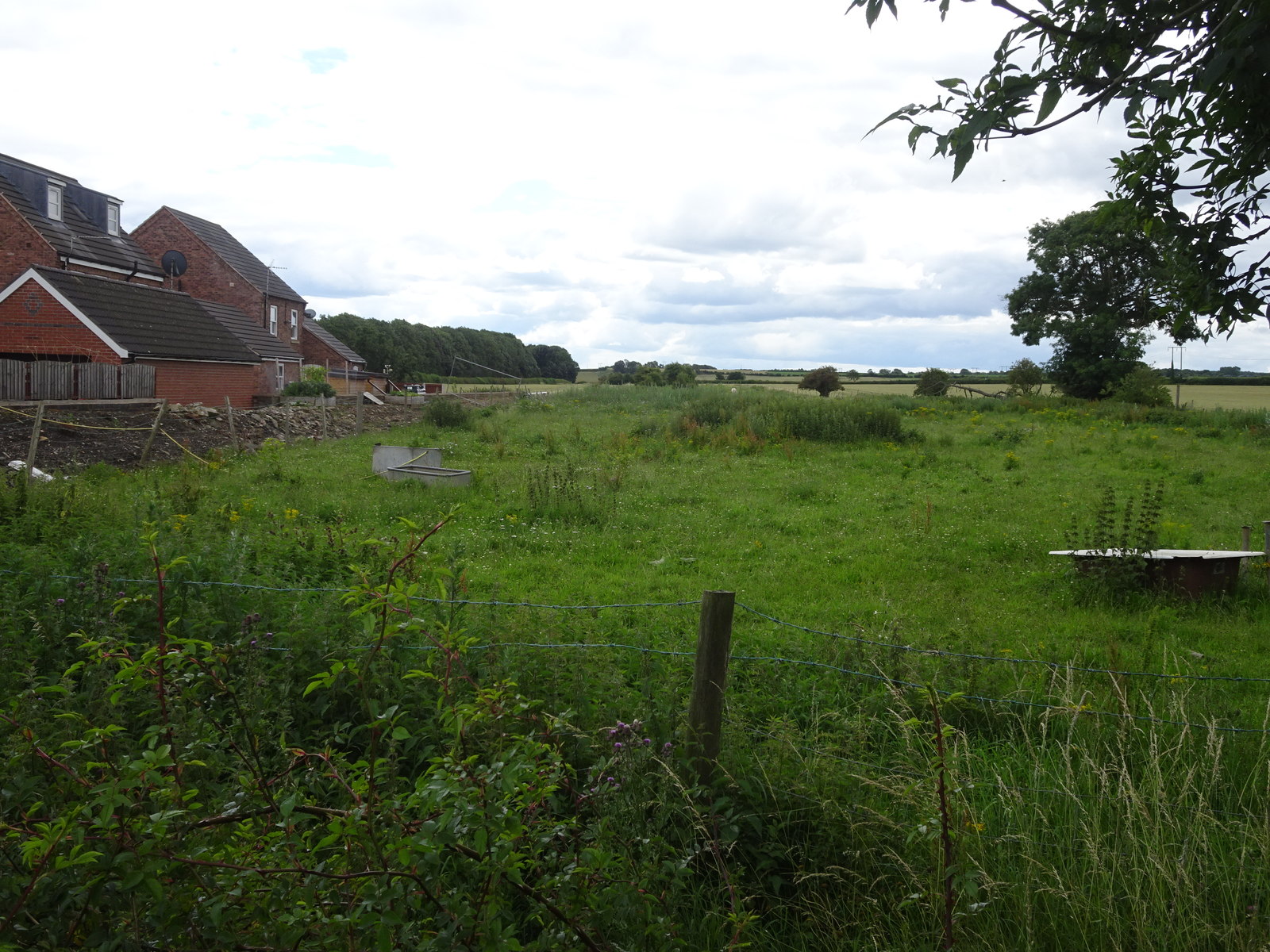
Brodsworth is a small village located in South Yorkshire, England. Situated approximately 5 miles north-west of Doncaster, it is part of the Metropolitan Borough of Doncaster. The village is nestled within the charming countryside of Yorkshire, surrounded by beautiful landscapes and rolling hills.

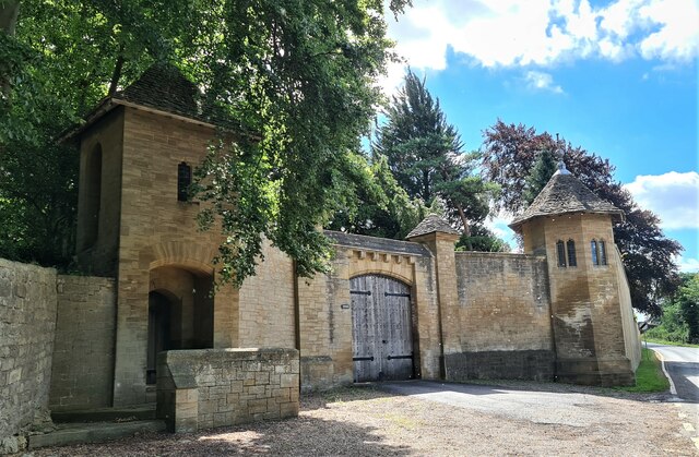
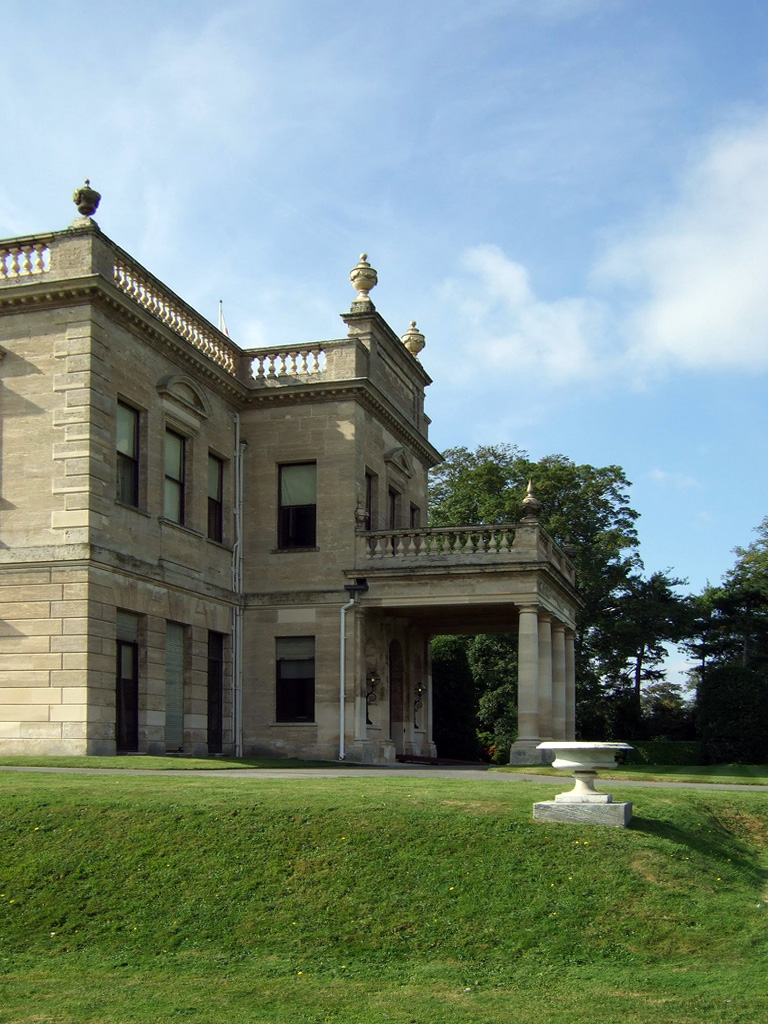
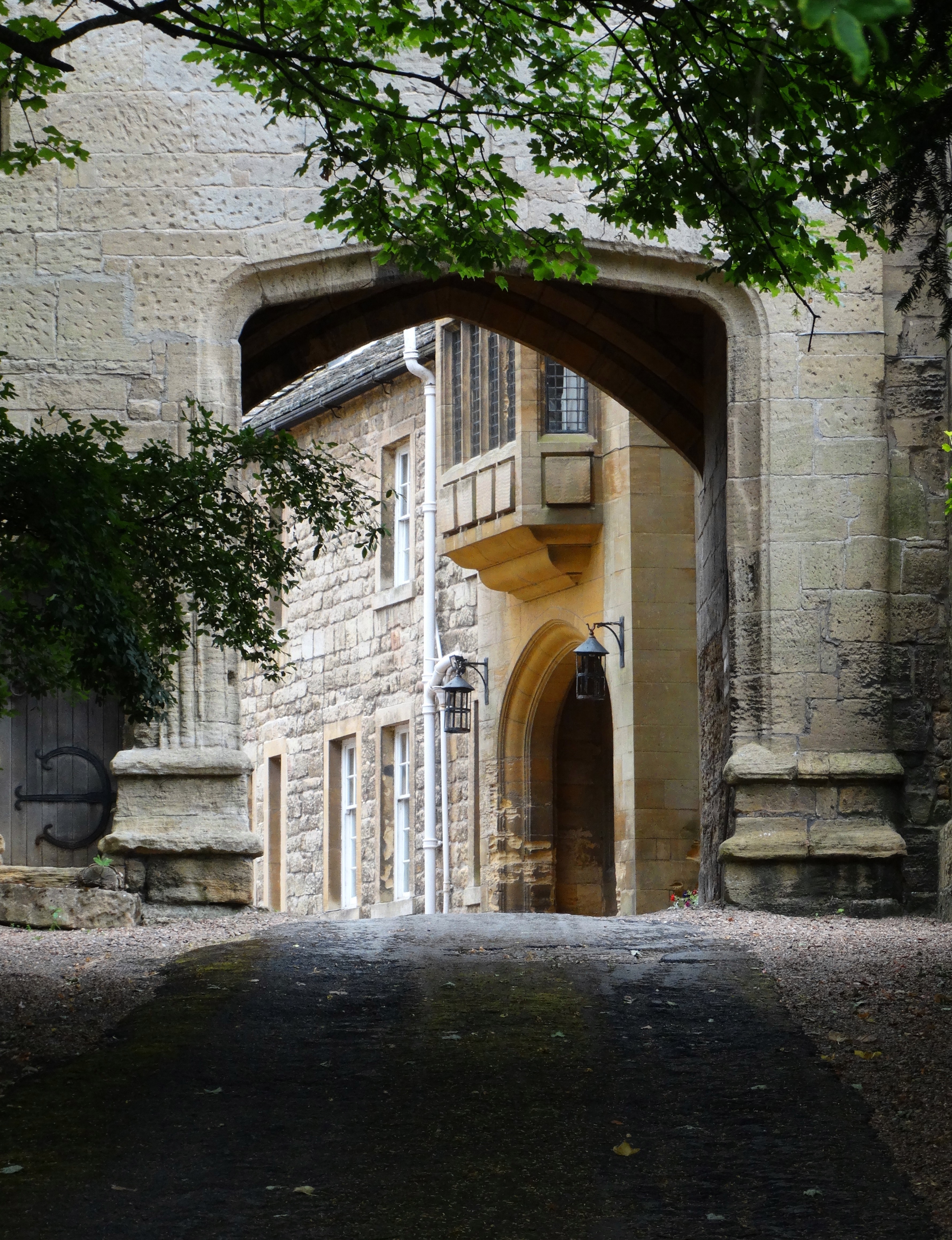
Brodsworth is best known for its historic mansion, Brodsworth Hall, which dates back to the 1860s. The hall is a prime example of Victorian architecture and is renowned for its well-preserved interiors and stunning gardens. Visitors can explore the opulent rooms, filled with original furniture and artwork, and wander through the meticulously maintained gardens, featuring picturesque flower beds and tranquil pathways.

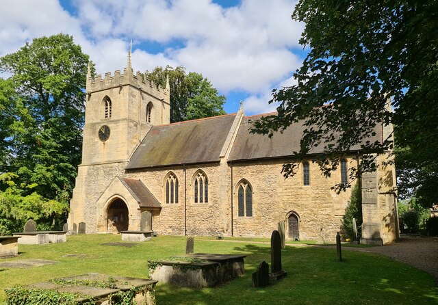
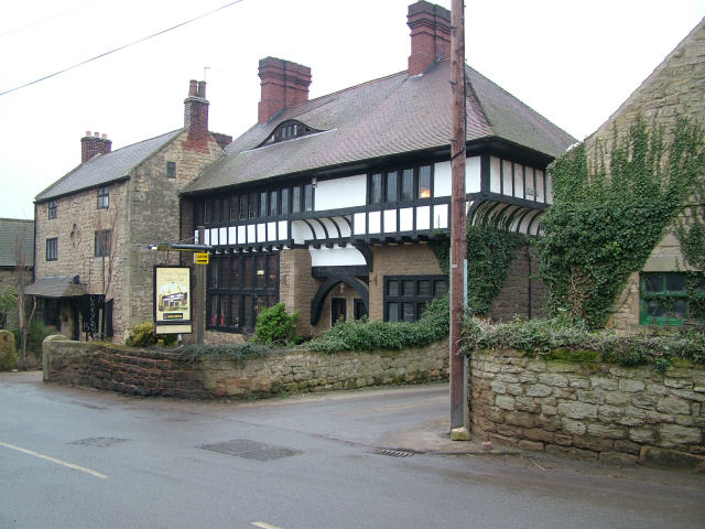
In addition to its architectural splendor, Brodsworth offers a range of amenities for its residents and visitors. The village has a primary school, a church, and a community center that hosts various events and activities throughout the year. There are also several local shops, pubs, and restaurants, providing plenty of options for dining and entertainment.

For nature enthusiasts, Brodsworth is an ideal base for exploring the surrounding countryside. The village is located near several nature reserves and country parks, offering opportunities for walking, cycling, and wildlife spotting.

Overall, Brodsworth is a picturesque village that combines history, natural beauty, and a close-knit community. Whether visiting the grand Brodsworth Hall or enjoying the tranquility of the surrounding countryside, there is something for everyone to appreciate in this charming Yorkshire village.

If you have any feedback on the listing, please let us know in the comments section below.

Brodsworth Images

Images are sourced within 2km of 53.559898/-1.243162 or Grid Reference SE5007. Thanks to Geograph Open Source API. All images are credited.

All Saints church, Hooton Pagnell
Gateway to Hooton Pagnell Hall Not as old as first appears, only dating to about 1914-20.
Gateway to Hooton Pagnell Hall
Not as old as first appears, only dating to about 1914-20.
Lound Lane
Lound Lane
View from Lound Lane
Lound Lane, cross paths
Narrow Baulk
Narrow Baulk
Medieval village cross Remains of
Medieval village cross
Remains of
'1903' restaurant Seemingly closed after Covid
'1903' restaurant
Seemingly closed after Covid
Entrance door, All Saints church, Hooton Roberts Old, but how old?
Entrance door, All Saints church, Hooton Roberts
Old, but how old?
In the thick of it Can't seen wood for trees
In the thick of it
Can't seen wood for trees
Lound Lane A tree-lined concessionary track and concessionary footpath
Lound Lane
A tree-lined concessionary track and concessionary footpath
Church of All Saints A grade 1 listed parish church dating from the 12th century.
Church of All Saints
A grade 1 listed parish church dating from the 12th century.
Harvesting a field of oats In North Field
Harvesting a field of oats
In North Field
Harvesting a field of oats In North Field near Hooton Pagnell
Harvesting a field of oats
In North Field near Hooton Pagnell
Junction of Lound Lane and Narrow Balk A junction of byway, bridleway and footpath. a byway
Junction of Lound Lane and Narrow Balk
A junction of byway, bridleway and footpath. a byway
Redroof A large house beside a wheat field to the east of Hooton Pagnell
Redroof
A large house beside a wheat field to the east of Hooton Pagnell
Clearing in Hampole Wood
Hooton Pagnell - All Saints Church
Show me another place!

Brodsworth is located at Grid Ref: SE5007 (Lat: 53.559898, Lng: -1.243162)

Division: West Riding

Unitary Authority: Doncaster

Police Authority: South Yorkshire

What 3 Words

///hours.discussed.slams. Near Marr, South Yorkshire

Related Wikis

Brodsworth

Brodsworth is a village, civil parish and suburb of Doncaster in the City of Doncaster district in South Yorkshire, England. Situated about five miles...

Brodsworth Hall

Brodsworth Hall, near Brodsworth, 5 miles (8 km) north-west of Doncaster in South Yorkshire, is one of the most complete surviving examples of a Victorian...

Bilham Sand Pits

Bilham Sand Pits (grid reference SE487066) is a 0.2 hectare (0.1 acre) geological site of Special Scientific Interest in South Yorkshire. The site was...

Pickburn and Brodsworth railway station

Pickburn and Brodsworth railway station was a small railway station situated on the South Yorkshire Junction Railway's line between Wrangbrook Junction...

Hooton Pagnell Hall

Hooton Pagnell Hall is a historic house in Hooton Pagnell, near Doncaster, South Yorkshire, occupied by the Warde family since the 18th century. ��2�...

Hooton Pagnell

Hooton Pagnell is a village and civil parish in the Metropolitan Borough of Doncaster in South Yorkshire, England, on the border with West Yorkshire. It...

St Chad's Hostel

St Chad's Hostel, in Hooton Pagnell near Doncaster, England, was a hostel to prepare candidates for theological college. It was opened in 1902 by Frederick...

Pickburn

Pickburn is a hamlet in South Yorkshire, England, close to the village of Brodsworth and Brodsworth Hall. == History == The hamlet appears to get its name...

Nearby Amenities

Located within 500m of 53.559898,-1.243162
Bus Stop
Brodsworth Road/Hooton Road
Naptan AtcoCode: 370040897
Naptan Bearing: E
Naptan CommonName: Brodsworth Road/Hooton Road
Naptan Indicator: 40897
Naptan Landmark: Home Farm
Naptan PlusbusZoneRef: ROTHCEN
Naptan Street: Brodsworth Road
Naptan Verified: no
Source: naptan_import
Lat/Long: 53.559964/-1.243158
Bus Stop
Brodsworth Road/Brodsworth Church
Alt Name: Brodsworth Road/Brodsworth Church
Naptan AltCommonName: Brodsworth Road/Brodsworth Church
Naptan AtcoCode: 370040898
Naptan Bearing: SW
Naptan CommonName: Brodsworth Road/Brodsworth Church
Naptan Indicator: 40898
Naptan Landmark: Brodsworth Church
Naptan PlusbusZoneRef: ROTHCEN
Naptan Street: Brodsworth Road
Naptan Verified: no
Source: naptan_import
Lat/Long: 53.5601436/-1.2360591
Bus Stop
Brodsworth Road/The Cliff
Alt Name: Brodsworth Road/The Cliff
Naptan AltCommonName: Brodsworth Road/The Cliff
Naptan AtcoCode: 370041099
Naptan Bearing: W
Naptan CommonName: Brodsworth Road/The Cliff
Naptan Indicator: 41099
Naptan Landmark: Glebe Farm
Naptan PlusbusZoneRef: ROTHCEN
Naptan Street: Brodsworth Road
Naptan Verified: no
Source: naptan_import
Lat/Long: 53.5599839/-1.2392173
Brodsworth Road/Hooton Road
Naptan AtcoCode: 370045905
Naptan Bearing: W
Naptan BusStopType: CUS
Naptan CommonName: Brodsworth Road/Hooton Road
Naptan Indicator: 45905
Naptan Landmark: HOME FARM
Naptan PlusbusZoneRef: ROTHCEN
Naptan Street: Brodsworth Road
Naptan Verified: no
Source: naptan_import
Lat/Long: 53.5598461/-1.2429941
Brodsworth Road/The Cliff
Alt Name: Brodsworth Road/The Cliff
Naptan AltCommonName: Brodsworth Road/The Cliff
Naptan AtcoCode: 370045906
Naptan Bearing: E
Naptan BusStopType: CUS
Naptan CommonName: Brodsworth Road/The Cliff
Naptan Indicator: 45906
Naptan Landmark: GLEBE FARM
Naptan PlusbusZoneRef: ROTHCEN
Naptan Street: Brodsworth Road
Naptan Verified: no
Source: naptan_import
Lat/Long: 53.5601103/-1.2393056
Bus Stop
Hooton Road/Street Lane
Alt Name: Hooton Road/Street Lane
Naptan AltCommonName: Hooton Road/Street Lane
Naptan AtcoCode: 370041153
Naptan Bearing: W
Naptan CommonName: Hooton Road/Street Lane
Naptan Indicator: 41153
Naptan Landmark: Streetlight No 01200
Naptan PlusbusZoneRef: ROTHCEN
Naptan Street: Hooton Road
Naptan Verified: no
Source: naptan_import
Lat/Long: 53.5617598/-1.2499804
Brodsworth
Place: village
Lat/Long: 53.5603787/-1.2403015
Toilets
Lat/Long: 53.5582557/-1.2378074
The data included in this document is from www.openstreetmap.org. The data is made available under ODbL.

Have you been to Brodsworth?

Leave your review of Brodsworth below (or comments, questions and feedback).