Gorsley and Kilcot

Civil Parish in Gloucestershire Forest of Dean

England

Gorsley and Kilcot

Farm drive to Knappers Farm The winding farm drive leading to Knappers Farm near Newent.  A public footpath follows this drive.
Farm drive to Knappers Farm Credit: Philip Halling

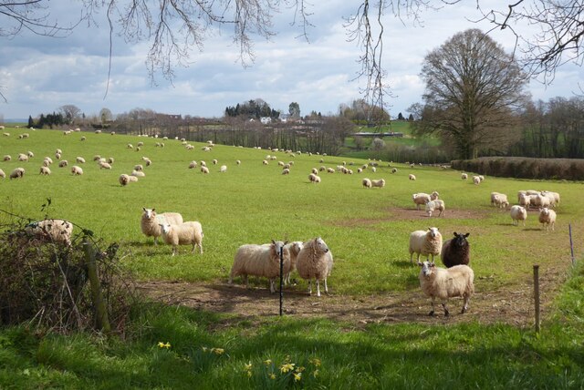
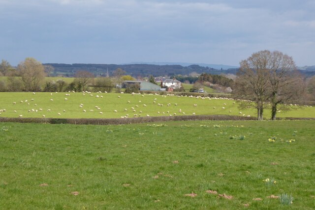
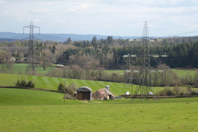
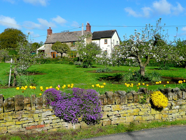
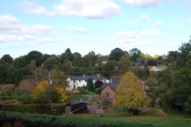
Gorsley and Kilcot is a civil parish located in the Forest of Dean district of Gloucestershire, England. It is situated approximately 7 miles southwest of the market town of Newent and 14 miles northeast of the city of Gloucester. The parish is made up of two distinct villages, Gorsley and Kilcot, which are separated by open fields and woodlands.

Gorsley is the larger of the two villages and is home to a small but vibrant community. It features a range of amenities including a primary school, a village hall, a pub, and a community shop. The village is known for its picturesque countryside, with rolling hills and meandering streams providing a scenic backdrop.

Kilcot, on the other hand, is a much smaller and more rural village. It consists mainly of a scattering of cottages and farmhouses, surrounded by farmland and wooded areas. The village is renowned for its tranquil atmosphere and is popular with those seeking a peaceful countryside retreat.

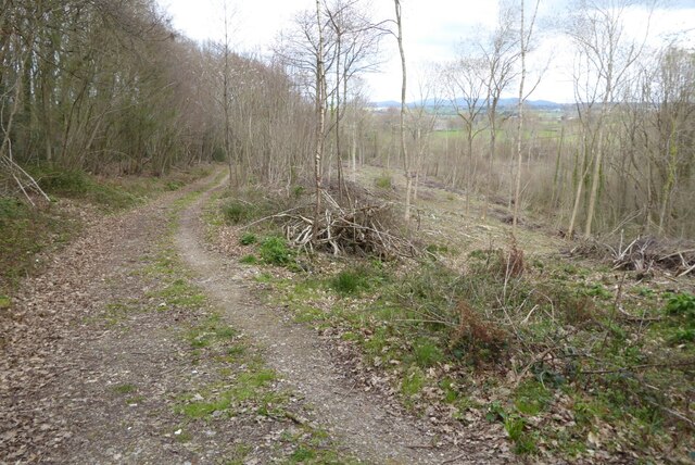
Both Gorsley and Kilcot offer excellent opportunities for outdoor activities such as walking, cycling, and horse riding. The surrounding area is rich in natural beauty, with numerous footpaths and bridleways crisscrossing the countryside.

Overall, Gorsley and Kilcot provides a charming and idyllic setting for those looking to escape the hustle and bustle of city life. With its beautiful landscapes, friendly community, and range of amenities, it is a highly desirable location to live in Gloucestershire.

If you have any feedback on the listing, please let us know in the comments section below.

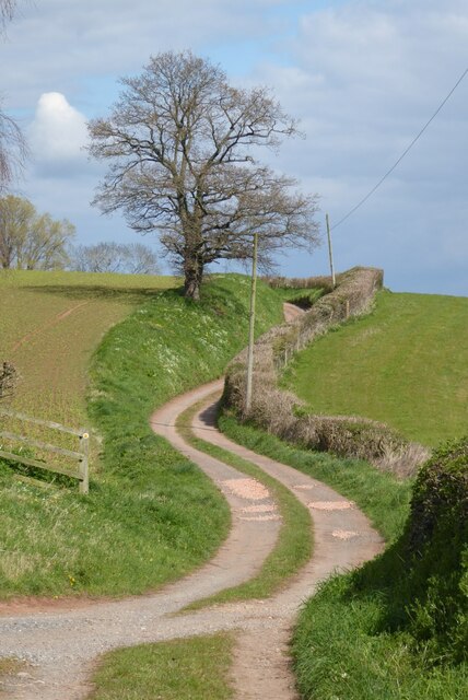
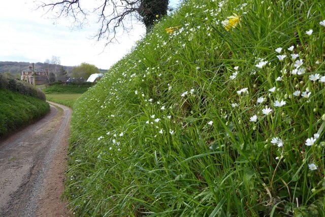
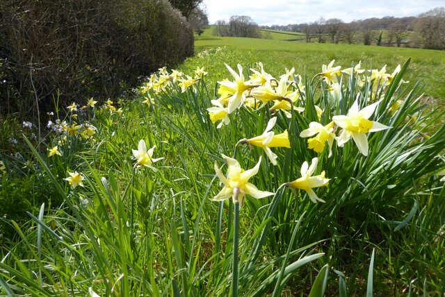
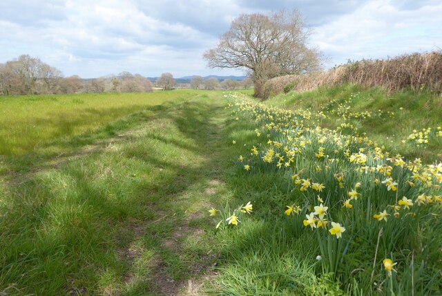
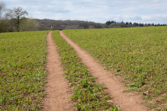
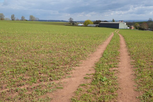
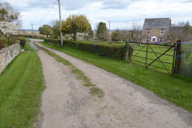
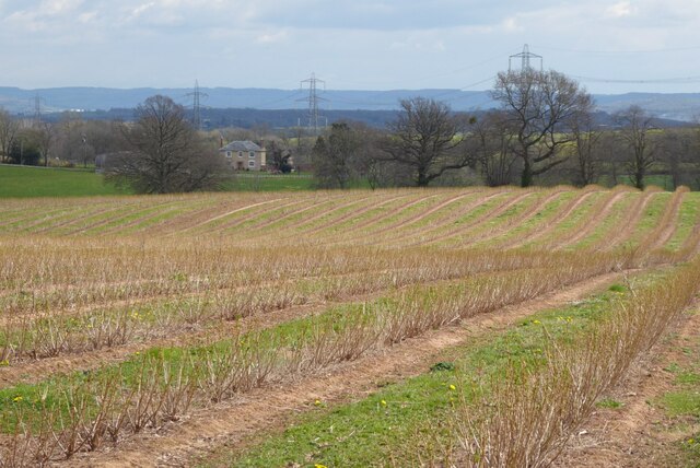
Gorsley and Kilcot Images

Images are sourced within 2km of 51.921903/-2.447006 or Grid Reference SO6924. Thanks to Geograph Open Source API. All images are credited.

Farm drive to Knappers Farm The winding farm drive leading to Knappers Farm near Newent.  A public footpath follows this drive.
Farm drive to Knappers Farm
The winding farm drive leading to Knappers Farm near Newent. A public footpath follows this drive.
Spring blooms on the roadside The farm drive to Knappers Farm has become sunken, no doubt from centuries of use.  Spring bloom as colour to the grass bank.  The farmhouse can be seen in the background.
Spring blooms on the roadside
The farm drive to Knappers Farm has become sunken, no doubt from centuries of use. Spring bloom as colour to the grass bank. The farmhouse can be seen in the background.
Wild daffodils Wild daffodils beside a field hedgerow near Knappers Farm.
Wild daffodils
Wild daffodils beside a field hedgerow near Knappers Farm.
Daffodils and a footpath This footpath near Knappers Farm is the route of the Geopark Way.  Wild daffodils are a feature of this corner of Gloucestershire.
Daffodils and a footpath
This footpath near Knappers Farm is the route of the Geopark Way. Wild daffodils are a feature of this corner of Gloucestershire.
Sheep near Knappers Farm Sheep in a field beside the Geopark Way to the south-west of Knappers Farm.
Sheep near Knappers Farm
Sheep in a field beside the Geopark Way to the south-west of Knappers Farm.
Farmland around Knappers Farm View to the north-east from the Geopark Way where it enters Acorn Wood.  Sheep graze a field in the middle distance with Knappers Farm beyond.  The spire of Newent Church can be seen to the left of centre.
Farmland around Knappers Farm
View to the north-east from the Geopark Way where it enters Acorn Wood. Sheep graze a field in the middle distance with Knappers Farm beyond. The spire of Newent Church can be seen to the left of centre.
Footpath through Acorn Word The Geopark Way follows this footpath through Acorn Wood to the south of Newent.  Here the wood is partially felled.
Footpath through Acorn Word
The Geopark Way follows this footpath through Acorn Wood to the south of Newent. Here the wood is partially felled.
Farm buildings Farm buildings and electricity pylons near Clifford Mesne.
Farm buildings
Farm buildings and electricity pylons near Clifford Mesne.
Footpath crossing an arable field The Geopark Way follows this footpath across this field near Knappers Farm.
Footpath crossing an arable field
The Geopark Way follows this footpath across this field near Knappers Farm.
Footpath approaching Knappers Farm The Geopark Way follows this footpath approaching Knappers Farm.
Footpath approaching Knappers Farm
The Geopark Way follows this footpath approaching Knappers Farm.
Footpath and track Footpath and track near Clifford's Mesne.
Footpath and track
Footpath and track near Clifford's Mesne.
Farmland near Clifford's Mesne I am not sure what the bushes are in this field, possibly currents.
Farmland near Clifford's Mesne
I am not sure what the bushes are in this field, possibly currents.
Former Newent Falconry centre Sadly this falconry centre is no longer open.
Former Newent Falconry centre
Sadly this falconry centre is no longer open.
A field of broad beans Broad beans beside a footpath in a field to the south of Newent.
A field of broad beans
Broad beans beside a footpath in a field to the south of Newent.
St Peter's Church - Clifford's Mesne
Path through Acorn Wood A footpath leading north through Acorn Wood.
Path through Acorn Wood
A footpath leading north through Acorn Wood.
Gate into field A track leading to a gate on a sheep field.
Gate into field
A track leading to a gate on a sheep field.
Llama in field A llama in a field belonging to Briery Hill Llamas, a llama trekking company.
Llama in field
A llama in a field belonging to Briery Hill Llamas, a llama trekking company.
Show me another place!

Gorsley and Kilcot is located at Grid Ref: SO6924 (Lat: 51.921903, Lng: -2.447006)

Administrative County: Gloucestershire

District: Forest of Dean

Police Authority: Gloucestershire

What 3 Words

///debating.animator.repeats. Near Newent, Gloucestershire

Related Wikis

Aston Ingham

Aston Ingham is a village in south-eastern Herefordshire, England, near Newent and about 7 miles (11 km) east of Ross-on-Wye. The population of the village...

Gorsley and Kilcot

Gorsley and Kilcot is a civil parish forming part of the district of the Forest of Dean in the English county of Gloucestershire. The single parish of...

Gorsley

Gorsley is a small village in the Forest of Dean district of Gloucestershire, forming part of the civil parish of Gorsley and Kilcot in the South West...
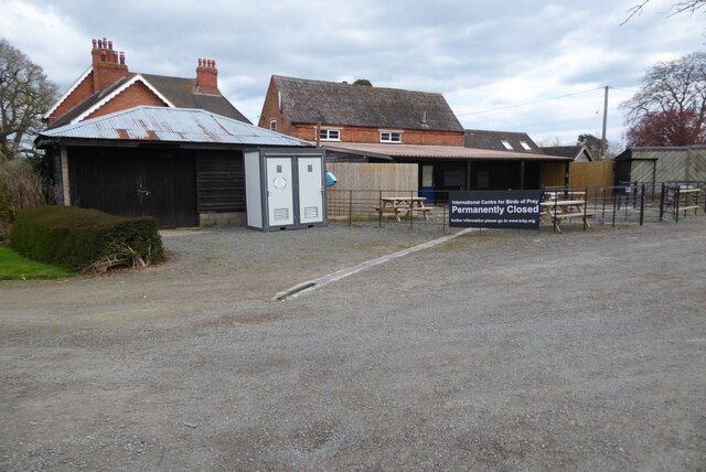
Boulsdon

Boulsdon is a village in Gloucestershire, England. It is the location of the International Centre for Birds of Prey.A low mound in the village may have...

Beavan's Hill

Beavan's Hill is a village in south east Herefordshire, England. The village is situated on the edge of Withymoor Wood, an area of ancient woodland, and...

Gorsley Common

Gorsley Common is a village in Herefordshire, west of Gorsley and Kilcot and east of Linton. == References == == External links == Media related to Gorsley...

Newent Community School

Newent Community School is a secondary school in Newent, Gloucestershire, England. It is an Academy of 1,340 students, serving the town and the rural...

Oxenhall

Oxenhall is a village and civil parish 10 miles (16 km) north west of Gloucester, in the Forest of Dean district, in the county of Gloucestershire, England...

Nearby Amenities

Located within 500m of 51.921903,-2.447006
Post Box
Post Box Type: lamp
Ref: GL18 244
Royal Cypher: EIIR
Royal Cypher Wikidata: Q33102113
Lat/Long: 51.9184072/-2.4509457
Generator Method: photovoltaic
Generator Output Electricity: yes
Generator Source: solar
Generator Type: solar_photovoltaic_panel
Location: roof
Power: generator
Lat/Long: 51.9183819/-2.4507961
Generator Output Electricity: yes
Generator Source: solar
Location: roof
Power: generator
Lat/Long: 51.9177781/-2.4486288
Generator Output Electricity: yes
Generator Source: solar
Location: roof
Power: generator
Lat/Long: 51.9186019/-2.4515364
Rose Villa
Power: pole
Transformer: distribution
Voltage Primary: 11000
Lat/Long: 51.9181238/-2.450102
Power: pole
Lat/Long: 51.9177896/-2.4495602
Power: pole
Lat/Long: 51.918214/-2.4494684
Power: pole
Lat/Long: 51.9187396/-2.4493577
Power: pole
Lat/Long: 51.9192388/-2.4498164
Kilcot Wood
Power: pole
Transformer: distribution
Voltage Primary: 11000
Lat/Long: 51.9205445/-2.4502489
Power: pole
Lat/Long: 51.9201355/-2.4503622
Power: pole
Lat/Long: 51.919803/-2.4504326
Power: pole
Lat/Long: 51.9194328/-2.4505413
Power: pole
Lat/Long: 51.9195606/-2.4510274
Power: pole
Lat/Long: 51.9196785/-2.451472
Power: pole
Lat/Long: 51.9198087/-2.4519662
Tennis Club
Power: pole
Transformer: distribution
Voltage Primary: 11000
Lat/Long: 51.9200399/-2.4528674
Ford Farm
Power: pole
Transformer: distribution
Voltage Primary: 11000
Lat/Long: 51.9253697/-2.4481937
Power: pole
Lat/Long: 51.9256567/-2.4488334
Power: pole
Lat/Long: 51.9259623/-2.4495073
The data included in this document is from www.openstreetmap.org. The data is made available under ODbL.

Have you been to Gorsley and Kilcot?

Leave your review of Gorsley and Kilcot below (or comments, questions and feedback).