Brockweir

Settlement in Gloucestershire Forest of Dean

England

Brockweir

Tourist at Tintern Abbey As I was wandering around and about the abbey taking photos this retired couple pulled their car onto the pavement and the wife climbed out and took a few digital photos of the ruins, the husband rummaged in a camera case in the boot and took a few photos with his digital SLR then he climbed back into the car and they went. Tintern done in maybe two minutes. "What is this life, if full of care, we have no time to stand and stare?"...
Tourist at Tintern Abbey Credit: Jeremy Bolwell

Brockweir is a picturesque village situated in the Forest of Dean district of Gloucestershire, England. Nestled along the banks of the River Wye, it is located near the border with Wales, offering stunning views of the surrounding countryside. With a population of around 200 residents, it is a small but vibrant community.

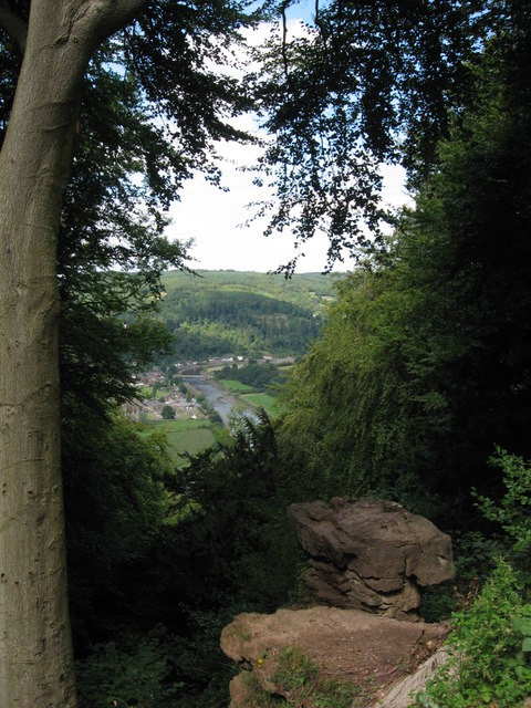
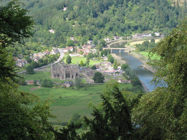
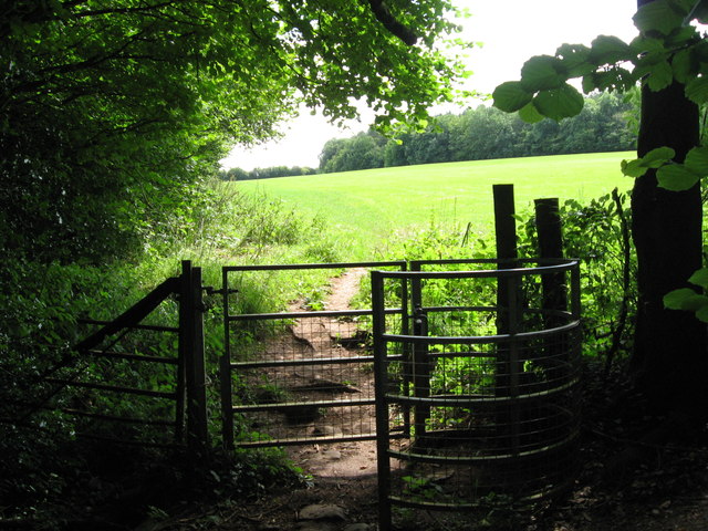
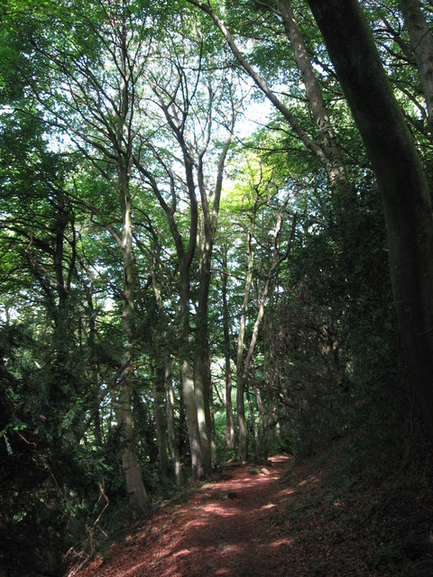
The village is known for its tranquil atmosphere, making it a popular destination for those seeking a peaceful retreat. The area is rich in natural beauty, with lush green landscapes, rolling hills, and dense forests that provide ample opportunities for outdoor activities such as hiking, cycling, and birdwatching.

Brockweir is also home to several historic landmarks, including the Grade II listed St. Peter's Church, which dates back to the 12th century. The church features a unique wooden spire and is known for its beautiful stained glass windows. Additionally, the village is home to a traditional pub, The Brockweir Inn, which offers a warm and friendly atmosphere for locals and visitors alike.

Although small in size, Brockweir has a strong sense of community, with various events and activities organized throughout the year. The village also has a community shop, run by volunteers, providing essential goods and services to residents.

Overall, Brockweir is a charming and idyllic village, offering a peaceful escape from the hustle and bustle of city life. Its natural beauty, historic landmarks, and strong community spirit make it a hidden gem in the Gloucestershire countryside.

If you have any feedback on the listing, please let us know in the comments section below.
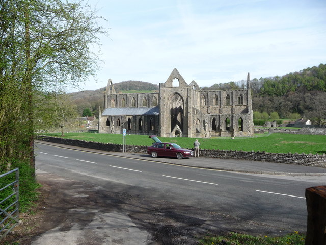
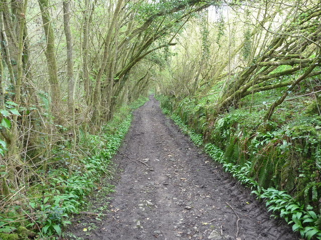
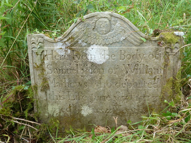
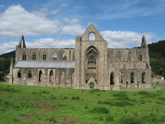
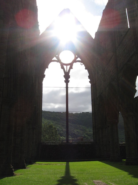
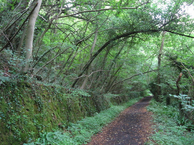
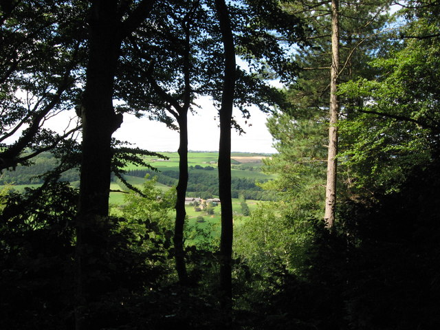
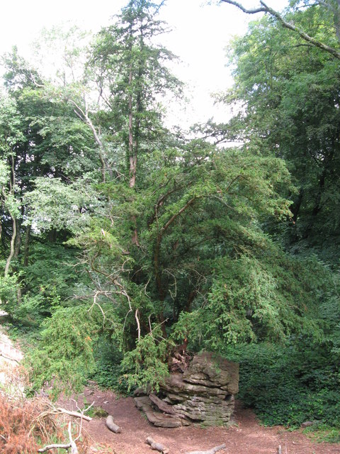
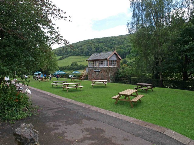
Brockweir Images

Images are sourced within 2km of 51.708495/-2.667158 or Grid Reference SO5401. Thanks to Geograph Open Source API. All images are credited.

Tourist at Tintern Abbey As I was wandering around and about the abbey taking photos this retired couple pulled their car onto the pavement and the wife climbed out and took a few digital photos of the ruins, the husband rummaged in a camera case in the boot and took a few photos with his digital SLR then he climbed back into the car and they went. Tintern done in maybe two minutes. "What is this life, if full of care, we have no time to stand and stare?"...
Tourist at Tintern Abbey
As I was wandering around and about the abbey taking photos this retired couple pulled their car onto the pavement and the wife climbed out and took a few digital photos of the ruins, the husband rummaged in a camera case in the boot and took a few photos with his digital SLR then he climbed back into the car and they went. Tintern done in maybe two minutes. "What is this life, if full of care, we have no time to stand and stare?"...
The Wye Valley Walk in Limekiln Woods This track carries the WVW into beautiful woodland.
The Wye Valley Walk in Limekiln Woods
This track carries the WVW into beautiful woodland.
Tintern - 1713 gravestone in St Mary's churchyard "Here lyeth the Body of Samuel ye son of William Mathews who departed this Life June ye 7th 1713 aged 9 Years ..."
Tintern - 1713 gravestone in St Mary's churchyard
"Here lyeth the Body of Samuel ye son of William Mathews who departed this Life June ye 7th 1713 aged 9 Years ..."
Tintern Abbey
Tintern Abbey
Tintern Abbey, east window
Path along course of Wye Valley Railway near Tintern
View west from Offa's Dyke Reddings Farm can be seen between the trees.
View west from Offa's Dyke
Reddings Farm can be seen between the trees.
Yew tree growing from rocky outcrop Near the Devil's Pulpit on Offa's Dyke.
Yew tree growing from rocky outcrop
Near the Devil's Pulpit on Offa's Dyke.
The Devil's Pulpit
The Devil's Pulpit
View from the Devil's Pulpit As seen in <a href="https://www.geograph.org.uk/photo/2544763">ST5499 : The Devil's Pulpit</a>, the view is over Tintern, with its Abbey, the River Wye and the Wireworks Branch bridge prominent.
View from the Devil's Pulpit
As seen in ST5499 : The Devil's Pulpit, the view is over Tintern, with its Abbey, the River Wye and the Wireworks Branch bridge prominent.
Kissing Gate near the Devil's Pulpit
On Offa's Dyke
On Offa's Dyke
The Abbey Hotel at Tintern Commanding a fine view of the Abbey on the opposite side of the main road.
The Abbey Hotel at Tintern
Commanding a fine view of the Abbey on the opposite side of the main road.
Another Kissing Gate The stiles on the path from Tidenham Chase to the "Devil's Pulpit" have been replaced with kissing gates.
Another Kissing Gate
The stiles on the path from Tidenham Chase to the "Devil's Pulpit" have been replaced with kissing gates.
The Devil's Pulpit Limestone stack on the edge of the escarpment above the Wye. Tintern Abbey is visible in the distance.
The Devil's Pulpit
Limestone stack on the edge of the escarpment above the Wye. Tintern Abbey is visible in the distance.
Offa's Dyke Path The path follows the wooded scarp edge north of the Devil's Pulpit.
Offa's Dyke Path
The path follows the wooded scarp edge north of the Devil's Pulpit.
Devils Pulpit
Devils Pulpit
Rock and roots  Close to the Devils pulpit
Rock and roots
Close to the Devils pulpit
Show me another place!

Brockweir is located at Grid Ref: SO5401 (Lat: 51.708495, Lng: -2.667158)

Administrative County: Gloucestershire

District: Forest of Dean

Police Authority: Gloucestershire

What 3 Words

///sweated.cheaply.acrobatic. Near Tintern, Monmouthshire

Related Wikis

Brockweir

Brockweir is a village in Hewelsfield and Brockweir civil parish, in the Forest of Dean District of Gloucestershire, England. The civil parish also includes...

Brockweir Halt railway station

Brockweir Halt was a request stop on the former Wye Valley Railway. It was opened to the public on 19 August 1929. It closed in 1959 when passenger services...

Tintern railway station

Tintern railway station served the village of Tintern on the Wye Valley Railway. It was opened in 1876 and closed for passengers in 1959 and freight in...

Shorn Cliff and Caswell Woods

Shorn Cliff And Caswell Woods (SO540005 & SO540990) is a 69.2-hectare (171-acre) biological Site of Special Scientific Interest in Gloucestershire, notified...

Nearby Amenities

Located within 500m of 51.708495,-2.667158
Brockweir
Is In: Gloucestershire, England, UK
Place: village
Wikidata: Q4972911
Wikipedia: en:Brockweir
Lat/Long: 51.7071861/-2.6679324
Brockweir
Historic Railway: halt
Railway: site
Wikidata: Q4972907
Wikipedia: en:Brockweir Halt railway station
Lat/Long: 51.7073705/-2.6700238
Toilets
Lat/Long: 51.7067579/-2.6658638
Bus Stop
Lat/Long: 51.7069398/-2.6700683
Bus Stop
Naptan AtcoCode: 5330AWB31269
Naptan NaptanCode: gwemawm
Note: 69 chepstow to monmouth
Lat/Long: 51.7086362/-2.6720436
Leisure: slipway
Lat/Long: 51.7073899/-2.6689387
Post Box
Collection Times: Mo-Fr 09:00; Sa 07:00
Operator: Royal Mail
Post Box Type: lamp
Ref: NP16 457D
Royal Cypher: EIIR
Royal Cypher Wikidata: Q33102113
Lat/Long: 51.707235/-2.6673921
Telephone
Defibrillator
Booth: K6
Covered: booth
Defibrillator Location: inside red phone box, Brockweir
Emergency: defibrillator
Man Made: telephone_box
Lat/Long: 51.7072593/-2.6673981
Barrier: stile
Foot: yes
Lat/Long: 51.7122452/-2.6698346
The data included in this document is from www.openstreetmap.org. The data is made available under ODbL.

Have you been to Brockweir?

Leave your review of Brockweir below (or comments, questions and feedback).