Framingham Earl

Civil Parish in Norfolk South Norfolk

England

Framingham Earl

Poringland, All Saints Church: Southern aspect
Poringland, All Saints Church: Southern aspect Credit: Michael Garlick

Framingham Earl is a civil parish located in the county of Norfolk, England. Situated approximately 6 miles south of the city of Norwich, it covers an area of about 6.5 square miles. The parish is predominantly rural, with a small population of around 1,200 residents.

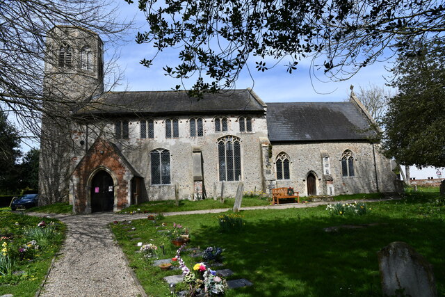
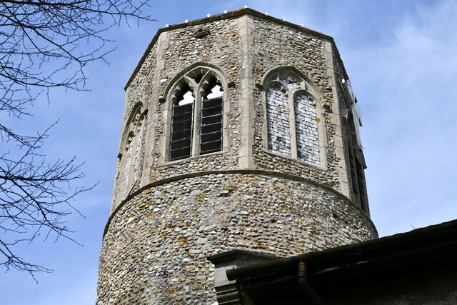
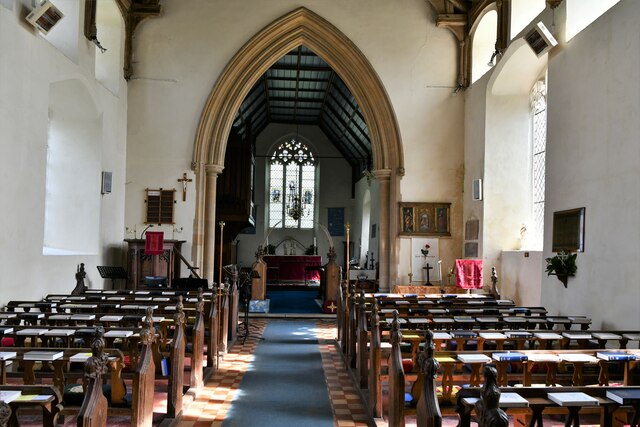
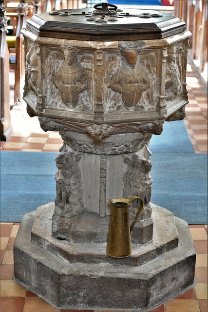
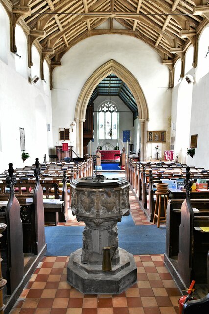
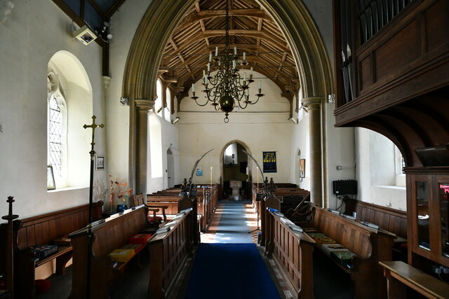
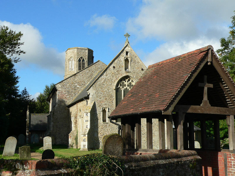
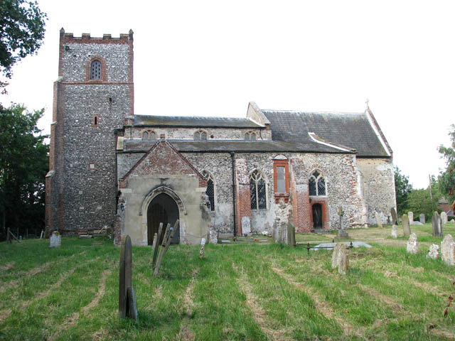
The landscape of Framingham Earl is characterized by open fields, farmland, and pockets of woodland, providing picturesque views and a tranquil setting. The River Tas runs through the parish, adding to its natural beauty. The parish is also home to several historic buildings, including a 14th-century church, St. Andrew's, which is a Grade I listed building.

Despite its relatively small population, Framingham Earl offers a range of amenities and services to its residents. These include a primary school, a village hall, a community center, and a local pub. The parish is well-connected to nearby towns and cities, with good transport links and easy access to major roads, such as the A47.

Framingham Earl is known for its strong community spirit, with a number of social and recreational activities organized throughout the year. Many residents also participate in local sports clubs and societies, contributing to the vibrant community life.

Overall, Framingham Earl offers a charming countryside living experience, with its idyllic landscapes, historic buildings, and close-knit community.

If you have any feedback on the listing, please let us know in the comments section below.

Framingham Earl Images

Images are sourced within 2km of 52.57601/1.362225 or Grid Reference TG2702. Thanks to Geograph Open Source API. All images are credited.

Poringland, All Saints Church: Southern aspect
Poringland, All Saints Church: c.1200 round tower with octagonal c14th top
Poringland, All Saints Church: Blocked north doorway
Poringland, All Saints Church: The nave
Poringland, All Saints Church: Octagonal font with the signs of the four Evangelists
Poringland, All Saints Church: Octagonal font with the signs of the four Evangelists and nave
Poringland, All Saints Church: The hammerbeam nave roof
Poringland, All Saints Church: c15th glass in the east window
Poringland, All Saints Church: c15th glass in the east window (detail)
Poringland, All Saints Church: The chancel and nave beyond
Poringland, All Saints Church: c15th glass fragments in a chancel window
Show me another place!

Framingham Earl is located at Grid Ref: TG2702 (Lat: 52.57601, Lng: 1.362225)

Administrative County: Norfolk

District: South Norfolk

Police Authority: Norfolk

What 3 Words

///town.beanbag.increment. Near Poringland, Norfolk

Related Wikis

Framingham Earl

Framingham Earl is a small village and civil parish in the English county of Norfolk. The village is located 5.8 miles (9.3 km) north-west of Loddon and...

Framingham Pigot

Framingham Pigot is a village and civil parish in the English county of Norfolk. The village is located 6.4 miles (10.3 km) north-west of Loddon and 3...

Poringland

Poringland is a village in the district of South Norfolk, England. It lies 5 miles (8.0 km) south of Norwich city centre and 10 miles (16 km) north of...

Yelverton, Norfolk

Yelverton is a village and civil parish in the English county of Norfolk, situated some 5 miles (8.0 km) south east of Norwich and closely associated with...

Nearby Amenities

Located within 500m of 52.57601,1.362225
Power: pole
Lat/Long: 52.576731/1.368106
Power: pole
Lat/Long: 52.575878/1.366962
Power: pole
Lat/Long: 52.577547/1.369158
Power: pole
Lat/Long: 52.574416/1.365126
Power: pole
Lat/Long: 52.574968/1.365815
Power: pole
Lat/Long: 52.573523/1.363968
Power: pole
Lat/Long: 52.572802/1.362651
Power: pole
Lat/Long: 52.572047/1.361275
Note: Reference hidden by strap given plate slippage
Operator: National Grid
Pipeline: marker
Substance: gas
Support: ground
Lat/Long: 52.5733184/1.3568314
Barrier: stile
Foot: yes
Lat/Long: 52.5771778/1.368569
Waste Basket
Waste: dog_excrement
Lat/Long: 52.5741492/1.3576084
Operator: National Grid
Pipeline: marker
Ref: A6ND 9408 CP 1001
Substance: gas
Support: ground
Lat/Long: 52.5750982/1.3585456
Entrance: main
Lat/Long: 52.574977/1.3596656
Barrier: lych_gate
Foot: yes
Material: wood
Lat/Long: 52.5751646/1.3596361
Entrance: yes
Lat/Long: 52.5748553/1.3596712
Give Way
Lat/Long: 52.5750938/1.3586558
Give Way
Lat/Long: 52.5751718/1.3587125
Bench
Backrest: yes
Inscription: Dedicated to Edward Christopher Alston, 1917-2003. Framingham Earl parjsh councillor 1948-1998, chairman 1973-1996, 50 years service.
Material: wood
Seats: 2
Lat/Long: 52.5778699/1.3634768
The data included in this document is from www.openstreetmap.org. The data is made available under ODbL.

Have you been to Framingham Earl?

Leave your review of Framingham Earl below (or comments, questions and feedback).