Brockhampton

Settlement in Gloucestershire Cotswold

England

Brockhampton

The Salt Way The ancient route for transporting salt from Droitwich to the south. Looking in the return direction.
The Salt Way Credit: Robin Webster

Brockhampton is a small village located in the county of Gloucestershire, England. Situated in the beautiful countryside of the Cotswolds, it is nestled between the towns of Cheltenham and Tewkesbury. With a population of approximately 600 residents, Brockhampton is known for its picturesque landscapes and tranquil atmosphere.

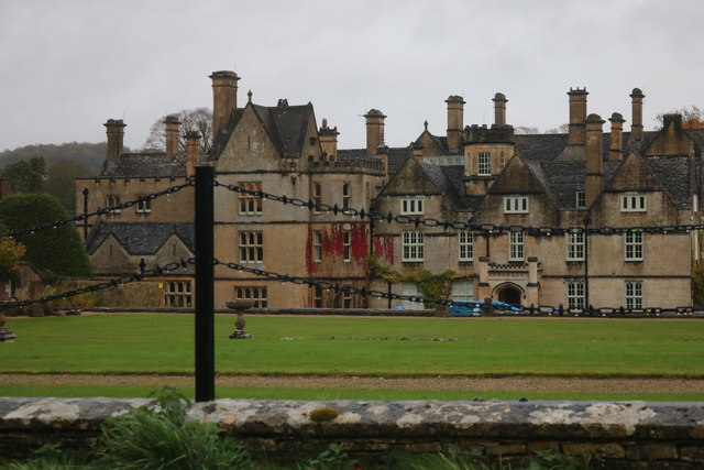
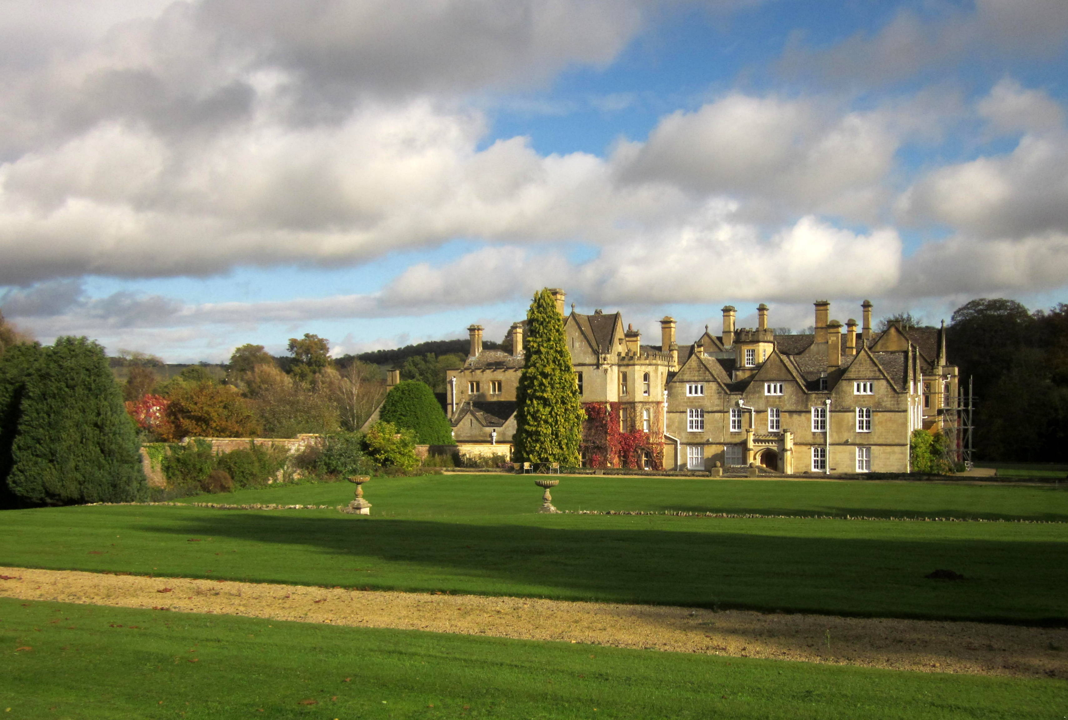
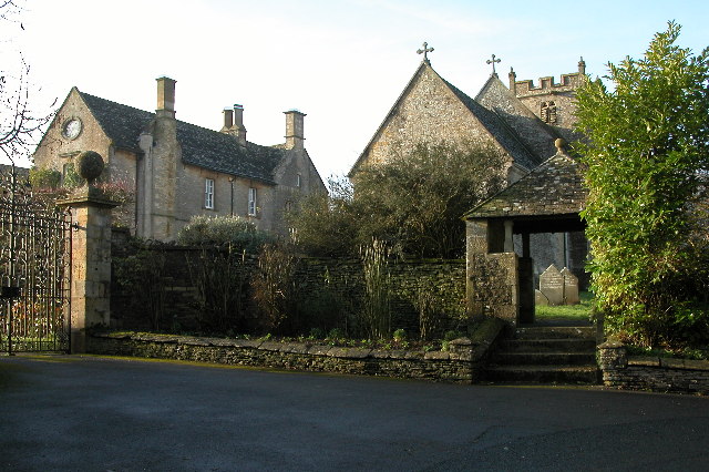
The village is characterized by its charming stone houses and quaint cottages, which exude a traditional English countryside charm. The architecture reflects the village's rich history, with some buildings dating back several centuries. The surrounding area is predominantly agricultural, with rolling hills and fields, providing a scenic backdrop for both residents and visitors.

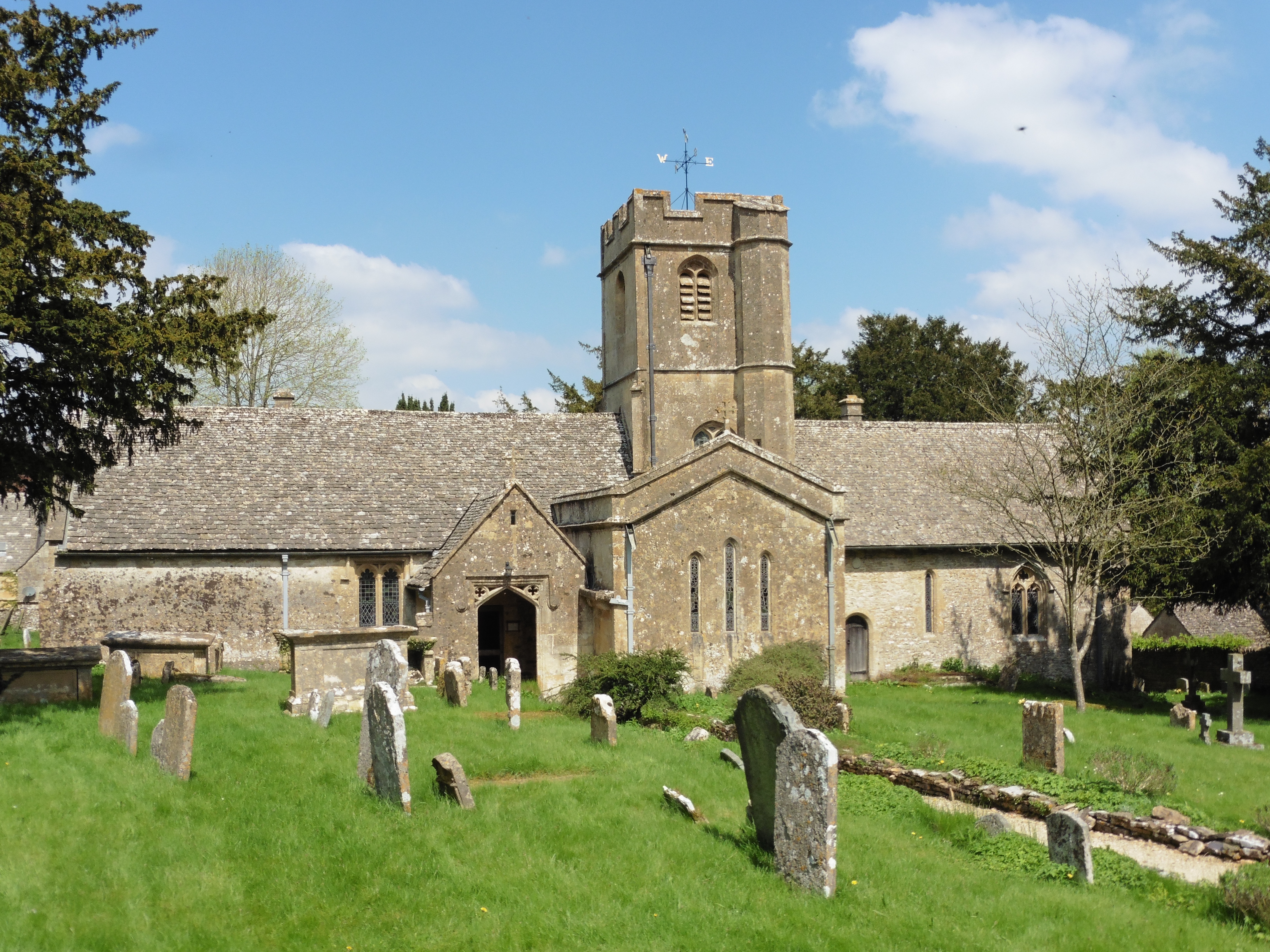
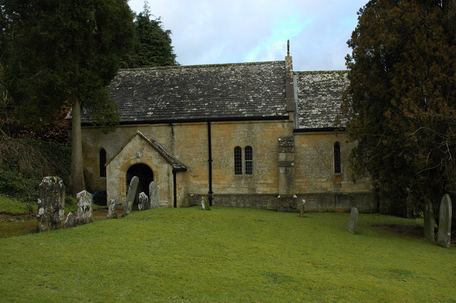
Brockhampton offers a sense of community, with a village hall serving as a hub for various local activities, events, and gatherings. The village also boasts a historic church, St. George's Church, which dates back to the 12th century and is known for its stunning medieval architecture.

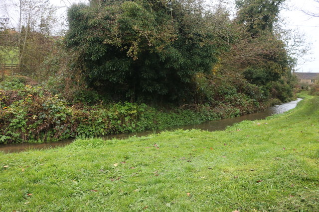
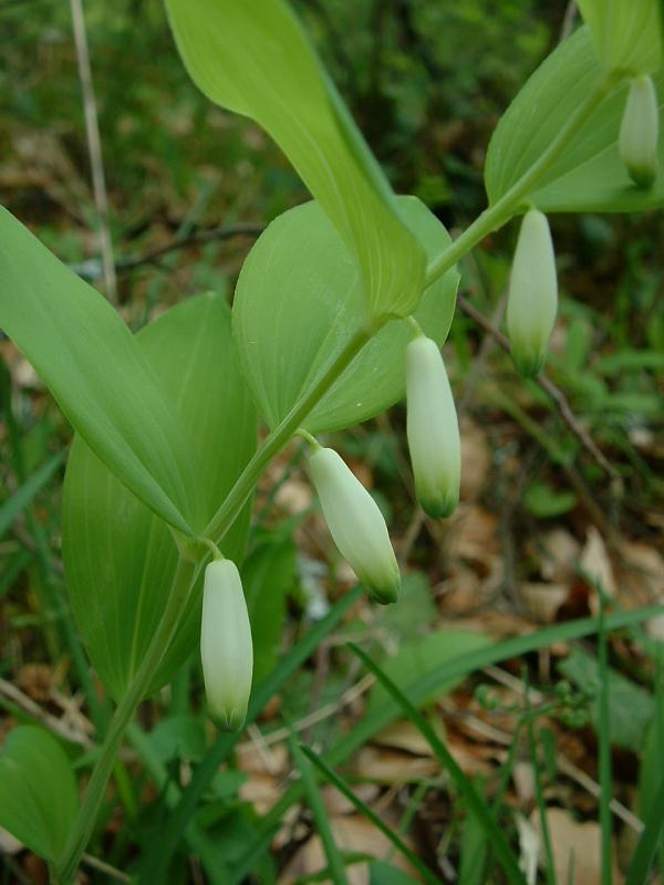
Nature enthusiasts will find plenty to explore in the area, as Brockhampton is surrounded by beautiful walking trails and nature reserves. The nearby Malvern Hills and Cotswold Way provide opportunities for outdoor activities such as hiking, cycling, and wildlife spotting.

Although small in size, Brockhampton is conveniently located near larger towns, offering easy access to amenities and services. The village is within a short driving distance to supermarkets, schools, healthcare facilities, and leisure amenities.

Overall, Brockhampton is a charming and peaceful village, perfect for those seeking a serene countryside lifestyle while still being within reach of modern conveniences.

If you have any feedback on the listing, please let us know in the comments section below.

Brockhampton Images

Images are sourced within 2km of 51.90063/-1.945901 or Grid Reference SP0322. Thanks to Geograph Open Source API. All images are credited.

The Salt Way The ancient route for transporting salt from Droitwich to the south. Looking in the return direction.
The Salt Way
The ancient route for transporting salt from Droitwich to the south. Looking in the return direction.
Bus shelter and telephone box in Brockhampton
The lane to Brockhampton in early April
Woodland at Clayhill in early April
Sheep grazing near Charlton Abbots
Brockhampton Park This large country house was converted into apartments in the 1980s.  The house was built in 1639-41 by Paul Pert with alterations in the 19th and early 20th centuries.  For more information see: <span class="nowrap"><a title="https://www.historicengland.org.uk/listing/the-list/list-entry/1303429" rel="nofollow ugc noopener" href="https://www.historicengland.org.uk/listing/the-list/list-entry/1303429">Link</a><img style="margin-left:2px;" alt="External link" title="External link - shift click to open in new window" src="https://s1.geograph.org.uk/img/external.png" width="10" height="10"/></span>
Brockhampton Park
This large country house was converted into apartments in the 1980s. The house was built in 1639-41 by Paul Pert with alterations in the 19th and early 20th centuries. For more information see: LinkExternal link
A root crop in a field A field of turnips, I think, near Charlton Abbots.
A root crop in a field
A field of turnips, I think, near Charlton Abbots.
Sevenhampton, Gloucestershire, St Andrew
The River Coln, Sevenhampton
Ford over the River Coln, Sevenhampton Although it was pouring with rain this feature was a permanent one regardless of the precipitation.
Ford over the River Coln, Sevenhampton
Although it was pouring with rain this feature was a permanent one regardless of the precipitation.
Brockhampton Park A grade II listed building, now private residences. <span class="nowrap"><a title="https://historicengland.org.uk/listing/the-list/list-entry/1303429" rel="nofollow ugc noopener" href="https://historicengland.org.uk/listing/the-list/list-entry/1303429">Link</a><img style="margin-left:2px;" alt="External link" title="External link - shift click to open in new window" src="https://s1.geograph.org.uk/img/external.png" width="10" height="10"/></span>
Brockhampton Park
A grade II listed building, now private residences. LinkExternal link
Sevenhampton village Nearly all of the village is along this little road
Sevenhampton village
Nearly all of the village is along this little road
Houses in Sevenhampton
New sign on an old pole, Sevenhampton At least they kept the stripes, I far prefer them.
New sign on an old pole, Sevenhampton
At least they kept the stripes, I far prefer them.
Brockhampton Park A stately home now converted into flats
Brockhampton Park
A stately home now converted into flats
House in Brockhampton
The Lane to Charlton Abbots
Lane in Charlton Abbots
Show me another place!

Brockhampton is located at Grid Ref: SP0322 (Lat: 51.90063, Lng: -1.945901)

Administrative County: Gloucestershire

District: Cotswold

Police Authority: Gloucestershire

What 3 Words

///apple.playoffs.crumples. Near Westfield, Gloucestershire

Related Wikis

Brockhampton, Gloucestershire

Brockhampton is a small village east of Cheltenham in Gloucestershire, England. It forms part of the parish of Sevenhampton.In the 2001 census the parish...

Church of St Andrew, Sevenhampton

The Anglican Church of St Andrew at Sevenhampton in the Cotswold District of Gloucestershire, England was built in the 12th century. It is a grade I listed...

Sevenhampton, Gloucestershire

Sevenhampton is a village and civil parish in Cotswold District, Gloucestershire. The parish is located in the Cotswolds in an area designated as an Area...

Charlton Abbots

Charlton Abbots is a village and former civil parish 12 miles (19 km) east of Gloucester, now in the parish of Sudeley, in the Tewkesbury district, in...

Hawling Manor, Gloucestershire

Hawling Manor in Hawling, Gloucestershire is a Grade II listed building. == History == Information from Country Life states that the manor "was held in...

Puckham Woods

Puckham Woods (grid reference SP010224) is a 32.38-hectare (80.0-acre) biological Site of Special Scientific Interest in Gloucestershire to the east of...

Whittington, Gloucestershire

Whittington, Gloucestershire is a village and rural parish in the county of Gloucestershire in England, United Kingdom. == Location == Whittington, Gloucestershire...

Hampen Railway Cutting

Hampen Railway Cutting (grid reference SP062205) is a 3.9-hectare (9.6-acre) geological Site of Special Scientific Interest in Gloucestershire, notified...

Nearby Amenities

Located within 500m of 51.90063,-1.945901
Brockhampton
Is In: Gloucestershire, England, UK
Is In Parish: Sevenhampton
Place: village
Wikidata: Q4972796
Lat/Long: 51.900521/-1.949513
Craven Arms
Disused Amenity: pub
Lat/Long: 51.8989799/-1.949781
Bus Stop
Chapel End
Bus: yes
Naptan AtcoCode: 1600GL763
Naptan Bearing: SE
Naptan CommonName: Chapel End
Naptan NaptanCode: glogamdj
Naptan Street: Main Street
Naptan Verified: no
Public Transport: platform
Source: naptan_import
Lat/Long: 51.8998035/-1.9482877
Bus Stop
Chapel End
Bus: yes
Naptan AtcoCode: 1600GL764
Naptan Bearing: W
Naptan CommonName: Chapel End
Naptan Indicator: Opp
Naptan NaptanCode: glogamdg
Naptan Street: Main Street
Naptan Verified: no
Public Transport: platform
Source: naptan_import
Lat/Long: 51.8997958/-1.9487064
Defibrillator
Emergency: defibrillator
Source: survey
Lat/Long: 51.9008391/-1.9483982
Post Box
Brand: Royal Mail
Brand Wikidata: Q638098
Collection Times: Mo-Fr 16:30; Sa 10:00
Operator: Royal Mail
Operator Wikidata: Q638098
Post Box Mounting: stone_pillar
Post Box Type: wall
Ref: GL54 155
Royal Cypher: GR
Royal Cypher Wikidata: Q33102273
Source: survey
Lat/Long: 51.8998631/-1.9482111
Telephone
Booth: K6
Covered: booth
Operator: BT
Operator Wikidata: Q593786
Phone: +44 1242 820459
Source: survey
Lat/Long: 51.8998006/-1.94824
Barrier: kissing_gate
Foot: designated
Lat/Long: 51.9014265/-1.9484771
Bench
Lat/Long: 51.8997299/-1.9480121
Give Way
Direction: backward
Lat/Long: 51.8998312/-1.9484183
Give Way
Direction: forward
Lat/Long: 51.8996401/-1.9481407
Give Way
Direction: backward
Lat/Long: 51.8997187/-1.948126
Give Way
Direction: forward
Lat/Long: 51.90001/-1.9481769
The data included in this document is from www.openstreetmap.org. The data is made available under ODbL.

Have you been to Brockhampton?

Leave your review of Brockhampton below (or comments, questions and feedback).