Ewerby and Evedon

Civil Parish in Lincolnshire North Kesteven

England

Ewerby and Evedon

Ash Holt, near Ewerby Thorpe
Ash Holt, near Ewerby Thorpe Credit: Chris

Ewerby and Evedon is a civil parish located in the county of Lincolnshire, in the East Midlands region of England. It is a rural area encompassing the villages of Ewerby and Evedon, which lie approximately 5 miles northwest of the town of Sleaford.

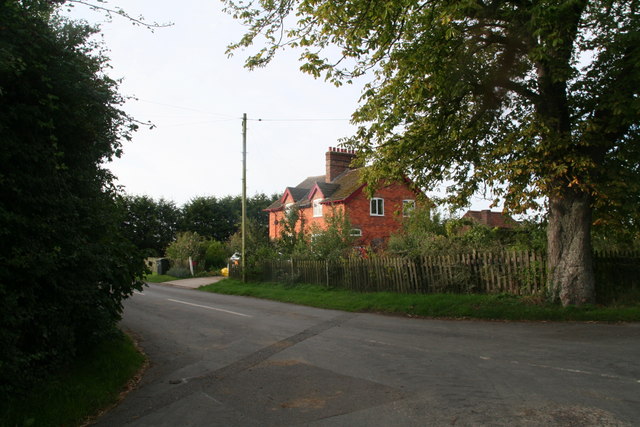
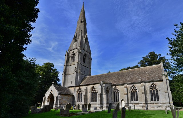
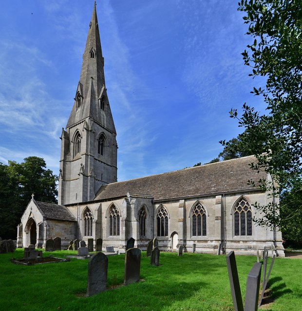
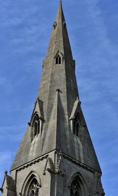
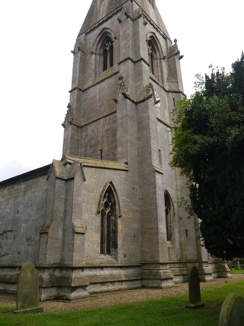
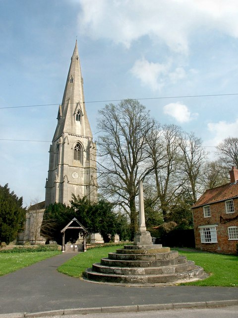
Ewerby is a picturesque village with a rich history, dating back to the medieval period. It is characterized by its charming cottages, historic buildings, and a beautiful church dedicated to St. Andrew. The village has a close-knit community and offers a peaceful and idyllic setting for its residents.

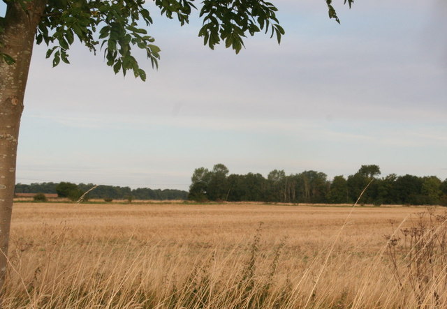
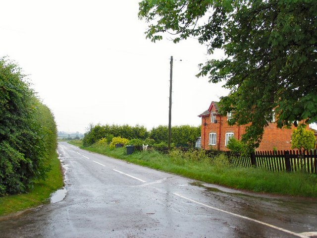
Evedon, on the other hand, is a smaller village within the parish. It is known for its agricultural heritage and is surrounded by farmland and open countryside. Evedon has a tranquil atmosphere and is a haven for those seeking a quieter lifestyle away from the hustle and bustle of larger towns and cities.

Both villages benefit from their proximity to Sleaford, where residents can access a wide range of amenities and services. Sleaford offers schools, shops, healthcare facilities, and leisure activities, ensuring that residents of Ewerby and Evedon have easy access to all the necessities of modern life.

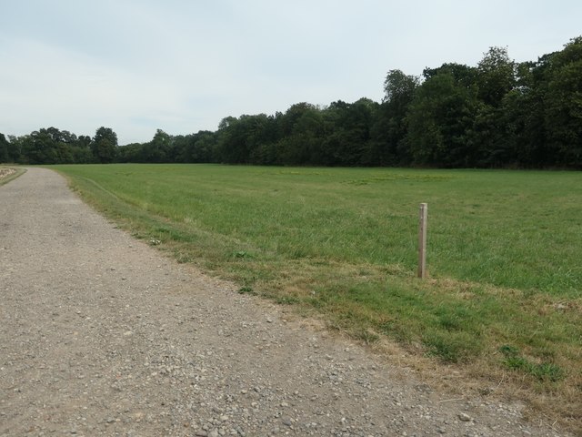
The area is popular with walkers and nature enthusiasts, with numerous footpaths and green spaces to explore. It is also conveniently located for those who need to commute to nearby towns and cities, with good transport links to Lincoln, Grantham, and Nottingham.

Overall, Ewerby and Evedon provide a charming and peaceful countryside living experience, with a strong sense of community and access to nearby amenities.

If you have any feedback on the listing, please let us know in the comments section below.

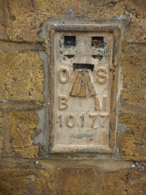
Ewerby and Evedon Images

Images are sourced within 2km of 53.019422/-0.331244 or Grid Reference TF1248. Thanks to Geograph Open Source API. All images are credited.

Ash Holt, near Ewerby Thorpe
Cottages in Ewerby Thorpe
Ewerby: St. Andrew's Church
Ewerby, St. Andrew's Church: The spire, its long broaches rising direct from the walls
Ewerby, St. Andrew's Church: The south doorway with carved foliage around it
Cut Mark: Ewerby, St Andrew's Church Cut bench mark on the north-west angle.  See <a title="https://www.geograph.org.uk/photo/5530040" href="https://www.geograph.org.uk/photo/5530040">Link</a> for a wider view and <span class="nowrap"><a title="http://www.bench-marks.org.uk/bm53211" rel="nofollow ugc noopener" href="http://www.bench-marks.org.uk/bm53211">Link</a><img style="margin-left:2px;" alt="External link" title="External link - shift click to open in new window" src="https://s1.geograph.org.uk/img/external.png" width="10" height="10"/></span> for details.
Cut Mark: Ewerby, St Andrew's Church
Cut bench mark on the north-west angle. See Link for a wider view and LinkExternal link for details.
Ewerby, St Andrew's Church There is a cut bench mark on the north-west angle.  See <a title="https://www.geograph.org.uk/photo/5530037" href="https://www.geograph.org.uk/photo/5530037">Link</a> for a closer view and <span class="nowrap"><a title="http://www.bench-marks.org.uk/bm53211" rel="nofollow ugc noopener" href="http://www.bench-marks.org.uk/bm53211">Link</a><img style="margin-left:2px;" alt="External link" title="External link - shift click to open in new window" src="https://s1.geograph.org.uk/img/external.png" width="10" height="10"/></span> for details.
Ewerby, St Andrew's Church
There is a cut bench mark on the north-west angle. See Link for a closer view and LinkExternal link for details.
Flush Bracket OSBM 10177: Ewerby, School Flush bracket bench mark on a former school, now part of a private house.  See <span class="nowrap"><a title="http://www.bench-marks.org.uk/bm21837" rel="nofollow ugc noopener" href="http://www.bench-marks.org.uk/bm21837">Link</a><img style="margin-left:2px;" alt="External link" title="External link - shift click to open in new window" src="https://s1.geograph.org.uk/img/external.png" width="10" height="10"/></span> for details of the mark.
Flush Bracket OSBM 10177: Ewerby, School
Flush bracket bench mark on a former school, now part of a private house. See LinkExternal link for details of the mark.
Footpath to Ewerby Recently re-routed.
Footpath to Ewerby
Recently re-routed.
Haverholme Priory: aerial 2020 (1)
Haverholme Priory: aerial 2020 (2)
Track on the north bank of the Old River Slea Heading west from Park Lane alongside a field of barley.
Track on the north bank of the Old River Slea
Heading west from Park Lane alongside a field of barley.
Pipe bridge across the Old River Slea Near the Lodge on Park Lane. Contents unknown.
Pipe bridge across the Old River Slea
Near the Lodge on Park Lane. Contents unknown.
Stubble field on the south bank of the Old River Slea Of Park Lane. About 5 metres above sea level.
Stubble field on the south bank of the Old River Slea
Of Park Lane. About 5 metres above sea level.
The Old River Slea, by the Lodge, Park Lane Looking downstream [locally east].
The Old River Slea, by the Lodge, Park Lane
Looking downstream [locally east].
Cereal field and Haverholme Wood On the north bank of the Old River Slea, about 5 metres above sea level.
Cereal field and Haverholme Wood
On the north bank of the Old River Slea, about 5 metres above sea level.
Strip of woodland off Park Lane Narrow and irregular in shape, the strip of woodland wriggles for about a mile between Evedon Wood and Haverholme Wood.
Strip of woodland off Park Lane
Narrow and irregular in shape, the strip of woodland wriggles for about a mile between Evedon Wood and Haverholme Wood.
Show me another place!

Ewerby and Evedon is located at Grid Ref: TF1248 (Lat: 53.019422, Lng: -0.331244)

Administrative County: Lincolnshire

District: North Kesteven

Police Authority: Lincolnshire

What 3 Words

///artichoke.native.person. Near Heckington, Lincolnshire

Related Wikis

Ewerby and Evedon

Ewerby and Evedon is a civil Parish in North Kesteven, Lincolnshire, England. It includes the villages of Ewerby and Evedon, the hamlet of Haverholme,...

Ewerby

Ewerby is a village in the North Kesteven district of Lincolnshire, England. It lies 3 miles (4.8 km) north-east from Sleaford and 2 miles (3.2 km) south...

Ewerby Thorpe

Ewerby Thorpe is a hamlet in the civil parish of Ewerby and Evedon, in the North Kesteven district of Lincolnshire, England. It lies 2 miles (3.2 km) north...

Haverholme

Haverholme is a hamlet and site of Haverholme Priory in the North Kesteven district of Lincolnshire, England. It is situated about 4 miles (6 km) north...
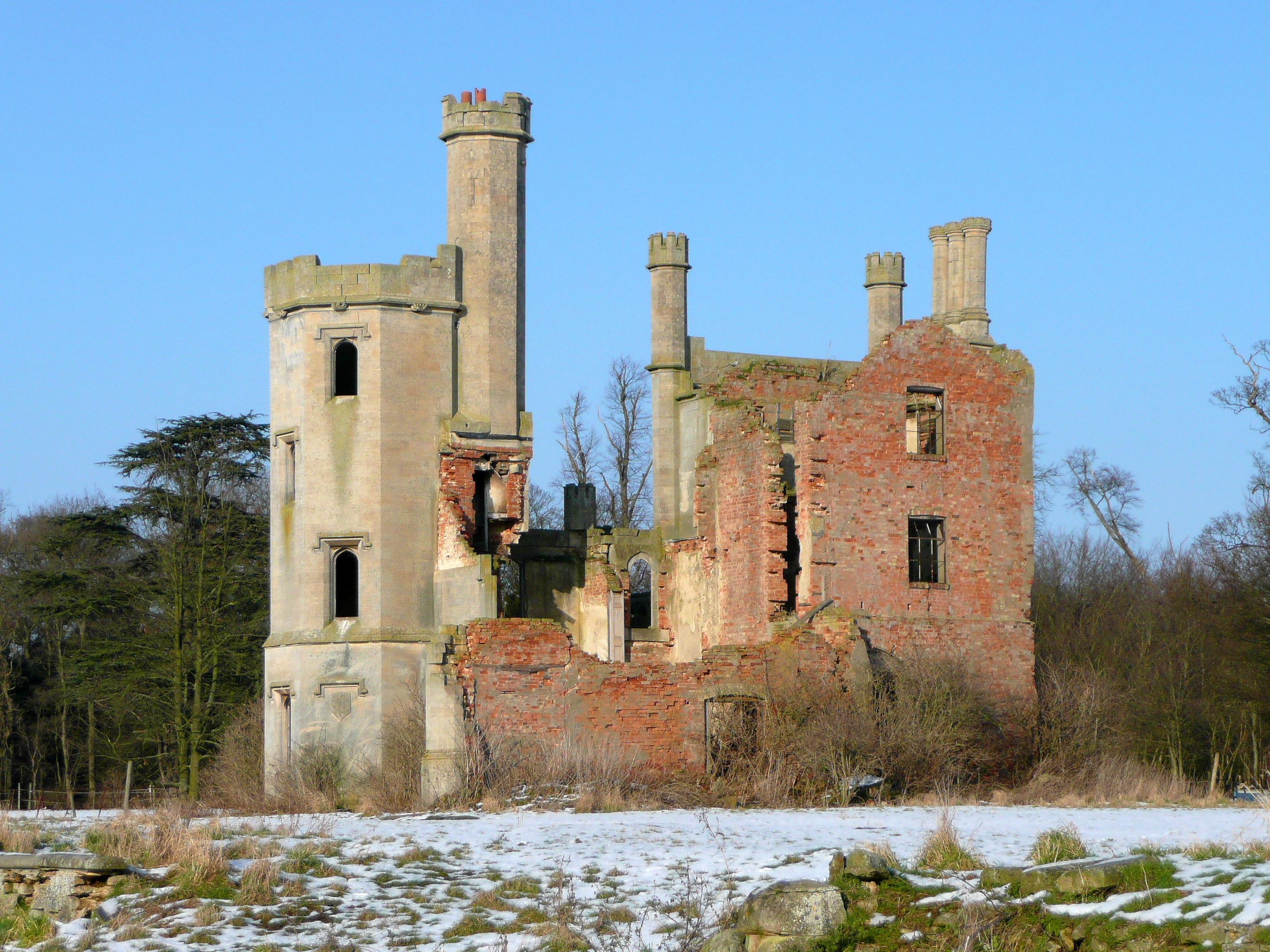
Haverholme Priory

Haverholme Priory was a monastery in Lincolnshire, England. Its remains are situated 4 miles (6 km) north-east of the town of Sleaford and less than 1...

Sleaford Rural District

Sleaford was a rural district in Lincolnshire, Parts of Kesteven, England, from 1894 to 1931. It was created by the Local Government Act 1894 based on...

Asgarby and Howell

Asgarby and Howell is a civil parish in the North Kesteven district of Lincolnshire, England, consisting of the villages of Asgarby and Howell. According...

Anwick

Anwick is a small village and civil parish in the North Kesteven district of Lincolnshire, England. The population of the civil parish at the 2011 census...

Nearby Amenities

Located within 500m of 53.019422,-0.331244
Power: pole
Lat/Long: 53.015674/-0.3343588
Power: pole
Lat/Long: 53.0162129/-0.3328192
Power: pole
Lat/Long: 53.0167906/-0.3310973
Power: pole
Lat/Long: 53.0170084/-0.3296247
Power: pole
Lat/Long: 53.017265/-0.3281146
Power: pole
Lat/Long: 53.0174424/-0.326685
Power: pole
Lat/Long: 53.0177635/-0.3252527
Power: pole
Lat/Long: 53.0181976/-0.3241181
The data included in this document is from www.openstreetmap.org. The data is made available under ODbL.

Have you been to Ewerby and Evedon?

Leave your review of Ewerby and Evedon below (or comments, questions and feedback).