Ermington

Civil Parish in Devon South Hams

England

Ermington

Ermington : The A3121 Roadworks taking place on the A3121
Ermington : The A3121 Credit: Lewis Clarke

Ermington is a civil parish located in the South Hams district of Devon, England. It is situated on the western bank of the River Erme, about 7 miles northeast of Plymouth and 9 miles southwest of Ivybridge. The parish covers an area of approximately 7 square miles and has a population of around 1,100 people.

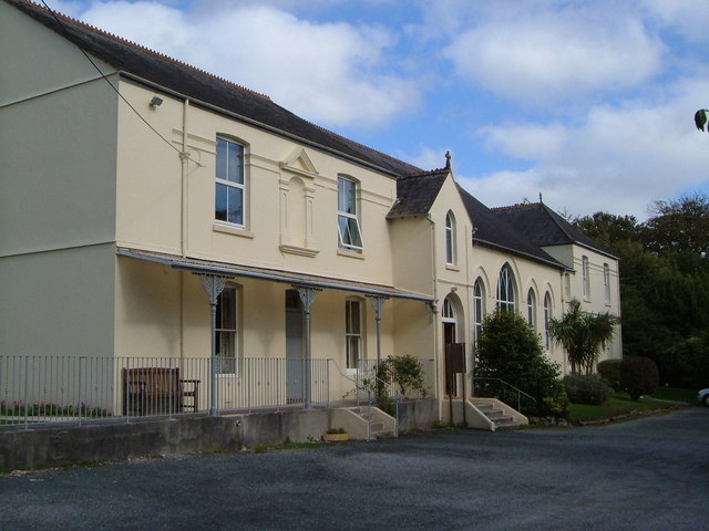
The village of Ermington itself is a charming rural settlement with a rich history dating back to the Saxon period. It is characterized by its picturesque thatched cottages, narrow lanes, and a beautiful 13th-century church dedicated to St. Peter and St. Paul. The church is a prominent landmark and is known for its impressive tower and medieval features.

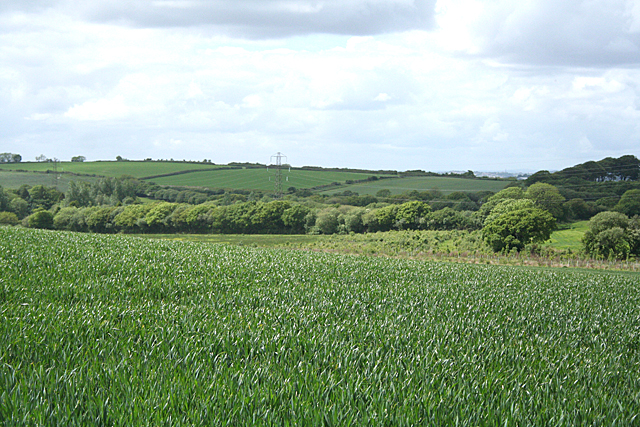
The surrounding countryside of Ermington is predominantly agricultural, with lush green fields and rolling hills. The area is renowned for its scenic beauty, offering several opportunities for outdoor activities such as walking, cycling, and birdwatching. The River Erme, which flows through the parish, provides a tranquil setting for fishing and boating enthusiasts.

Ermington is a close-knit community with a friendly and welcoming atmosphere. It has a primary school, a pub, a post office, and a village hall that hosts various events and activities throughout the year. The parish also has good transport links, with regular bus services connecting it to nearby towns and villages.

Overall, Ermington is a peaceful and idyllic rural parish, offering a high quality of life for its residents and an attractive destination for visitors seeking a tranquil getaway in the heart of Devon.

If you have any feedback on the listing, please let us know in the comments section below.

Ermington Images

Images are sourced within 2km of 50.370758/-3.932568 or Grid Reference SX6254. Thanks to Geograph Open Source API. All images are credited.

Ermington : The A3121 Roadworks taking place on the A3121
Ermington : The A3121
Roadworks taking place on the A3121
Ermington : The A3121 Looking along the road.
Ermington : The A3121
Looking along the road.
Ermington : Town Hill Looking along Town Hill off the A3121.
Ermington : Town Hill
Looking along Town Hill off the A3121.
Ermington : Road A small road off the A3121.
Ermington : Road
A small road off the A3121.
Ermington : Road A small road off the A3121.
Ermington : Road
A small road off the A3121.
Devon Expressway, Westover Junction The A38 is a major A-class trunk route. When first designated in 1922, it ran from Derby to Plymouth but it was later extended at both ends so that it now runs for 292 miles from Mansfield in Nottinghamshire to Bodmin in Cornwall.

Prior to the opening of the M5 motorway in the 1960s and 1970s, the A38 formed the main "holiday route" from the Midlands to Somerset, Devon and Cornwall and the south-western section was notorious at holiday times for the congestion. Nowadays, for most of the southern section, the A38 is a fairly quiet road shadowing the M5 extremely closely; often running alongside the motorway as a single carriageway road. The section between Exeter and Plymouth is, however, a busy dual carriageway which serves as the southern extension of the M5 and is known as “the Devon Expressway”.

More information at <span class="nowrap"><a title="http://en.wikipedia.org/wiki/A38_road" rel="nofollow ugc noopener" href="http://en.wikipedia.org/wiki/A38_road">Link</a><img style="margin-left:2px;" alt="External link" title="External link - shift click to open in new window" src="https://s1.geograph.org.uk/img/external.png" width="10" height="10"/></span>  (Wikipedia) and <span class="nowrap"><a title="http://www.sabre-roads.org.uk/wiki/index.php?title=A38" rel="nofollow ugc noopener" href="http://www.sabre-roads.org.uk/wiki/index.php?title=A38">Link</a><img style="margin-left:2px;" alt="External link" title="External link - shift click to open in new window" src="https://s1.geograph.org.uk/img/external.png" width="10" height="10"/></span>  (SABRE).
Devon Expressway, Westover Junction
The A38 is a major A-class trunk route. When first designated in 1922, it ran from Derby to Plymouth but it was later extended at both ends so that it now runs for 292 miles from Mansfield in Nottinghamshire to Bodmin in Cornwall. Prior to the opening of the M5 motorway in the 1960s and 1970s, the A38 formed the main "holiday route" from the Midlands to Somerset, Devon and Cornwall and the south-western section was notorious at holiday times for the congestion. Nowadays, for most of the southern section, the A38 is a fairly quiet road shadowing the M5 extremely closely; often running alongside the motorway as a single carriageway road. The section between Exeter and Plymouth is, however, a busy dual carriageway which serves as the southern extension of the M5 and is known as “the Devon Expressway”. More information at LinkExternal link (Wikipedia) and LinkExternal link (SABRE).
A38 at the Westlake Turnoff The A38 is a major A-class trunk route. When first designated in 1922, it ran from Derby to Plymouth but it was later extended at both ends so that it now runs for 292 miles from Mansfield in Nottinghamshire to Bodmin in Cornwall.

Prior to the opening of the M5 motorway in the 1960s and 1970s, the A38 formed the main "holiday route" from the Midlands to Somerset, Devon and Cornwall and the south-western section was notorious at holiday times for the congestion. Nowadays, for most of the southern section, the A38 is a fairly quiet road shadowing the M5 extremely closely; often running alongside the motorway as a single carriageway road. The section between Exeter and Plymouth is, however, a busy dual carriageway which serves as the southern extension of the M5 and is known as “the Devon Expressway”.

More information at <span class="nowrap"><a title="http://en.wikipedia.org/wiki/A38_road" rel="nofollow ugc noopener" href="http://en.wikipedia.org/wiki/A38_road">Link</a><img style="margin-left:2px;" alt="External link" title="External link - shift click to open in new window" src="https://s1.geograph.org.uk/img/external.png" width="10" height="10"/></span>  (Wikipedia) and <span class="nowrap"><a title="http://www.sabre-roads.org.uk/wiki/index.php?title=A38" rel="nofollow ugc noopener" href="http://www.sabre-roads.org.uk/wiki/index.php?title=A38">Link</a><img style="margin-left:2px;" alt="External link" title="External link - shift click to open in new window" src="https://s1.geograph.org.uk/img/external.png" width="10" height="10"/></span>  (SABRE).
A38 at the Westlake Turnoff
The A38 is a major A-class trunk route. When first designated in 1922, it ran from Derby to Plymouth but it was later extended at both ends so that it now runs for 292 miles from Mansfield in Nottinghamshire to Bodmin in Cornwall. Prior to the opening of the M5 motorway in the 1960s and 1970s, the A38 formed the main "holiday route" from the Midlands to Somerset, Devon and Cornwall and the south-western section was notorious at holiday times for the congestion. Nowadays, for most of the southern section, the A38 is a fairly quiet road shadowing the M5 extremely closely; often running alongside the motorway as a single carriageway road. The section between Exeter and Plymouth is, however, a busy dual carriageway which serves as the southern extension of the M5 and is known as “the Devon Expressway”. More information at LinkExternal link (Wikipedia) and LinkExternal link (SABRE).
Eastbound A38, Exit for Ivybridge The A38 is a major A-class trunk route. When first designated in 1922, it ran from Derby to Plymouth but it was later extended at both ends so that it now runs for 292 miles from Mansfield in Nottinghamshire to Bodmin in Cornwall.

Prior to the opening of the M5 motorway in the 1960s and 1970s, the A38 formed the main "holiday route" from the Midlands to Somerset, Devon and Cornwall and the south-western section was notorious at holiday times for the congestion. Nowadays, for most of the southern section, the A38 is a fairly quiet road shadowing the M5 extremely closely; often running alongside the motorway as a single carriageway road. The section between Exeter and Plymouth is, however, a busy dual carriageway which serves as the southern extension of the M5 and is known as “the Devon Expressway”.

More information at <span class="nowrap"><a title="http://en.wikipedia.org/wiki/A38_road" rel="nofollow ugc noopener" href="http://en.wikipedia.org/wiki/A38_road">Link</a><img style="margin-left:2px;" alt="External link" title="External link - shift click to open in new window" src="https://s1.geograph.org.uk/img/external.png" width="10" height="10"/></span>  (Wikipedia) and <span class="nowrap"><a title="http://www.sabre-roads.org.uk/wiki/index.php?title=A38" rel="nofollow ugc noopener" href="http://www.sabre-roads.org.uk/wiki/index.php?title=A38">Link</a><img style="margin-left:2px;" alt="External link" title="External link - shift click to open in new window" src="https://s1.geograph.org.uk/img/external.png" width="10" height="10"/></span>  (SABRE).
Eastbound A38, Exit for Ivybridge
The A38 is a major A-class trunk route. When first designated in 1922, it ran from Derby to Plymouth but it was later extended at both ends so that it now runs for 292 miles from Mansfield in Nottinghamshire to Bodmin in Cornwall. Prior to the opening of the M5 motorway in the 1960s and 1970s, the A38 formed the main "holiday route" from the Midlands to Somerset, Devon and Cornwall and the south-western section was notorious at holiday times for the congestion. Nowadays, for most of the southern section, the A38 is a fairly quiet road shadowing the M5 extremely closely; often running alongside the motorway as a single carriageway road. The section between Exeter and Plymouth is, however, a busy dual carriageway which serves as the southern extension of the M5 and is known as “the Devon Expressway”. More information at LinkExternal link (Wikipedia) and LinkExternal link (SABRE).
Western Road, Ivybridge Snowy scene . Looking East towards the town centre
Western Road, Ivybridge
Snowy scene . Looking East towards the town centre
The church of St Peter and St Paul Noted for its bent spire. Viewed from alongside Ermeside cottages.
The church of St Peter and St Paul
Noted for its bent spire. Viewed from alongside Ermeside cottages.
The church of St Peter and St Paul, Western entrance Just to the lest of the gateway can be seen a sacred spring of holy well.
The church of St Peter and St Paul, Western entrance
Just to the lest of the gateway can be seen a sacred spring of holy well.
Ermington: lane to Worthele Cross And on to Ivybridge. In Ermington parish
Ermington: lane to Worthele Cross
And on to Ivybridge. In Ermington parish
Ermington: towards Tod Moor Not far from Westlake in Ermington parish
Ermington: towards Tod Moor
Not far from Westlake in Ermington parish
Ermington: Ivybridge NTL tower TV transmitter on a high point between Ivybridge and the village of Ermington
Ermington: Ivybridge NTL tower
TV transmitter on a high point between Ivybridge and the village of Ermington
Ermington: Worthele Cross The lane by the signpost leads to East Worthele farm
Ermington: Worthele Cross
The lane by the signpost leads to East Worthele farm
Ermington: towards Ivybridge View from Worthele Cross with Western Beacon on the skyline, centre right. Overlooking a field of mown grass
Ermington: towards Ivybridge
View from Worthele Cross with Western Beacon on the skyline, centre right. Overlooking a field of mown grass
Ermington: towards Tod Moor Field ploughed, harrowed and sown. Compare with a similar view -<a href="https://www.geograph.org.uk/photo/2407302">SX6253 : Ermington: towards Tod Moor</a>
Ermington: towards Tod Moor
Field ploughed, harrowed and sown. Compare with a similar view -SX6253 : Ermington: towards Tod Moor
Newly built  house at Thornham
Newly built house at Thornham
Show me another place!

Ermington is located at Grid Ref: SX6254 (Lat: 50.370758, Lng: -3.932568)

Administrative County: Devon

District: South Hams

Police Authority: Devon & Cornwall

What 3 Words

///focal.inferior.duties. Near Ivybridge, Devon

Related Wikis

Ivybridge Town F.C.

Ivybridge Town Football Club is an amateur football club based in Ivybridge, Devon, England. They are currently members of the South West Peninsula League...

Ermington, Devon

Ermington is a village and civil parish located approximately 2 miles (3.2 km) south of the town of Ivybridge in the county of Devon, England. The village...

Ivybridge

Ivybridge is a town and civil parish in the South Hams, in Devon, England. It lies about thirteen miles (twenty-one kilometres) east of Plymouth. It...

Ivybridge Priory

Ivybridge Priory or St. Austin's Priory was a monastic house in Devon, England. From 1932 it was a priory of the Order of Augustinian Recollects. They...

Ivybridge Community College

Ivybridge Community College is a state-funded secondary school and academy in Ivybridge, Devon, England. Located on the southern slopes of Dartmoor, it...

Flete House

Flete House is a Grade I listed country house at Holbeton, in the South Hams region of Devon, England. == History == With roots in Saxon times, the Manor...

Stowford House

Stowford House is a former manor house in the South Hams district of Devon. It is close to the village of Harford. The building was designated a Grade...

Ivybridge railway station

Ivybridge railway station is situated on the Exeter to Plymouth line and serves the town of Ivybridge in Devon, England. It is 234 miles 27 chains (234...

Nearby Amenities

Located within 500m of 50.370758,-3.932568
Tod Moor Cross
Place: locality
Lat/Long: 50.3719839/-3.9375879
Power: tower
Source: bing
Lat/Long: 50.3702259/-3.9314751
Power: tower
Source: bing
Lat/Long: 50.3695337/-3.9356357
Power: tower
Source: bing
Lat/Long: 50.3707255/-3.9282457
Power: pole
Lat/Long: 50.3747056/-3.9356348
Power: pole
Lat/Long: 50.3745311/-3.9340469
Power: pole
Lat/Long: 50.3741565/-3.932054
Power: pole
Lat/Long: 50.3738896/-3.9307317
Power: pole
Lat/Long: 50.3736244/-3.9293692
Power: pole
Lat/Long: 50.3731061/-3.9266735
The data included in this document is from www.openstreetmap.org. The data is made available under ODbL.

Have you been to Ermington?

Leave your review of Ermington below (or comments, questions and feedback).