Elmbridge

Civil Parish in Worcestershire Wychavon

England

Elmbridge

Elmbridge Village Hall
Elmbridge Village Hall Credit: Philip Halling

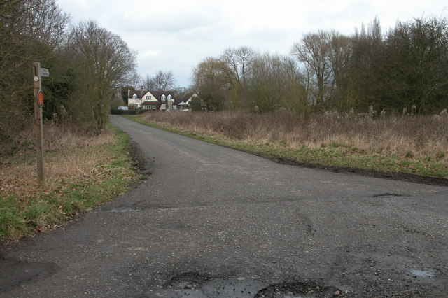
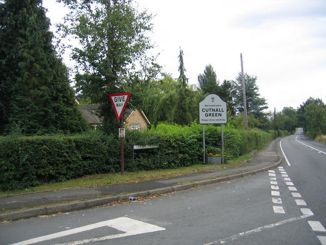
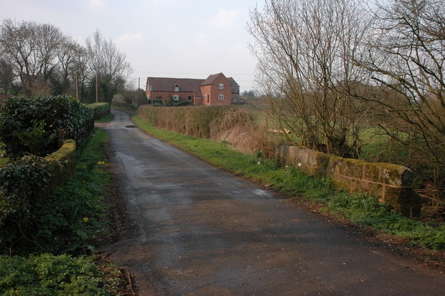
Elmbridge is a civil parish located in the county of Worcestershire, England. Situated in the district of Wychavon, the parish covers an area of approximately 4.5 square kilometers. Elmbridge is a predominantly rural area, characterized by its picturesque countryside and charming villages.

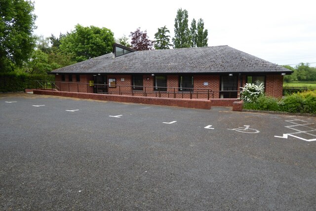
The parish is home to a small population, estimated to be around 600 residents. The village of Elmbridge itself serves as the main settlement within the parish, offering a range of amenities and services to its inhabitants. These include a primary school, a village hall, and several local shops and businesses.

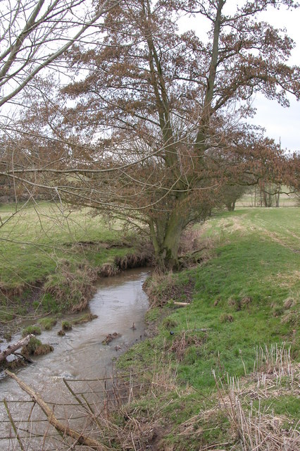
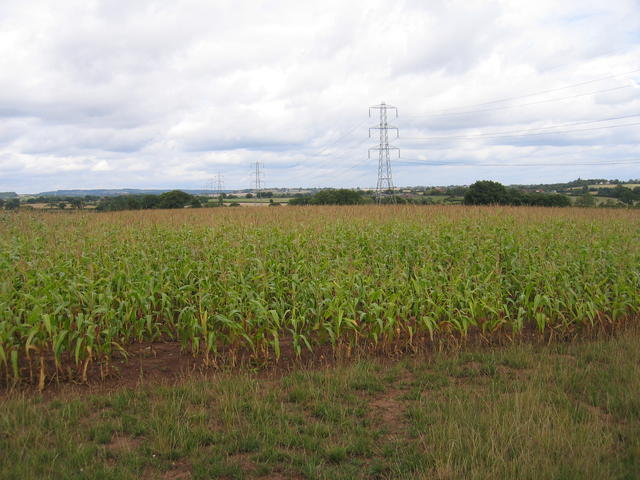
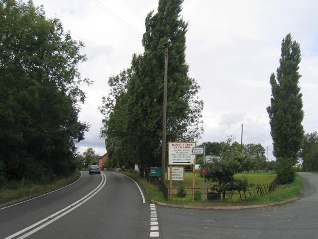
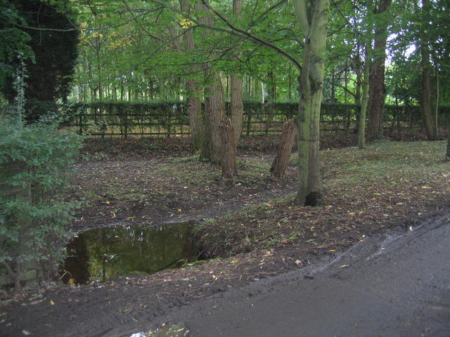
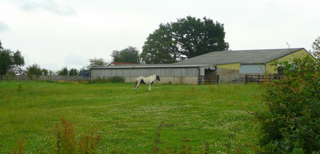
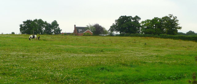
The surrounding landscape of Elmbridge is largely agricultural, with fertile farmland and rolling hills dominating the scenery. The area is known for its tranquil beauty, attracting visitors and nature enthusiasts alike. The nearby River Avon also adds to the charm of Elmbridge, providing opportunities for boating, fishing, and riverside walks.

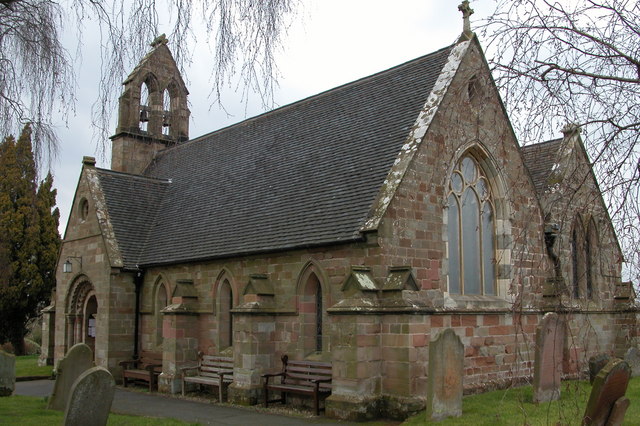
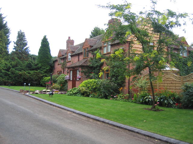
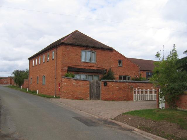
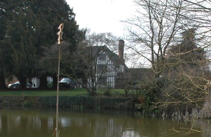
Historically, Elmbridge has deep roots, with evidence of human settlement dating back to the Roman period. The parish is dotted with ancient landmarks and historical sites, such as the Grade II listed Elmbridge Court Farmhouse, which dates back to the 17th century.

Overall, Elmbridge offers a peaceful and idyllic setting for its residents, with its rural charm and close-knit community. It is a place where nature, history, and modern amenities come together to create a truly unique and desirable place to live.

If you have any feedback on the listing, please let us know in the comments section below.
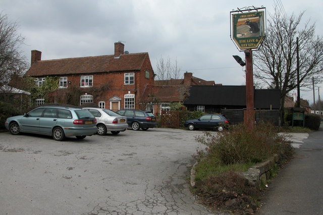
Elmbridge Images

Images are sourced within 2km of 52.318098/-2.160274 or Grid Reference SO8968. Thanks to Geograph Open Source API. All images are credited.

Elmbridge Village Hall
St Mary's church, Elmbridge Pevsner describes this church as 'drastically restored and mostly rebuilt in 1872', though there are remnants dating back to the late Norman times.
St Mary's church, Elmbridge
Pevsner describes this church as 'drastically restored and mostly rebuilt in 1872', though there are remnants dating back to the late Norman times.
Elmbridge Brook, Elmbridge Here the brook is viewed from the Elmbridge to Cutnall Green road.
Elmbridge Brook, Elmbridge
Here the brook is viewed from the Elmbridge to Cutnall Green road.
Bryan's Green, near Cutnall Green The Monarch's Way follows this road at Bryan's Green.
Bryan's Green, near Cutnall Green
The Monarch's Way follows this road at Bryan's Green.
The Live and Let Live Inn at Cutnall Green
Maize near Cashes Farm A power line strides across the field of maize in the north of the square.  The hills on the skyline are the northern edge of the Lickey's and beyond lies SW Birmingham.
Maize near Cashes Farm
A power line strides across the field of maize in the north of the square. The hills on the skyline are the northern edge of the Lickey's and beyond lies SW Birmingham.
Clattercut Lane junction The interestingly named Clattercut Lane joins the Kidderminster - Droitwich road on the northern edge of Cutnall Green.  Judging by internet searches the name of this lane is unique, however nothing appears to explain the origin of the name.
Clattercut Lane junction
The interestingly named Clattercut Lane joins the Kidderminster - Droitwich road on the northern edge of Cutnall Green. Judging by internet searches the name of this lane is unique, however nothing appears to explain the origin of the name.
Broad Alley A picturesque and well maintained cottage and garden by the lane through Broad Alley.
Broad Alley
A picturesque and well maintained cottage and garden by the lane through Broad Alley.
The Old Bakehouse Part of the old farm building conversions at Cashes Farm.
The Old Bakehouse
Part of the old farm building conversions at Cashes Farm.
Bannut Tree Bannut Tree Farm is situated in the "v" of the road junction between Clattercut Lane and the Droitwich - Kidderminster Road just to the north of Cutnall Green.
Bannut Tree
Bannut Tree Farm is situated in the "v" of the road junction between Clattercut Lane and the Droitwich - Kidderminster Road just to the north of Cutnall Green.
Drained pond at Broad Alley This muddy patch beside the lane at Broad Alley seem to be the site of a small pond, water feature and probably at one time, a ford.  Judging by the muddy state of the area the whole lot has recently been underwater probably due to flash flooding.  The pond is drained at the moment however.
Drained pond at Broad Alley
This muddy patch beside the lane at Broad Alley seem to be the site of a small pond, water feature and probably at one time, a ford. Judging by the muddy state of the area the whole lot has recently been underwater probably due to flash flooding. The pond is drained at the moment however.
Turn Mill, Purshull Green Lane
Chequers Inn, Cutnall Green
Paddock and barn At Cornshire House Farm.
Paddock and barn
At Cornshire House Farm.
Mare and foal in pasture South of Cornshire House Farm, Cooksey Green
Mare and foal in pasture
South of Cornshire House Farm, Cooksey Green
The "New Inn" no longer. Sandwiched between the Chequers and the Live and Let Live, this pub hasn't survived.
The "New Inn" no longer.
Sandwiched between the Chequers and the Live and Let Live, this pub hasn't survived.
The New Inn - in happier days
Road junction off A442 Droitwich - Kidderminster road. The minor road to Broad Alley leaves the main A442 on this long sweeping bend.
Road junction off A442 Droitwich - Kidderminster road.
The minor road to Broad Alley leaves the main A442 on this long sweeping bend.
Show me another place!

Elmbridge is located at Grid Ref: SO8968 (Lat: 52.318098, Lng: -2.160274)

Administrative County: Worcestershire

District: Wychavon

Police Authority: West Mercia

What 3 Words

///flattery.norms.evoked. Near Wychbold, Worcestershire

Nearby Locations

Elmbridge

Related Wikis

Elmbridge, Worcestershire

Elmbridge is a small community, mainly clustered in a village and forms a civil parish in Worcestershire, England. == Geography == It occupies the top...

Badge Court

Badge Court is an estate in Worcestershire, England. Originally known as Batchcott, the home's most famous occupant was Helena Wintour, daughter of Gunpowder...

Elmley Lovett

Elmley Lovett in Worcestershire, England is a civil parish whose residents' homes are quite loosely clustered east of its Hartlebury Trading Estate, as...

Rushock

Rushock is a village and civil parish in the Wyre Forest District of Worcestershire, England. At the 2001 census it had a population of 138. The grave...

Cutnall Green Halt railway station

Cutnall Green Halt was a railway station in Worcestershire, England, serving the nearby village of Hampton Lovett on the Oxford, Worcester and Wolverhampton...

Snead's Green

Snead's Green, sometimes written Sneads Green, is an area of Droitwich Spa, Worcestershire, England.Francis Moule, of Snead's Green House, sold the manorial...

Hampton Lovett

Hampton Lovett is a village and civil parish in the Wychavon district of the county of Worcestershire, England. It is just north of Droitwich. The church...

Upton Warren

Upton Warren is a village and civil parish in the Wychavon district, in Worcestershire, England. The village is situated just off the A38 road between...

Nearby Amenities

Located within 500m of 52.318098,-2.160274
Barrier: stile
Foot: yes
Lat/Long: 52.3142086/-2.1608873
Barrier: stile
Foot: yes
Lat/Long: 52.3142484/-2.1608309
Barrier: stile
Foot: yes
Lat/Long: 52.3142566/-2.1596822
Barrier: stile
Foot: yes
Lat/Long: 52.3142926/-2.1595647
Barrier: stile
Foot: yes
Lat/Long: 52.314456/-2.1613397
Barrier: stile
Foot: yes
Lat/Long: 52.3148261/-2.1578863
Barrier: kissing_gate
Foot: yes
Lat/Long: 52.3148687/-2.1615695
Barrier: stile
Foot: yes
Lat/Long: 52.3150488/-2.1580434
Fixme: continue
Lat/Long: 52.3150985/-2.1579068
Barrier: kissing_gate
Foot: yes
Lat/Long: 52.3153636/-2.1633731
Barrier: kissing_gate
Foot: yes
Lat/Long: 52.3153888/-2.1656965
Barrier: kissing_gate
Foot: yes
Lat/Long: 52.3155074/-2.1621599
Gateley Farm
Power: pole
Transformer: distribution
Voltage Primary: 11000
Lat/Long: 52.316398/-2.1652508
Power: pole
Lat/Long: 52.315979/-2.1660367
The data included in this document is from www.openstreetmap.org. The data is made available under ODbL.

Have you been to Elmbridge?

Leave your review of Elmbridge below (or comments, questions and feedback).