Elm

Civil Parish in Cambridgeshire Fenland

England

Elm

Coldham: Farm track
Coldham: Farm track Credit: Michael Garlick

Elm is a civil parish located in the county of Cambridgeshire, England. Situated approximately 7 miles northeast of the city of Peterborough, Elm covers an area of around 5.8 square miles. The parish is surrounded by the towns of Wisbech and March, and is part of the Fenland district.

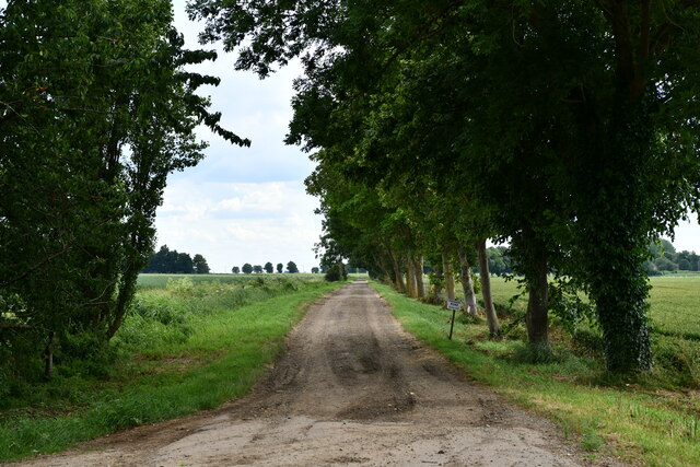
Elm is known for its picturesque countryside and agricultural landscape. The flat terrain, characteristic of the Fens, is dominated by farmlands and open fields. The area is especially renowned for its potato farming, with vast potato fields stretching across the parish.

The village of Elm itself is a small, close-knit community, with a population of around 1,200 residents. The village is centered around the historic St. Peter's Church, which dates back to the 14th century. The church's striking tower stands as a prominent landmark in the area.

Despite its small size, Elm offers a range of amenities to its residents. These include a primary school, a post office, a convenience store, and a village hall. The village also has several pubs and restaurants, providing social spaces for locals and visitors alike.

Elm benefits from its proximity to larger towns such as Wisbech, which offer a wider range of services and facilities. The village is well-connected, with good road links to nearby towns and cities, making it easily accessible for commuters.

Overall, Elm is a quiet and idyllic rural parish, offering a peaceful living environment and a strong sense of community.

If you have any feedback on the listing, please let us know in the comments section below.

Elm Images

Images are sourced within 2km of 52.607349/0.12529 or Grid Reference TF4403. Thanks to Geograph Open Source API. All images are credited.

Coldham: Farm track
Coldham: Farm track
Coldham: Percival Farm
Coldham: Station Road
Coldham: March Road
Coldham: March Road
Coldham: Wheat field
Coldham: Private farm track
Coldham: Field with potato crop
Coldham: Farm track
Coldham: Farm track
Coldham: Farm track
Coldham: Farm track
Coldham Windfarm expansion Seven wind turbines are being added to the existing eight (which are contiguous with eight more in the Stags Holt cluster). the positions of the turbines and access routes have been fenced off with the crop sprayed. See <span class="nowrap"><a title="http://www.guardian.co.uk/vestas/coldham.wind.farm" rel="nofollow ugc noopener" href="http://www.guardian.co.uk/vestas/coldham.wind.farm">Link</a><img style="margin-left:2px;" alt="External link" title="External link - shift click to open in new window" src="https://s1.geograph.org.uk/img/external.png" width="10" height="10"/></span> and <span class="nowrap"><a title="http://www.co-operative.coop/corporate/ethicsinaction/climatechange/climate-change-projects/our-wind-farms/" rel="nofollow ugc noopener" href="http://www.co-operative.coop/corporate/ethicsinaction/climatechange/climate-change-projects/our-wind-farms/">Link</a><img style="margin-left:2px;" alt="External link" title="External link - shift click to open in new window" src="https://s1.geograph.org.uk/img/external.png" width="10" height="10"/></span> for details of the project and <a href="https://www.geograph.org.uk/photo/2839424">TF4401 : Giant yellow crane building wind turbine at Coldham</a> for a view of the construction of the new turbines in March 2012
Coldham Windfarm expansion
Seven wind turbines are being added to the existing eight (which are contiguous with eight more in the Stags Holt cluster). the positions of the turbines and access routes have been fenced off with the crop sprayed. See LinkExternal link and LinkExternal link for details of the project and TF4401 : Giant yellow crane building wind turbine at Coldham for a view of the construction of the new turbines in March 2012
Small strip of woodland A spring version of <a href="https://www.geograph.org.uk/photo/1694899">TF4401 : Small strip of woodland</a>
Small strip of woodland
A spring version of TF4401 : Small strip of woodland
Two types of fenland farming Arable farming at Waldersey and a distant wind farm near Coldham
Two types of fenland farming
Arable farming at Waldersey and a distant wind farm near Coldham
Waldersea level crossing on Long Drove This single track line between March and Wisbech was closed to passengers in 1968 but remained in use as a goods line until 2001. Volunteer groups have plans to re-open the line but it will cost millions as it is in a very poor state of repair and overgrown in a lot of places.
Waldersea level crossing on Long Drove
This single track line between March and Wisbech was closed to passengers in 1968 but remained in use as a goods line until 2001. Volunteer groups have plans to re-open the line but it will cost millions as it is in a very poor state of repair and overgrown in a lot of places.
Bramley Line Waldersea Depot on Long Drove This single track line between March and Wisbech was closed to passengers in 1968 but remained in use as a goods line until 2001. Volunteer groups have plans to re-open the line but it will cost millions as it is in a very poor state of repair and overgrown in a lot of places.
Bramley Line Waldersea Depot on Long Drove
This single track line between March and Wisbech was closed to passengers in 1968 but remained in use as a goods line until 2001. Volunteer groups have plans to re-open the line but it will cost millions as it is in a very poor state of repair and overgrown in a lot of places.
The Bramley Line looks more like the bramble line! A view towards Wisbech from Waldersea level crossing. This single track line between March and Wisbech was closed to passengers in 1968 but remained in use as a goods line until 2001. Volunteer groups have plans to re-open the line but it will cost millions as it is in a very poor state of repair and overgrown in a lot of places.
The Bramley Line looks more like the bramble line!
A view towards Wisbech from Waldersea level crossing. This single track line between March and Wisbech was closed to passengers in 1968 but remained in use as a goods line until 2001. Volunteer groups have plans to re-open the line but it will cost millions as it is in a very poor state of repair and overgrown in a lot of places.
Level crossing gate at Waldersea This single track line between March and Wisbech was closed to passengers in 1968 but remained in use as a goods line until 2001. Volunteer groups have plans to re-open the line but it will cost millions as it is in a very poor state of repair and overgrown in a lot of places.
Level crossing gate at Waldersea
This single track line between March and Wisbech was closed to passengers in 1968 but remained in use as a goods line until 2001. Volunteer groups have plans to re-open the line but it will cost millions as it is in a very poor state of repair and overgrown in a lot of places.
Power lines near Speedwell farm, Waldersey
Copse and track, Long Drove, Waldersey
Show me another place!

Elm is located at Grid Ref: TF4403 (Lat: 52.607349, Lng: 0.12529)

Division: Isle of Ely

Administrative County: Cambridgeshire

District: Fenland

Police Authority: Cambridgeshire

What 3 Words

///boom.trickster.lush. Near Upwell, Norfolk

Nearby Locations

Elm

Related Wikis

Coldham, Cambridgeshire

Coldham is a hamlet in Elm civil parish, part of the Fenland district of the Isle of Ely, Cambridgeshire, England. Coldham is the site of a wind farm on...

March Elm Road railway station

March Elm Road railway station is a proposed station in March, Cambridgeshire, which if successful, the Bramley Line will make as the southern terminus...

Waldersea railway station

Waldersea railway station is a proposed station situated on the former Wisbech line from March to Wisbech, and will be the proposed terminal of the railway...

Coldham railway station

Coldham railway station was a station in Coldham, Cambridgeshire. It was on the branch of the Great Eastern Railway which ran from March to Watlington...

Nearby Amenities

Located within 500m of 52.607349,0.12529
Power: pole
Lat/Long: 52.604921/0.1310285
Power: pole
Lat/Long: 52.6065889/0.1320611
Power: pole
Lat/Long: 52.6057418/0.13153
Building: yes
Lat/Long: 52.604716/0.1229726
The data included in this document is from www.openstreetmap.org. The data is made available under ODbL.

Have you been to Elm?

Leave your review of Elm below (or comments, questions and feedback).