Ellingham

Civil Parish in Norfolk South Norfolk

England

Ellingham

Low Rd
Low Rd Credit: N Chadwick

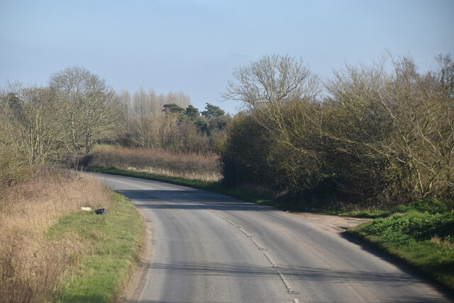
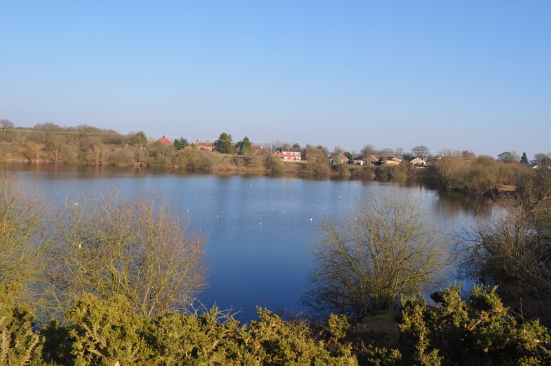
Ellingham is a civil parish located in the county of Norfolk, England. Situated on the edge of the Norfolk Broads, it is surrounded by picturesque countryside and offers a tranquil and idyllic setting for residents and visitors alike. The village is situated around 15 miles southwest of the city of Norwich.

The parish of Ellingham encompasses a small rural community with a population of approximately 500 people. It is known for its charming and well-preserved historic buildings, including St. Mary's Church, which dates back to the 12th century. The church is a prominent feature of the village and serves as a reminder of Ellingham's rich history.

The village itself offers a range of amenities for its residents, including a primary school, a village hall, and a pub. The local community is active and close-knit, with several social and recreational activities taking place throughout the year.

For nature enthusiasts, Ellingham provides easy access to the stunning natural beauty of the Norfolk Broads. The area offers opportunities for boating, fishing, and birdwatching, as well as scenic walks along the waterways and through the surrounding countryside.

Although the village is predominantly residential, it is located within close proximity to larger towns such as Bungay and Beccles, which offer a wider range of services and amenities. The location of Ellingham provides a perfect balance between a peaceful rural lifestyle and convenient access to nearby towns and cities.

If you have any feedback on the listing, please let us know in the comments section below.

Ellingham Images

Images are sourced within 2km of 52.468921/1.479851 or Grid Reference TM3691. Thanks to Geograph Open Source API. All images are credited.

Low Rd
Low Rd
The Anchorage, Low Rd
Entering Mettingham, B1062 <span class="nowrap"><a title="https://www.sabre-roads.org.uk/wiki/index.php?title=B1062" rel="nofollow ugc noopener" href="https://www.sabre-roads.org.uk/wiki/index.php?title=B1062">Link</a><img style="margin-left:2px;" alt="External link" title="External link - shift click to open in new window" src="https://s1.geograph.org.uk/img/external.png" width="10" height="10"/></span>
Entering Mettingham, B1062
Beccles Rd <span class="nowrap"><a title="https://www.sabre-roads.org.uk/wiki/index.php?title=B1062" rel="nofollow ugc noopener" href="https://www.sabre-roads.org.uk/wiki/index.php?title=B1062">Link</a><img style="margin-left:2px;" alt="External link" title="External link - shift click to open in new window" src="https://s1.geograph.org.uk/img/external.png" width="10" height="10"/></span>
Beccles Rd
Watch House Hill <span class="nowrap"><a title="https://www.sabre-roads.org.uk/wiki/index.php?title=B1062" rel="nofollow ugc noopener" href="https://www.sabre-roads.org.uk/wiki/index.php?title=B1062">Link</a><img style="margin-left:2px;" alt="External link" title="External link - shift click to open in new window" src="https://s1.geograph.org.uk/img/external.png" width="10" height="10"/></span>
Watch House Hill
Vicarage Lane
Vicarage Lane
Mettingham Village sign Village signs are typically placed along the principal road or in a prominent location such as a village green or close by the church. The design often depicts a particularly feature of the village or a scene from its history, heritage, or culture. They are typically made of wood or metal or a combination of both, the designs are often made by the local community.
Although they do appear in villages and towns all over the country they are more prominent in East Anglia than elsewhere in the country.
Mettingham Village sign
Village signs are typically placed along the principal road or in a prominent location such as a village green or close by the church. The design often depicts a particularly feature of the village or a scene from its history, heritage, or culture. They are typically made of wood or metal or a combination of both, the designs are often made by the local community. Although they do appear in villages and towns all over the country they are more prominent in East Anglia than elsewhere in the country.
Entering Shipmeadow, B1062 <span class="nowrap"><a title="https://www.sabre-roads.org.uk/wiki/index.php?title=B1062" rel="nofollow ugc noopener" href="https://www.sabre-roads.org.uk/wiki/index.php?title=B1062">Link</a><img style="margin-left:2px;" alt="External link" title="External link - shift click to open in new window" src="https://s1.geograph.org.uk/img/external.png" width="10" height="10"/></span>
Entering Shipmeadow, B1062
Young crop field, Shipmeadow Looking towards Viewpoint Mews (the former Beccles and Bungay workhouse).
Young crop field, Shipmeadow
Looking towards Viewpoint Mews (the former Beccles and Bungay workhouse).
Heading west from Shipmeadow On the B1062.
Heading west from Shipmeadow
On the B1062.
Grazing, Shipmeadow Off the B1062.
Grazing, Shipmeadow
Off the B1062.
Farmland towards Vicarage Farm Off the B1062.
Farmland towards Vicarage Farm
Off the B1062.
B1062 towards Bungay Looking west.
B1062 towards Bungay
Looking west.
Elizabeth II postbox on the B1062, Mettingham Postbox No. NR35 3517.

See <a href="https://www.geograph.org.uk/photo/5169977">TM3589 : Close up, Elizabeth II postbox on the B1062, Mettingham</a> for close up.

See <a href="https://www.geograph.org.uk/photo/5169981">TM3589 : B1062, Mettingham</a> for context.
Elizabeth II postbox on the B1062, Mettingham
Postbox No. NR35 3517. See TM3589 : Close up, Elizabeth II postbox on the B1062, Mettingham for close up. See TM3589 : B1062, Mettingham for context.
Close up, Elizabeth II postbox on the B1062, Mettingham Postbox No. NR35 3517.

See <a href="https://www.geograph.org.uk/photo/5169972">TM3589 : Elizabeth II postbox on the B1062, Mettingham</a> for wider view.
Close up, Elizabeth II postbox on the B1062, Mettingham
Postbox No. NR35 3517. See TM3589 : Elizabeth II postbox on the B1062, Mettingham for wider view.
Show me another place!

Ellingham is located at Grid Ref: TM3691 (Lat: 52.468921, Lng: 1.479851)

Administrative County: Norfolk

District: South Norfolk

Police Authority: Norfolk

What 3 Words

///hourglass.defeated.mugs. Near Ditchingham, Norfolk

Nearby Locations

Benstead Marshes Ellingham

Related Wikis

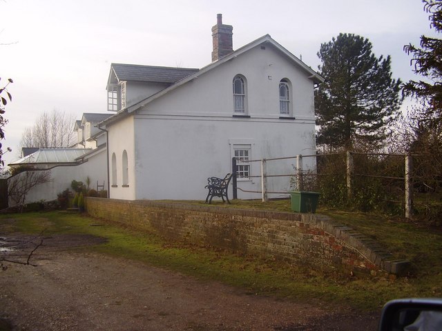
Ellingham railway station

Ellingham is a former railway station in Ellingham, Norfolk. It was opened in 1863 as part of the Waveney Valley Line between Tivetshall and Beccles, Suffolk...

Ellingham, Norfolk

Ellingham is a village and civil parish in the English county of Norfolk. The village is located 2.3 miles (3.7 km) north-east of Bungay and 13 miles...

Mettingham

Mettingham is a village and civil parish in the north of the English county of Suffolk. It is 2 miles (3.2 km) east of the market town of Bungay in the...

Broome, Norfolk

Broome is a village and civil parish in the English county of Norfolk. It is situated on the north bank of the River Waveney, which forms the border with...

Broome Heath Pit

Broome Heath Pit is a 1.2-hectare (3.0-acre) geological Site of Special Scientific Interest east of Ditchingham in Norfolk. It is a Geological Conservation...

Broome Heath

Broome Heath is a 31.7-hectare (78-acre) Local Nature Reserve in Ditchingham in Norfolk. It is owned by South Norfolk District Council and managed by...

Leet Hill, Kirby Cane

Leet Hill, Kirby Cane is a 6.5-hectare (16-acre) geological Site of Special Scientific Interest in Kirby Cane in Norfolk. It is a Geological Conservation...
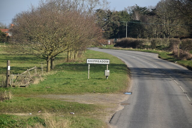
Shipmeadow

Shipmeadow is a village and civil parish located in the north of the English county of Suffolk. It is in the East Suffolk district, 2.5 miles (4.0 km)...

Nearby Amenities

Located within 500m of 52.468921,1.479851
Waterway: weir
Lat/Long: 52.4712957/1.4797077
Waterway: weir
Lat/Long: 52.4715765/1.4791792
Power: pole
Lat/Long: 52.4727037/1.4758883
Give Way
Lat/Long: 52.4730212/1.4810355
Give Way
Lat/Long: 52.4729057/1.4809578
Post Box
Operator: Royal Mail
Post Box Mounting: pier
Post Box Type: lamp
Royal Cypher: EIIR
Royal Cypher Wikidata: Q33102113
Lat/Long: 52.4726834/1.4808154
Power: pole
Lat/Long: 52.4719362/1.4753579
Power: pole
Lat/Long: 52.4712638/1.4740355
Waterway: weir
Lat/Long: 52.4718583/1.4799611
Marker: aerial
Utility: gas
Lat/Long: 52.4663625/1.4836333
The data included in this document is from www.openstreetmap.org. The data is made available under ODbL.

Have you been to Ellingham?

Leave your review of Ellingham below (or comments, questions and feedback).