Broadwater Down
Settlement in Sussex Tunbridge Wells
England
Broadwater Down

Broadwater Down is a residential area located in the county of Sussex, in the southeast region of England. Situated in the town of Tunbridge Wells, Broadwater Down is known for its picturesque surroundings and affluent community.
The area is characterized by its tree-lined streets and elegant Victorian and Edwardian houses, which contribute to the overall charm and beauty of the neighborhood. Many of these properties boast well-manicured gardens and offer stunning views of the surrounding countryside.
Broadwater Down is home to a number of amenities that cater to the needs of its residents. These include several highly-rated schools, such as the renowned Claremont Primary School and The Skinners' School. Additionally, the area benefits from its close proximity to the town center of Tunbridge Wells, which offers a wide range of shops, restaurants, and entertainment options.
For those seeking outdoor activities, Broadwater Down is conveniently located near several parks and green spaces. The nearby Dunorlan Park, with its picturesque lake and landscaped gardens, provides a tranquil setting for leisurely walks or picnics. Additionally, the expansive High Weald Area of Outstanding Natural Beauty is just a short drive away, offering opportunities for hiking, cycling, and exploring the countryside.
With its idyllic setting, attractive housing, and excellent amenities, Broadwater Down remains a sought-after location for those looking for a peaceful and upscale residential area in Sussex.
If you have any feedback on the listing, please let us know in the comments section below.
Broadwater Down Images
Images are sourced within 2km of 51.119795/0.251925 or Grid Reference TQ5738. Thanks to Geograph Open Source API. All images are credited.


Broadwater Down is located at Grid Ref: TQ5738 (Lat: 51.119795, Lng: 0.251925)
Administrative County: Kent
District: Tunbridge Wells
Police Authority: Kent
What 3 Words
///link.expand.lands. Near Royal Tunbridge Wells, Kent
Nearby Locations
Related Wikis
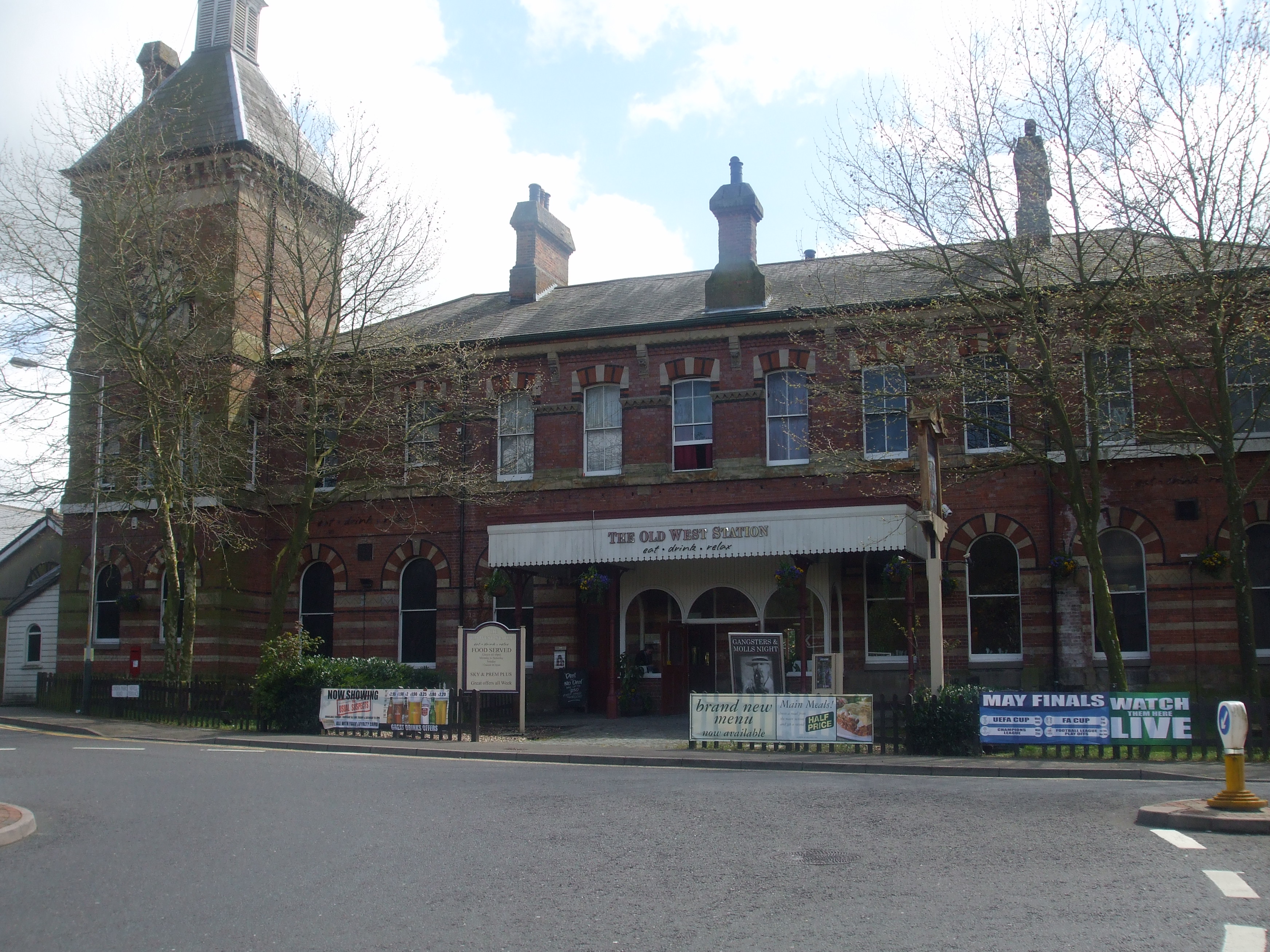
Tunbridge Wells West railway station
Tunbridge Wells West is a railway station located in Royal Tunbridge Wells, Kent. It is one of two railway stations in Tunbridge Wells constructed by rival...

Tunbridge Wells West DEMU Depot
Tunbridge Wells West DEMU Depot was a traction maintenance depot located in Tunbridge Wells, Kent, England. The depot was near Tunbridge Wells West station...
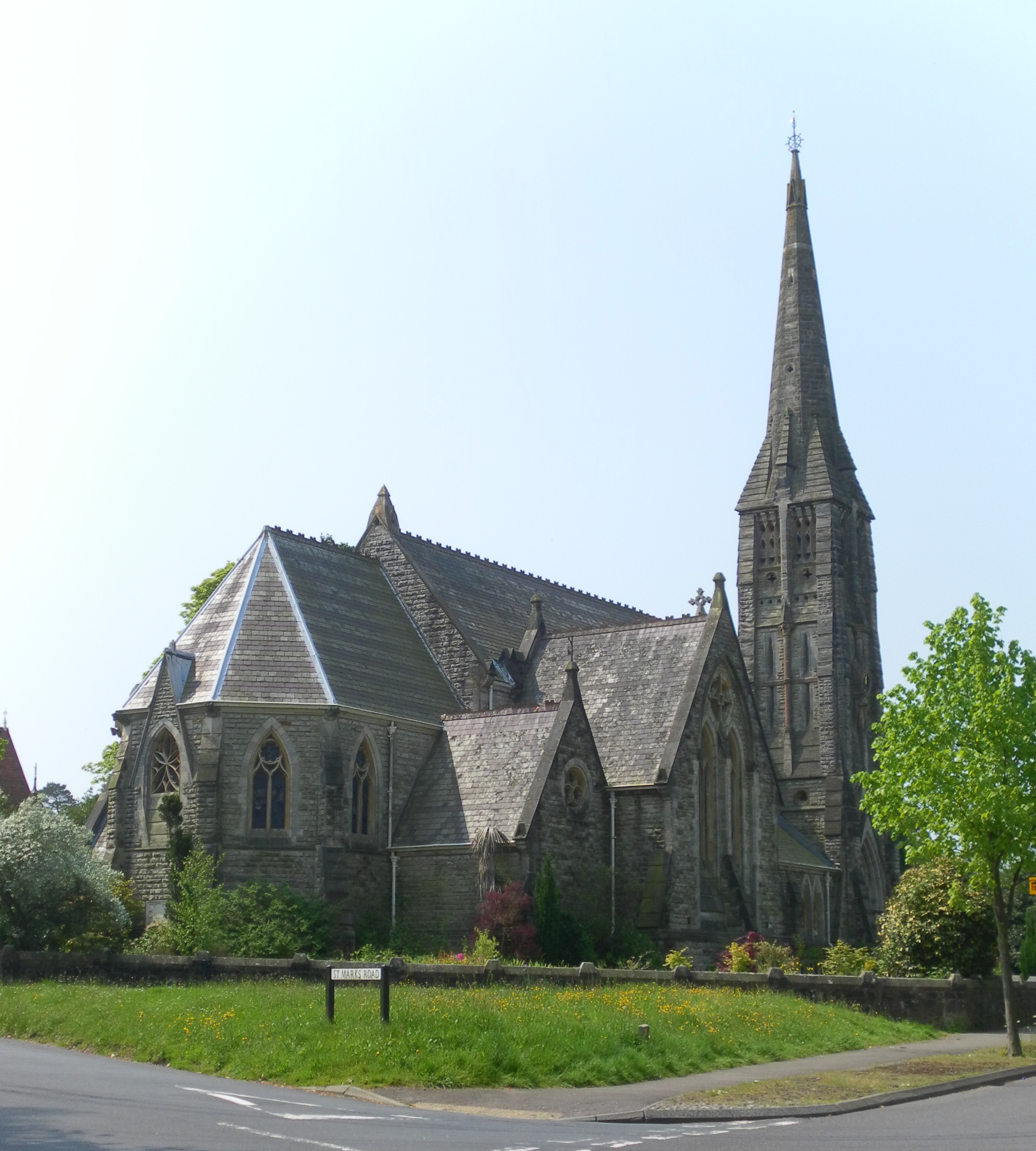
St Mark's Church, Royal Tunbridge Wells
St. Mark's Church is the Church of England parish church for the Broadwater Down area of Royal Tunbridge Wells, Kent, England, in the Diocese of Rochester...

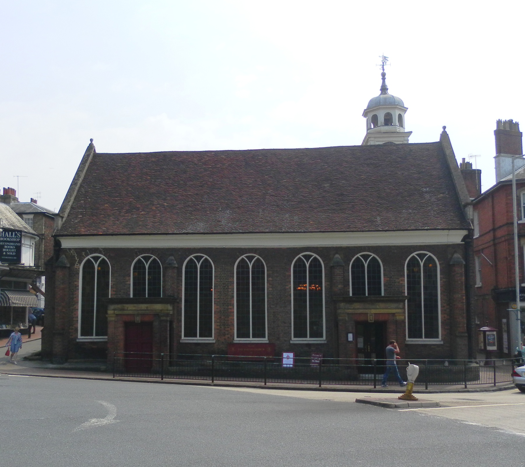
Corn Exchange, Tunbridge Wells
The Corn Exchange is a commercial building in The Pantiles, Royal Tunbridge Wells, Kent, England. The structure, which is currently used as an antiques...

The Pantiles
The Pantiles is a Georgian colonnade in the town of Royal Tunbridge Wells, Kent, England. Formerly known as "The Walks" and the (Royal) "Parade", it leads...

The Forum, Tunbridge Wells
The Forum is an independent music venue in Royal Tunbridge Wells, Kent, England, with a standing capacity of 250. The venue opened in 1993, the building...
Church of King Charles the Martyr, Royal Tunbridge Wells
The Church of King Charles the Martyr is a Church of England parish church in Royal Tunbridge Wells, Kent, England. It is a Grade I listed building....

Higher Common Ground
Higher Common Ground is a cricket ground on Tunbridge Wells Common in the town of Royal Tunbridge Wells in Kent. It was used as a ground by Kent County...
Nearby Amenities
Located within 500m of 51.119795,0.251925Have you been to Broadwater Down?
Leave your review of Broadwater Down below (or comments, questions and feedback).