Broadwater
Settlement in Sussex Worthing
England
Broadwater

Broadwater is a small village located in the Adur District of West Sussex, England. Situated just north of the coastal town of Worthing, it forms a part of the wider Worthing urban area. The village lies between the South Downs National Park and the English Channel, providing residents with beautiful natural surroundings.
Broadwater has a rich history, with evidence of settlements dating back to the Bronze Age. In the Domesday Book of 1086, it is recorded as "Bradeuuelle," highlighting its early importance. Over the centuries, the village grew and developed, becoming a thriving community.
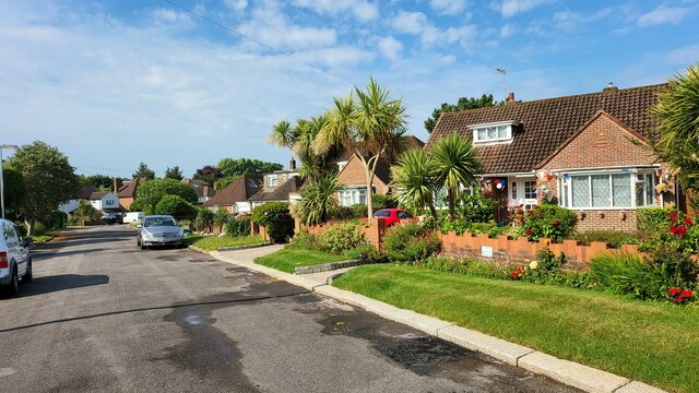
Today, Broadwater is a peaceful residential area with a close-knit community. It offers a range of amenities, including schools, shops, and recreational facilities. The village is also well-served by public transportation, with regular bus services connecting it to neighboring towns and villages.
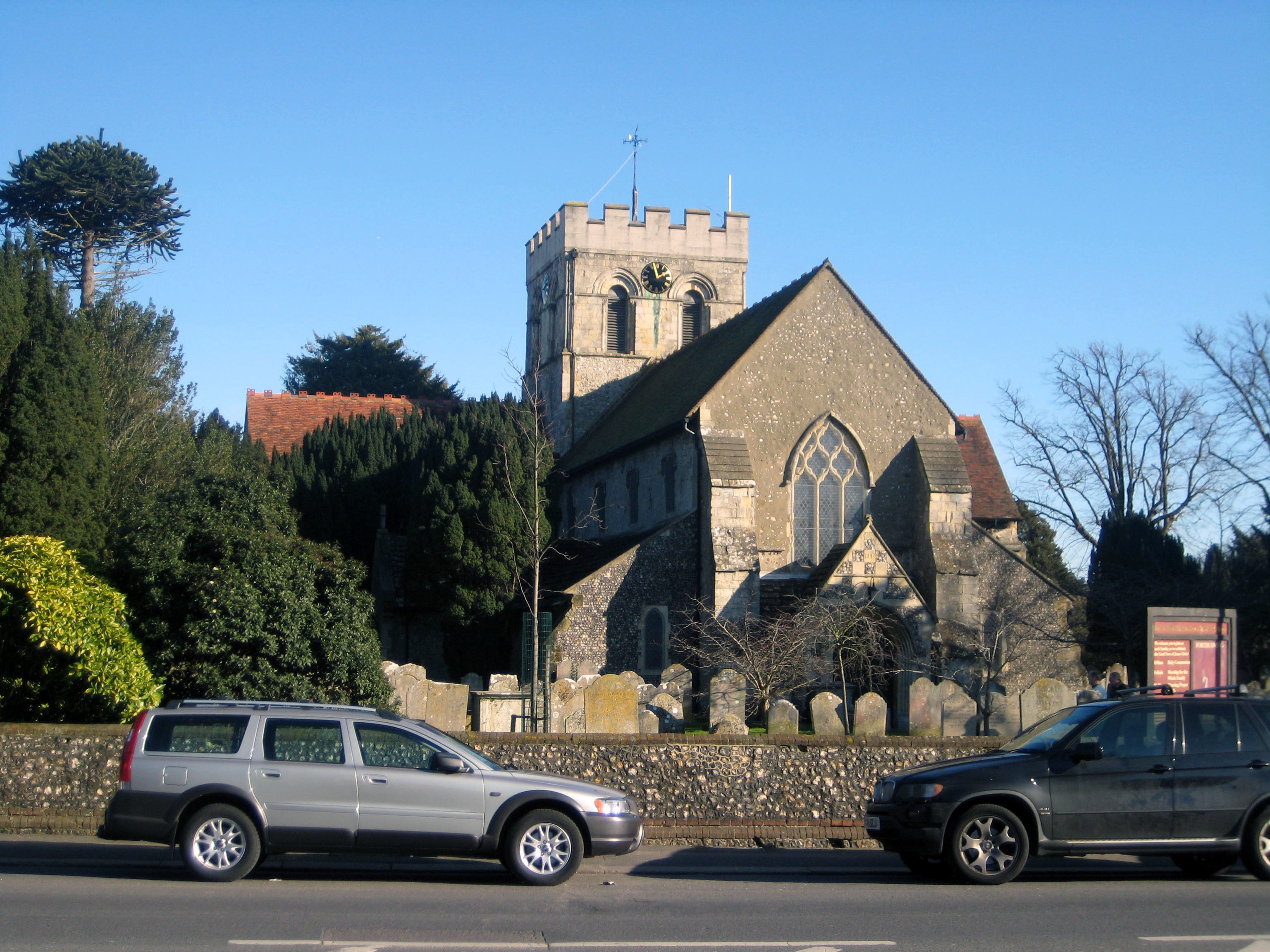
One of the notable landmarks in Broadwater is St. Mary's Church, a 13th-century parish church that showcases impressive architecture and holds regular services. Additionally, there are several green spaces and parks where residents can enjoy outdoor activities and leisurely walks.
The village benefits from its proximity to the coast, with popular beaches such as Worthing Beach and Goring Beach just a short distance away. This makes Broadwater an attractive location for those seeking a peaceful, coastal lifestyle.
In summary, Broadwater is a charming village in West Sussex, offering a tranquil and community-focused environment. With its rich history, convenient amenities, and beautiful natural surroundings, it provides residents with a desirable place to call home.
If you have any feedback on the listing, please let us know in the comments section below.
Broadwater Images
Images are sourced within 2km of 50.828683/-0.371034 or Grid Reference TQ1404. Thanks to Geograph Open Source API. All images are credited.


Broadwater is located at Grid Ref: TQ1404 (Lat: 50.828683, Lng: -0.371034)
Administrative County: West Sussex
District: Worthing
Police Authority: Sussex
What 3 Words
///asking.leaps.lamps. Near Broadwater, West Sussex
Nearby Locations
Related Wikis
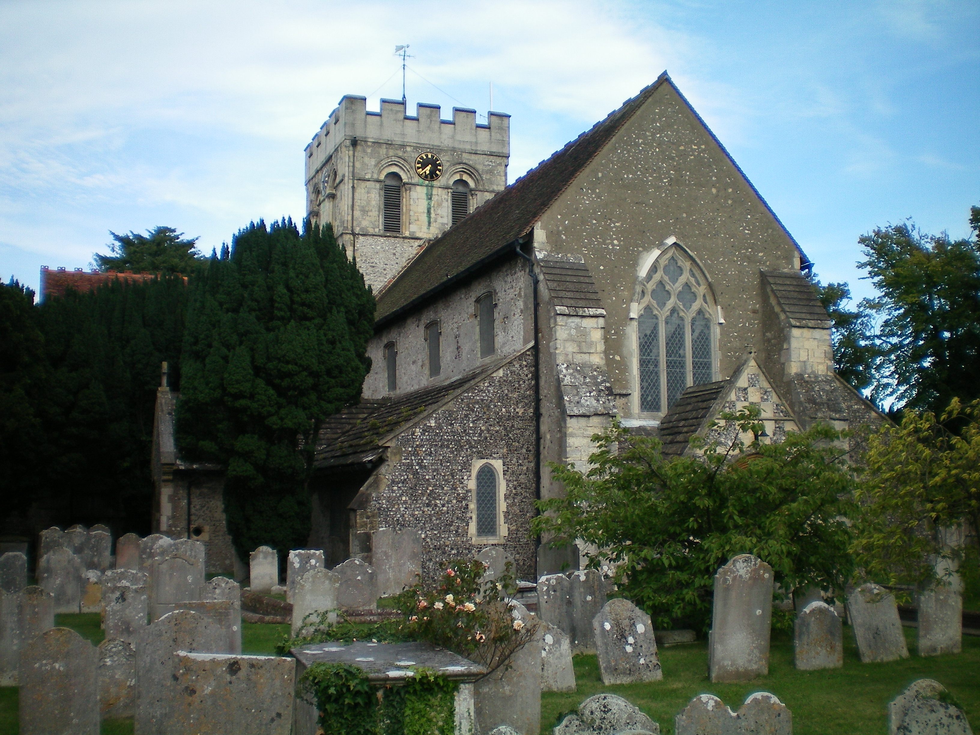
St Mary's Church, Broadwater
St. Mary's Church, Broadwater, is a Church of England parish church in the Worthing Deanery of the Diocese of Chichester. It serves the ecclesiastical...
Broadwater, West Sussex
Broadwater is a neighbourhood of Worthing, in the borough of Worthing in West Sussex, England. Situated between the South Downs and the English Channel...
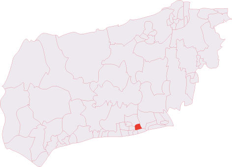
Broadwater (electoral division)
Broadwater is an electoral division of West Sussex in the United Kingdom, and returns one member to sit on West Sussex County Council. == Extent == The...
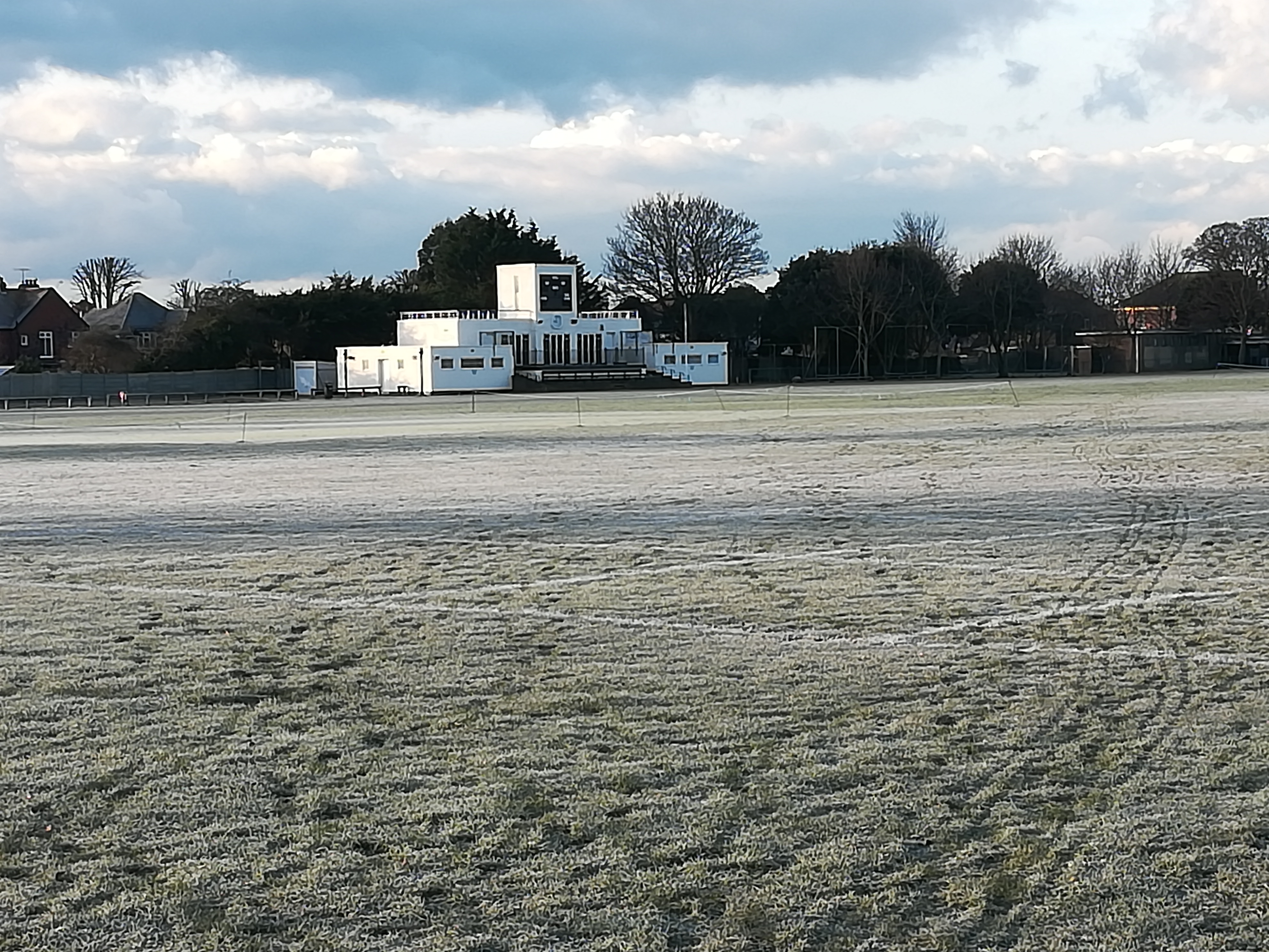
Manor Sports Ground
The Manor Sports Ground, is a cricket venue in Worthing, West Sussex, England. It is home to Worthing Cricket Club. == History == One of the earliest recorded...

St Andrew's High School, Worthing
St Andrew's High School is located in Worthing, West Sussex, catchment area. It was founded in 1897. == The 1890s == St Andrew's Church Clifton Road, Worthing...

Worthing High School, West Sussex
Worthing High School is a secondary school with academy status located in Worthing, West Sussex. It caters to academic years 7-11 (ages 11–16) and has...
Worthing United F.C.
Worthing United Football Club is a football club based in Worthing, England. Established in 1988 by a merger of Wigmore Athletic and Southdown, they are...
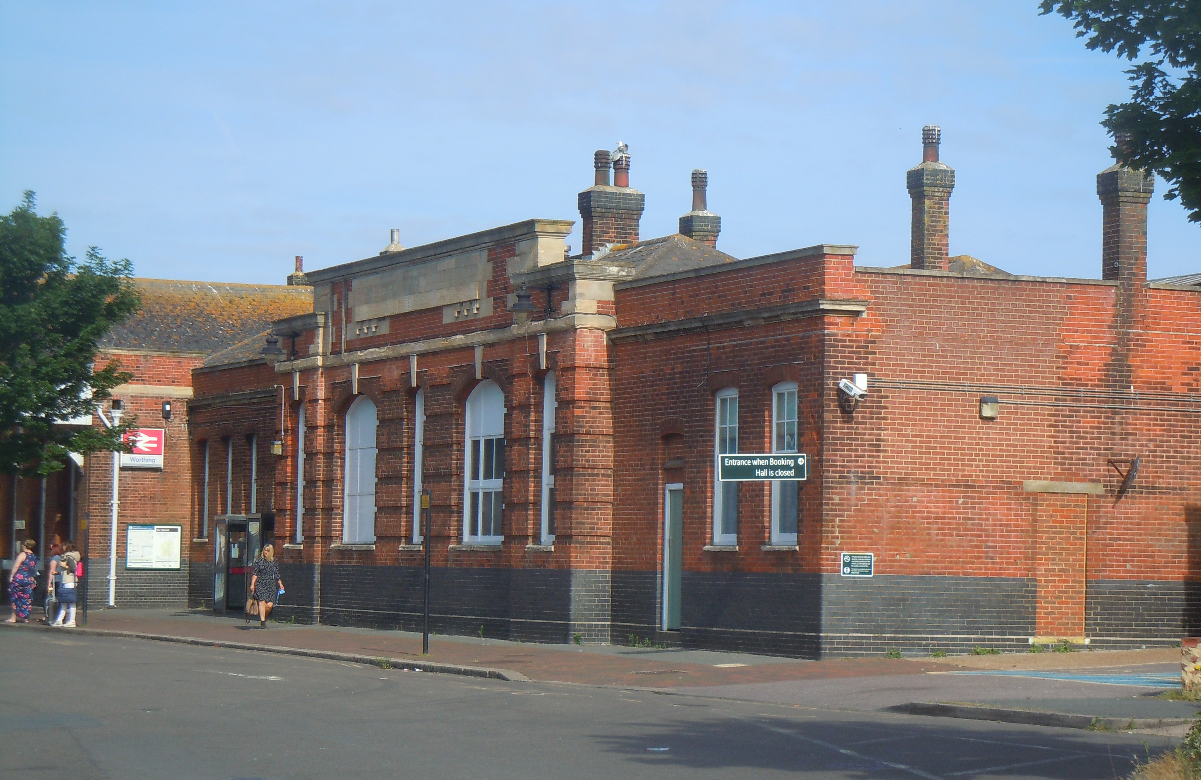
Worthing railway station
Worthing railway station is the largest of the five stations serving the town of Worthing in West Sussex (The other stations being East Worthing, West...
Nearby Amenities
Located within 500m of 50.828683,-0.371034Have you been to Broadwater?
Leave your review of Broadwater below (or comments, questions and feedback).