Broadstone

Settlement in Monmouthshire

Wales

Broadstone

Arable land near Hygga Arable land north of Hygga near Llanishen.
Arable land near Hygga Credit: Philip Halling

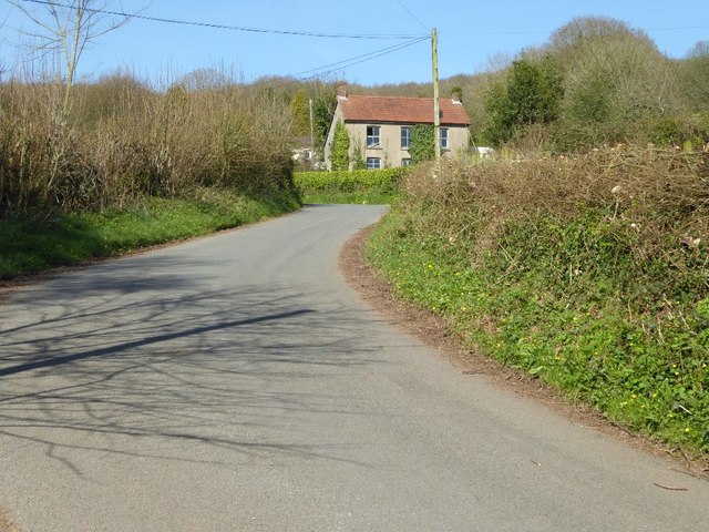
Broadstone is a small village located in Monmouthshire, Wales. Situated in the southeastern part of the county, it is nestled amidst picturesque rolling hills and lush green landscapes. The village is part of the historic community of Shirenewton and is surrounded by other charming rural settlements.

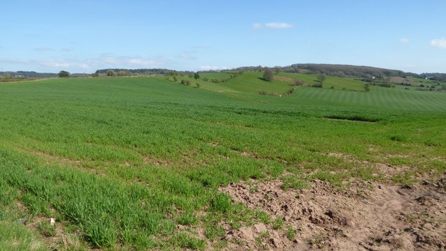
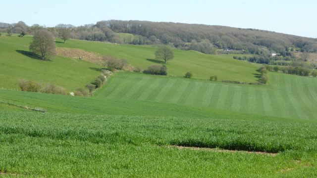
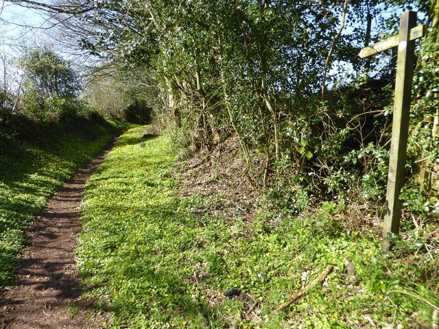
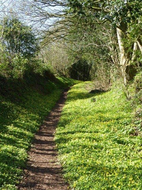
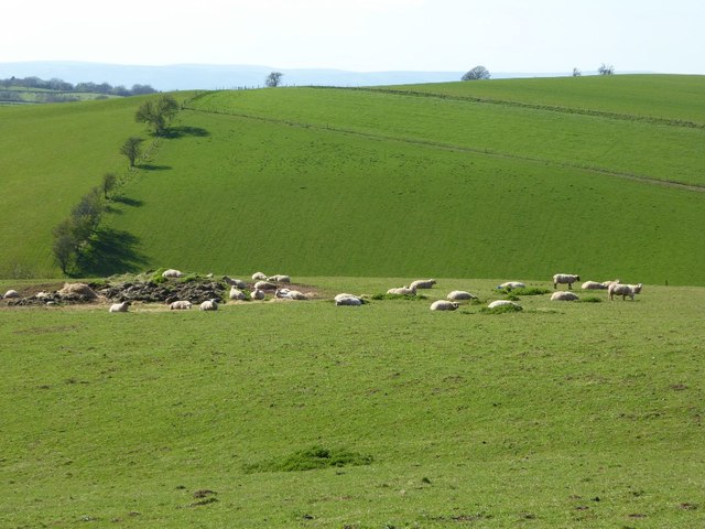
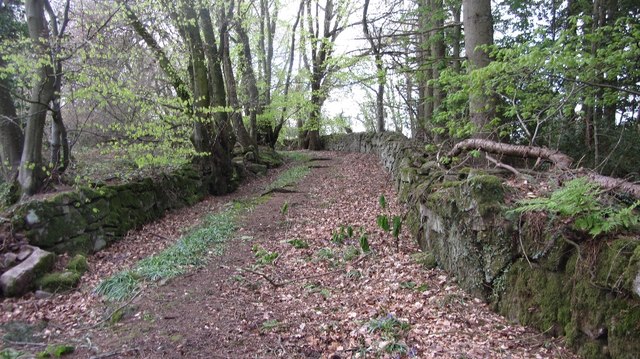
Broadstone is renowned for its tranquil and idyllic atmosphere, making it an ideal destination for those seeking a peaceful retreat. The village is characterized by its traditional stone buildings and quaint cottages, which add to its charm and appeal. The surrounding countryside offers stunning views and opportunities for outdoor activities such as hiking, cycling, and horseback riding.

Despite its small size, Broadstone has a close-knit community with a strong sense of local pride. The village boasts a community hall that serves as a hub for various activities and events, providing a space for residents to come together and socialize. Additionally, there are a few local businesses, including a village shop and a cozy pub, which further contribute to the village's sense of community.

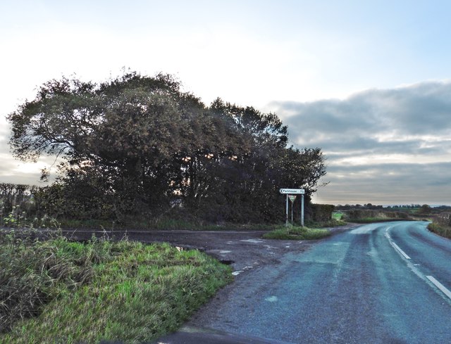
Broadstone's location is advantageous for those who appreciate the beauty of nature while still desiring easy access to modern amenities. The nearby towns of Chepstow and Monmouth offer a wider range of services, including shops, supermarkets, schools, and healthcare facilities. The village's proximity to major road networks also provides convenient transportation links to larger cities such as Cardiff and Bristol.

Overall, Broadstone is a charming village that offers a peaceful and scenic setting, perfect for those looking to escape the hustle and bustle of city life and immerse themselves in the tranquility of the Welsh countryside.

If you have any feedback on the listing, please let us know in the comments section below.

Broadstone Images

Images are sourced within 2km of 51.724187/-2.720088 or Grid Reference SO5003. Thanks to Geograph Open Source API. All images are credited.

Arable land near Hygga Arable land north of Hygga near Llanishen.
Arable land near Hygga
Arable land north of Hygga near Llanishen.
Farmland near Llanishen Farmland to the north-east of Llanishen viewed from the B4293.  On the high ground to the left the OS map indicates it was the site of a hill fort.  The field in the centre with the stripes like a lawn has probably either just been rolled or been chain harrowed.
Farmland near Llanishen
Farmland to the north-east of Llanishen viewed from the B4293. On the high ground to the left the OS map indicates it was the site of a hill fort. The field in the centre with the stripes like a lawn has probably either just been rolled or been chain harrowed.
Public right of way A springtime public right of way at Parkhouse.
Public right of way
A springtime public right of way at Parkhouse.
Public right of way Springtime public right of way at Parkhouse.
Public right of way
Springtime public right of way at Parkhouse.
House in Parkhouse
House in Parkhouse
Sheep in the sun Sheep lay in the warm spring sunshine near Ffynnon Gaer.
Sheep in the sun
Sheep lay in the warm spring sunshine near Ffynnon Gaer.
Base of a cross beside a road junction
Base of a roadside cross The base with two steps and a socket stone for a wayside cross at Trelleck Cross.  There is a large OS cutmark cut into the side of the top.
Base of a roadside cross
The base with two steps and a socket stone for a wayside cross at Trelleck Cross. There is a large OS cutmark cut into the side of the top.
OS cutmark at Trelleck Cross A large OS cutmark in the remains of a wayside cross at Trelleck Cross.
OS cutmark at Trelleck Cross
A large OS cutmark in the remains of a wayside cross at Trelleck Cross.
Base of a wayside cross with OS cutmark Base of a wayside cross with a very visible OS cutmark beside a crossroads at Trelleck Cross.
Base of a wayside cross with OS cutmark
Base of a wayside cross with a very visible OS cutmark beside a crossroads at Trelleck Cross.
Turning for Cross Lane
Nant Penarth / Penarth Brook Cerddwyr yn croesi Nant Penarth.

Walkers crossing Penarth Brook (trans. headland)
Nant Penarth / Penarth Brook
Cerddwyr yn croesi Nant Penarth. Walkers crossing Penarth Brook (trans. headland)
Tuag at Ffarm Hygga / Towards Hygga Farm Cerddwyr yn agosau at Ffarm Hygga.

Walkers approaching Hygga Farm.
Tuag at Ffarm Hygga / Towards Hygga Farm
Cerddwyr yn agosau at Ffarm Hygga. Walkers approaching Hygga Farm.
Ger Ffarm Hygga / Near Hygga Farm Cerddwyr yn dilyn llwybr ceffyl ger Ffarm Hygga.


Walkers following a bridleway near Hygga Farm.
Ger Ffarm Hygga / Near Hygga Farm
Cerddwyr yn dilyn llwybr ceffyl ger Ffarm Hygga. Walkers following a bridleway near Hygga Farm.
Dilyn trac gwlyb / Following a wet track Cerddwyr yn dilyn llwybr ceffyl gwlyb.


Walkers following a wet bridleway.
Dilyn trac gwlyb / Following a wet track
Cerddwyr yn dilyn llwybr ceffyl gwlyb. Walkers following a wet bridleway.
Llwybr yn gadael hewl / Path exiting a road Llwybr yn gadael heol fach ger anhedd-dy o'r enw Parkhouse.

A path exiting a minor road near a property called Parkhouse.
Llwybr yn gadael hewl / Path exiting a road
Llwybr yn gadael heol fach ger anhedd-dy o'r enw Parkhouse. A path exiting a minor road near a property called Parkhouse.
Field opening on the Chepstow Road The field dips down to Penarth Brook
Field opening on the Chepstow Road
The field dips down to Penarth Brook
Old road, Cleddon The walls suggest that this was once a more important route than today's path.
Old road, Cleddon
The walls suggest that this was once a more important route than today's path.
Show me another place!

Broadstone is located at Grid Ref: SO5003 (Lat: 51.724187, Lng: -2.720088)

Unitary Authority: Monmouthshire

Police Authority: Gwent

What 3 Words

///lightens.lock.sheep. Near Tintern, Monmouthshire

Related Wikis

Catbrook

Catbrook (Welsh: Catffrwd) is a village in Monmouthshire, south east Wales, United Kingdom. The population in 2011 was 412. == Location == Catbrook is...

Cleddon Bog

Cleddon Bog (grid reference SO509039) is a bog in the vice-county of Monmouthshire which has been notified as a biological Site of Special Scientific Interest...

Gaer hillfort, Trellech

Gaer hillfort (Welsh: Bryngaer Croes Trelech) is a Celtic Iron Age hillfort near Trellech in Monmouthshire, Wales (grid reference SO492037). This fort...

Cleddon Hall

Cleddon Hall, formerly known as Ravenscroft, is a 19th-century Victorian country house in Trellech, Monmouthshire, Wales. In the later 19th century it...

Nearby Amenities

Located within 500m of 51.724187,-2.720088
Post Box
Post Box Type: lamp
Ref: NP25 524
Lat/Long: 51.7231771/-2.7221621
Broadstone
Place: hamlet
Lat/Long: 51.7243073/-2.7201953
Parkhouse
Place: hamlet
Lat/Long: 51.7230249/-2.7256869
Direction: 260
Generator Method: photovoltaic
Generator Output Electricity: yes
Generator Solar Modules: 16
Generator Source: solar
Generator Type: solar_photovoltaic_panel
Location: roof
Power: generator
Lat/Long: 51.7251462/-2.7189808
Direction: 100
Generator Method: photovoltaic
Generator Output Electricity: yes
Generator Solar Modules: 13
Generator Source: solar
Generator Type: solar_photovoltaic_panel
Location: roof
Power: generator
Lat/Long: 51.723714/-2.7222256
Direction: 190
Generator Method: photovoltaic
Generator Output Electricity: yes
Generator Solar Modules: 8
Generator Source: solar
Generator Type: solar_photovoltaic_panel
Location: roof
Power: generator
Lat/Long: 51.7237443/-2.7221873
Direction: 165
Generator Method: photovoltaic
Generator Output Electricity: yes
Generator Solar Modules: 3
Generator Source: solar
Generator Type: solar_photovoltaic_panel
Location: roof
Power: generator
Lat/Long: 51.7230747/-2.7213813
Direction: 165
Generator Method: photovoltaic
Generator Output Electricity: yes
Generator Solar Modules: 3
Generator Source: solar
Generator Type: solar_photovoltaic_panel
Location: roof
Power: generator
Lat/Long: 51.7230548/-2.7214926
Direction: 165
Generator Method: photovoltaic
Generator Output Electricity: yes
Generator Solar Modules: 3
Generator Source: solar
Generator Type: solar_photovoltaic_panel
Location: roof
Power: generator
Lat/Long: 51.7230465/-2.721663
Direction: 165
Generator Method: photovoltaic
Generator Output Electricity: yes
Generator Solar Modules: 3
Generator Source: solar
Generator Type: solar_photovoltaic_panel
Location: roof
Power: generator
Lat/Long: 51.7230332/-2.7217689
Direction: 165
Generator Method: photovoltaic
Generator Output Electricity: yes
Generator Solar Modules: 3
Generator Source: solar
Generator Type: solar_photovoltaic_panel
Location: roof
Power: generator
Lat/Long: 51.7229925/-2.7219124
Direction: 165
Generator Method: photovoltaic
Generator Output Electricity: yes
Generator Solar Modules: 3
Generator Source: solar
Generator Type: solar_photovoltaic_panel
Location: roof
Power: generator
Lat/Long: 51.7229684/-2.7220519
Direction: 185
Generator Method: photovoltaic
Generator Output Electricity: yes
Generator Solar Modules: 16
Generator Source: solar
Generator Type: solar_photovoltaic_panel
Location: roof
Power: generator
Lat/Long: 51.7227931/-2.7235258
Direction: 145
Generator Method: photovoltaic
Generator Output Electricity: yes
Generator Solar Modules: 7
Generator Source: solar
Generator Type: solar_photovoltaic_panel
Location: roof
Power: generator
Lat/Long: 51.7233763/-2.7239378
Direction: 145
Generator Method: photovoltaic
Generator Output Electricity: yes
Generator Solar Modules: 7
Generator Source: solar
Generator Type: solar_photovoltaic_panel
Location: roof
Power: generator
Lat/Long: 51.7233514/-2.7239898
Direction: S
Generator Method: photovoltaic
Generator Output Electricity: yes
Generator Solar Modules: 8
Generator Source: solar
Generator Type: solar_photovoltaic_panel
Location: roof
Power: generator
Lat/Long: 51.7239462/-2.7198404
Direction: S
Generator Method: photovoltaic
Generator Output Electricity: yes
Generator Solar Modules: 8
Generator Source: solar
Generator Type: solar_photovoltaic_panel
Location: roof
Power: generator
Lat/Long: 51.7239495/-2.7199933
Direction: S
Generator Method: photovoltaic
Generator Output Electricity: yes
Generator Solar Modules: 8
Generator Source: solar
Generator Type: solar_photovoltaic_panel
Location: roof
Power: generator
Lat/Long: 51.7239296/-2.7201596
Direction: 260
Generator Method: photovoltaic
Generator Output Electricity: yes
Generator Solar Modules: 10
Generator Source: solar
Generator Type: solar_photovoltaic_panel
Location: roof
Power: generator
Lat/Long: 51.7244662/-2.7148743
Direction: SSW
Generator Method: photovoltaic
Generator Output Electricity: yes
Generator Solar Modules: 36
Generator Source: solar
Generator Type: solar_photovoltaic_panel
Location: roof
Power: generator
Lat/Long: 51.7235773/-2.7138376
Direction: 170
Generator Method: photovoltaic
Generator Output Electricity: yes
Generator Solar Modules: 7
Generator Source: solar
Generator Type: solar_photovoltaic_panel
Location: roof
Power: generator
Lat/Long: 51.7244064/-2.714759
Booth: K6
Covered: booth
Disused Amenity: telephone
Man Made: telephone_box
Lat/Long: 51.7230373/-2.7224881
The data included in this document is from www.openstreetmap.org. The data is made available under ODbL.

Have you been to Broadstone?

Leave your review of Broadstone below (or comments, questions and feedback).