Drinkstone

Civil Parish in Suffolk Mid Suffolk

England

Drinkstone

Field off Rattlesden Road
Field off Rattlesden Road Credit: JThomas

Drinkstone is a civil parish located in the county of Suffolk, England. It is a rural area situated approximately five miles northeast of the town of Bury St Edmunds. The parish covers an area of around 7.6 square kilometers and is home to a small population of around 300 people.

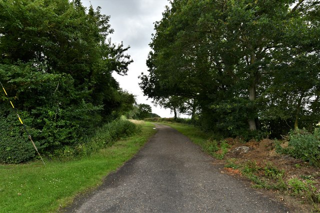
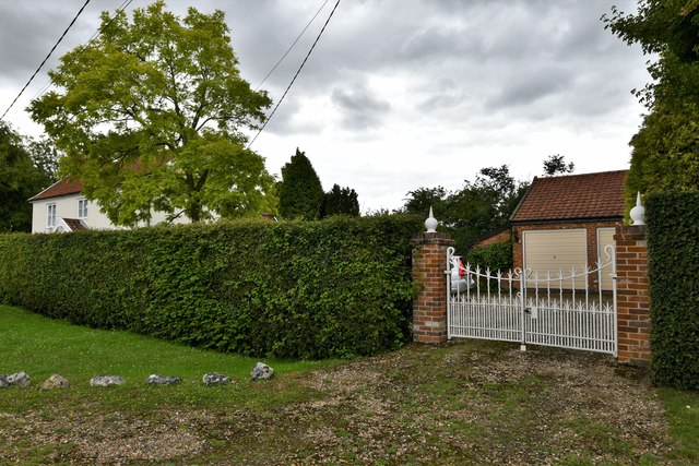
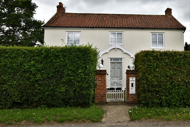
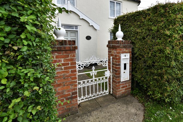
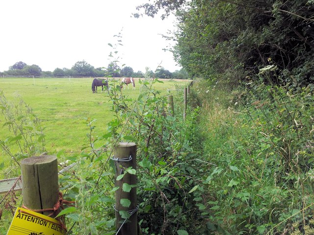
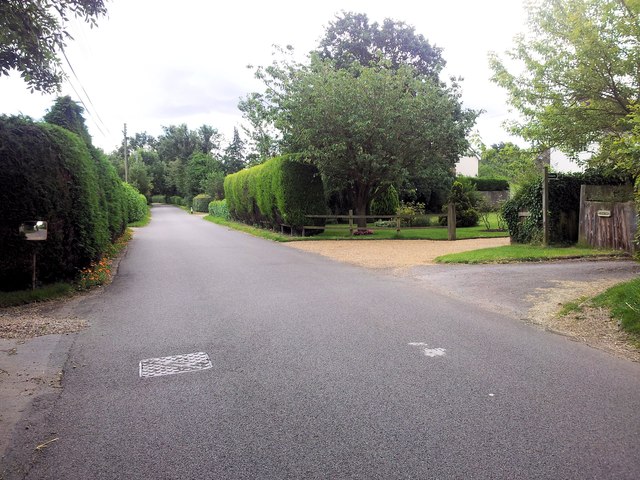
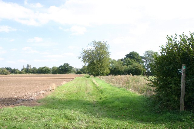
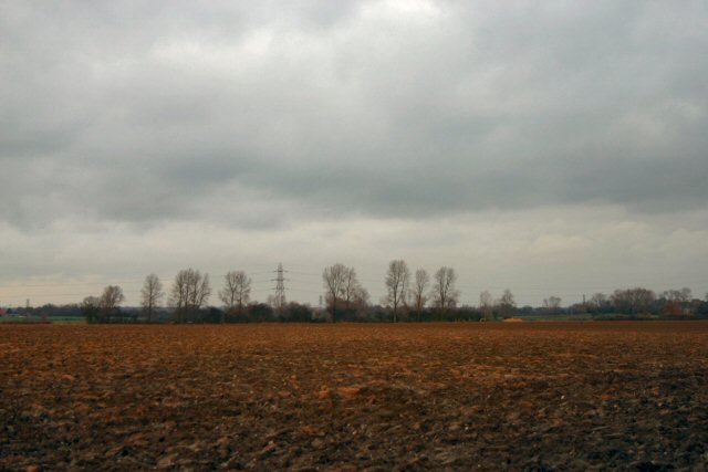
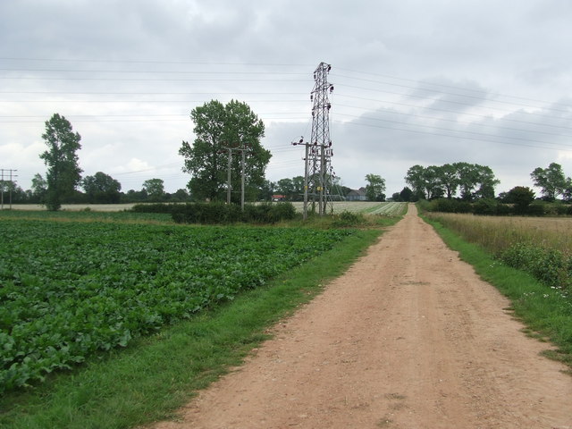
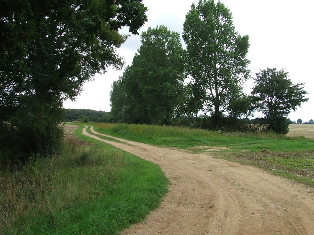
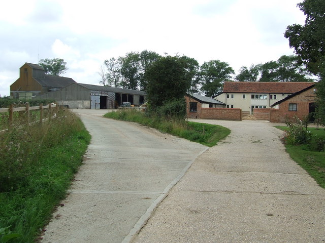
Drinkstone is known for its picturesque countryside, characterized by rolling hills, lush green fields, and charming country lanes. The landscape is predominantly agricultural, with farming being a significant part of the local economy. The area is dotted with traditional farmhouses, barns, and cottages, giving it a quaint and idyllic feel.

The main focal point of the parish is the St. Mary's Church, which dates back to the 14th century and stands as a testament to the area's rich history. The church is a prominent landmark and serves as a gathering place for the local community.

Despite its rural nature, Drinkstone benefits from its proximity to Bury St Edmunds, which offers a wider range of amenities, including shops, schools, and healthcare facilities. The parish is well-connected to the surrounding areas via a network of country roads and is within easy reach of major transport links.

Drinkstone offers a peaceful and tranquil environment, making it an attractive place to live for those seeking a rural lifestyle. The community is tight-knit, with a strong sense of community spirit, and residents often come together for various social events and activities throughout the year.

If you have any feedback on the listing, please let us know in the comments section below.

Drinkstone Images

Images are sourced within 2km of 52.210176/0.8636 or Grid Reference TL9560. Thanks to Geograph Open Source API. All images are credited.

Field off Rattlesden Road
Rattlesden Road Looking north.
Rattlesden Road
Looking north.
Drinkstone Green: Track to Buck's Wood
Drinkstone Green: Drinkstone Road
Drinkstone Green: Detached house
Drinkstone Green: Detached house with novel reuse of Victorian letter box
A very overgrown footpath near Drinkstone Green
Further along Rattlesden Road, Drinkstone Green
Footpath to Drinkstone Green This path leads eastwards from Drinkstone Road.
Footpath to Drinkstone Green
This path leads eastwards from Drinkstone Road.
Clover field at Drinkstone Green This field lies north of Garden House Lane.
Clover field at Drinkstone Green
This field lies north of Garden House Lane.
Suffolk ploughed field Between Gedding and Drinkstone Green in the heart of rural Suffolk.
Suffolk ploughed field
Between Gedding and Drinkstone Green in the heart of rural Suffolk.
Towards Hall Farm Footpath leading to Hall Farm near to Drinkstone Green, Suffolk.
Towards Hall Farm
Footpath leading to Hall Farm near to Drinkstone Green, Suffolk.
Track to Smallwood Green Track leading to Smallwood Green, Suffolk.
Track to Smallwood Green
Track leading to Smallwood Green, Suffolk.
Distant Cyclist Loan cyclist in the distance having just made the long climb up Rattlesden Road at Drinkstone, Suffolk.
Distant Cyclist
Loan cyclist in the distance having just made the long climb up Rattlesden Road at Drinkstone, Suffolk.
Hall Farm Hall Farm near to Drinkstone Green, Suffolk.
Hall Farm
Hall Farm near to Drinkstone Green, Suffolk.
Drinkstone Road, on the approach to the village
The road to Rattlesden from Drinkstone
Show me another place!

Drinkstone is located at Grid Ref: TL9560 (Lat: 52.210176, Lng: 0.8636)

Administrative County: Suffolk

District: Mid Suffolk

Police Authority: Suffolk

What 3 Words

///earmarked.values.across. Near Woolpit, Suffolk

Related Wikis

Drinkstone

Drinkstone is a small settlement and civil parish in Suffolk, England. Its name is derived from Dremic's homestead. It was located in the hundred of Thedwastre...

Woolpit Green

Woolpit Green is a hamlet in Suffolk, England near the village of Woolpit. == External links == Media related to Woolpit Green at Wikimedia Commons

Woolpit Heath

Woolpit Heath is a hamlet in Suffolk, England near the village of Woolpit.

Hessett

Hessett is a village and civil parish in the Mid Suffolk district of Suffolk in eastern England. Hessett is located around four miles south east of Bury...

Woolpit

Woolpit ( WUUL-pit) is a village in the English county of Suffolk, midway between the towns of Bury St. Edmunds and Stowmarket. In 2011 Woolpit parish...

Saint Mary's Church, Woolpit

Saint Mary's Church is the parish church of Woolpit, Suffolk, England. Much of the church was built in the fifteenth century. but its most salient feature...

2011 murder of the Ding family

The 2011 murder of the Ding family occurred in Wootton, a suburb of Northampton, England, in late April. Four members of the Ding family—Professor Jifeng...
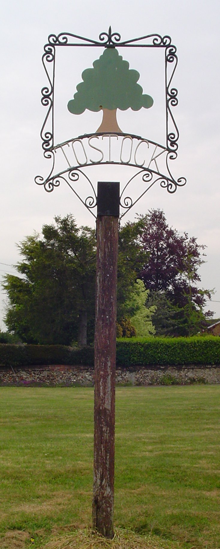
Tostock

Tostock is a small village around eight miles east of Bury St. Edmunds in the county of Suffolk. It is a very traditional Suffolk village, with a good...

Nearby Amenities

Located within 500m of 52.210176,0.8636
Bus Stop
Post Box
Bus: yes
Naptan AtcoCode: 390040449
Naptan Bearing: SE
Naptan CommonName: Post Box
Naptan Indicator: adj
Naptan Landmark: Gedding Road
Naptan NaptanCode: sufgadmd
Naptan Street: Rattlesden Road
Naptan Verified: no
Public Transport: platform
Source: naptan_import
Lat/Long: 52.2062084/0.8653307
Bus Stop
Post Box
Bus: yes
Naptan AtcoCode: 390040450
Naptan Bearing: NW
Naptan BusStopType: CUS
Naptan CommonName: Post Box
Naptan Indicator: opp
Naptan Landmark: Gedding Road
Naptan NaptanCode: sufgadmg
Naptan Street: Rattlesden Road
Naptan Verified: no
Public Transport: platform
Source: naptan_import
Lat/Long: 52.2061921/0.8651776
Bus Stop
Rattlesden Road
Bus: yes
Naptan AtcoCode: 390040709
Naptan Bearing: SW
Naptan CommonName: Rattlesden Road
Naptan Indicator: adj
Naptan Landmark: Rattlesden Road
Naptan NaptanCode: sufgatpg
Naptan Street: Gedding Road
Naptan Verified: no
Public Transport: platform
Source: naptan_import
Lat/Long: 52.2063947/0.8652812
Bus Stop
Rattlesden Road
Bus: yes
Naptan AtcoCode: 390040710
Naptan Bearing: NE
Naptan BusStopType: CUS
Naptan CommonName: Rattlesden Road
Naptan Indicator: opp
Naptan Landmark: Rattlesden Road
Naptan NaptanCode: sufgatpj
Naptan Street: Gedding Road
Naptan Verified: no
Public Transport: platform
Source: naptan_import
Lat/Long: 52.206395/0.8649711
Cherry Tree
Naptan AtcoCode: 390041074
Naptan Bearing: N
Naptan BusStopType: CUS
Naptan CommonName: Cherry Tree
Naptan Indicator: opp
Naptan Landmark: Cherry Tree
Naptan NaptanCode: sufjpdja
Naptan Street: Gedding Road
Naptan Verified: no
Source: naptan_import
Lat/Long: 52.2117592/0.8666487
Cherry Tree
Naptan AtcoCode: 390041075
Naptan Bearing: SE
Naptan BusStopType: CUS
Naptan CommonName: Cherry Tree
Naptan Indicator: adj
Naptan Landmark: Cherry Tree
Naptan NaptanCode: sufjpdgw
Naptan Street: Gedding Road
Naptan Verified: no
Source: naptan_import
Lat/Long: 52.2117891/0.8668995
Power: pole
Lat/Long: 52.212498/0.8654844
Power: pole
Lat/Long: 52.2126616/0.8666297
Power: pole
Lat/Long: 52.2102819/0.8640373
Power: pole
Lat/Long: 52.2135893/0.8675041
Power: pole
Lat/Long: 52.2132047/0.8674934
Power: pole
Lat/Long: 52.213535/0.8669248
Power: pole
Lat/Long: 52.2086521/0.8622229
Power: pole
Lat/Long: 52.2135871/0.8676619
Power: pole
Lat/Long: 52.2134019/0.8676651
Power: pole
Lat/Long: 52.206637/0.8600288
Power: pole
Lat/Long: 52.2130667/0.8686521
Power: pole
Lat/Long: 52.2129894/0.8686173
Power: pole
Lat/Long: 52.2132096/0.8668819
Power: pole
Lat/Long: 52.2132146/0.8671796
Power: pole
Lat/Long: 52.2094673/0.8631456
Power: pole
Lat/Long: 52.210253/0.8612573
Power: pole
Lat/Long: 52.2077054/0.8611822
Power: pole
Lat/Long: 52.2132532/0.8676589
Power: pole
Lat/Long: 52.211055/0.862762
Power: pole
Lat/Long: 52.2095364/0.8598572
Power: pole
Lat/Long: 52.2132113/0.8673513
Power: pole
Lat/Long: 52.2118209/0.8642318
Power: pole
Lat/Long: 52.2119007/0.8658003
Power: pole
Lat/Long: 52.2111006/0.8649198
Power: pole
Lat/Long: 52.2087884/0.8584033
Power: tower
Lat/Long: 52.2132581/0.8673928
Power: pole
Lat/Long: 52.213286/0.8676543
Power: pole
Lat/Long: 52.2133287/0.8675135
Power: tower
Lat/Long: 52.2132589/0.8672185
Power: pole
Lat/Long: 52.2083581/0.8688571
Power: pole
Lat/Long: 52.2075344/0.8688988
The data included in this document is from www.openstreetmap.org. The data is made available under ODbL.

Have you been to Drinkstone?

Leave your review of Drinkstone below (or comments, questions and feedback).