Broadoak

Settlement in Hampshire Eastleigh

England

Broadoak

Deer Park School, entrance The larger brick building is the Sports Hall. The main school building is out of sight to the left. The school is currently under the final stages of construction, and is due to open in September this year. Currently, the school is surrounded by open fields, though these are destined to shortly be turned into a new housing estate.
Deer Park School, entrance Credit: Richard Dorrell

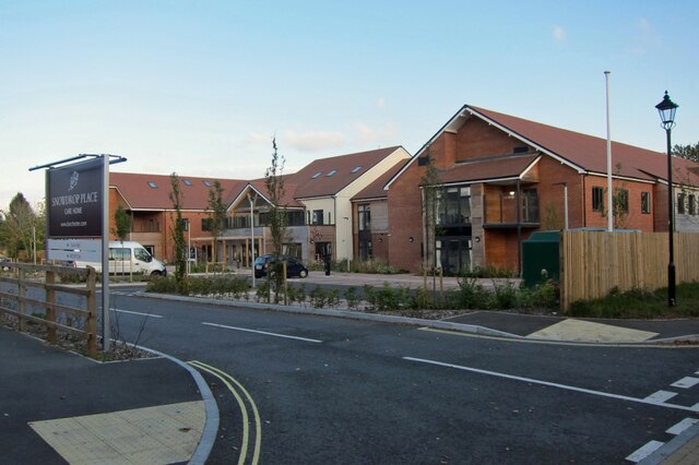
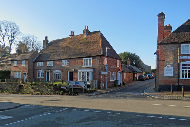
Broadoak is a small village located in the county of Hampshire, England. Situated near the South Downs National Park, it is surrounded by picturesque countryside, offering residents and visitors alike a peaceful and scenic environment.

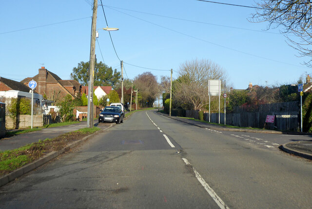
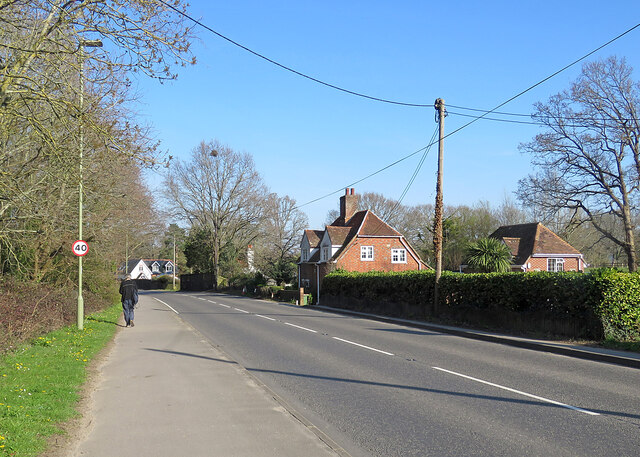
The village is characterized by its traditional English charm, with a mix of period houses and newer developments. The community in Broadoak is close-knit and friendly, creating a welcoming atmosphere for all who live and visit there.

Although small in size, Broadoak boasts a range of amenities to cater to the needs of its residents. These include a village hall, a local pub, a primary school, and a convenience store, ensuring that daily essentials and services are easily accessible.

Nature lovers will appreciate the village's proximity to the stunning South Downs, which provides ample opportunities for outdoor activities such as hiking, cycling, and horse riding. The area is also home to several nature reserves, offering a chance to observe the diverse wildlife that inhabits the region.

Broadoak enjoys a convenient location, with good transport links to nearby towns and cities. The village is within easy reach of major road networks, making it accessible by car. Additionally, the nearest train station is just a short drive away, providing connections to larger cities such as Winchester and Southampton.

In summary, Broadoak is a charming village in Hampshire, offering a peaceful and picturesque setting, a friendly community, and easy access to amenities and outdoor activities.

If you have any feedback on the listing, please let us know in the comments section below.
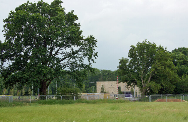
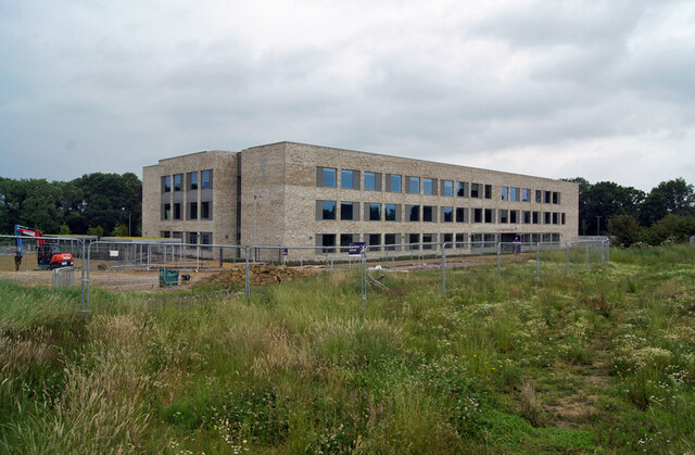
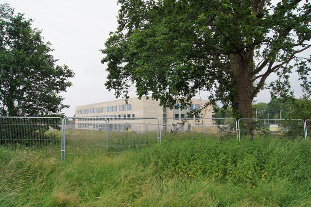
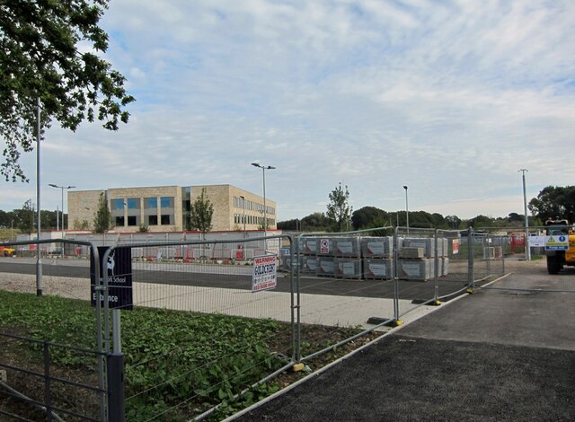
Broadoak Images

Images are sourced within 2km of 50.914306/-1.2901383 or Grid Reference SU5013. Thanks to Geograph Open Source API. All images are credited.

Deer Park School, entrance The larger brick building is the Sports Hall. The main school building is out of sight to the left. The school is currently under the final stages of construction, and is due to open in September this year. Currently, the school is surrounded by open fields, though these are destined to shortly be turned into a new housing estate.
Deer Park School, entrance
The larger brick building is the Sports Hall. The main school building is out of sight to the left. The school is currently under the final stages of construction, and is due to open in September this year. Currently, the school is surrounded by open fields, though these are destined to shortly be turned into a new housing estate.
Deer Park School, nearing completion This new secondary school is due to open in September this year. It is currently surrounded by open fields, though very shortly, construction of a new housing estate will swallow them up.
Deer Park School, nearing completion
This new secondary school is due to open in September this year. It is currently surrounded by open fields, though very shortly, construction of a new housing estate will swallow them up.
Deer Park School, under construction The leafy rural setting of the new school will soon change. While most of the larger trees will survive, the fields which surround the school are soon to become a housing development.
Deer Park School, under construction
The leafy rural setting of the new school will soon change. While most of the larger trees will survive, the fields which surround the school are soon to become a housing development.
Deer Park School - now open This view is across the not-yet open car park of the school towards the main building. The school started accepting pupils in September of this year, though clearly parts of the campus are still unfinished.
Deer Park School - now open
This view is across the not-yet open car park of the school towards the main building. The school started accepting pupils in September of this year, though clearly parts of the campus are still unfinished.
Snowdrop Place Care Home Newly opened residential care home operated by Barchester Healthcare.
(See also <a href="https://www.geograph.org.uk/photo/6635397">SU5013 : Snowdrop Place Care Home - under construction</a>).
Snowdrop Place Care Home
Newly opened residential care home operated by Barchester Healthcare. (See also SU5013 : Snowdrop Place Care Home - under construction).
Garden centre café A pleasant place to enjoy a cup of tea and enjoy the autumn sunshine while thinking about all that gardening you could be doing.
Garden centre café
A pleasant place to enjoy a cup of tea and enjoy the autumn sunshine while thinking about all that gardening you could be doing.
A334 towards Wickham Leaving Botley, crossing the River Hamble.
A334 towards Wickham
Leaving Botley, crossing the River Hamble.
A334 High Street, Botley Eastwards towards Wickham.
A334 High Street, Botley
Eastwards towards Wickham.
A334 towards Botley
A334 towards Botley
B3354 Winchester Road, Boorley Green Towards Winchester.
B3354 Winchester Road, Boorley Green
Towards Winchester.
Botley: at the corner of Church Lane and Mill Hill High Street is to the left and Winchester Street ahead. The house on the corner is one of many fine Grade II listed 18th-century houses in Botley. The bricks of the single-storey wing on the right are laid in Chinese bond - on their sides, rather than laid flat, they appear larger than bricks laid normally.
Botley: at the corner of Church Lane and Mill Hill
High Street is to the left and Winchester Street ahead. The house on the corner is one of many fine Grade II listed 18th-century houses in Botley. The bricks of the single-storey wing on the right are laid in Chinese bond - on their sides, rather than laid flat, they appear larger than bricks laid normally.
Botley: former maltings, Church Lane Now residential.
Botley: former maltings, Church Lane
Now residential.
Botley: north along Church Lane Looking past  Grade II listed Ivy Cottage towards the former maltings on an April evening.
Botley: north along Church Lane
Looking past Grade II listed Ivy Cottage towards the former maltings on an April evening.
Botley: Cobbetts Cottage, Church Lane This Grade II listed 18th-century house is the only remaining part of the estate of William Cobbett, pamphleteer, journalist and author of "Rural Rides". The south wall is slate-hung.
Botley: Cobbetts Cottage, Church Lane
This Grade II listed 18th-century house is the only remaining part of the estate of William Cobbett, pamphleteer, journalist and author of "Rural Rides". The south wall is slate-hung.
Broadoak, nearing Botley A stretch of the A334 between Hedge End and Botley.
Broadoak, nearing Botley
A stretch of the A334 between Hedge End and Botley.
Botley: William Cobbett memorial and the Market Hall Cobbett, journalist, pamphleteer, reformer and author of "Rural Rides", lived in Botley for some time.

The memorial stone reads

William Cobbett
1763-1835
Lived in Botley near this spot
circa 1805-1817
A great Englishman and
a champion of free journalism
This memorial was erected
by public subscription
Opened by Hampshire members
of the Institute of Journalists
1957

The Grade II listed Market Hall is dated 1848 and the clock turret was added in 1897 to mark Queen Victoria's Diamond Jubilee.
Botley: William Cobbett memorial and the Market Hall
Cobbett, journalist, pamphleteer, reformer and author of "Rural Rides", lived in Botley for some time. The memorial stone reads William Cobbett 1763-1835 Lived in Botley near this spot circa 1805-1817 A great Englishman and a champion of free journalism This memorial was erected by public subscription Opened by Hampshire members of the Institute of Journalists 1957 The Grade II listed Market Hall is dated 1848 and the clock turret was added in 1897 to mark Queen Victoria's Diamond Jubilee.
Botley: Winchester Street Looking from the corner of High Street past a fine Grade II listed timber-framed house of 1610 towards The Brewery Bar.
Botley: Winchester Street
Looking from the corner of High Street past a fine Grade II listed timber-framed house of 1610 towards The Brewery Bar.
Botley: listed buildings at the crossroads Mill Hill is to the left, Church Lane ahead and High Street to the right in this view from the corner of Winchester Street. The house to the left of centre is "Late C18. Two storeys, 4 windows (west end ground floor a bay). Massive red tile roof, half-hipped at one end and fully-hipped at corner; red brick dentil eaves. Walling in Flemish bond, red stretchers/blue headers, flush first floor red band, cambered ground floor openings, plinth. Three and 4-light casements" (Grade II listing).

<a href="https://www.geograph.org.uk/photo/7451183">SU5113 : Botley: at the corner of Church Lane and Mill Hill</a> shows the rear and side of the house from Church Lane.
Botley: listed buildings at the crossroads
Mill Hill is to the left, Church Lane ahead and High Street to the right in this view from the corner of Winchester Street. The house to the left of centre is "Late C18. Two storeys, 4 windows (west end ground floor a bay). Massive red tile roof, half-hipped at one end and fully-hipped at corner; red brick dentil eaves. Walling in Flemish bond, red stretchers/blue headers, flush first floor red band, cambered ground floor openings, plinth. Three and 4-light casements" (Grade II listing). SU5113 : Botley: at the corner of Church Lane and Mill Hill shows the rear and side of the house from Church Lane.
Show me another place!

Broadoak is located at Grid Ref: SU5013 (Lat: 50.914306, Lng: -1.2901383)

Administrative County: Hampshire

District: Eastleigh

Police Authority: Hampshire

What 3 Words

///animator.drape.delay. Near Hedge End, Hampshire

Related Wikis

Edward Sparshott

Edward Sparshott (3 March 1788 – 9 November 1873) was an English officer of the Royal Navy, serving during the Napoleonic Wars. As midshipman on HMS Centaur...

Hedge End

Hedge End is a town and civil parish in Hampshire, England. Situated to the east of the City of Southampton, it adjoins the districts of West End and Botley...

Wildern School

Wildern School is an 11–16 mixed secondary school with academy status in Hedge End, Hampshire, England. It was formerly a foundation school that was established...

Strawberry Trail

The Strawberry Trail is a 15-mile footpath through Hampshire, England The trail is part linear and part circular. The linear section connects Botley to...

Botley, Hampshire

Botley is a historic village in Hampshire, England. The village was once described as "the most delightful village in the world" by 18th century journalist...

River Hamble Country Park

River Hamble Country Park is a 144.1-hectare (356-acre) Local Nature Reserve which runs along the west bank of the River Hamble between the villages of...

Shamblehurst Farmhouse

Shamblehurst Farmhouse is a Grade II listed building in Hedge End, Hampshire. Situated on Shamblehurst Lane, it was first listed on 14 February 1983. The...

HMS Cricket (shore establishment)

HMS Cricket was the name given to a Royal Navy shore establishment on the River Hamble from 1943 to 1946. This name was previously used by the Insect-class...

Nearby Amenities

Located within 500m of 50.914306,-1.2901383
Fuel
Texaco
Brand: Texaco
Brand Wikidata: Q775060
Mapillary: 810227843226788
Survey Date: 2020-09-17
Website: https://locations.valero.com/en-gb/LocationDetails/Index/BOTLEY/0000251620
Lat/Long: 50.9165263/-1.2903915
Noexit: yes
Lat/Long: 50.9099078/-1.2915364
Bus Stop
Maypole Retirement Home
Bus: yes
Naptan AtcoCode: 1900HA030325
Naptan Bearing: NW
Naptan CommonName: Maypole Retirement Home
Naptan Crossing: Longclose Road
Naptan NaptanCode: hamdjptd
Naptan Street: Grange Road
Naptan Verified: no
Public Transport: platform
Source: naptan_import
Lat/Long: 50.9168324/-1.29282
Bus Stop
Maypole Retirement Home
Bus: yes
Naptan AtcoCode: 1900HA030326
Naptan Bearing: SE
Naptan CommonName: Maypole Retirement Home
Naptan NaptanCode: hamdjpwa
Naptan Street: Grange Road
Naptan Verified: no
Public Transport: platform
Source: naptan_import
Lat/Long: 50.916785/-1.2924082
Bus Stop
Maypole
Bus: yes
Naptan AtcoCode: 1900HA030327
Naptan Bearing: E
Naptan CommonName: Maypole Retirement Home
Naptan Crossing: Beech Road
Naptan NaptanCode: hamdjptg
Naptan Street: Lower Northam Road
Naptan Verified: no
Public Transport: platform
Source: naptan_import
Lat/Long: 50.9158698/-1.2927493
Bus Stop
Maypole
Bus: yes
Naptan AtcoCode: 1900HA030328
Naptan Bearing: W
Naptan CommonName: Maypole Retirement Home
Naptan NaptanCode: hamdjptw
Naptan Street: Lower Northam Road
Naptan Verified: no
Public Transport: platform
Source: naptan_import
Lat/Long: 50.9158055/-1.2925226
Bus Stop
Hobb Lane
Bus: yes
Naptan AtcoCode: 1900HA030329
Naptan Bearing: W
Naptan CommonName: Hobb Lane
Naptan Crossing: Hobb Lane
Naptan NaptanCode: hamdjmwp
Naptan Street: Lower Northam Road
Naptan Verified: no
Public Transport: platform
Source: naptan_import
Lat/Long: 50.9150494/-1.2968728
Bus Stop
Marls Road
Bus: yes
Naptan AtcoCode: 1900HA030423
Naptan Bearing: S
Naptan CommonName: Marls Road
Naptan Crossing: Marls Road
Naptan NaptanCode: hamdjtdw
Naptan Street: Kings Copse Avenue
Naptan Verified: no
Public Transport: platform
Source: naptan_import
Lat/Long: 50.9128806/-1.2906751
Bus Stop
Marls Road
Bus: yes
Naptan AtcoCode: 1900HA030424
Naptan Bearing: N
Naptan CommonName: Marls Road
Naptan Crossing: Marls Road
Naptan NaptanCode: hamdjtdt
Naptan Street: Kings Copse Avenue
Naptan Verified: no
Public Transport: platform
Source: naptan_import
Lat/Long: 50.9132048/-1.2907555
Bus Stop
Tripps End Caravan Site
Bus: yes
Naptan AtcoCode: 1900HA030425
Naptan Bearing: N
Naptan CommonName: Tripps End Caravan Site
Naptan Crossing: Marvin Close
Naptan NaptanCode: hamdjtdg
Naptan Street: Kings Copse Avenue
Naptan Verified: no
Public Transport: platform
Source: naptan_import
Lat/Long: 50.9151569/-1.2908681
Bus Stop
Tripps End Caravan Site
Bus: yes
Naptan AtcoCode: 1900HA030426
Naptan Bearing: S
Naptan CommonName: Tripps End Caravan Site
Naptan Crossing: Marvin Close
Naptan NaptanCode: hamdjtdj
Naptan Street: Kings Copse Avenue
Naptan Verified: no
Public Transport: platform
Source: naptan_import
Lat/Long: 50.9154266/-1.2908498
Bus Stop
Bowling Green
Bus: yes
Naptan AtcoCode: 1900HA030427
Naptan Bearing: NE
Naptan CommonName: Bowling Green
Naptan Crossing: Pavilion Road
Naptan NaptanCode: hamdjtja
Naptan Street: Woodhouse Lane
Naptan Verified: no
Public Transport: platform
Source: naptan_import
Lat/Long: 50.9182061/-1.2894845
Bus Stop
Broad Oak Service Station
Bus: yes
Naptan AtcoCode: 1900HA030444
Naptan Bearing: E
Naptan CommonName: Broad Oak Service Station
Naptan NaptanCode: hamdjwaw
Naptan Street: Broad Oak
Naptan Verified: no
Public Transport: platform
Source: naptan_import
Lat/Long: 50.915888/-1.2839291
Bus Stop
Texaco Service Station
Bus: yes
Naptan AtcoCode: 1900HA030445
Naptan Bearing: E
Naptan CommonName: Texaco Service Station
Naptan Crossing: Kings Copse Avenue
Naptan NaptanCode: hamdjtgm
Naptan Street: Marvin Way
Naptan Verified: no
Public Transport: platform
Source: naptan_import
Lat/Long: 50.916577/-1.2903545
Bus Stop
Woodhouse Lane
Bus: yes
Naptan AtcoCode: 1900HAA10020
Naptan Bearing: E
Naptan CommonName: Woodhouse Lane
Naptan Crossing: Woodhouse Lane
Naptan Landmark: Texaco Service Station
Naptan NaptanCode: hamjmdtm
Naptan Street: Grange Road
Naptan Verified: no
Public Transport: platform
Source: naptan_import
Lat/Long: 50.91613/-1.2882073
Crossing
Lat/Long: 50.9163353/-1.2908193
Post Box
Brand: Royal Mail
Brand Wikidata: Q638098
Brand Wikipedia: en:Royal Mail
Collection Times: Mo-Fr 16:45; Sa 08:45
Operator: Royal Mail
Operator Wikidata: Q638098
Ref: SO30 131
Source: Bing, Survey
Lat/Long: 50.9159438/-1.2923909
Post Box
Brand: Royal Mail
Brand Wikidata: Q638098
Brand Wikipedia: en:Royal Mail
Collection Times: Mo-Fr 16:45; Sa 09:00
Operator: Royal Mail
Operator Wikidata: Q638098
Ref: SO30 628
Source: Bing, Survey
Lat/Long: 50.9149792/-1.2964052
Material: wood
Power: pole
Source: bing
Lat/Long: 50.9139194/-1.2831579
Material: wood
Power: pole
Source: bing
Lat/Long: 50.9149092/-1.283087
Addr City: Hedge End, Southampton
Addr Street: Lower Northam Road
Mapillary: 849767752276645
Payment Coins: no
Removed Amenity: telephone
Survey Date: 2021-03-19
Lat/Long: 50.9160849/-1.2914444
Generator Method: photovoltaic
Generator Output Electricity: yes
Generator Source: solar
Generator Type: solar_photovoltaic_panel
Location: roof
Power: generator
Lat/Long: 50.9156412/-1.295287
Generator Method: photovoltaic
Generator Output Electricity: yes
Generator Source: solar
Generator Type: solar_photovoltaic_panel
Location: roof
Power: generator
Lat/Long: 50.9156429/-1.2952146
Generator Method: photovoltaic
Generator Output Electricity: yes
Generator Source: solar
Generator Type: solar_photovoltaic_panel
Location: roof
Power: generator
Lat/Long: 50.9162483/-1.2954238
Generator Method: photovoltaic
Generator Output Electricity: yes
Generator Source: solar
Generator Type: solar_photovoltaic_panel
Location: roof
Power: generator
Lat/Long: 50.916491/-1.2923996
Generator Method: photovoltaic
Generator Output Electricity: yes
Generator Source: solar
Generator Type: solar_photovoltaic_panel
Location: roof
Power: generator
Lat/Long: 50.9164647/-1.2922132
Generator Method: photovoltaic
Generator Output Electricity: yes
Generator Source: solar
Generator Type: solar_photovoltaic_panel
Location: roof
Power: generator
Lat/Long: 50.9164022/-1.2921046
Generator Method: photovoltaic
Generator Output Electricity: yes
Generator Source: solar
Generator Type: solar_photovoltaic_panel
Location: roof
Power: generator
Lat/Long: 50.9163244/-1.2920871
Generator Method: photovoltaic
Generator Output Electricity: yes
Generator Source: solar
Generator Type: solar_photovoltaic_panel
Location: roof
Power: generator
Lat/Long: 50.9162593/-1.2921609
Generator Method: photovoltaic
Generator Output Electricity: yes
Generator Source: solar
Generator Type: solar_photovoltaic_panel
Location: roof
Power: generator
Lat/Long: 50.9162111/-1.2922373
Generator Method: photovoltaic
Generator Output Electricity: yes
Generator Source: solar
Generator Type: solar_photovoltaic_panel
Location: roof
Power: generator
Lat/Long: 50.9162365/-1.2923728
Generator Method: photovoltaic
Generator Output Electricity: yes
Generator Source: solar
Generator Type: solar_photovoltaic_panel
Location: roof
Power: generator
Lat/Long: 50.9162534/-1.2925042
Generator Method: photovoltaic
Generator Output Electricity: yes
Generator Source: solar
Generator Type: solar_photovoltaic_panel
Location: roof
Power: generator
Lat/Long: 50.9162703/-1.2926196
Generator Method: photovoltaic
Generator Output Electricity: yes
Generator Source: solar
Generator Type: solar_photovoltaic_panel
Location: roof
Power: generator
Lat/Long: 50.9164191/-1.2925203
Post Box
Brand: Royal Mail
Brand Wikidata: Q638098
Brand Wikipedia: en:Royal Mail
Check Date: 2021-04-18
Collection Times: Mo-Fr 16:45; Sa 09:00
Operator: Royal Mail
Operator Wikidata: Q638098
Post Box Design: type_b
Post Box Type: pillar
Ref: SO30 703
Royal Cypher: EIIR
Royal Cypher Wikidata: Q33102113
Source: survey
Lat/Long: 50.9111505/-1.2919638
Crossing
Lat/Long: 50.9161282/-1.2911725
Crossing
Lat/Long: 50.9161419/-1.2910607
Crossing
Lat/Long: 50.9167293/-1.2913709
Crossing
Lat/Long: 50.916443/-1.2907901
Crossing
Lat/Long: 50.9162109/-1.2916584
Crossing
Lat/Long: 50.916138/-1.2915571
Crossing
Lat/Long: 50.9167328/-1.2912144
Defibrillator
Emergency: defibrillator
Lat/Long: 50.9186496/-1.2902265
Broadoak
Place: suburb
Lat/Long: 50.913957/-1.2900143
The data included in this document is from www.openstreetmap.org. The data is made available under ODbL.

Have you been to Broadoak?

Leave your review of Broadoak below (or comments, questions and feedback).