Dickens Heath
Civil Parish in Warwickshire Solihull
England
Dickens Heath

Dickens Heath is a civil parish located in the county of Warwickshire, England. Situated in the Metropolitan Borough of Solihull, it is part of the West Midlands region. The parish has a population of approximately 4,500 residents.
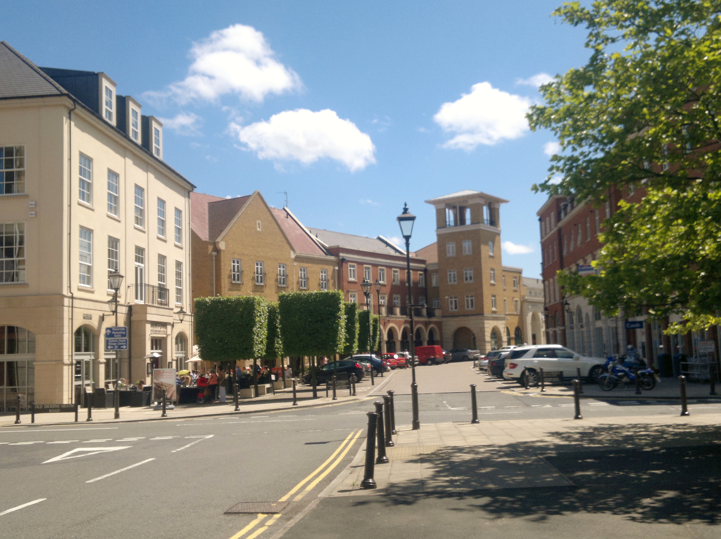
The area of Dickens Heath was previously farmland until it was developed in the early 2000s. It is a relatively new village, designed to be a self-sufficient community with a mix of residential, commercial, and recreational facilities. The architecture of the village reflects a modern and contemporary style, with a variety of housing types including detached houses, townhouses, and apartments.
The village center features a range of amenities including shops, restaurants, and cafes, providing residents with convenient access to daily essentials. Additionally, there are recreational facilities such as parks, playgrounds, and sports fields, promoting an active lifestyle for the community. The village also has its own primary school, ensuring educational needs are met locally.
Dickens Heath benefits from its proximity to major transport links, with easy access to the M42 motorway and the A34 road. It is well-connected to nearby towns and cities such as Birmingham, Solihull, and Warwick, offering residents a range of employment and leisure opportunities.
The village has a vibrant community spirit and hosts various events throughout the year, including festivals and markets, bringing residents together and creating a sense of belonging. With its modern amenities, convenient location, and community-focused environment, Dickens Heath offers a desirable place to live for individuals and families alike.
If you have any feedback on the listing, please let us know in the comments section below.
Dickens Heath Images
Images are sourced within 2km of 52.38821/-1.836851 or Grid Reference SP1176. Thanks to Geograph Open Source API. All images are credited.


Dickens Heath is located at Grid Ref: SP1176 (Lat: 52.38821, Lng: -1.836851)
Administrative County: West Midlands
District: Solihull
Police Authority: West Midlands
What 3 Words
///jazzy.fence.chemistry. Near Dickens Heath, West Midlands
Nearby Locations
Related Wikis
Dickens Heath
Dickens Heath is a large modern village and civil parish within the Metropolitan Borough of Solihull in the English county of West Midlands incorporating...

Highgate United F.C.
Highgate United Football Club is a football club based in the Shirley district of Solihull, having relocated from their original location of Highgate in...
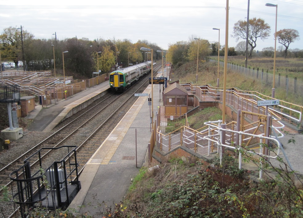
Whitlocks End railway station
Whitlocks End railway station is a railway station on the North Warwickshire Line located next to, and named after the hamlet of Whitlock's End in the...
Major's Green
Major's Green is a village in the Wythall parish of Bromsgrove district and is the northeastern-most settlement in the county of Worcestershire, England...
Light Hall School
Light Hall School is a secondary school located in Shirley, West Midlands, England. Light Hall School was established on Hathaway Road in 1965 as a boys...
Bills Wood
Bills Wood is a local nature reserve and park located in Shirley, Solihull. It covers an area of approximately 6.6 hectares (16 acres) and consists of...
Tidbury Green
Tidbury Green is a village and civil parish within the Metropolitan Borough of Solihull in the county of West Midlands in England. The population of the...
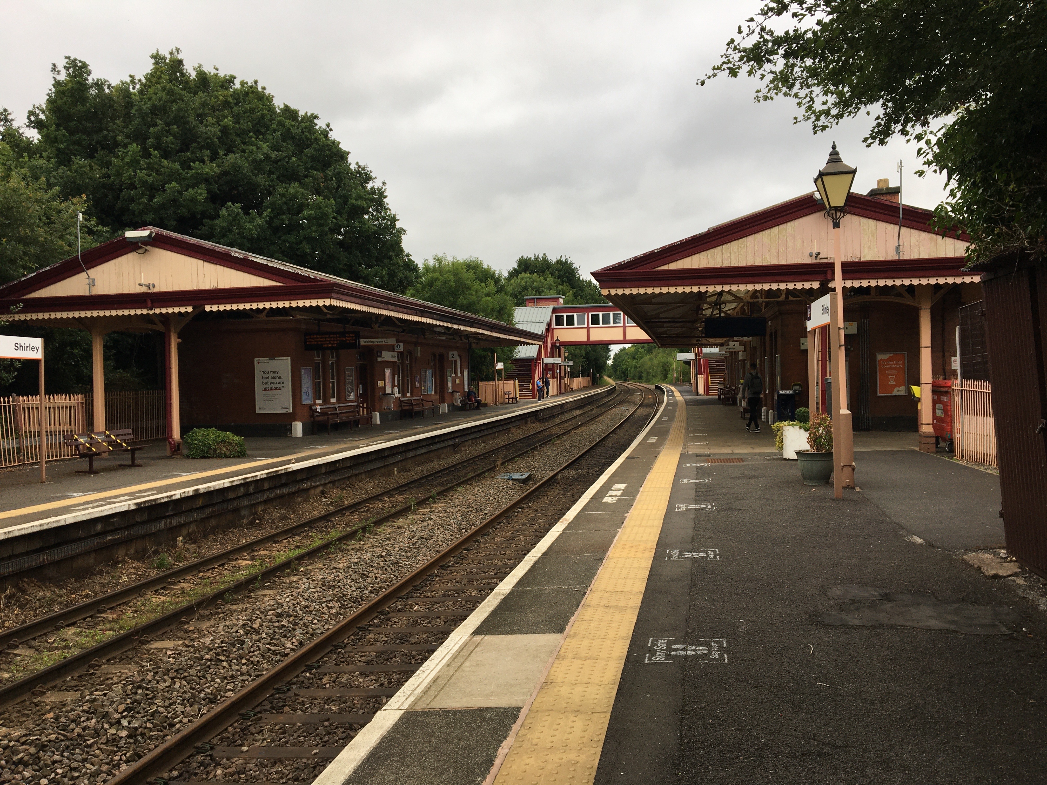
Shirley railway station (England)
Shirley railway station serves the Shirley area of Solihull in the West Midlands of England. Situated on the North Warwickshire Line, the station, and...
Nearby Amenities
Located within 500m of 52.38821,-1.836851Have you been to Dickens Heath?
Leave your review of Dickens Heath below (or comments, questions and feedback).