Dewsall

Civil Parish in Herefordshire

England

Dewsall

View towards King's Pitts from Aconbury Hill
View towards King's Pitts from Aconbury Hill Credit: Roger Cornfoot

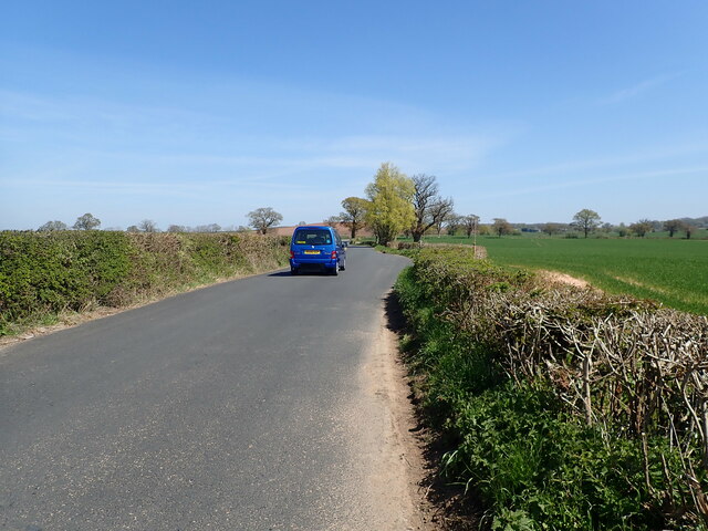
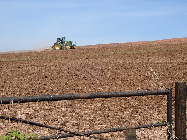
Dewsall is a civil parish located in the county of Herefordshire, England. Situated in the beautiful Wye Valley, it is a small rural area that encompasses an area of approximately 3 square miles. The parish is dotted with picturesque villages and hamlets, including Dewsall itself, Upper Dewsall, and Lower Dewsall.

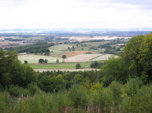
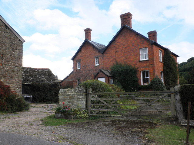
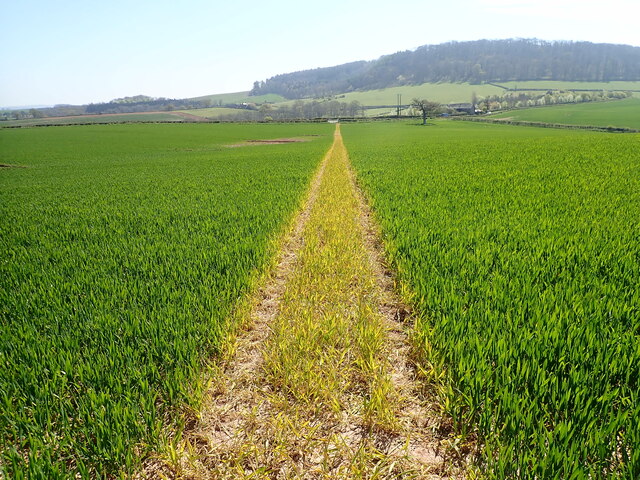
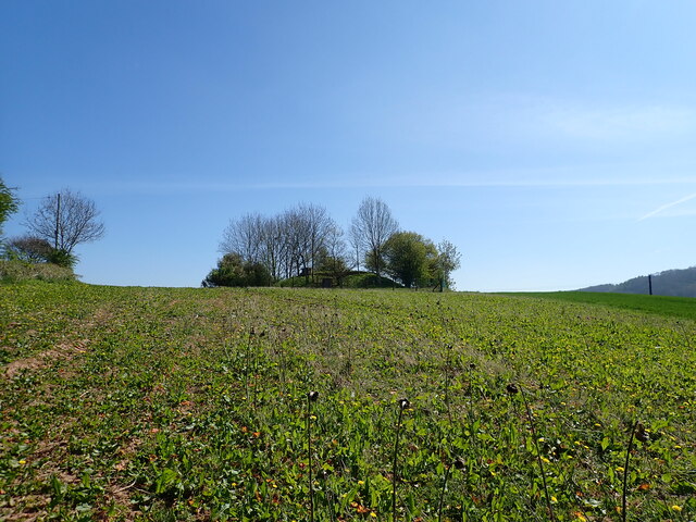
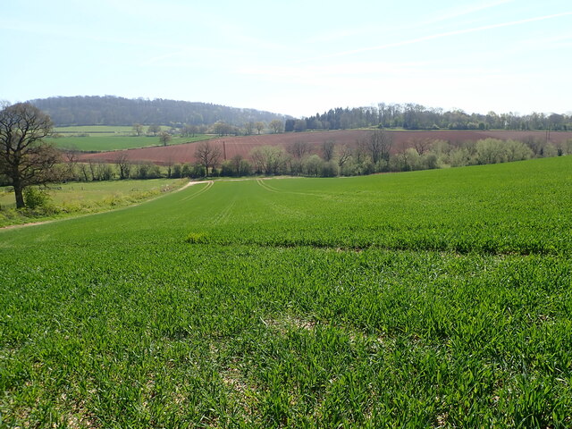
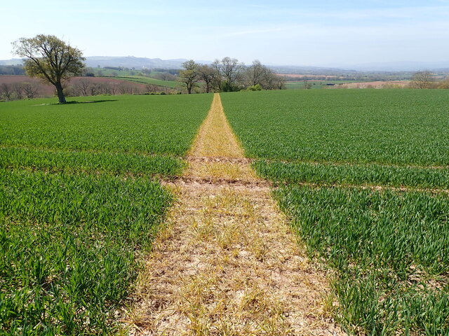
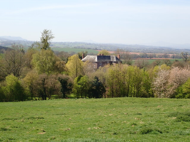
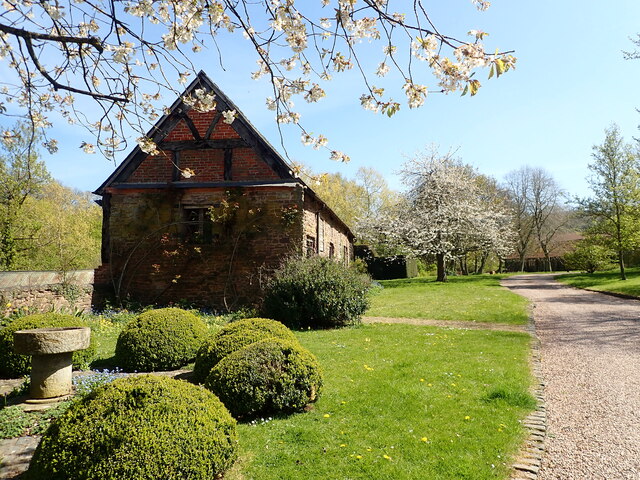
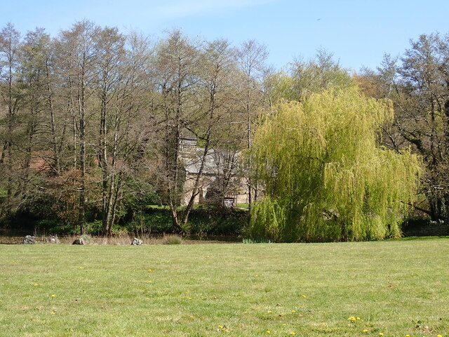
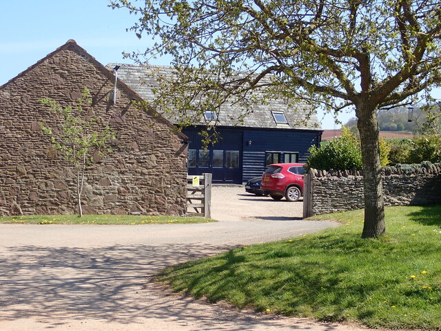
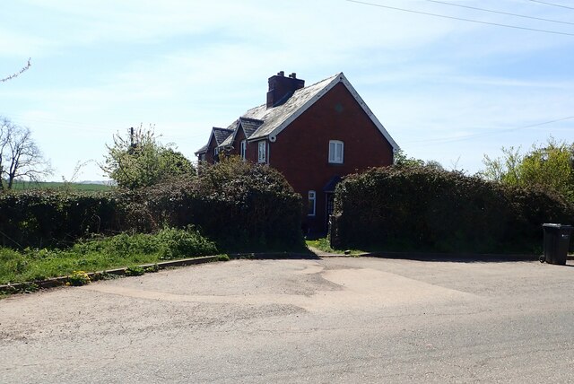
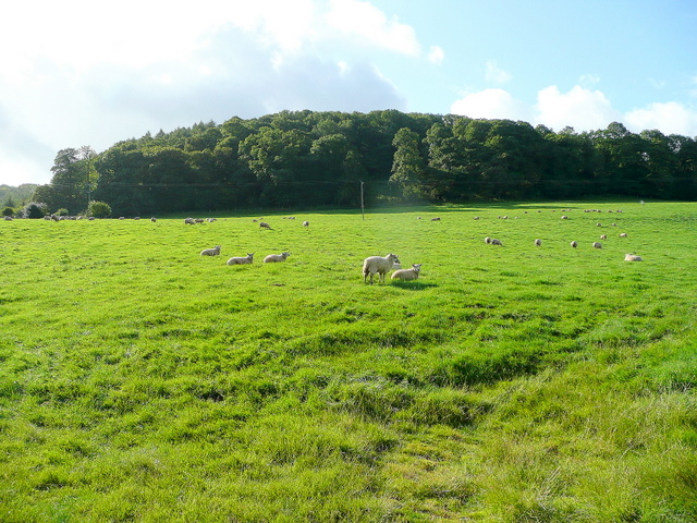
The landscape of Dewsall is characterized by rolling hills, lush green fields, and charming woodlands. The area is known for its natural beauty, offering stunning views of the surrounding countryside. The parish is also home to the Dewsall Court, a historic country house that dates back to the 17th century. This grade II listed building is known for its grand architecture and beautiful gardens.

Despite its small size, Dewsall has a tight-knit community that takes pride in its local heritage and traditions. The parish has a village hall that serves as a hub for various community activities and events. Residents also have access to a number of amenities, including a primary school, church, and a few local businesses.

Dewsall is surrounded by other notable areas of interest, such as the city of Hereford, which is located approximately 7 miles to the northeast. Hereford offers a wide range of amenities, including shopping centers, restaurants, and cultural attractions.

Overall, Dewsall, Herefordshire, is a charming and idyllic rural parish that offers a peaceful and picturesque setting for residents and visitors alike.

If you have any feedback on the listing, please let us know in the comments section below.

Dewsall Images

Images are sourced within 2km of 51.997619/-2.754808 or Grid Reference SO4833. Thanks to Geograph Open Source API. All images are credited.

View towards King's Pitts from Aconbury Hill
King's Pitts Farm
King's Pitts Farm
Footpath through a field of wheat No mistaking where the footpath is
Footpath through a field of wheat
No mistaking where the footpath is
Covered reservoir near Callow Surrounded by trees and a fence, in the middle of a field
Covered reservoir near Callow
Surrounded by trees and a fence, in the middle of a field
Covered reservoir near Callow Surrounded by trees and a fence, in the middle of a field
Covered reservoir near Callow
Surrounded by trees and a fence, in the middle of a field
Herefordshire farmland
Footpath heading towards Dewsall Court
Dewsall Court C17th century mansion a few miles south of Hereford set within 12 acres of grounds.
Dewsall Court
C17th century mansion a few miles south of Hereford set within 12 acres of grounds.
Barn at Dewsall Court
St Michael's Church, Dewsall Court
Duchy of Cornwall Offices 1000 acres of Duchy land surrounds nearby Dewsall Court and the estate office is here.
Duchy of Cornwall Offices
1000 acres of Duchy land surrounds nearby Dewsall Court and the estate office is here.
Freshly ploughed & rolled field near King's Thorn On the Duchy of Cornwall's Herefordshire Estate
Freshly ploughed & rolled field near King's Thorn
On the Duchy of Cornwall's Herefordshire Estate
Field ploughed in furrows On the Duchy of Cornwall's Herefordshire Estate
Field ploughed in furrows
On the Duchy of Cornwall's Herefordshire Estate
Dilapidated house at The Rhydd Looks like this building <a href="https://www.geograph.org.uk/photo/3105153">SO4633 : Ruinous house near Kivernoll</a> is finally being renovated or being demolished
Dilapidated house at The Rhydd
Looks like this building SO4633 : Ruinous house near Kivernoll is finally being renovated or being demolished
Cast iron milestone Near the ruined building at The Rhydd. 11 miles to Ross, 9 to Peterchurch
Cast iron milestone
Near the ruined building at The Rhydd. 11 miles to Ross, 9 to Peterchurch
Minor country road heading for Callow
Ploughing on Blakemore Hill
Haywood Cottages On a minor road west of Callow
Haywood Cottages
On a minor road west of Callow
Show me another place!

Dewsall is located at Grid Ref: SO4833 (Lat: 51.997619, Lng: -2.754808)

Unitary Authority: County of Herefordshire

Police Authority: West Mercia

What 3 Words

///workloads.earplugs.smaller. Near Callow, Herefordshire

Nearby Locations

Ark Wood Dewsall

Related Wikis

Dewsall

Dewsall is a civil parish in south Herefordshire, England, approximately 4 miles (6 km) south from the city and county town of Hereford. The nearest market...

Callow, Herefordshire

Callow is a village and civil parish in Herefordshire, England, about 4 miles (6.4 km) south of Hereford. The church is dedicated to St Mary. == External... ==

Kivernoll

Kivernoll (originally Kiverknoll) is a hamlet in the county of Herefordshire, England. It is part of Much Dewchurch parish. Kivernoll consists of a small...

Tram Inn railway station

Tram Inn railway station was a station to the east of Thruxton, Herefordshire, England. It was named after a local public house, itself named after a tramway...

Aconbury Camp

Aconbury Camp is an Iron Age hillfort on Aconbury Hill in Herefordshire, England, about 4 miles (6 km) south of Hereford, and near the village of Aconbury...

Steiner Academy Hereford

The Steiner Academy Hereford is a Steiner-Waldorf Academy school in Much Dewchurch near Hereford, Herefordshire, UK. It opened in September 2008 based...

Kingsthorne

Kingsthorne, also known as King's Thorn, is a village in Herefordshire, England, in Much Birch parish between Hereford and Ross-on-Wye, adjacent to the...

Much Dewchurch

Much Dewchurch (Welsh: Llanddewi Rhos Ceirion) is a village and civil parish in Herefordshire, England. The village lies about 6 miles (10 km) south of...

Nearby Amenities

Located within 500m of 51.997619,-2.754808
Dewsall
Place: village
Source: NPE
Lat/Long: 51.9970036/-2.7524435
Barrier: yes
Lat/Long: 51.9960303/-2.7484628
Barrier: stile
Lat/Long: 51.9970532/-2.7518796
Barrier: cattle_grid
Lat/Long: 51.9969715/-2.7516254
Dewsall Court
Power: pole
Transformer: distribution
Voltage Primary: 11000
Lat/Long: 51.9975607/-2.7508628
Power: pole
Lat/Long: 51.9976904/-2.7510439
Power: pole
Lat/Long: 51.9981453/-2.7516353
Dewsall Court Grain Dryer
Power: pole
Transformer: distribution
Voltage Primary: 11000
Lat/Long: 51.9984186/-2.7520162
Power: pole
Lat/Long: 51.998777/-2.752503
Monkhall Farm
Power: pole
Transformer: distribution
Voltage Primary: 11000
Lat/Long: 52.0001418/-2.7576998
Power: pole
Lat/Long: 51.999734/-2.7581048
Power: pole
Lat/Long: 51.9993054/-2.7577038
Power: pole
Lat/Long: 51.9988381/-2.7572639
Power: pole
Lat/Long: 51.9976301/-2.7607897
Power: pole
Lat/Long: 51.9978241/-2.7593896
Power: pole
Lat/Long: 51.9980074/-2.7580096
Power: pole
Lat/Long: 51.9981941/-2.756635
Power: pole
Lat/Long: 51.9983823/-2.7552992
Power: pole
Lat/Long: 51.9991593/-2.7530327
Ark Cottages Dewsall
Power: pole
Transformer: distribution
Voltage Primary: 11000
Lat/Long: 51.999994/-2.7505316
Power: pole
Lat/Long: 52.0003813/-2.749393
The data included in this document is from www.openstreetmap.org. The data is made available under ODbL.

Have you been to Dewsall?

Leave your review of Dewsall below (or comments, questions and feedback).