Curbar

Civil Parish in Derbyshire Derbyshire Dales

England

Curbar

Woodland behind the Eyre Arms This woodland on this hill behind the Eyre Arms is just to the south-west of the centre of SK27.
Woodland behind the Eyre Arms Credit: Roger Temple

Curbar is a civil parish located in the county of Derbyshire, England. Situated within the Peak District National Park, it lies approximately 4 miles east of Bakewell and 10 miles south of Sheffield. The parish covers an area of about 10 square kilometers and is home to a population of around 300 people.

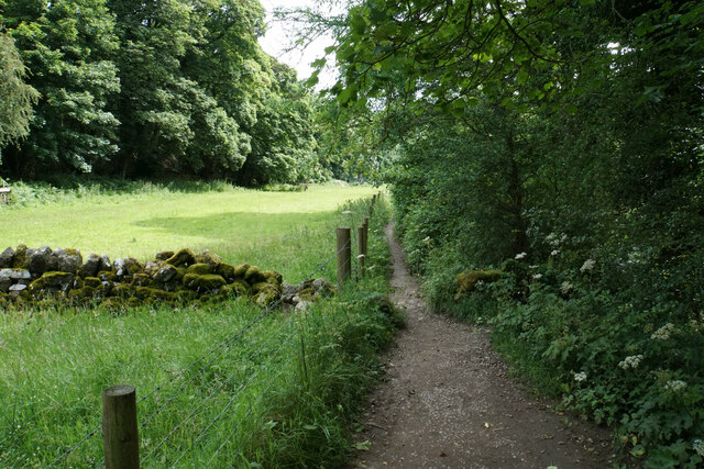
Curbar is renowned for its natural beauty and picturesque landscapes. It is characterized by rolling hills, deep valleys, and rugged moorland, making it a popular destination for outdoor enthusiasts and nature lovers. The area offers numerous walking trails, including the famous Curbar Edge, a gritstone escarpment that provides breathtaking panoramic views of the surrounding countryside.

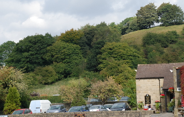
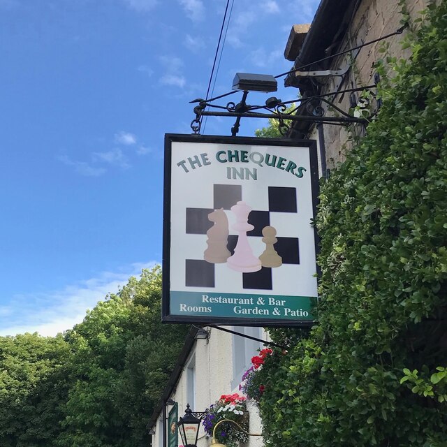
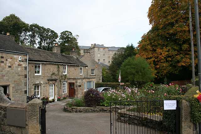
The village itself is small and charming, with a mix of traditional stone cottages and more modern houses. It has a close-knit community and a friendly, welcoming atmosphere. The parish church, St. Mary's, is a prominent feature of the village, dating back to the 13th century. There is also a village hall, which serves as a hub for community activities and events.

Curbar is well-connected to neighboring towns and cities, with good road links to Bakewell, Sheffield, and beyond. The nearby Curbar Gap car park provides a convenient starting point for exploring the area on foot. The village is also served by public transportation, with regular bus services connecting it to surrounding towns.

Overall, Curbar offers a tranquil and idyllic setting, perfect for those seeking a rural retreat or a base to explore the stunning Peak District National Park.

If you have any feedback on the listing, please let us know in the comments section below.
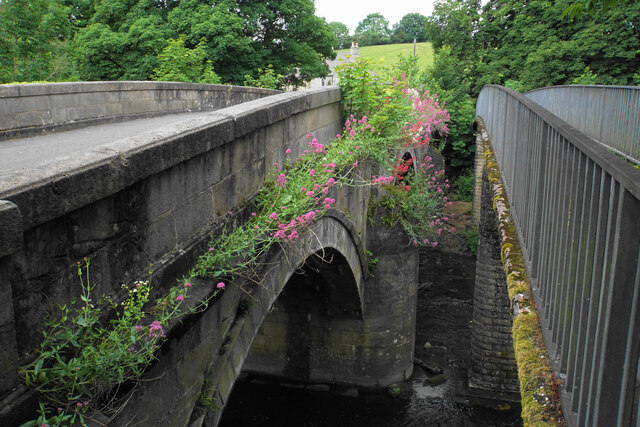
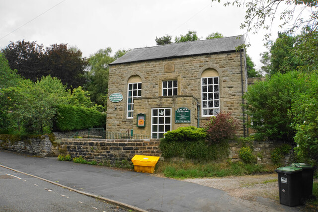
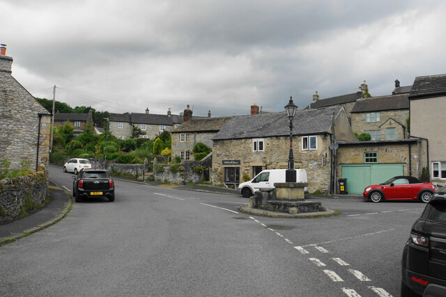
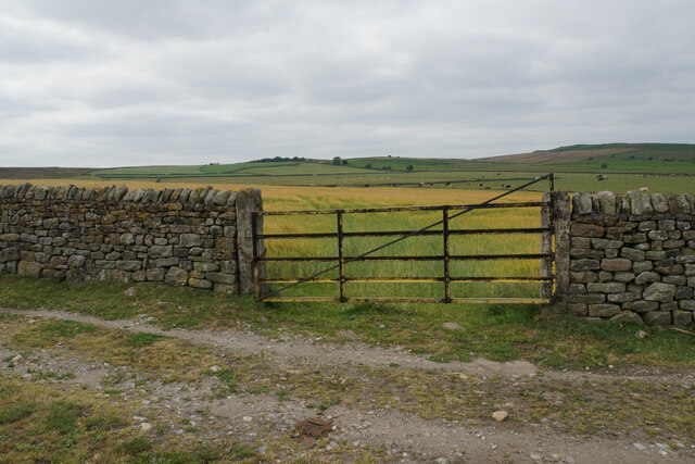
Curbar Images

Images are sourced within 2km of 53.267585/-1.614647 or Grid Reference SK2574. Thanks to Geograph Open Source API. All images are credited.

Woodland behind the Eyre Arms This woodland on this hill behind the Eyre Arms is just to the south-west of the centre of SK27.
Woodland behind the Eyre Arms
This woodland on this hill behind the Eyre Arms is just to the south-west of the centre of SK27.
The Chequers Inn Former Wards brewery pub beside the A625 in Froggatt
The Chequers Inn
Former Wards brewery pub beside the A625 in Froggatt
The sign of The Chequers Inn See <a href="https://www.geograph.org.uk/photo/6922975">SK2476 : The Chequers Inn</a>.
The sign of The Chequers Inn
Chequers Inn wall plaque Dating back to the halcyon days of the Wards brewery in Sheffield.  Oh to be able to drink a pint of that excellent brew again!
Chequers Inn wall plaque
Dating back to the halcyon days of the Wards brewery in Sheffield. Oh to be able to drink a pint of that excellent brew again!
Crossroads in Calver A lot of people will only know Calver from these crossroads, as the A623 passes through, and the A625 turns off. There is a village green here, with more on the opposite side, but the village has quieter and more attractive bits.
Crossroads in Calver
A lot of people will only know Calver from these crossroads, as the A623 passes through, and the A625 turns off. There is a village green here, with more on the opposite side, but the village has quieter and more attractive bits.
Fields by Knouchley Farm Looking down the Derwent Valley, with Curbar and Baslow Edges up on the left.
Fields by Knouchley Farm
Looking down the Derwent Valley, with Curbar and Baslow Edges up on the left.
Path down to the Derwent Froggatt Edge is at the top of the other side.
Path down to the Derwent
Froggatt Edge is at the top of the other side.
River Derwent Very smooth flowing above Calver Weir.
River Derwent
Very smooth flowing above Calver Weir.
River Derwent by New Bridge On the opposite side is the Shuttle House, for which the local authority conservation records are here: <span class="nowrap"><a title="https://her.derbyshire.gov.uk/Monument/MDR3974" rel="nofollow ugc noopener" href="https://her.derbyshire.gov.uk/Monument/MDR3974">Link</a><img style="margin-left:2px;" alt="External link" title="External link - shift click to open in new window" src="https://s1.geograph.org.uk/img/external.png" width="10" height="10"/></span>.
River Derwent by New Bridge
On the opposite side is the Shuttle House, for which the local authority conservation records are here: LinkExternal link.
Path by the River Derwent You can't see a great deal of the river through the foliage on the right.
Path by the River Derwent
You can't see a great deal of the river through the foliage on the right.
River Derwent near Calver Both sides of this stretch of the river are lined by trees. There is quite a lot of white water below Calver Weir.
River Derwent near Calver
Both sides of this stretch of the river are lined by trees. There is quite a lot of white water below Calver Weir.
Bridges over the River Derwent The bridge on the left carried the old main road from Baslow before it was replaced by a new Calver Bridge. The bridge on the right is a footbridge.
Bridges over the River Derwent
The bridge on the left carried the old main road from Baslow before it was replaced by a new Calver Bridge. The bridge on the right is a footbridge.
Calver Methodist Church The inscription states that this was Jubilee Primitive Methodist Chapel dating from 1860.
Calver Methodist Church
The inscription states that this was Jubilee Primitive Methodist Chapel dating from 1860.
Lamp standard and mounting block in Calver The lamp and its base are Grade II listed, with its listing details here: <span class="nowrap"><a title="https://historicengland.org.uk/listing/the-list/list-entry/1088211" rel="nofollow ugc noopener" href="https://historicengland.org.uk/listing/the-list/list-entry/1088211">Link</a><img style="margin-left:2px;" alt="External link" title="External link - shift click to open in new window" src="https://s1.geograph.org.uk/img/external.png" width="10" height="10"/></span>.
The cottage behind the hair salon is also Grade II listed.
Lamp standard and mounting block in Calver
The lamp and its base are Grade II listed, with its listing details here: LinkExternal link. The cottage behind the hair salon is also Grade II listed.
Long wall above Blackstone Edge The wall lines a long distance of the track. On the other side, there are fields maintained by Gorse Bank Farm as a conservation area.
Long wall above Blackstone Edge
The wall lines a long distance of the track. On the other side, there are fields maintained by Gorse Bank Farm as a conservation area.
Cattle above Blackstone Edge The dip just beyond the cattle is the valley of Bar Brook. Birchen Edge is in the background.
Cattle above Blackstone Edge
The dip just beyond the cattle is the valley of Bar Brook. Birchen Edge is in the background.
Barley field on Eaglestone Flat Part of an area of farmland above Baslow Edge.
Barley field on Eaglestone Flat
Part of an area of farmland above Baslow Edge.
Gate to farmland on Eaglestone Flat Not an active gate. Barley is growing on the other side. The farmland is on the plateau above Baslow Edge.
Gate to farmland on Eaglestone Flat
Not an active gate. Barley is growing on the other side. The farmland is on the plateau above Baslow Edge.
Show me another place!

Curbar is located at Grid Ref: SK2574 (Lat: 53.267585, Lng: -1.614647)

Administrative County: Derbyshire

District: Derbyshire Dales

Police Authority: Derbyshire

What 3 Words

///rocky.opinion.challenge. Near Baslow, Derbyshire

Nearby Locations

Curbar Curbar Gap Curbar

Related Wikis

Curbar Edge

Curbar Edge is a gritstone moorland escarpment above the village of Curbar, in Derbyshire, England and close to the villages of Baslow, Calver, and Froggatt...

Curbar

Curbar is a village and civil parish in the Derbyshire Dales district of Derbyshire, England. The population based on the 2011 Census was 417. Curbar is...

Cliff College

Cliff College is a Christian theological college in Calver, Derbyshire, that teaches Biblical Theology at the undergraduate level and a number of mission...

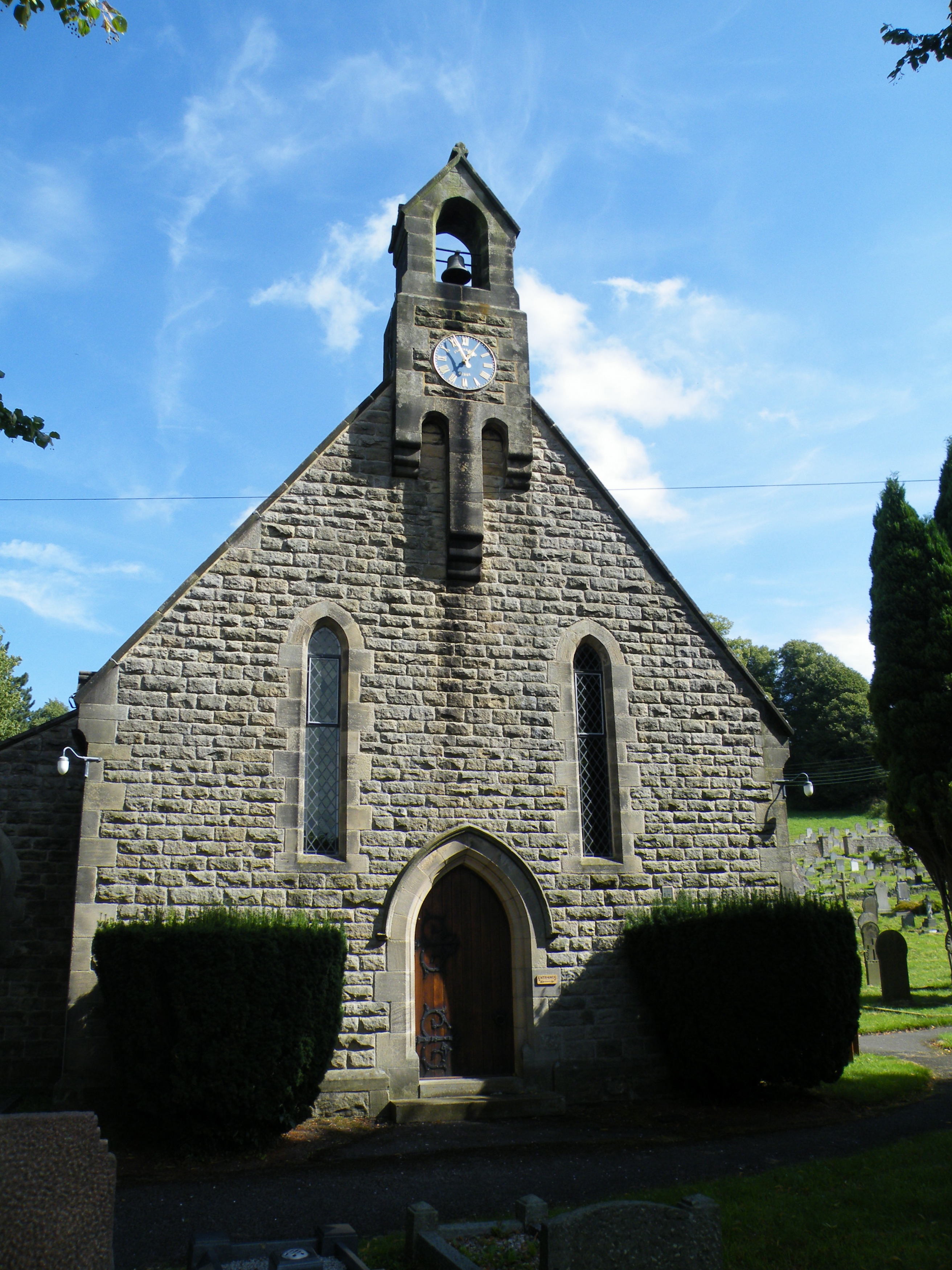
All Saints' Church, Curbar

All Saints’ Church, Curbar is a Church of England parish church in Curbar, Derbyshire. == History == Until the church was built, the nearest parish church...

Upper Derwent Valley

The Upper Derwent Valley is an area of the Peak District National Park in England. It largely lies in Derbyshire, but its north eastern area lies in Sheffield...

Calver

Calver (Old English Calf Slope) is a village and civil parish in Derbyshire, England. The population of the civil parish at the 2011 census was 710....

Baslow Hall

Baslow Hall is a Grade II listed building in Baslow, Derbyshire. == History == Baslow Hall, just off Calver Road, was built in 1907 to the designs of the...

Gardom's Edge

Gardom's Edge is a rocky outcrop near Baslow in Derbyshire, England. The shelf between Gardom's Edge and Birchen Edge is now moorland used for grazing...

Nearby Amenities

Located within 500m of 53.267585,-1.614647
Barrier: kissing_gate
Lat/Long: 53.269214/-1.6097361
Barrier: stile
Material: stone
Stile: squeezer
Lat/Long: 53.268057/-1.6141847
Barrier: stile
Material: stone
Stile: squeezer
Lat/Long: 53.268346/-1.612698
Ele: 303
Lat/Long: 53.2687804/-1.6079137
Barrier: stile
Material: stone
Source: survey;gps
Stile: squeezer
Lat/Long: 53.2680158/-1.6166735
Barrier: stile
Material: stone
Source: survey;gps
Stile: squeezer
Lat/Long: 53.2663199/-1.6201724
Barrier: cattle_grid
Bicycle: yes
Foot: yes
Lat/Long: 53.2665034/-1.6205382
Barrier: entrance
Source: survey;gps
Lat/Long: 53.263435/-1.6153988
Barrier: stile
Lat/Long: 53.2675903/-1.6176386
Bench
Lat/Long: 53.2686475/-1.6097349
Bench
Backrest: no
Lat/Long: 53.2687756/-1.6121221
Bench
Lat/Long: 53.268319/-1.6101644
Barrier: stile
Material: stone
Source: survey;gps
Stile: squeezer
Lat/Long: 53.2681335/-1.6146546
Barrier: kissing_gate
Source: survey;gps
Lat/Long: 53.2691179/-1.6206454
Barrier: stile
Material: stone
Source: survey;gps
Stile: squeezer
Lat/Long: 53.2694692/-1.6165209
Barrier: stile
Material: stone
Stile: stepover
Lat/Long: 53.2679287/-1.6177485
Baslow Edge
Tourism: viewpoint
Lat/Long: 53.2674731/-1.6116857
Bench
Lat/Long: 53.2702454/-1.6192837
Source: survey
Tourism: picnic_site
Lat/Long: 53.2687426/-1.6095234
Bench
Source: survey;gps
Lat/Long: 53.2679794/-1.6203251
Bench
Source: survey;gps
Lat/Long: 53.2680379/-1.6166827
Companion Stone 7
Artist Name: Val Carman and C J Allen
Artwork Type: sculpture
Material: stone
Tourism: artwork
Lat/Long: 53.2687245/-1.6076504
Curbar Edge
Name Zh: 科巴边缘
Tourism: attraction
Wheelchair: no
Lat/Long: 53.2712683/-1.6126773
The Loafstone
Climbing: boulder
Climbing Bouldering: yes
Climbing Rock: gritstone
Natural: stone
Sport: climbing
Lat/Long: 53.2705908/-1.6181713
Gorilla Warfare
Climbing: boulder
Climbing Bouldering: yes
Climbing Rock: gritstone
Natural: stone
Sport: climbing
Lat/Long: 53.2715/-1.6152083
Mini Prow Boulder
Climbing: boulder
Climbing Bouldering: yes
Climbing Rock: gritstone
Natural: stone
Sport: climbing
Lat/Long: 53.2717613/-1.6157722
Trackside Boulder
Climbing: boulder
Climbing Bouldering: yes
Climbing Rock: gritstone
Natural: stone
Sport: climbing
Lat/Long: 53.2710405/-1.6161765
Not A Jerry Traverse
Climbing: boulder
Climbing Bouldering: yes
Climbing Rock: gritstone
Natural: stone
Sport: climbing
Lat/Long: 53.2708663/-1.6179225
Bad Landing Boulder
Climbing: boulder
Climbing Bouldering: yes
Climbing Rock: gritstone
Natural: stone
Sport: climbing
Lat/Long: 53.2719349/-1.6157951
Crescent Slab
Climbing: boulder
Climbing Bouldering: yes
Climbing Rock: gritstone
Natural: stone
Sport: climbing
Lat/Long: 53.2713944/-1.6153686
Bench
Lat/Long: 53.2696046/-1.6135709
Bench
Lat/Long: 53.2692166/-1.6207143
Generator Method: photovoltaic
Generator Output Electricity: yes
Generator Source: solar
Generator Type: solar_photovoltaic_panel
Location: roof
Power: generator
Lat/Long: 53.2677403/-1.6203627
Generator Method: photovoltaic
Generator Output Electricity: yes
Generator Source: solar
Generator Type: solar_photovoltaic_panel
Location: roof
Power: generator
Lat/Long: 53.2685215/-1.6210681
Baslow Edge
Information: map
Tourism: information
Lat/Long: 53.2674825/-1.6116858
Vending: parking_tickets
Lat/Long: 53.268771/-1.6079444
Covered: no
Leisure: picnic_table
Lat/Long: 53.2689146/-1.6080554
Covered: no
Leisure: picnic_table
Lat/Long: 53.268828/-1.6079709
Format: squared_stone
Historic: milestone
Source: GPS
Lat/Long: 53.2685867/-1.6076272
Parking
Access: yes
Fee: yes
Operator: National Trust/RSPB
Parking: surface
Lat/Long: 53.2689799/-1.6080762
Bench
Backrest: yes
Lat/Long: 53.2694832/-1.6131876
The data included in this document is from www.openstreetmap.org. The data is made available under ODbL.

Have you been to Curbar?

Leave your review of Curbar below (or comments, questions and feedback).