Curbar

Settlement in Derbyshire Derbyshire Dales

England

Curbar

Woodland behind the Eyre Arms This woodland on this hill behind the Eyre Arms is just to the south-west of the centre of SK27.
Woodland behind the Eyre Arms Credit: Roger Temple

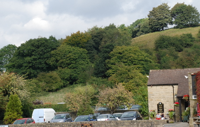
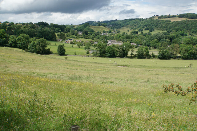
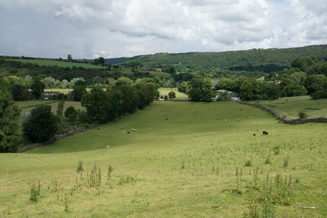
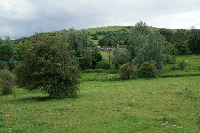
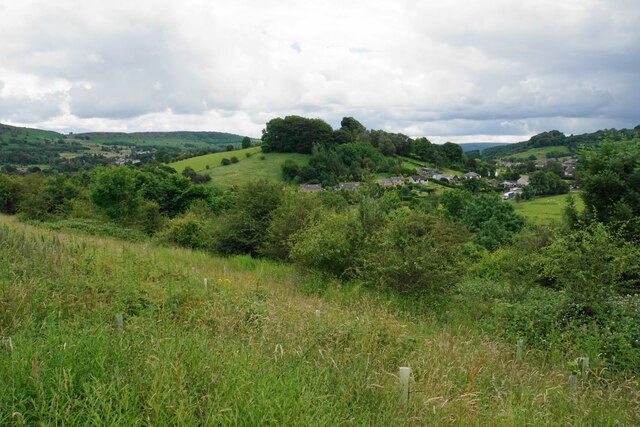
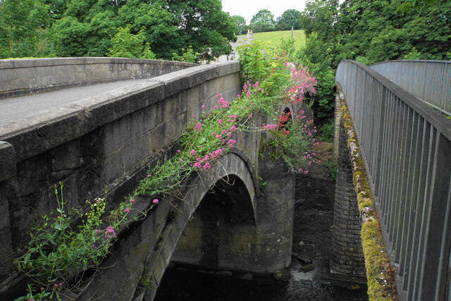
Curbar is a quaint village located in the county of Derbyshire, England. Situated within the Peak District National Park, it is surrounded by breathtaking natural beauty. The village is nestled on the eastern bank of the River Derwent, with the picturesque Curbar Edge rising prominently to the west.

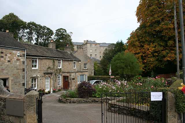
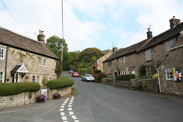
With a population of around 450 residents, Curbar maintains its rural charm and tranquility. The village features a mix of traditional stone cottages, historic buildings, and a handful of modern houses. The local community is closely-knit, fostering a friendly and welcoming atmosphere.

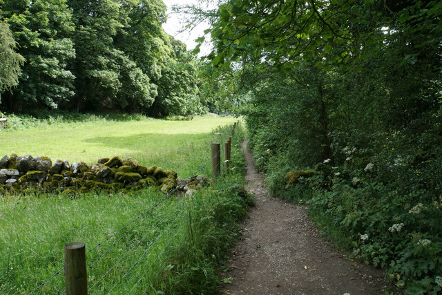
Curbar is renowned for its stunning countryside landscapes, attracting outdoor enthusiasts and nature lovers from far and wide. Curbar Edge, a prominent gritstone escarpment, offers panoramic views of the surrounding countryside, making it a popular destination for hikers, climbers, and photographers. The area is also rich in wildlife, with birdwatchers spotting various species including peregrine falcons and kestrels.

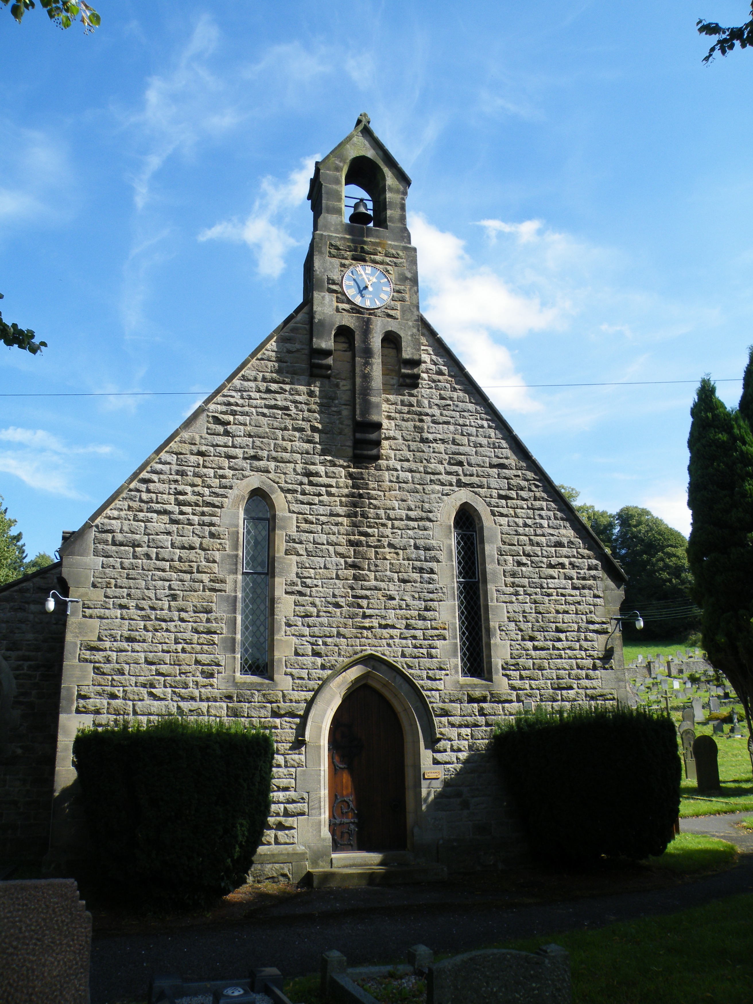
In addition to its natural wonders, Curbar boasts a rich history. The village is home to the Grade II listed Curbar Primary School, which has been educating local children for over a century. The nearby Curbar Church, dedicated to St. Giles, dates back to the 12th century and features a beautiful medieval tower.

Although small, Curbar offers a peaceful retreat for those seeking an escape from the bustling city life. Whether it's exploring the countryside, immersing in history, or simply enjoying the serenity, Curbar provides an idyllic setting for residents and visitors alike.

If you have any feedback on the listing, please let us know in the comments section below.

Curbar Images

Images are sourced within 2km of 53.268967/-1.625145 or Grid Reference SK2574. Thanks to Geograph Open Source API. All images are credited.

Woodland behind the Eyre Arms This woodland on this hill behind the Eyre Arms is just to the south-west of the centre of SK27.
Woodland behind the Eyre Arms
This woodland on this hill behind the Eyre Arms is just to the south-west of the centre of SK27.
The Chequers Inn Former Wards brewery pub beside the A625 in Froggatt
The Chequers Inn
Former Wards brewery pub beside the A625 in Froggatt
The sign of The Chequers Inn See <a href="https://www.geograph.org.uk/photo/6922975">SK2476 : The Chequers Inn</a>.
The sign of The Chequers Inn
Chequers Inn wall plaque Dating back to the halcyon days of the Wards brewery in Sheffield.  Oh to be able to drink a pint of that excellent brew again!
Chequers Inn wall plaque
Dating back to the halcyon days of the Wards brewery in Sheffield. Oh to be able to drink a pint of that excellent brew again!
Crossroads in Calver A lot of people will only know Calver from these crossroads, as the A623 passes through, and the A625 turns off. There is a village green here, with more on the opposite side, but the village has quieter and more attractive bits.
Crossroads in Calver
A lot of people will only know Calver from these crossroads, as the A623 passes through, and the A625 turns off. There is a village green here, with more on the opposite side, but the village has quieter and more attractive bits.
Hillside below Calver Low Looking down towards Stoney Middleton. Eyam is just visible further up the far hill.
Hillside below Calver Low
Looking down towards Stoney Middleton. Eyam is just visible further up the far hill.
Field at the bottom of Coombs Dale The A623 runs at the other end of the field. The Derwent valley is in the background with Froggatt Edge on the far side.
Field at the bottom of Coombs Dale
The A623 runs at the other end of the field. The Derwent valley is in the background with Froggatt Edge on the far side.
Green fields at the bottom of Middleton Dale Calver Peak is opposite.
Green fields at the bottom of Middleton Dale
Calver Peak is opposite.
Hillside above Stoke Brook The course of Stoke Brook below is obscured by shrubbery. Opposite is Hare Knoll and Calver.
Hillside above Stoke Brook
The course of Stoke Brook below is obscured by shrubbery. Opposite is Hare Knoll and Calver.
Fields by Knouchley Farm Looking down the Derwent Valley, with Curbar and Baslow Edges up on the left.
Fields by Knouchley Farm
Looking down the Derwent Valley, with Curbar and Baslow Edges up on the left.
Hilly farmland near Knouchley Farm Part of the western side of the Derwent valley opposite Froggatt.
Hilly farmland near Knouchley Farm
Part of the western side of the Derwent valley opposite Froggatt.
Path down to the Derwent Froggatt Edge is at the top of the other side.
Path down to the Derwent
Froggatt Edge is at the top of the other side.
River Derwent Very smooth flowing above Calver Weir.
River Derwent
Very smooth flowing above Calver Weir.
Froggatt Bridge Crossing the River Derwent. Grade II listed and mostly rebuilt in the 19th Century.
Froggatt Bridge
Crossing the River Derwent. Grade II listed and mostly rebuilt in the 19th Century.
River Derwent by New Bridge On the opposite side is the Shuttle House, for which the local authority conservation records are here: <span class="nowrap"><a title="https://her.derbyshire.gov.uk/Monument/MDR3974" rel="nofollow ugc noopener" href="https://her.derbyshire.gov.uk/Monument/MDR3974">Link</a><img style="margin-left:2px;" alt="External link" title="External link - shift click to open in new window" src="https://s1.geograph.org.uk/img/external.png" width="10" height="10"/></span>.
River Derwent by New Bridge
On the opposite side is the Shuttle House, for which the local authority conservation records are here: LinkExternal link.
Path by the River Derwent You can't see a great deal of the river through the foliage on the right.
Path by the River Derwent
You can't see a great deal of the river through the foliage on the right.
River Derwent near Calver Both sides of this stretch of the river are lined by trees. There is quite a lot of white water below Calver Weir.
River Derwent near Calver
Both sides of this stretch of the river are lined by trees. There is quite a lot of white water below Calver Weir.
Bridges over the River Derwent The bridge on the left carried the old main road from Baslow before it was replaced by a new Calver Bridge. The bridge on the right is a footbridge.
Bridges over the River Derwent
The bridge on the left carried the old main road from Baslow before it was replaced by a new Calver Bridge. The bridge on the right is a footbridge.
Show me another place!

Curbar is located at Grid Ref: SK2574 (Lat: 53.268967, Lng: -1.625145)

Administrative County: Derbyshire

District: Derbyshire Dales

Police Authority: Derbyshire

What 3 Words

///eternally.inserting.cascade. Near Baslow, Derbyshire

Nearby Locations

Curbar Gap Curbar Curbar

Related Wikis

Curbar

Curbar is a village and civil parish in the Derbyshire Dales district of Derbyshire, England. The population based on the 2011 Census was 417. Curbar is...

All Saints' Church, Curbar

All Saints’ Church, Curbar is a Church of England parish church in Curbar, Derbyshire. == History == Until the church was built, the nearest parish church...

Cliff College

Cliff College is a Christian theological college in Calver, Derbyshire, that teaches Biblical Theology at the undergraduate level and a number of mission...

Curbar Edge

Curbar Edge is a gritstone moorland escarpment above the village of Curbar, in Derbyshire, England and close to the villages of Baslow, Calver, and Froggatt...

Upper Derwent Valley

The Upper Derwent Valley is an area of the Peak District National Park in England. It largely lies in Derbyshire, but its north eastern area lies in Sheffield...

Calver

Calver (Old English Calf Slope) is a village and civil parish in Derbyshire, England. The population of the civil parish at the 2011 census was 710....

Froggatt, Derbyshire

Froggatt is a village and a civil parish on the A625 road and the River Derwent in the English county of Derbyshire. The population of the civil parish...

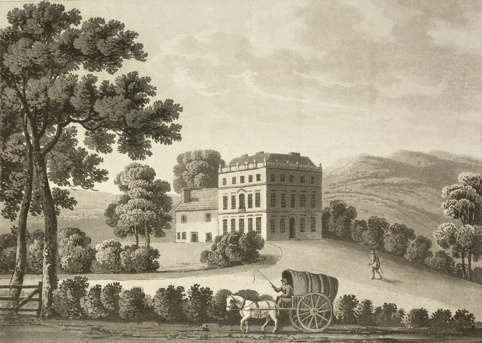
Stoke Hall, Derbyshire

Stoke Hall is a Grade II* listed 30-room Georgian Palladian mansion near the village of Grindleford, Derbyshire, England, whose restoration featured on...

Nearby Amenities

Located within 500m of 53.268967,-1.625145
Curbar
Is In: Derbyshire, England, UK
Place: village
Wikidata: Q2744982
Wikipedia: en:Curbar
Lat/Long: 53.2684064/-1.6253621
Created By: Merkaartor 0.12
Lat/Long: 53.2722029/-1.628589
Created By: Merkaartor 0.12
Lat/Long: 53.2719399/-1.628524
Created By: Merkaartor 0.12
Lat/Long: 53.271678/-1.62855
Created By: Merkaartor 0.12
Lat/Long: 53.271017/-1.6288279
Created By: Merkaartor 0.12
Lat/Long: 53.2699989/-1.6288609
Created By: Merkaartor 0.12
Lat/Long: 53.267936/-1.6294349
Created By: Merkaartor 0.12
Lat/Long: 53.2670498/-1.6301607
Calver Mill
Historic: building
Lat/Long: 53.2678848/-1.6306222
Barrier: stile
Material: stone
Source: survey;gps
Stile: squeezer
Lat/Long: 53.2663199/-1.6201724
Barrier: cattle_grid
Bicycle: yes
Foot: yes
Lat/Long: 53.2665034/-1.6205382
Barrier: stile
Material: stone
Source: survey;gps
Stile: stepover
Lat/Long: 53.2655177/-1.6219904
Barrier: stile
Material: stone
Source: survey;gps
Stile: squeezer
Lat/Long: 53.2658757/-1.6218702
Barrier: stile
Material: stone
Source: survey;gps
Stile: stepover
Lat/Long: 53.2661492/-1.6243037
Barrier: stile
Material: stone
Source: survey;gps
Stile: stepover
Lat/Long: 53.2665867/-1.6221167
Barrier: stile
Material: stone
Source: survey;gps
Stile: squeezer
Lat/Long: 53.2670616/-1.6225464
Barrier: kissing_gate
Source: survey;gps
Lat/Long: 53.2691179/-1.6206454
Natural: spring
Lat/Long: 53.2690047/-1.6250139
Watering Place
Lat/Long: 53.2689971/-1.6250845
Bench
Lat/Long: 53.2715533/-1.6198053
Bench
Lat/Long: 53.2702454/-1.6192837
Calver Weir
Board Type: history
Information: board
Tourism: information
Lat/Long: 53.2679715/-1.6323017
Post Box
Post Box Type: lamp
Ref: S32 201
Lat/Long: 53.2682191/-1.6247991
Bench
Source: survey;gps
Lat/Long: 53.2679794/-1.6203251
The Loafstone
Climbing: boulder
Climbing Bouldering: yes
Climbing Rock: gritstone
Natural: stone
Sport: climbing
Lat/Long: 53.2705908/-1.6181713
Bench
Lat/Long: 53.2692166/-1.6207143
Booth: K6
Covered: booth
Disused Amenity: telephone
Man Made: telephone_box
Source: survey
Tourism: information
Lat/Long: 53.2675283/-1.6243114
Generator Method: photovoltaic
Generator Output Electricity: yes
Generator Source: solar
Generator Type: solar_photovoltaic_panel
Location: roof
Power: generator
Lat/Long: 53.2678683/-1.6233891
Generator Method: photovoltaic
Generator Output Electricity: yes
Generator Source: solar
Generator Type: solar_photovoltaic_panel
Location: roof
Power: generator
Lat/Long: 53.2678731/-1.6234535
Generator Method: photovoltaic
Generator Output Electricity: yes
Generator Source: solar
Generator Type: solar_photovoltaic_panel
Location: roof
Power: generator
Lat/Long: 53.2677403/-1.6203627
Generator Method: photovoltaic
Generator Output Electricity: yes
Generator Source: solar
Generator Type: solar_photovoltaic_panel
Location: roof
Power: generator
Lat/Long: 53.2685215/-1.6210681
Parking
Lat/Long: 53.2672402/-1.6300609
Bench
Backrest: yes
Lat/Long: 53.2661289/-1.6304574
Entrance: yes
Lat/Long: 53.266157/-1.6304073
Barrier: kissing_gate
Source: survey;gps
Lat/Long: 53.2689142/-1.631906
Defibrillator
Access: yes
Defibrillator Location: On the wall at the crossroads.
Emergency: defibrillator
Indoor: no
Lat/Long: 53.2689593/-1.6250515
Man Made: flagpole
Lat/Long: 53.2689666/-1.6249976
Bench
Backrest: yes
Lat/Long: 53.2714102/-1.6261301
Bench
Backrest: yes
Lat/Long: 53.2689652/-1.6250233
The data included in this document is from www.openstreetmap.org. The data is made available under ODbL.

Have you been to Curbar?

Leave your review of Curbar below (or comments, questions and feedback).