Alderton

Settlement in Suffolk East Suffolk

England

Alderton

Bawdsey - High House and High House Farm C17 and C18 house Grade II listed - The farmer must have been doing very well at some point.
Bawdsey - High House and High House Farm Credit: James Emmans

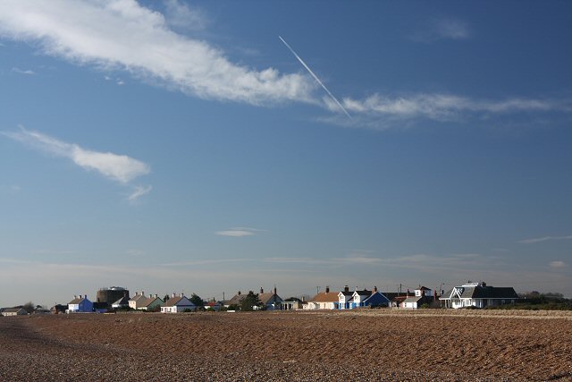
Alderton is a small village located in the county of Suffolk, England. Situated about 10 miles east of Ipswich, the village is nestled in the picturesque countryside of East Anglia. With a population of around 300 residents, Alderton offers a tranquil and close-knit community atmosphere.

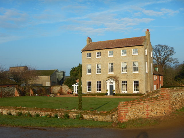
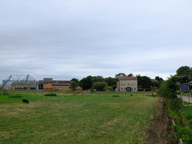
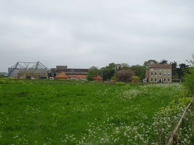
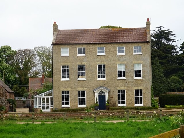
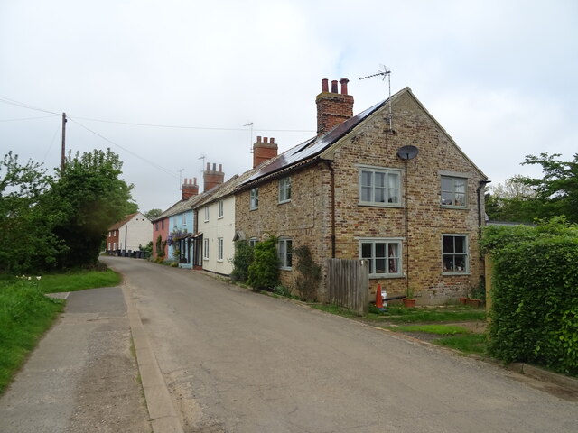
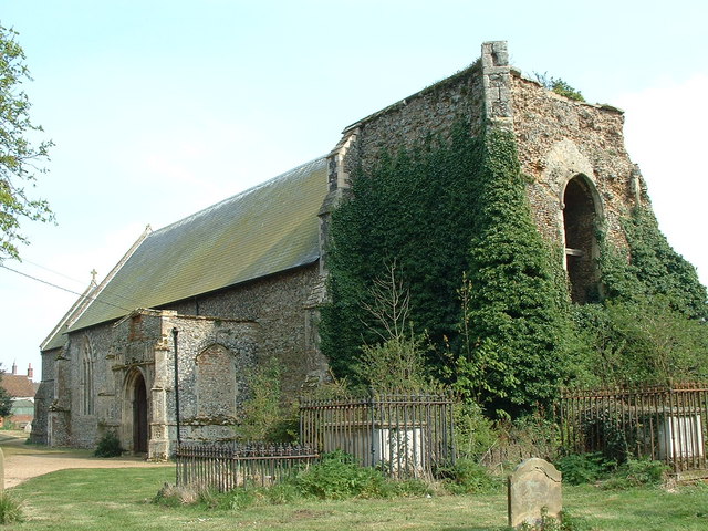
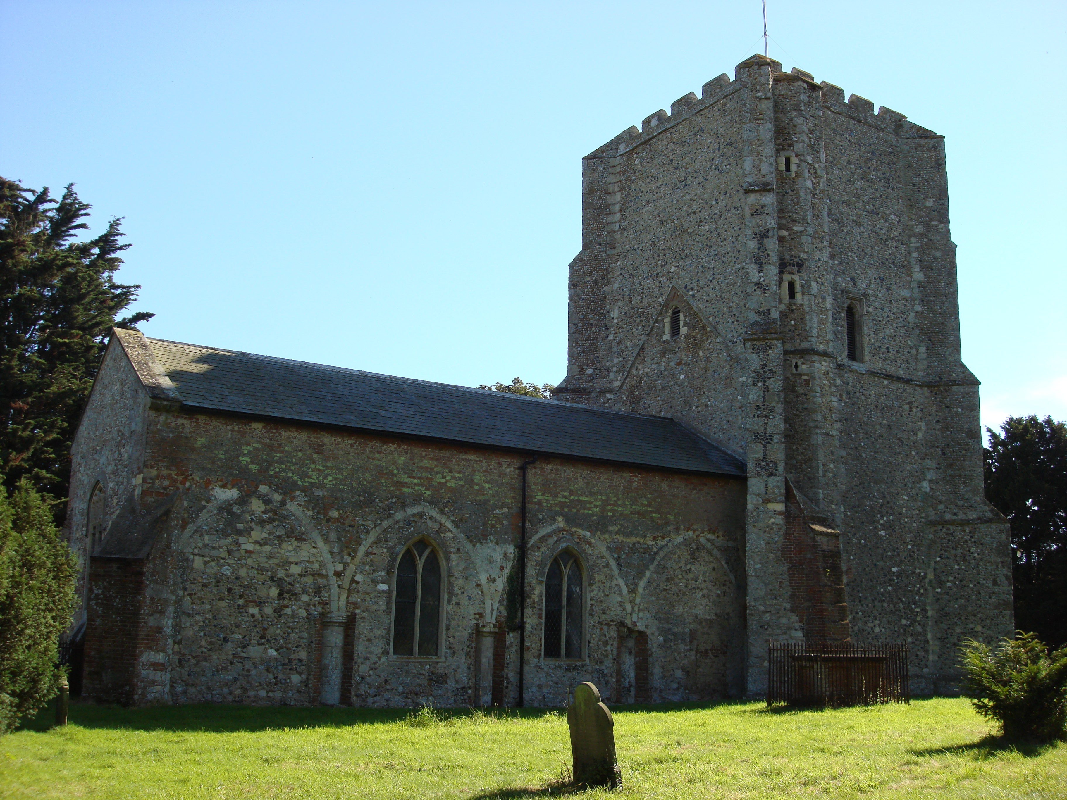
The village is known for its charming thatched-roof cottages and historic buildings, which give it a timeless and traditional feel. The centerpiece of Alderton is the 14th-century St. Andrew's Church, renowned for its beautiful stained-glass windows and intricate stonework. The church serves as a focal point for the community and hosts regular services and events.

Alderton boasts a range of amenities for its residents, including a local pub, The Alderton Swan, which serves traditional British cuisine and is a popular meeting place for villagers. The village also has a primary school, providing education for the local children.

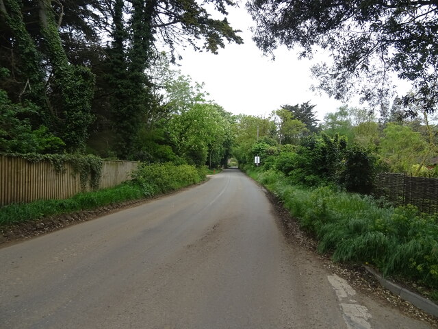
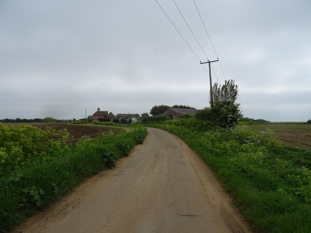
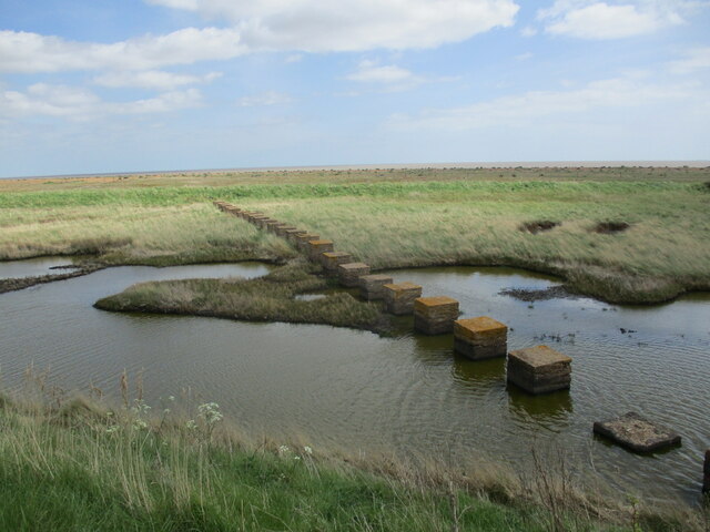
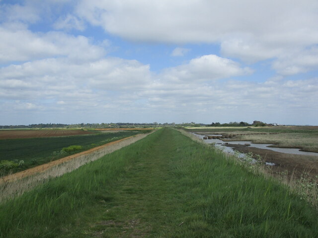
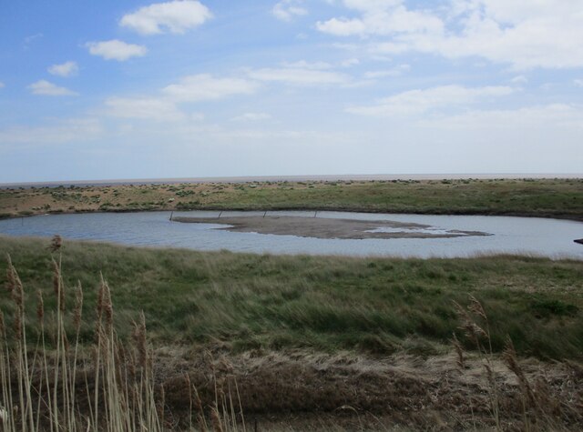
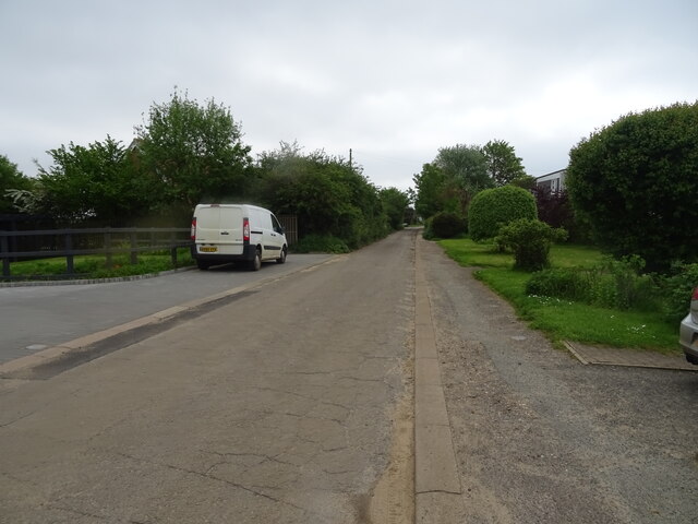
Surrounded by picturesque countryside, Alderton offers numerous opportunities for outdoor activities. The village is located near the River Deben, providing scenic walks and fishing spots. It is also close to the popular Aldeburgh and Thorpeness coastal towns, offering sandy beaches and seaside attractions.

Transport links in Alderton are limited, with the nearest train station located in Woodbridge, about 7 miles away. However, the village is well-connected by road, with the A12 providing easy access to Ipswich and other nearby towns.

Overall, Alderton is a delightful village with a rich history and a strong sense of community, making it an attractive place to live for those seeking a peaceful and idyllic rural lifestyle.

If you have any feedback on the listing, please let us know in the comments section below.

Alderton Images

Images are sourced within 2km of 52.023692/1.4151609 or Grid Reference TM3441. Thanks to Geograph Open Source API. All images are credited.

Bawdsey - High House and High House Farm C17 and C18 house Grade II listed - The farmer must have been doing very well at some point.
Bawdsey - High House and High House Farm
C17 and C18 house Grade II listed - The farmer must have been doing very well at some point.
High House Bawdsey A Grade II Listed building <span class="nowrap"><a title="https://britishlistedbuildings.co.uk/101030776-high-house-bawdsey#.Xx8A7R3TVsM" rel="nofollow ugc noopener" href="https://britishlistedbuildings.co.uk/101030776-high-house-bawdsey#.Xx8A7R3TVsM">Link</a><img style="margin-left:2px;" alt="External link" title="External link - shift click to open in new window" src="https://s1.geograph.org.uk/img/external.png" width="10" height="10"/></span>
High House Bawdsey
A Grade II Listed building LinkExternal link
The Power set Amazon are using this area to film the second series of The Power.  This was the set that was being built for filming the following week.  The roads were a real problem - farmers had been paid up to £38k for 'inconvenience' and 'disturbance'.
The Power set
Amazon are using this area to film the second series of The Power. This was the set that was being built for filming the following week. The roads were a real problem - farmers had been paid up to £38k for 'inconvenience' and 'disturbance'.
High House Farm
High House Farm
Farmhouse, High House Farm
The Street, Bawdsey
The Street, Bawdsey
Barn, East Lane Farm
Field and woodland near East Lane Farm
East Lane
East Lane
Martello Tower Z near Alderton
Martello Tower near Shingle Street Dates from 1810-12 <span class="nowrap"><a title="https://historicengland.org.uk/listing/the-list/list-entry/1030773?section=official-list-entry" rel="nofollow ugc noopener" href="https://historicengland.org.uk/listing/the-list/list-entry/1030773?section=official-list-entry">Link</a><img style="margin-left:2px;" alt="External link" title="External link - shift click to open in new window" src="https://s1.geograph.org.uk/img/external.png" width="10" height="10"/></span>
Martello Tower near Shingle Street
Dates from 1810-12 LinkExternal link
Farm track and irrigation pond, Shingle Street
Second World War defences near Shingle Street
Sea bank near Shingle Street
Pool behind the shingle bank near Shingle Street
Half buried pill box near Shingle Street
Cottages on East Lane
East Lane
East Lane
Show me another place!

Alderton is located at Grid Ref: TM3441 (Lat: 52.023692, Lng: 1.4151609)

Administrative County: Suffolk

District: East Suffolk

Police Authority: Suffolk

What 3 Words

///equality.seagulls.rooting. Near Felixstowe, Suffolk

Nearby Locations

Williams Wood Alderton

Related Wikis

Alderton, Suffolk

Alderton is a village and civil parish in the East Suffolk district of Suffolk, England, about six miles north of Felixstowe, 10 miles south-east of Woodbridge...

Buckanay Farm Pit, Alderton

Buckanay Farm Pit, Alderton is a 0.7-hectare (1.7-acre) geological Site of Special Scientific Interest east of Alderton in Suffolk. It is a Geological...

Bawdsey

Bawdsey is a village and civil parish in Suffolk, eastern England. Located on the other side of the river Deben from Felixstowe, it had an estimated population...

Shingle Street

Shingle Street is a coastal settlement on the North Sea coast of the English county of Suffolk. It is 8 miles (13 km) north-east of Felixstowe and 12 miles...

Related Videos

Large Flock of Geese at Bawdsey Quay, suffolk Uk 🇬🇧 😃

This Video was Taken 4 Days ago on Friday 12Th January 2024 and it Shows a fairly Large Flock of Geese at Bawdsey Quay ...

RUN COTTAGE TOURING PARK Hollesley | Walk to SHINGLE STREET | Ep214

PLEASE NOTE THIS VIDEO WAS RECORDED BEFORE ANY MOVEMENT RESTRICTIONS WERE IMPLEMENTED. We head off ...

SECRET WW2 BEACH LANDINGS SITE FOUND BY CAMPERVAN COUPLE AND THEIR POOCH MISS DARCY

WE MANAGED A WEEKEND GETAWAY BEFORE THE LOCKDOWN STARTED, AND WHAT A FIND, MR P HAS BEEN WANTING ...

On The Trail Of Edward VIII (Part 3) Bawdsey

We continue our quest to visit Britain's Edward VIII postboxes. This time we went to Bawdsey in Suffolk to view a particularly fine ...

Nearby Amenities

Located within 500m of 52.023692,1.4151609
Alderton
Is In: Suffolk,England,UK
Name Ru: Олдертон
Place: village
Wikidata: Q2108416
Wikipedia: en:Alderton, Suffolk
Lat/Long: 52.0244212/1.4162838
Bus Stop
Swan
Naptan AtcoCode: 390060335
Naptan Bearing: N
Naptan CommonName: Swan
Naptan Indicator: adj
Naptan Landmark: Swan
Naptan NaptanCode: sufgpgpa
Naptan Street: B1083
Naptan Verified: no
Source: naptan_import
Lat/Long: 52.0238172/1.4151115
Bus Stop
Swan
Naptan AtcoCode: 390060336
Naptan Bearing: S
Naptan BusStopType: CUS
Naptan CommonName: Swan
Naptan Indicator: opp
Naptan Landmark: Swan
Naptan NaptanCode: sufgpgpd
Naptan Street: B1083
Naptan Verified: no
Source: naptan_import
Lat/Long: 52.0238629/1.415166
Post Office
Alderton Post Office Stores
Addr Postcode: IP12 3BS
Addr Street: The Street
Fhrs Id: 659200
Shop: convenience
Source Addr: FSA Food Hygiene Ratings Database
Lat/Long: 52.0245575/1.4149506
Hospital
Alderton Health Centre
Lat/Long: 52.0246392/1.4155003
Post Box
Collection Times: Mo-Fr 16:15; Sa 09:00
Post Box Type: wall
Ref: IP12 6289
Royal Cypher: EIIR
Royal Cypher Wikidata: Q33102113
Lat/Long: 52.0245569/1.4148662
Leisure: picnic_table
Lat/Long: 52.0248652/1.4158413
Pub
The Alderton Swan
Addr Postcode: IP12 3BL
Addr Street: The Street
Fhrs Id: 659552
Source Addr: FSA Food Hygiene Ratings Database
Url: http://www.thealdertonswan.co.uk/
Wikidata: Q26657665
Lat/Long: 52.0240697/1.4147965
Alderton Hall
Place: locality
Lat/Long: 52.0235216/1.4119682
Parking
Access: private
Lat/Long: 52.0242414/1.41453
Parking
Lat/Long: 52.0266155/1.4135858
Parking
Access: private
Lat/Long: 52.0236411/1.4120402
Parking
Access: private
Lat/Long: 52.0221899/1.4158858
Parking
Access: private
Lat/Long: 52.0223071/1.4157946
Parking
Access: private
Lat/Long: 52.022364/1.4157853
Parking
Access: private
Lat/Long: 52.0220727/1.4166583
Parking
Access: private
Lat/Long: 52.0222287/1.4163592
Parking
Access: private
Lat/Long: 52.0226834/1.4161983
Parking
Lat/Long: 52.0228583/1.4158081
Parking
Access: private
Lat/Long: 52.0212986/1.4163271
Parking
Access: private
Lat/Long: 52.0214216/1.416889
Parking
Access: private
Lat/Long: 52.0215643/1.4168756
Parking
Access: private
Lat/Long: 52.0219555/1.4162841
Parking
Access: private
Lat/Long: 52.0217566/1.4163096
Parking
Access: private
Lat/Long: 52.0238948/1.4148934
Parking
Access: private
Lat/Long: 52.0239113/1.4154983
Parking
Access: private
Lat/Long: 52.0242299/1.4153306
Parking
Access: private
Lat/Long: 52.0234327/1.4154902
Parking
Access: private
Lat/Long: 52.0231117/1.4150557
Parking
Access: private
Lat/Long: 52.0233064/1.4152354
Parking
Access: private
Lat/Long: 52.0234286/1.4152206
Parking
Access: private
Lat/Long: 52.0233609/1.4152743
Parking
Access: private
Lat/Long: 52.0228897/1.4168675
Parking
Access: private
Lat/Long: 52.0228699/1.4167777
Parking
Access: private
Lat/Long: 52.0229367/1.4166114
Parking
Access: private
Lat/Long: 52.0232693/1.4163713
Parking
Access: private
Lat/Long: 52.0232495/1.4162734
Parking
Access: private
Lat/Long: 52.0232396/1.4161648
Parking
Access: private
Lat/Long: 52.0231703/1.4166006
Parking
Access: private
Lat/Long: 52.0226966/1.4175327
Parking
Access: private
Lat/Long: 52.0224251/1.4169426
Parking
Access: private
Lat/Long: 52.0246334/1.4153212
Parking
Access: private
Lat/Long: 52.0244799/1.4153588
Parking
Access: private
Lat/Long: 52.0242918/1.4150409
Parking
Access: private
Lat/Long: 52.0255312/1.4149484
Parking
Access: private
Lat/Long: 52.0254751/1.4149229
Parking
Access: private
Lat/Long: 52.0250831/1.4146721
Parking
Access: private
Lat/Long: 52.0247465/1.4138138
Parking
Access: private
Lat/Long: 52.0250386/1.4129864
Parking
Access: private
Lat/Long: 52.0248034/1.4131795
Parking
Access: private
Lat/Long: 52.0247902/1.4126256
Parking
Access: private
Lat/Long: 52.0247696/1.412411
Parking
Access: private
Lat/Long: 52.0246239/1.4099394
Parking
Access: private
Lat/Long: 52.0247671/1.4119926
Parking
Access: private
Lat/Long: 52.0245162/1.4141706
Parking
Access: private
Lat/Long: 52.0244304/1.4137119
Parking
Access: private
Lat/Long: 52.0262318/1.4177379
Parking
Access: private
Lat/Long: 52.0262615/1.4174321
Parking
Access: private
Lat/Long: 52.0266551/1.4177714
Parking
Access: private
Lat/Long: 52.025995/1.4176266
Parking
Access: private
Lat/Long: 52.0260082/1.4174268
Parking
Access: private
Lat/Long: 52.0248372/1.4156418
Parking
Access: private
Lat/Long: 52.0259917/1.4178398
Parking
Access: private
Lat/Long: 52.0265561/1.4176145
Parking
Access: private
Lat/Long: 52.0265346/1.4179297
Parking
Access: private
Lat/Long: 52.0266477/1.4171317
Parking
Access: private
Lat/Long: 52.0264662/1.4170861
Parking
Access: private
Lat/Long: 52.027175/1.4168233
Parking
Access: private
Lat/Long: 52.0275447/1.4171559
Parking
Access: private
Lat/Long: 52.0271973/1.4167052
Parking
Access: private
Lat/Long: 52.0271321/1.4172122
Parking
Access: private
Lat/Long: 52.027307/1.4172605
Parking
Access: private
Lat/Long: 52.0275339/1.4173155
Parking
Access: private
Lat/Long: 52.0275273/1.4168581
Parking
Lat/Long: 52.0266295/1.4160991
Parking
Lat/Long: 52.0267327/1.4161541
Parking
Access: private
Lat/Long: 52.0260717/1.4167361
Parking
Access: private
Lat/Long: 52.0260841/1.4166087
Parking
Access: private
Lat/Long: 52.0256649/1.4156552
Parking
Access: private
Lat/Long: 52.0251426/1.4151831
Parking
Access: private
Lat/Long: 52.0250518/1.415102
Parking
Access: private
Lat/Long: 52.0258044/1.4151523
Parking
Access: private
Lat/Long: 52.0259438/1.4152314
Parking
Access: private
Lat/Long: 52.0261625/1.4154379
Parking
Access: private
Lat/Long: 52.026212/1.4154513
Parking
Lat/Long: 52.0231694/1.4182522
Power: pole
Lat/Long: 52.0271321/1.4107132
Power: pole
Lat/Long: 52.0254058/1.4108902
Power: pole
Lat/Long: 52.0244399/1.4110015
Power: pole
Lat/Long: 52.0237389/1.4112282
Power: pole
Lat/Long: 52.0230968/1.4114401
Power: pole
Lat/Long: 52.022539/1.4116345
Power: pole
Lat/Long: 52.0216823/1.411888
Power: pole
Lat/Long: 52.0208488/1.4122045
Power: pole
Lat/Long: 52.0199344/1.4125344
Defibrillator
Defibrillator Location: On the left-hand side wall of the Swan Inn.
Emergency: defibrillator
Indoor: no
Ref: AAV69
Ref GB The Circuit: D013F3DD-ADB1-4E79-BA4E-AD48014E904B
Lat/Long: 52.0240414/1.4147696
The data included in this document is from www.openstreetmap.org. The data is made available under ODbL.

Have you been to Alderton?

Leave your review of Alderton below (or comments, questions and feedback).