Alderton Fields

Settlement in Gloucestershire Tewkesbury

England

Alderton Fields

Pipeline crossing a brook Pipeline crossing a brook in the village of Alderton.  This subject was the first picture submitted on this webpage for this grid square, see: <a href="https://www.geograph.org.uk/photo/67965">SO9932 : Pipeline near Alderton</a>.
Pipeline crossing a brook Credit: Philip Halling

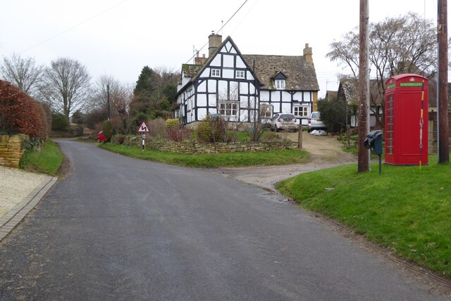
Alderton Fields is a charming and picturesque village located in the county of Gloucestershire, England. Situated in the western part of the county, it is nestled in the beautiful Cotswold Hills, offering stunning views of the surrounding countryside. With a population of around 700 residents, it maintains a close-knit community atmosphere.

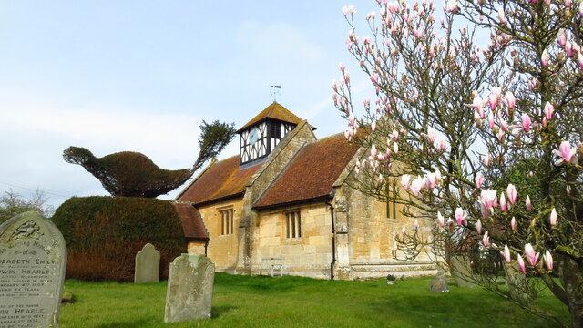
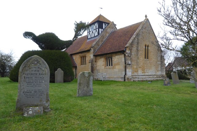
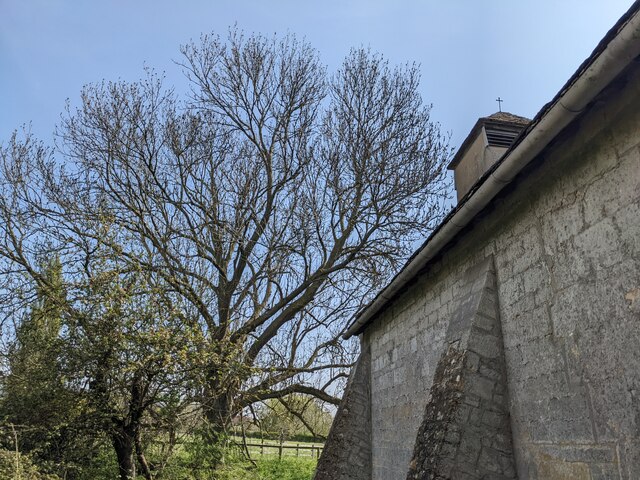
The village is rich in history, with evidence of its existence dating back to the Roman era. The name "Alderton" is derived from Old English and means "farmstead by the old alders," hinting at its agricultural heritage. Today, remnants of its past can be seen in the form of historic buildings and landmarks, such as the village church, St. Margaret's, which dates back to the 12th century.

Alderton Fields boasts a range of amenities that cater to its residents' needs. These include a primary school, a village hall, a post office, and a local pub, The Gardeners Arms, which serves as a popular gathering spot for locals and visitors alike. The village also benefits from a strong sense of community, with various social clubs and organizations offering activities and events throughout the year.

The village's idyllic location provides ample opportunities for outdoor enthusiasts. The surrounding countryside offers scenic walking trails, perfect for exploring the area's natural beauty. Additionally, the nearby Bredon Hill provides stunning panoramic views of the Cotswold landscape and is a popular destination for hikers and nature lovers.

Overall, Alderton Fields offers a peaceful and picturesque setting, steeped in history and community spirit, making it a sought-after place to live in Gloucestershire.

If you have any feedback on the listing, please let us know in the comments section below.

Alderton Fields Images

Images are sourced within 2km of 51.988484/-2.000186 or Grid Reference SP0032. Thanks to Geograph Open Source API. All images are credited.

Pipeline crossing a brook Pipeline crossing a brook in the village of Alderton.  This subject was the first picture submitted on this webpage for this grid square, see: <a href="https://www.geograph.org.uk/photo/67965">SO9932 : Pipeline near Alderton</a>.
Pipeline crossing a brook
Pipeline crossing a brook in the village of Alderton. This subject was the first picture submitted on this webpage for this grid square, see: SO9932 : Pipeline near Alderton.
Alder Green development Alder Green development site in the village of Alderton.
Alder Green development
Alder Green development site in the village of Alderton.
Alstone - St Margaret's Church
Winchcombe Way leading north towards Washbourne Hill from Alderton
Stained glass window - Alstone church The upper stained glass figure is thought possibly to be the Archangel Gabriel holding a lily in an Annunciation scene, this is thought to be 16th century.  The lower glass is thought to be 15th century and possibly represents St Gregory, though it could also represent a Biblical Patriarch, a Prophet or even God the Father personified as the Pope.  The stained glass in the lower window may be the work of John Thornton of Coventry and date from the 15th century.
Stained glass window - Alstone church
The upper stained glass figure is thought possibly to be the Archangel Gabriel holding a lily in an Annunciation scene, this is thought to be 16th century. The lower glass is thought to be 15th century and possibly represents St Gregory, though it could also represent a Biblical Patriarch, a Prophet or even God the Father personified as the Pope. The stained glass in the lower window may be the work of John Thornton of Coventry and date from the 15th century.
Stained glass window - Alstone church The upper part of the stained glass window is thought to be the head of a divine or academic.  The middle part of the window is thought to be a Bishop or St Philip.  The lower part of the window is thought to depict a Christ of Pity standing in the tomb.  The stained glass in the lower window may be the work of John Thornton of Coventry and date from the 15th century.
Stained glass window - Alstone church
The upper part of the stained glass window is thought to be the head of a divine or academic. The middle part of the window is thought to be a Bishop or St Philip. The lower part of the window is thought to depict a Christ of Pity standing in the tomb. The stained glass in the lower window may be the work of John Thornton of Coventry and date from the 15th century.
Alstone church Alstone church is dedicated to St Margaret of Antioch, and dates back to the 12th century.  The church is Grade II* listed, see: <span class="nowrap"><a title="https://historicengland.org.uk/listing/the-list/list-entry/1340159?section=official-list-entry" rel="nofollow ugc noopener" href="https://historicengland.org.uk/listing/the-list/list-entry/1340159?section=official-list-entry">Link</a><img style="margin-left:2px;" alt="External link" title="External link - shift click to open in new window" src="https://s1.geograph.org.uk/img/external.png" width="10" height="10"/></span> This is a similar view of the church to the first picture uploaded into this grid square, little changed other than the topiary <a href="https://www.geograph.org.uk/photo/61446">SO9832 : Alstone Church</a>.
Alstone church
Alstone church is dedicated to St Margaret of Antioch, and dates back to the 12th century. The church is Grade II* listed, see: LinkExternal link This is a similar view of the church to the first picture uploaded into this grid square, little changed other than the topiary SO9832 : Alstone Church.
Timber-framed house, Alstone A timber-framed house, along with a redundant K6 telephone box, now housing a defibrillator.
Timber-framed house, Alstone
A timber-framed house, along with a redundant K6 telephone box, now housing a defibrillator.
Trees at St. Mary church (Little Washbourne) The church of St. Mary in Little Washbourne is surrounded by several trees, and this view faces east to the north of the church structure.
Trees at St. Mary church (Little Washbourne)
The church of St. Mary in Little Washbourne is surrounded by several trees, and this view faces east to the north of the church structure.
St. Mary's church (Little Washbourne) The small church of St. Mary is sheltered in a churchyard with trees east of the B4077 road. Founded and built in the twelfth century, this was altered in the eighteenth century, and the building has seen little change since. This was grade II* listed in July 1960, and is in the care of the Churches Conservation Trust.
St. Mary's church (Little Washbourne)
The small church of St. Mary is sheltered in a churchyard with trees east of the B4077 road. Founded and built in the twelfth century, this was altered in the eighteenth century, and the building has seen little change since. This was grade II* listed in July 1960, and is in the care of the Churches Conservation Trust.
St. Mary's church (Little Washbourne) The small church of St. Mary is sheltered in a churchyard with trees east of the B4077 road. Founded and built in the twelfth century, it was altered in the eighteenth century, and the building has seen little change since. It was grade II* listed in July 1960, and is in the care of the Churches Conservation Trust. This was the last place we visited in the Cotswolds on this day, and I felt relieved that this site was peaceful compared to our visits in Broadway and Toddington church (the latter because I think a local keeps an eye on tourists looking at Toddington Manor, covered in scaffolding since 2005). There were daffodils in the churchyard on my visit to Little Washbourne, although they look deceased.
St. Mary's church (Little Washbourne)
The small church of St. Mary is sheltered in a churchyard with trees east of the B4077 road. Founded and built in the twelfth century, it was altered in the eighteenth century, and the building has seen little change since. It was grade II* listed in July 1960, and is in the care of the Churches Conservation Trust. This was the last place we visited in the Cotswolds on this day, and I felt relieved that this site was peaceful compared to our visits in Broadway and Toddington church (the latter because I think a local keeps an eye on tourists looking at Toddington Manor, covered in scaffolding since 2005). There were daffodils in the churchyard on my visit to Little Washbourne, although they look deceased.
Pipeline at Alderton Renewal work appears to have taken place on this pipeline since I photographed it last September <a href="https://www.geograph.org.uk/photo/7292820">SO9932 : Pipeline crossing a brook</a>.
Pipeline at Alderton
Renewal work appears to have taken place on this pipeline since I photographed it last September SO9932 : Pipeline crossing a brook.
House building at Alderton Ubiquitous house building such as this here on the approach to the village of Alderton could be anywhere.
House building at Alderton
Ubiquitous house building such as this here on the approach to the village of Alderton could be anywhere.
House building at Alderton New housing development on the southern edge of the village in Alderton.
House building at Alderton
New housing development on the southern edge of the village in Alderton.
Farmland near Stanley Pontlarge
Scrub and fields next to B4077 close to Willowbrook Farm, Alderton
Car park at Hobnails Inn
B4077 at Alderton Nurseries
Show me another place!

Alderton Fields is located at Grid Ref: SP0032 (Lat: 51.988484, Lng: -2.000186)

Administrative County: Gloucestershire

District: Tewkesbury

Police Authority: Gloucestershire

What 3 Words

///engage.stem.chuck. Near Winchcombe, Gloucestershire

Nearby Locations

Alderton Fields

Related Wikis

Nearby Amenities

Located within 500m of 51.988484,-2.000186
Sunrise Nurseries
Naptan AtcoCode: 1600GL2261
Naptan Bearing: NW
Naptan BusStopType: CUS
Naptan CommonName: Sunrise Nurseries
Naptan NaptanCode: glodwmdg
Naptan Street: Gretton Rd
Naptan Verified: no
Source: naptan_import
Lat/Long: 51.9886193/-2.0003349
Sunrise Nurseries
Naptan AtcoCode: 1600GL2262
Naptan Bearing: SE
Naptan BusStopType: CUS
Naptan CommonName: Sunrise Nurseries
Naptan Indicator: Opp
Naptan NaptanCode: glodwmdm
Naptan Street: Gretton Rd
Naptan Verified: no
Source: naptan_import
Lat/Long: 51.9885024/-2.0001165
Alderton Fields
Is In: Gloucestershire, England, UK
Place: hamlet
Source: NPE
Lat/Long: 51.988662/-1.9999094
Material: wood
Power: pole
Lat/Long: 51.9914582/-1.9982623
Material: wood
Power: pole
Lat/Long: 51.9922257/-1.9974785
Material: wood
Power: pole
Lat/Long: 51.9875492/-1.9933659
Material: wood
Power: pole
Lat/Long: 51.9875899/-1.9931417
Material: wood
Power: pole
Lat/Long: 51.9883148/-1.9940056
Material: wood
Power: pole
Lat/Long: 51.9883244/-1.9937166
Material: wood
Power: pole
Lat/Long: 51.9888306/-1.9944441
Material: wood
Power: pole
Lat/Long: 51.9890486/-1.9943288
Material: wood
Power: pole
Lat/Long: 51.9893318/-1.9948847
Material: wood
Power: pole
Lat/Long: 51.9897836/-1.9949505
Material: wood
Power: pole
Lat/Long: 51.9898972/-1.9953616
Material: wood
Power: pole
Lat/Long: 51.9904437/-1.9958219
Material: wood
Power: pole
Lat/Long: 51.9907605/-1.9957686
Material: wood
Power: pole
Lat/Long: 51.9909902/-1.9967799
Location Transition: yes
Material: wood
Power: pole
Lat/Long: 51.9915044/-1.9971175
Location Transition: yes
Material: wood
Power: pole
Lat/Long: 51.9915389/-1.9977382
Power: pole
Lat/Long: 51.9876822/-2.0069897
Power: pole
Lat/Long: 51.9883569/-2.0056951
Material: wood
Power: pole
Lat/Long: 51.9890642/-2.0042779
Material: wood
Power: pole
Lat/Long: 51.9897945/-2.0028862
Material: wood
Power: pole
Lat/Long: 51.9905191/-2.0014786
Material: wood
Power: pole
Lat/Long: 51.990833/-1.9998475
Material: wood
Power: pole
Lat/Long: 51.9910672/-1.9984298
Addr Hamlet: Alderton Fields
Addr Housename: The Homestead
Lat/Long: 51.9892985/-2.0009987
Addr Hamlet: Alderton Fields
Addr Housename: Sunrise Bungalow
Addr Postcode: GL54 5HJ
Lat/Long: 51.9885947/-2.0006179
Addr Hamlet: Gretton Fields
Addr Housename: Lower Lime
Addr Postcode: GL54 5HH
Lat/Long: 51.9846522/-1.9981494
Material: wood
Power: pole
Source: bing
Lat/Long: 51.9926384/-1.9990289
Local
Location Transition: yes
Material: wood
Power: pole
Source: bing
Transformer: distribution
Voltage Primary: 11000
Lat/Long: 51.9916024/-1.9983932
Alderton Fields
Material: wood
Power: pole
Transformer: distribution
Voltage Primary: 11000
Lat/Long: 51.9886067/-1.9994205
Material: wood
Power: pole
Lat/Long: 51.9885587/-1.9983195
Material: wood
Power: pole
Lat/Long: 51.9885084/-1.9971876
Material: wood
Power: pole
Lat/Long: 51.9884175/-1.9953959
Gretton Fields
Material: wood
Power: pole
Transformer: distribution
Voltage Primary: 11000
Lat/Long: 51.9868838/-1.9975778
Material: wood
Power: pole
Lat/Long: 51.987011/-1.996631
Material: wood
Power: pole
Lat/Long: 51.9871531/-1.9956225
Material: wood
Power: pole
Lat/Long: 51.987315/-1.9945094
Elm Villa
Material: wood
Power: pole
Transformer: distribution
Voltage Primary: 11000
Lat/Long: 51.9913443/-2.0030113
Material: wood
Power: pole
Lat/Long: 51.9910248/-2.0042223
Power: pole
Lat/Long: 51.9912461/-2.0051551
Fixme: stile, gate or entrance?
Lat/Long: 51.9923659/-2.0028321
Gretton Solar
Power: transformer
Transformer: distribution
Voltage Primary: 11000
Lat/Long: 51.9852221/-2.0026472
The data included in this document is from www.openstreetmap.org. The data is made available under ODbL.

Have you been to Alderton Fields?

Leave your review of Alderton Fields below (or comments, questions and feedback).