Crowle

Civil Parish in Worcestershire Wychavon

England

Crowle

Sale Green Methodist Church I am not sure whether this is currently a functioning church/chapel.
Sale Green Methodist Church Credit: Chris Allen

Crowle is a civil parish located in the county of Worcestershire, England. Situated about 5 miles northeast of Worcester, it covers an area of approximately 8 square miles. The village of Crowle is the main settlement within the parish, which also includes several smaller hamlets and scattered farms.

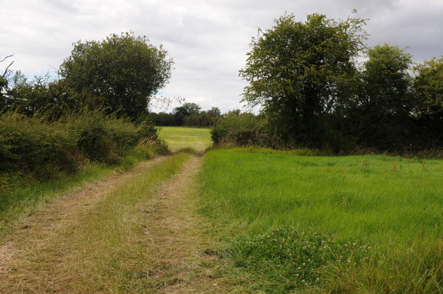
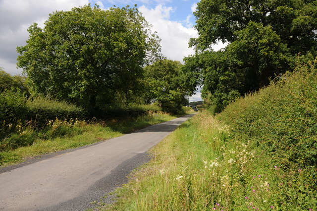
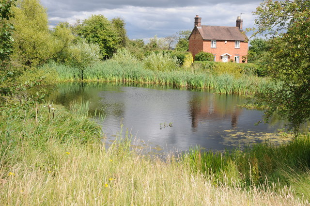
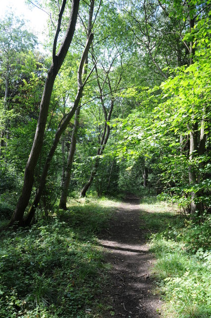
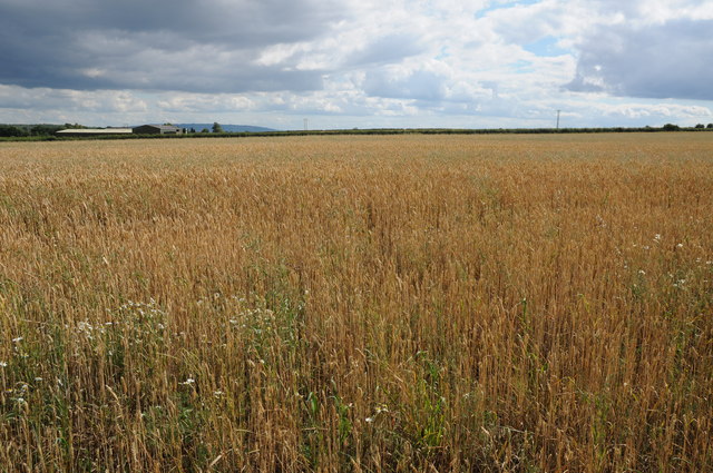
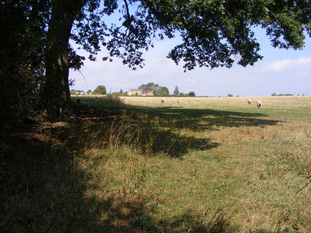
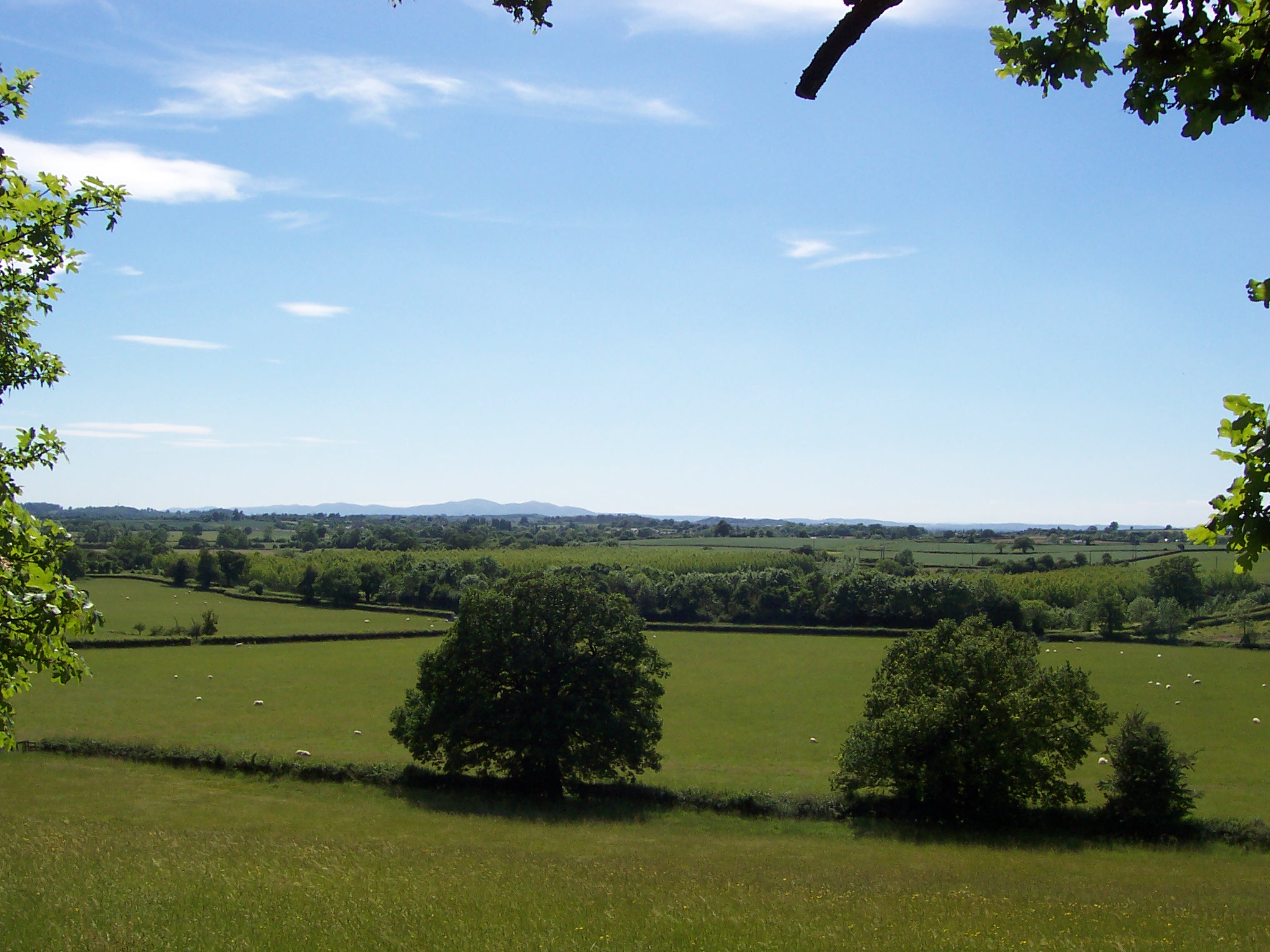
The landscape of Crowle is predominantly rural, characterized by rolling hills and fertile farmland. The parish is bordered by the River Salwarpe to the west, offering picturesque views and opportunities for outdoor activities such as fishing and boating. The surrounding countryside is known for its natural beauty, with expansive fields, woodlands, and meadows creating a scenic backdrop.

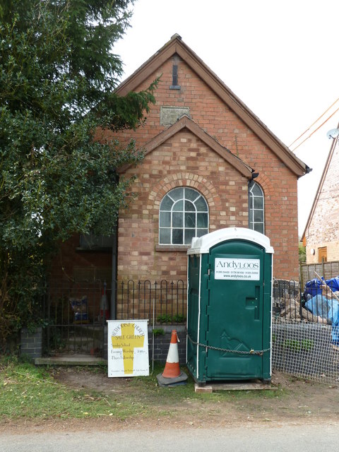
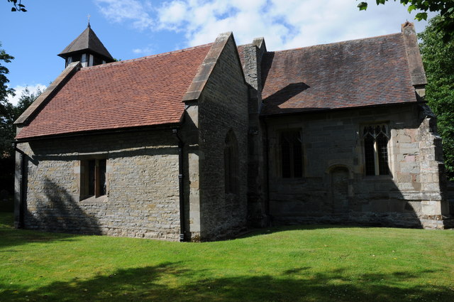
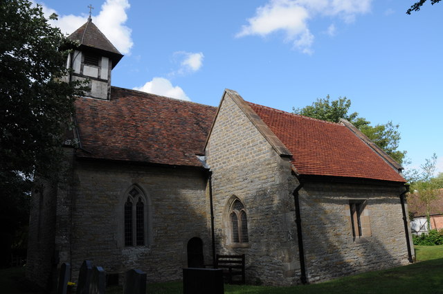
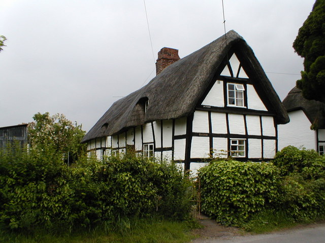
The village of Crowle itself is a charming and close-knit community, with a population of around 1,000 residents. It boasts a range of amenities including a parish church, a primary school, a village hall, and a local pub. The history of Crowle can be traced back to the Domesday Book, where it is mentioned as "Crawele."

Despite its rural setting, Crowle benefits from good transport links. It is situated near the A38 road, which connects it to nearby towns and cities, including Worcester and Droitwich Spa. The parish is also served by a regular bus service, providing easy access to surrounding areas.

Overall, Crowle offers a tranquil and picturesque setting for residents and visitors alike, with its idyllic countryside, friendly community, and convenient location.

If you have any feedback on the listing, please let us know in the comments section below.

Crowle Images

Images are sourced within 2km of 52.206846/-2.109064 or Grid Reference SO9256. Thanks to Geograph Open Source API. All images are credited.

Sale Green Methodist Church I am not sure whether this is currently a functioning church/chapel.
Sale Green Methodist Church
I am not sure whether this is currently a functioning church/chapel.
Froxmere Court chimneys All the chimneys on Froxmere Court are different, showing beautiful brickwork.
Froxmere Court chimneys
All the chimneys on Froxmere Court are different, showing beautiful brickwork.
Field entrance and footpath off Netherwood Lane Field entrance and footpath off Netherwood Lane to the north of Crowle.
Field entrance and footpath off Netherwood Lane
Field entrance and footpath off Netherwood Lane to the north of Crowle.
Netherwood Lane Netherwood Lane links the villages of Crowle and Oddingley.
Netherwood Lane
Netherwood Lane links the villages of Crowle and Oddingley.
Village pond and cottage, Crowle A very traditional scene of a village pond and cottage in the village of Crowle.
Village pond and cottage, Crowle
A very traditional scene of a village pond and cottage in the village of Crowle.
Path through Pope's Wood Path through Pope's Wood, part of the Worcestershire Wildlife Nature Reserve of Trench Wood near Sale Green.
Path through Pope's Wood
Path through Pope's Wood, part of the Worcestershire Wildlife Nature Reserve of Trench Wood near Sale Green.
Wheatfield at Sale Green View across a field of wheat from a footpath near Sale Green.  The buildings of Diamond Hall Farm can be seen in the middle distance with Bredon Hill on the distant horizon.
Wheatfield at Sale Green
View across a field of wheat from a footpath near Sale Green. The buildings of Diamond Hall Farm can be seen in the middle distance with Bredon Hill on the distant horizon.
Hay bales near Broughton Hackett Hay bales in a field between Broughton Hackett and Bredicot, Thrift Wood can be seen on the hill in the background.
Hay bales near Broughton Hackett
Hay bales in a field between Broughton Hackett and Bredicot, Thrift Wood can be seen on the hill in the background.
Huddington church Huddington church is dedicated to St James and it is situated close to Huddington Court, so close in fact that to access it one has to cross the lawn of the court.  The nave of church dates back to the Norman period.
Huddington church
Huddington church is dedicated to St James and it is situated close to Huddington Court, so close in fact that to access it one has to cross the lawn of the court. The nave of church dates back to the Norman period.
The Old Chequers The Pub off Crowle Green road at Crowle, Worcestershire.
The Old Chequers
The Pub off Crowle Green road at Crowle, Worcestershire.
Crowle Green The road junction in Crowle with Netherwood Lane viewed from the pub car park.
Crowle Green
The road junction in Crowle with Netherwood Lane viewed from the pub car park.
Church View The view towards Crowle Church.
Church View
The view towards Crowle Church.
Tree View The view west from Thrift Wood Hill near Crowle.
Tree View
The view west from Thrift Wood Hill near Crowle.
Path to Thrift Wood The Footpath view up hill near Crowle.
Path to Thrift Wood
The Footpath view up hill near Crowle.
Thrift Wood View
Thrift Wood View
Broughton Hackett Church The view of St Leonard's church in the Worcestershire village.
Broughton Hackett Church
The view of St Leonard's church in the Worcestershire village.
Field view The view towards Crowle from the footpath near Broughton Hackett.
Field view
The view towards Crowle from the footpath near Broughton Hackett.
Show me another place!

Crowle is located at Grid Ref: SO9256 (Lat: 52.206846, Lng: -2.109064)

Administrative County: Worcestershire

District: Wychavon

Police Authority: West Mercia

What 3 Words

///attends.uttering.spenders. Near Kington, Worcestershire

Nearby Locations

Crowle Green Crowle Crowle

Related Wikis

Crowle, Worcestershire

Crowle (rhymes with coal) is a village in Worcestershire, England situated 4 miles (6.4 km) east of the City of Worcester. Crowle is known for its Church...
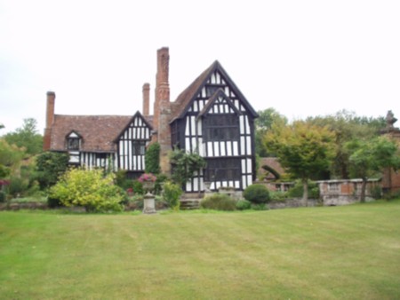
Huddington Court

Huddington Court is a 15th-century moated manor house in the village of Huddington in Worcestershire, England, some six miles east of Worcester. It was...

Huddington

Huddington is a village in Worcestershire, England. == Location == Huddington is located 5 miles (8.0 km) east of Worcester and 5 miles (8.0 km) south...

Broughton Hackett

Broughton Hackett is a village and civil parish in the Wychavon district of the county of Worcestershire, England. It is about 5 miles east of the city...

Trench Wood

Trench Wood is a woodland area part managed by the Worcestershire Wildlife Trust and Butterfly Conservation. It is located around 6 miles (9.7 km) miles...

Tibberton, Worcestershire

Tibberton is a village in Worcestershire, England. It is located around 4 miles north-east of Worcester and less than a mile from junction 6 of the M5...

Bredicot railway station

Bredicot railway station served the village of Bredicot, Worcestershire, England, from 1845 to 1855 on the Birmingham and Gloucester Railway. == History... ==

Dunhampstead railway station

Dunhampstead railway station served the village of Dunhampstead, Worcestershire, England, from 1841 to 1855 on the Birmingham and Gloucester Railway....

Nearby Amenities

Located within 500m of 52.206846,-2.109064
Froxmere Close
Naptan AtcoCode: 2000G056000
Naptan Bearing: W
Naptan BusStopType: CUS
Naptan CommonName: Froxmere Close
Naptan Indicator: opp
Naptan Landmark: Froxmere Close (Geneva Crescent)
Naptan NaptanCode: wocgmgjp
Naptan Street: Froxmere Road
Naptan Verified: no
Source: naptan_import
Lat/Long: 52.2025417/-2.108223
Generator Method: photovoltaic
Generator Output Electricity: yes
Generator Source: solar
Generator Type: solar_photovoltaic_panel
Location: roof
Power: generator
Lat/Long: 52.2084137/-2.1115422
Generator Method: photovoltaic
Generator Output Electricity: yes
Generator Source: solar
Generator Type: solar_photovoltaic_panel
Location: roof
Power: generator
Lat/Long: 52.2082625/-2.1120411
Power: pole
Lat/Long: 52.2059211/-2.1148025
Location: indoor
Power: transformer
Transformer: distribution
Voltage Primary: 11000
Lat/Long: 52.2086755/-2.1097847
Crowle Green East
Power: pole
Transformer: distribution
Voltage Primary: 11000
Lat/Long: 52.2079338/-2.1119888
Power: pole
Lat/Long: 52.2074259/-2.11265
Froxmere Close
Power: transformer
Transformer: distribution
Voltage Primary: 11000
Lat/Long: 52.2032672/-2.1096372
Location Transition: yes
Power: pole
Lat/Long: 52.2042181/-2.1096352
Power: pole
Lat/Long: 52.2043422/-2.1090196
Crowle Cross
Power: pole
Transformer: distribution
Voltage Primary: 11000
Lat/Long: 52.2036855/-2.1053235
Power: pole
Lat/Long: 52.2038869/-2.1064648
Power: pole
Lat/Long: 52.2040768/-2.1075484
Power: pole
Lat/Long: 52.2041916/-2.1081781
Power: pole
Lat/Long: 52.2044635/-2.1096995
Power: pole
Lat/Long: 52.2052375/-2.1098451
Power: pole
Lat/Long: 52.2058627/-2.1100167
Power: pole
Lat/Long: 52.2066533/-2.1114028
Power: pole
Lat/Long: 52.206466/-2.1101327
Power: pole
Lat/Long: 52.2068087/-2.1124662
Power: pole
Lat/Long: 52.2069426/-2.1133433
Power: pole
Lat/Long: 52.2064224/-2.1140917
Power: pole
Lat/Long: 52.2053441/-2.115638
Power: pole
Lat/Long: 52.205582/-2.1152705
The data included in this document is from www.openstreetmap.org. The data is made available under ODbL.

Have you been to Crowle?

Leave your review of Crowle below (or comments, questions and feedback).