Crowle

Settlement in Worcestershire Wychavon

England

Crowle

Sale Green Methodist Church I am not sure whether this is currently a functioning church/chapel.
Sale Green Methodist Church Credit: Chris Allen

Crowle is a small village located in the county of Worcestershire, England. Situated about 8 miles east of Worcester, the village is nestled in the picturesque countryside of the Severn Valley. With a population of around 700 residents, Crowle exudes a tranquil and close-knit community atmosphere.

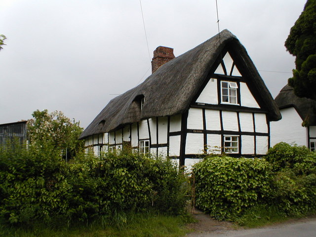
The village boasts a rich history, with evidence of its existence dating back to Roman times. It is home to the beautiful St. John the Baptist Church, a Grade II listed building dating back to the 12th century. The church's architecture and stained glass windows are notable features that attract visitors from far and wide.

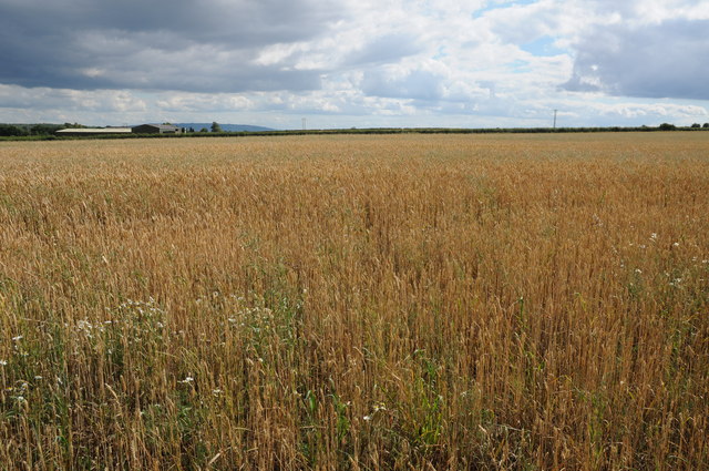
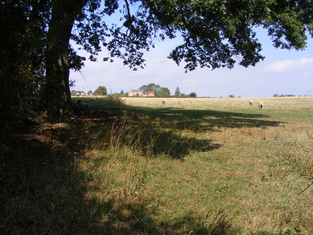
Crowle is largely an agricultural village, with farming playing a significant role in the local economy. The surrounding fields are predominantly used for grazing livestock, and the village benefits from its proximity to the fertile soils of the Severn Valley.

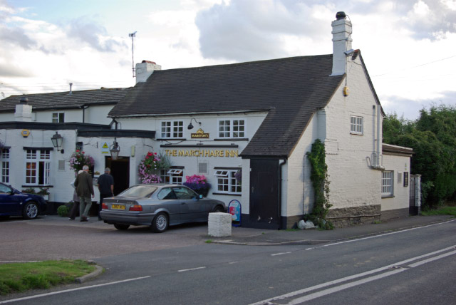
Despite its small size, Crowle is well-served by amenities. The village has a primary school, a village hall, and a local pub that serves as a central gathering place for residents. Additionally, the nearby city of Worcester provides access to a wider range of services and facilities, including shops, healthcare, and leisure activities.

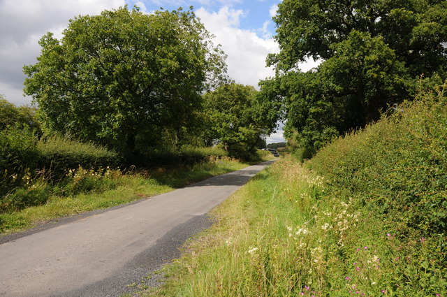
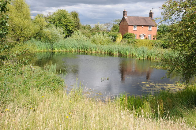
The village is surrounded by stunning natural beauty, with several walking paths and bridleways that allow residents and visitors to explore the picturesque Worcestershire countryside. The peacefulness of Crowle, combined with its scenic landscapes, make it an attractive destination for those seeking a tranquil retreat away from the hustle and bustle of city life.

If you have any feedback on the listing, please let us know in the comments section below.
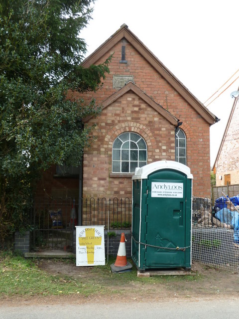
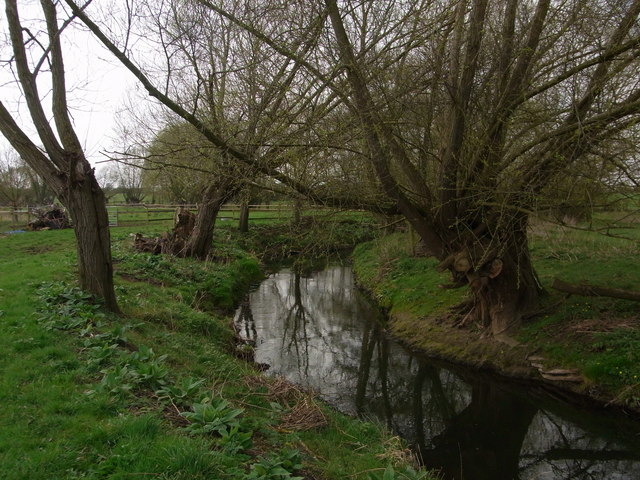
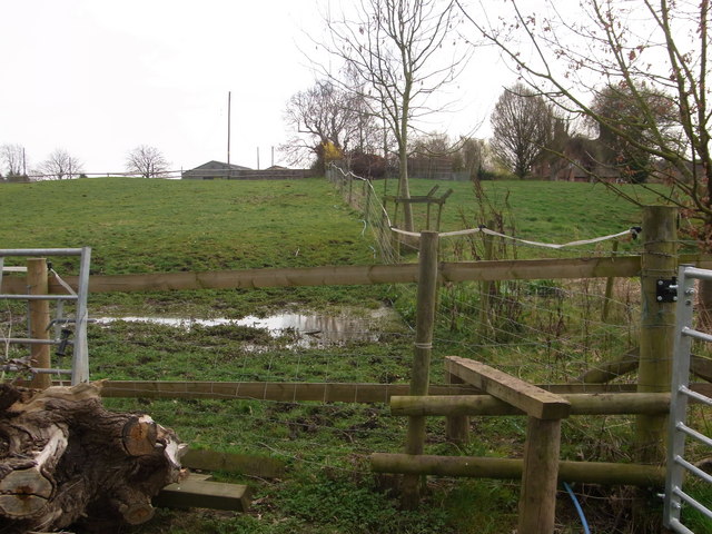
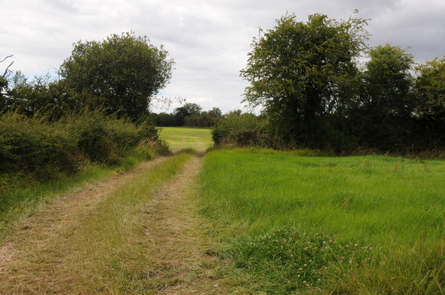
Crowle Images

Images are sourced within 2km of 52.20266/-2.114438 or Grid Reference SO9256. Thanks to Geograph Open Source API. All images are credited.

Sale Green Methodist Church I am not sure whether this is currently a functioning church/chapel.
Sale Green Methodist Church
I am not sure whether this is currently a functioning church/chapel.
Froxmere Court chimneys All the chimneys on Froxmere Court are different, showing beautiful brickwork.
Froxmere Court chimneys
All the chimneys on Froxmere Court are different, showing beautiful brickwork.
Bow Brook below Court Farm Late winter but no floods.
Bow Brook below Court Farm
Late winter but no floods.
Footpath from the farm Boggy area making footpath almost impassable,below Court Farm.
Footpath from the farm
Boggy area making footpath almost impassable,below Court Farm.
Field entrance and footpath off Netherwood Lane Field entrance and footpath off Netherwood Lane to the north of Crowle.
Field entrance and footpath off Netherwood Lane
Field entrance and footpath off Netherwood Lane to the north of Crowle.
Netherwood Lane Netherwood Lane links the villages of Crowle and Oddingley.
Netherwood Lane
Netherwood Lane links the villages of Crowle and Oddingley.
Village pond and cottage, Crowle A very traditional scene of a village pond and cottage in the village of Crowle.
Village pond and cottage, Crowle
A very traditional scene of a village pond and cottage in the village of Crowle.
Wheatfield at Sale Green View across a field of wheat from a footpath near Sale Green.  The buildings of Diamond Hall Farm can be seen in the middle distance with Bredon Hill on the distant horizon.
Wheatfield at Sale Green
View across a field of wheat from a footpath near Sale Green. The buildings of Diamond Hall Farm can be seen in the middle distance with Bredon Hill on the distant horizon.
Hay bales near Broughton Hackett Hay bales in a field between Broughton Hackett and Bredicot, Thrift Wood can be seen on the hill in the background.
Hay bales near Broughton Hackett
Hay bales in a field between Broughton Hackett and Bredicot, Thrift Wood can be seen on the hill in the background.
The Old Chequers The Pub off Crowle Green road at Crowle, Worcestershire.
The Old Chequers
The Pub off Crowle Green road at Crowle, Worcestershire.
Crowle Green The road junction in Crowle with Netherwood Lane viewed from the pub car park.
Crowle Green
The road junction in Crowle with Netherwood Lane viewed from the pub car park.
Church View The view towards Crowle Church.
Church View
The view towards Crowle Church.
Tree View The view west from Thrift Wood Hill near Crowle.
Tree View
The view west from Thrift Wood Hill near Crowle.
Path to Thrift Wood The Footpath view up hill near Crowle.
Path to Thrift Wood
The Footpath view up hill near Crowle.
Thrift Wood View
Thrift Wood View
Under the Rails The footpath passes under the Birmingham to Cheltenham railway line near Bredicot.
Under the Rails
The footpath passes under the Birmingham to Cheltenham railway line near Bredicot.
Broughton Hackett Church The view of St Leonard's church in the Worcestershire village.
Broughton Hackett Church
The view of St Leonard's church in the Worcestershire village.
Field view The view towards Crowle from the footpath near Broughton Hackett.
Field view
The view towards Crowle from the footpath near Broughton Hackett.
Show me another place!

Crowle is located at Grid Ref: SO9256 (Lat: 52.20266, Lng: -2.114438)

Administrative County: Worcestershire

District: Wychavon

Police Authority: West Mercia

What 3 Words

///happening.overcomes.teach. Near Fernhill Heath, Worcestershire

Nearby Locations

Crowle Green Crowle Crowle

Related Wikis

Crowle, Worcestershire

Crowle (rhymes with coal) is a village in Worcestershire, England situated 4 miles (6.4 km) east of the City of Worcester. Crowle is known for its Church...

Broughton Hackett

Broughton Hackett is a village and civil parish in the Wychavon district of the county of Worcestershire, England. It is about 5 miles east of the city...

Bredicot railway station

Bredicot railway station served the village of Bredicot, Worcestershire, England, from 1845 to 1855 on the Birmingham and Gloucester Railway. == History... ==

Bredicot

Bredicot is a small village and civil parish in Worcestershire, England, about 4 miles (6.4 km) east of Worcester. It was formerly (as described in 1868...

Tibberton, Worcestershire

Tibberton is a village in Worcestershire, England. It is located around 4 miles north-east of Worcester and less than a mile from junction 6 of the M5...

Huddington Court

Huddington Court is a 15th-century moated manor house in the village of Huddington in Worcestershire, England, some six miles east of Worcester. It was...

Huddington

Huddington is a village in Worcestershire, England. == Location == Huddington is located 5 miles (8.0 km) east of Worcester and 5 miles (8.0 km) south...

Churchill, Wychavon

Churchill or Churchill by Spetchley is a village and civil parish 4 miles (6.4 km) from Worcester, in the Wychavon district, in the county of Worcestershire...

Nearby Amenities

Located within 500m of 52.20266,-2.114438
Crowle
Place: village
Source: NPE
Wikidata: Q1973911
Lat/Long: 52.2025405/-2.1148144
Froxmere Close
Naptan AtcoCode: 2000G056000
Naptan Bearing: W
Naptan BusStopType: CUS
Naptan CommonName: Froxmere Close
Naptan Indicator: opp
Naptan Landmark: Froxmere Close (Geneva Crescent)
Naptan NaptanCode: wocgmgjp
Naptan Street: Froxmere Road
Naptan Verified: no
Source: naptan_import
Lat/Long: 52.2025417/-2.108223
School Lane
Naptan AtcoCode: 2000G612336
Naptan Bearing: S
Naptan BusStopType: CUS
Naptan CommonName: School Lane
Naptan Crossing: School Lane
Naptan Indicator: Adj
Naptan Landmark: Crowle First School
Naptan NaptanCode: wocgjwpw
Naptan Street: Church Road
Naptan Verified: no
Source: naptan_import
Lat/Long: 52.2032959/-2.1142939
Post Box
Ref: WR7 252
Lat/Long: 52.2033521/-2.1146123
School Lane
Naptan AtcoCode: 2000G323349
Naptan Bearing: N
Naptan BusStopType: CUS
Naptan CommonName: School Lane
Naptan Crossing: School Lane
Naptan Indicator: opp
Naptan Landmark: Crowle First School
Naptan NaptanCode: wocgmdwp
Naptan Street: Church Road
Naptan Verified: no
Source: naptan_import
Lat/Long: 52.2032959/-2.1145009
Generator Method: photovoltaic
Generator Output Electricity: yes
Generator Source: solar
Generator Type: solar_photovoltaic_panel
Location: roof
Power: generator
Lat/Long: 52.2007274/-2.1157265
Generator Method: photovoltaic
Generator Output Electricity: yes
Generator Source: solar
Generator Type: solar_photovoltaic_panel
Location: roof
Power: generator
Lat/Long: 52.201477/-2.1152195
Generator Method: photovoltaic
Generator Output Electricity: yes
Generator Source: solar
Generator Type: solar_photovoltaic_panel
Location: roof
Power: generator
Lat/Long: 52.2025735/-2.1118909
Generator Method: photovoltaic
Generator Output Electricity: yes
Generator Source: solar
Generator Type: solar_photovoltaic_panel
Location: roof
Power: generator
Lat/Long: 52.2025669/-2.1117595
Generator Method: photovoltaic
Generator Output Electricity: yes
Generator Source: solar
Generator Type: solar_photovoltaic_panel
Location: roof
Power: generator
Lat/Long: 52.2022973/-2.1072024
Church Road Crowle - Trans
Power: pole
Transformer: distribution
Voltage Primary: 11000
Lat/Long: 52.1982738/-2.1156339
Power: pole
Lat/Long: 52.1987341/-2.1168382
Power: pole
Lat/Long: 52.1991352/-2.1179031
Power: pole
Lat/Long: 52.199538/-2.1189505
Power: pole
Lat/Long: 52.1997723/-2.1195754
Power: pole
Lat/Long: 52.2003773/-2.1203882
Power: pole
Lat/Long: 52.2010102/-2.1212465
Crowle
Power: pole
Transformer: distribution
Voltage Primary: 11000
Lat/Long: 52.2043632/-2.115695
Power: pole
Lat/Long: 52.2059211/-2.1148025
Froxmere Close
Power: transformer
Transformer: distribution
Voltage Primary: 11000
Lat/Long: 52.2032672/-2.1096372
Power: transformer
Transformer: distribution
Voltage Primary: 11000
Lat/Long: 52.2026573/-2.1136799
Location Transition: yes
Power: pole
Lat/Long: 52.2020729/-2.1133313
Power: pole
Lat/Long: 52.2013973/-2.1132267
Power: pole
Lat/Long: 52.2009082/-2.1133849
Power: pole
Lat/Long: 52.1999087/-2.1136263
Power: pole
Lat/Long: 52.1994205/-2.1128123
Power: pole
Lat/Long: 52.1986684/-2.1116522
Location Transition: yes
Power: pole
Lat/Long: 52.2042181/-2.1096352
Power: pole
Lat/Long: 52.2043422/-2.1090196
Power: pole
Lat/Long: 52.2040768/-2.1075484
Power: pole
Lat/Long: 52.2041916/-2.1081781
Power: pole
Lat/Long: 52.2044635/-2.1096995
Power: pole
Lat/Long: 52.2052375/-2.1098451
Power: pole
Lat/Long: 52.2058627/-2.1100167
Power: pole
Lat/Long: 52.2066533/-2.1114028
Power: pole
Lat/Long: 52.2068087/-2.1124662
Power: pole
Lat/Long: 52.2069426/-2.1133433
Power: pole
Lat/Long: 52.2064224/-2.1140917
Old Chequers
Power: pole
Transformer: distribution
Voltage Primary: 11000
Lat/Long: 52.2064791/-2.1174887
Power: pole
Lat/Long: 52.2060246/-2.1163648
Power: pole
Lat/Long: 52.2053441/-2.115638
Power: pole
Lat/Long: 52.205582/-2.1152705
Power: pole
Lat/Long: 52.2047437/-2.1164453
Power: pole
Lat/Long: 52.2044142/-2.1169013
Power: pole
Lat/Long: 52.2044721/-2.1180426
Power: pole
Lat/Long: 52.2045378/-2.119389
Power: pole
Lat/Long: 52.2051518/-2.120077
Power: pole
Lat/Long: 52.2045888/-2.1204203
Leisure: picnic_table
Lat/Long: 52.1988565/-2.111867
The data included in this document is from www.openstreetmap.org. The data is made available under ODbL.

Have you been to Crowle?

Leave your review of Crowle below (or comments, questions and feedback).