Broadfield

Settlement in Sussex Crawley

England

Broadfield

Bewbush Barn Church An old barn conversion. The barn predates the surrounding housing by several decade. Money was raised by the local church community over several years with the church opening in the late 1990s, and making one of the more interesting parish churches around
Bewbush Barn Church Credit: Michael of Crawley

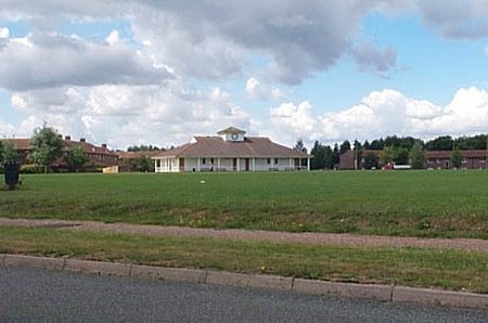
Broadfield is a neighborhood located in the town of Crawley, in the county of West Sussex, England. Situated approximately 30 miles south of London, Broadfield is a residential area that forms part of the Crawley New Town development. It is bordered by the neighborhoods of Bewbush, Southgate, and Ifield.

Broadfield is primarily known for its housing estates, which consist of a mix of housing types including detached houses, semi-detached houses, and apartment buildings. The area offers a range of housing options suitable for families, professionals, and retirees.

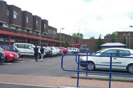
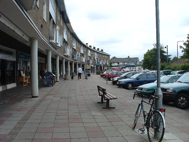
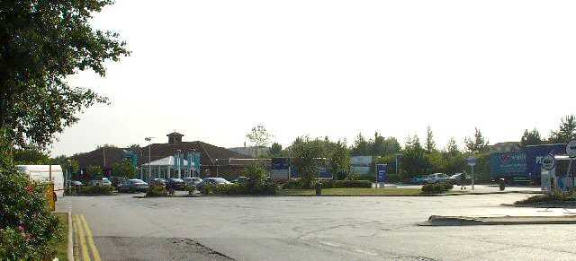
In terms of amenities, Broadfield has a good range of local shops, including grocery stores, convenience stores, and a shopping parade. There are also several primary schools within the area, making it an attractive place for families with young children. For leisure activities, residents can enjoy the nearby Broadfield Park, which offers open green spaces, a children's play area, and sports facilities.

Transportation links in Broadfield are convenient, with regular bus services connecting the neighborhood to Crawley town center and surrounding areas. The neighborhood is also well-connected to major road networks, with the A23 and M23 motorway easily accessible.

Overall, Broadfield offers a pleasant suburban living environment within close proximity to Crawley town center, making it an appealing place for those seeking a residential area with good amenities and transport connections.

If you have any feedback on the listing, please let us know in the comments section below.

Broadfield Images

Images are sourced within 2km of 51.096847/-0.207251 or Grid Reference TQ2534. Thanks to Geograph Open Source API. All images are credited.

Bewbush Barn Church An old barn conversion. The barn predates the surrounding housing by several decade. Money was raised by the local church community over several years with the church opening in the late 1990s, and making one of the more interesting parish churches around
Bewbush Barn Church
An old barn conversion. The barn predates the surrounding housing by several decade. Money was raised by the local church community over several years with the church opening in the late 1990s, and making one of the more interesting parish churches around
Bewbush Leisure Centre Crawley's second leisure Centre, opened in 1984, demolished in 2009.
Bewbush Leisure Centre
Crawley's second leisure Centre, opened in 1984, demolished in 2009.
Bewbush Playing Fields Cricket Pavilion on the playing fields on the former plot of Gasson Wood.
Bewbush Playing Fields
Cricket Pavilion on the playing fields on the former plot of Gasson Wood.
Bewbush Water Gardens Council-owned water gardens, based around the western end of the Ifield Mill Pond
Bewbush Water Gardens
Council-owned water gardens, based around the western end of the Ifield Mill Pond
Broadfield Stadium Built by Crawley Council in the early 1990s to re-home Crawley Town Football Club. One of the best non-league stadia in the UK
Broadfield Stadium
Built by Crawley Council in the early 1990s to re-home Crawley Town Football Club. One of the best non-league stadia in the UK
Holy Trinity School Opened in the late 1960s, the main Church of England Secondary School in North Sussex
Holy Trinity School
Opened in the late 1960s, the main Church of England Secondary School in North Sussex
St Wilfrid's RC School Catholic Comprehensive School, Crawley
St Wilfrid's RC School
Catholic Comprehensive School, Crawley
Thomas Bennett Community College Former buildings of the secondary school named for Sir Thomas Bennett, Chairman of Crawley New Town Development Corporation. The school was opened in 1959 and rebuilt on the same campus in 2004-5. The buildings shown were demolished in the summer of 2005.
Thomas Bennett Community College
Former buildings of the secondary school named for Sir Thomas Bennett, Chairman of Crawley New Town Development Corporation. The school was opened in 1959 and rebuilt on the same campus in 2004-5. The buildings shown were demolished in the summer of 2005.
Broadfield Barton Local shopping parade for the neighbourhood of Broadfield in South-west Crawley
Broadfield Barton
Local shopping parade for the neighbourhood of Broadfield in South-west Crawley
Tilgate Parade, Tilgate, Crawley Tilgate was one of Crawley New Town's original 12 neighbourhoods. Each neighbourhood had its own shops, pub, church etc. Tilgate Parade still commands a position at the centre of everyday life for many people in this neighbourhood (built mid-1950s).
Tilgate Parade, Tilgate, Crawley
Tilgate was one of Crawley New Town's original 12 neighbourhoods. Each neighbourhood had its own shops, pub, church etc. Tilgate Parade still commands a position at the centre of everyday life for many people in this neighbourhood (built mid-1950s).
Pease Pottage Services At the (current) end of the M23, Junction 11. Operated by Moto.
Pease Pottage Services
At the (current) end of the M23, Junction 11. Operated by Moto.
Pease Pottage Radar Station Taking advantage of this relatively high site (140m above sea level), 80m above Gatwick airport, this is an air traffic control radar. Painted white to blend into the sky.
Pease Pottage Radar Station
Taking advantage of this relatively high site (140m above sea level), 80m above Gatwick airport, this is an air traffic control radar. Painted white to blend into the sky.
Telecoms mast, South Lodge, Pease Pottage, West Sussex One of several facilities in the area taking advantage of the relatively high altitude (water tower, radar station, reservoir). Much of the mast is masked by trees (similar to the radar station location) from most angles.
Telecoms mast, South Lodge, Pease Pottage, West Sussex
One of several facilities in the area taking advantage of the relatively high altitude (water tower, radar station, reservoir). Much of the mast is masked by trees (similar to the radar station location) from most angles.
Corn Fields, Pease Pottage A very summery rural site. Ripening corn in this large field, which covers the N side of this grid square. Much of the rural sussex terrain is patches of trees interspersed by fields of various crops. Tilgate Forest can be seen in the far distance and Bensonshill Wood is on the right. High voltage electricity transmission cross the field (the pylons are just visible). View taken from the old A23 road between Pease Pottage and Handcross, looking E.
Corn Fields, Pease Pottage
A very summery rural site. Ripening corn in this large field, which covers the N side of this grid square. Much of the rural sussex terrain is patches of trees interspersed by fields of various crops. Tilgate Forest can be seen in the far distance and Bensonshill Wood is on the right. High voltage electricity transmission cross the field (the pylons are just visible). View taken from the old A23 road between Pease Pottage and Handcross, looking E.
Golf Course at Cottesmore Golf and Country Club This golf course spreads over much of this grid square and into TQ2533. This view is from a public footpath, looking east. The large radar scanner of the Pease Pottage Radar station can be seen above the trees in the distance.
Golf Course at Cottesmore Golf and Country Club
This golf course spreads over much of this grid square and into TQ2533. This view is from a public footpath, looking east. The large radar scanner of the Pease Pottage Radar station can be seen above the trees in the distance.
Cottesmore School, Buchan Hill, near Pease Pottage, West Sussex A full boarding co-educational prep school (the only one in the UK - according to their website <span class="nowrap"><a title="http://www.cottesmoreschool.com" rel="nofollow ugc noopener" href="http://www.cottesmoreschool.com">Link</a><img style="margin-left:2px;" alt="External link" title="External link - shift click to open in new window" src="https://s1.geograph.org.uk/img/external.png" width="10" height="10"/></span> ). A couple of sand traps of the Cottesmore Country Club golf course can also be seen.
Cottesmore School, Buchan Hill, near Pease Pottage, West Sussex
A full boarding co-educational prep school (the only one in the UK - according to their website LinkExternal link ). A couple of sand traps of the Cottesmore Country Club golf course can also be seen.
Bridleway through Cottesmore Country Club and School. The sign indicates a bend in the route of the bridleway that cuts through the country club and school grounds between Pease Pottage and the Broadfield neighbourhood of Crawley. At this point the public right of way is following the drive to the school. Behind the sign can be seen the flag of one of the golf greens.
Bridleway through Cottesmore Country Club and School.
The sign indicates a bend in the route of the bridleway that cuts through the country club and school grounds between Pease Pottage and the Broadfield neighbourhood of Crawley. At this point the public right of way is following the drive to the school. Behind the sign can be seen the flag of one of the golf greens.
Cottesmore Golf and Country Club - Golfer Taking a Swing The view is of a golfer on the fairway taking a swing at his ball.
Cottesmore Golf and Country Club - Golfer Taking a Swing
The view is of a golfer on the fairway taking a swing at his ball.
Show me another place!

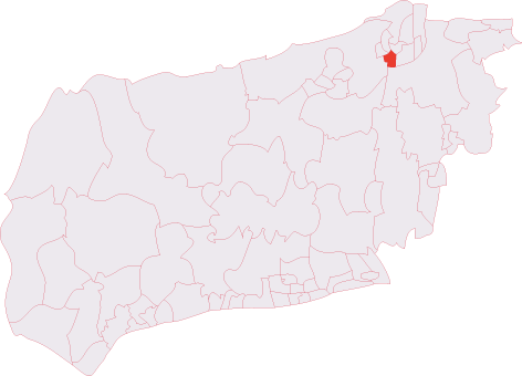
Broadfield is located at Grid Ref: TQ2534 (Lat: 51.096847, Lng: -0.207251)

Administrative County: West Sussex

District: Crawley

Police Authority: Sussex

What 3 Words

///discouraged.token.tracks. Near Broadfield, West Sussex

Nearby Locations

Broadfield

Related Wikis

Broadfield (electoral division)

Broadfield also known as Lowest Pease Pottage is an electoral division of West Sussex in the United Kingdom, and returns one member to sit on West Sussex...

Broadfield, West Sussex

Broadfield is one of 14 neighbourhoods within the town of Crawley in West Sussex, England. Broadfield is located in the south west of the town. It is...

Target Hill Park

Target Hill Park is a 9-hectare (22-acre) Local Nature Reserve in Crawley in West Sussex. It is owned by Crawley Borough Council and managed by the council...

Discovery New School

Discovery New School was a co-educational Montessori free school for pupils aged 4 to 10 located in Crawley, West Sussex. The school opened in September...

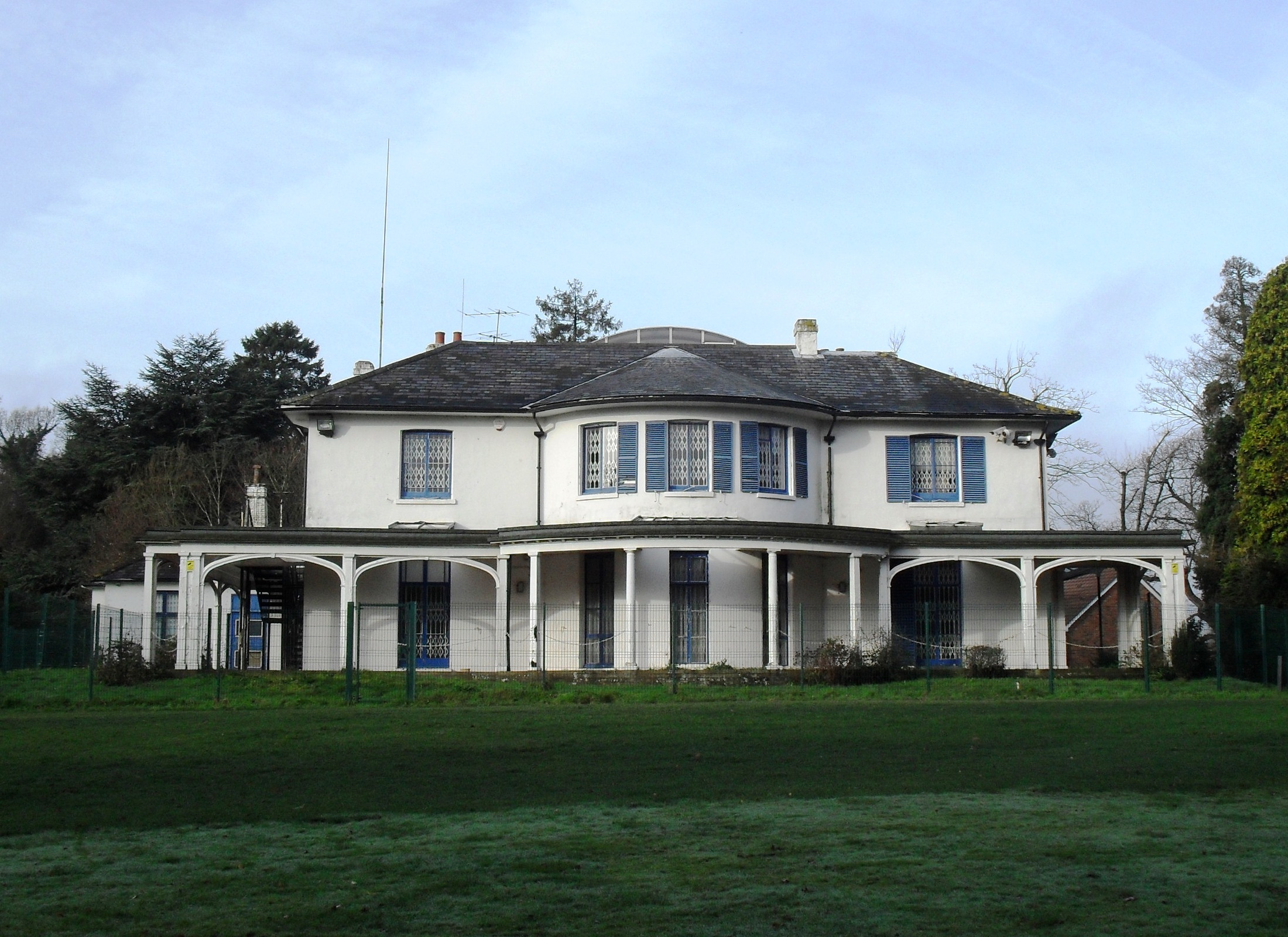
Broadfield House, Crawley

Broadfield House is a 19th-century villa-style house in the Broadfield neighbourhood of Crawley, a town and borough in West Sussex, England. Built in 1830...

Crawley Town F.C.

Crawley Town Football Club is a professional association football club based in the town of Crawley, West Sussex, England. The team compete in EFL League...
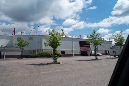
Broadfield Stadium

The Broadfield Stadium is a multi-purpose stadium in Crawley, England. It is currently used mostly for football matches and is the home ground of Crawley...

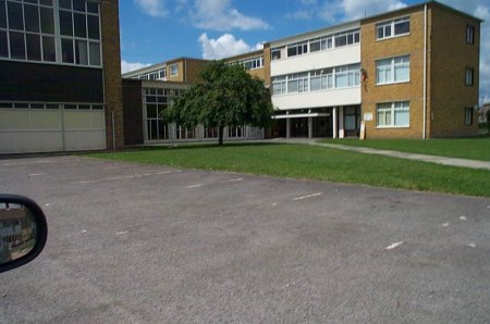
Holy Trinity School, Crawley

The Holy Trinity Church of England Secondary School is a voluntary-aided comprehensive school in Crawley, West Sussex, England. The school has a roll of...

Nearby Amenities

Located within 500m of 51.096847,-0.207251
Mini Roundabout
Direction: clockwise
Lat/Long: 51.0999721/-0.2055145
Broadfield
Created By: Potlatch 0.5d
Is In: Crawley
Place: village
Wikidata: Q4426650
Lat/Long: 51.0972382/-0.2051258
Mini Roundabout
Direction: clockwise
Source: Yahoo WMS
Lat/Long: 51.0961658/-0.2027483
Mini Roundabout
Direction: clockwise
Lat/Long: 51.0977747/-0.202699
Noexit: yes
Lat/Long: 51.0984974/-0.2109384
Noexit: yes
Lat/Long: 51.0975183/-0.2100013
Noexit: yes
Lat/Long: 51.097271/-0.2089239
Noexit: yes
Lat/Long: 51.0973256/-0.208689
Noexit: yes
Lat/Long: 51.0979707/-0.2080298
Noexit: yes
Lat/Long: 51.0984666/-0.2092099
Noexit: yes
Lat/Long: 51.0987159/-0.2080085
Noexit: yes
Lat/Long: 51.0993963/-0.2093676
Noexit: yes
Lat/Long: 51.0994963/-0.2079809
Post Box
Trefoil Crescent
Collection Times: Mo-Fr 09:00; Sa 07:00
Old Ref: RH11 134
Operator: Royal Mail
Operator Wikidata: Q638098
Post Box Type: pillar
Ref: RH11 134D
Royal Cypher: EIIR
Royal Cypher Wikidata: Q33102113
Source: photograph
Lat/Long: 51.0990195/-0.2105209
Noexit: yes
Lat/Long: 51.0971998/-0.211964
Noexit: yes
Lat/Long: 51.0960747/-0.2086467
Noexit: yes
Lat/Long: 51.0957264/-0.2099699
Noexit: yes
Lat/Long: 51.0954095/-0.2099812
Noexit: yes
Lat/Long: 51.095338/-0.2120091
Noexit: yes
Lat/Long: 51.0961911/-0.2110242
Noexit: yes
Lat/Long: 51.0961908/-0.2108123
Noexit: yes
Lat/Long: 51.0970016/-0.2104417
Noexit: yes
Lat/Long: 51.0969897/-0.2100144
Post Box
Collection Times: Mo-Fr 09:00; Sa 07:00; Su off
Drive Through: no
Operator: Royal Mail
Operator Wikidata: Q638098
Post Box Type: pillar
Ref: RH11 46D
Royal Cypher: EIIR
Royal Cypher Wikidata: Q33102113
Source: survey
Lat/Long: 51.1002173/-0.2049102
Noexit: yes
Lat/Long: 51.0964758/-0.2079565
Noexit: yes
Lat/Long: 51.0963463/-0.2079666
Noexit: yes
Lat/Long: 51.0962355/-0.209886
Noexit: yes
Lat/Long: 51.0962311/-0.2096518
Telephone
Booth: KX100
Covered: booth
Lat/Long: 51.1000598/-0.2048738
Buckingham Court
Building: yes
Fixme: location approximate
Lat/Long: 51.0992728/-0.2045352
Post Box
Operator: Royal Mail
Operator Wikidata: Q638098
Ref: RH10 140
Lat/Long: 51.093064/-0.2040407
Noexit: yes
Lat/Long: 51.0973353/-0.2116627
Wilkinson Court
Building: yes
Lat/Long: 51.0958208/-0.2066506
Adamson Court
Building: yes
Lat/Long: 51.0948058/-0.2076422
Bevan Court
Building: yes
Lat/Long: 51.0950412/-0.2087457
Bus Stop
Pelham Drive
Bus: yes
Naptan AtcoCode: 4400CY0090
Naptan Bearing: E
Naptan CommonName: Pelham Drive
Naptan Indicator: opp. Seaford Road
Naptan Landmark: Seaford Road
Naptan NaptanCode: wsxajpmd
Naptan PlusbusZoneRef: CRAWLEY
Naptan Street: Pelham Drive
Naptan Verified: no
Public Transport: platform
Source: naptan_import
Lat/Long: 51.0974066/-0.2102168
Bus Stop
Pelham Drive
Bus: yes
Naptan AtcoCode: 4400CY0091
Naptan Bearing: W
Naptan CommonName: Pelham Drive
Naptan Indicator: Seaford Road
Naptan Landmark: Seaford Road
Naptan NaptanCode: wsxajpmg
Naptan PlusbusZoneRef: CRAWLEY
Naptan Street: Pelham Drive
Naptan Verified: no
Public Transport: platform
Source: naptan_import
Lat/Long: 51.0970867/-0.2093204
Bus Stop
Creasys Drive North
Bus: yes
Naptan AtcoCode: 4400CY0092
Naptan Bearing: SW
Naptan CommonName: Creasys Drive North
Naptan Indicator: opp Beachy Road
Naptan Landmark: Beachy Road
Naptan NaptanCode: wsxajpmj
Naptan PlusbusZoneRef: CRAWLEY
Naptan Street: Creaseys Drive
Naptan Verified: no
Public Transport: platform
Source: naptan_import
Lat/Long: 51.0955221/-0.2084691
Bus Stop
Creasys Drive North
Bus: yes
Naptan AtcoCode: 4400CY0093
Naptan Bearing: NE
Naptan CommonName: Creasys Drive North
Naptan Indicator: adj Beachy Road
Naptan Landmark: Beachy Road
Naptan NaptanCode: wsxajpmp
Naptan PlusbusZoneRef: CRAWLEY
Naptan Street: Creaseys Drive
Naptan Verified: no
Public Transport: platform
Source: naptan_import
Lat/Long: 51.0953361/-0.2094413
Bus Stop
Barton
Bus: yes
Naptan AtcoCode: 4400CY0097
Naptan Bearing: S
Naptan CommonName: Barton
Naptan Indicator: Shops
Naptan Landmark: Broadfield Place
Naptan NaptanCode: wsxajpmt
Naptan PlusbusZoneRef: CRAWLEY
Naptan ShortCommonName: Broadfield Barton
Naptan Street: Broadfield Barton
Naptan Verified: no
Public Transport: platform
Source: naptan_import
Lat/Long: 51.0970877/-0.2069598
Coachmans Drive Central
Naptan AtcoCode: 4400CY0105
Naptan Bearing: N
Naptan CommonName: Coachmans Drive Central
Naptan Indicator: adj Broadfield Place
Naptan Landmark: Broadfield Place
Naptan NaptanCode: wsxajptp
Naptan PlusbusZoneRef: CRAWLEY
Naptan Street: Coachmans Drive
Naptan Verified: no
Source: naptan_import
Lat/Long: 51.0971436/-0.2029871
Bus Stop
Coachmans Drive Central
Naptan AtcoCode: 4400CY0106
Naptan Bearing: S
Naptan CommonName: Coachmans Drive Central
Naptan Indicator: opp. Broadfield Place
Naptan Landmark: Broadfield Place
Naptan NaptanCode: wsxajptw
Naptan PlusbusZoneRef: CRAWLEY
Naptan Street: Coachmans Drive
Naptan Verified: no
Public Transport: platform
Source: naptan_import
Lat/Long: 51.097374/-0.2027212
Bus Stop
Sandringham Road
Bus: yes
Naptan AtcoCode: 4400CY0108
Naptan Bearing: NE
Naptan CommonName: Sandringham Rd
Naptan Indicator: opp. Sandringham Road
Naptan Landmark: Seymour Road
Naptan NaptanCode: wsxajpwd
Naptan PlusbusZoneRef: CRAWLEY
Naptan Street: Seymour Road
Naptan Verified: no
Public Transport: platform
Source: naptan_import
Lat/Long: 51.1004035/-0.2046047
Bus Stop
Sandringham Road
Bus: yes
Naptan AtcoCode: 4400CY0109
Naptan Bearing: SW
Naptan CommonName: Sandringham Rd
Naptan Indicator: adj Sandringham Road
Naptan Landmark: Seymour Road
Naptan NaptanCode: wsxajpwg
Naptan PlusbusZoneRef: CRAWLEY
Naptan Street: Seymour Road
Naptan Verified: no
Public Transport: platform
Source: naptan_import
Lat/Long: 51.1000192/-0.2050476
Bus Stop
Seymour Schools
Bus: yes
Naptan AtcoCode: 4400CY0110
Naptan Bearing: W
Naptan CommonName: Seymour Schools
Naptan Indicator: o/s Schools
Naptan Landmark: Broadfield North Schools
Naptan NaptanCode: wsxajpwj
Naptan PlusbusZoneRef: CRAWLEY
Naptan Street: Seymour Road
Naptan Verified: no
Public Transport: platform
Source: naptan_import
Lat/Long: 51.099794/-0.207348
Bus Stop
Seymour Schools
Bus: yes
Naptan AtcoCode: 4400CY0111
Naptan Bearing: E
Naptan CommonName: Seymour Schools
Naptan Indicator: opp Schools
Naptan Landmark: Broadfield North Schools
Naptan NaptanCode: wsxajpwm
Naptan PlusbusZoneRef: CRAWLEY
Naptan Street: Seymour Road
Naptan Verified: no
Public Transport: platform
Source: naptan_import
Lat/Long: 51.0998988/-0.2074358
Bus Stop
Trefoil Crescent
Bus: yes
Naptan AtcoCode: 4400CY0112
Naptan Bearing: NE
Naptan CommonName: Trefoil Crescent
Naptan Indicator: opp. Trefoil Crescent
Naptan Landmark: Trefoil Crescent
Naptan NaptanCode: wsxajpwp
Naptan PlusbusZoneRef: CRAWLEY
Naptan Street: Seymour Road
Naptan Verified: no
Public Transport: platform
Source: naptan_import
Lat/Long: 51.0990168/-0.2108866
Bus Stop
Trefoil Crescent
Bus: yes
Naptan AtcoCode: 4400CY0113
Naptan Bearing: SW
Naptan CommonName: Trefoil Crescent
Naptan Indicator: adj Trefoil Crescent
Naptan Landmark: Trefoil Crescent
Naptan NaptanCode: wsxajpwt
Naptan PlusbusZoneRef: CRAWLEY
Naptan Street: Seymour Road
Naptan Verified: no
Public Transport: platform
Source: naptan_import
Lat/Long: 51.0987112/-0.2111261
Bus Stop
Creasys Drive West
Naptan AtcoCode: 4400CY0277
Naptan Bearing: S
Naptan CommonName: Creasys Drive West
Naptan Indicator: Adj Eddington Hill
Naptan Landmark: Eddington Hill
Naptan NaptanCode: wsxamdja
Naptan PlusbusZoneRef: CRAWLEY
Naptan ShortCommonName: Creasys Drive West
Naptan Street: Creasys Drive
Naptan Verified: no
Public Transport: platform
Source: naptan_import
Lat/Long: 51.093102/-0.2097932
Bus Stop
Broadfield Barton North
Bus: yes
Naptan AtcoCode: 4400CY0410
Naptan Bearing: E
Naptan CommonName: Broadfield Barton North
Naptan Indicator: opp Sommerfield
Naptan Landmark: Hollyrood Place
Naptan NaptanCode: wsxdptwp
Naptan PlusbusZoneRef: CRAWLEY
Naptan Street: Pelham Place
Naptan Verified: no
Public Transport: platform
Source: naptan_import
Lat/Long: 51.0977301/-0.2058112
Bus Stop
Broadfield Barton North
Bus: yes
Naptan AtcoCode: 4400CY0411
Naptan Bearing: W
Naptan CommonName: Broadfield Barton North
Naptan Indicator: O/S Sommerfield
Naptan Landmark: Hollyrood Place
Naptan NaptanCode: wsxdptwt
Naptan PlusbusZoneRef: CRAWLEY
Naptan Street: Pelham Place
Naptan Verified: no
Public Transport: platform
Source: naptan_import
Lat/Long: 51.0976264/-0.2059732
Bus Stop
Coachmans Drive North
Bus: yes
Naptan AtcoCode: 4400CY0412
Naptan Bearing: NE
Naptan CommonName: Coachmans Drive North
Naptan Indicator: Opp
Naptan Landmark: Moyne Rd
Naptan NaptanCode: wsxdpwad
Naptan PlusbusZoneRef: CRAWLEY
Naptan ShortCommonName: Coachmans Dr North
Naptan Street: Coachman's Drive
Naptan Verified: no
Public Transport: platform
Source: naptan_import
Lat/Long: 51.0984242/-0.2016034
Morrisons
Brand: Morrisons
Brand Wikidata: Q922344
Shop: supermarket
Lat/Long: 51.0972882/-0.2062044
Iceland
Addr City: Crawley
Addr Housenumber: 3
Addr Postcode: RH11 9BA
Addr Street: Broadfield Barton
Brand: Iceland
Brand Wikidata: Q721810
Brand Wikipedia: en:Iceland (supermarket)
Contact Website: https://www.iceland.co.uk/store-finder/store?StoreID=370&StoreName=CRAWLEY%20BROAD
Opening Hours: Mo-Sa 08:00-20:00; Su 10:00-16:00
Shop: frozen_food
Lat/Long: 51.0972848/-0.206022
Fast Food
Kebab
Lat/Long: 51.0971366/-0.2064887
Shop: convenience
Lat/Long: 51.0971366/-0.2062098
Post Office
Broadfield Post Office
Addr City: Crawley
Addr Housenumber: 28-30
Addr Postcode: RH11 9BA
Addr Street: Broadfield Place
Brand: Post Office
Brand Wikidata: Q1783168
Operator: Post Office Ltd
Ref Pol Id: 352
Source: survey
Source Ref Pol Id: pol_branch_list_2018-02
Lat/Long: 51.0971386/-0.2054947
Parking
Lat/Long: 51.0934012/-0.2050714
Noexit: yes
Lat/Long: 51.0956118/-0.2109919
Noexit: yes
Lat/Long: 51.0954754/-0.2109948
Noexit: yes
Lat/Long: 51.0964894/-0.2119818
Noexit: yes
Lat/Long: 51.0963917/-0.2119764
Noexit: yes
Lat/Long: 51.0974565/-0.2086684
Noexit: yes
Lat/Long: 51.097841/-0.2080338
Noexit: yes
Lat/Long: 51.0981177/-0.2107066
Noexit: yes
Lat/Long: 51.0981308/-0.2093247
Noexit: yes
Lat/Long: 51.0986159/-0.2080114
Noexit: yes
Lat/Long: 51.0988424/-0.2095491
Noexit: yes
Lat/Long: 51.0989511/-0.2095507
Noexit: yes
Lat/Long: 51.0992983/-0.2093696
Noexit: yes
Lat/Long: 51.0994059/-0.2079841
Mini Roundabout
Direction: clockwise
Lat/Long: 51.09982/-0.2083168
Dentist
Broadfield Dental Centre
Addr City: Crawley
Addr Postcode: RH11 9BA
Addr Street: Broadfield Place
Contact Email: appt@broadfielddentalcentre.com
Contact Phone: +44 844 815 1411
Contact Website: www.broadfielddentalcentre.com
Healthcare: dentist
Opening Hours: Mo-Fr 08:00-17:00
Lat/Long: 51.097012/-0.2056405
Post Box
Broadfield Barton P O
Collection Plate: CP1
Collection Times: Mo-Fr 17:15; Sa 11:45
Operator: Royal Mail
Operator Wikidata: Q638098
Post Box Type: pillar
Ref: RH11 137
Royal Cypher: EIIR
Royal Cypher Wikidata: Q33102113
Source: survey
Lat/Long: 51.0971567/-0.2056876
Mini Roundabout
Direction: clockwise
Lat/Long: 51.09794/-0.2132662
Pharmacy
Kamsons Pharmacy
Dispensing: yes
Healthcare: pharmacy
Lat/Long: 51.0971434/-0.2063439
Washout Hydrant
Fire Hydrant
Emergency: fire_hydrant
Fire Hydrant Type: underground
Survey Date: 2018-11-11
Water Source: main
Lat/Long: 51.100198/-0.2041684
Washout Hydrant
Fire Hydrant
Emergency: fire_hydrant
Fire Hydrant Type: underground
Survey Date: 2018-11-11
Water Source: main
Lat/Long: 51.100716/-0.2051196
Washout Hydrant
Fire Hydrant
Emergency: fire_hydrant
Fire Hydrant Type: underground
Survey Date: 2018-11-11
Water Source: main
Lat/Long: 51.094855/-0.2105878
Washout Hydrant
Fire Hydrant
Emergency: fire_hydrant
Fire Hydrant Type: underground
Survey Date: 2018-11-11
Water Source: main
Lat/Long: 51.097239/-0.2105958
Communication 3G: yes
Communication 4G: yes
Communication 5G: yes
Communication Gsm: yes
Communication Lte: yes
Communication Mobile Phone: yes
Communication Nr: yes
Communication Umts: yes
Description: 3 UK eNB 49667 Bands 1+3+20+28, with 5G NSA ENDC support on n78.
Man Made: mast
Tower Construction: monopole
Tower Type: communication
Lat/Long: 51.0988444/-0.2128493
Fuel
Esso
Brand: Esso
Brand Wikidata: Q867662
Operator: Rontec
Operator Website: http://www.rontec-servicestations.co.uk/ss_results-id.cfm?id=6992
Operator Wikidata: Q107439152
Lat/Long: 51.0976909/-0.2070384
Crossing
Crossing: unmarked
Crossing Markings: no
Lat/Long: 51.0955879/-0.2024951
The data included in this document is from www.openstreetmap.org. The data is made available under ODbL.

Have you been to Broadfield?

Leave your review of Broadfield below (or comments, questions and feedback).