Cresswell

Civil Parish in Northumberland

England

Cresswell

Seaweed on the beach at Broad Sands
Seaweed on the beach at Broad Sands Credit: Oliver Dixon

Cresswell is a civil parish located in the county of Northumberland, in the northeast of England. Situated on the North Sea coast, Cresswell is a small village that offers a picturesque and tranquil setting for its residents and visitors alike.

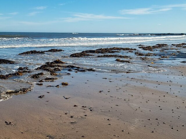
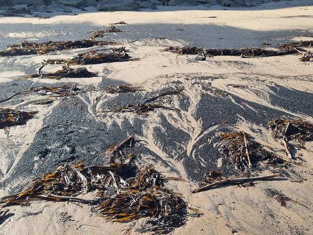
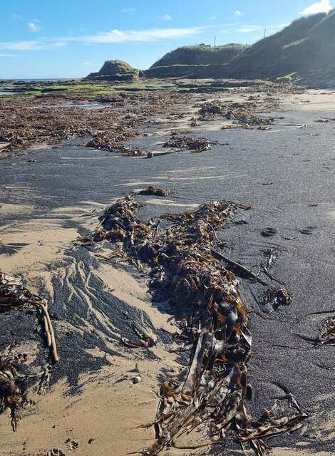
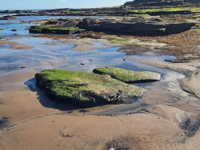
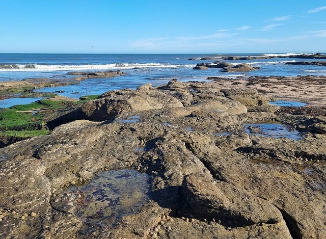
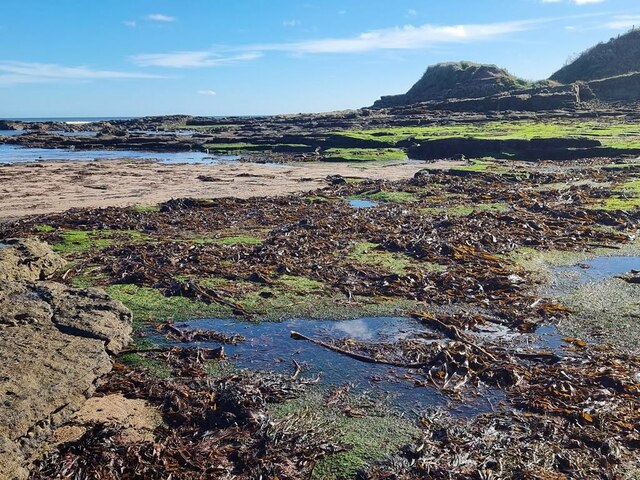
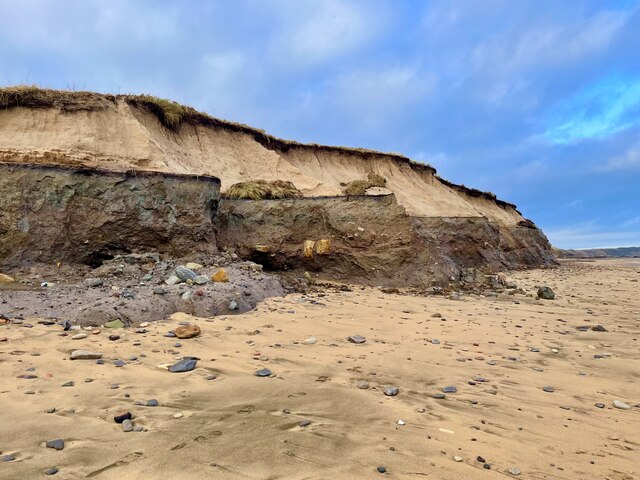
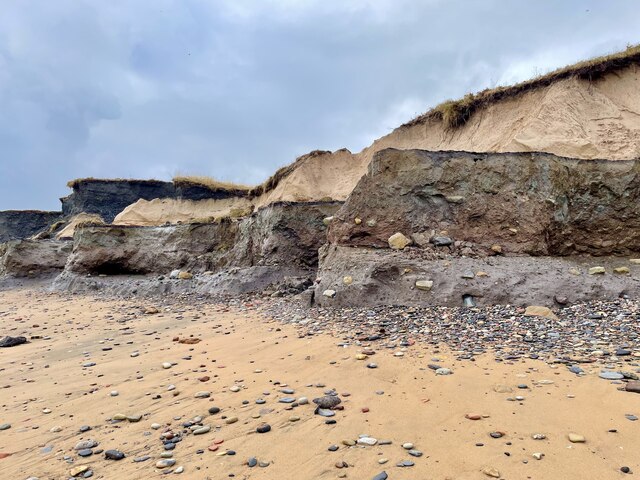
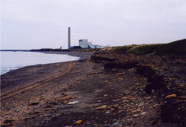
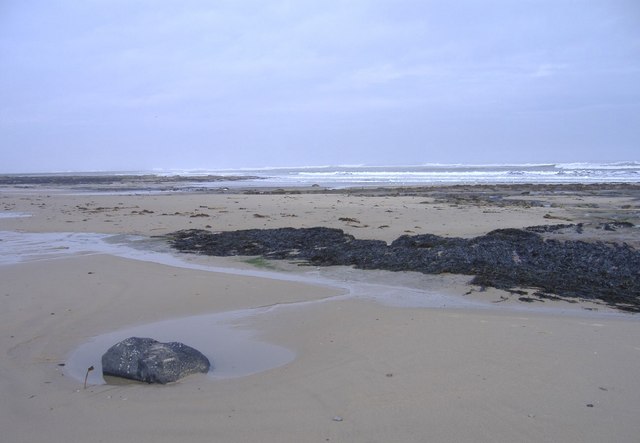
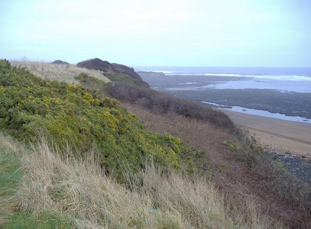
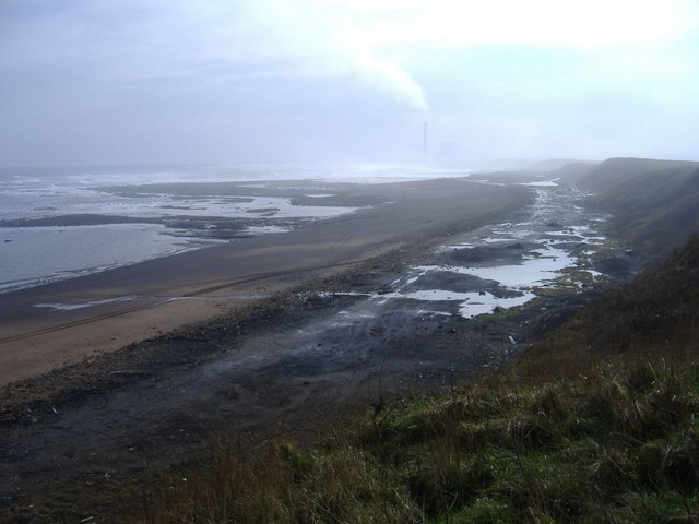
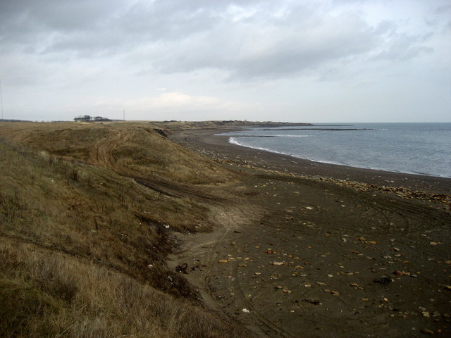
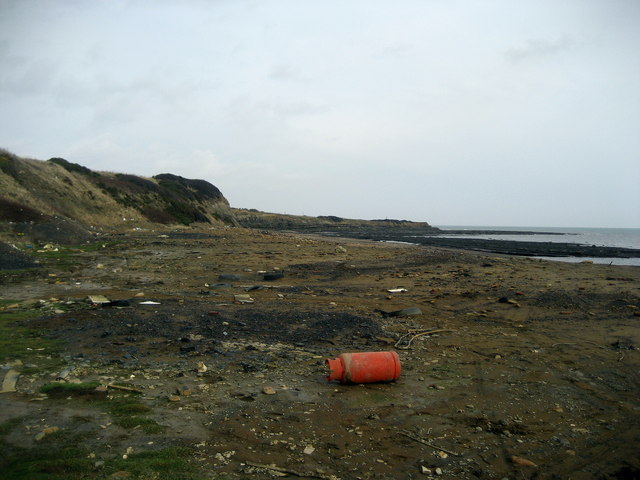
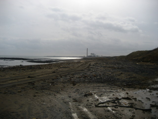
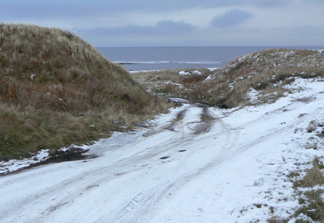
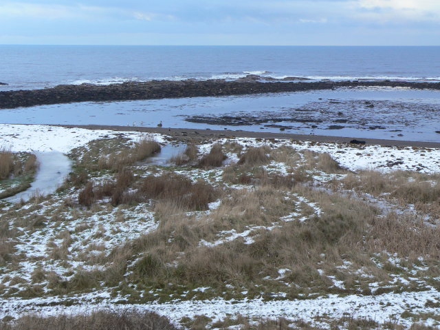
The village is known for its beautiful sandy beach, which stretches for miles and provides a popular destination for those seeking relaxation or outdoor activities. The beach is backed by sand dunes, providing a natural barrier between the land and sea. It is also home to a variety of wildlife, including seabirds and seals.

Cresswell boasts a rich history, with evidence of human settlement dating back to the Neolithic period. The village was once a thriving mining community, with coal being the primary industry. However, the mines closed in the 1960s, and the village has since transitioned into a charming coastal retreat.

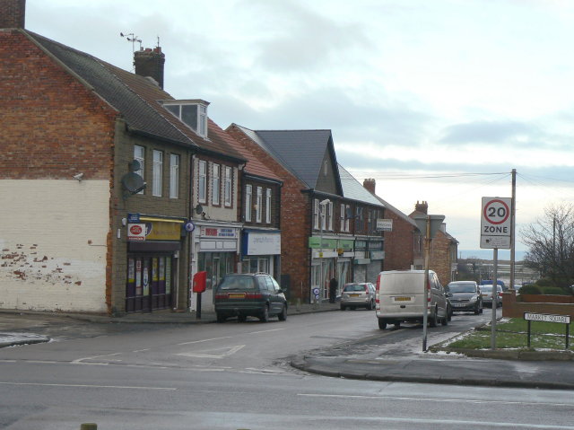
In terms of amenities, Cresswell offers a few local shops and a pub, providing essential services to its residents. The village is also well-connected to nearby towns and cities, with good transport links via road and public transport.

The surrounding area offers plenty of opportunities for outdoor activities, including walking, cycling, and birdwatching. Nearby attractions include Druridge Bay Country Park, which offers nature trails and a lake for water sports, and the historic Warkworth Castle.

Overall, Cresswell is a delightful village that combines natural beauty, historical significance, and a peaceful coastal lifestyle, making it a desirable place to live or visit in Northumberland.

If you have any feedback on the listing, please let us know in the comments section below.

Cresswell Images

Images are sourced within 2km of 55.230657/-1.543529 or Grid Reference NZ2993. Thanks to Geograph Open Source API. All images are credited.

Seaweed on the beach at Broad Sands
Seaweed and coal dust on the beach At Broad Sands. The coal dust is a legacy of the local coal mining industry.
Seaweed and coal dust on the beach
At Broad Sands. The coal dust is a legacy of the local coal mining industry.
Seaweed and coal dust on the beach Looking towards Snab Point.  The coal dust is a legacy of the local coal mining industry.
Seaweed and coal dust on the beach
Looking towards Snab Point. The coal dust is a legacy of the local coal mining industry.
Broad Sand Rocks A short way north of Snab Point.
Broad Sand Rocks
A short way north of Snab Point.
Broad Sand Rocks
Broad Sand Rocks
Broad Sand Rocks Accumulation of seaweed on the coastal rocks just north of Snab Point.
Broad Sand Rocks
Accumulation of seaweed on the coastal rocks just north of Snab Point.
A rare oasis of beauty on Lynemouth cliffs Courtesy of the huge waves of Storm Babet.
A rare oasis of beauty on Lynemouth cliffs
Courtesy of the huge waves of Storm Babet.
The chocolate cliffs of Lynemouth A rare section of beauty on this beach courtesy of the huge waves of Storm Babet.  Different strata highlighted like the layers of an exotic cake.
The chocolate cliffs of Lynemouth
A rare section of beauty on this beach courtesy of the huge waves of Storm Babet. Different strata highlighted like the layers of an exotic cake.
Lynemouth beach This stretch of beach was a dumping ground for colliery spoil for a number of years and it has left it looking like a moonscape in places.
Lynemouth beach
This stretch of beach was a dumping ground for colliery spoil for a number of years and it has left it looking like a moonscape in places.
Broad Sand Rocks, Cresswell
Snab Point, Cresswell
Broad Skear, Cresswell Looking south, towards Lynemouth.
Broad Skear, Cresswell
Looking south, towards Lynemouth.
Lynemouth Bay Looking north towards Snab Point.  The beach appears black, due to the spoil of colliery operations in the past.
Lynemouth Bay
Looking north towards Snab Point. The beach appears black, due to the spoil of colliery operations in the past.
The Beach at Lynemouth I found this most depressing.  This is a beach in Northumberland, a county famed for its clean and beautiful golden sands.  This has been used as an unofficial landfill site, with, I suspect toxic waste mixed in.  The council needs to seriously get a grip on this!
The Beach at Lynemouth
I found this most depressing. This is a beach in Northumberland, a county famed for its clean and beautiful golden sands. This has been used as an unofficial landfill site, with, I suspect toxic waste mixed in. The council needs to seriously get a grip on this!
Rubbish on Lynemouth Bay Looking south towards the Alcan Power Station, this stretch of coast is a disgrace.  The black sands from coal operations from the past can be forgiven, but the vast amount of rubbish cannot.
Rubbish on Lynemouth Bay
Looking south towards the Alcan Power Station, this stretch of coast is a disgrace. The black sands from coal operations from the past can be forgiven, but the vast amount of rubbish cannot.
Track to the beach Apparently more used by fly-tippers than holiday makers!
Track to the beach
Apparently more used by fly-tippers than holiday makers!
Headagee rocks Low rock formations on the sea shore between Lynemouth and Cresswell.
Headagee rocks
Low rock formations on the sea shore between Lynemouth and Cresswell.
Winter coastline Between Lynemouth and Cresswell. Unfortunately easily accessible for flytippers.
Winter coastline
Between Lynemouth and Cresswell. Unfortunately easily accessible for flytippers.
Show me another place!

Cresswell is located at Grid Ref: NZ2993 (Lat: 55.230657, Lng: -1.543529)

Unitary Authority: Northumberland

Police Authority: Northumbria

What 3 Words

///liberated.incensed.greet. Near Cresswell, Northumberland

Related Wikis

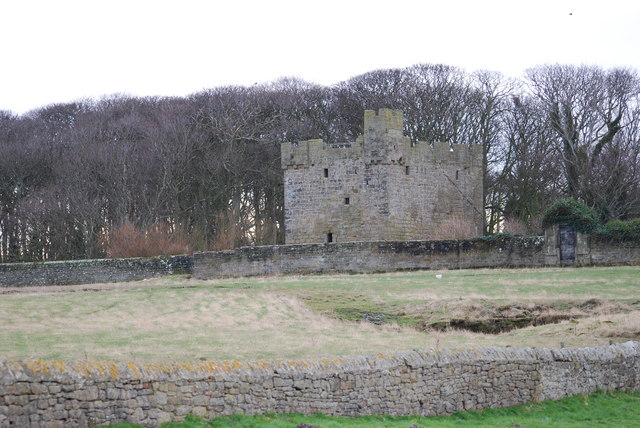
Cresswell Castle, Northumberland

Cresswell Pele Tower is in the village of Cresswell, situated overlooking the coast approximately 4 miles (6 km) to the north of Ashington, Northumberland...

Cresswell, Northumberland

Cresswell is a village in Northumberland, England. It is about 4 miles (6 km) to the north of Ashington, on the North Sea coast. == History == The place...

Cresswell radar station

Cresswell radar station (also known as RAF Cresswell), was a Chain Home Low (later a Chain Home Extra Low) Second World War radar site at Cresswell, in...

Lynemouth

Lynemouth is a village in Northumberland, England, 3 miles (5 km) northeast of Ashington, close to the village of Ellington to the north west. It was built...

Ellington, Northumberland

Ellington is a small village in the civil parish of Ellington and Linton, on the coast of Northumberland, England. Ellington is 4 miles (6 km) from Ashington...

Ellington Colliery

Ellington Colliery (also known as The Big E), was a coal mine situated to the south of the village of Ellington in Northumberland, England. The colliery...

A1068 road

The A1068 is a road in northern England that runs from Seaton Burn in North Tyneside to Alnwick in Northumberland. The section between Ellington and Alnmouth...

Lynemouth Colliery

Lynemouth Colliery was a coal mine in Lynemouth, Northumberland, England. It was in operation between 1927 and 1994. According to Historic England, "it...

Nearby Amenities

Located within 500m of 55.230657,-1.543529
Crossing
Crossing: uncontrolled
Crossing Ref: zebra
Lat/Long: 55.2305152/-1.543574
Post Box
Collection Times: Mo-Fr 09:00; Sa 07:00
Post Box Type: lamp
Ref: NE61 151D
Royal Cypher: EIIR
Royal Cypher Wikidata: Q33102113
Source: survey
Lat/Long: 55.2332629/-1.5432438
Give Way
Direction: forward
Lat/Long: 55.2332378/-1.5433867
Give Way
Direction: forward
Lat/Long: 55.2306032/-1.5512723
Crossing
Crossing: uncontrolled
Crossing Ref: zebra
Lat/Long: 55.2306628/-1.5419966
Crossing
Crossing: uncontrolled
Crossing Ref: zebra
Lat/Long: 55.2323352/-1.5430787
Crossing
Crossing: uncontrolled
Crossing Ref: zebra
Lat/Long: 55.2328169/-1.5432835
Crossing
Crossing: uncontrolled
Crossing Ref: zebra
Lat/Long: 55.2324668/-1.5431346
Crossing
Crossing: uncontrolled
Crossing Ref: zebra
Lat/Long: 55.2321446/-1.5437697
Crossing
Crossing: uncontrolled
Crossing Ref: zebra
Lat/Long: 55.2320478/-1.5429911
Bench
Backrest: yes
Material: wood
Lat/Long: 55.2340985/-1.5406513
Waste Basket
Material: plastic
Waste: trash
Lat/Long: 55.2340905/-1.5406258
Waste Basket
Material: wood
Waste: trash
Lat/Long: 55.2335765/-1.5400887
Waste Basket
Material: plastic
Waste: dog_excrement
Lat/Long: 55.2320169/-1.5414705
Bench
Backrest: yes
Lat/Long: 55.2335316/-1.539961
Bench
Backrest: yes
Lat/Long: 55.2335057/-1.5399135
Board Type: history
Information: board
Tourism: information
Lat/Long: 55.2337649/-1.5402931
Board Type: history
Information: board
Tourism: information
Lat/Long: 55.2337088/-1.5401097
Noexit: yes
Lat/Long: 55.229309/-1.5416185
Noexit: yes
Lat/Long: 55.2294559/-1.5376112
Turning Circle
Lat/Long: 55.2304196/-1.5380135
Turning Circle
Lat/Long: 55.2303492/-1.5385044
Noexit: yes
Lat/Long: 55.2297141/-1.5423713
Noexit: yes
Lat/Long: 55.2302038/-1.5403963
Noexit: yes
Lat/Long: 55.2291563/-1.5424069
The data included in this document is from www.openstreetmap.org. The data is made available under ODbL.

Have you been to Cresswell?

Leave your review of Cresswell below (or comments, questions and feedback).