Cransford

Civil Parish in Suffolk East Suffolk

England

Cransford

Grassed  field  track  to  Low  Road Stubble field cleared
Grassed field track to Low Road Credit: Martin Dawes

Cransford is a small civil parish located in the county of Suffolk, England. Situated in the East Anglian region, it is part of the district of Suffolk Coastal. The parish covers an area of approximately 6 square miles and has a population of around 200 residents.

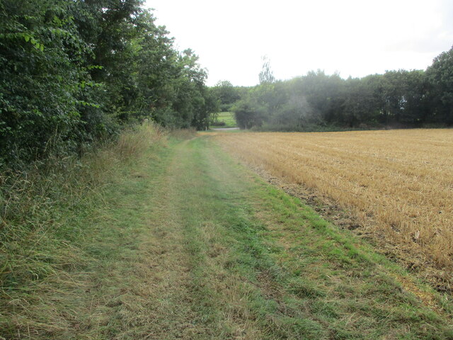
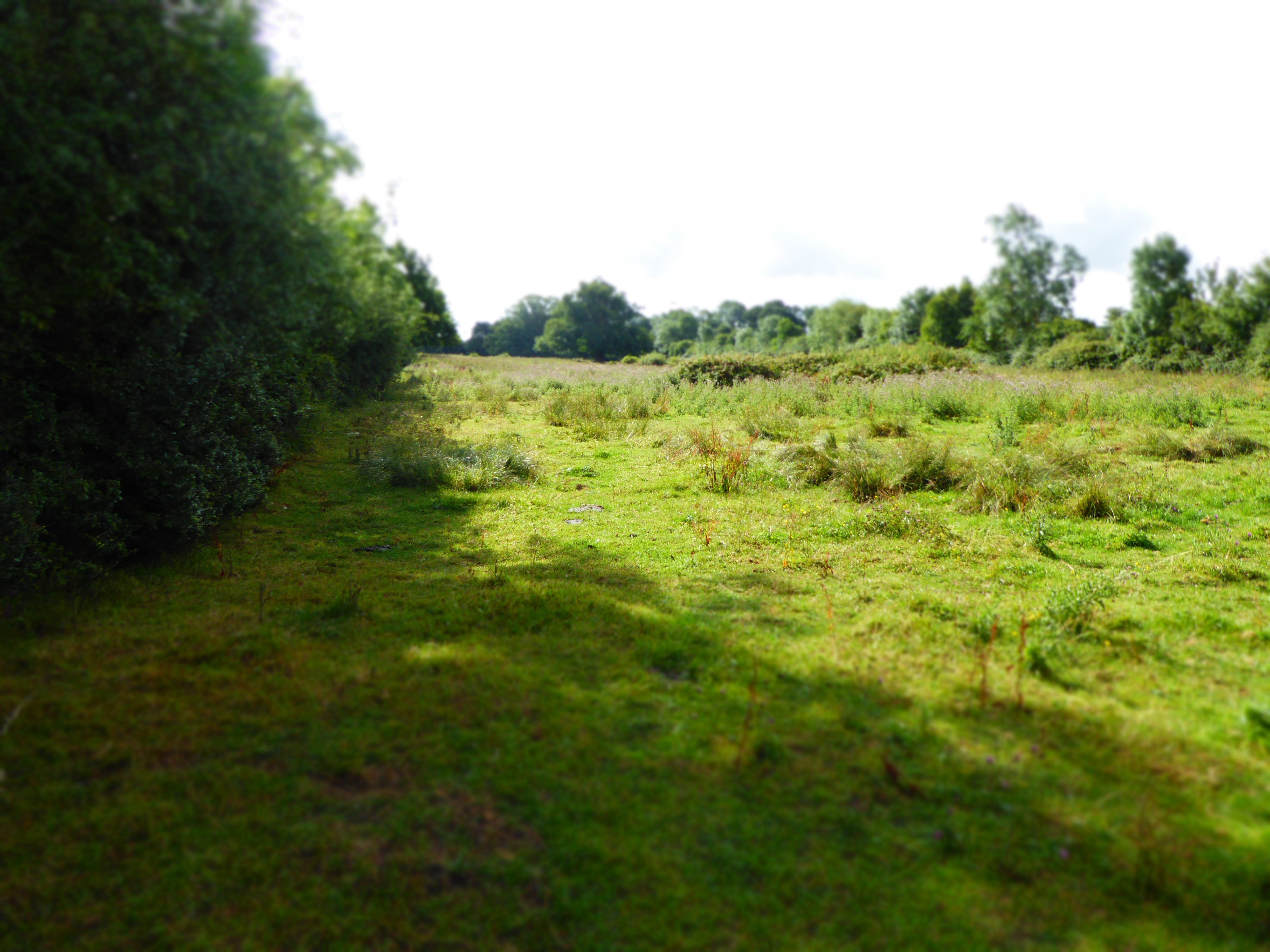
Cransford is a rural area characterized by its picturesque landscape of rolling hills, scattered woodlands, and open fields. The village itself is small and compact, with a charming collection of traditional cottages and farmhouses. The parish is mainly agricultural, with farming playing a significant role in the local economy.

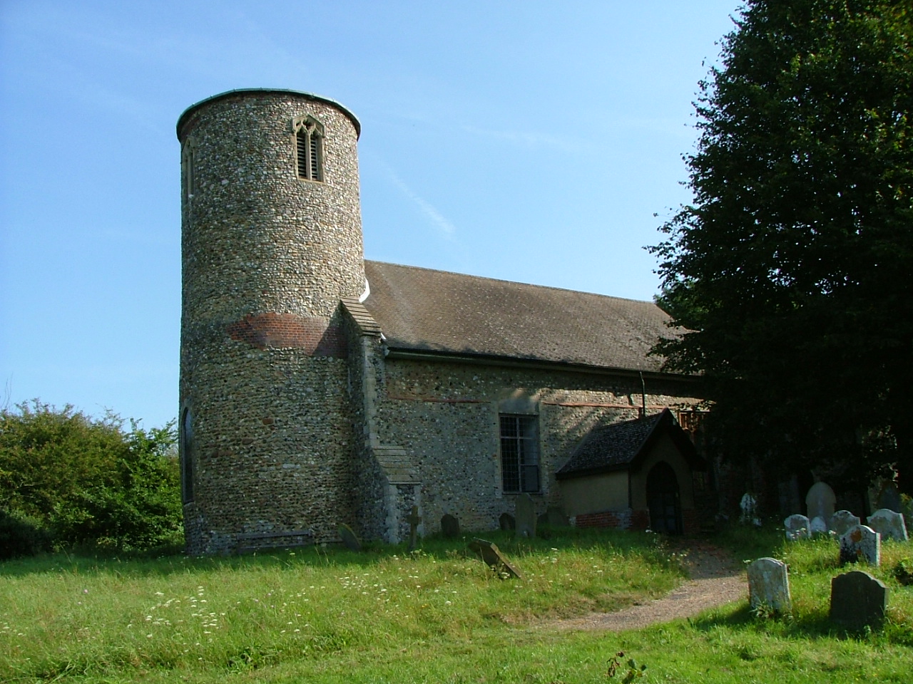
The centerpiece of Cransford is its historic church, St. Peter's Church, which dates back to the 14th century. The church is a Grade I listed building and features beautiful stained glass windows and intricate stonework. It serves as a place of worship for the local community and is also a popular attraction for visitors interested in its architectural and historical significance.

Cransford offers a peaceful and tranquil environment, ideal for those seeking a rural lifestyle away from the hustle and bustle of larger towns and cities. The parish is well-connected to neighboring areas by road, with the A12 and A14 highways providing easy access to nearby towns and cities.

While Cransford may be small in size, it offers a strong sense of community and a close-knit atmosphere. Residents enjoy the tranquility of the countryside, along with the convenience of having essential amenities and services within a short distance.

If you have any feedback on the listing, please let us know in the comments section below.

Cransford Images

Images are sourced within 2km of 52.233779/1.396764 or Grid Reference TM3264. Thanks to Geograph Open Source API. All images are credited.

Grassed  field  track  to  Low  Road Stubble field cleared
Grassed field track to Low Road
Stubble field cleared
The  B1119  east  toward  Rendham Arable fields and woods, the trees on the skyline right go by the name of, Kilderbee's Grove
The B1119 east toward Rendham
Arable fields and woods, the trees on the skyline right go by the name of, Kilderbee's Grove
View south from the B1119
View south-east from the B1119
Bruisyard Road, Cransford
Junction of the B1119 with the lane to Parham
Track from the B1119 towards Sweffling Hall
Minor  roads  crossroad  on  B1119  toward  Framlingham Left for Parham, right for Cransford
Minor roads crossroad on B1119 toward Framlingham
Left for Parham, right for Cransford
Junction  of  minor  road  from  Parham  with  B1119
Junction of minor road from Parham with B1119
Cransford  Village  Hall
Cransford Village Hall
Church of St. Peter, Bruisyard <span class="nowrap"><a title="https://historicengland.org.uk/listing/the-list/list-entry/1377166?section=official-list-entry" rel="nofollow ugc noopener" href="https://historicengland.org.uk/listing/the-list/list-entry/1377166?section=official-list-entry">Link</a><img style="margin-left:2px;" alt="External link" title="External link - shift click to open in new window" src="https://s1.geograph.org.uk/img/external.png" width="10" height="10"/></span>
Church of St. Peter, Bruisyard
Church of St. Peter, Cransford <span class="nowrap"><a title="https://historicengland.org.uk/listing/the-list/list-entry/1183119?section=official-list-entry" rel="nofollow ugc noopener" href="https://historicengland.org.uk/listing/the-list/list-entry/1183119?section=official-list-entry">Link</a><img style="margin-left:2px;" alt="External link" title="External link - shift click to open in new window" src="https://s1.geograph.org.uk/img/external.png" width="10" height="10"/></span>
Church of St. Peter, Cransford
Floods in the valley of the River Alde
Wood Road, Badingham Road No.C231
Wood Road, Badingham
Road No.C231
Wood Road, Badingham
River Alde off Wood Road <span class="nowrap"><a title="https://en.wikipedia.org/wiki/Bruisyard" rel="nofollow ugc noopener" href="https://en.wikipedia.org/wiki/Bruisyard">Link</a><img style="margin-left:2px;" alt="External link" title="External link - shift click to open in new window" src="https://s1.geograph.org.uk/img/external.png" width="10" height="10"/></span>
River Alde off Wood Road
Field Entrance off Wood Road <span class="nowrap"><a title="https://en.wikipedia.org/wiki/Bruisyard" rel="nofollow ugc noopener" href="https://en.wikipedia.org/wiki/Bruisyard">Link</a><img style="margin-left:2px;" alt="External link" title="External link - shift click to open in new window" src="https://s1.geograph.org.uk/img/external.png" width="10" height="10"/></span>
Field Entrance off Wood Road
Wood Road, Badingham <span class="nowrap"><a title="https://en.wikipedia.org/wiki/Bruisyard" rel="nofollow ugc noopener" href="https://en.wikipedia.org/wiki/Bruisyard">Link</a><img style="margin-left:2px;" alt="External link" title="External link - shift click to open in new window" src="https://s1.geograph.org.uk/img/external.png" width="10" height="10"/></span>
Wood Road, Badingham
Show me another place!

Cransford is located at Grid Ref: TM3264 (Lat: 52.233779, Lng: 1.396764)

Administrative County: Suffolk

District: East Suffolk

Police Authority: Suffolk

What 3 Words

///roadshow.frogs.online. Near Framlingham, Suffolk

Nearby Locations

Cransford Cransford

Related Wikis

Cransford

Cransford is a village and a civil parish in the East Suffolk district, in the English county of Suffolk. The civil parish had a population at the 2011...

Cransford Meadow

Cransford Meadow is a 4.6-hectare (11-acre) biological Site of Special Scientific Interest south of Cransford in Suffolk.This unimproved grassland site...

Bruisyard

Bruisyard is a village in the valley of the River Alde in the county of Suffolk, England. The village had a population of around 175 at the 2011 census...

Bruisyard Abbey

The Abbey of Bruisyard was a house of Minoresses (Poor Clares) at Bruisyard in Suffolk. It was founded from Campsey Priory in Suffolk on the initiative...

Nearby Amenities

Located within 500m of 52.233779,1.396764
Cransford
Place: hamlet
Wikidata: Q3147154
Wikipedia: en:Cransford
Lat/Long: 52.2303545/1.395944
Bus Stop
Village Sign
Naptan AtcoCode: 390060345
Naptan Bearing: SE
Naptan BusStopType: CUS
Naptan CommonName: Village Sign
Naptan Indicator: adj
Naptan Landmark: Village Sign
Naptan NaptanCode: sufgpgtj
Naptan Street: B116
Naptan Verified: no
Source: naptan_import
Lat/Long: 52.2301638/1.3984004
Bus Stop
Village Sign
Naptan AtcoCode: 390060346
Naptan Bearing: NW
Naptan BusStopType: CUS
Naptan CommonName: Village Sign
Naptan Indicator: opp
Naptan Landmark: Village Sign
Naptan NaptanCode: sufgpgtm
Naptan Street: B116
Naptan Verified: no
Source: naptan_import
Lat/Long: 52.2301125/1.3983086
Post Box
Ref: IP13 6270
Lat/Long: 52.2307497/1.396261
The data included in this document is from www.openstreetmap.org. The data is made available under ODbL.

Have you been to Cransford?

Leave your review of Cransford below (or comments, questions and feedback).