Countesthorpe

Civil Parish in Leicestershire Blaby

England

Countesthorpe

Track to Whetstone Gorse This entrance is along Willoughby Road
Track to Whetstone Gorse Credit: Mat Fascione

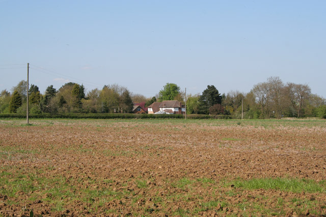
Countesthorpe is a civil parish located in the district of Blaby in Leicestershire, England. Situated approximately six miles southeast of Leicester, the parish covers an area of about 5.5 square miles. It is bordered by the parishes of Kilby, Eyres Monsell, Whetstone, and South Wigston.

Countesthorpe has a population of around 6,000 residents, according to the latest census. The parish is primarily a residential area with a mix of housing, ranging from modern developments to traditional village homes. The village center features a variety of amenities, including shops, pubs, and a post office, providing convenience for the local community.

The area is known for its strong sense of community spirit, with active local groups and organizations offering a range of activities and events. Countesthorpe also benefits from several green spaces, such as Bouskell Park, which offers recreational opportunities including playgrounds, sports fields, and walking paths.

The parish is well-connected to surrounding areas, with good transportation links. The nearby M1 motorway provides easy access to Leicester and other major cities, while regular bus services connect Countesthorpe to neighboring towns.

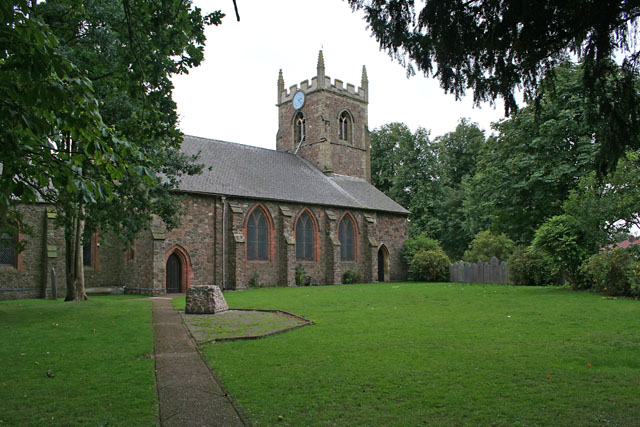
Countesthorpe has a rich history, with evidence of human habitation dating back to Roman times. The village is home to several historic buildings, including St. Andrew's Church, which dates back to the 14th century. The local heritage is celebrated through various community events and initiatives.

Overall, Countesthorpe offers a pleasant residential environment with a strong sense of community, making it an attractive place to live in Leicestershire.

If you have any feedback on the listing, please let us know in the comments section below.

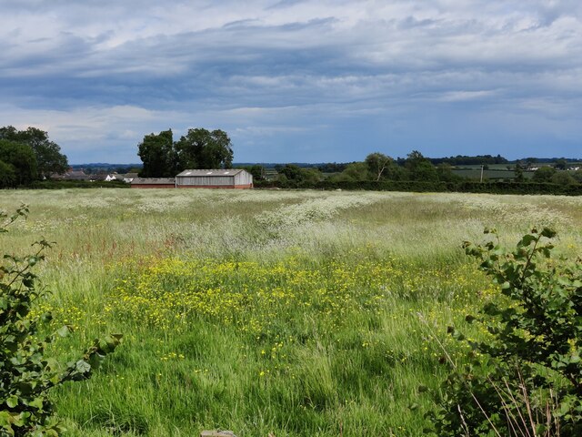
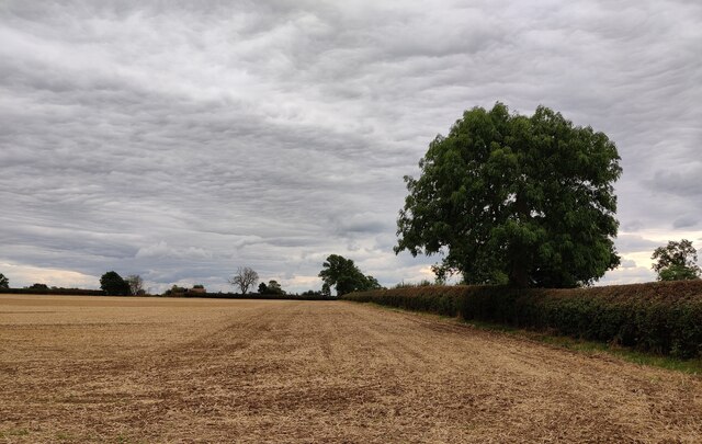
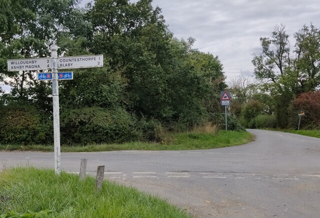
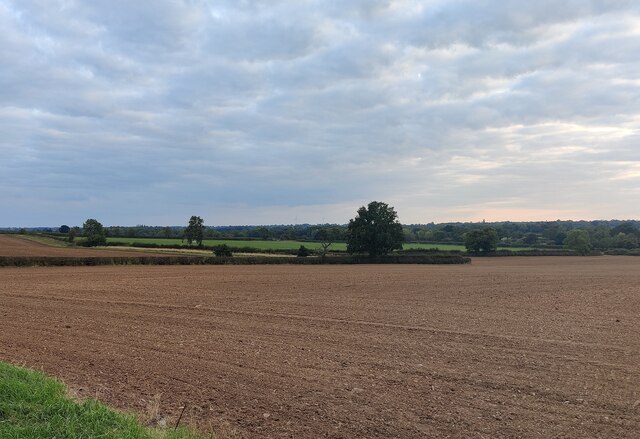
Countesthorpe Images

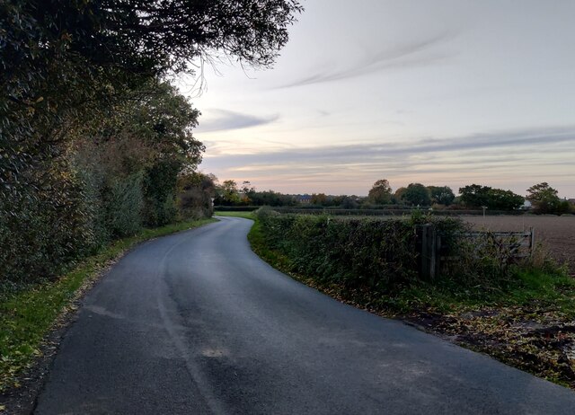
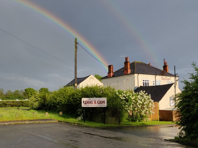
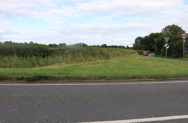
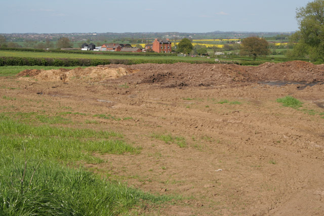
Images are sourced within 2km of 52.553296/-1.143622 or Grid Reference SP5895. Thanks to Geograph Open Source API. All images are credited.

Track to Whetstone Gorse This entrance is along Willoughby Road
Track to Whetstone Gorse
This entrance is along Willoughby Road
Farmland on the southern edge of Countesthorpe
Farmland along Willoughby Road
Signpost along Willoughby Road At the junction of Bambury Lane.
Signpost along Willoughby Road
At the junction of Bambury Lane.
Farmland near Countesthorpe
Hill Lane near Countesthorpe
Rainbow over the Dog and Gun public house
Lutterworth Road, Countesthorpe Hill Lane is on the right.
Lutterworth Road, Countesthorpe
Hill Lane is on the right.
Lutterworth Road, Countesthorpe
Farmland next to Hill Lane, Countesthorpe
The Square, Countesthorpe Countesthorpe is a large suburban village to the south of Leicester. It is seen here on a dull day in light rain with an Arriva bus on route 85 running between Leicester and South Wigston.
The Square, Countesthorpe
Countesthorpe is a large suburban village to the south of Leicester. It is seen here on a dull day in light rain with an Arriva bus on route 85 running between Leicester and South Wigston.
Farmland at Whetstone Gorse
Farmland at Whetstone Gorse The trees on the left follow the line of the dismantled railway.
Farmland at Whetstone Gorse
The trees on the left follow the line of the dismantled railway.
Farmland off Bambury Lane Westdale Farm in the centre, Countesthorpe in the distance.
Farmland off Bambury Lane
Westdale Farm in the centre, Countesthorpe in the distance.
Farm on Bambury Lane near Countesthorpe A new farmhouse and buildings
Farm on Bambury Lane near Countesthorpe
A new farmhouse and buildings
Farmland off Bambury Lane Bambury Lane runs behind the trees on the right.
Farmland off Bambury Lane
Bambury Lane runs behind the trees on the right.
Hill Lane near Countesthorpe
Farmland off Hill Lane near Countesthorpe Glebe Farm on Willoughby Road in the centre.
Farmland off Hill Lane near Countesthorpe
Glebe Farm on Willoughby Road in the centre.
Show me another place!

Countesthorpe is located at Grid Ref: SP5895 (Lat: 52.553296, Lng: -1.143622)

Administrative County: Leicestershire

District: Blaby

Police Authority: Leicestershire

What 3 Words

///sketch.dates.trader. Near Countesthorpe, Leicestershire

Related Wikis

Countesthorpe

Countesthorpe is a large village and civil parish in the Leicestershire district of Blaby, with a population of 6,393 (2001 census, falling slightly to...

Countesthorpe railway station

Countesthorpe railway station was a railway station serving Countesthorpe in Leicestershire. The station was on the Midland Counties Railway main line...

Countesthorpe Academy

Countesthorpe Academy (formerly Countesthorpe Leysland Community College) is a coeducational secondary school situated on the western edge of Countesthorpe...

Leysland High School

Leysland High School was a coeducational middle school with academy status, located in Countesthorpe, Leicestershire, England. It was open for students...

Nearby Amenities

Located within 500m of 52.553296,-1.143622
Countesthorpe
Is In County: Leicestershire
Is In District: Blaby
Place: village
Source: NPE
Lat/Long: 52.5547871/-1.1441337
Pub
Bull's Head
Addr City: Countesthorpe
Addr Country: GB
Addr Housenumber: 13
Addr Postcode: LE8 5QX
Addr Street: Main Street
Fhrs Authority: Blaby
Fhrs Id: 1202158
Fhrs Local Authority Id: 48429
Lat/Long: 52.5529885/-1.138179
Crossing: uncontrolled
Crossing Ref: zebra
Lat/Long: 52.5540275/-1.1404129
Bus Stop
Green Lane
Alt Name: Countesthorpe - Main Street
Bus: yes
Naptan AltCommonName: Countesthorpe - Main Street
Naptan AtcoCode: 260003406
Naptan Bearing: NE
Naptan CommonName: Green Lane
Naptan Indicator: adjacent
Naptan Landmark: Green Lane
Naptan NaptanCode: leidjgjp
Naptan Notes: Hourly - County
Naptan Street: The Square
Naptan Verified: no
Public Transport: platform
Source: naptan_import
Lat/Long: 52.5543187/-1.1376691
Bus Stop
Green Lane
Alt Name: Countesthorpe - Green Lane
Bus: yes
Naptan AltCommonName: Countesthorpe - Green Lane
Naptan AtcoCode: 260003407
Naptan Bearing: W
Naptan CommonName: Green Lane
Naptan Indicator: opposite
Naptan Landmark: Green Lane
Naptan NaptanCode: leidjgtp
Naptan Notes: Hourly - County
Naptan Street: Station Road
Naptan Verified: no
Public Transport: platform
Source: naptan_import
Lat/Long: 52.5540893/-1.1382636
Bus Stop
Hallcroft Avenue
Alt Name: Countesthorpe - Chapmans Garden Machines
Bus: yes
Naptan AltCommonName: Countesthorpe - Chapmans Garden Machines
Naptan AtcoCode: 260003408
Naptan Bearing: E
Naptan CommonName: Hallcroft Avenue
Naptan Indicator: outside
Naptan Landmark: 19 Station Road
Naptan NaptanCode: leidjgjm
Naptan Notes: Hourly - County
Naptan Street: Station Road
Naptan Verified: no
Public Transport: platform
Source: naptan_import
Lat/Long: 52.5540938/-1.1413609
Bus Stop
Bassett Avenue
Alt Name: Countesthorpe - Station Road (Library)
Bus: yes
Naptan AltCommonName: Countesthorpe - Station Road (Library)
Naptan AtcoCode: 260003409
Naptan Bearing: W
Naptan CommonName: Bassett Avenue
Naptan Indicator: adjacent
Naptan Landmark: Bassett Avenue
Naptan NaptanCode: leidjgtm
Naptan Notes: Hourly - County
Naptan Street: Station Road
Naptan Verified: no
Public Transport: platform
Source: naptan_import
Lat/Long: 52.5537236/-1.1443239
Bus Stop
Bassett Avenue
Alt Name: Countesthorpe - Station Road (Library)
Bus: yes
Naptan AltCommonName: Countesthorpe - Station Road (Library)
Naptan AtcoCode: 260003410
Naptan Bearing: E
Naptan CommonName: Bassett Avenue
Naptan Indicator: opposite
Naptan Landmark: Bassett Avenue
Naptan NaptanCode: leidjgjg
Naptan Notes: Hourly - County
Naptan Street: Station Road
Naptan Verified: no
Public Transport: platform
Source: naptan_import
Lat/Long: 52.5538087/-1.1452027
Bus Stop
Waterloo Crescent
Bus: yes
Naptan AtcoCode: 260003411
Naptan Bearing: W
Naptan CommonName: Waterloo Crescent
Naptan Indicator: adjacent
Naptan Landmark: Waterloo Crescent
Naptan NaptanCode: leidjgtj
Naptan Notes: Hourly - County
Naptan Street: Station Road
Naptan Verified: no
Public Transport: platform
Source: naptan_import
Lat/Long: 52.553531/-1.1483475
Bus Stop
Waterloo Crescent
Bus: yes
Naptan AtcoCode: 260003412
Naptan Bearing: E
Naptan CommonName: Waterloo Cresccent
Naptan Indicator: opposite
Naptan Landmark: Waterloo Cresccent
Naptan NaptanCode: leidjgjd
Naptan Notes: Hourly - County
Naptan Street: Station Road
Naptan Verified: no
Public Transport: platform
Source: naptan_import
Lat/Long: 52.5536718/-1.1489062
Turning Circle
Lat/Long: 52.5521784/-1.1495053
Turning Circle
Lat/Long: 52.5523676/-1.1479248
Post Box
Post Box Type: pillar
Royal Cypher: GVIR
Royal Cypher Wikidata: Q33102169
Lat/Long: 52.553786/-1.1459457
Tesco Express
Addr City: Countesthorpe
Addr Country: GB
Addr Housenumber: 5
Addr Postcode: LE8 5RN
Addr Street: The Square
Brand: Tesco Express
Brand Wikidata: Q98456772
Contact Website: https://www.tesco.com/store-locator/countesthorpe/king-william-iv
Fhrs Id: 1202018
Shop: convenience
Lat/Long: 52.5541379/-1.1368487
Generator Method: photovoltaic
Generator Output Electricity: yes
Generator Source: solar
Generator Type: solar_photovoltaic_panel
Location: roof
Power: generator
Lat/Long: 52.5566129/-1.1447802
Generator Method: photovoltaic
Generator Output Electricity: yes
Generator Source: solar
Generator Type: solar_photovoltaic_panel
Location: roof
Power: generator
Lat/Long: 52.5553621/-1.144791
Generator Method: photovoltaic
Generator Output Electricity: yes
Generator Source: solar
Generator Type: solar_photovoltaic_panel
Location: roof
Power: generator
Lat/Long: 52.5548484/-1.1449599
Generator Method: photovoltaic
Generator Output Electricity: yes
Generator Source: solar
Generator Type: solar_photovoltaic_panel
Location: roof
Power: generator
Lat/Long: 52.5548565/-1.1479586
Generator Method: photovoltaic
Generator Output Electricity: yes
Generator Source: solar
Generator Type: solar_photovoltaic_panel
Location: roof
Power: generator
Lat/Long: 52.5546282/-1.1472157
Generator Method: photovoltaic
Generator Output Electricity: yes
Generator Source: solar
Generator Type: solar_photovoltaic_panel
Location: roof
Power: generator
Lat/Long: 52.5548875/-1.149171
Generator Method: photovoltaic
Generator Output Electricity: yes
Generator Source: solar
Generator Type: solar_photovoltaic_panel
Location: roof
Power: generator
Lat/Long: 52.5549267/-1.1491147
Generator Method: photovoltaic
Generator Output Electricity: yes
Generator Source: solar
Generator Type: solar_photovoltaic_panel
Location: roof
Power: generator
Lat/Long: 52.55485/-1.1486667
Generator Method: photovoltaic
Generator Output Electricity: yes
Generator Source: solar
Generator Type: solar_photovoltaic_panel
Location: roof
Power: generator
Lat/Long: 52.5550767/-1.148302
Generator Method: photovoltaic
Generator Output Electricity: yes
Generator Source: solar
Generator Type: solar_photovoltaic_panel
Location: roof
Power: generator
Lat/Long: 52.5551745/-1.1480713
Generator Method: photovoltaic
Generator Output Electricity: yes
Generator Source: solar
Generator Type: solar_photovoltaic_panel
Location: roof
Power: generator
Lat/Long: 52.5554681/-1.1476046
Generator Method: photovoltaic
Generator Output Electricity: yes
Generator Source: solar
Generator Type: solar_photovoltaic_panel
Location: roof
Power: generator
Lat/Long: 52.5553898/-1.1472479
Generator Method: photovoltaic
Generator Output Electricity: yes
Generator Source: solar
Generator Type: solar_photovoltaic_panel
Location: roof
Power: generator
Lat/Long: 52.5556344/-1.1470145
Generator Method: photovoltaic
Generator Output Electricity: yes
Generator Source: solar
Generator Type: solar_photovoltaic_panel
Location: roof
Power: generator
Lat/Long: 52.5559899/-1.1457512
Generator Method: photovoltaic
Generator Output Electricity: yes
Generator Source: solar
Generator Type: solar_photovoltaic_panel
Location: roof
Power: generator
Lat/Long: 52.555972/-1.1456519
Generator Method: photovoltaic
Generator Output Electricity: yes
Generator Source: solar
Generator Type: solar_photovoltaic_panel
Location: roof
Power: generator
Lat/Long: 52.5561399/-1.1438736
Generator Method: photovoltaic
Generator Output Electricity: yes
Generator Source: solar
Generator Type: solar_photovoltaic_panel
Location: roof
Power: generator
Lat/Long: 52.5561416/-1.1439809
Generator Method: photovoltaic
Generator Output Electricity: yes
Generator Source: solar
Generator Type: solar_photovoltaic_panel
Location: roof
Power: generator
Lat/Long: 52.5563568/-1.1437771
Generator Method: photovoltaic
Generator Output Electricity: yes
Generator Source: solar
Generator Type: solar_photovoltaic_panel
Location: roof
Power: generator
Lat/Long: 52.5563193/-1.1462769
Generator Method: photovoltaic
Generator Output Electricity: yes
Generator Source: solar
Generator Type: solar_photovoltaic_panel
Location: roof
Power: generator
Lat/Long: 52.5566194/-1.1459658
Generator Method: photovoltaic
Generator Output Electricity: yes
Generator Source: solar
Generator Type: solar_photovoltaic_panel
Location: roof
Power: generator
Lat/Long: 52.553653/-1.1399362
Generator Method: photovoltaic
Generator Output Electricity: yes
Generator Source: solar
Generator Type: solar_photovoltaic_panel
Location: roof
Power: generator
Lat/Long: 52.5520433/-1.1408079
Generator Method: photovoltaic
Generator Output Electricity: yes
Generator Source: solar
Generator Type: solar_photovoltaic_panel
Location: roof
Power: generator
Lat/Long: 52.5520433/-1.1404619
Generator Method: photovoltaic
Generator Output Electricity: yes
Generator Source: solar
Generator Type: solar_photovoltaic_panel
Location: roof
Power: generator
Lat/Long: 52.5517449/-1.1405852
Generator Method: photovoltaic
Generator Output Electricity: yes
Generator Source: solar
Generator Type: solar_photovoltaic_panel
Location: roof
Power: generator
Lat/Long: 52.5530806/-1.1362374
Generator Method: photovoltaic
Generator Output Electricity: yes
Generator Source: solar
Generator Type: solar_photovoltaic_panel
Location: roof
Power: generator
Lat/Long: 52.556369/-1.1382168
Generator Method: photovoltaic
Generator Output Electricity: yes
Generator Source: solar
Generator Type: solar_photovoltaic_panel
Location: roof
Power: generator
Lat/Long: 52.5573931/-1.1436657
Generator Method: photovoltaic
Generator Output Electricity: yes
Generator Source: solar
Generator Type: solar_photovoltaic_panel
Location: roof
Power: generator
Lat/Long: 52.5570726/-1.1461172
Generator Method: photovoltaic
Generator Output Electricity: yes
Generator Source: solar
Generator Type: solar_photovoltaic_panel
Location: roof
Power: generator
Lat/Long: 52.5573388/-1.1430984
Generator Method: photovoltaic
Generator Output Electricity: yes
Generator Source: solar
Generator Type: solar_photovoltaic_panel
Location: roof
Power: generator
Lat/Long: 52.5569343/-1.142165
Generator Method: photovoltaic
Generator Output Electricity: yes
Generator Source: solar
Generator Type: solar_photovoltaic_panel
Location: roof
Power: generator
Lat/Long: 52.5558923/-1.142224
Generator Method: photovoltaic
Generator Output Electricity: yes
Generator Source: solar
Generator Type: solar_photovoltaic_panel
Location: roof
Power: generator
Lat/Long: 52.5538192/-1.1411578
Generator Method: photovoltaic
Generator Output Electricity: yes
Generator Source: solar
Generator Type: solar_photovoltaic_panel
Location: roof
Power: generator
Lat/Long: 52.5538144/-1.1411873
Generator Method: photovoltaic
Generator Output Electricity: yes
Generator Source: solar
Generator Type: solar_photovoltaic_panel
Location: roof
Power: generator
Lat/Long: 52.557307/-1.1405033
Generator Method: photovoltaic
Generator Output Electricity: yes
Generator Source: solar
Generator Type: solar_photovoltaic_panel
Location: roof
Power: generator
Lat/Long: 52.5571732/-1.1408359
Generator Method: photovoltaic
Generator Output Electricity: yes
Generator Source: solar
Generator Type: solar_photovoltaic_panel
Location: roof
Power: generator
Lat/Long: 52.5563029/-1.1448713
Generator Method: photovoltaic
Generator Output Electricity: yes
Generator Source: solar
Generator Type: solar_photovoltaic_panel
Location: roof
Power: generator
Lat/Long: 52.5563054/-1.1450215
Station Barbers
Shop: hairdresser
Lat/Long: 52.5534279/-1.1509359
Social Facility
Cherrytree Residential Home
Addr City: Countesthorpe
Addr Country: GB
Addr Housenumber: 123
Addr Postcode: LE8 5TD
Addr Street: Station Road
Fhrs Authority: Blaby
Fhrs Id: 1201605
Fhrs Local Authority Id: 2129
Social Facility: assisted_living
Social Facility For: senior
Lat/Long: 52.5536367/-1.1503753
Mercury News Shop
Addr City: Countesthorpe
Addr Country: GB
Addr Housenumber: 119
Addr Postcode: LE8 5TD
Addr Street: Station Road
Fhrs Authority: Blaby
Fhrs Id: 1201615
Fhrs Local Authority Id: 2177
Shop: newsagent
Lat/Long: 52.5536416/-1.1497691
Unique 2
Shop: hairdresser
Lat/Long: 52.5536546/-1.1496109
The Barber Shop
Shop: hairdresser
Lat/Long: 52.5536628/-1.149525
Countesthorpe Express
Addr City: Countesthorpe
Addr Country: GB
Addr Housenumber: 113
Addr Postcode: LE8 5TD
Addr Street: Station Road
Fhrs Authority: Blaby
Fhrs Id: 1201465
Fhrs Local Authority Id: 12367
Shop: convenience
Lat/Long: 52.5536775/-1.1493775
Cafe
Myah's Place
Addr City: Countesthorpe
Addr Country: GB
Addr Housenumber: 115A
Addr Postcode: LE8 5TD
Addr Street: Station Road
Fhrs Authority: Blaby
Fhrs Id: 1202226
Fhrs Local Authority Id: 9283
Lat/Long: 52.553666/-1.1494687
Defibrillator
Defibrillator Location: outside Countesthorpe Village Hall/ Community Hub
Emergency: defibrillator
Indoor: no
Lat/Long: 52.5540703/-1.1449088
Restaurant
Dine India
Addr City: Countesthorpe
Addr Country: GB
Addr Housenumber: 62
Addr Postcode: LE8 5QX
Addr Street: Main Street
Fhrs Authority: Blaby
Fhrs Id: 1201607
Fhrs Local Authority Id: 2147
Lat/Long: 52.5527707/-1.1372137
Community Centre
109th Leicester District Scout Group HQ
Lat/Long: 52.5527544/-1.1374658
Bar
Countesthorpe and District Conservative Club
Lat/Long: 52.5529354/-1.1376777
Leyton Beauty Therapy
Shop: beauty
Lat/Long: 52.5533741/-1.1379218
Cafe
St Andrews Church Centre And The Rainbow Shop
Addr City: Countesthorpe
Addr Country: GB
Addr Housenumber: 1
Addr Postcode: LE8 5QX
Addr Street: Main Street
Fhrs Authority: Blaby
Fhrs Id: 1201610
Fhrs Local Authority Id: 2150
Lat/Long: 52.5534133/-1.1380184
Fast Food
Countesthorpe Fish Bar
Addr City: Countesthorpe
Addr Country: GB
Addr Housenumber: 1-2
Addr Postcode: LE8 5RN
Addr Street: The Square
Fhrs Authority: Blaby
Fhrs Id: 1201612
Fhrs Local Authority Id: 2166
Lat/Long: 52.5540689/-1.1371708
Doctors
The Health Centre
Healthcare: doctor
Lat/Long: 52.5549381/-1.1371722
Pharmacy
Countesthorpe Chemist
Addr City: Countesthorpe
Addr Country: GB
Addr Housenumber: 16
Addr Postcode: LE8 5QJ
Addr Street: Central Street
Fhrs Authority: Blaby
Fhrs Id: 1201603
Fhrs Local Authority Id: 2109
Healthcare: pharmacy
Lat/Long: 52.5545206/-1.1368704
Place Of Worship
Countesthorpe Baptist Church
Religion: christian
Lat/Long: 52.553821/-1.1365512
Church Street Butchers
Addr City: Countesthorpe
Addr Country: GB
Addr Housenumber: 2
Addr Postcode: LE8 5QH
Addr Street: Church Street
Fhrs Authority: Blaby
Fhrs Id: 1202083
Fhrs Local Authority Id: 47468
Shop: butcher
Lat/Long: 52.5539987/-1.1364117
Countesthorpe Cricket Club
Addr City: Countesthorpe
Addr Country: GB
Addr Postcode: LE8 5QG
Addr Street: Bassett Avenue
Fhrs Authority: Blaby
Fhrs Id: 1201601
Fhrs Local Authority Id: 2107
Leisure: sports_centre
Sport: cricket
Lat/Long: 52.5514383/-1.1464003
Crossing
Lat/Long: 52.5563232/-1.1436081
Defibrillator
Defibrillator Location: outside Co-op, Main Street, Countesthorpe - to right of entrance
Emergency: defibrillator
Indoor: no
Lat/Long: 52.553384/-1.1376504
Entrance: yes
Lat/Long: 52.5534015/-1.1376413
Man Made: flagpole
Lat/Long: 52.5539759/-1.1392777
Bench
Lat/Long: 52.5538103/-1.1391476
Telephone
Booth: K6
Covered: booth
Listed Status: Grade II
Operator: BT
Phone: +44 116 278 5089
Lat/Long: 52.5537296/-1.1375182
Post Box
Post Box Type: pillar
Royal Cypher: GVIR
Royal Cypher Wikidata: Q33102169
Lat/Long: 52.5537524/-1.1375074
The data included in this document is from www.openstreetmap.org. The data is made available under ODbL.

Have you been to Countesthorpe?

Leave your review of Countesthorpe below (or comments, questions and feedback).