Countesthorpe

Settlement in Leicestershire Blaby

England

Countesthorpe

Track to Whetstone Gorse This entrance is along Willoughby Road
Track to Whetstone Gorse Credit: Mat Fascione

Countesthorpe is a village located in the county of Leicestershire, England. Situated approximately six miles south of Leicester city center, it falls within the Blaby district. With a population of around 7,500 people, it is a small yet vibrant community.

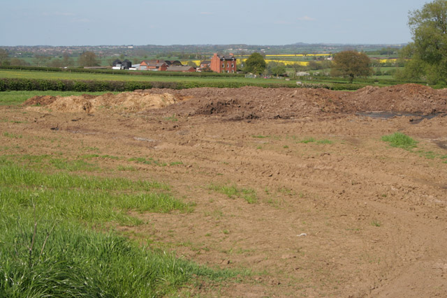
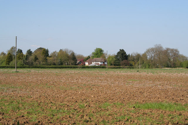
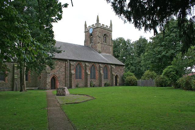
The village boasts a rich history, with evidence of occupation dating back to the Roman times. Today, Countesthorpe is known for its picturesque countryside and charming village atmosphere. The village center features a mix of modern and traditional buildings, including a variety of local shops, cafes, and pubs.

Countesthorpe is well-served by a range of amenities, including a primary school, a community center, and a library. The village also has excellent transport links, with regular bus services connecting it to Leicester and surrounding towns. Additionally, the nearby Blaby bypass provides easy access to major road networks, making it convenient for commuting.

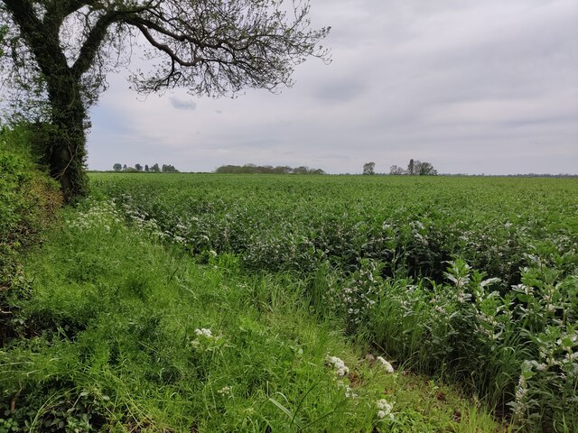
Nature enthusiasts will appreciate the beautiful countryside surrounding Countesthorpe, which offers plenty of opportunities for walking, cycling, and exploring. The village is also home to several parks and green spaces, including the popular Foston Road Recreation Ground.

Countesthorpe prides itself on being a close-knit community, with a range of social and sporting groups catering to various interests. The village hosts regular events, such as fairs and festivals, fostering a strong sense of community spirit.

In summary, Countesthorpe is a charming village with a rich history, offering a peaceful and picturesque setting for its residents. With its range of amenities, convenient location, and strong community spirit, it is a sought-after place to live in Leicestershire.

If you have any feedback on the listing, please let us know in the comments section below.

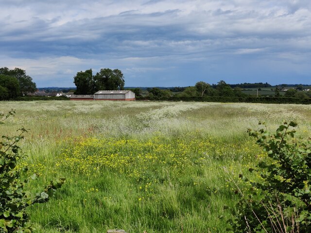
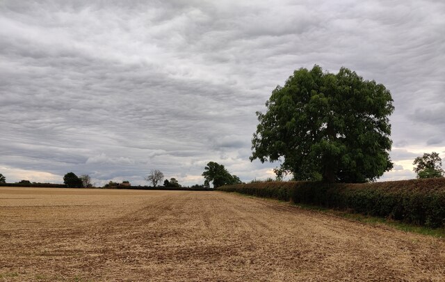
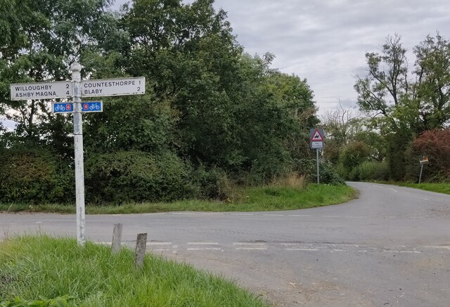
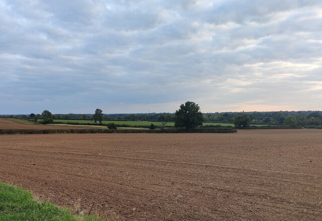
Countesthorpe Images

Images are sourced within 2km of 52.553971/-1.137458 or Grid Reference SP5895. Thanks to Geograph Open Source API. All images are credited.

Track to Whetstone Gorse This entrance is along Willoughby Road
Track to Whetstone Gorse
This entrance is along Willoughby Road
Farmland on the southern edge of Countesthorpe
Farmland along Willoughby Road
Signpost along Willoughby Road At the junction of Bambury Lane.
Signpost along Willoughby Road
At the junction of Bambury Lane.
Farmland near Countesthorpe
Farmland next to Hill Lane, Countesthorpe
The Square, Countesthorpe Countesthorpe is a large suburban village to the south of Leicester. It is seen here on a dull day in light rain with an Arriva bus on route 85 running between Leicester and South Wigston.
The Square, Countesthorpe
Countesthorpe is a large suburban village to the south of Leicester. It is seen here on a dull day in light rain with an Arriva bus on route 85 running between Leicester and South Wigston.
Farmland at Whetstone Gorse
Gate at St Bartholomew's Church, Foston
St Bartholomew's Church at Foston
Farmland at Foston
Farmland at Foston
Farmland off Bambury Lane Westdale Farm in the centre, Countesthorpe in the distance.
Farmland off Bambury Lane
Westdale Farm in the centre, Countesthorpe in the distance.
Farm on Bambury Lane near Countesthorpe A new farmhouse and buildings
Farm on Bambury Lane near Countesthorpe
A new farmhouse and buildings
Farmland off Bambury Lane Bambury Lane runs behind the trees on the right.
Farmland off Bambury Lane
Bambury Lane runs behind the trees on the right.
Hill Lane near Countesthorpe
Farmland off Hill Lane near Countesthorpe Glebe Farm on Willoughby Road in the centre.
Farmland off Hill Lane near Countesthorpe
Glebe Farm on Willoughby Road in the centre.
Foston Lane This road goes from Countesthorpe  (<a href="https://www.geograph.org.uk/gridref/SP5895">SP5895</a>) to the A5199 (<a href="https://www.geograph.org.uk/gridref/SP6195">SP6195</a>).
Foston Lane
This road goes from Countesthorpe (SP5895) to the A5199 (SP6195).
Foston Hall Farm Built on the site of the old hall, the farmhouse is just in the featured square, while the barns and grain dryer are in <a href="https://www.geograph.org.uk/gridref/SP6094">SP6094</a>. The old medieval village of Foston lies in fields to the left. It was gradually destroyed by 17th Century enclosures, which explains the large size of the fields here. See <span class="nowrap"><a title="http://www.foston-church.org.uk/" rel="nofollow ugc noopener" href="http://www.foston-church.org.uk/">Link</a><img style="margin-left:2px;" alt="External link" title="External link - shift click to open in new window" src="https://s1.geograph.org.uk/img/external.png" width="10" height="10"/></span> for more information.
Foston Hall Farm
Built on the site of the old hall, the farmhouse is just in the featured square, while the barns and grain dryer are in SP6094. The old medieval village of Foston lies in fields to the left. It was gradually destroyed by 17th Century enclosures, which explains the large size of the fields here. See LinkExternal link for more information.
Show me another place!

Countesthorpe is located at Grid Ref: SP5895 (Lat: 52.553971, Lng: -1.137458)

Administrative County: Leicestershire

District: Blaby

Police Authority: Leicestershire

What 3 Words

///person.myself.bridge. Near Countesthorpe, Leicestershire

Related Wikis

Countesthorpe

Countesthorpe is a large village and civil parish in the Leicestershire district of Blaby, with a population of 6,393 (2001 census, falling slightly to...

Countesthorpe railway station

Countesthorpe railway station was a railway station serving Countesthorpe in Leicestershire. The station was on the Midland Counties Railway main line...

Countesthorpe Academy

Countesthorpe Academy (formerly Countesthorpe Leysland Community College) is a coeducational secondary school situated on the western edge of Countesthorpe...

Leysland High School

Leysland High School was a coeducational middle school with academy status, located in Countesthorpe, Leicestershire, England. It was open for students...

Nearby Amenities

Located within 500m of 52.553971,-1.137458
Countesthorpe
Is In County: Leicestershire
Is In District: Blaby
Place: village
Source: NPE
Lat/Long: 52.5547871/-1.1441337
Mini Roundabout
Direction: clockwise
Lat/Long: 52.5579084/-1.135562
Pub
Bull's Head
Addr City: Countesthorpe
Addr Country: GB
Addr Housenumber: 13
Addr Postcode: LE8 5QX
Addr Street: Main Street
Fhrs Authority: Blaby
Fhrs Id: 1202158
Fhrs Local Authority Id: 48429
Lat/Long: 52.5529885/-1.138179
Crossing: uncontrolled
Crossing Ref: zebra
Lat/Long: 52.5540275/-1.1404129
Bus Stop
Church Street
Alt Name: Countesthorpe - Alliance and Leicester
Bus: yes
Naptan AltCommonName: Countesthorpe - Alliance and Leicester
Naptan AtcoCode: 260003404
Naptan Bearing: W
Naptan CommonName: Church Street
Naptan Indicator: opposite
Naptan Landmark: Alliance & Leicester
Naptan NaptanCode: leidjgtw
Naptan Notes: Hourly - County
Naptan Street: Church Street
Naptan Verified: no
Public Transport: platform
Source: naptan_import
Lat/Long: 52.5540001/-1.1358906
Bus Stop
Axe and Square
Bus: yes
Naptan AtcoCode: 260003405
Naptan Bearing: N
Naptan CommonName: Axe and Square
Naptan Indicator: outside
Naptan Landmark: 22 The Axe & Square
Naptan NaptanCode: leidjgjt
Naptan Notes: Hourly - County
Naptan Street: Wigston Street
Naptan Verified: no
Public Transport: platform
Source: naptan_import
Lat/Long: 52.5548449/-1.1358445
Bus Stop
Green Lane
Alt Name: Countesthorpe - Main Street
Bus: yes
Naptan AltCommonName: Countesthorpe - Main Street
Naptan AtcoCode: 260003406
Naptan Bearing: NE
Naptan CommonName: Green Lane
Naptan Indicator: adjacent
Naptan Landmark: Green Lane
Naptan NaptanCode: leidjgjp
Naptan Notes: Hourly - County
Naptan Street: The Square
Naptan Verified: no
Public Transport: platform
Source: naptan_import
Lat/Long: 52.5543187/-1.1376691
Bus Stop
Green Lane
Alt Name: Countesthorpe - Green Lane
Bus: yes
Naptan AltCommonName: Countesthorpe - Green Lane
Naptan AtcoCode: 260003407
Naptan Bearing: W
Naptan CommonName: Green Lane
Naptan Indicator: opposite
Naptan Landmark: Green Lane
Naptan NaptanCode: leidjgtp
Naptan Notes: Hourly - County
Naptan Street: Station Road
Naptan Verified: no
Public Transport: platform
Source: naptan_import
Lat/Long: 52.5540893/-1.1382636
Bus Stop
Hallcroft Avenue
Alt Name: Countesthorpe - Chapmans Garden Machines
Bus: yes
Naptan AltCommonName: Countesthorpe - Chapmans Garden Machines
Naptan AtcoCode: 260003408
Naptan Bearing: E
Naptan CommonName: Hallcroft Avenue
Naptan Indicator: outside
Naptan Landmark: 19 Station Road
Naptan NaptanCode: leidjgjm
Naptan Notes: Hourly - County
Naptan Street: Station Road
Naptan Verified: no
Public Transport: platform
Source: naptan_import
Lat/Long: 52.5540938/-1.1413609
Bus Stop
Bassett Avenue
Alt Name: Countesthorpe - Station Road (Library)
Bus: yes
Naptan AltCommonName: Countesthorpe - Station Road (Library)
Naptan AtcoCode: 260003409
Naptan Bearing: W
Naptan CommonName: Bassett Avenue
Naptan Indicator: adjacent
Naptan Landmark: Bassett Avenue
Naptan NaptanCode: leidjgtm
Naptan Notes: Hourly - County
Naptan Street: Station Road
Naptan Verified: no
Public Transport: platform
Source: naptan_import
Lat/Long: 52.5537236/-1.1443239
Bus Stop
Foston Lane
Bus: yes
Naptan AtcoCode: 260003402
Naptan Bearing: S
Naptan CommonName: Foston Lane
Naptan Indicator: adjacent
Naptan Landmark: Foston Lane
Naptan NaptanCode: leidjgjw
Naptan Notes: Hourly - County
Naptan Street: Leicester Road
Naptan Verified: no
Public Transport: platform
Source: naptan_import
Lat/Long: 52.5576119/-1.1355689
Bus Stop
Foston Lane
Bus: yes
Naptan AtcoCode: 260003403
Naptan Bearing: N
Naptan CommonName: Foston Lane
Naptan Indicator: opposite
Naptan Landmark: Foston Lane
Naptan NaptanCode: leidtagj
Naptan Notes: Hourly - County
Naptan Street: Leicester Road
Naptan Verified: no
Public Transport: platform
Source: naptan_import
Lat/Long: 52.5566347/-1.1359421
Leisure: playground
Lat/Long: 52.5546928/-1.1338961
Tesco Express
Addr City: Countesthorpe
Addr Country: GB
Addr Housenumber: 5
Addr Postcode: LE8 5RN
Addr Street: The Square
Brand: Tesco Express
Brand Wikidata: Q98456772
Contact Website: https://www.tesco.com/store-locator/countesthorpe/king-william-iv
Fhrs Id: 1202018
Shop: convenience
Lat/Long: 52.5541379/-1.1368487
Ginns & Gutteridge
Shop: funeral_directors
Lat/Long: 52.5542835/-1.135895
Countesthorpe Local
Addr City: Countesthorpe
Addr Country: GB
Addr Housenumber: 1
Addr Postcode: LE8 5RL
Addr Street: The Bank
Fhrs Authority: Blaby
Fhrs Id: 1201597
Fhrs Local Authority Id: 2100
Shop: convenience
Lat/Long: 52.5544925/-1.1358931
Man Made: manhole
Manhole: drain
Lat/Long: 52.556987/-1.1326617
Artwork Type: statue
Tourism: artwork
Lat/Long: 52.5568443/-1.1320608
Generator Method: photovoltaic
Generator Output Electricity: yes
Generator Source: solar
Generator Type: solar_photovoltaic_panel
Location: roof
Power: generator
Lat/Long: 52.5561399/-1.1438736
Generator Method: photovoltaic
Generator Output Electricity: yes
Generator Source: solar
Generator Type: solar_photovoltaic_panel
Location: roof
Power: generator
Lat/Long: 52.5566112/-1.1376214
Generator Method: photovoltaic
Generator Output Electricity: yes
Generator Source: solar
Generator Type: solar_photovoltaic_panel
Location: roof
Power: generator
Lat/Long: 52.5566341/-1.1373612
Generator Method: photovoltaic
Generator Output Electricity: yes
Generator Source: solar
Generator Type: solar_photovoltaic_panel
Location: roof
Power: generator
Lat/Long: 52.5554681/-1.1322275
Generator Method: photovoltaic
Generator Output Electricity: yes
Generator Source: solar
Generator Type: solar_photovoltaic_panel
Location: roof
Power: generator
Lat/Long: 52.5537101/-1.1358994
Generator Method: photovoltaic
Generator Output Electricity: yes
Generator Source: solar
Generator Type: solar_photovoltaic_panel
Location: roof
Power: generator
Lat/Long: 52.5528147/-1.1312673
Generator Method: photovoltaic
Generator Output Electricity: yes
Generator Source: solar
Generator Type: solar_photovoltaic_panel
Location: roof
Power: generator
Lat/Long: 52.5543331/-1.1333004
Generator Method: photovoltaic
Generator Output Electricity: yes
Generator Source: solar
Generator Type: solar_photovoltaic_panel
Location: roof
Power: generator
Lat/Long: 52.5542923/-1.1339709
Generator Method: photovoltaic
Generator Output Electricity: yes
Generator Source: solar
Generator Type: solar_photovoltaic_panel
Location: roof
Power: generator
Lat/Long: 52.5543151/-1.1335659
Generator Method: photovoltaic
Generator Output Electricity: yes
Generator Source: solar
Generator Type: solar_photovoltaic_panel
Location: roof
Power: generator
Lat/Long: 52.5539759/-1.1339092
Generator Method: photovoltaic
Generator Output Electricity: yes
Generator Source: solar
Generator Type: solar_photovoltaic_panel
Location: roof
Power: generator
Lat/Long: 52.553653/-1.1399362
Generator Method: photovoltaic
Generator Output Electricity: yes
Generator Source: solar
Generator Type: solar_photovoltaic_panel
Location: roof
Power: generator
Lat/Long: 52.5520433/-1.1408079
Generator Method: photovoltaic
Generator Output Electricity: yes
Generator Source: solar
Generator Type: solar_photovoltaic_panel
Location: roof
Power: generator
Lat/Long: 52.5520433/-1.1404619
Generator Method: photovoltaic
Generator Output Electricity: yes
Generator Source: solar
Generator Type: solar_photovoltaic_panel
Location: roof
Power: generator
Lat/Long: 52.5517449/-1.1405852
Generator Method: photovoltaic
Generator Output Electricity: yes
Generator Source: solar
Generator Type: solar_photovoltaic_panel
Location: roof
Power: generator
Lat/Long: 52.5530806/-1.1362374
Generator Method: photovoltaic
Generator Output Electricity: yes
Generator Source: solar
Generator Type: solar_photovoltaic_panel
Location: roof
Power: generator
Lat/Long: 52.5532649/-1.13359
Generator Method: photovoltaic
Generator Output Electricity: yes
Generator Source: solar
Generator Type: solar_photovoltaic_panel
Location: roof
Power: generator
Lat/Long: 52.5532143/-1.1339307
Generator Method: photovoltaic
Generator Output Electricity: yes
Generator Source: solar
Generator Type: solar_photovoltaic_panel
Location: roof
Power: generator
Lat/Long: 52.5531849/-1.1341158
Generator Method: photovoltaic
Generator Output Electricity: yes
Generator Source: solar
Generator Type: solar_photovoltaic_panel
Location: roof
Power: generator
Lat/Long: 52.5531801/-1.1341935
Generator Method: photovoltaic
Generator Output Electricity: yes
Generator Source: solar
Generator Type: solar_photovoltaic_panel
Location: roof
Power: generator
Lat/Long: 52.5531116/-1.134561
Generator Method: photovoltaic
Generator Output Electricity: yes
Generator Source: solar
Generator Type: solar_photovoltaic_panel
Location: roof
Power: generator
Lat/Long: 52.5530202/-1.1331046
Generator Method: photovoltaic
Generator Output Electricity: yes
Generator Source: solar
Generator Type: solar_photovoltaic_panel
Location: roof
Power: generator
Lat/Long: 52.5529648/-1.1338556
Generator Method: photovoltaic
Generator Output Electricity: yes
Generator Source: solar
Generator Type: solar_photovoltaic_panel
Location: roof
Power: generator
Lat/Long: 52.5528898/-1.1341909
Generator Method: photovoltaic
Generator Output Electricity: yes
Generator Source: solar
Generator Type: solar_photovoltaic_panel
Location: roof
Power: generator
Lat/Long: 52.5528702/-1.1344564
Generator Method: photovoltaic
Generator Output Electricity: yes
Generator Source: solar
Generator Type: solar_photovoltaic_panel
Location: roof
Power: generator
Lat/Long: 52.5526386/-1.1340889
Generator Method: photovoltaic
Generator Output Electricity: yes
Generator Source: solar
Generator Type: solar_photovoltaic_panel
Location: roof
Power: generator
Lat/Long: 52.5525995/-1.1338422
Generator Method: photovoltaic
Generator Output Electricity: yes
Generator Source: solar
Generator Type: solar_photovoltaic_panel
Location: roof
Power: generator
Lat/Long: 52.5514546/-1.1333111
Generator Method: photovoltaic
Generator Output Electricity: yes
Generator Source: solar
Generator Type: solar_photovoltaic_panel
Location: roof
Power: generator
Lat/Long: 52.5511871/-1.134392
Generator Method: photovoltaic
Generator Output Electricity: yes
Generator Source: solar
Generator Type: solar_photovoltaic_panel
Location: roof
Power: generator
Lat/Long: 52.5521181/-1.1325774
Generator Method: photovoltaic
Generator Output Electricity: yes
Generator Source: solar
Generator Type: solar_photovoltaic_panel
Location: roof
Power: generator
Lat/Long: 52.5526571/-1.1337817
Generator Method: photovoltaic
Generator Output Electricity: yes
Generator Source: solar
Generator Type: solar_photovoltaic_panel
Location: roof
Power: generator
Lat/Long: 52.5535533/-1.1324473
Generator Method: photovoltaic
Generator Output Electricity: yes
Generator Source: solar
Generator Type: solar_photovoltaic_panel
Location: roof
Power: generator
Lat/Long: 52.5533461/-1.1327531
Generator Method: photovoltaic
Generator Output Electricity: yes
Generator Source: solar
Generator Type: solar_photovoltaic_panel
Location: roof
Power: generator
Lat/Long: 52.5533527/-1.1326861
Generator Method: photovoltaic
Generator Output Electricity: yes
Generator Source: solar
Generator Type: solar_photovoltaic_panel
Location: roof
Power: generator
Lat/Long: 52.556369/-1.1382168
Generator Method: photovoltaic
Generator Output Electricity: yes
Generator Source: solar
Generator Type: solar_photovoltaic_panel
Location: roof
Power: generator
Lat/Long: 52.5575969/-1.1395914
Generator Method: photovoltaic
Generator Output Electricity: yes
Generator Source: solar
Generator Type: solar_photovoltaic_panel
Location: roof
Power: generator
Lat/Long: 52.5578733/-1.1409741
Generator Method: photovoltaic
Generator Output Electricity: yes
Generator Source: solar
Generator Type: solar_photovoltaic_panel
Location: roof
Power: generator
Lat/Long: 52.5569343/-1.142165
Generator Method: photovoltaic
Generator Output Electricity: yes
Generator Source: solar
Generator Type: solar_photovoltaic_panel
Location: roof
Power: generator
Lat/Long: 52.5558923/-1.142224
Generator Method: photovoltaic
Generator Output Electricity: yes
Generator Source: solar
Generator Type: solar_photovoltaic_panel
Location: roof
Power: generator
Lat/Long: 52.5538192/-1.1411578
Generator Method: photovoltaic
Generator Output Electricity: yes
Generator Source: solar
Generator Type: solar_photovoltaic_panel
Location: roof
Power: generator
Lat/Long: 52.5538144/-1.1411873
Generator Method: photovoltaic
Generator Output Electricity: yes
Generator Source: solar
Generator Type: solar_photovoltaic_panel
Location: roof
Power: generator
Lat/Long: 52.5562927/-1.1319417
Generator Method: photovoltaic
Generator Output Electricity: yes
Generator Source: solar
Generator Type: solar_photovoltaic_panel
Location: roof
Power: generator
Lat/Long: 52.557307/-1.1405033
Generator Method: photovoltaic
Generator Output Electricity: yes
Generator Source: solar
Generator Type: solar_photovoltaic_panel
Location: roof
Power: generator
Lat/Long: 52.5571732/-1.1408359
Defibrillator
Emergency: defibrillator
Lat/Long: 52.5551273/-1.135859
Countesthorpe Kitchens Bedrooms & Bathrooms
Shop: kitchen
Lat/Long: 52.5546723/-1.1356553
Restaurant
Dine India
Addr City: Countesthorpe
Addr Country: GB
Addr Housenumber: 62
Addr Postcode: LE8 5QX
Addr Street: Main Street
Fhrs Authority: Blaby
Fhrs Id: 1201607
Fhrs Local Authority Id: 2147
Lat/Long: 52.5527707/-1.1372137
Community Centre
109th Leicester District Scout Group HQ
Lat/Long: 52.5527544/-1.1374658
Bar
Countesthorpe and District Conservative Club
Lat/Long: 52.5529354/-1.1376777
Leyton Beauty Therapy
Shop: beauty
Lat/Long: 52.5533741/-1.1379218
Cafe
St Andrews Church Centre And The Rainbow Shop
Addr City: Countesthorpe
Addr Country: GB
Addr Housenumber: 1
Addr Postcode: LE8 5QX
Addr Street: Main Street
Fhrs Authority: Blaby
Fhrs Id: 1201610
Fhrs Local Authority Id: 2150
Lat/Long: 52.5534133/-1.1380184
Kindergarten
Blackberry Bush Nursery
Addr City: Countesthorpe
Addr Country: GB
Addr Postcode: LE8 5QW
Addr Street: Leicester Road
Fhrs Authority: Blaby
Fhrs Id: 1202222
Fhrs Local Authority Id: 828
Lat/Long: 52.5577103/-1.135312
Fast Food
Countesthorpe Fish Bar
Addr City: Countesthorpe
Addr Country: GB
Addr Housenumber: 1-2
Addr Postcode: LE8 5RN
Addr Street: The Square
Fhrs Authority: Blaby
Fhrs Id: 1201612
Fhrs Local Authority Id: 2166
Lat/Long: 52.5540689/-1.1371708
Doctors
The Health Centre
Healthcare: doctor
Lat/Long: 52.5549381/-1.1371722
Pharmacy
Countesthorpe Chemist
Addr City: Countesthorpe
Addr Country: GB
Addr Housenumber: 16
Addr Postcode: LE8 5QJ
Addr Street: Central Street
Fhrs Authority: Blaby
Fhrs Id: 1201603
Fhrs Local Authority Id: 2109
Healthcare: pharmacy
Lat/Long: 52.5545206/-1.1368704
Countesthorpe and District Funeral Diectors
Shop: funeral_directors
Lat/Long: 52.5546413/-1.1363554
Pub
The Axe and Square
Lat/Long: 52.5546918/-1.1359504
Fast Food
Pizza Point
Addr City: Countesthorpe
Addr Country: GB
Addr Housenumber: 2
Addr Postcode: LE8 5RL
Addr Street: The Bank
Fhrs Authority: Blaby
Fhrs Id: 1201949
Fhrs Local Authority Id: 39631
Lat/Long: 52.5544293/-1.1358887
Amaryllis Hair
Shop: hairdresser
Lat/Long: 52.554382/-1.1358914
M Garratt Bakers
Addr City: Countesthorpe
Addr Country: GB
Addr Housenumber: 4
Addr Postcode: LE8 5RL
Addr Street: The Bank
Fhrs Authority: Blaby
Fhrs Id: 1201598
Fhrs Local Authority Id: 2103
Shop: bakery
Lat/Long: 52.5543282/-1.1358914
Fast Food
Wings Takeaway
Addr City: Countesthorpe
Addr Country: GB
Addr Housenumber: 6
Addr Postcode: LE8 5RL
Addr Street: The Bank
Fhrs Authority: Blaby
Fhrs Id: 1201599
Fhrs Local Authority Id: 2105
Lat/Long: 52.5542385/-1.135886
Place Of Worship
Countesthorpe Baptist Church
Religion: christian
Lat/Long: 52.553821/-1.1365512
Church Street Butchers
Addr City: Countesthorpe
Addr Country: GB
Addr Housenumber: 2
Addr Postcode: LE8 5QH
Addr Street: Church Street
Fhrs Authority: Blaby
Fhrs Id: 1202083
Fhrs Local Authority Id: 47468
Shop: butcher
Lat/Long: 52.5539987/-1.1364117
Crossing
Lat/Long: 52.5563232/-1.1436081
Defibrillator
Defibrillator Location: outside Co-op, Main Street, Countesthorpe - to right of entrance
Emergency: defibrillator
Indoor: no
Lat/Long: 52.553384/-1.1376504
Entrance: yes
Lat/Long: 52.5534015/-1.1376413
Man Made: flagpole
Lat/Long: 52.5539759/-1.1392777
Bench
Lat/Long: 52.5538103/-1.1391476
Telephone
Booth: K6
Covered: booth
Listed Status: Grade II
Operator: BT
Phone: +44 116 278 5089
Lat/Long: 52.5537296/-1.1375182
Post Box
Post Box Type: pillar
Royal Cypher: GVIR
Royal Cypher Wikidata: Q33102169
Lat/Long: 52.5537524/-1.1375074
The data included in this document is from www.openstreetmap.org. The data is made available under ODbL.

Have you been to Countesthorpe?

Leave your review of Countesthorpe below (or comments, questions and feedback).