Coleford

Civil Parish in Somerset Mendip

England

Coleford

Humped zebra Not a cross of some African animals but a speed-reducing measure along Anchor Road in Highbury.
Humped zebra Credit: Neil Owen

Coleford is a civil parish located in the county of Somerset, England. It is situated approximately 10 miles southwest of the city of Bath and 7 miles north of the town of Frome. The parish covers an area of about 3.5 square miles and has a population of around 1,200 people.

The landscape of Coleford is predominantly rural, with rolling hills and picturesque countryside. The River Frome passes through the parish, providing scenic views and recreational opportunities. The area is known for its agricultural heritage, with farming playing a key role in the local economy.

In terms of amenities, Coleford offers a range of facilities to its residents. There is a primary school, a village hall, and a local pub that serves as a social hub for the community. The parish also has a number of small businesses, including shops and services that cater to the needs of the local population.

Coleford is surrounded by several other villages and hamlets, creating a close-knit rural community. It benefits from its proximity to larger towns and cities, providing residents with access to a wider range of amenities and employment opportunities.

The parish is known for its natural beauty and is popular with outdoor enthusiasts. There are several walking and cycling routes that traverse the area, allowing visitors to explore the scenic landscapes and enjoy the tranquility of the countryside.

Overall, Coleford is a peaceful and picturesque civil parish in Somerset, offering a rural lifestyle with close proximity to larger towns and cities.

If you have any feedback on the listing, please let us know in the comments section below.
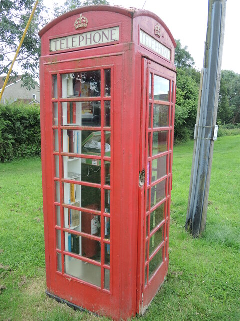
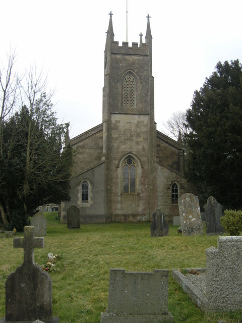
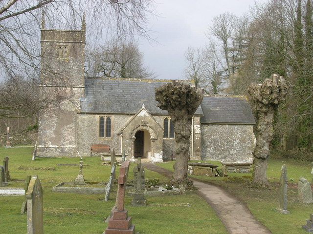
Coleford Images

Images are sourced within 2km of 51.247001/-2.449903 or Grid Reference ST6849. Thanks to Geograph Open Source API. All images are credited.

Humped zebra Not a cross of some African animals but a speed-reducing measure along Anchor Road in Highbury.
Humped zebra
Not a cross of some African animals but a speed-reducing measure along Anchor Road in Highbury.
The Crossways garage is crushed No more petrol at this station. Having been declared redundant it has been demolished to make room for a new store and a house.
The Crossways garage is crushed
No more petrol at this station. Having been declared redundant it has been demolished to make room for a new store and a house.
A village that remembers Coleford's village signpost also provides room for a silhouette of a soldier. See <a href="https://www.geograph.org.uk/photo/7059790">ST6849 : Welcome to Coleford</a> for a better look at the hanpainted sign. The bench seat beyond marks the  Queen's Diamond Jubilee, 2012.
A village that remembers
Coleford's village signpost also provides room for a silhouette of a soldier. See ST6849 : Welcome to Coleford for a better look at the hanpainted sign. The bench seat beyond marks the Queen's Diamond Jubilee, 2012.
Welcome to Coleford A hand-painted village sign; pity the elements have taken the shine off it as it looks rather fetching. See <a href="https://www.geograph.org.uk/photo/7059781">ST6849 : A village that remembers</a> for a wider view of the roadside position.
Welcome to Coleford
A hand-painted village sign; pity the elements have taken the shine off it as it looks rather fetching. See ST6849 : A village that remembers for a wider view of the roadside position.
A post box remains The village post office was here up until quite recently, but the premises are now a piano shop. However, the postbox and a notice board remain on site.
A post box remains
The village post office was here up until quite recently, but the premises are now a piano shop. However, the postbox and a notice board remain on site.
Coleford Royal British Legion hall The hall was built in 1956, with later extensions. See <a href="https://www.geograph.org.uk/photo/7059810">ST6849 : The Legion scroll</a> for a look at the front sign and legend.
Coleford Royal British Legion hall
The hall was built in 1956, with later extensions. See ST6849 : The Legion scroll for a look at the front sign and legend.
The Legion scroll Coleford Royal British Legion hall has this stone plaque on the front that records the fallen of both world wars. It seems such an obvious place to have a war memorial, yet not many do. See <a href="https://www.geograph.org.uk/photo/7059804">ST6849 : Coleford Royal British Legion hall</a> for a location view.
The Legion scroll
Coleford Royal British Legion hall has this stone plaque on the front that records the fallen of both world wars. It seems such an obvious place to have a war memorial, yet not many do. See ST6849 : Coleford Royal British Legion hall for a location view.
Coleford Gospel Hall The village had held some meetings in various places before a worshipper, Harry Beer, drove a horse and cart to Devizes to purchase an old army hut. The corrugated hut became the first hall for the community by 1920. Later meetings were also held under canvas as the needs outgrew. Today this spacious modern hall welcomes all.
Coleford Gospel Hall
The village had held some meetings in various places before a worshipper, Harry Beer, drove a horse and cart to Devizes to purchase an old army hut. The corrugated hut became the first hall for the community by 1920. Later meetings were also held under canvas as the needs outgrew. Today this spacious modern hall welcomes all.
Coleford and Highbury signpost At the junction of Anchor Road and Church Street. Coleford is nowhere near the sea but presumably Anchor Road is named after the Anchor Inn further up the way.
Coleford and Highbury signpost
At the junction of Anchor Road and Church Street. Coleford is nowhere near the sea but presumably Anchor Road is named after the Anchor Inn further up the way.
Coleford pharmacy At the top of Church Street. Prior to this it was the village fish and chip shop.
Coleford pharmacy
At the top of Church Street. Prior to this it was the village fish and chip shop.
Coleford's K6 This telephone box is now a library and second-hand outlet.
Coleford's K6
This telephone box is now a library and second-hand outlet.
The old Miners Arms Naturally, a mining village would have a pub of this name; sadly, it stood almost opposite another, the Eagle, and lost that battle for customers. Today it has been redeveloped as a small group of apartments with original features and even includes a bar area.
The old Miners Arms
Naturally, a mining village would have a pub of this name; sadly, it stood almost opposite another, the Eagle, and lost that battle for customers. Today it has been redeveloped as a small group of apartments with original features and even includes a bar area.
The Eagle Inn, Coleford This pub has had to bear the brunt of the Covid problem and hence was closed for quite some time as staff were unavailable. It remains in a parlous financial state and there are worries it too will be lost - as was the Miners Arms opposite.

The building is nineteenth century with some unusual additions.
The Eagle Inn, Coleford
This pub has had to bear the brunt of the Covid problem and hence was closed for quite some time as staff were unavailable. It remains in a parlous financial state and there are worries it too will be lost - as was the Miners Arms opposite. The building is nineteenth century with some unusual additions.
The Eagle Inn on Highbury Street One of the last pubs still standing in the village. As mining was the dominant form of employment in the past there were a number of them, but times and tastes have changed.
The Eagle Inn on Highbury Street
One of the last pubs still standing in the village. As mining was the dominant form of employment in the past there were a number of them, but times and tastes have changed.
Coleford recreation ground A small paddock for the more sturdy equipment opened for the Millennium.
Coleford recreation ground
A small paddock for the more sturdy equipment opened for the Millennium.
Breaking the nets The hard court at the back of the Eagle Inn is one of the sports facilities that are part of the recreation ground. Although quiet today it seems to be well used.
Breaking the nets
The hard court at the back of the Eagle Inn is one of the sports facilities that are part of the recreation ground. Although quiet today it seems to be well used.
Left after the match The football pitch in Coleford has kept someone's top. Note the different treatment of parts of the pitch.
Left after the match
The football pitch in Coleford has kept someone's top. Note the different treatment of parts of the pitch.
The changing rooms Coleford's football facilities.
The changing rooms
Coleford's football facilities.
Show me another place!

Coleford is located at Grid Ref: ST6849 (Lat: 51.247001, Lng: -2.449903)

Administrative County: Somerset

District: Mendip

Police Authority: Avon and Somerset

What 3 Words

///blues.torso.mountain. Near Chilcompton, Somerset

Related Wikis

Coleford, Somerset

Coleford is a village and civil parish in Somerset, England, situated on the Mells River in the Mendip Hills five miles west of Frome. The parish has a...

Holcombe, Somerset

Holcombe is a small village and civil parish (population 936) in the Mendip local government district of Somerset, England. The parish contains the hamlets...

Newbury Manor School

Newbury Manor School, formerly Farleigh College, is a mainly residential special school for pupils with Asperger syndrome, situated at Newbury, near Mells...

Church of St Andrew, Holcombe

The Church of St. Andrew close to Downside Abbey in Holcombe, Somerset, England has late Saxon-early Norman origins and was rebuilt in the 16th century...

Babington House

Babington House is a Grade II* listed manor house, located in the village of Babington, between Radstock and Frome, in the county of Somerset, England...

Babington, Somerset

Babington is a small village between Radstock and Frome, Somerset, England, which has now largely disappeared. == History == In 1233 or 1234 much of the...

Leigh-on-Mendip

Leigh-on-Mendip or Leigh upon Mendip (on Ordnance Survey maps) is a small village on the Mendip Hills in Somerset, England. It lies roughly equidistant...

Edford Woods and Meadows

Edford Woods and Meadows (grid reference ST665485) is a 54.3 hectare (134.1 acre) biological Site of Special Scientific Interest, between Nettlebridge...

Nearby Amenities

Located within 500m of 51.247001,-2.449903
Highbury
Place: village
Postal Code: BA3 5
Source Ref: NPE
Lat/Long: 51.2432212/-2.4501703
Post Office
Source: OS OpenData StreetView
Lat/Long: 51.243883/-2.451736
Barrier: stile
Foot: yes
Lat/Long: 51.2472225/-2.4440356
Crossing
Crossing: uncontrolled
Crossing Ref: zebra
Source: bing
Lat/Long: 51.2438668/-2.4522894
Crossing
Crossing: uncontrolled
Crossing Ref: zebra
Lat/Long: 51.2448818/-2.4544835
Fast Food
Crossway Fish Bar
Cuisine: fish_and_chips
Lat/Long: 51.2431915/-2.4504288
Power: pole
Lat/Long: 51.2470567/-2.4551654
Power: pole
Lat/Long: 51.2479348/-2.455278
Power: pole
Lat/Long: 51.2488448/-2.45538
Power: pole
Lat/Long: 51.2498102/-2.4554873
Power: pole
Lat/Long: 51.2495113/-2.4550366
Power: pole
Lat/Long: 51.2495936/-2.4533066
Power: pole
Lat/Long: 51.2496658/-2.4516249
Power: pole
Lat/Long: 51.249748/-2.4501658
Power: pole
Lat/Long: 51.2497867/-2.4490982
Power: pole
Lat/Long: 51.2494055/-2.4474567
Power: pole
Lat/Long: 51.2489925/-2.445834
Power: pole
Lat/Long: 51.2485946/-2.4441871
Turning Circle
Lat/Long: 51.2458689/-2.455459
Bus Stop
Highbury Cottages
Bus: yes
Naptan AtcoCode: 3600SOB21880
Naptan Bearing: SE
Naptan CommonName: Highbury Cottages
Naptan Indicator: SE-bound
Naptan NaptanCode: sotdjgwa
Naptan Street: Highbury Street
Naptan Verified: no
Public Transport: platform
Lat/Long: 51.2428317/-2.4485588
Bus Stop
Highbury Cottage
Bus: yes
Naptan AtcoCode: 3600SOB21879
Naptan Bearing: NW
Naptan CommonName: Highbury Cottage
Naptan Indicator: NW-bound
Naptan NaptanCode: sotdjgtw
Naptan Street: Highbury Street
Naptan Verified: no
Public Transport: platform
Lat/Long: 51.2427898/-2.4486011
Bus Stop
Farley Dell
Bus: yes
Naptan AtcoCode: 3600SOB21882
Naptan Bearing: SE
Naptan CommonName: Farley Dell
Naptan Indicator: SE-bound
Naptan NaptanCode: sotdjgta
Naptan Street: Anchor Road
Naptan Verified: no
Public Transport: platform
Lat/Long: 51.2456639/-2.4552889
Bus Stop
Farley Dell
Bus: yes
Naptan AtcoCode: 3600SOB21883
Naptan Bearing: N
Naptan CommonName: Farley Dell
Naptan Indicator: N-bound
Naptan NaptanCode: sotdjgpt
Naptan Street: Anchor Road
Naptan Verified: no
Public Transport: platform
Lat/Long: 51.2456481/-2.455357
The data included in this document is from www.openstreetmap.org. The data is made available under ODbL.

Have you been to Coleford?

Leave your review of Coleford below (or comments, questions and feedback).