Coleby

Civil Parish in Lincolnshire North Kesteven

England

Coleby

Ivy House, Coleby Early nineteenth century house <span class="nowrap"><a title="https://historicengland.org.uk/listing/the-list/list-entry/1164872?section=official-list-entry" rel="nofollow ugc noopener" href="https://historicengland.org.uk/listing/the-list/list-entry/1164872?section=official-list-entry">Link</a><img style="margin-left:2px;" alt="External link" title="External link - shift click to open in new window" src="https://s1.geograph.org.uk/img/external.png" width="10" height="10"/></span>
Ivy House, Coleby Credit: Jonathan Thacker

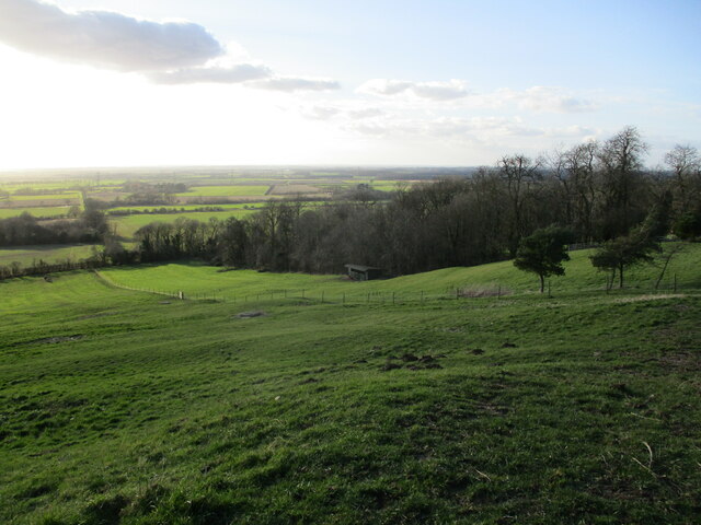
Coleby is a civil parish located in the North Kesteven district of Lincolnshire, England. Situated approximately 6 miles south of the city of Lincoln, the village of Coleby is nestled in a picturesque rural setting.

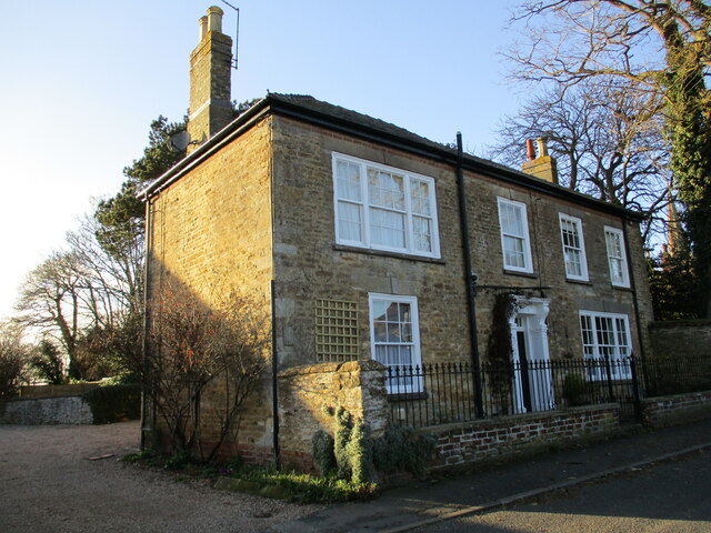
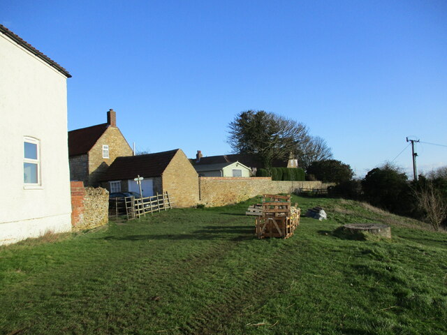
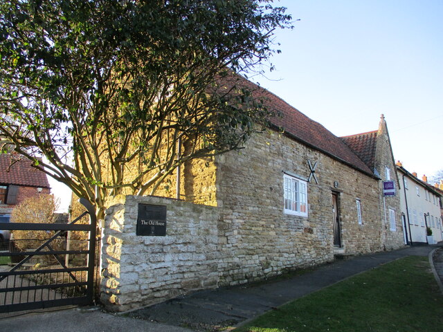
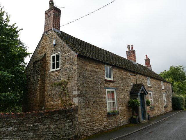
Coleby is a small village with a population of around 400 residents, according to the latest available data. The village is known for its tranquility and charm, with its attractive cottages, historic buildings, and well-maintained gardens. The parish is surrounded by open fields and farmland, making it an idyllic location for those seeking a peaceful countryside lifestyle.

The village boasts a number of amenities for its residents, including a primary school, a village hall, a church, and a pub. The primary school, Coleby Church of England Primary School, provides education for children aged 4 to 11. The village hall serves as a community hub, hosting various events and activities throughout the year.

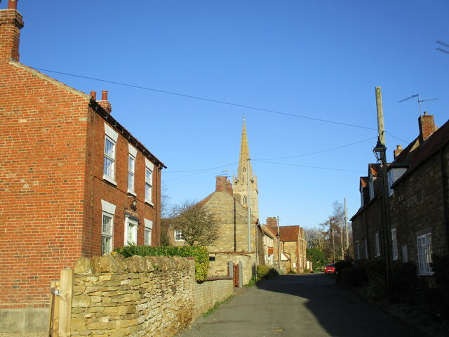
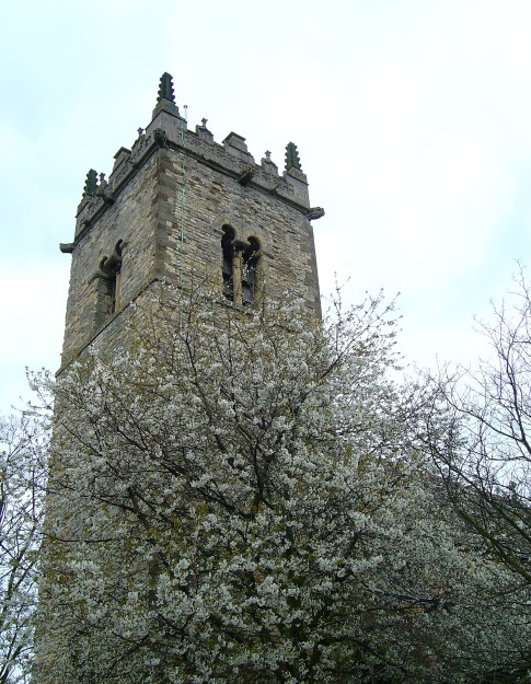
One of the notable landmarks in Coleby is St. Michael and All Angels Church, a Grade I listed building. This medieval church dates back to the 13th century and features intricate architectural details, including stained glass windows and a beautiful spire.

Coleby is well-connected to surrounding areas by road, with the A607 passing through the village. The nearby city of Lincoln offers a wider range of amenities, including shopping centers, restaurants, and cultural attractions.

Overall, Coleby is a charming and close-knit community, offering a peaceful countryside lifestyle with the convenience of nearby urban facilities.

If you have any feedback on the listing, please let us know in the comments section below.
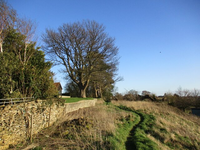
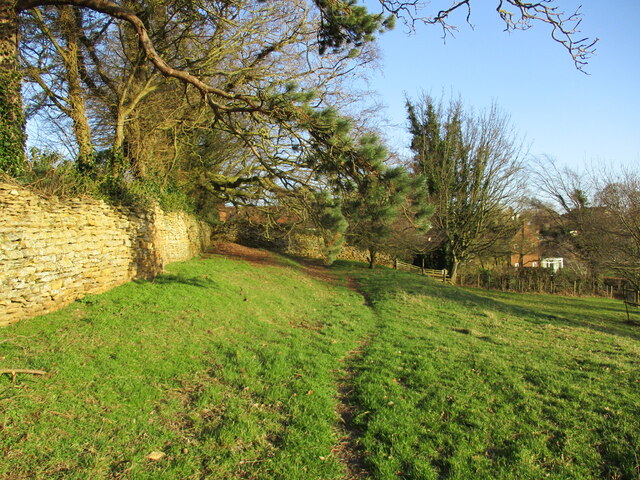
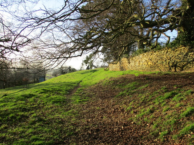
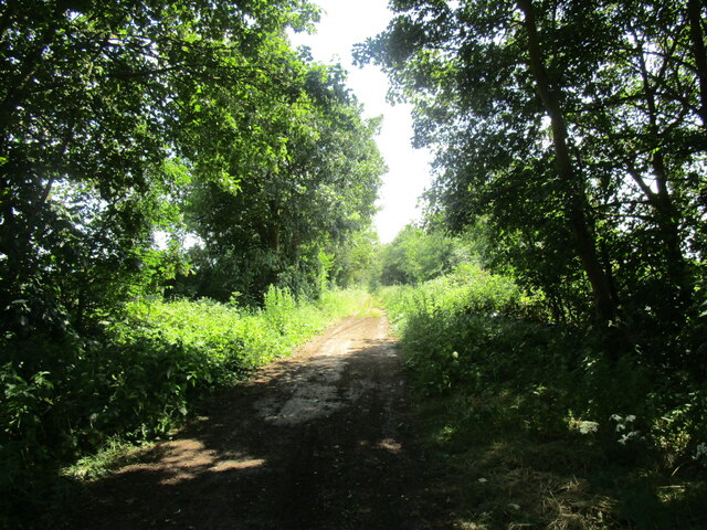
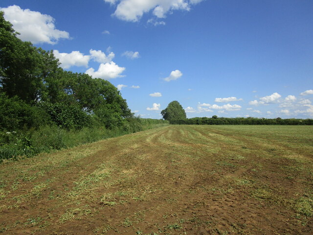
Coleby Images

Images are sourced within 2km of 53.133505/-0.544759 or Grid Reference SK9760. Thanks to Geograph Open Source API. All images are credited.

Ivy House, Coleby Early nineteenth century house <span class="nowrap"><a title="https://historicengland.org.uk/listing/the-list/list-entry/1164872?section=official-list-entry" rel="nofollow ugc noopener" href="https://historicengland.org.uk/listing/the-list/list-entry/1164872?section=official-list-entry">Link</a><img style="margin-left:2px;" alt="External link" title="External link - shift click to open in new window" src="https://s1.geograph.org.uk/img/external.png" width="10" height="10"/></span>
Ivy House, Coleby
Early nineteenth century house LinkExternal link
The Manor House, Coleby Early nineteenth century house <span class="nowrap"><a title="https://historicengland.org.uk/listing/the-list/list-entry/1317557?section=official-list-entry" rel="nofollow ugc noopener" href="https://historicengland.org.uk/listing/the-list/list-entry/1317557?section=official-list-entry">Link</a><img style="margin-left:2px;" alt="External link" title="External link - shift click to open in new window" src="https://s1.geograph.org.uk/img/external.png" width="10" height="10"/></span>
The Manor House, Coleby
Early nineteenth century house LinkExternal link
Field of oilseed rape near Coleby The line of bushes and trees marks the course of the former Railway from Lincoln to Honington Junction.
Field of oilseed rape near Coleby
The line of bushes and trees marks the course of the former Railway from Lincoln to Honington Junction.
Roadside drain. Coleby Low Fields
Autumn sown crop, Coleby Low Fields
Entrance to the Cemetery, Coleby Commemorates the Diamond Jubilee of Queen Victoria,
Entrance to the Cemetery, Coleby
Commemorates the Diamond Jubilee of Queen Victoria,
Scarp at Coleby Looking into the Witham Vallay.
Scarp at Coleby
Looking into the Witham Vallay.
Footpath at Coleby The crates contain block of finished stone. It is not obvious why they are here.
Footpath at Coleby
The crates contain block of finished stone. It is not obvious why they are here.
Church Lane, Coleby
Church Lane, Coleby
Footpath at Coleby Runs along the top of the scarp.
Footpath at Coleby
Runs along the top of the scarp.
This is my field! As it turned out, a rather timid ram,
This is my field!
As it turned out, a rather timid ram,
Footpath at Coleby Runs along the top of the scarp.
Footpath at Coleby
Runs along the top of the scarp.
Footpath at Coleby Runs along the top of the scarp.
Footpath at Coleby
Runs along the top of the scarp.
The Old House, Coleby Cottage dating from the seventeenth and eighteenth centuries <span class="nowrap"><a title="https://historicengland.org.uk/listing/the-list/list-entry/1061981?section=official-list-entry" rel="nofollow ugc noopener" href="https://historicengland.org.uk/listing/the-list/list-entry/1061981?section=official-list-entry">Link</a><img style="margin-left:2px;" alt="External link" title="External link - shift click to open in new window" src="https://s1.geograph.org.uk/img/external.png" width="10" height="10"/></span>
The Old House, Coleby
Cottage dating from the seventeenth and eighteenth centuries LinkExternal link
All Saints' church, Coleby The lower parts of the tower are pre-Conquest <span class="nowrap"><a title="https://historicengland.org.uk/listing/the-list/list-entry/1164829?section=official-list-entry" rel="nofollow ugc noopener" href="https://historicengland.org.uk/listing/the-list/list-entry/1164829?section=official-list-entry">Link</a><img style="margin-left:2px;" alt="External link" title="External link - shift click to open in new window" src="https://s1.geograph.org.uk/img/external.png" width="10" height="10"/></span>
All Saints' church, Coleby
The lower parts of the tower are pre-Conquest LinkExternal link
High Dyke The Roman Ermine Street.
High Dyke
The Roman Ermine Street.
Recently harvested field This field has produced a crop of peas.
Recently harvested field
This field has produced a crop of peas.
School House, Harmston Dates from the early nineteenth century <span class="nowrap"><a title="https://historicengland.org.uk/listing/the-list/list-entry/1061988?section=official-list-entry" rel="nofollow ugc noopener" href="https://historicengland.org.uk/listing/the-list/list-entry/1061988?section=official-list-entry">Link</a><img style="margin-left:2px;" alt="External link" title="External link - shift click to open in new window" src="https://s1.geograph.org.uk/img/external.png" width="10" height="10"/></span>
School House, Harmston
Dates from the early nineteenth century LinkExternal link
Show me another place!

Coleby is located at Grid Ref: SK9760 (Lat: 53.133505, Lng: -0.544759)

Administrative County: Lincolnshire

District: North Kesteven

Police Authority: Lincolnshire

What 3 Words

///pacifist.producers.sunroof. Near Navenby, Lincolnshire

Nearby Locations

Coleby Coleby

Related Wikis

Coleby, North Kesteven

Coleby is a village and civil parish in the North Kesteven district of Lincolnshire, England. It is situated on the A607, and approximately 6 miles (10...

Boothby Graffoe

Boothby Graffoe is a village and civil parish in the North Kesteven district of Lincolnshire, England. The population of the civil parish at the 2011 census...

Harmston

Harmston is a village and civil parish in the North Kesteven district of Lincolnshire, England. It is situated just west off the A607, and 5 miles (8 km...

North Kesteven Rural District

North Kesteven was a rural district in Kesteven, Lincolnshire from 1931 to 1974. It was created in 1931 under a County Review Order, and was formed from...

Nearby Amenities

Located within 500m of 53.133505,-0.544759
Coleby
Is In: Lincolnshire, England, UK
Place: village
Source: GPS waypoint
Lat/Long: 53.1328743/-0.5426358
Disused Amenity: pub
Old Name: The Bell
Lat/Long: 53.1337368/-0.544939
Pub
The Tempest
Food: yes
Phone: +44 11522 810287
Source Name: Pub sign
Lat/Long: 53.1317859/-0.5431966
Barrier: cycle_barrier
Bicycle: no
Foot: yes
Horse: no
Material: wood
Motor Vehicle: no
Lat/Long: 53.1322383/-0.5396291
Bus Stop
Primary School
Naptan AtcoCode: 270000014437
Naptan Bearing: SW
Naptan CommonName: Primary School
Naptan Indicator: adj
Naptan Landmark: Primary School
Naptan NaptanCode: linjpmwm
Naptan Street: Rectory Road
Naptan Verified: no
Source: naptan_import
Lat/Long: 53.1337103/-0.5424268
Bus Stop
Primary School
Naptan AtcoCode: 270000014438
Naptan Bearing: NE
Naptan CommonName: Primary School
Naptan Indicator: opp
Naptan Landmark: Primary School
Naptan NaptanCode: linjpmwp
Naptan Street: Rectory Road
Naptan Verified: no
Source: naptan_import
Lat/Long: 53.133765/-0.5424847
Bus Stop
Methodist Church
Naptan AtcoCode: 270000014440
Naptan Bearing: S
Naptan CommonName: Methodist Church
Naptan Indicator: adj
Naptan Landmark: Methodist Church
Naptan NaptanCode: linjpmwt
Naptan Street: Dovecote Lane
Naptan Verified: no
Source: naptan_import
Lat/Long: 53.1314929/-0.5419488
Bus Stop
Methodist Church
Naptan AtcoCode: 270000014441
Naptan Bearing: N
Naptan CommonName: Methodist Church
Naptan Indicator: opp
Naptan Landmark: Methodist Church
Naptan NaptanCode: linjptad
Naptan Street: Dovecote Lane
Naptan Verified: no
Source: naptan_import
Lat/Long: 53.1314678/-0.5420991
Bus Stop
Rectory Road
Naptan AtcoCode: 2700LCFL1782
Naptan Bearing: SE
Naptan CommonName: Rectory Road
Naptan Indicator: opp
Naptan Landmark: Rectory Road
Naptan NaptanCode: linampjd
Naptan Street: Grantham Road
Naptan Verified: no
Public Transport: platform
Source: naptan_import
Lat/Long: 53.1354775/-0.5384503
Bus Stop
Rectory Road
Naptan AtcoCode: 2700LCFLE545
Naptan Bearing: NW
Naptan CommonName: Rectory Road
Naptan Indicator: adj
Naptan Landmark: Rectory Road
Naptan NaptanCode: linadwam
Naptan Street: Grantham Road
Naptan Verified: no
Source: naptan_import
Lat/Long: 53.1354623/-0.5386751
Addr City: Lincoln
Addr Country: GB
Addr Postcode: LN5 0AH
Addr Suburb: Coleby
Source: knowledge
Lat/Long: 53.1340928/-0.5436859
Coleby
Information: board
Tourism: information
Lat/Long: 53.1341465/-0.5416649
Post Box
Post Box Type: pillar
Royal Cypher: EIIR
Lat/Long: 53.1341712/-0.5416058
Hilltop Farm
Place: farm
Source: Bing
Lat/Long: 53.1338517/-0.5461409
Ivy House Farm
Place: farm
Source: Bing
Lat/Long: 53.1324911/-0.5442724
West Hall
Place: isolated_dwelling
Source: Bing
Lat/Long: 53.1355499/-0.5469652
Barrier: cycle_barrier
Bicycle: no
Foot: yes
Horse: no
Material: wood
Motor Vehicle: no
Lat/Long: 53.1331444/-0.5404523
Barrier: cycle_barrier
Bicycle: no
Foot: yes
Horse: no
Material: wood
Motor Vehicle: no
Lat/Long: 53.133254/-0.5415207
Generator Method: photovoltaic
Generator Output Electricity: yes
Generator Source: solar
Generator Type: solar_photovoltaic_panel
Location: roof
Power: generator
Lat/Long: 53.132251/-0.5425787
Generator Method: photovoltaic
Generator Output Electricity: yes
Generator Source: solar
Generator Type: solar_photovoltaic_panel
Location: roof
Power: generator
Lat/Long: 53.133663/-0.5459784
Generator Method: photovoltaic
Generator Output Electricity: yes
Generator Source: solar
Generator Type: solar_photovoltaic_panel
Location: roof
Power: generator
Lat/Long: 53.1336896/-0.5458872
Generator Method: photovoltaic
Generator Output Electricity: yes
Generator Source: solar
Generator Type: solar_photovoltaic_panel
Location: roof
Power: generator
Lat/Long: 53.1340195/-0.5433726
Defibrillator
Access: yes
Defibrillator Location: outside Coleby Village Hall
Emergency: defibrillator
Indoor: no
Lat/Long: 53.1353874/-0.540503
Leisure: playground
Lat/Long: 53.1354757/-0.5404832
Bench
Lat/Long: 53.1342552/-0.5416015
Give Way
Direction: backward
Lat/Long: 53.1315211/-0.5430441
Give Way
Direction: backward
Lat/Long: 53.131758/-0.5421941
Give Way
Direction: backward
Lat/Long: 53.1317932/-0.542272
Give Way
Direction: forward
Lat/Long: 53.13196/-0.5428936
The data included in this document is from www.openstreetmap.org. The data is made available under ODbL.

Have you been to Coleby?

Leave your review of Coleby below (or comments, questions and feedback).