Cold Aston
Civil Parish in Gloucestershire Cotswold
England
Cold Aston
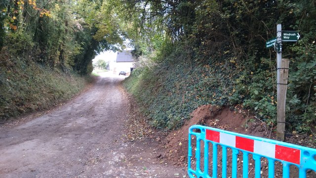
Cold Aston is a small civil parish located in the county of Gloucestershire, England. Situated in the Cotswolds Area of Outstanding Natural Beauty, the village is nestled amidst picturesque rolling hills and lush green fields. It lies approximately 6 miles east of the market town of Northleach and 8 miles north of Cirencester.
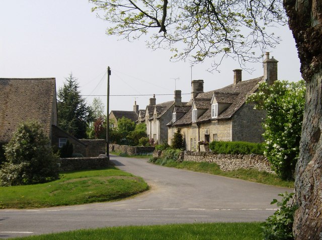
The village itself is characterized by its charming traditional Cotswold stone cottages, many of which date back centuries. It has a population of around 200 residents, making it a close-knit and tight community. The parish is predominantly rural, with a few scattered farms and agricultural land surrounding the village.
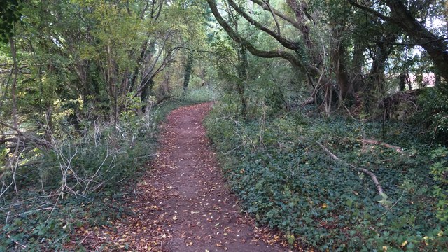
Cold Aston is endowed with natural beauty, offering stunning views of the surrounding countryside. The area is known for its peaceful and tranquil atmosphere, making it a popular destination for nature lovers and those seeking a break from the bustling city life.
Although small in size, the parish boasts a rich history. The Church of St. Andrew, which dates back to the 12th century, is a prominent landmark in the village. It features a beautiful Norman doorway and a medieval font, adding to the historical significance of the area.
While Cold Aston is a quiet and idyllic village, it benefits from its proximity to larger towns such as Cirencester and Cheltenham, offering residents easy access to amenities and services. Overall, Cold Aston provides a quintessential Cotswold experience, showcasing the beauty of rural England.
If you have any feedback on the listing, please let us know in the comments section below.
Cold Aston Images
Images are sourced within 2km of 51.87719/-1.802768 or Grid Reference SP1319. Thanks to Geograph Open Source API. All images are credited.


Cold Aston is located at Grid Ref: SP1319 (Lat: 51.87719, Lng: -1.802768)
Administrative County: Gloucestershire
District: Cotswold
Police Authority: Gloucestershire
What 3 Words
///ramp.whiplash.removed. Near Bourton on the Water, Gloucestershire
Nearby Locations
Related Wikis
Cold Aston
Cold Aston (also known as Aston Blank) is a village and civil parish in Gloucestershire, England, approximately 18 miles (29 km) to the east of Gloucester...
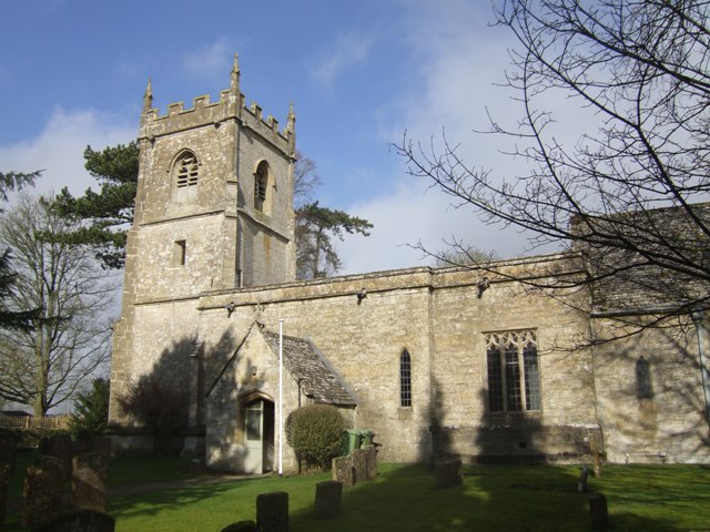
Church of St Andrew, Cold Aston
The Anglican St Andrew's Church at Cold Aston in the Cotswold District of Gloucestershire, England was built in the 12th century. It is a grade I listed...

Harford Railway Cutting
Harford Railway Cutting (SP135218 to SP141215) is a 1.2-hectare (3.0-acre) geological Site of Special Scientific Interest in Gloucestershire, notified...
Brassey SSSI
Brassey (grid reference SP139223) is a 2.1-hectare (5.2-acre) biological Site of Special Scientific Interest in Gloucestershire, notified in 1954 and renotified...
Nearby Amenities
Located within 500m of 51.87719,-1.802768Have you been to Cold Aston?
Leave your review of Cold Aston below (or comments, questions and feedback).