Courthill Coppice

Wood, Forest in Gloucestershire Cotswold

England

Courthill Coppice

The Gloucestershire Way near Cold Aston The Gloucestershire Way follows this belt of trees to the village of Not grove.  I photographed a similar view in December 2005 <a href="https://www.geograph.org.uk/photo/92969">SP1220 : The Gloucestershire Way near Cold Aston</a>.
The Gloucestershire Way near Cold Aston Credit: Philip Halling

Courthill Coppice is a picturesque woodland area located in Gloucestershire, England. Covering an expansive area of approximately 100 acres, this ancient woodland is known for its diverse range of flora and fauna, making it a haven for nature enthusiasts and walkers alike.

The coppice is predominantly made up of native broadleaf trees, including oak, beech, and ash, which create a dense canopy overhead. This provides a shaded and tranquil environment, perfect for those looking to escape the hustle and bustle of everyday life. The forest floor is carpeted with a variety of wildflowers, such as bluebells and primroses, adding bursts of color to the landscape.

The abundance of wildlife in Courthill Coppice is truly remarkable. Visitors may spot deer grazing quietly in the glades, squirrels darting up trees, or hear the distinctive call of various woodland birds, including woodpeckers and nightingales. The coppice is also home to a diverse range of insects, amphibians, and small mammals, creating a rich and thriving ecosystem.

For outdoor enthusiasts, Courthill Coppice offers a network of well-maintained walking trails, providing opportunities to explore the woodland and discover its hidden treasures. These trails range from short and easy strolls suitable for families to longer hikes for more experienced walkers. In addition, there are designated picnic areas and benches scattered throughout the coppice, allowing visitors to relax and soak in the natural beauty of the surroundings.

Overall, Courthill Coppice is a true gem in Gloucestershire, offering a peaceful retreat for nature lovers and a chance to connect with the natural world. Whether it's a leisurely walk or a wildlife-spotting adventure, this woodland provides a memorable experience for all who venture within its leafy embrace.

If you have any feedback on the listing, please let us know in the comments section below.

Courthill Coppice Images

Images are sourced within 2km of 51.874746/-1.8051214 or Grid Reference SP1319. Thanks to Geograph Open Source API. All images are credited.

The Gloucestershire Way near Cold Aston The Gloucestershire Way follows this belt of trees to the village of Not grove.  I photographed a similar view in December 2005 <a href="https://www.geograph.org.uk/photo/92969">SP1220 : The Gloucestershire Way near Cold Aston</a>.
The Gloucestershire Way near Cold Aston
The Gloucestershire Way follows this belt of trees to the village of Not grove. I photographed a similar view in December 2005 SP1220 : The Gloucestershire Way near Cold Aston.
The Gloucestershire Way passing through trees The Gloucestershire Way passing through trees between Cold Aston and Notgrove.  Here is a similar view five years ago <a href="https://www.geograph.org.uk/photo/3808341">SP1220 : Beech trees on the Cotswold Way</a>.
The Gloucestershire Way passing through trees
The Gloucestershire Way passing through trees between Cold Aston and Notgrove. Here is a similar view five years ago SP1220 : Beech trees on the Cotswold Way.
Road heading into Cold Aston Road heading into Cold Aston passing the path to Folly Farm and the Gloucestershire Way
Road heading into Cold Aston
Road heading into Cold Aston passing the path to Folly Farm and the Gloucestershire Way
Road heading to Cold Aston Road heading to Cold Aston passing the bridleway to the A429
Road heading to Cold Aston
Road heading to Cold Aston passing the bridleway to the A429
Road heading to the A436 By Claylodge Coppice the road heading to the A436
Road heading to the A436
By Claylodge Coppice the road heading to the A436
Windrush Way heading for the woods
Hedgerow at the end of the landing strip
Airstrip at Upper Harford
Footpath into Upper Harford
Paths diverge It looks like the tree has gone since <a href="https://www.geograph.org.uk/photo/1856677">SP1221 : Two ways to go</a> was taken
Paths diverge
It looks like the tree has gone since SP1221 : Two ways to go was taken
Footpath to Cold Aston
Coldmoor Coppice
Coldmoor Coppice
The drive to Folly Farm
View from Hill Farm From the minor road near Hill Farm is this lovely view the valley of the River Windrush looking towards Cold Aston.  Windrush Farm and the houses at Upper Harford are just visible.
View from Hill Farm
From the minor road near Hill Farm is this lovely view the valley of the River Windrush looking towards Cold Aston. Windrush Farm and the houses at Upper Harford are just visible.
Drive to Aston Farm
Drive to Aston Farm
Two ways Seen from the minor road is, to the left, the gate taking the Gloucestershire Way into the avenue of trees.  The gate on the right marks the start of a recently created permissive bridleway which avoids the riders having to ride between the trees.
Two ways
Seen from the minor road is, to the left, the gate taking the Gloucestershire Way into the avenue of trees. The gate on the right marks the start of a recently created permissive bridleway which avoids the riders having to ride between the trees.
Old Track This has the appearance of being an ancient track as it leads from here at the top of the hill down to the site of the old mill at Aston Farm on the River Windrush. The poor weather prevented much of a view.
Old Track
This has the appearance of being an ancient track as it leads from here at the top of the hill down to the site of the old mill at Aston Farm on the River Windrush. The poor weather prevented much of a view.
Long Barrow at Camp Farm The large solitary tree in the middle of the rain swept barley field marks the site of an ancient long barrow just east of Camp Farm. The Gloucestershire Way long distance footpath passes through the farm and just the other side of the barrow and tree.
Long Barrow at Camp Farm
The large solitary tree in the middle of the rain swept barley field marks the site of an ancient long barrow just east of Camp Farm. The Gloucestershire Way long distance footpath passes through the farm and just the other side of the barrow and tree.
Show me another place!

Courthill Coppice is located at Grid Ref: SP1319 (Lat: 51.874746, Lng: -1.8051214)

Administrative County: Gloucestershire

District: Cotswold

Police Authority: Gloucestershire

What 3 Words

///prospered.surface.crowns. Near Bourton on the Water, Gloucestershire

Related Wikis

Cold Aston

Cold Aston (also known as Aston Blank) is a village and civil parish in Gloucestershire, England, approximately 18 miles (29 km) to the east of Gloucester...

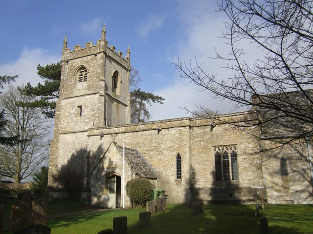
Church of St Andrew, Cold Aston

The Anglican St Andrew's Church at Cold Aston in the Cotswold District of Gloucestershire, England was built in the 12th century. It is a grade I listed...

Harford Railway Cutting

Harford Railway Cutting (SP135218 to SP141215) is a 1.2-hectare (3.0-acre) geological Site of Special Scientific Interest in Gloucestershire, notified...

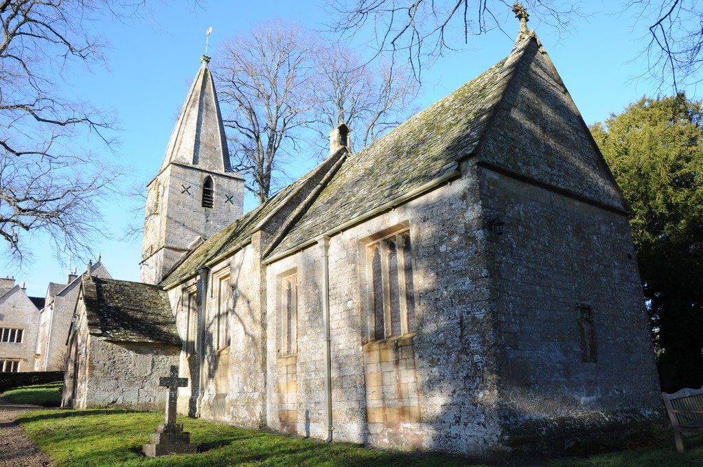
Church of St Bartholomew, Notgrove

The Anglican Church of St Bartholomew at Notgrove in the Cotswold District of Gloucestershire, England was built in the 12th century. It is a grade I listed...

Nearby Amenities

Located within 500m of 51.874746,-1.8051214
The data included in this document is from www.openstreetmap.org. The data is made available under ODbL.

Have you been to Courthill Coppice?

Leave your review of Courthill Coppice below (or comments, questions and feedback).