Cleeve Prior

Civil Parish in Worcestershire Wychavon

England

Cleeve Prior

Footpath on Cleeve Hill
Footpath on Cleeve Hill Credit: Row17

Cleeve Prior is a civil parish located in the county of Worcestershire, England. It is situated about 4 miles northeast of Evesham, a market town in the Vale of Evesham. The parish covers an area of approximately 5 square kilometers and has a population of around 400 people.

The village of Cleeve Prior is nestled in a picturesque setting, surrounded by rolling hills and lush green fields. It is a rural and tranquil community, known for its idyllic countryside and charming character. The village is predominantly residential, with a mix of traditional cottages and more modern houses.

Cleeve Prior boasts several historical landmarks, including the 12th-century St. Andrew's Church, which is a Grade II listed building. The church is known for its Norman architecture and beautiful stained glass windows. Additionally, there are a number of listed buildings scattered throughout the village, adding to its historical appeal.

The village has a strong sense of community, with various local organizations and events that bring residents together. These include a village hall, which hosts a range of activities and functions, as well as an annual summer fete that attracts visitors from nearby areas.

Cleeve Prior benefits from its proximity to Evesham, which provides a range of amenities, including shops, schools, and healthcare facilities. The village is also well-connected, with good transport links to nearby towns and cities.

Overall, Cleeve Prior offers a peaceful and picturesque setting, combined with a strong community spirit, making it an attractive place to live for those seeking a rural lifestyle in Worcestershire.

If you have any feedback on the listing, please let us know in the comments section below.
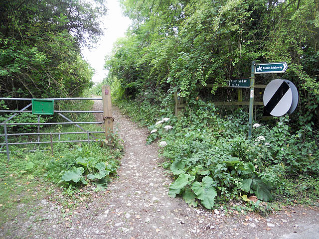
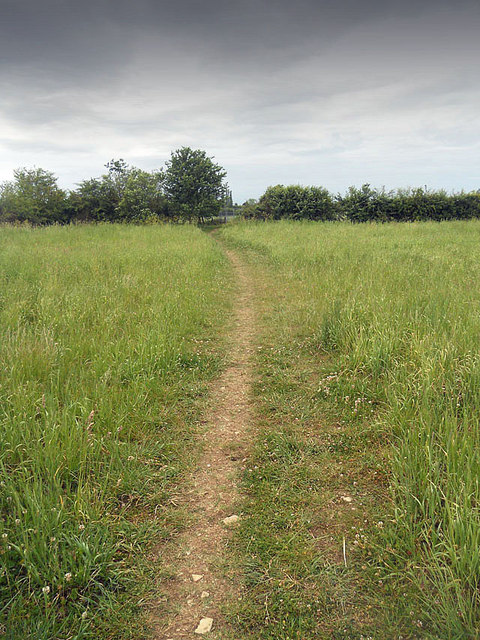
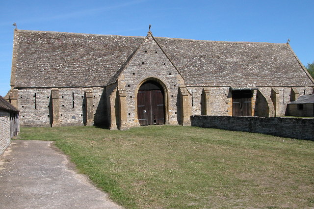
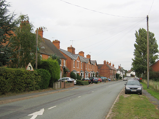
Cleeve Prior Images

Images are sourced within 2km of 52.140281/-1.875151 or Grid Reference SP0849. Thanks to Geograph Open Source API. All images are credited.

Footpath on Cleeve Hill
Footpath on Cleeve Hill ridge
Footpath through the fields
Track passing Island Barn
On the village green
Footpath beside the gallops
Footpath and hedge
Footpath and hedge
Footbridge beside the River Avon
Marlcliff This small village situated at a bend in the River Avon gets its name from the cliff formed by the rivers erosion of the adjacent Marlcliff Hill. In the cliff there is exposed a geological sequence through the Triassic Blue Anchor Formation (formerly the Tea Green Marls) up into the overlying Westbury Formation of the Penarth group. The area was probably known for mining of marl. Marl is clay which has a content of calcium carbonate and was used to improve the fertility of arable land.
Marlcliff
This small village situated at a bend in the River Avon gets its name from the cliff formed by the rivers erosion of the adjacent Marlcliff Hill. In the cliff there is exposed a geological sequence through the Triassic Blue Anchor Formation (formerly the Tea Green Marls) up into the overlying Westbury Formation of the Penarth group. The area was probably known for mining of marl. Marl is clay which has a content of calcium carbonate and was used to improve the fertility of arable land.
Park House Park House is a prominent red brick Victorian detached house standing on its own on the east side of the Cleeve Road just north east of the village of Cleeve Prior.
Park House
Park House is a prominent red brick Victorian detached house standing on its own on the east side of the Cleeve Road just north east of the village of Cleeve Prior.
Cleeve Prior Garage This garage from yesteryear complete with an ancient petrol pump beside it has just been left to decay slowly at the side of a small roadside car park in the centre of the village.
Cleeve Prior Garage
This garage from yesteryear complete with an ancient petrol pump beside it has just been left to decay slowly at the side of a small roadside car park in the centre of the village.
Houses in Cleeve Prior This row of old stone cottages is located in the centre of the village on the very sharp bend in the main road.
Houses in Cleeve Prior
This row of old stone cottages is located in the centre of the village on the very sharp bend in the main road.
Field Barn Field Barn is a farm sitting on top of the Cleeve Hill scarp slope above the river Avon. It is halfway between Cleeve Prior and the Littletons.
Field Barn
Field Barn is a farm sitting on top of the Cleeve Hill scarp slope above the river Avon. It is halfway between Cleeve Prior and the Littletons.
Fields near North Littleton This is the view from Arrow Lane which runs from the village west to the B4085 road to Cleeve Prior. The houses in the village can just be seen in the distance.
Fields near North Littleton
This is the view from Arrow Lane which runs from the village west to the B4085 road to Cleeve Prior. The houses in the village can just be seen in the distance.
The Ivy Inn The village pub is located right in the centre of the village on a sizeable green
The Ivy Inn
The village pub is located right in the centre of the village on a sizeable green
Field headland at Cleeve Prior A field of oats with a footpath following the headland to Cleeve Road to the north of the village of Cleeve Prior.
Field headland at Cleeve Prior
A field of oats with a footpath following the headland to Cleeve Road to the north of the village of Cleeve Prior.
Bridleway to North Littleton Public bridleway from Holden Lane at Cleeve Prior to North Littleton.
Bridleway to North Littleton
Public bridleway from Holden Lane at Cleeve Prior to North Littleton.
Holden Lane, Cleeve Prior Holden Lane is a no through road from the village of Cleeve Prior to Holden Farm.  Field Barn can be seen just above the hedge on the left.
Holden Lane, Cleeve Prior
Holden Lane is a no through road from the village of Cleeve Prior to Holden Farm. Field Barn can be seen just above the hedge on the left.
Show me another place!

Cleeve Prior is located at Grid Ref: SP0849 (Lat: 52.140281, Lng: -1.875151)

Administrative County: Worcestershire

District: Wychavon

Police Authority: West Mercia

What 3 Words

///whisker.fantastic.hobble. Near South Littleton, Worcestershire

Related Wikis

Cleeve Prior

Cleeve Prior is a village in the Vale of Evesham Worcestershire, England. It is situated five miles north-east of Evesham. There are many picturesque houses...

River Arrow, Worcestershire

The River Arrow is a tributary of the River Avon, which flows through Worcestershire and Warwickshire in the English Midlands. == Course == The Arrow rises...

Bickmarsh

Bickmarsh is a village and civil parish in the Wychavon district of Worcestershire, England. According to the 2001 census it had a population of 65....

North and Middle Littleton

North and Middle Littleton is a civil parish located in the Wychavon district of Worcestershire, England. The parish comprises the villages of North Littleton...

Abbot's Salford

Abbot's Salford is the name of a village in the English county of Warwickshire. It is found six miles south of Alcester, about the same distance from Evesham...

Middle Littleton Tythe Barn

Middle Littleton Tythe Barn, also known as Middle Littleton Tithe Barn, is a grade I listed 13th or 14th-century tithe barn in the village of Middle Littleton...

Littleton F.C.

Littleton Football Club is a football club based in North and Middle Littleton, near Evesham, Worcestershire. They are members of the Midland League Division...

Salford Priors

Salford Priors is a rural, agricultural village and civil parish about four miles south-west of Alcester, Warwickshire, England. The population of the...

Nearby Amenities

Located within 500m of 52.140281,-1.875151
Cleeve Prior
Place: village
Source: NPE
Wikidata: Q5131071
Wikipedia: en:Cleeve Prior
Lat/Long: 52.1418103/-1.8727506
Bus Stop
King's Arms
Bus: yes
Naptan AtcoCode: 2000G029100
Naptan Bearing: SW
Naptan CommonName: King's Arms
Naptan Indicator: Adj
Naptan Landmark: King's Arms
Naptan NaptanCode: wocgmdmt
Naptan Street: Cleeve Road
Naptan Verified: no
Public Transport: platform
Source: naptan_import
Lat/Long: 52.1412416/-1.8721548
Bus Stop
The Green
Bus: yes
Naptan AtcoCode: 2000G323157
Naptan Bearing: NW
Naptan CommonName: The Green
Naptan Indicator: Adj
Naptan Landmark: The Green
Naptan NaptanCode: wocdtama
Naptan Street: The Green
Naptan Verified: no
Public Transport: platform
Source: naptan_import
Lat/Long: 52.1421564/-1.8751313
The Green
Naptan AtcoCode: 2000G323158
Naptan Bearing: SE
Naptan BusStopType: CUS
Naptan CommonName: The Green
Naptan Indicator: Opp
Naptan Landmark: The Green
Naptan NaptanCode: wocdtamd
Naptan Street: The Green
Naptan Verified: no
Source: naptan_import
Lat/Long: 52.1421976/-1.8749432
Pub
Kings Arms
Addr City: Evesham
Addr Postcode: WR11 8LQ
Addr Street: Bidford Road
Addr Village: Cleeve Prior
Fhrs Id: 1084003
Source Addr: FHRS Open Data
Lat/Long: 52.1409799/-1.8721324
Barrier: stile
Lat/Long: 52.140881/-1.8736131
Barrier: kissing_gate
Lat/Long: 52.1390287/-1.873816
Barrier: kissing_gate
Lat/Long: 52.1362775/-1.8747094
Barrier: stile
Lat/Long: 52.1398224/-1.8711151
Barrier: stile
Lat/Long: 52.1390735/-1.86818
Booth: K6
Covered: booth
Disused Amenity: telephone
Note: phone has been removed. Booth now owned by Wychavon council
Source: survey
Lat/Long: 52.1419505/-1.8749516
Post Box
Collection Times: Mo-Fr 16:00; Sa 08:00
Operator: Royal Mail
Operator Wikidata: Q638098
Post Box Type: lamp
Ref: WR11 52
Royal Cypher: EIIR
Royal Cypher Wikidata: Q33102113
Source: survey
Lat/Long: 52.1419036/-1.8746353
Barrier: stile
Lat/Long: 52.1404502/-1.8748529
Barrier: stile
Lat/Long: 52.1389557/-1.8779658
Barrier: stile
Lat/Long: 52.141237/-1.8756931
Barrier: stile
Lat/Long: 52.1418115/-1.8753119
Barrier: stile
Lat/Long: 52.1401681/-1.8767338
Bench
Backrest: yes
Source: survey
Lat/Long: 52.141952/-1.8745505
Bench
Backrest: yes
Source: survey
Lat/Long: 52.1419199/-1.8745908
The data included in this document is from www.openstreetmap.org. The data is made available under ODbL.

Have you been to Cleeve Prior?

Leave your review of Cleeve Prior below (or comments, questions and feedback).