Claverdon

Civil Parish in Warwickshire Stratford-on-Avon

England

Claverdon

St Michael & All Angels Church, Claverdon
St Michael & All Angels Church, Claverdon Credit: Ian S

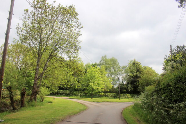
Claverdon is a small civil parish located in the county of Warwickshire, England. Situated approximately 8 miles west of the town of Warwick, it covers an area of about 2.4 square miles. The village is nestled in the beautiful Warwickshire countryside, offering picturesque views and a tranquil atmosphere.

The parish is home to a population of around 1,800 residents, according to the latest census data. The village itself is centered around a historic church, St. Michael and All Angels, which dates back to the 12th century and is a notable architectural landmark in the area.

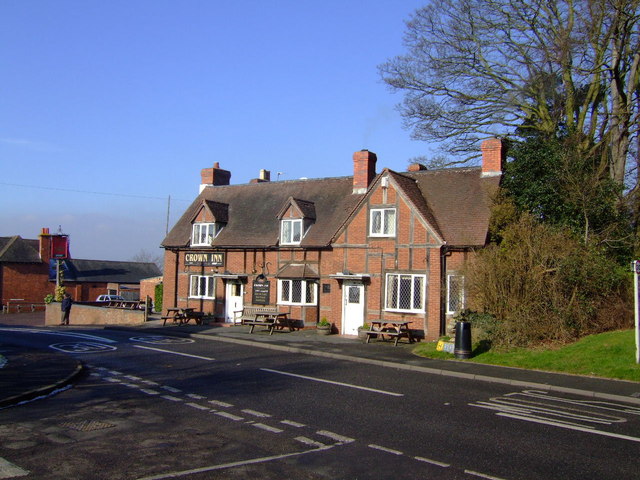
Claverdon has a strong sense of community, with various local amenities and services available to its residents. These include a primary school, a village hall, a post office, a convenience store, and a few pubs and restaurants. The village also has a cricket club and a football club, providing recreational opportunities for both children and adults.

The surrounding countryside offers plenty of opportunities for outdoor activities, such as walking, cycling, and horse riding. The nearby Claverdon Station provides convenient access to larger towns and cities, including Birmingham and Warwick.

Overall, Claverdon is a charming and peaceful village with a close-knit community and a range of amenities. Its picturesque location and proximity to larger urban areas make it an attractive place to live for those seeking a balance between rural and urban lifestyles.

If you have any feedback on the listing, please let us know in the comments section below.
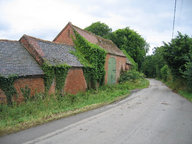
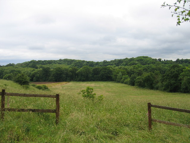
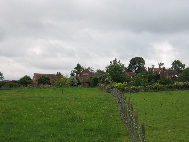
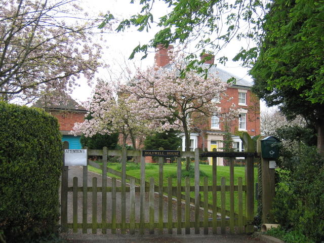
Claverdon Images

Images are sourced within 2km of 52.279695/-1.709931 or Grid Reference SP1964. Thanks to Geograph Open Source API. All images are credited.

St Michael & All Angels Church, Claverdon
Glebe Road, Claverdon
Langley Road, Claverdon
Langley Road towards Kington Lane
Langley near Yew Tree Farm
Langley Road, Langley
House at Langley
House at Langley
Road Junction in Holywell Holywell is a small village well off the beaten track just north of Claverdon.
Road Junction in Holywell
Holywell is a small village well off the beaten track just north of Claverdon.
Holywell A typical Warwickshire timber framed building seen across the village green.
Holywell
A typical Warwickshire timber framed building seen across the village green.
Lye Green Looking across the golf course in front of the Ardencote Hotel with the water tower at Lye Green in the trees
Lye Green
Looking across the golf course in front of the Ardencote Hotel with the water tower at Lye Green in the trees
Barnmoor Green The Henley in Arden road and the junction with the lane to Kington Grange
Barnmoor Green
The Henley in Arden road and the junction with the lane to Kington Grange
Claverdon The Church of St. Michael and All Angels.
Claverdon
The Church of St. Michael and All Angels.
Barns of Kington Grange The actual Grange is hidden away behind high walls and all that can be seen from Kington Lane are these sturdy old farm buildings.
Barns of Kington Grange
The actual Grange is hidden away behind high walls and all that can be seen from Kington Lane are these sturdy old farm buildings.
Tattle Bank Looking westwards across the square to the woods on Tattle Bank from Langley Road near Claverdon.
Tattle Bank
Looking westwards across the square to the woods on Tattle Bank from Langley Road near Claverdon.
Langley Cottages and Yew Tree Farm seen from the public footpath runs across the fields north westerly from the main village
Langley
Cottages and Yew Tree Farm seen from the public footpath runs across the fields north westerly from the main village
Holywell House A lovely display of blossom, seen from the lane as it enters the small village of Holywell.
Holywell House
A lovely display of blossom, seen from the lane as it enters the small village of Holywell.
Crown  Inn, Claverdon Nice traditional local with Brew XI to bring back memories of Cape Hill and a guest beer.
Crown Inn, Claverdon
Nice traditional local with Brew XI to bring back memories of Cape Hill and a guest beer.
Claverdon Hall This manor house is in lovely condition.
Claverdon Hall
This manor house is in lovely condition.
Show me another place!

Claverdon is located at Grid Ref: SP1964 (Lat: 52.279695, Lng: -1.709931)

Administrative County: Warwickshire

District: Stratford-on-Avon

Police Authority: Warwickshire

What 3 Words

///fortnight.create.emeralds. Near Henley in Arden, Warwickshire

Nearby Locations

Claverdon

Related Wikis

Claverdon

Claverdon is a village and civil parish in the Stratford-on-Avon district of Warwickshire, England, about 5 miles (8.0 km) west of the county town of Warwick...
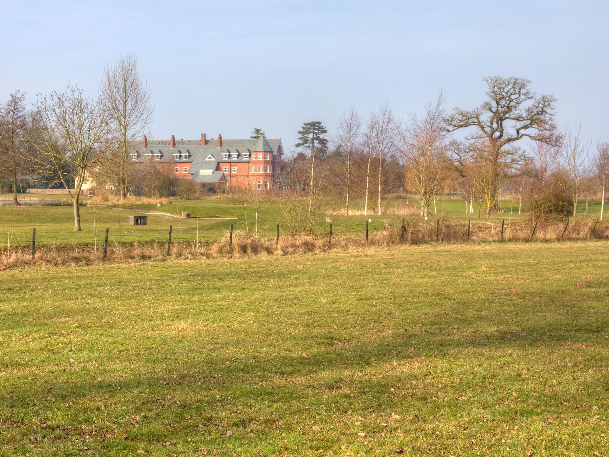
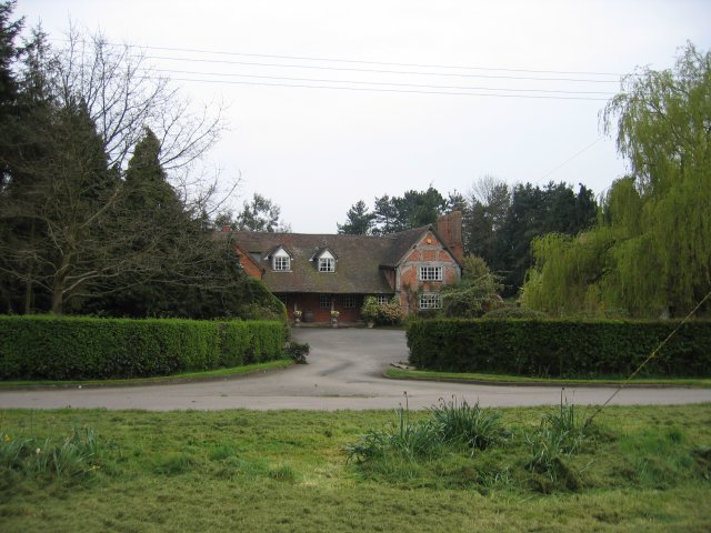
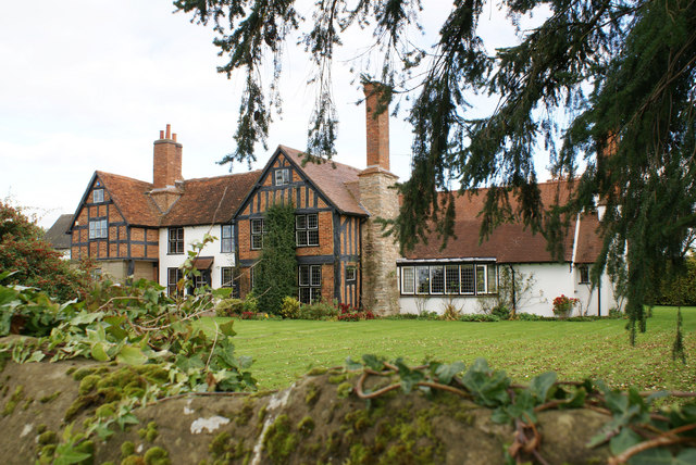
Ardencote Manor

Ardencote Manor is a hotel and former manor house located 0.5 miles (0.8 km) north of the village of Claverdon, Warwickshire, England. The manor was originally...

Claverdon railway station

Claverdon railway station serves the village of Claverdon in Warwickshire, England. It is managed by West Midlands Railway, although most of the services...

Barnmoor Green

Barnmoor Green is a village in Warwickshire, England. For populations details see Claverdon.

Nearby Amenities

Located within 500m of 52.279695,-1.709931
Claverdon
Place: village
Source: NPE
Lat/Long: 52.2806036/-1.7111709
Bus Stop
Church
Bus: yes
Naptan AtcoCode: 4200F015900
Naptan Bearing: SW
Naptan CommonName: Church
Naptan Indicator: Opp
Naptan Landmark: Church
Naptan NaptanCode: waramtjd
Naptan Street: Church Road
Naptan Verified: no
Public Transport: platform
Source: naptan_import
Lat/Long: 52.2787821/-1.7104068
Church
Naptan AtcoCode: 4200F015901
Naptan Bearing: NE
Naptan BusStopType: CUS
Naptan CommonName: Church
Naptan Indicator: Adj
Naptan NaptanCode: wardjamg
Naptan Street: Church Road
Naptan Verified: no
Source: naptan_import
Lat/Long: 52.2788901/-1.7104501
St Michaels Road
Naptan AtcoCode: 4200F084300
Naptan Bearing: NE
Naptan BusStopType: CUS
Naptan CommonName: St Michaels Road
Naptan Indicator: Opp
Naptan NaptanCode: waratmat
Naptan Street: Langley Road
Naptan Verified: no
Source: naptan_import
Lat/Long: 52.2811104/-1.7140123
St Michaels Road
Naptan AtcoCode: 4200F084301
Naptan Bearing: SW
Naptan BusStopType: CUS
Naptan CommonName: St Michaels Road
Naptan Indicator: Jcn
Naptan NaptanCode: wardjamd
Naptan Street: Langley Road
Naptan Verified: no
Source: naptan_import
Lat/Long: 52.2810465/-1.7138998
Barrier: kissing_gate
Lat/Long: 52.2794681/-1.7109096
Barrier: kissing_gate
Lat/Long: 52.2796255/-1.711189
Post Box
Collection Times: Mo-Fr 16:15; Sa 08:30
Operator: Royal Mail
Operator Wikidata: Q638098
Post Box Mounting: brick_pillar
Post Box Type: wall
Ref: CV35 97
Royal Cypher: GVIR
Royal Cypher Wikidata: Q33102169
Source: survey
Lat/Long: 52.2806089/-1.7081156
Public Transport: stop_position
Source: Warwicks Aerial Imagery OGL v2
Lat/Long: 52.2810696/-1.7139286
Give Way
Source: Warwicks CC Aerial Imagery 2013
Lat/Long: 52.2829314/-1.7144539
Give Way
Source: Warwicks CC Aerial Imagery 2013
Lat/Long: 52.2830093/-1.714476
Operator: National Grid Electricity Distribution
Operator Wikidata: Q7988183
Power: pole
Lat/Long: 52.2752051/-1.7100129
Operator: National Grid Electricity Distribution
Operator Wikidata: Q7988183
Power: pole
Lat/Long: 52.2754545/-1.7086342
Material: wood
Operator: National Grid Electricity Distribution
Operator Wikidata: Q7988183
Power: pole
Lat/Long: 52.2756745/-1.707336
Material: wood
Operator: National Grid Electricity Distribution
Operator Wikidata: Q7988183
Power: pole
Lat/Long: 52.2758944/-1.7060217
Post Office
Claverdon Mobile Post Office Service
Addr City: Warwick
Addr Housename: Car Park By The Community Shop
Addr Postcode: CV35 8HF
Addr Street: Station Road
Addr Village: Claverdon
Fixme: verify by survey
Opening Hours: Mo,We 12:15-14:15
Ref Pol Id: 136433
Source: pol_branch_list_2018-02
Lat/Long: 52.2806978/-1.7093571
Stop
Lat/Long: 52.2800799/-1.7088823
Generator Method: photovoltaic
Generator Output Electricity: yes
Generator Source: solar
Generator Type: solar_photovoltaic_panel
Location: roof
Power: generator
Lat/Long: 52.2821335/-1.7158815
Generator Method: photovoltaic
Generator Output Electricity: yes
Generator Source: solar
Generator Type: solar_photovoltaic_panel
Location: roof
Power: generator
Lat/Long: 52.281295/-1.7146745
Generator Method: photovoltaic
Generator Output Electricity: yes
Generator Source: solar
Generator Type: solar_photovoltaic_panel
Location: roof
Power: generator
Lat/Long: 52.2800282/-1.7165387
Generator Method: photovoltaic
Generator Output Electricity: yes
Generator Source: solar
Generator Type: solar_photovoltaic_panel
Location: roof
Power: generator
Lat/Long: 52.2789583/-1.7169437
Generator Method: photovoltaic
Generator Output Electricity: yes
Generator Source: solar
Generator Type: solar_photovoltaic_panel
Location: roof
Power: generator
Lat/Long: 52.2816823/-1.7147577
Generator Method: photovoltaic
Generator Output Electricity: yes
Generator Source: solar
Generator Type: solar_photovoltaic_panel
Power: generator
Lat/Long: 52.2805845/-1.7032322
Operator: National Grid Electricity Distribution
Operator Wikidata: Q7988183
Power: pole
Ref: 931578
Source: wpd_opendata
Transformer: distribution
Lat/Long: 52.2781985/-1.70986
Operator: National Grid Electricity Distribution
Operator Wikidata: Q7988183
Power: pole
Source: bing
Lat/Long: 52.2776963/-1.7096159
Operator: National Grid Electricity Distribution
Operator Wikidata: Q7988183
Power: pole
Source: bing
Lat/Long: 52.2770514/-1.7091948
Operator: National Grid Electricity Distribution
Operator Wikidata: Q7988183
Power: pole
Source: bing
Lat/Long: 52.2763096/-1.7089266
The data included in this document is from www.openstreetmap.org. The data is made available under ODbL.

Have you been to Claverdon?

Leave your review of Claverdon below (or comments, questions and feedback).