Chilcote

Civil Parish in Leicestershire North West Leicestershire

England

Chilcote

Acresford Road, Appleby Magna
Acresford Road, Appleby Magna Credit: David Howard

Chilcote is a civil parish located in the county of Leicestershire, England. Situated in the district of North West Leicestershire, it covers an area of approximately 1.5 square miles. The parish is home to a small population of around 100 residents.

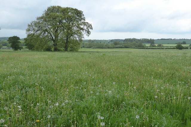
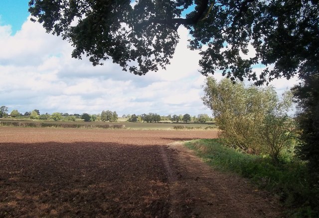
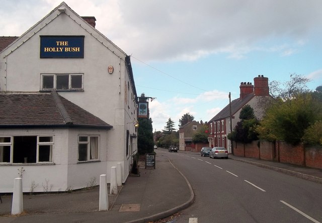
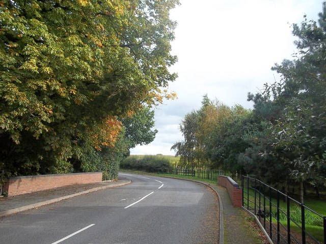
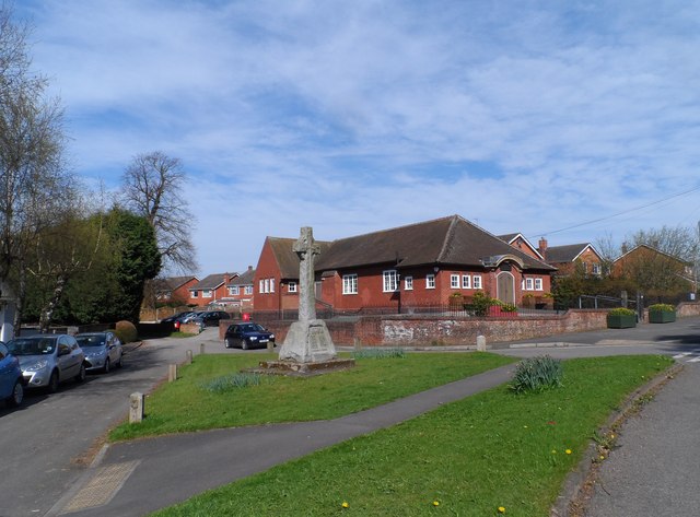
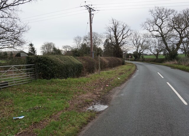
Chilcote is a rural village surrounded by picturesque countryside, offering a tranquil and peaceful atmosphere. It is primarily an agricultural area, with farms and fields dominating the landscape. The parish is characterized by its beautiful old buildings and traditional English countryside charm.

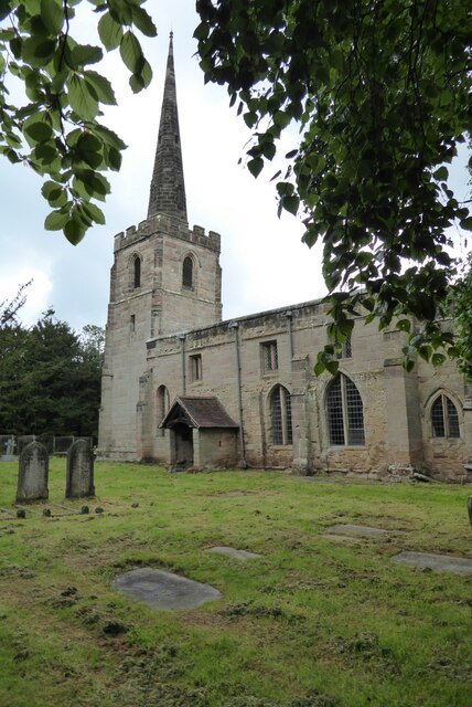
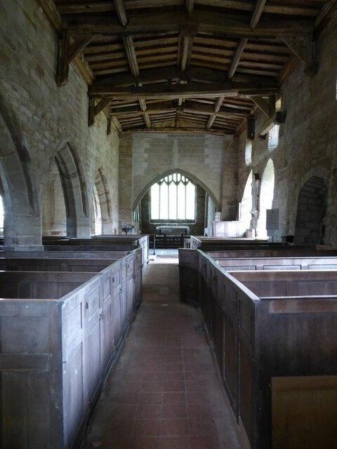
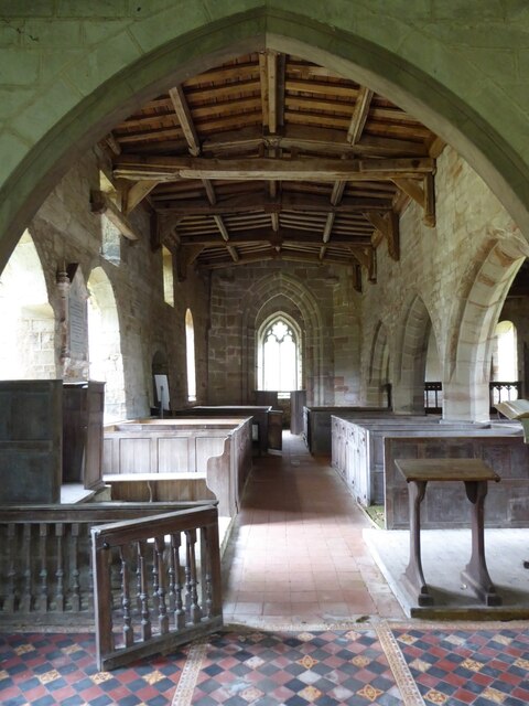
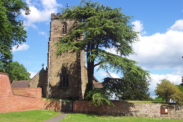
The village itself consists of a small cluster of houses, some of which date back several centuries. There is also a quaint village church, St. Mary's, which serves as a place of worship for the local community. The church is known for its historic architecture and beautiful stained-glass windows.

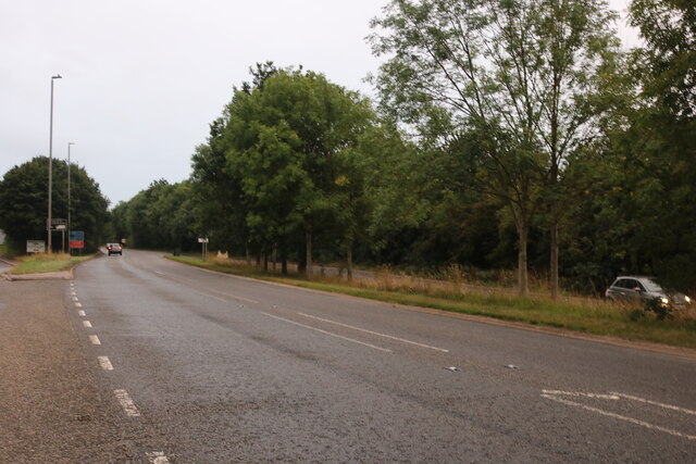
Chilcote is well-connected to neighboring areas via road networks, with the A444 passing nearby. The village is situated approximately 8 miles south of the town of Burton upon Trent in Staffordshire, providing access to a wider range of amenities and services.

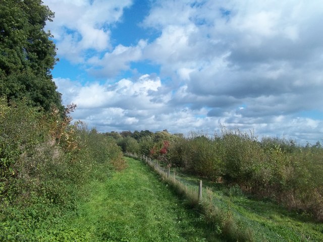
The parish offers a peaceful and idyllic lifestyle, making it an attractive place for those seeking a quiet rural retreat. It is an ideal location for nature lovers and those who enjoy outdoor activities such as walking, cycling, and exploring the countryside.

If you have any feedback on the listing, please let us know in the comments section below.

Chilcote Images

Images are sourced within 2km of 52.696449/-1.577272 or Grid Reference SK2811. Thanks to Geograph Open Source API. All images are credited.

Acresford Road, Appleby Magna
Stretton en le Field church Stretton en le Field church is dedicated to St Michael and is Grade II* listed, see: <span class="nowrap"><a title="https://historicengland.org.uk/listing/the-list/list-entry/1074318?section=official-list-entry" rel="nofollow ugc noopener" href="https://historicengland.org.uk/listing/the-list/list-entry/1074318?section=official-list-entry">Link</a><img style="margin-left:2px;" alt="External link" title="External link - shift click to open in new window" src="https://s1.geograph.org.uk/img/external.png" width="10" height="10"/></span>  The church dates from the 14th and 15th centuries.
Stretton en le Field church
Stretton en le Field church is dedicated to St Michael and is Grade II* listed, see: LinkExternal link The church dates from the 14th and 15th centuries.
Interior of Stretton en le Field church Interior of Stretton en le Field St Michael's church.  The church is Grade II* listed, see: <span class="nowrap"><a title="https://historicengland.org.uk/listing/the-list/list-entry/1074318?section=official-list-entry" rel="nofollow ugc noopener" href="https://historicengland.org.uk/listing/the-list/list-entry/1074318?section=official-list-entry">Link</a><img style="margin-left:2px;" alt="External link" title="External link - shift click to open in new window" src="https://s1.geograph.org.uk/img/external.png" width="10" height="10"/></span>
Interior of Stretton en le Field church
Interior of Stretton en le Field St Michael's church. The church is Grade II* listed, see: LinkExternal link
Interior of Stretton en le Field church Interior of Stretton en le Field St Michael's church.  View from the chancel along the nave.  The church is Grade II* listed, see: <span class="nowrap"><a title="https://historicengland.org.uk/listing/the-list/list-entry/1074318?section=official-list-entry" rel="nofollow ugc noopener" href="https://historicengland.org.uk/listing/the-list/list-entry/1074318?section=official-list-entry">Link</a><img style="margin-left:2px;" alt="External link" title="External link - shift click to open in new window" src="https://s1.geograph.org.uk/img/external.png" width="10" height="10"/></span>
Interior of Stretton en le Field church
Interior of Stretton en le Field St Michael's church. View from the chancel along the nave. The church is Grade II* listed, see: LinkExternal link
Farmland at Stretton en le Field View over farmland to the north of Stretton en le Field church.
Farmland at Stretton en le Field
View over farmland to the north of Stretton en le Field church.
The Most Southerly Point in Derbyshire This stretch of riverbank is the very southern tip of the county. It's at SK26731105 close to Clifton Campville, separated from Staffordshire by the River Mease.
The Most Southerly Point in Derbyshire
This stretch of riverbank is the very southern tip of the county. It's at SK26731105 close to Clifton Campville, separated from Staffordshire by the River Mease.
The River Mease near Seal Fields Farm 3 counties share this grid square. This picture was taken from Derbyshire with Leicestershire on the opposite bank. Further along the far bank we are over into Staffordshire.
The River Mease near Seal Fields Farm
3 counties share this grid square. This picture was taken from Derbyshire with Leicestershire on the opposite bank. Further along the far bank we are over into Staffordshire.
Riverside Bridleway Approaching Netherseal Ploughed field and riverbank pictured here on a pleasant midweek day in early October.
Riverside Bridleway Approaching Netherseal
Ploughed field and riverbank pictured here on a pleasant midweek day in early October.
Nether Wood near Netherseal An area of infant woodland sandwiched between a bridleway and the River Mease.
Nether Wood near Netherseal
An area of infant woodland sandwiched between a bridleway and the River Mease.
Main Street in Netherseal This picture was taken from the southern edge of the grid square near the junction with Dog Lane and shows the village post office on the right of the street as well as the obvious pub.
Main Street in Netherseal
This picture was taken from the southern edge of the grid square near the junction with Dog Lane and shows the village post office on the right of the street as well as the obvious pub.
Church Street in Netherseal Heading east out of the village. Beyond the bend Church Street becomes Acresford Road.
Church Street in Netherseal
Heading east out of the village. Beyond the bend Church Street becomes Acresford Road.
St Peter's, Netherseal Originally C13-C15 but largely rebuilt in 1877 under the direction of Arthur Blomfield (probably best known for designing the Royal College of Music).
St Peter's, Netherseal
Originally C13-C15 but largely rebuilt in 1877 under the direction of Arthur Blomfield (probably best known for designing the Royal College of Music).
War memorial and school, Netherseal
Clifton Road at Clifton Lodge
Clifton Road at Lodge Cottages
St. Peter, Netherseale
Follow me Rigsby disappears under the stile at the entrance to Moneyhill Farm Woodland, a small plantation east of Netherseal
Follow me
Rigsby disappears under the stile at the entrance to Moneyhill Farm Woodland, a small plantation east of Netherseal
All fall down? This lovely old derelict barn, between Netherseal and Clifton Campville, would make a fantastic house. The sign on the door says "Danger. Stay away".
All fall down?
This lovely old derelict barn, between Netherseal and Clifton Campville, would make a fantastic house. The sign on the door says "Danger. Stay away".
Show me another place!

Chilcote is located at Grid Ref: SK2811 (Lat: 52.696449, Lng: -1.577272)

Administrative County: Leicestershire

District: North West Leicestershire

Police Authority: Leicestershire

What 3 Words

///smoker.motive.ruffling. Near Donisthorpe, Leicestershire

Nearby Locations

Chilcote Chilcote

Related Wikis

Chilcote

Chilcote is a village and civil parish in the North West Leicestershire district of Leicestershire, England. Until 1897 it was in Derbyshire. The parish...

River Mease SSSI

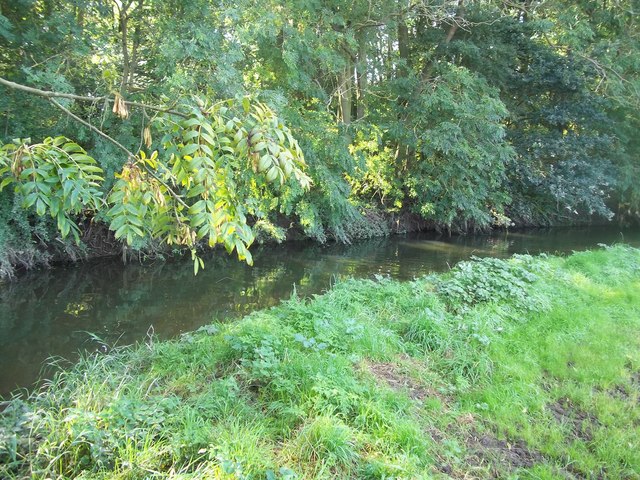
River Mease SSSI is a 23.0 hectares (57 acres) biological Site of Special Scientific Interest. It is a stretch of the River Mease and its tributary Gilwiskaw...

St Peter's Church, Netherseal

St Peter's Church, Netherseal is a Grade II* listed parish church in the Church of England in Netherseal, Derbyshire. == History == The church dates from...

St Michael's Church, Stretton en le Field

St Michael's Church is a redundant Anglican church in the village of Stretton en le Field, Leicestershire, England (grid reference SK303119). It is recorded...

Stretton en le Field

Stretton en le Field is a small village and civil parish in the North West Leicestershire district of Leicestershire, England, about 7 miles/11 km south...

Netherseal

Netherseal (or 'Netherseale') is a village and civil parish in the English county of Derbyshire, situated in the South Derbyshire district. Together with...

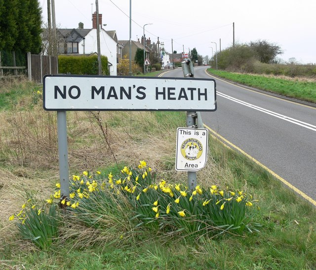
No Man's Heath, Warwickshire

No Man's Heath is an area of the civil parish of Newton Regis, in the North Warwickshire district, in the county of Warwickshire, England, about 6 miles...

Acresford

Acresford is a hamlet in North West Leicestershire, it shares civil parish authorities with Donisthorpe and Oakthorpe and forms part of the border with...

Nearby Amenities

Located within 500m of 52.696449,-1.577272
Chilcote
Place: village
Wikidata: Q5097647
Wikipedia: en:Chilcote
Lat/Long: 52.7007252/-1.5770786
Village
Naptan AtcoCode: 260013800
Naptan Bearing: W
Naptan BusStopType: CUS
Naptan CommonName: Village
Naptan Indicator: adjacent
Naptan Landmark: Rock Farm
Naptan NaptanCode: leijdwdm
Naptan Notes: Non-Hourly - County
Naptan Street: Netherseal Road
Naptan Verified: no
Source: naptan_import
Lat/Long: 52.7003662/-1.5774704
Village
Naptan AtcoCode: 260013801
Naptan Bearing: E
Naptan BusStopType: CUS
Naptan CommonName: Village
Naptan Indicator: opposite
Naptan Landmark: Rock Farm
Naptan NaptanCode: leijdwdp
Naptan Notes: Non-Hourly - County
Naptan Street: Netherseal Road
Naptan Verified: no
Source: naptan_import
Lat/Long: 52.7003672/-1.5777516
Post Box
Operator: Royal Mail
Post Box Type: wall
Ref: DE12 1158
Lat/Long: 52.699922/-1.5801356
Power: pole
Source: Bing
Lat/Long: 52.7002623/-1.5805397
Turning Circle
Lat/Long: 52.699924/-1.5781723
Telephone
Defibrillator
Booth: K6
Covered: booth
Defibrillator Location: inside red phone box outside St Matthew Church, Church Lane, Chilcote
Emergency: defibrillator
Man Made: telephone_box
Old Phone: +44 1827 373210
Ref GB The Circuit: 820426E5-0E2A-451C-8463-1CC868095570
Lat/Long: 52.699638/-1.5808576
Advertising: board
Lat/Long: 52.6998903/-1.5801534
Grit Bin
Lat/Long: 52.6999163/-1.5803613
Information: guidepost
Tourism: information
Lat/Long: 52.6999082/-1.5803975
The data included in this document is from www.openstreetmap.org. The data is made available under ODbL.

Have you been to Chilcote?

Leave your review of Chilcote below (or comments, questions and feedback).