Chickney
Civil Parish in Essex Uttlesford
England
Chickney

Chickney is a small civil parish located in the county of Essex, in the eastern part of England. It is situated approximately 5 miles southeast of the town of Saffron Walden and covers an area of about 2.4 square miles. The parish is predominantly rural, characterized by open fields, farmland, and scattered farmhouses.
The village of Chickney itself is a quaint settlement with a small population of around 100 residents. It is known for its picturesque and tranquil surroundings, offering beautiful views of the surrounding countryside. The village consists of a cluster of traditional cottages and houses, some of which date back several centuries, giving it a charming and historic feel.
The main focal point of the village is the St. Mary's Church, a medieval building that has been well-preserved. It serves as a place of worship for the local community and also attracts visitors interested in its architectural and historical significance.
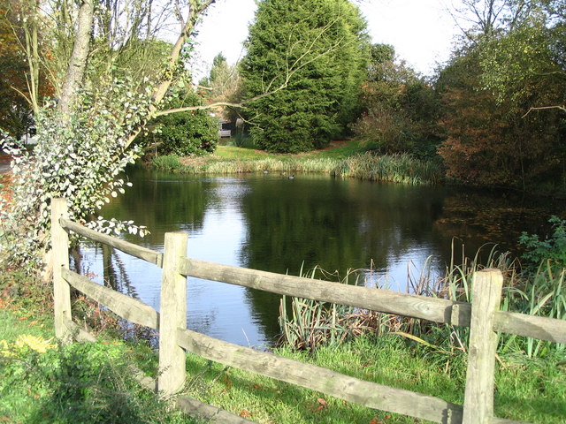
Chickney is surrounded by lush green fields and meadows, making it an ideal location for countryside walks and outdoor activities. The area is rich in wildlife and offers opportunities for birdwatching and nature exploration.
Although there are no shops or amenities within the village itself, the nearby town of Saffron Walden provides residents with access to a wider range of services, including shops, schools, and healthcare facilities.
Overall, Chickney, Essex, offers a peaceful and idyllic rural retreat for those seeking a slower pace of life and a close connection to nature.
If you have any feedback on the listing, please let us know in the comments section below.
Chickney Images
Images are sourced within 2km of 51.934564/0.27919 or Grid Reference TL5628. Thanks to Geograph Open Source API. All images are credited.


Chickney is located at Grid Ref: TL5628 (Lat: 51.934564, Lng: 0.27919)
Administrative County: Essex
District: Uttlesford
Police Authority: Essex
What 3 Words
///summit.invest.grand. Near Elsenham, Essex
Nearby Locations
Related Wikis

Chickney
Chickney is a village and civil parish near Broxted and southwest of Thaxted, in Uttlesford, Essex, England. The parish borders Broxted, Debden, Henham...
St Mary's Church, Chickney
St Mary's Church is a redundant Anglican church in the parish of Chickney, Essex, England. It is recorded in the National Heritage List for England as...
Cherry Green, Essex
Cherry Green or Chaureth Green is a hamlet in the civil parish of Broxted and the Uttlesford district of Essex, England. The hamlet is 1.5 miles (2.4 km...

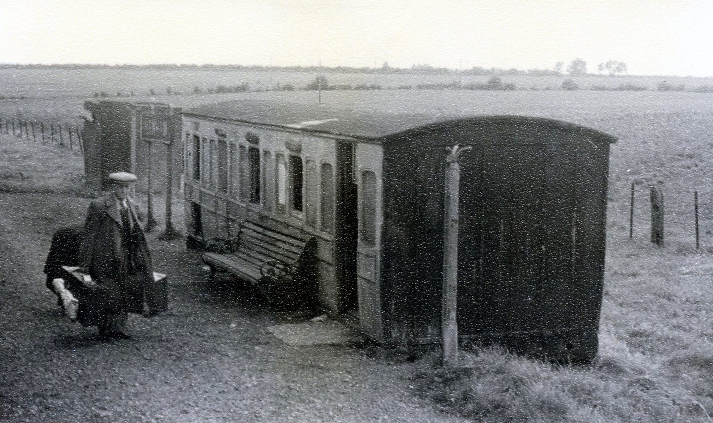
Sibleys railway station
Sibleys railway station was a station in Sibleys Green, in the civil parish of Chickney, Essex. It was located 2 miles 78 chains (4.79 km) from Elsenham...

Elsenham & Thaxted Light Railway
The Elsenham & Thaxted Light Railway was a 5+1⁄2-mile (9 km) long light railway in Essex, England. The line was sanctioned in 1906, although did not finally...
Henham Halt railway station
Henham Halt railway station was a station serving the village of Henham, Essex, England. It was located 1 mile 57 chains (2.76 km) from Elsenham station...

Henham
Henham, or Henham-on-the-Hill is a village and civil parish in the Uttlesford district of Essex, England. The village is situated 2.5 miles (4 km) north...

Broxted
Broxted is a village and civil parish in the Uttlesford district, in the county of Essex, England. It is situated 11 km (6.8 mi) north-east from Bishop...
Nearby Amenities
Located within 500m of 51.934564,0.27919Have you been to Chickney?
Leave your review of Chickney below (or comments, questions and feedback).