Chicklade

Civil Parish in Wiltshire

England

Chicklade

Entering Chicklade on the A303 The A303 is a main trunk road running 92 miles between Basingstoke and Honiton. Along with the A30 and M3 it forms a major route between London and the South West. Much of the road is dual carriageway, but some stretches remain single and prone to congestion.

Wikipedia: <span class="nowrap"><a title="http://en.wikipedia.org/wiki/A303_road" rel="nofollow ugc noopener" href="http://en.wikipedia.org/wiki/A303_road">Link</a><img style="margin-left:2px;" alt="External link" title="External link - shift click to open in new window" src="https://s1.geograph.org.uk/img/external.png" width="10" height="10"/></span>
Entering Chicklade on the A303 Credit: N Chadwick

Chicklade is a small civil parish located in the county of Wiltshire, England. Situated in the beautiful countryside of the Cranborne Chase Area of Outstanding Natural Beauty, Chicklade offers a tranquil and picturesque setting for its residents and visitors alike.

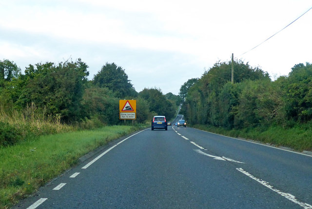
The parish is nestled between the larger towns of Shaftesbury and Salisbury, providing easy access to amenities and services. Despite its small size, Chicklade has a close-knit community and a rich history dating back several centuries.

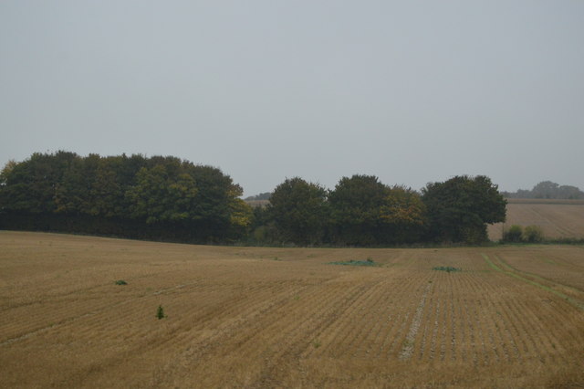
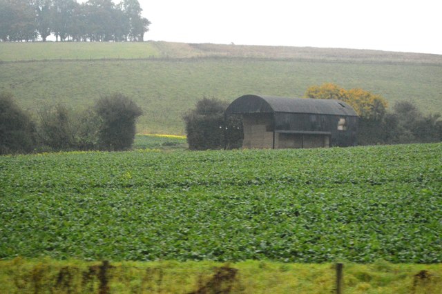
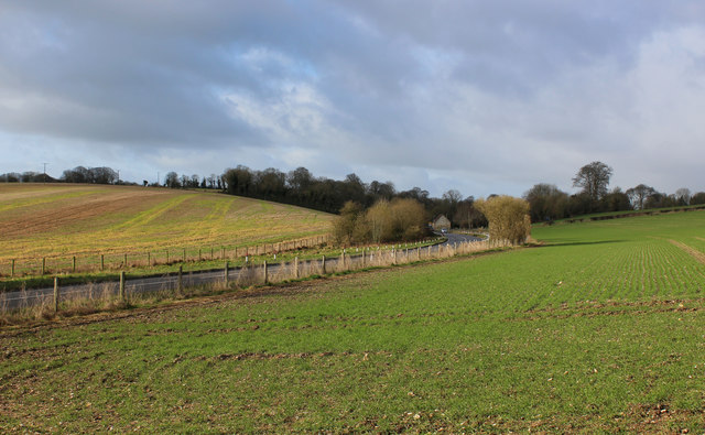
The landscape of Chicklade is predominantly rural, with rolling hills and lush green fields dominating the scenery. The area is known for its farming activities, with agriculture playing a significant role in the local economy.

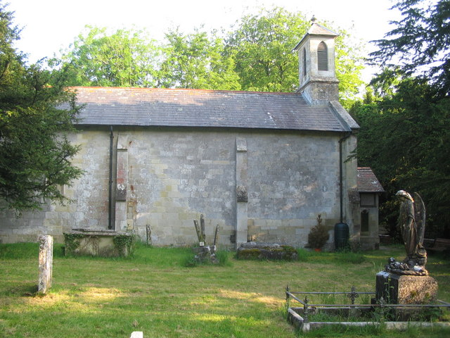
One of the notable landmarks in Chicklade is the St. John the Baptist Church, a charming medieval church that stands as a testament to the area's heritage. The church is a focal point for the community, hosting regular services and events.

Chicklade is also home to a number of traditional cottages and farmhouses, adding to the village's charm and character. The parish offers a peaceful and idyllic environment, making it popular among those seeking a quiet rural retreat.

In summary, Chicklade is a small civil parish in Wiltshire known for its picturesque countryside, close-knit community, and rich history. With its rural charm and proximity to larger towns, it offers residents and visitors a tranquil and welcoming place to call home.

If you have any feedback on the listing, please let us know in the comments section below.

Chicklade Images

Images are sourced within 2km of 51.114135/-2.144759 or Grid Reference ST8934. Thanks to Geograph Open Source API. All images are credited.

Entering Chicklade on the A303 The A303 is a main trunk road running 92 miles between Basingstoke and Honiton. Along with the A30 and M3 it forms a major route between London and the South West. Much of the road is dual carriageway, but some stretches remain single and prone to congestion.

Wikipedia: <span class="nowrap"><a title="http://en.wikipedia.org/wiki/A303_road" rel="nofollow ugc noopener" href="http://en.wikipedia.org/wiki/A303_road">Link</a><img style="margin-left:2px;" alt="External link" title="External link - shift click to open in new window" src="https://s1.geograph.org.uk/img/external.png" width="10" height="10"/></span>
Entering Chicklade on the A303
The A303 is a main trunk road running 92 miles between Basingstoke and Honiton. Along with the A30 and M3 it forms a major route between London and the South West. Much of the road is dual carriageway, but some stretches remain single and prone to congestion. Wikipedia: LinkExternal link
A303, Chicklade The A303 is a main trunk road running 92 miles between Basingstoke and Honiton. Along with the A30 and M3 it forms a major route between London and the South West. Much of the road is dual carriageway, but some stretches remain single and prone to congestion.

Wikipedia: <span class="nowrap"><a title="http://en.wikipedia.org/wiki/A303_road" rel="nofollow ugc noopener" href="http://en.wikipedia.org/wiki/A303_road">Link</a><img style="margin-left:2px;" alt="External link" title="External link - shift click to open in new window" src="https://s1.geograph.org.uk/img/external.png" width="10" height="10"/></span>
A303, Chicklade
The A303 is a main trunk road running 92 miles between Basingstoke and Honiton. Along with the A30 and M3 it forms a major route between London and the South West. Much of the road is dual carriageway, but some stretches remain single and prone to congestion. Wikipedia: LinkExternal link
Murco filling station, A303 The A303 is a main trunk road running 92 miles between Basingstoke and Honiton. Along with the A30 and M3 it forms a major route between London and the South West. Much of the road is dual carriageway, but some stretches remain single and prone to congestion.

Wikipedia: <span class="nowrap"><a title="http://en.wikipedia.org/wiki/A303_road" rel="nofollow ugc noopener" href="http://en.wikipedia.org/wiki/A303_road">Link</a><img style="margin-left:2px;" alt="External link" title="External link - shift click to open in new window" src="https://s1.geograph.org.uk/img/external.png" width="10" height="10"/></span>
Murco filling station, A303
The A303 is a main trunk road running 92 miles between Basingstoke and Honiton. Along with the A30 and M3 it forms a major route between London and the South West. Much of the road is dual carriageway, but some stretches remain single and prone to congestion. Wikipedia: LinkExternal link
A303, eastbound The A303 is a main trunk road running 92 miles between Basingstoke and Honiton. Along with the A30 and M3 it forms a major route between London and the South West. Much of the road is dual carriageway, but some stretches remain single and prone to congestion.

Wikipedia: <span class="nowrap"><a title="http://en.wikipedia.org/wiki/A303_road" rel="nofollow ugc noopener" href="http://en.wikipedia.org/wiki/A303_road">Link</a><img style="margin-left:2px;" alt="External link" title="External link - shift click to open in new window" src="https://s1.geograph.org.uk/img/external.png" width="10" height="10"/></span>
A303, eastbound
The A303 is a main trunk road running 92 miles between Basingstoke and Honiton. Along with the A30 and M3 it forms a major route between London and the South West. Much of the road is dual carriageway, but some stretches remain single and prone to congestion. Wikipedia: LinkExternal link
Murco filling station The A303 is a main trunk road running 92 miles between Basingstoke and Honiton. Along with the A30 and M3 it forms a major route between London and the South West. Much of the road is dual carriageway, but some stretches remain single and prone to congestion.

Wikipedia: <span class="nowrap"><a title="http://en.wikipedia.org/wiki/A303_road" rel="nofollow ugc noopener" href="http://en.wikipedia.org/wiki/A303_road">Link</a><img style="margin-left:2px;" alt="External link" title="External link - shift click to open in new window" src="https://s1.geograph.org.uk/img/external.png" width="10" height="10"/></span>
Murco filling station
The A303 is a main trunk road running 92 miles between Basingstoke and Honiton. Along with the A30 and M3 it forms a major route between London and the South West. Much of the road is dual carriageway, but some stretches remain single and prone to congestion. Wikipedia: LinkExternal link
Barn by the A303
Barn by the A303
Trees by Chicklade Dairy
Crops south of the A303
Barn, Berwick Down
Barn, Berwick Down
Minor road off the A303, Chicklade
Chicklade Service Station It has been rebuilt in the last year or so
Chicklade Service Station
It has been rebuilt in the last year or so
The A303, Chicklade By the service station
The A303, Chicklade
By the service station
A303 heading west, Chicklade The former school is on the left.
A303 heading west, Chicklade
The former school is on the left.
A303 heading west Slow lorries for 3/4 mile.
A303 heading west
Slow lorries for 3/4 mile.
Wessex Ridgeway Crossing Cold Berwick Hill The long distance footpath heading north east revealing the wide open spaces of the Wiltshire Downs to be traversed
Wessex Ridgeway Crossing Cold Berwick Hill
The long distance footpath heading north east revealing the wide open spaces of the Wiltshire Downs to be traversed
Muck and Manure beside the Wessex Ridgeway Espied at the point where the long distance footpath leaves the minor road between Hindon and Chicklade
Muck and Manure beside the Wessex Ridgeway
Espied at the point where the long distance footpath leaves the minor road between Hindon and Chicklade
A303, Chicklade Bottom As seen from the Wessex Ridgeway, after crossing the A303
A303, Chicklade Bottom
As seen from the Wessex Ridgeway, after crossing the A303
Wessex Ridgeway descending to Chicklade Bottom The Wessex Ridgeway is a 136-mile long-distance footpath which runs from Marlborough in Wiltshire to Lyme Regis in Dorset. It was opened in 1994. 

Wikipedia entry: <span class="nowrap"><a title="https://en.wikipedia.org/wiki/Wessex_Ridgeway" rel="nofollow ugc noopener" href="https://en.wikipedia.org/wiki/Wessex_Ridgeway">Link</a><img style="margin-left:2px;" alt="External link" title="External link - shift click to open in new window" src="https://s1.geograph.org.uk/img/external.png" width="10" height="10"/></span>
Wessex Ridgeway descending to Chicklade Bottom
The Wessex Ridgeway is a 136-mile long-distance footpath which runs from Marlborough in Wiltshire to Lyme Regis in Dorset. It was opened in 1994. Wikipedia entry: LinkExternal link
Show me another place!

Chicklade is located at Grid Ref: ST8934 (Lat: 51.114135, Lng: -2.144759)

Unitary Authority: Wiltshire

Police Authority: Wiltshire

What 3 Words

///rotation.headlines.study. Near Chicklade, Wiltshire

Nearby Locations

Chicklade

Related Wikis

Chicklade

Chicklade is a small village and civil parish in Wiltshire, South West England. The village is on the A303 road, about 7 miles (11 km) south of Warminster...

1963 BAC One-Eleven test crash

The 1963 BAC One-Eleven test crash was a fatal accident of a British Aircraft Corporation prototype aircraft on 22 October 1963, near Chicklade in Wiltshire...

Pertwood

Pertwood is an ancient settlement and former civil parish, near Warminster in the county of Wiltshire in the west of England. Its land and houses now lie...

Hindon, Wiltshire

Hindon is a village and civil parish in Wiltshire, England, about 16 miles (26 km) west of Salisbury and 9.6 miles (15.4 km) south of Warminster. It is...

Have you been to Chicklade?

Leave your review of Chicklade below (or comments, questions and feedback).