Chartham

Civil Parish in Kent Canterbury

England

Chartham

Stour Valley Walk South of Shalmsford Street The long distance footpath veers left at the post - indicating a crossing of routes in the middle of the field
Stour Valley Walk South of Shalmsford Street Credit: Chris Heaton

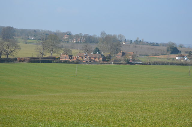
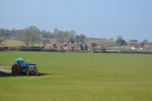
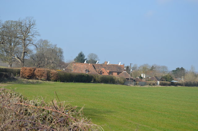
Chartham is a civil parish located in the county of Kent, England. Situated about four miles southwest of the city of Canterbury, it lies on the southern bank of the River Great Stour. The parish covers an area of approximately 4.5 square miles and is surrounded by picturesque countryside.

The village of Chartham has a rich history, dating back to Roman times. Evidence of Roman occupation, including pottery and coins, has been discovered in the area. The village grew in importance during the Middle Ages, with the construction of a bridge over the River Great Stour, which facilitated trade and travel.

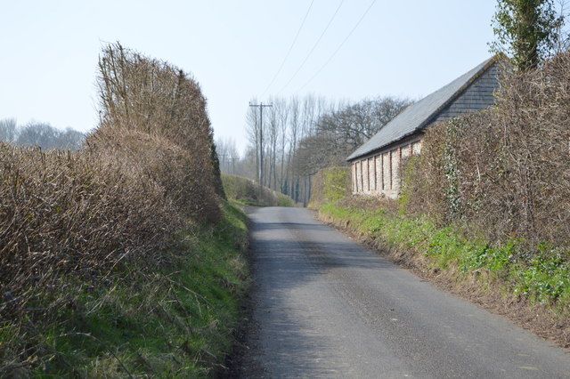
Today, Chartham retains much of its historic charm. The village center features a mix of charming cottages, Georgian houses, and historic buildings. Notable landmarks include the Church of St. Mary, a Grade I listed building dating back to the 13th century, and Chartham Park, a large country estate with beautiful gardens.

The village is well-served by amenities, including a primary school, a post office, a convenience store, and several pubs. It also benefits from excellent transport links, with the A28 road passing through the parish and providing easy access to Canterbury and other nearby towns.

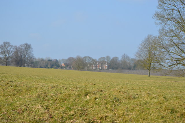
The surrounding countryside offers plenty of opportunities for outdoor activities, including walking, cycling, and boating along the River Great Stour. The area is also home to several nature reserves, providing habitats for a variety of wildlife.

Overall, Chartham is a charming and historic village, offering a peaceful and picturesque setting while still providing easy access to nearby urban centers.

If you have any feedback on the listing, please let us know in the comments section below.
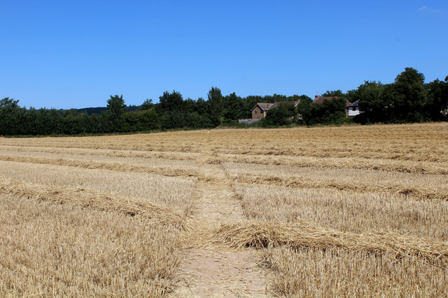
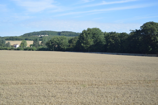
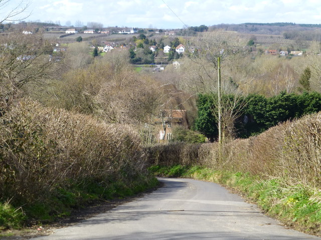
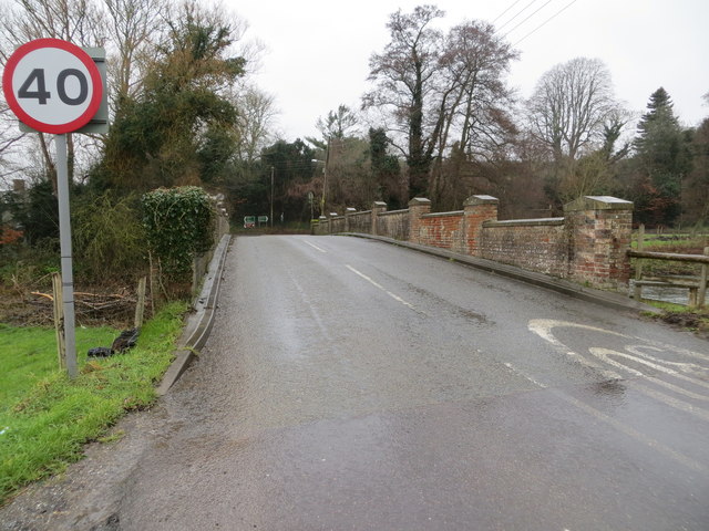
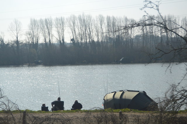
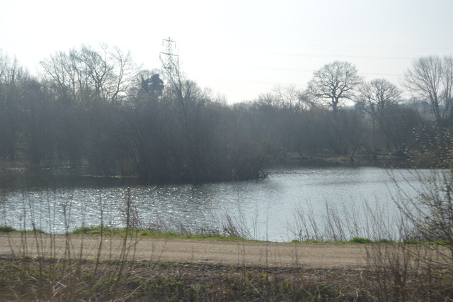
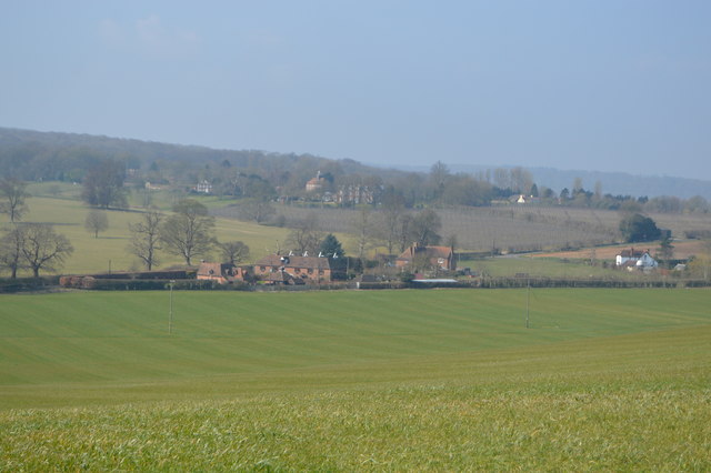
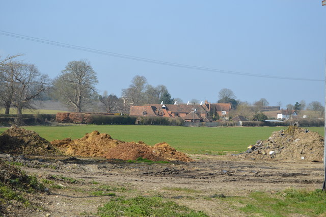
Chartham Images

Images are sourced within 2km of 51.255351/1.014547 or Grid Reference TR1055. Thanks to Geograph Open Source API. All images are credited.

Stour Valley Walk South of Shalmsford Street The long distance footpath veers left at the post - indicating a crossing of routes in the middle of the field
Stour Valley Walk South of Shalmsford Street
The long distance footpath veers left at the post - indicating a crossing of routes in the middle of the field
Footpath heading towards Shalmsford Street
Pickeldon Lane Lane deep in the Great Stour Valley
Pickeldon Lane
Lane deep in the Great Stour Valley
Flooded gravel pit, Stour Valley
Farmland near Shalmsford Street
Pickelden Lane It looks steeper than this when cycling up it!
Pickelden Lane
It looks steeper than this when cycling up it!
Road over Shalmsford Bridge heading to its junction with the A28 Looking westward,
Road over Shalmsford Bridge heading to its junction with the A28
Looking westward,
Fishing in the Stour Valley
Fishing lake, Stour Valley
Thruxted Oast
Thruxted Oast
Thruxted Oast
Thruxted Oast
Thruxted Oast
Thruxted Oast
Thruxted Oast
Thruxted Oast
Thruxted Oast
Thruxted Oast
Thruxted Oast
Thruxted Oast
Mystole House Grade II* listed. <span class="nowrap"><a title="http://www.britishlistedbuildings.co.uk/en-171080-mystole-house-south-mystole-west-wing-ch" rel="nofollow ugc noopener" href="http://www.britishlistedbuildings.co.uk/en-171080-mystole-house-south-mystole-west-wing-ch">Link</a><img style="margin-left:2px;" alt="External link" title="External link - shift click to open in new window" src="https://s1.geograph.org.uk/img/external.png" width="10" height="10"/></span>
Mystole House
Grade II* listed. LinkExternal link
Penny Pot Lane
Penny Pot Lane
Show me another place!

Chartham is located at Grid Ref: TR1055 (Lat: 51.255351, Lng: 1.014547)

Administrative County: Kent

District: Canterbury

Police Authority: Kent

What 3 Words

///trickling.backs.nods. Near Chartham, Kent

Nearby Locations

Chartham Chartham

Related Wikis

Church of St Mary, Chartham

St Mary's Church is in the village of Chartham, Kent, England. It is an active Anglican parish church in the Diocese of Canterbury. Constructed between...

Chartham railway station

Chartham railway station is in Chartham, Kent, on the Ashford to Ramsgate line. The station, and all trains serving it, is operated by Southeastern....

St Augustine's Hospital, Chartham

St Augustine's Hospital was a psychiatric hospital in Chartham, Kent, England. It was founded as the second, or East, Kent County Asylum in 1872. In 1948...

Larkey Valley Wood

Larkey Valley Wood is a 44.1-hectare (109-acre) biological Site of Special Scientific Interest south of Canterbury in Kent. It is also a Local Nature Reserve...

Nearby Amenities

Located within 500m of 51.255351,1.014547
Chartham
Is In: Kent, England, UK
Place: village
Wikidata: Q2743911
Lat/Long: 51.2542677/1.0203901
Chartham
Local Ref: 2
Public Transport: stop_position
Train: yes
Lat/Long: 51.2572104/1.0182119
Post Box
Check Date Collection Times: 2023-05-11
Collection Times: Mo-Fr 09:00; Sa 07:00
Post Box Type: wall
Postal Code: CT4
Ref: CT4 240D
Royal Cypher: EIIR
Royal Cypher Wikidata: Q33102113
Source: survey
Lat/Long: 51.2539663/1.0209232
Crossing Barrier: double_half
Crossing Bell: yes
Crossing Light: yes
Railway: level_crossing
Lat/Long: 51.2571235/1.0177118
Post Box
Collection Times: Mo-Fr 09:00; Sa 07:00
Post Box Type: pillar
Postal Code: CT4
Ref: CT4 306
Royal Cypher: GR
Royal Cypher Wikidata: Q33102273
Source: survey
Lat/Long: 51.2561618/1.0171231
Public Bookcase
Chartham Village Phone Box Library
Booth: K6
Colour: red
Disused Amenity: telephone
Listed Status: Grade II
Man Made: telephone_box
Note: In former telephone box
Public Bookcase Type: phone_box
Lat/Long: 51.2561602/1.0157748
Turning Circle
Lat/Long: 51.2512521/1.015962
Crossing
Crossing: unmarked
Crossing Island: no
Kerb: lowered
Tactile Paving: no
Lat/Long: 51.2560806/1.0172743
Bus Stop
Surgery
Bench: no
Bin: no
Lit: yes
Naptan AtcoCode: 240097786
Naptan Bearing: W
Naptan CommonName: Surgery
Naptan Indicator: opp
Naptan Landmark: Chartham Surgery
Naptan NaptanCode: kntgpmwd
Naptan Street: Parish Road
Naptan Verified: yes
Public Transport: platform
Ref: kntgpmwd
Shelter: no
Source: naptan_import
Source Date: 2018-05-03
Tactile Paving: no
Lat/Long: 51.2559249/1.0139213
Bus Stop
Old School
Bench: no
Bin: no
Lit: yes
Naptan AtcoCode: 2400A039060A
Naptan Bearing: SW
Naptan CommonName: Old School
Naptan Indicator: opp
Naptan Landmark: Old School
Naptan NaptanCode: kntdpjpd
Naptan Street: Bolts Hill
Naptan Verified: no
Shelter: no
Source: naptan_import
Tactile Paving: no
Lat/Long: 51.2545227/1.0094664
Bus Stop
The Hyde
Bench: yes
Bin: yes
Lit: yes
Naptan AtcoCode: 2400A039070A
Naptan Bearing: SW
Naptan CommonName: The Hyde
Naptan Indicator: opp
Naptan Landmark: The Hyde
Naptan NaptanCode: kntdpjpg
Naptan Street: Bolts Hill
Naptan Verified: no
Public Transport: platform
Ref: kntdpjpg
Shelter: no
Source: naptan_import
Source Date: 2018-05-03
Tactile Paving: no
Lat/Long: 51.2537628/1.0080775
Bus Stop
Old School
Bench: yes
Bin: no
Lit: yes
Naptan AtcoCode: 2400A039080A
Naptan Bearing: NE
Naptan CommonName: Old School
Naptan Indicator: adj
Naptan Landmark: Old School
Naptan NaptanCode: kntdpjpj
Naptan Street: Parish Road
Naptan Verified: no
Public Transport: platform
Ref: kntdpjpj
Shelter: no
Source: naptan_import
Source Date: 2018-05-03
Tactile Paving: no
Lat/Long: 51.2551575/1.0098027
Bus Stop
Surgery
Bench: no
Bin: no
Lit: yes
Naptan AtcoCode: 2400A039090A
Naptan Bearing: E
Naptan CommonName: Surgery
Naptan Indicator: o/s
Naptan Landmark: Chartham Surgery
Naptan NaptanCode: kntdpjpm
Naptan Street: Parish Road
Naptan Verified: yes
Public Transport: platform
Ref: kntdpjpm
Shelter: no
Source: naptan_import
Source Date: 2018-05-03
Tactile Paving: no
Lat/Long: 51.2559845/1.0138963
Bus Stop
Railway Station
Bench: yes
Naptan AtcoCode: 2400A039100A
Naptan Bearing: NW
Naptan CommonName: Railway Station
Naptan Indicator: NW-bound
Naptan Landmark: Railway Station
Naptan NaptanCode: kntdpjpt
Naptan ShortCommonName: Chartham Station
Naptan Street: Station Road
Naptan Verified: no
Public Transport: platform
Ref: kntdpjpt
Shelter: yes
Source: naptan_import
Source Date: 2018-05-03
Lat/Long: 51.257642/1.0175709
Bus Stop
Turning
Bench: yes
Bin: no
Naptan AtcoCode: 2400A039110A
Naptan Bearing: E
Naptan CommonName: Turning
Naptan Indicator: opp
Naptan Landmark: Station Road
Naptan NaptanCode: kntdpjpw
Naptan ShortCommonName: Chartham Turning
Naptan Street: Ashford Road
Naptan Verified: no
Public Transport: platform
Ref: kntdpjpw
Shelter: yes
Source: naptan_import
Source Date: 2018-05-03
Lat/Long: 51.2581896/1.0170965
Bus Stop
Turning
Bench: no
Bin: no
Naptan AtcoCode: 2400A039120A
Naptan Bearing: W
Naptan CommonName: Turning
Naptan Indicator: adj
Naptan Landmark: Station Road
Naptan NaptanCode: kntdpjta
Naptan ShortCommonName: Chartham Turning
Naptan Street: Ashford Road
Naptan Verified: no
Public Transport: platform
Ref: kntdpjta
Shelter: no
Source: naptan_import
Source Date: 2014-07-04
Lat/Long: 51.2580639/1.0170883
Bus Stop
Railway Station
Bench: no
Bin: no
Lit: no
Naptan AtcoCode: 2400A062650R
Naptan Bearing: W
Naptan CommonName: Railway Station
Naptan Indicator: W-bound
Naptan Landmark: Railway Station
Naptan NaptanCode: kntgdawm
Naptan ShortCommonName: Chartham Station
Naptan Street: The Green
Naptan Verified: no
Public Transport: platform
Ref: kntgdawm
Shelter: no
Source: naptan_import
Source Date: 2018-05-03
Tactile Paving: no
Lat/Long: 51.2569437/1.017154
Bicycle Parking
Bicycle Parking: wall_loops
Capacity: 4
Colour: green
Covered: no
Cyclestreets Id: 197631
Material: metal
Source: survey
Lat/Long: 51.2560254/1.0196652
Bicycle Parking
Bicycle Parking: stands
Capacity: 8
Check Date Capacity: 2022-03-16
Covered: no
Source: survey
Lat/Long: 51.2571283/1.0180707
Bicycle Parking
Bicycle Parking: stands
Capacity: 8
Covered: no
Cyclestreets Id: 26731;196755
Lit: yes
Source: survey
Lat/Long: 51.2572707/1.0178002
Bicycle Parking
Bicycle Parking: stands
Capacity: 4
Check Date Capacity: 2023-05-10
Colour: silver
Covered: no
Cyclestreets Id: 26750
Material: metal
Lat/Long: 51.2557359/1.0192136
Barrier: kissing_gate
Lat/Long: 51.2575206/1.0133863
Stour Farm
Landuse: farm
Note Retag: CS #48756035
Lat/Long: 51.2585015/1.012209
Crossing Barrier: no
Railway: level_crossing
Supervised: no
Lat/Long: 51.2552916/1.0097049
Barrier: stile
Lat/Long: 51.2584063/1.013554
Crossing Barrier: no
Railway: crossing
Lat/Long: 51.2564742/1.0145512
Bench
Backrest: yes
Lat/Long: 51.2562634/1.0185545
Bench
Backrest: yes
Lat/Long: 51.2564164/1.0184697
Bicycle Parking
Bicycle Parking: stands
Capacity: 4
Check Date Capacity: 2023-09-27
Covered: no
Cyclestreets Id: 197901
Material: metal
Lat/Long: 51.2545784/1.0090662
Chartham
Local Ref: 2
Naptan AtcoCode: 9100CHARTHM
Network: National Rail
Public Transport: stop_position
Ref: CRT
Train: yes
Wikidata: Q2774125
Lat/Long: 51.2572503/1.018199
Crossing Barrier: no
Railway: level_crossing
Supervised: no
Lat/Long: 51.255327/1.0096871
Crossing Barrier: no
Railway: crossing
Lat/Long: 51.2565033/1.0145178
Crossing Barrier: double_half
Crossing Bell: yes
Crossing Light: yes
Railway: level_crossing
Lat/Long: 51.2571579/1.0176935
Barrier: cycle_barrier
Cycle Barrier: single
Cycle Barrier Installation: fixed
Lat/Long: 51.2537905/1.0081965
Man Made: ground_loop
Lat/Long: 51.2561939/1.0209999
Material: wood
Power: pole
Lat/Long: 51.2522448/1.0161534
Material: wood
Power: pole
Lat/Long: 51.2523691/1.0159564
Man Made: street_cabinet
Operator: Openreach
Street Cabinet: telecom
Lat/Long: 51.2580602/1.0172837
Man Made: street_cabinet
Operator: Openreach
Street Cabinet: telecom
Lat/Long: 51.2580602/1.0173627
Bicycle Parking
Bicycle Parking: stands
Capacity: 2
Check Date Capacity: 2023-09-27
Colour: black
Covered: no
Cyclestreets Id: 197907
Material: metal
Lat/Long: 51.2558393/1.0179469
Board Type: notice
Check Date: 2022-03-16
Information: board
Tourism: information
Lat/Long: 51.2558243/1.0185769
Barrier: bollard
Bollard: fixed
Lat/Long: 51.2534053/1.0210271
Street Lamp
Lat/Long: 51.2539236/1.0211029
Waste Basket
Lat/Long: 51.253587/1.0210747
Grit Bin
Colour: yellow
Lat/Long: 51.2558406/1.0189296
Street Lamp
Lat/Long: 51.2562817/1.0184763
Street Lamp
Lat/Long: 51.2561422/1.0176298
Waste Basket
Lat/Long: 51.256134/1.0171057
Street Lamp
Lat/Long: 51.255959/1.0174276
Historic: memorial
Memorial: war_memorial
Lat/Long: 51.2560064/1.0173867
Kerb: no
Lat/Long: 51.2560583/1.0165306
Crossing
Crossing: unmarked
Crossing Island: no
Kerb: lowered
Tactile Paving: no
Lat/Long: 51.2560284/1.016996
Waste Basket
Waste: dog_excrement
Lat/Long: 51.256155/1.0158277
Street Lamp
Lat/Long: 51.2561902/1.015774
Street Lamp
Lat/Long: 51.2565574/1.0163326
Street Lamp
Lat/Long: 51.2569078/1.0168
Street Lamp
Lat/Long: 51.25123/1.0169193
Grit Bin
Colour: yellow
Ref GB Uprn: 10033171266
Lat/Long: 51.2512338/1.0168925
Atm
Check Date: 2023-05-11
Fee: yes
Lat/Long: 51.2563904/1.0180504
Generator Method: photovoltaic
Generator Orientation: 165
Generator Output Electricity: yes
Generator Source: solar
Generator Type: solar_photovoltaic_panel
Location: roof
Power: generator
Lat/Long: 51.2582759/1.0180646
Chartham
Naptan AtcoCode: 9100CHARTHM
Network: National Rail
Network Website: https://www.nationalrail.co.uk/stations/crt/
Network Wikidata: Q26334
Operator: Southeastern
Operator Website: https://www.southeasternrailway.co.uk/travel-information/more-travel-help/station-information/stations/chartham
Operator Wikidata: Q1696490
Platforms: 2
Public Transport: station
Railway: station
Ref Crs: CRT
Wheelchair: yes
Wikidata: Q2774125
Wikipedia: en:Chartham railway station
Lat/Long: 51.2571747/1.0179051
Generator Method: photovoltaic
Generator Orientation: 194
Generator Solar Modules: 10
Generator Source: solar
Generator Type: solar_photovoltaic_panel
Location: roof
Power: generator
Lat/Long: 51.2514508/1.0160107
Generator Method: photovoltaic
Generator Orientation: 172
Generator Solar Modules: 7
Generator Source: solar
Generator Type: solar_photovoltaic_panel
Location: roof
Power: generator
Lat/Long: 51.2519276/1.0125158
Generator Method: photovoltaic
Generator Orientation: 165
Generator Output Electricity: 4500 W
Generator Solar Modules: 18
Generator Source: solar
Generator Type: solar_photovoltaic_panel
Location: roof
Note: PV output estimated based upon 18 modules at approx 250W each.
Power: generator
Lat/Long: 51.2586796/1.0176288
Generator Method: photovoltaic
Generator Orientation: 240
Generator Solar Modules: 8
Generator Source: solar
Generator Type: solar_photovoltaic_panel
Location: roof
Power: generator
Lat/Long: 51.2556363/1.0156178
Defibrillator
Access: yes
Defibrillator Location: Outside wall of Chartham Village Hall, to left of main entrance
Emergency: defibrillator
Indoor: no
Ref GB The Circuit: 0C63F758-02DE-4EAF-B7FE-AE3E00B9AD01
Lat/Long: 51.2560477/1.0196258
Generator Method: photovoltaic
Generator Orientation: 119
Generator Solar Modules: 7
Generator Source: solar
Generator Type: solar_photovoltaic_panel
Location: roof
Power: generator
Lat/Long: 51.2514777/1.0115113
Generator Method: photovoltaic
Generator Orientation: 180
Generator Solar Modules: 7
Generator Source: solar
Generator Type: solar_photovoltaic_panel
Location: roof
Power: generator
Lat/Long: 51.2514571/1.0115495
Generator Method: photovoltaic
Generator Orientation: 262
Generator Solar Modules: 4
Generator Source: solar
Generator Type: solar_photovoltaic_panel
Location: roof
Power: generator
Lat/Long: 51.2519376/1.0124622
Grit Bin
Colour: yellow
Lat/Long: 51.2525886/1.0189256
Grit Bin
Colour: yellow
Lat/Long: 51.2524148/1.0181629
Grit Bin
Colour: yellow
Ref GB Uprn: 10025107113
Lat/Long: 51.2533726/1.0181612
Grit Bin
Colour: yellow
Ref GB Uprn: 10033171486
Lat/Long: 51.2529529/1.0158505
Playground: seesaw
Lat/Long: 51.256186/1.0194064
Playground: springy
Lat/Long: 51.2560954/1.0193193
Playground: swing
Lat/Long: 51.2561273/1.0194789
Playground: roundabout
Wheelchair: yes
Lat/Long: 51.256165/1.0193327
Playground: slide
Lat/Long: 51.2560794/1.0191919
Playground: structure
Lat/Long: 51.2560509/1.0191986
Covered: no
Leisure: picnic_table
Lat/Long: 51.2561273/1.0191355
Generator Method: photovoltaic
Generator Source: solar
Generator Type: solar_photovoltaic_panel
Location: roof
Power: generator
Lat/Long: 51.25751/1.0172962
Waste Basket
Waste: trash
Lat/Long: 51.2537826/1.0081244
Bench
Backrest: yes
Lat/Long: 51.253778/1.0080989
Generator Method: photovoltaic
Generator Orientation: 208
Generator Solar Modules: 2
Generator Source: solar
Generator Type: solar_photovoltaic_panel
Location: roof
Power: generator
Lat/Long: 51.2557068/1.0162139
Waste Basket
Waste: dog_excrement
Lat/Long: 51.2566947/1.018184
Waste Basket
Waste: trash
Lat/Long: 51.2566644/1.0182135
Waste Basket
Waste: trash
Lat/Long: 51.2563489/1.0185219
Waste Basket
Waste: trash
Lat/Long: 51.256228/1.018585
Barrier: height_restrictor
Maxheight: 4.4
Lat/Long: 51.2555146/1.0191067
Street Lamp
Lat/Long: 51.2532328/1.0176643
Street Lamp
Lat/Long: 51.2530746/1.0166129
Street Lamp
Lat/Long: 51.2530351/1.0160389
Street Lamp
Lat/Long: 51.2527825/1.0162622
Street Lamp
Lat/Long: 51.2528496/1.0170595
Street Lamp
Lat/Long: 51.2532823/1.0184321
Street Lamp
Lat/Long: 51.2535778/1.0190604
Grit Bin
Colour: yellow
Lat/Long: 51.2532781/1.0193229
Street Lamp
Lat/Long: 51.2532748/1.0193179
Street Lamp
Lat/Long: 51.2531017/1.0197071
Street Lamp
Lat/Long: 51.2525504/1.0189652
Street Lamp
Lat/Long: 51.2514739/1.0164275
Street Lamp
Lat/Long: 51.2516787/1.0165451
Crossing
Crossing: unmarked
Lat/Long: 51.2567499/1.0180879
Bench
Backrest: yes
Colour: brown
Material: wood
Lat/Long: 51.2551818/1.0098738
Defibrillator
Access: yes
Colour: yellow
Defibrillator Location: On wall at entrance to London-bound platform at Chartham railway station
Emergency: defibrillator
Indoor: no
Ref GB The Circuit: F0DBBE37-8A96-44F6-9D6F-AF270115F0FF
Lat/Long: 51.2571353/1.018112
Recycling
Colour: blue
Recycling Clothes: yes
Recycling Shoes: yes
Recycling Type: container
Lat/Long: 51.2558348/1.0189379
Charging Station
Bicycle: no
Capacity: 2
Motorcar: yes
Lat/Long: 51.2558058/1.0189819
Bicycle Parking
Capacity: 3
Covered: no
Cyclestreets Id: 196760
Lat/Long: 51.2540164/1.0204826
Bicycle Parking
Bicycle Parking: stands
Capacity: 4
Colour: green
Covered: no
Cyclestreets Id: 197363
Material: metal
Lat/Long: 51.2561311/1.019074
Entrance: main
Lat/Long: 51.256038/1.0196318
Bicycle Parking
Bicycle Parking: wall_loops
Capacity: 3
Colour: silver
Covered: yes
Cyclestreets Id: 197902
Material: metal
Lat/Long: 51.2561132/1.0139522
The data included in this document is from www.openstreetmap.org. The data is made available under ODbL.

Have you been to Chartham?

Leave your review of Chartham below (or comments, questions and feedback).