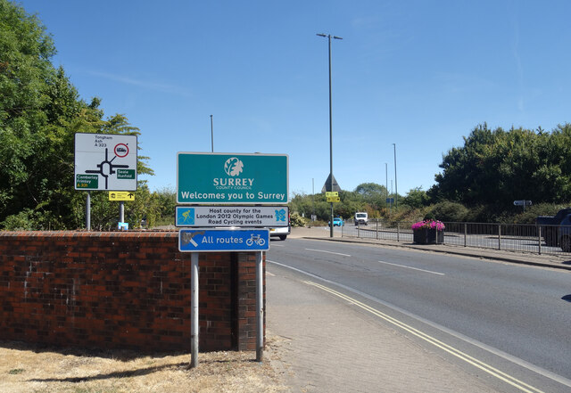
Aldershot

Settlement in Hampshire Rushmoor

England

Aldershot

Storage Warehouse by the Blackwater Now upstream of the generous input from Aldershot Sewage Works and much depleted as a result, the diminutive River Blackwater goes past here in a concrete trough of weeds after culverting under the busy A323.
Storage Warehouse by the Blackwater Credit: Des Blenkinsopp

Aldershot is a town located in the county of Hampshire, England. Situated about 37 miles southwest of London, it is often referred to as the "Home of the British Army" due to its long-standing connection with the military. With a population of approximately 37,000 people, Aldershot has a rich history dating back to the Roman era when it served as a stop on the major road between London and Winchester.

The town experienced significant growth during the 19th century when it became an important army town. Today, it continues to have a strong military presence, with several barracks and training facilities located in the area. The Royal Military Academy Sandhurst, one of the world's leading military training institutions, is also nearby.

Aldershot offers a range of amenities and attractions for residents and visitors alike. The town center features a variety of shops, restaurants, and entertainment venues, providing a vibrant social scene. Princes Hall, a popular arts venue, hosts a range of performances, including theater productions, concerts, and comedy shows.

For those interested in history, Aldershot Military Museum provides an insight into the town's military heritage, showcasing a collection of artifacts and displays. The nearby Aldershot Observatory offers stunning views of the surrounding countryside and is a popular spot for stargazing enthusiasts.

Transport links in Aldershot are well-developed, with excellent road and rail connections. The town has its own railway station, providing easy access to London and other major cities. Additionally, the nearby M3 motorway ensures convenient travel by car.

Overall, Aldershot offers a unique blend of military history, cultural attractions, and convenient transport links, making it an appealing place to live or visit in Hampshire.

If you have any feedback on the listing, please let us know in the comments section below.
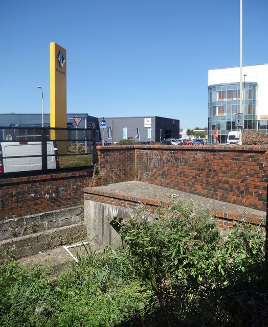
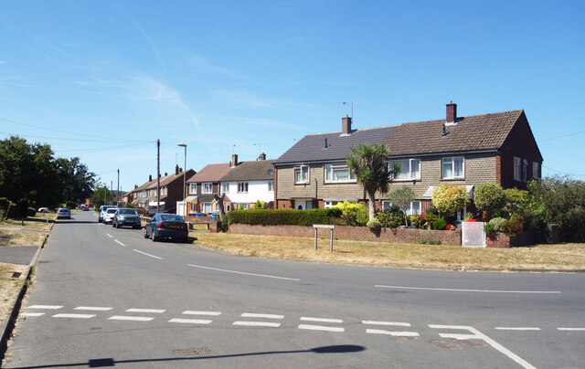
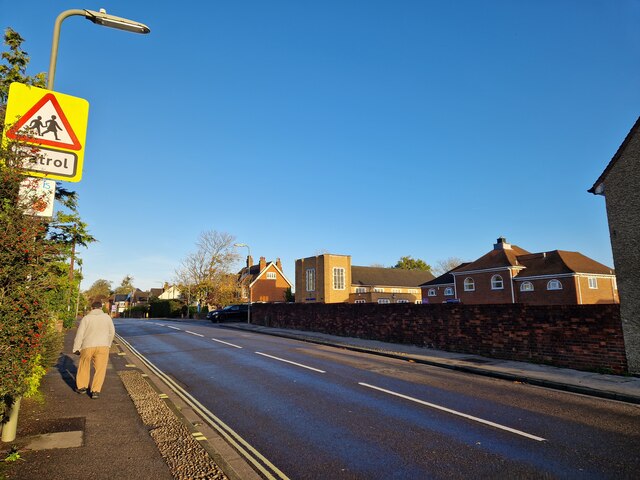
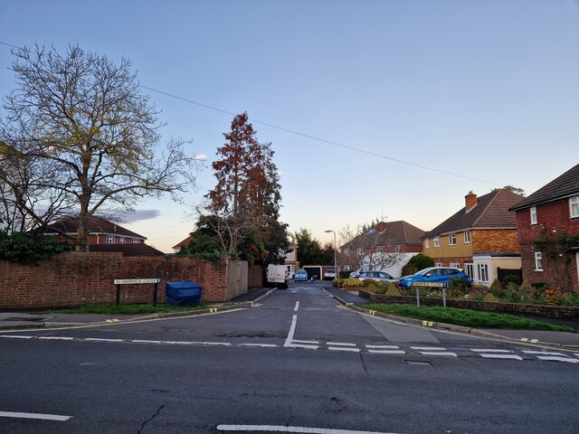
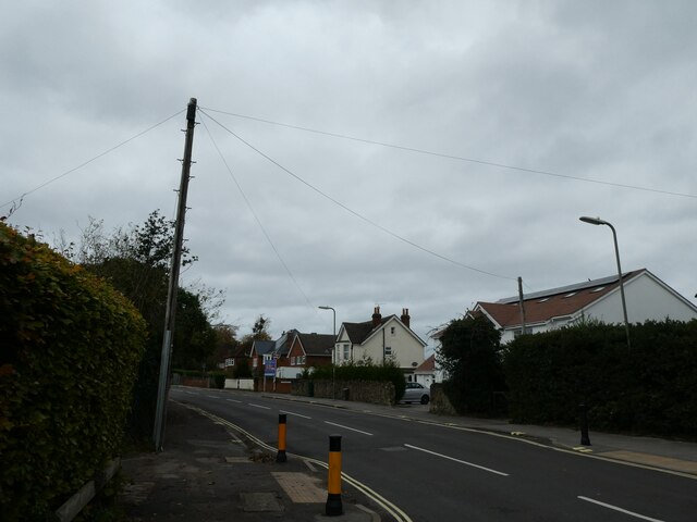
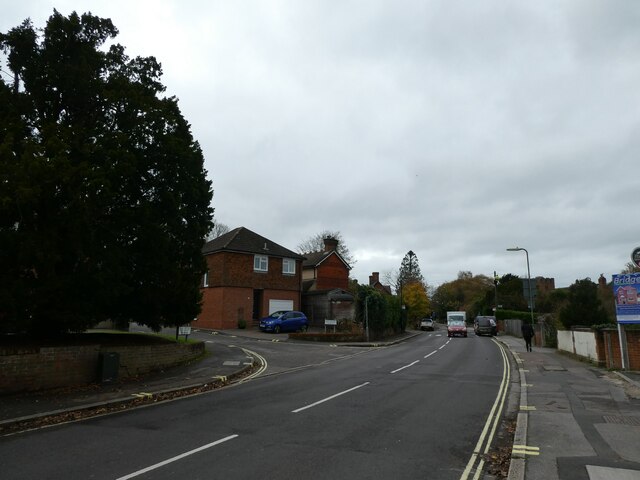
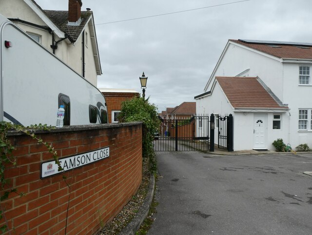
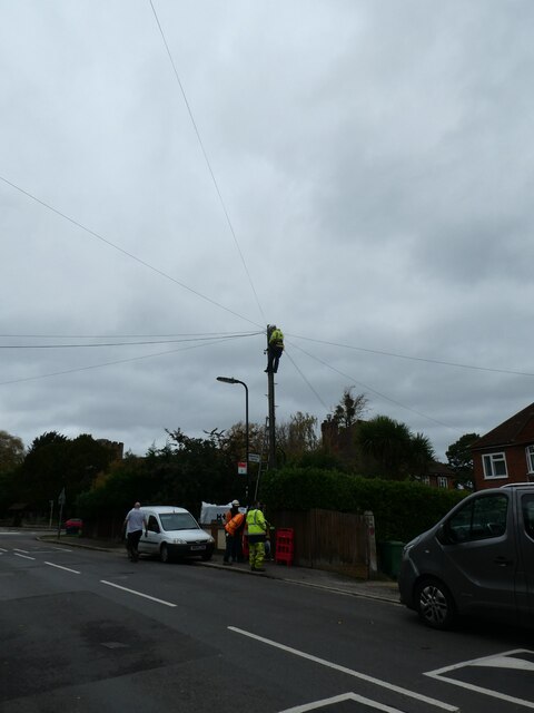
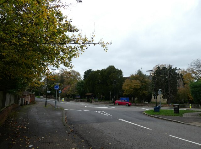
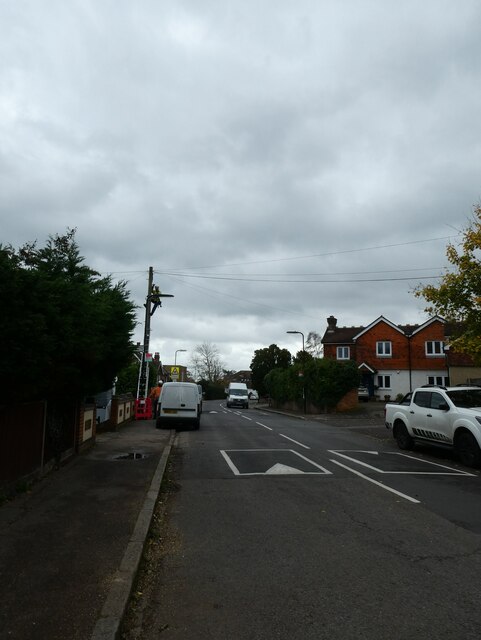
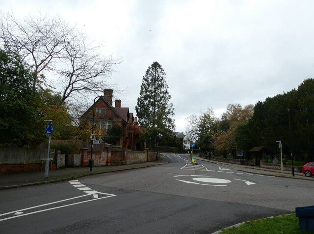
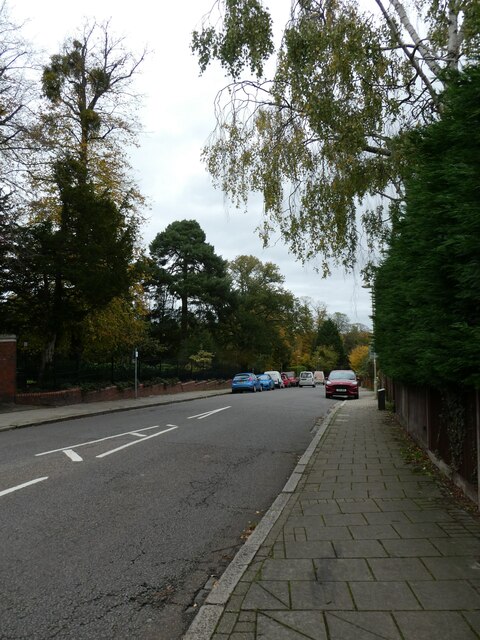
Aldershot Images

Images are sourced within 2km of 51.249538/-0.757705 or Grid Reference SU8650. Thanks to Geograph Open Source API. All images are credited.

Storage Warehouse by the Blackwater Now upstream of the generous input from Aldershot Sewage Works and much depleted as a result, the diminutive River Blackwater goes past here in a concrete trough of weeds after culverting under the busy A323.
Storage Warehouse by the Blackwater
Now upstream of the generous input from Aldershot Sewage Works and much depleted as a result, the diminutive River Blackwater goes past here in a concrete trough of weeds after culverting under the busy A323.
Welcome to Surrey The River Blackwater is used as a county border for its whole length, firstly between Hampshire and Surrey and later between Hampshire and Berkshire. Here is where it goes under the A323 as that road crosses into Surrey county.
Welcome to Surrey
The River Blackwater is used as a county border for its whole length, firstly between Hampshire and Surrey and later between Hampshire and Berkshire. Here is where it goes under the A323 as that road crosses into Surrey county.
Weeds & Warehouses, River Blackwater The Blackwater is not at its best through here as it enters a culvert under the A323.
Weeds & Warehouses, River Blackwater
The Blackwater is not at its best through here as it enters a culvert under the A323.
Tongham Road, Aldershot
Looking north-west in Church Lane East The pedestrian is just passing St Michael's Junior School, with Park Church just ahead of him on the opposite side of the road
Looking north-west in Church Lane East
The pedestrian is just passing St Michael's Junior School, with Park Church just ahead of him on the opposite side of the road
Looking from Church Lane East into Warwick Close
Looking north-west along Church Lane East
Approaching the junction of Church Lane East and Lee Court
Looking from Church Lane East into Samson Close
Mending a telegraph pole in Church Lane East The very first lines that were hung from poles were telegraph wires. Places was connected to the network with just one or two lines –  very few poles were needed. With the invention of the telephone, this all changed. At first, rival companies did not want to share their poles with one another. Inevitably, legislation was passed to compel it.

Most telegraph poles are about 30ft above the ground with 6 feet planted in the ground.They are tested by a B.T. Openreach  operative after they have been “planted” for twelve years and then at ten yearly intervals. Telegraph poles are still plentiful in the UK and Ireland although they have been completely eradicated in Holland. 

They also have their own web site <span class="nowrap"><a title="https://www.telegraphpoleappreciationsociety.org/" rel="nofollow ugc noopener" href="https://www.telegraphpoleappreciationsociety.org/">Link</a><img style="margin-left:2px;" alt="External link" title="External link - shift click to open in new window" src="https://s1.geograph.org.uk/img/external.png" width="10" height="10"/></span>
Mending a telegraph pole in Church Lane East
The very first lines that were hung from poles were telegraph wires. Places was connected to the network with just one or two lines – very few poles were needed. With the invention of the telephone, this all changed. At first, rival companies did not want to share their poles with one another. Inevitably, legislation was passed to compel it. Most telegraph poles are about 30ft above the ground with 6 feet planted in the ground.They are tested by a B.T. Openreach operative after they have been “planted” for twelve years and then at ten yearly intervals. Telegraph poles are still plentiful in the UK and Ireland although they have been completely eradicated in Holland. They also have their own web site LinkExternal link
Approaching a roundabout in Church Lane East  You know that word association game: black-white; Morecambe-Wise; Milton Keynes-roundabouts. A friend of mine supervises Geography dissertations for the University of Portsmouth. He always gives students two actual titles he has rejected: 'Rivers' (too broad) and 'The Roundabouts of Basingstoke' (too narrow)) But where did the idea for an "island", around which traffic could flow, come from? It was a Frenchman. In 1791 the architect and engineer Pierre L'Enfant proposed a number of circular intersections in Washington, D.C.  Fast forward to 1905 and we have New York City's Columbus Circle, widely considered the country's first circular intersection designed for the automotive era.  Known as rotaries, they certainly sped up traffic- but also the number of collisions . Then in 1966 the UK came up with a marvellous idea: this required vehicles entering a circular intersection to yield to those already on it. As to the two countries that started them, France has the highest roundabout ratio with one roundabout for every 45 intersections and the US one roundabout for every 1,118 intersections.
Approaching a roundabout in Church Lane East
You know that word association game: black-white; Morecambe-Wise; Milton Keynes-roundabouts. A friend of mine supervises Geography dissertations for the University of Portsmouth. He always gives students two actual titles he has rejected: 'Rivers' (too broad) and 'The Roundabouts of Basingstoke' (too narrow)) But where did the idea for an "island", around which traffic could flow, come from? It was a Frenchman. In 1791 the architect and engineer Pierre L'Enfant proposed a number of circular intersections in Washington, D.C. Fast forward to 1905 and we have New York City's Columbus Circle, widely considered the country's first circular intersection designed for the automotive era. Known as rotaries, they certainly sped up traffic- but also the number of collisions . Then in 1966 the UK came up with a marvellous idea: this required vehicles entering a circular intersection to yield to those already on it. As to the two countries that started them, France has the highest roundabout ratio with one roundabout for every 45 intersections and the US one roundabout for every 1,118 intersections.
Looking south-east along Church Lane East
Roundabout in Church Lane East You know that word association game: black-white; Morecambe-Wise; Milton Keynes-roundabouts. A friend of mine supervises Geography dissertations for the University of Portsmouth. He always gives students two actual titles he has rejected: 'Rivers' (too broad) and 'The Roundabouts of Basingstoke' (too narrow)) But where did the idea for an "island", around which traffic could flow, come from? It was a Frenchman. In 1791 the architect and engineer Pierre L'Enfant proposed a number of circular intersections in Washington, D.C.  Fast forward to 1905 and we have New York City's Columbus Circle, widely considered the country's first circular intersection designed for the automotive era.  Known as rotaries, they certainly sped up traffic- but also the number of collisions . Then in 1966 the UK came up with a marvellous idea: this required vehicles entering a circular intersection to yield to those already on it. As to the two countries that started them, France has the highest roundabout ratio with one roundabout for every 45 intersections and the US one roundabout for every 1,118 intersections.
Roundabout in Church Lane East
You know that word association game: black-white; Morecambe-Wise; Milton Keynes-roundabouts. A friend of mine supervises Geography dissertations for the University of Portsmouth. He always gives students two actual titles he has rejected: 'Rivers' (too broad) and 'The Roundabouts of Basingstoke' (too narrow)) But where did the idea for an "island", around which traffic could flow, come from? It was a Frenchman. In 1791 the architect and engineer Pierre L'Enfant proposed a number of circular intersections in Washington, D.C. Fast forward to 1905 and we have New York City's Columbus Circle, widely considered the country's first circular intersection designed for the automotive era. Known as rotaries, they certainly sped up traffic- but also the number of collisions . Then in 1966 the UK came up with a marvellous idea: this required vehicles entering a circular intersection to yield to those already on it. As to the two countries that started them, France has the highest roundabout ratio with one roundabout for every 45 intersections and the US one roundabout for every 1,118 intersections.
Looking north-east along Church Hill
Looking from Church Hill towards Church Lane East
Autumn in Manor Park
Houses on Church Hill
Mid section of Church Hill
Show me another place!

Aldershot is located at Grid Ref: SU8650 (Lat: 51.249538, Lng: -0.757705)

Administrative County: Hampshire

District: Rushmoor

Police Authority: Hampshire

What 3 Words

///piper.ruins.riches. Near Aldershot, Hampshire

Nearby Locations

Aldershot

Related Wikis

Aldershot Buddhist Centre

Aldershot Buddhist Centre (also the Buddhist Community Centre UK or BCCUK) is a Buddhist temple and community centre catering for the Buddhists of Aldershot...

Recreation Ground (Aldershot)

The Recreation Ground, currently known as The EBB Stadium at The Recreation Ground for sponsorship reasons and informally known as The Rec, is a football...

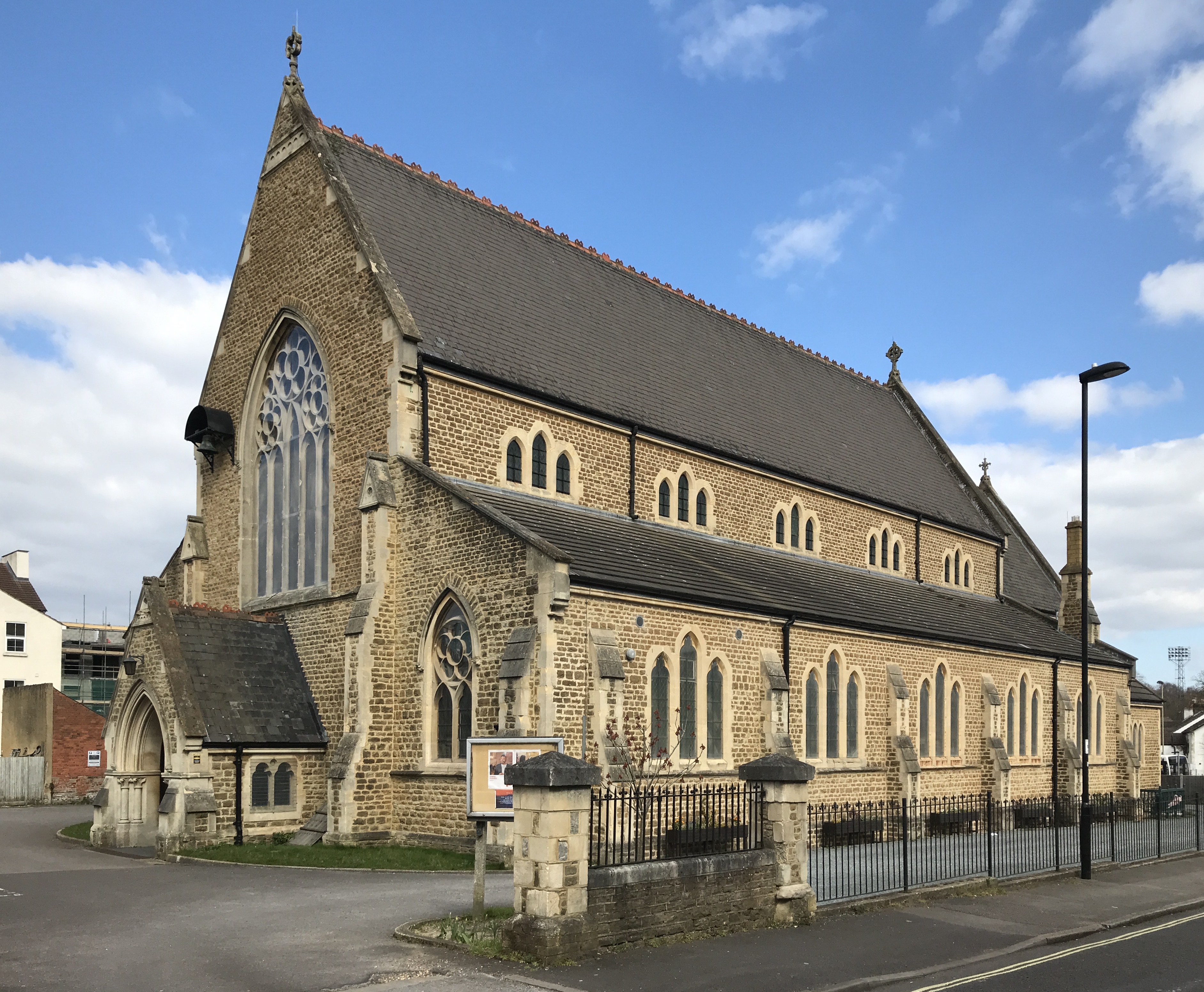
Holy Trinity Church, Aldershot

The Church of the Holy Trinity is one of four Anglican churches in Aldershot in Hampshire and is the parish church for the centre of the town being located...

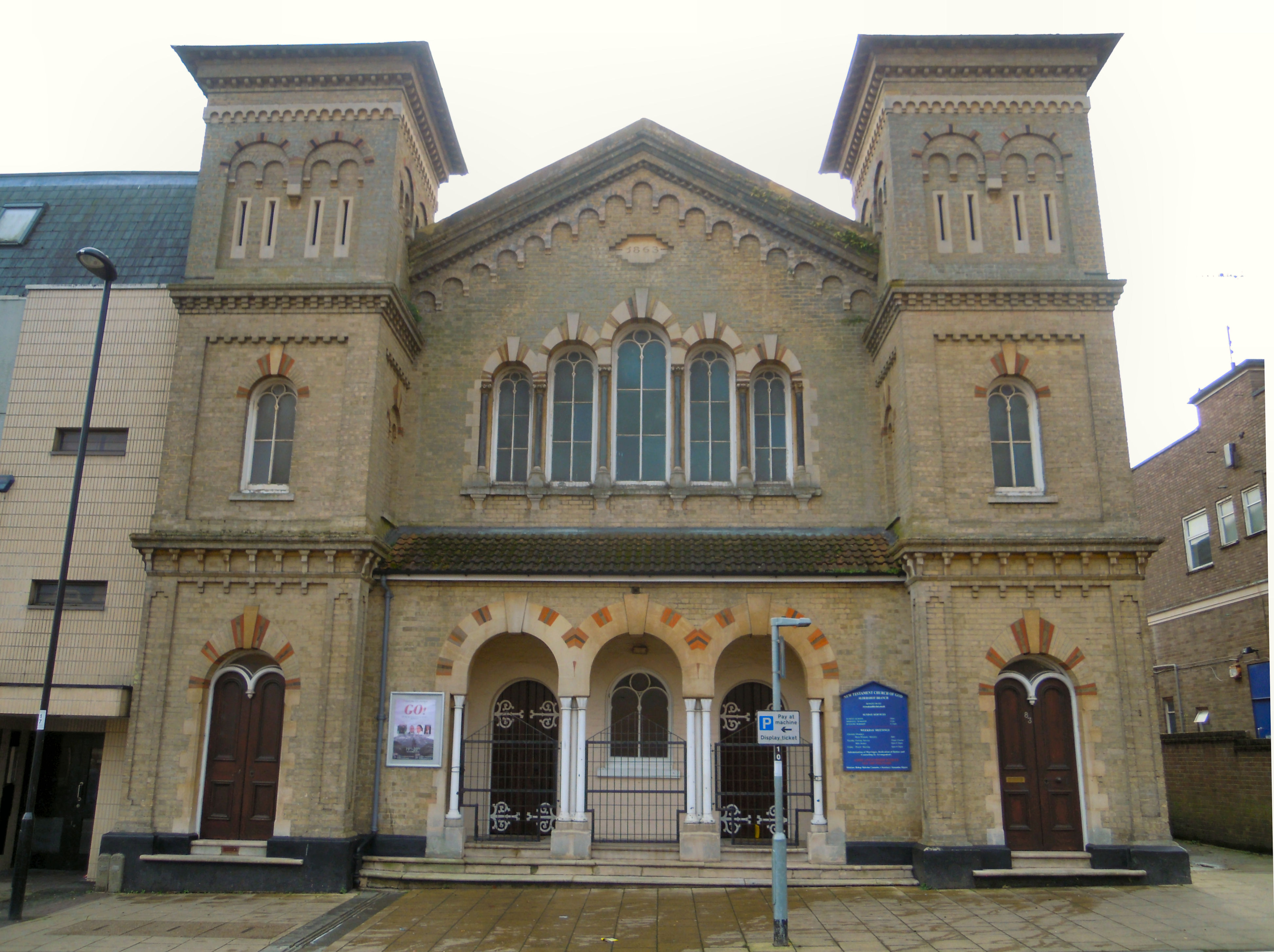
Presbyterian Church, Aldershot

The English Presbyterian Church is the former Presbyterian church for Aldershot in Hampshire. Built in 1863 it served that denomination until 1972 when...

Aldershot

Aldershot () is a town in Hampshire, England. It lies on heathland in the extreme north-east corner of the county, 31 mi (50 km) south-west of London....

Rotunda, Aldershot

The Rotunda was a Primitive Methodist church in Aldershot in Hampshire in the UK that was completed in 1876 and demolished in the 1980s. While the building...

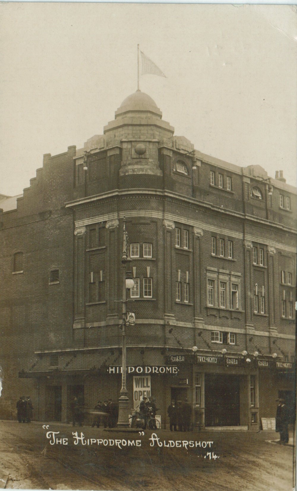
Hippodrome, Aldershot

The Hippodrome was a theatre in the town of Aldershot in Hampshire. It operated as a venue for variety shows, pantomimes, musical comedies and other shows...

Aldershot railway station

Aldershot railway station is located near the town centre of Aldershot in Hampshire, England. It is 35 miles (56 km) down the line from London Waterloo...

Nearby Amenities

Located within 500m of 51.249538,-0.757705
Crossing
Bicycle: yes
Button Operated: yes
Crossing: traffic_signals
Crossing Island: no
Crossing Ref: toucan
Kerb: lowered
Tactile Paving: yes
Traffic Signals Sound: yes
Traffic Signals Vibration: no
Lat/Long: 51.250519/-0.7640943
Crossing
Bicycle: yes
Button Operated: yes
Crossing: traffic_signals
Crossing Island: no
Crossing Ref: toucan
Kerb: lowered
Tactile Paving: yes
Traffic Signals Sound: yes
Traffic Signals Vibration: yes
Lat/Long: 51.2501712/-0.7619148
Traffic Signals
Traffic Signals Direction: forward
Lat/Long: 51.2475374/-0.7618823
Crossing
Button Operated: yes
Crossing: traffic_signals
Crossing Island: no
Crossing Ref: pelican
Kerb: lowered
Tactile Paving: no
Traffic Signals Sound: yes
Traffic Signals Vibration: yes
Lat/Long: 51.2473614/-0.7614595
Crossing
Crossing: unmarked
Crossing Island: no
Crossing Markings: no
Kerb: lowered
Tactile Paving: no
Lat/Long: 51.2459124/-0.7549857
Post Box
Collection Times: Mo-Fr 09:00, Sa 07:00
Ref: GU11 67D
Royal Cypher: GR
Royal Cypher Wikidata: Q33102273
Lat/Long: 51.2511256/-0.7553654
Post Box
Brand: Royal Mail
Brand Wikidata: Q638098
Collection Plate: CPR
Collection Times: Mo-Fr 17:30, Sa 10:30
Operator: Royal Mail
Operator Wikidata: Q638098
Post Box Type: wall
Ref: GU11 12
Royal Cypher: VR
Royal Cypher Wikidata: Q33102356
Lat/Long: 51.2464005/-0.7601937
Bicycle Parking
Access: customers
Bicycle Parking: shed
Capacity: 20
Fee: yes
Lat/Long: 51.2465513/-0.7599685
Telephone
Booth: KX100
Check Date: 2023-03-16
Covered: booth
Operator: BT
Operator Wikidata: Q593786
Phone: +44 1252 320460
Lat/Long: 51.2465695/-0.7598862
Post Box
Brand: Royal Mail
Brand Wikidata: Q638098
Collection Times: Mo-Fr 09:00, Sa 07:00
Drive Through: no
Old Ref: GU12 39
Operator: Royal Mail
Operator Wikidata: Q638098
Post Box Type: pillar
Ref: GU12 39D
Royal Cypher: GR
Royal Cypher Wikidata: Q33102273
Lat/Long: 51.2456717/-0.7591948
Crossing
Crossing: unmarked
Crossing Island: yes
Crossing Markings: no
Tactile Paving: no
Lat/Long: 51.2482566/-0.7515073
Barrier: bollard
Lat/Long: 51.2487457/-0.7513794
Entrance: yes
Lat/Long: 51.2484709/-0.753563
Mini Roundabout
Direction: clockwise
Lat/Long: 51.2481109/-0.7518075
Bicycle Parking
Bicycle Parking: stands
Capacity: 12
Covered: yes
Lat/Long: 51.2462505/-0.7603167
Crossing
Button Operated: yes
Crossing: traffic_signals
Crossing Island: no
Crossing Ref: pelican
Kerb: lowered
Tactile Paving: yes
Traffic Signals Sound: yes
Traffic Signals Vibration: no
Lat/Long: 51.2477556/-0.7560173
Away Supporters
Barrier: entrance
Lat/Long: 51.2485518/-0.7531947
Redan Hill
Ele: 109
Natural: peak
Note: 358 feet - 109 metres not sure if this is correct location: most maps of Aldershot have this location as Windmill Hill and Redan Hill is just to the south at the crest of Redan Road. It is not clear where the demarcation between the two lies: there is no
Lat/Long: 51.2493447/-0.7515956
Tourism: viewpoint
Lat/Long: 51.2496376/-0.7516189
Tourism: viewpoint
Lat/Long: 51.249459/-0.7510878
Power: substation
Lat/Long: 51.2482266/-0.7508932
Telephone
Booth: KX100
Check Date: 2023-03-16
Covered: booth
Phone: +44 1252 320203
Lat/Long: 51.2467738/-0.7607502
Telephone
Booth: KX100
Check Date: 2023-03-16
Covered: booth
Phone: +44 1252 320837
Lat/Long: 51.2467852/-0.7607609
Atm
Brand: Lloyds Bank
Brand Wikidata: Q1152847
Cash In: yes
Check Date: 2023-06-07
Drive Through: no
Fee: no
Indoor: no
Operator: Lloyds Bank
Operator Wikidata: Q1152847
Lat/Long: 51.2483414/-0.7635699
Telephone
Booth: KX100
Check Date: 2023-05-29
Covered: booth
Lat/Long: 51.2485279/-0.7636867
Telephone
Booth: KX100
Check Date: 2023-05-29
Covered: booth
Lat/Long: 51.2485413/-0.7636924
Atm
Brand: NatWest
Brand Wikidata: Q2740021
Cash In: yes
Check Date: 2023-05-26
Designation: 60-01-08
Drive Through: no
Fee: no
Indoor: no
Operator: NatWest
Operator Wikidata: Q2740021
Source: Survey
Lat/Long: 51.2484915/-0.7634544
Check Date: 2023-01-13
Shop: vacant
Lat/Long: 51.2483329/-0.7622026
Railway: switch
Lat/Long: 51.2472066/-0.7570524
Wellington Avenue
Power: substation
Lat/Long: 51.2503909/-0.763997
Recycling
Check Date Recycling: 2023-05-17
Location: overground
Recycling Glass Bottles: yes
Recycling Type: container
Lat/Long: 51.2500336/-0.7620249
Crossing
Crossing: zebra
Crossing Island: no
Kerb: lowered
Tactile Paving: yes
Lat/Long: 51.2499123/-0.7627044
Crossing
Crossing: uncontrolled
Crossing Island: no
Crossing Ref: zebra
Kerb: lowered
Source: Bing
Tactile Paving: yes
Traffic Calming: table
Lat/Long: 51.2499674/-0.7642119
Taxi
Lat/Long: 51.2502566/-0.7643785
Post Box
Collection Times: Mo-Fr 17:00, Sa 10:30
Ref: GU11 8
Royal Cypher: EIIR
Royal Cypher Wikidata: Q33102113
Lat/Long: 51.2500018/-0.7646197
Bicycle Parking
Bicycle Parking: stands
Capacity: 4
Covered: yes
Lat/Long: 51.2499064/-0.7642728
Taxi
Check Date: 2023-01-30
Lat/Long: 51.2466044/-0.7601231
Bus Stop
Redan Road
Bench: no
Bin: no
Bus: yes
Lit: yes
Naptan AtcoCode: 1900HA090243
Naptan Bearing: SE
Naptan CommonName: Redan Road
Naptan Crossing: Redan Road
Naptan NaptanCode: hamjagja
Naptan PlusbusZoneRef: ALDRSHT
Naptan Street: Holly Road
Naptan Verified: no
Public Transport: platform
Shelter: no
Source: naptan_import
Tactile Paving: no
Lat/Long: 51.24784/-0.7510533
Bus Stop
Rosedale
Bench: no
Bin: no
Bus: yes
Lit: yes
Naptan AtcoCode: 1900HA090244
Naptan Bearing: W
Naptan CommonName: Rosedale
Naptan Crossing: Rosedale
Naptan NaptanCode: hamjadwm
Naptan PlusbusZoneRef: ALDRSHT
Naptan Street: Redan Road
Naptan Verified: no
Public Transport: platform
Shelter: no
Source: naptan_import
Tactile Paving: no
Lat/Long: 51.2480452/-0.7522864
Bus Stop
Football Stadium
Bench: no
Bin: no
Bus: yes
Lit: yes
Naptan AtcoCode: 1900HA090245
Naptan Bearing: NE
Naptan CommonName: Aldershot Football Ground
Naptan Crossing: Opp Redan Gardens
Naptan NaptanCode: hamjadjp
Naptan PlusbusZoneRef: ALDRSHT
Naptan Street: Redan Road
Naptan Verified: no
Public Transport: platform
Ref: Q
Shelter: no
Source: naptan_import
Tactile Paving: no
Lat/Long: 51.2475522/-0.7550013
Bus Stop
Football Stadium
Bench: no
Bin: no
Bus: yes
Lit: yes
Naptan AtcoCode: 1900HA090246
Naptan Bearing: SW
Naptan CommonName: Aldershot Football Ground
Naptan Crossing: High Street
Naptan NaptanCode: hamjadjd
Naptan PlusbusZoneRef: ALDRSHT
Naptan Street: Redan Road
Naptan Verified: no
Public Transport: platform
Ref: R
Shelter: no
Source: naptan_import
Tactile Paving: no
Lat/Long: 51.247295/-0.7553378
Bus Stop
Redan Road
Bench: no
Bin: yes
Bus: yes
Lit: yes
Naptan AtcoCode: 1900HA090247
Naptan Bearing: SE
Naptan CommonName: Redan Road
Naptan Crossing: Redan Road
Naptan NaptanCode: hamjadgt
Naptan PlusbusZoneRef: ALDRSHT
Naptan Street: High Street
Naptan Verified: no
Public Transport: platform
Shelter: yes
Source: naptan_import
Tactile Paving: no
Lat/Long: 51.2470305/-0.7554463
Bus Stop
Station Road
Bus: yes
Naptan AtcoCode: 1900HA090303
Naptan Bearing: S
Naptan CommonName: Station Road
Naptan Crossing: Ascot Court
Naptan NaptanCode: hamgwtdw
Naptan PlusbusZoneRef: ALDRSHT
Naptan Street: The Grove
Naptan Verified: no
Public Transport: platform
Source: naptan_import
Lat/Long: 51.2467732/-0.7621004
Bus Stop
Station Road
Bus: yes
Naptan AtcoCode: 1900HA090304
Naptan Bearing: N
Naptan CommonName: Station Road
Naptan Crossing: Birchett Road
Naptan NaptanCode: hamgwtga
Naptan PlusbusZoneRef: ALDRSHT
Naptan Street: The Grove
Naptan Verified: no
Public Transport: platform
Source: naptan_import
Lat/Long: 51.2470871/-0.7620203
Bus Stop
Football Stadium
Bench: yes
Bin: no
Bus: yes
Lit: yes
Naptan AtcoCode: 1900HA090314
Naptan Bearing: NW
Naptan CommonName: Aldershot Football Ground
Naptan Crossing: Crimea Road
Naptan NaptanCode: hamjadaj
Naptan PlusbusZoneRef: ALDRSHT
Naptan Street: High Street
Naptan Verified: no
Public Transport: platform
Ref: T
Shelter: yes
Source: naptan_import
Tactile Paving: no
Lat/Long: 51.2484356/-0.7566653
Bus Stop
Library
Bench: yes
Bin: yes
Bus: yes
Lit: yes
Naptan AtcoCode: 1900HA090315
Naptan Bearing: W
Naptan CommonName: High Street Library
Naptan Crossing: Station Road
Naptan NaptanCode: hamgwtdt
Naptan PlusbusZoneRef: ALDRSHT
Naptan Street: High Street
Naptan Verified: no
Public Transport: platform
Ref: G
Shelter: yes
Source: naptan_import
Tactile Paving: no
Lat/Long: 51.2498086/-0.7620962
Bus Stop
Talavera School
Bench: no
Bin: no
Bus: yes
Lit: yes
Naptan AtcoCode: 1900HA090344
Naptan Bearing: N
Naptan CommonName: Talavera School
Naptan Crossing: Falaise Close
Naptan NaptanCode: hamgwtgm
Naptan PlusbusZoneRef: ALDRSHT
Naptan Street: Gun Hill
Naptan Verified: no
Public Transport: platform
Shelter: no
Source: naptan_import
Tactile Paving: no
Lat/Long: 51.2516375/-0.7607315
Bus Stop
Arthur Street
Bench: yes
Bin: yes
Bus: yes
Lit: yes
Local Ref: H
Naptan AtcoCode: 1900HAA13546
Naptan Bearing: E
Naptan CommonName: Victoria Road Court House
Naptan Crossing: Pickford Street
Naptan NaptanCode: hamgwtmg
Naptan PlusbusZoneRef: ALDRSHT
Naptan Street: Victoria Road
Naptan Verified: no
Operator: Stagecoach
Public Transport: platform
Ref: H
Shelter: yes
Source: naptan_import
Tactile Paving: no
Lat/Long: 51.2482391/-0.7602345
Railway: switch
Lat/Long: 51.2469268/-0.7579327
Aldershot
Public Transport: stop_position
Railway: stop
Train: yes
Lat/Long: 51.2460958/-0.7600281
Parking Entrance
Lat/Long: 51.2500601/-0.7624809
Aldershot
Name Ur: ایلڈرشوٹ
Place: town
Source: OS_OpenData_VectorMapDistrict
Wikidata: Q646980
Wikipedia: en:Aldershot
Lat/Long: 51.2494169/-0.7630148
Crossing
Crossing: uncontrolled
Crossing Island: yes
Crossing Ref: zebra
Tactile Paving: yes
Lat/Long: 51.2479949/-0.7583859
Access: yes
Leisure: playground
Wheelchair: limited
Lat/Long: 51.2506658/-0.7623345
Aldershot
Public Transport: stop_position
Railway: stop
Train: yes
Lat/Long: 51.2466999/-0.7588758
Aldershot
Public Transport: stop_position
Railway: stop
Train: yes
Lat/Long: 51.2459477/-0.7606186
Railway: switch
Lat/Long: 51.2472917/-0.7567031
Railway: switch
Lat/Long: 51.246962/-0.7579637
Railway: switch
Lat/Long: 51.2474659/-0.7561376
Railway: switch
Lat/Long: 51.2471788/-0.7572753
Crossing
Crossing: uncontrolled
Crossing Ref: zebra
Kerb: lowered
Source: Bing
Tactile Paving: yes
Lat/Long: 51.2484788/-0.7645302
Traffic Signals
Traffic Signals Direction: backward
Lat/Long: 51.2473253/-0.7614095
Traffic Signals
Traffic Signals Direction: backward
Lat/Long: 51.2473045/-0.7617622
Crossing
Button Operated: yes
Crossing: traffic_signals
Crossing Island: no
Crossing Ref: pelican
Kerb: lowered
Tactile Paving: yes
Traffic Signals Sound: yes
Traffic Signals Vibration: yes
Lat/Long: 51.2483652/-0.7614768
Crossing
Button Operated: yes
Crossing: traffic_signals
Crossing Ref: pelican
Kerb: lowered
Tactile Paving: yes
Traffic Signals Sound: yes
Traffic Signals Vibration: yes
Lat/Long: 51.2482767/-0.7613104
Crossing
Button Operated: yes
Crossing: traffic_signals
Crossing Ref: pelican
Kerb: lowered
Tactile Paving: yes
Traffic Signals Sound: yes
Traffic Signals Vibration: yes
Lat/Long: 51.2481896/-0.7615161
Traffic Signals
Source: bing
Traffic Signals Direction: forward
Lat/Long: 51.2483058/-0.761692
Traffic Signals
Source: bing
Traffic Signals Direction: forward
Lat/Long: 51.2484149/-0.7614658
Traffic Signals
Source: bing
Traffic Signals Direction: forward
Lat/Long: 51.2481562/-0.761523
Crossing
Button Operated: yes
Crossing: traffic_signals
Crossing Ref: pelican
Kerb: lowered
Tactile Paving: yes
Traffic Signals Sound: yes
Traffic Signals Vibration: yes
Lat/Long: 51.2483022/-0.7616351
East End
Place: neighbourhood
Lat/Long: 51.2463891/-0.7527015
Pearson Centre - Aldershot
Addr City: Aldershot
Addr Housename: London House
Addr Postcode: GU11 1TY
Addr Street: Pickford Street
Office: company
Phone: +44 300 200 1122
Lat/Long: 51.2484198/-0.7605684
Crossing
Crossing: unmarked
Crossing Island: yes
Crossing Markings: no
Kerb: lowered
Tactile Paving: yes
Lat/Long: 51.2457889/-0.7548051
Barrier: kerb
Kerb: lowered
Tactile Paving: no
Lat/Long: 51.2458745/-0.7549626
Crossing
Button Operated: yes
Crossing: traffic_signals
Crossing Island: no
Crossing Ref: pelican
Kerb: lowered
Tactile Paving: yes
Traffic Signals Sound: yes
Traffic Signals Vibration: yes
Lat/Long: 51.2473379/-0.7617422
Crossing
Button Operated: yes
Crossing: traffic_signals
Crossing Island: no
Crossing Ref: pelican
Kerb: lowered
Tactile Paving: yes
Traffic Signals Sound: yes
Traffic Signals Vibration: yes
Lat/Long: 51.2475303/-0.7618027
Crossing
Button Operated: yes
Crossing: traffic_signals
Crossing Ref: pelican
Kerb: lowered
Tactile Paving: yes
Traffic Signals Sound: yes
Traffic Signals Vibration: yes
Lat/Long: 51.2476003/-0.7616318
Crossing
Crossing: uncontrolled
Kerb: lowered
Tactile Paving: yes
Traffic Calming: choker
Lat/Long: 51.248453/-0.763754
Crossing
Crossing: unmarked
Crossing Markings: no
Kerb: lowered
Tactile Paving: yes
Lat/Long: 51.2483716/-0.763618
Crossing
Crossing: unmarked
Crossing Island: no
Crossing Markings: no
Kerb: lowered
Source: seen from shared use path
Tactile Paving: yes
Lat/Long: 51.250268/-0.7609249
Goose Green Park
Place: locality
Lat/Long: 51.2508539/-0.7510973
Crossing
Crossing: uncontrolled
Crossing Island: yes
Kerb: lowered
Source: survey
Tactile Paving: no
Lat/Long: 51.2492126/-0.7577002
Crossing
Crossing: uncontrolled
Crossing Island: yes
Kerb: lowered
Tactile Paving: no
Lat/Long: 51.2494233/-0.7578189
Crossing
Crossing: uncontrolled
Crossing Island: yes
Kerb: lowered
Source: survey
Tactile Paving: no
Lat/Long: 51.2490762/-0.7578932
Crossing
Crossing: uncontrolled
Crossing Island: yes
Kerb: lowered
Tactile Paving: no
Lat/Long: 51.2493249/-0.7582336
Crossing
Crossing: uncontrolled
Crossing Island: yes
Kerb: lowered
Source: survey
Tactile Paving: no
Lat/Long: 51.2490266/-0.7577357
Crossing
Crossing: unmarked
Crossing Island: no
Crossing Markings: no
Kerb: lowered
Tactile Paving: no
Lat/Long: 51.2487055/-0.7570855
Crossing
Check Date Tactile Paving: 2023-01-28
Crossing: unmarked
Crossing Markings: no
Kerb: lowered
Tactile Paving: no
Lat/Long: 51.249942/-0.7619555
Direction: 180
Fixme: There is a layby and benches here
Tourism: viewpoint
Wheelchair: yes
Lat/Long: 51.2529182/-0.7595455
MobileBitz
Addr City: Aldershot
Addr Housename: 36 High Walk
Addr Postcode: GU11 1DB
Addr Street: Wellington Centre
Level: 1
Opening Hours: Mo-Sa 09:00-17:30; Su 10:00-16:00
Operator: MobileBitz LTD
Payment Cash: yes
Payment Credit Cards: yes
Payment Debit Cards: yes
Phone: +44 7405 434179
Shop: mobile_phone
Website: https://mobilebitz.co.uk
Lat/Long: 51.2488149/-0.7647363
Barrier: height_restrictor
Maxheight: 2.1
Lat/Long: 51.2469162/-0.760449
Worldwide Food Centre
Addr City: Aldershot
Addr Housenumber: 6-8
Addr Postcode: GU11 1HT
Addr Street: Station Road
Description: Food store with a very good selection of regional foods from all over the world
Fhrs Id: 1042606
Phone: +44 1252 311533
Shop: supermarket
Lat/Long: 51.2473571/-0.7612569
Mini Roundabout
Direction: clockwise
Source: survey
Lat/Long: 51.2471892/-0.7556573
Addr Housenumber: 51
Addr Street: Alamein Road
Fixme: check location - appears to be in carriageway
Internet Access: wlan
Lat/Long: 51.2521255/-0.7572106
Aldershot
Naptan AtcoCode: 9100ALDRSHT
Network: National Rail
Network Website: https://www.nationalrail.co.uk/stations/aht/
Network Wikidata: Q26334
Public Transport: station
Railway: station
Ref Crs: AHT
Train: yes
Wheelchair: yes
Wikidata: Q4502625
Wikipedia: en:Aldershot railway station
Lat/Long: 51.2462832/-0.7599088
Crossing
Bicycle: yes
Crossing: unmarked
Crossing Island: no
Crossing Markings: no
Kerb: lowered
Source: survey
Tactile Paving: yes
Lat/Long: 51.2498846/-0.761695
Barrier: kerb
Kerb: lowered
Tactile Paving: yes
Lat/Long: 51.2498484/-0.7616984
Barrier: kerb
Kerb: lowered
Tactile Paving: yes
Lat/Long: 51.2499199/-0.7616916
Tactile Paving: yes
Lat/Long: 51.2495932/-0.7613545
Crossing
Crossing: unmarked
Crossing Island: no
Crossing Markings: no
Kerb: lowered
Source: survey
Tactile Paving: yes
Lat/Long: 51.2495885/-0.7612671
Barrier: kerb
Kerb: lowered
Tactile Paving: yes
Lat/Long: 51.2501984/-0.7619028
Barrier: kerb
Kerb: lowered
Tactile Paving: yes
Lat/Long: 51.2501376/-0.7619297
Barrier: kerb
Kerb: lowered
Tactile Paving: yes
Lat/Long: 51.2505618/-0.7640814
Barrier: kerb
Kerb: lowered
Tactile Paving: yes
Lat/Long: 51.2504795/-0.7641105
Barrier: kerb
Kerb: lowered
Tactile Paving: yes
Lat/Long: 51.2500179/-0.7642111
Traffic Signals
Source: Bing; survey
Traffic Signals Direction: backward
Lat/Long: 51.2505113/-0.7640194
Traffic Signals
Source: Bing; survey
Traffic Signals Direction: forward
Lat/Long: 51.2505247/-0.7641566
Barrier: cycle_barrier
Cycle Barrier: double
Cycle Barrier Installation: fixed
Lat/Long: 51.2505901/-0.764073
Barrier: cycle_barrier
Cycle Barrier: double
Cycle Barrier Installation: fixed
Lat/Long: 51.2509736/-0.7642566
Traffic Signals
Source: Bing; survey
Traffic Signals Direction: forward
Lat/Long: 51.2501854/-0.7619854
Traffic Signals
Source: Bing; survey
Traffic Signals Direction: backward
Lat/Long: 51.2501561/-0.7618413
Barrier: cycle_barrier
Cycle Barrier: double
Cycle Barrier Installation: fixed
Lat/Long: 51.2505917/-0.7609258
Crossing
Crossing: uncontrolled
Crossing Island: yes
Kerb: lowered
Source: Hampshire-Aerial-FCIR
Tactile Paving: yes
Lat/Long: 51.2468747/-0.7609101
Crossing
Crossing: uncontrolled
Crossing Island: yes
Crossing Ref: zebra
Tactile Paving: yes
Lat/Long: 51.2480721/-0.7581551
Crossing
Crossing: uncontrolled
Crossing Island: yes
Crossing Ref: zebra
Tactile Paving: yes
Lat/Long: 51.2480533/-0.7582408
Crossing
Crossing: unmarked
Crossing Island: no
Crossing Markings: no
Kerb: lowered
Source: Hampshire-Aerial-FCIR
Tactile Paving: yes
Lat/Long: 51.2473952/-0.7604297
Crossing
Crossing: uncontrolled
Crossing Island: yes
Crossing Ref: zebra
Tactile Paving: yes
Lat/Long: 51.2480052/-0.7581695
Crossing
Crossing: uncontrolled
Crossing Island: yes
Crossing Ref: zebra
Tactile Paving: yes
Lat/Long: 51.2480758/-0.7583644
Barrier: bollard
Bollard: fixed
Lat/Long: 51.2464657/-0.7600868
Crossing
Crossing: uncontrolled
Crossing Island: yes
Kerb: lowered
Source: Hampshire-Aerial-FCIR
Tactile Paving: yes
Lat/Long: 51.2469254/-0.7609715
Crossing
Crossing: unmarked
Crossing Markings: no
Kerb: lowered
Source: survey
Lat/Long: 51.2463953/-0.7603812
Crossing
Crossing: uncontrolled
Crossing Island: yes
Kerb: lowered
Tactile Paving: no
Lat/Long: 51.2469287/-0.7555032
Crossing
Crossing: uncontrolled
Crossing Island: yes
Kerb: lowered
Tactile Paving: yes
Lat/Long: 51.2472435/-0.7555199
Give Way
Source: Hampshire-Aerial-FCIR
Lat/Long: 51.2461543/-0.7566487
Crossing
Crossing: unmarked
Crossing Island: no
Crossing Markings: no
Kerb: lowered
Tactile Paving: no
Lat/Long: 51.2465568/-0.7563015
Traffic Calming: rumble_strip
Lat/Long: 51.245713/-0.7590931
Crossing
Crossing: unmarked
Crossing Island: no
Crossing Markings: no
Kerb: lowered
Tactile Paving: no
Lat/Long: 51.2462821/-0.7565591
Crossing
Crossing: unmarked
Crossing Markings: no
Kerb: lowered
Tactile Paving: no
Lat/Long: 51.2469411/-0.7555963
Give Way
Direction: backward
Source: Hampshire-Aerial-FCIR
Lat/Long: 51.245687/-0.7590535
Crossing
Crossing: unmarked
Crossing Island: no
Crossing Markings: no
Kerb: lowered
Tactile Paving: no
Lat/Long: 51.2456099/-0.7589333
Give Way
Direction: forward
Source: Hampshire-Aerial-FCIR
Lat/Long: 51.2456393/-0.7589795
Crossing
Crossing: unmarked
Crossing Island: no
Crossing Markings: no
Kerb: lowered
Tactile Paving: no
Lat/Long: 51.245698/-0.7590702
Give Way
Source: Hampshire-Aerial-FCIR
Lat/Long: 51.246252/-0.7566769
Barrier: kerb
Kerb: raised
Tactile Paving: no
Lat/Long: 51.2478588/-0.756518
Noexit: yes
Lat/Long: 51.2475233/-0.7563962
Traffic Signals
Source: Hampshire-Aerial-FCIR; survey
Traffic Signals Direction: forward
Lat/Long: 51.2477139/-0.7559924
Traffic Signals
Source: Hampshire-Aerial-FCIR; survey
Traffic Signals Direction: backward
Lat/Long: 51.2477874/-0.7560364
Crossing
Crossing: unmarked
Crossing Markings: no
Kerb: lowered
Tactile Paving: no
Lat/Long: 51.2479014/-0.7561688
Crossing
Crossing: uncontrolled
Crossing Island: yes
Kerb: lowered
Tactile Paving: no
Lat/Long: 51.2493814/-0.7581892
Crossing
Crossing: uncontrolled
Crossing Island: yes
Kerb: lowered
Tactile Paving: no
Lat/Long: 51.2494418/-0.7579145
Barrier: kerb
Kerb: lowered
Tactile Paving: no
Lat/Long: 51.2492528/-0.7576613
Crossing
Crossing: uncontrolled
Crossing Island: yes
Kerb: lowered
Source: survey
Tactile Paving: no
Lat/Long: 51.2490734/-0.7580184
Crossing
Crossing: uncontrolled
Crossing Island: yes
Kerb: lowered
Source: survey
Tactile Paving: no
Lat/Long: 51.2491393/-0.7577586
Barrier: kerb
Kerb: lowered
Tactile Paving: yes
Lat/Long: 51.2498577/-0.76068
Crossing
Crossing: unmarked
Crossing Markings: no
Kerb: lowered
Source: Hampshire-Aerial-FCIR;survey
Tactile Paving: yes
Lat/Long: 51.2497817/-0.760608
Crossing
Crossing: unmarked
Crossing Island: no
Crossing Markings: no
Tactile Paving: yes
Lat/Long: 51.2499088/-0.7606688
Barrier: kerb
Kerb: lowered
Tactile Paving: yes
Lat/Long: 51.2497857/-0.7606457
Barrier: bollard
Bollard: fixed
Lat/Long: 51.2497905/-0.760732
Crossing
Crossing: unmarked
Crossing Island: no
Crossing Markings: no
Tactile Paving: no
Lat/Long: 51.2519595/-0.7555753
Crossing
Crossing: unmarked
Crossing Markings: no
Tactile Paving: no
Lat/Long: 51.2540207/-0.7576785
Bench
Backrest: yes
Lat/Long: 51.2538842/-0.7583757
Bench
Backrest: yes
Lat/Long: 51.2539072/-0.7580692
Bench
Backrest: yes
Lat/Long: 51.2539229/-0.7578521
Bench
Backrest: yes
Lat/Long: 51.2539616/-0.7580166
Bench
Backrest: yes
Lat/Long: 51.2540192/-0.7581586
Bench
Backrest: yes
Lat/Long: 51.253955/-0.758135
Gun Hill Park
Architect: Weston Homes
Place: neighbourhood
Lat/Long: 51.2538695/-0.7580627
The East Bank
Description: East Bank of the Recreation Ground. Well known local name of this part of the stadium.
Place: locality
Lat/Long: 51.2486673/-0.7538924
The North Bank
Description: Well known local name of this part of the stadium
Place: locality
Lat/Long: 51.2489175/-0.754461
Bicycle Parking
Access: yes
Bicycle Parking: stands
Capacity: 16
Covered: yes
Fee: no
Lat/Long: 51.2502311/-0.7641572
Crossing
Crossing: unmarked
Crossing Markings: no
Tactile Paving: no
Lat/Long: 51.2469199/-0.760497
Crossing
Crossing: unmarked
Crossing Markings: no
Tactile Paving: no
Lat/Long: 51.2468064/-0.7605877
Crossing
Crossing: unmarked
Crossing Markings: no
Tactile Paving: no
Lat/Long: 51.2467913/-0.760689
Traffic Calming: hump
Lat/Long: 51.2521894/-0.7536506
Crossing
Crossing: unmarked
Crossing Island: no
Crossing Markings: no
Kerb: lowered
Tactile Paving: no
Lat/Long: 51.2521336/-0.7534864
Grit Bin
Seasonal: no
Lat/Long: 51.2521145/-0.7533861
Crossing
Crossing: unmarked
Crossing Markings: no
Tactile Paving: no
Lat/Long: 51.2467751/-0.7604632
Barrier: bollard
Lat/Long: 51.2490747/-0.7634279
Bicycle Parking
Access: yes
Bicycle Parking: stands
Capacity: 8
Covered: no
Fee: no
Lat/Long: 51.2539165/-0.7584576
Bench
Backrest: yes
Material: wood;metal
Lat/Long: 51.25364/-0.7603885
Bicycle Parking
Access: yes
Bicycle Parking: stands
Capacity: 8
Covered: no
Fee: no
Lat/Long: 51.253966/-0.7577164
Bench: yes
Covered: no
Leisure: picnic_table
Lat/Long: 51.2502379/-0.7597933
Artwork Type: statue
Tourism: artwork
Lat/Long: 51.2539462/-0.758078
Lidl
Addr City: Aldershot
Addr Country: GB
Addr Housenumber: 8
Addr Place: Wellington Centre
Addr Postcode: GU11 1DB
Addr Street: Wellington Centre
Brand: Lidl
Brand Wikidata: Q151954
Brand Wikipedia: en:Lidl
Check Date: 2023-05-26
Fhrs Id: 34821
Level: 0
Opening Hours: Mo-Sa 08:00-20:00; Su 10:00-16:00
Payment Cash: yes
Shop: supermarket
Website: https://www.lidl.co.uk/s/en-GB/store-finder/aldershot/wellington-centre-8/
Wheelchair: yes
Lat/Long: 51.2490733/-0.7641214
Letter Box
Lat/Long: 51.2532494/-0.7600804
Fire Hydrant
Emergency: fire_hydrant
Fire Hydrant Diameter: 75
Fire Hydrant Position: sidewalk
Fire Hydrant Type: underground
Water Source: main
Lat/Long: 51.2482268/-0.7518774
Fire Hydrant
Emergency: fire_hydrant
Fire Hydrant Diameter: 4"
Fire Hydrant Position: parking_lot
Fire Hydrant Type: underground
Water Source: main
Lat/Long: 51.2479627/-0.7576266
Fire Hydrant
Emergency: fire_hydrant
Fire Hydrant Diameter: 3"
Fire Hydrant Position: sidewalk
Fire Hydrant Type: underground
Water Source: main
Lat/Long: 51.2480022/-0.7517168
Fire Hydrant
Emergency: fire_hydrant
Fire Hydrant Diameter: 150
Fire Hydrant Position: sidewalk
Fire Hydrant Type: underground
Water Source: main
Lat/Long: 51.2521235/-0.7570616
Fire Hydrant
Emergency: fire_hydrant
Fire Hydrant Diameter: 6"
Fire Hydrant Position: green
Fire Hydrant Type: underground
Water Source: main
Lat/Long: 51.2505508/-0.7604481
Barrier: height_restrictor
Maxheight: 2.1
Lat/Long: 51.246791/-0.7604306
Barrier: bollard
Bollard: fixed
Lat/Long: 51.2467152/-0.7530573
Fire Hydrant
Emergency: fire_hydrant
Fire Hydrant Diameter: 100
Fire Hydrant Position: sidewalk
Fire Hydrant Type: underground
Water Source: main
Lat/Long: 51.2475014/-0.7622348
Magnum Bathrooms
Opening Hours: Mo-Th 08:00-17:00; Fr 08:00-16:00; Sa 08:00-12:00; Su off
Shop: bathroom_furnishing
Wheelchair: yes
Lat/Long: 51.2470019/-0.7556815
Aldershot Kitchen Deisgns Ltd
Shop: kitchen
Lat/Long: 51.2470868/-0.7557408
Covered: no
Leisure: picnic_table
Lat/Long: 51.2478722/-0.7523121
Bench
Backrest: yes
Lat/Long: 51.247749/-0.7526125
Waste Basket
Lat/Long: 51.2477753/-0.7526315
Entrance: main
Lat/Long: 51.2472032/-0.7546072
Entrance: main
Lat/Long: 51.2474183/-0.7547051
Waste Basket
Waste: cigarettes;trash
Lat/Long: 51.2470891/-0.755212
Waste Basket
Waste: cigarettes;trash
Lat/Long: 51.2470062/-0.7553711
Waste Basket
Waste: cigarettes;trash
Lat/Long: 51.247184/-0.7551612
Bench
Backrest: yes
Lat/Long: 51.2470898/-0.7551697
Bench
Backrest: yes
Lat/Long: 51.2471616/-0.7551306
Addr Flats: 1-2
Entrance: yes
Lat/Long: 51.2465088/-0.7564329
Addr Flats: 3-5
Entrance: yes
Lat/Long: 51.2465831/-0.756518
MKS Food & Wine
Check Date Opening Hours: 2023-05-29
Opening Hours Signed: no
Shop: alcohol
Lat/Long: 51.2467939/-0.7552498
Keates & Co.
Office: accountant
Lat/Long: 51.2467537/-0.7552271
Fast Food
Palace Pizza & Chicken
Lat/Long: 51.2466824/-0.7551786
Doctors
John the Footman
Check Date Opening Hours: 2023-05-29
Healthcare: doctor
Healthcare Speciality: podiatry
Opening Hours Signed: no
Lat/Long: 51.2466022/-0.7551185
Fast Food
China Rose
Lat/Long: 51.2467142/-0.7552006
Waste Basket
Waste: cigarettes;trash
Lat/Long: 51.2469443/-0.7533384
Vending Machine
Payment Credit Cards: yes
Vending: public_transport_tickets
Lat/Long: 51.2464098/-0.7601719
Vending Machine
Payment Cash: yes
Payment Credit Cards: yes
Vending: public_transport_tickets
Lat/Long: 51.2463909/-0.760216
Fire Hydrant
Emergency: fire_hydrant
Fire Hydrant Diameter: 8"
Fire Hydrant Position: sidewalk
Fire Hydrant Type: underground
Lat/Long: 51.2473134/-0.7555343
Crossing
Crossing: uncontrolled
Crossing Markings: yes
Kerb: lowered
Tactile Paving: yes
Lat/Long: 51.2484089/-0.7630578
Barrier: kerb
Kerb: lowered
Tactile Paving: yes
Lat/Long: 51.2499601/-0.7606588
Bus Stop
Union Yard
Bench: yes
Bin: yes
Bus: yes
Departures Board: realtime
Lit: yes
Local Ref: F
Network: Stagecoach Blackwater Valley
Operator: Stagecoach South
Public Transport: platform
Shelter: yes
Tactile Paving: no
Lat/Long: 51.2502194/-0.7642641
Parcel Locker
Amazon Locker – Athena
Brand: Amazon Locker
Brand Wikidata: Q16974764
Level: 0
Parcel Pickup: yes
Ref: Athena
Lat/Long: 51.2489363/-0.7642524
Barrier: kerb
Kerb: lowered
Tactile Paving: yes
Lat/Long: 51.2497767/-0.760562
Barrier: bollard
Bollard: fixed
Lat/Long: 51.2498437/-0.7606654
Bench
Backrest: yes
Material: wood
Lat/Long: 51.2495721/-0.7613845
Bench
Backrest: yes
Material: wood
Lat/Long: 51.2495559/-0.7613866
Bench
Backrest: yes
Material: wood
Lat/Long: 51.2495277/-0.7613888
Bench
Backrest: yes
Material: wood
Lat/Long: 51.2495109/-0.7613931
Waste Basket
Material: metal
Lat/Long: 51.2495519/-0.761421
Barrier: kerb
Kerb: lowered
Tactile Paving: yes
Lat/Long: 51.250278/-0.7609747
Barrier: kerb
Kerb: lowered
Tactile Paving: yes
Lat/Long: 51.2502636/-0.7609027
Barrier: kerb
Kerb: lowered
Tactile Paving: yes
Lat/Long: 51.2495839/-0.7612102
Barrier: kerb
Kerb: lowered
Tactile Paving: yes
Lat/Long: 51.2495907/-0.7613214
Taxi
Lat/Long: 51.2485275/-0.764622
Parking Entrance
Lat/Long: 51.2503116/-0.7639203
Atm
Brand: Nationwide
Brand Wikidata: Q846735
Operator: Nationwide
Operator Wikidata: Q846735
Lat/Long: 51.2486249/-0.7642618
Access: customers
Addr City: Aldershot
Addr Housenumber: 11
Addr Postcode: GU11 1HT
Addr Street: Station Road
Door: hinged
Entrance: shop
Level: 0
Lat/Long: 51.247576/-0.7617223
Bank
Nationwide
Addr City: Aldershot
Addr Housenumber: 140
Addr Postcode: GU11 1EH
Addr Street: Victoria Road
Atm: yes
Brand: Nationwide
Brand Wikidata: Q846735
Drive Through: no
Opening Hours: Mo,We 10:00-14:00; Tu 10:00-16:30; Th-Fr 12:30-16:30; Sa 09:00-12:00
Website: https://www.nationwide.co.uk/branches/aldershot/140-victoria-road
Lat/Long: 51.2485951/-0.764202
Post Office
Aldershot Post Office
Addr City: Aldershot
Addr Housenumber: 63-68
Addr Postcode: GU11 1DB
Addr Street: Wellington Centre
Brand: Post Office
Brand Wikidata: Q1783168
Level: 1
Opening Hours: Mo-Fr 09:00-17:30; Sa 09:00-14:00
Ref Pol Id: 93422
Website: https://www.postoffice.co.uk/branch-finder/140900x/aldershot
Wheelchair: yes
Lat/Long: 51.2491475/-0.7641242
F.Hinds
Addr City: Aldershot
Addr Housename: 35 High Walk
Addr Postcode: GU11 1DB
Addr Street: Wellington Centre
Brand: F.Hinds
Brand Wikidata: Q5423915
Level: 1
Opening Hours: Mo-Sa 09:15-17:15
Phone: +44 1252 315732
Shop: jewelry
Website: https://www.fhinds.co.uk/stores/aldershot
Lat/Long: 51.2488218/-0.7646913
Vodafone
Addr City: Aldershot
Addr Housename: 37 High Walk
Addr Postcode: GU11 1DB
Addr Street: Wellington Centre
Brand: Vodafone
Brand Wikidata: Q122141
Level: 1
Opening Hours: Mo,Su 10:00-16:00; Tu-Sa 09:00-17:30
Shop: mobile_phone
Lat/Long: 51.2488064/-0.7647864
Atm
Brand: Lloyds Bank
Brand Wikidata: Q1152847
Cash In: yes
Check Date: 2023-06-07
Drive Through: no
Fee: no
Indoor: no
Operator: Lloyds Bank
Operator Wikidata: Q1152847
Lat/Long: 51.248383/-0.7634345
Quality Superstore
Addr City: Aldershot
Addr Housenumber: 50b
Addr Postcode: GU11 1BG
Addr Street: Station Road
Contact Facebook: https://www.facebook.com/qsaldershot/
Fhrs Id: 25013
Opening Hours: Mo,Tu,Th,Sa 08:00-19:00; We,Fr 09:00-18:00
Phone: +44 1252 343464
Shop: supermarket
Lat/Long: 51.2492293/-0.7611636
Rushmoor Superstore
Addr City: Aldershot
Addr Housenumber: 11-13
Addr Postcode: GU11 1LS
Addr Street: Birchett Road
Contact Facebook: https://www.facebook.com/p/Rushmoor-Super-Store-100063640140176/
Fhrs Id: 1615408
Opening Hours: Mo-Su 06:30-23:15
Phone: +44 1252 285760
Shop: supermarket
Lat/Long: 51.2475922/-0.7636318
Parking Entrance
Lat/Long: 51.2471581/-0.7627153
Parking Entrance
Lat/Long: 51.246752/-0.7629607
Belvoir
Addr City: Aldershot
Addr Housenumber: 102
Addr Postcode: GU11 1JX
Addr Street: Victoria Road
Brand: Belvoir
Brand Wikidata: Q111463571
Office: estate_agent
Opening Hours: Mo-Th 09:00-17:30; Fr 09:00-17:00
Phone: +44 1252 758081
Website: https://belvoir.co.uk/aldershot-estate-agents
Wheelchair: yes
Lat/Long: 51.2483803/-0.7616162
Gurkha Travel
Addr City: Aldershot
Addr Housenumber: 104
Addr Postcode: GU11 1JX
Addr Street: Victoria Road
Contact Facebook: https://www.facebook.com/GurkhaTravels
Opening Hours: Mo-Sa 09:00-18:00; Su 09:00-17:00
Phone: +44 1252 266414
Shop: travel_agency
Wheelchair: limited
Lat/Long: 51.2483892/-0.7616941
Manik Tailoring
Addr City: Aldershot
Addr Housenumber: 106
Addr Postcode: GU11 1JX
Addr Street: Victoria Road
Phone: +44 7553 187597
Shop: tailor
Lat/Long: 51.248397/-0.7617746
Annie's Florist
Addr City: Aldershot
Addr Housename: 5 Townstead House
Addr Postcode: GU11 1JE
Addr Street: Victoria Road
Opening Hours: Mo-Fr 09:00-17:30; Sa 09:00-14:00
Phone: +44 1252 331977
Shop: florist
Website: https://www.anniesflorists.co.uk
Lat/Long: 51.2483484/-0.7633508
Smart Food & Wine
Addr City: Aldershot
Addr Housename: 4 Townstead House
Addr Postcode: GU11 1JE
Addr Street: Victoria Road
Fhrs Id: 1025856
Opening Hours: Mo-Th 06:00-23:00; Fr-Sa 06:00-23:30; Su 07:00-23:00
Phone: +44 1252 318822
Shop: convenience
Lat/Long: 51.2483433/-0.7632755
Shree Lucky Jewellery
Addr City: Aldershot
Addr Housename: 3 Townstead House
Addr Postcode: GU11 1JE
Addr Street: Victoria Road
Contact Facebook: https://www.facebook.com/shreeluckyjewellery/?locale=en_GB
Opening Hours: Mo 09:30-18:00; Tu-Su 10:00-18:00
Phone: +44 1252 337307
Shop: jewelry
Lat/Long: 51.2483368/-0.763194
Fast Food
Domino's
Addr City: Aldershot
Addr Housename: 2 Townstead House
Addr Postcode: GU11 1JE
Addr Street: Victoria Road
Brand: Domino's
Brand Wikidata: Q839466
Cuisine: pizza
Drive Through: no
Fhrs Id: 12370
Opening Hours: Mo-Th,Su 11:00-24:00; Fr-Sa 11:00-01:00
Phone: +44 1252 344455
Takeaway: yes
Website: https://www.dominos.co.uk/pizza-near-me/aldershot/2-townstead-house
Lat/Long: 51.2483315/-0.7631145
Fast Food
Maeme's Piri Piri
Addr City: Aldershot
Addr Housename: 1 Townstead House
Addr Postcode: GU11 1JE
Addr Street: Victoria Road
Cuisine: chicken
Diet Halal: yes
Drive Through: no
Fhrs Id: 1645482
Opening Hours: Mo-Su 11:00-23:00
Phone: +44 1252 403881
Website: https://www.maemespiripiri.co.uk/our_stores.php
Lat/Long: 51.2483261/-0.7630393
Bar
De'Lounge
Addr City: Aldershot
Addr Housename: Townstead House
Addr Postcode: GU11 1JE
Addr Street: Victoria Road
Contact Facebook: https://www.facebook.com/delounge18/?locale=en_GB
Fhrs Id: 1055744
Opening Hours: We-Th 12:00-22:30; Fr 12:00-01:00; Sa 15:00-01:00; Su 15:00-22:30
Phone: +44 7853 903559
Lat/Long: 51.248279/-0.7631926
Doctors
The Foot Clinic
Addr City: Aldershot
Addr Housenumber: 65A
Addr Postcode: GU11 1BY
Addr Street: High Street
Healthcare: doctor
Healthcare Speciality: podiatry
Phone: +44 1252 317421
Website: https://thefootclinicaldershot.co.uk
Lat/Long: 51.2498669/-0.7639577
Bridges (Lettings)
Addr City: Aldershot
Addr Housenumber: 75-79
Addr Postcode: GU11 1BY
Addr Street: High Street
Level: 0
Office: estate_agent
Opening Hours: Mo-Th 08:45-18:30; Fr 08:45-18:00; Sa 09:00-17:00
Phone: +44 1252 361555
Website: https://www.bridges.co.uk/branches/aldershot-letting-agents/
Wheelchair: no
Lat/Long: 51.2498318/-0.7633544
Addr City: Aldershot
Addr Housename: Caitlin House
Addr Housenumber: 77A
Addr Postcode: GU11 1BY
Addr Street: High Street
Landuse: residential
Level: 1
Residential: apartments
Lat/Long: 51.2497619/-0.7633547
E. Finch & Sons
Addr City: Aldershot
Addr Housenumber: 123
Addr Postcode: GU11 1TT
Addr Street: High Street
Opening Hours: Mo-Fr 09:00-17:00
Phone: +44 1252 240592
Shop: funeral_directors
Website: https://www.dignityfunerals.co.uk/funeral-directors/locations/england/hampshire/aldershot/123-high-street
Wheelchair: limited
Lat/Long: 51.2496779/-0.7604926
Entropy Financial
Addr City: Aldershot
Addr Housenumber: 131
Addr Postcode: GU11 1TT
Addr Street: High Street
Office: financial
Phone: +44 1252 325306
Lat/Long: 51.2496735/-0.7601347
Colourways Print & Embroidery
Addr City: Aldershot
Addr Housenumber: 135
Addr Postcode: GU11 1TT
Addr Street: High Street
Opening Hours: Mo-Th 10:00-16:00; Fr 10:00-15:00
Phone: +44 1252 344944
Shop: clothes
Website: https://www.colourwaysprintandembroidery.co.uk/
Wheelchair: no
Lat/Long: 51.2496607/-0.7600067
Restaurant
Oriental Express
Addr City: Aldershot
Addr Housenumber: 137
Addr Postcode: GU11 1TT
Addr Street: High Street
Cuisine: chinese
Fhrs Id: 781249
Opening Hours: Tu-Su 17:00-22:30
Phone: +44 1252 330493
Takeaway: only
Website: https://mealmap.co.uk/oealdershot/
Lat/Long: 51.2496521/-0.7599201
Addr City: Aldershot
Addr Housename: Trafalgar Court
Addr Housenumber: 88-90
Addr Postcode: GU11 1SS
Addr Street: Victoria Road
Landuse: residential
Residential: apartments
Lat/Long: 51.2483448/-0.7603298
Motest Head Office
Addr City: Aldershot
Addr Housename: Unit B Central Estate
Addr Postcode: GU11 1SZ
Addr Street: Albert Road
Office: company
Phone: +44 1252 328836
Website: https://motest.co.uk
Lat/Long: 51.2473898/-0.757719
Access: private
Addr City: Aldershot
Addr Flats: 1-16
Addr Housename: Avery Court
Addr Postcode: GU11 1HY
Addr Street: Alice Road
Entrance: yes
Lat/Long: 51.2478859/-0.7586855
Addr City: Aldershot
Addr Housename: 17 Avery Court
Addr Postcode: GU11 1HY
Addr Street: Alice Road
Entrance: home
Level: 0
Lat/Long: 51.2478988/-0.7586314
Access: private
Addr City: Aldershot
Addr Housenumber: 2
Addr Postcode: GU11 1JG
Addr Street: Windsor Way
Entrance: home
Level: 0
Lat/Long: 51.2477105/-0.7585374
Access: private
Addr City: Aldershot
Addr Housenumber: 4
Addr Postcode: GU11 1JG
Addr Street: Windsor Way
Entrance: home
Level: 0
Lat/Long: 51.2478024/-0.7585454
Access: private
Addr City: Aldershot
Addr Housenumber: 6
Addr Postcode: GU11 1JG
Addr Street: Windsor Way
Entrance: home
Level: 0
Lat/Long: 51.2478398/-0.7584739
Access: private
Addr City: Aldershot
Addr Housenumber: 47A
Addr Postcode: GU11 1SJ
Addr Street: Victoria Road
Entrance: home
Level: 0
Lat/Long: 51.247993/-0.758606
Access: private
Addr City: Aldershot
Addr Housenumber: 47B
Addr Postcode: GU11 1SJ
Addr Street: Victoria Road
Entrance: home
Level: 0
Lat/Long: 51.247909/-0.7586812
Avery Court
Addr City: Aldershot
Addr Housename: Avery Court
Addr Postcode: GU11 1HY
Addr Street: Alice Road
Landuse: residential
Residential: apartments
Lat/Long: 51.2478046/-0.7586269
Access: customers
Addr City: Aldershot
Addr Housenumber: 49
Addr Postcode: GU11 1SJ
Addr Street: Victoria Road
Door: double
Entrance: main
Level: 0
Lat/Long: 51.2480113/-0.7589106
Access: private
Addr City: Aldershot
Addr Housename: Systems House
Addr Housenumber: 1
Addr Postcode: GU11 1HH
Addr Street: Alice Road
Entrance: yes
Level: 0
Lat/Long: 51.2478212/-0.7589274
Access: private
Addr Flats: 2-6
Entrance: main
Level: 0
Lat/Long: 51.2492522/-0.7584627
Access: private
Addr Flats: 1
Entrance: home
Level: 0
Lat/Long: 51.2493434/-0.7584266
Elements Massage
Addr City: Aldershot
Addr Housenumber: 61A
Addr Postcode: GU11 1SJ
Addr Street: Victoria Road
Opening Hours: Mo-Sa 10:30-20:00; Su 11:00-19:00
Phone: +44 1252 318281
Shop: massage
Website: https://elementsmassage.co.uk/
Wheelchair: yes
Lat/Long: 51.2480358/-0.7597402
Beaver TV
Addr City: Aldershot
Addr Housenumber: 69
Addr Postcode: GU11 1SJ
Addr Street: Victoria Road
Check Date Opening Hours: 2024-03-04
Craft: electronics_repair
Opening Hours Signed: no
Phone: +44 1252 310162
Wheelchair: limited
Lat/Long: 51.2480803/-0.7601565
Access: private
Addr City: Aldershot
Addr Housenumber: 3
Addr Postcode: GU11 1HJ
Addr Street: Arthur Street
Door: hinged
Entrance: home
Level: 0
Lat/Long: 51.2479273/-0.7605219
Addr City: Aldershot
Addr Housenumber: 1A
Addr Postcode: GU11 1HJ
Addr Street: Arthur Street
Door: hinged
Entrance: home
Level: 0
Lat/Long: 51.2480423/-0.7604958
Access: private
Addr City: Aldershot
Addr Housenumber: 1
Addr Postcode: GU11 1HJ
Addr Street: Arthur Street
Door: hinged
Entrance: home
Level: 0
Lat/Long: 51.2480319/-0.7604977
Access: private
Addr City: Aldershot
Addr Housenumber: 73
Addr Postcode: GU11 1SH
Addr Street: Victoria Road
Door: hinged
Entrance: home
Level: 0
Lat/Long: 51.2481198/-0.7604644
Crossing
Crossing: unmarked
Crossing Island: yes
Crossing Markings: no
Tactile Paving: yes
Lat/Long: 51.2470284/-0.7610098
Crossing
Crossing: unmarked
Crossing Island: yes
Crossing Markings: no
Tactile Paving: yes
Lat/Long: 51.2470958/-0.7609554
Access: customers
Addr City: Aldershot
Addr Housenumber: 46
Addr Postcode: GU11 1HT
Addr Street: Station Road
Door: hinged
Entrance: shop
Level: 0
Lat/Long: 51.2481925/-0.7614172
Access: private
Addr City: Aldershot
Addr Housename: Hashimi Court
Addr Housenumber: 8
Addr Postcode: GU11 1HT
Addr Street: Station Road
Entrance: main
Level: 0
Lat/Long: 51.2473781/-0.7613414
Fast Food
Destination Momo
Addr City: Aldershot
Addr Housenumber: 14
Addr Postcode: GU11 1HT
Addr Street: Station Road
Contact Facebook: https://www.facebook.com/destination_momo-114394633620988
Cuisine: nepalese
Drive Through: no
Fhrs Id: 1242880
Opening Hours: Mo-Su 16:00-21:15
Phone: +44 1252 315541
Lat/Long: 51.2474735/-0.7614194
OM Sweet & Savouries
Addr City: Aldershot
Addr Housenumber: 16
Addr Postcode: GU11 1HT
Addr Street: Station Road
Fhrs Id: 1557696
Shop: confectionery
Lat/Long: 51.247497/-0.7614508
Access: private
Door: hinged
Entrance: main
Level: 0
Wheelchair: no
Lat/Long: 51.2481849/-0.7612334
Coral
Addr City: Aldershot
Addr Housenumber: 46
Addr Postcode: GU11 1HT
Addr Street: Station Road
Brand: Coral
Brand Wikidata: Q54621344
Opening Hours: Mo-Su 08:00-22:00
Phone: +44 800 169 0299
Shop: bookmaker
Wheelchair: yes
Lat/Long: 51.248163/-0.7613625
Access: customers
Addr City: Aldershot
Addr Housenumber: 40
Addr Postcode: GU11 1HT
Addr Street: Station Road
Door: hinged
Entrance: shop
Level: 0
Lat/Long: 51.247934/-0.7614766
Access: customers
Addr City: Aldershot
Addr Housenumber: 42-44
Addr Postcode: GU11 1HT
Addr Street: Station Road
Door: hinged
Entrance: shop
Level: 0
Lat/Long: 51.2480787/-0.761447
Access: private
Addr City: Aldershot
Addr Housenumber: 42A
Addr Postcode: GU11 1HT
Addr Street: Station Road
Door: hinged
Entrance: home
Level: 0
Lat/Long: 51.2479739/-0.7614686
Arian Store
Addr City: Aldershot
Addr Housenumber: 42-44
Addr Postcode: GU11 1HT
Addr Street: Station Road
Fhrs Id: 1079731
Opening Hours: Mo-Su 06:00-23:00
Phone: +44 1252 334012
Shop: convenience
Lat/Long: 51.2480696/-0.7613818
Shaban Halal Food
Addr City: Aldershot
Addr Housenumber: 40
Addr Postcode: GU11 1HT
Addr Street: Station Road
Fhrs Id: 907628
Phone: +44 1252 333130
Shop: convenience
Lat/Long: 51.2479273/-0.7613992
Atm
Lat/Long: 51.2477139/-0.7615367
Access: private
Addr City: Aldershot
Addr Housenumber: 32A
Addr Postcode: GU11 1HT
Addr Street: Station Road
Door: hinged
Entrance: home
Lat/Long: 51.2477744/-0.761525
Neu Care
Addr City: Aldershot
Addr Housenumber: 32
Addr Postcode: GU11 1HT
Addr Street: Station Road
Office: employment_agency
Phone: +44 1252 285406
Website: https://neucare.co.uk
Lat/Long: 51.2477809/-0.7614666
Restaurant
McChina Wok Away
Addr City: Aldershot
Addr Housenumber: 79
Addr Postcode: GU11 1SH
Addr Street: Victoria Road
Cuisine: chinese
Diet Vegetarian: yes
Opening Hours: Mo 12:00-14:00,17:30-22:30; Tu 12:00-14:00,17:30-23:00; We-Fr 12:00-14:30,17:30-23:00; Sa 17:30-23:00; Su 17:30-22:30
Phone: +44 1252 321800
Takeaway: only
Website: https://www.mcchinawokaway.com/#as
Lat/Long: 51.248128/-0.7608474
Access: private
Addr City: Aldershot
Addr Housenumber: 79
Addr Postcode: GU11 1SH
Addr Street: Victoria Road
Entrance: main
Level: 0
Lat/Long: 51.2481591/-0.7609115
Baileys Gym
Addr City: Aldershot
Addr Housenumber: 77
Addr Postcode: GU11 1SH
Addr Street: Victoria Road
Contact Facebook: https://www.facebook.com/p/Baileys-Gym-Aldershot-100076137788200
Leisure: fitness_centre
Opening Hours: Mo-Fr 06:00-22:00
Phone: +44 1252 418121
Website: https://baileys-gym.com
Wheelchair: yes
Lat/Long: 51.2481236/-0.7607429
Access: customers
Addr City: Aldershot
Addr Housenumber: 33
Addr Postcode: GU11 1BA
Addr Street: Station Road
Door: hinged
Entrance: office
Level: 0
Wheelchair: no
Lat/Long: 51.2484527/-0.7615446
The Vine Centre
Addr City: Aldershot
Addr Housenumber: 33
Addr Postcode: GU11 1BA
Addr Street: Station Road
Office: charity
Phone: +44 1252 400196
Website: https://thevinecentre.org.uk
Lat/Long: 51.2484407/-0.7616256
Access: customers
Addr City: Aldershot
Addr Housenumber: 23
Addr Postcode: GU11 1HT
Addr Street: Station Road
Door: hinged
Entrance: shop
Level: 0
Lat/Long: 51.2478936/-0.7616636
Access: customers
Addr City: Aldershot
Addr Housenumber: 21
Addr Postcode: GU11 1HT
Addr Street: Station Road
Door: hinged
Entrance: shop
Level: 0
Lat/Long: 51.2478563/-0.7616705
Access: customers
Addr City: Aldershot
Addr Housenumber: 19
Addr Postcode: GU11 1HT
Addr Street: Station Road
Door: hinged
Entrance: shop
Level: 0
Lat/Long: 51.2478067/-0.7616801
Access: customers
Addr City: Aldershot
Addr Housenumber: 17
Addr Postcode: GU11 1HT
Addr Street: Station Road
Door: hinged
Entrance: shop
Level: 0
Lat/Long: 51.247758/-0.761689
Access: customers
Addr City: Aldershot
Addr Housenumber: 15
Addr Postcode: GU11 1HT
Addr Street: Station Road
Door: hinged
Entrance: shop
Level: 0
Lat/Long: 51.2476992/-0.7616995
Access: no
Addr City: Aldershot
Addr Housenumber: 13
Addr Postcode: GU11 1HT
Addr Street: Station Road
Door: hinged
Entrance: shop
Level: 0
Lat/Long: 51.2476442/-0.7617097
Muna Hair & Beauty
Addr City: Aldershot
Addr Housenumber: 23
Addr Postcode: GU11 1HT
Addr Street: Station Road
Female: yes
Male: yes
Opening Hours: Mo-Su 09:00-19:00
Phone: +44 7463 431931
Shop: hairdresser
Lat/Long: 51.2478982/-0.7617445
Fast Food
King's Grill
Addr City: Aldershot
Addr Housenumber: 21
Addr Postcode: GU11 1HT
Addr Street: Station Road
Cuisine: burger;chicken;kebab
Drive Through: no
Fhrs Id: 907627
Opening Hours: Mo-Th 11:00-23:55; Fr-Sa 11:00-02:30; Su 11:00-00:20
Phone: +44 1252 334949
Website: https://kingsgrillaldershot.co.uk/
Lat/Long: 51.2478604/-0.7617494
Fast Food
Pizza King
Addr City: Aldershot
Addr Housenumber: 19
Addr Postcode: GU11 1HT
Addr Street: Station Road
Cuisine: pizza;burger
Diet Halal: yes
Drive Through: no
Fhrs Id: 1155715
Phone: +44 1252 321311
Website: https://pizzaking-aldershot.org.uk/
Lat/Long: 51.2478114/-0.761754
Restaurant
Panas Nepalese Restaurant
Addr City: Aldershot
Addr Housenumber: 17
Addr Postcode: GU11 1HT
Addr Street: Station Road
Cuisine: nepalese
Fhrs Id: 1557701
Phone: +44 1252 332218
Lat/Long: 51.2477629/-0.7617592
Al Makkah Halal Foods
Addr City: Aldershot
Addr Housenumber: 15
Addr Postcode: GU11 1HT
Addr Street: Station Road
Fhrs Id: 836402
Opening Hours: Mo-Su 08:00-20:30
Phone: +44 1252 315181
Shop: convenience
Lat/Long: 51.2477047/-0.761768
Addr City: Aldershot
Addr Housenumber: 13
Addr Postcode: GU11 1HT
Addr Street: Station Road
Shop: vacant
Lat/Long: 51.2476478/-0.761774
Station Corner Shop
Addr City: Aldershot
Addr Housenumber: 11
Addr Postcode: GU11 1HT
Addr Street: Station Road
Opening Hours: Mo-Su 06:00-23:00
Shop: convenience
Lat/Long: 51.2476046/-0.7617808
Access: private
Door: double
Entrance: main
Level: 0
Lat/Long: 51.2475887/-0.7618851
Access: customers
Addr City: Aldershot
Addr Housenumber: 8
Addr Postcode: GU11 1LZ
Addr Street: Birchett Road
Door: hinged
Entrance: shop
Level: 0
Lat/Long: 51.2475942/-0.7619551
Access: customers
Addr City: Aldershot
Addr Housenumber: 9-10
Addr Postcode: GU11 1LZ
Addr Street: Birchett Road
Door: hinged
Entrance: yes
Level: 0
Lat/Long: 51.247606/-0.7621049
Fresh Fish Mini Market
Addr City: Aldershot
Addr Housenumber: 9-10
Addr Postcode: GU11 1LZ
Addr Street: Birchett Road
Fhrs Id: 1625954
Shop: seafood
Lat/Long: 51.2476519/-0.7621013
NG Hair & Beauty
Addr City: Aldershot
Addr Housenumber: 8
Addr Postcode: GU11 1LZ
Addr Street: Birchett Road
Female: yes
Male: yes
Opening Hours: Mo-Su 10:00-18:00
Phone: +44 7411 131173
Shop: hairdresser
Lat/Long: 51.2476449/-0.7619509
Access: private
Addr Flats: 1-9
Door: hinged
Entrance: main
Lat/Long: 51.2466151/-0.7617736
Access: private
Addr Flats: 10-21
Door: hinged
Entrance: main
Lat/Long: 51.2466415/-0.7618999
Access: private
Addr Flats: 22-27
Door: hinged
Entrance: main
Lat/Long: 51.2467389/-0.7617703
Access: private
Addr Flats: 28-33
Door: hinged
Entrance: main
Lat/Long: 51.2468844/-0.7617306
Access: private
Addr Flats: 34-39
Door: hinged
Entrance: main
Lat/Long: 51.2469989/-0.7616088
Access: private
Addr Flats: 40-51
Door: hinged
Entrance: main
Lat/Long: 51.2471363/-0.7616187
Access: private
Addr Flats: 52-59
Door: hinged
Entrance: main
Lat/Long: 51.2470883/-0.7614981
Access: private
Addr Flats: 60-67
Door: hinged
Entrance: main
Lat/Long: 51.2470067/-0.7613858
Access: private
Addr Flats: 68-76
Door: hinged
Entrance: main
Lat/Long: 51.2469246/-0.761304
Access: private
Addr Flats: 77-79
Door: hinged
Entrance: main
Lat/Long: 51.246679/-0.7612555
Access: private
Addr Flats: 80-95
Door: hinged
Entrance: main
Lat/Long: 51.246503/-0.7612859
Access: private
Addr Flats: 96-101
Door: hinged
Entrance: main
Lat/Long: 51.2464125/-0.7614305
Access: private
Addr Flats: 102-109
Door: hinged
Entrance: main
Lat/Long: 51.2461474/-0.7611901
Access: private
Addr Flats: 110-117
Door: hinged
Entrance: main
Lat/Long: 51.245988/-0.761296
Access: private
Addr Flats: 182-187
Door: hinged
Entrance: main
Lat/Long: 51.2460317/-0.762201
Access: private
Addr Flats: 188-193
Door: hinged
Entrance: main
Lat/Long: 51.2461452/-0.7621351
Access: private
Addr Flats: 194-205
Door: hinged
Entrance: main
Lat/Long: 51.246278/-0.7621226
Access: private
Addr Flats: 206-214
Door: hinged
Entrance: main
Lat/Long: 51.2462435/-0.7620019
Access: private
Addr Flats: 215-222
Door: hinged
Entrance: main
Lat/Long: 51.2461156/-0.7616452
Access: private
Addr Flats: 223-230
Door: hinged
Entrance: main
Lat/Long: 51.2461904/-0.7615979
Barrier: kerb
Kerb: lowered
Source: Bing
Tactile Paving: yes
Lat/Long: 51.2499401/-0.761892
Barrier: kerb
Kerb: lowered
Tactile Paving: no
Lat/Long: 51.2494499/-0.7579564
Barrier: kerb
Kerb: lowered
Tactile Paving: no
Lat/Long: 51.2493993/-0.7581745
Barrier: kerb
Kerb: lowered
Tactile Paving: no
Lat/Long: 51.2493093/-0.7582475
Barrier: kerb
Kerb: lowered
Tactile Paving: no
Lat/Long: 51.2494148/-0.7577753
Barrier: kerb
Kerb: lowered
Tactile Paving: no
Lat/Long: 51.2491014/-0.7577888
Barrier: kerb
Kerb: lowered
Tactile Paving: no
Lat/Long: 51.2491512/-0.7577491
Barrier: kerb
Kerb: lowered
Tactile Paving: no
Lat/Long: 51.2491984/-0.7577115
Barrier: kerb
Kerb: lowered
Tactile Paving: no
Lat/Long: 51.249246/-0.7576696
Barrier: kerb
Kerb: lowered
Tactile Paving: no
Lat/Long: 51.2494283/-0.7578446
Barrier: kerb
Kerb: lowered
Tactile Paving: no
Lat/Long: 51.2494365/-0.7578874
Give Way
Lat/Long: 51.2489602/-0.7578548
Barrier: kerb
Kerb: lowered
Tactile Paving: no
Lat/Long: 51.2490774/-0.7578375
Barrier: kerb
Kerb: lowered
Tactile Paving: no
Lat/Long: 51.2490753/-0.7579353
Barrier: kerb
Kerb: lowered
Tactile Paving: no
Lat/Long: 51.2490743/-0.7579769
Barrier: kerb
Kerb: lowered
Tactile Paving: no
Lat/Long: 51.2490723/-0.7580688
Barrier: kerb
Kerb: lowered
Tactile Paving: no
Lat/Long: 51.2490393/-0.7577533
Barrier: kerb
Kerb: lowered
Tactile Paving: no
Lat/Long: 51.2493605/-0.7582061
Barrier: kerb
Kerb: lowered
Tactile Paving: no
Lat/Long: 51.2493486/-0.7582157
Crossing
Crossing: unmarked
Crossing Island: no
Crossing Markings: no
Kerb: lowered
Tactile Paving: no
Lat/Long: 51.2505306/-0.7606692
Barrier: kerb
Kerb: lowered
Tactile Paving: no
Lat/Long: 51.2504993/-0.7606754
Give Way
Lat/Long: 51.2514486/-0.7553215
Give Way
Lat/Long: 51.2505488/-0.7607949
Give Way
Lat/Long: 51.2502571/-0.7621918
Barrier: yes
Source: Bing
Lat/Long: 51.248992/-0.7562254
Barrier: lift_gate
Source: Bing
Lat/Long: 51.2495557/-0.7554472
Access: customers
Addr City: Aldershot
Addr Housenumber: 11-13
Addr Postcode: GU11 1LS
Addr Street: Birchett Road
Door: hinged
Entrance: main
Lat/Long: 51.2476169/-0.7636819
Addr Flats: 1-6
Entrance: yes
Lat/Long: 51.2474959/-0.7628491
Addr Flats: 13-18
Entrance: yes
Lat/Long: 51.247457/-0.7632177
Addr Flats: 7-12
Entrance: yes
Lat/Long: 51.2474906/-0.7630656
Fire Hydrant
Emergency: fire_hydrant
Fire Hydrant Diameter: 100
Fire Hydrant Position: sidewalk
Fire Hydrant Type: underground
Lat/Long: 51.2508257/-0.7528076
Waste Basket
Lat/Long: 51.2497779/-0.761388
Bench
Lat/Long: 51.2497616/-0.7615289
Bench
Lat/Long: 51.2497885/-0.7615072
Defibrillator
Defibrillator Location: yellow coded box to left of main entry doors.
Emergency: defibrillator
Indoor: no
Lat/Long: 51.246423/-0.7600392
Waste Basket
Lat/Long: 51.2538107/-0.7592596
Waste Basket
Lat/Long: 51.2526875/-0.7612011
Waste Basket
Lat/Long: 51.2489048/-0.7570316
Bicycle Parking
Access: yes
Bicycle Parking: shed
Capacity: 7
Covered: yes
Fee: no
Lat/Long: 51.2490473/-0.7567828
Entrance: yes
Lat/Long: 51.2493052/-0.757124
Fire Hydrant
Emergency: fire_hydrant
Fire Hydrant Diameter: 6"
Fire Hydrant Position: green
Fire Hydrant Type: underground
Lat/Long: 51.2509842/-0.7591997
Dry Cleaning and Laundry Centre
Addr City: Aldershot
Addr Housenumber: 59
Addr Postcode: GU11 1SJ
Addr Street: Victoria Road
Laundry Service: yes
Opening Hours: Mo-Fr 09:00-16:00; Sa 09:00-14:00
Phone: +44 1483 958795
Self Service: no
Shop: laundry
Website: https://www.drycleaninglaundrycentre.com/
Wheelchair: limited
Lat/Long: 51.2480305/-0.7596471
Entrance: main
Lat/Long: 51.2463829/-0.7602344
Door: gate
Entrance: yes
Lat/Long: 51.2462787/-0.7603836
Elevator
Lat/Long: 51.2460112/-0.7607129
Elevator
Lat/Long: 51.2459074/-0.7605909
Cafe
Coffee Bean Club
Addr City: Aldershot
Addr Housename: Unit 3 Aldershot Railway Station
Addr Postcode: GU11 1HN
Addr Street: Station Road
Contact Facebook: https://www.facebook.com/CoffeeBeanClub
Cuisine: coffee_shop
Fhrs Id: 958028
Opening Hours: Mo-Su 06:30-15:00
Outdoor Seating: yes
Phone: +44 7518 778981
Lat/Long: 51.246469/-0.7599368
Nowa Collection
Addr City: Aldershot
Addr Housename: 1A Low Walk
Addr Postcode: GU11 1DB
Addr Street: Wellington Centre
Contact Facebook: https://www.facebook.com/nowacollection
Level: 0
Phone: +44 7713 439838
Shop: clothes
Lat/Long: 51.2489343/-0.7639961
New York Nails
Addr City: Aldershot
Addr Housename: 1 Low Walk
Addr Postcode: GU11 1DB
Addr Street: Wellington Centre
Beauty: nails
Level: 0
Opening Hours: Mo-Sa 09:00-17:30; Su 10:00-16:00
Phone: +44 1252 333128
Shop: beauty
Lat/Long: 51.2489122/-0.7641557
Fosters
Addr City: Aldershot
Addr Housename: 10 Low Walk
Addr Postcode: GU11 1DB
Addr Street: Wellington Centre
Check Date Opening Hours: 2024-01-23
Level: 0
Office: estate_agent
Opening Hours Signed: no
Phone: +44 1252 344333
Website: https://fostersestateagents.com/
Lat/Long: 51.2487802/-0.7646423
Omru Clothing
Addr City: Aldershot
Addr Housename: 2 Low Walk
Addr Postcode: GU11 1DB
Addr Street: Wellington Centre
Level: 0
Opening Hours: Mo-Sa 09:00-17:30; Su 10:00-16:30
Phone: +44 7769 905334
Shop: clothes
Lat/Long: 51.2488793/-0.7643204
Restaurant
Santorini Greek Cuisine
Addr City: Aldershot
Addr Housename: 4 Low Walk
Addr Postcode: GU11 1DB
Addr Street: Wellington Centre
Contact Facebook: https://www.facebook.com/p/Santorini-Greek-Cuisine-100078105231826/
Cuisine: greek
Fhrs Id: 1456173
Indoor Seating: yes
Outdoor Seating: no
Phone: +44 1252 940010
Takeaway: yes
Lat/Long: 51.2488021/-0.764527
Mylookmyway
Addr City: Aldershot
Addr Housename: 3 Low Walk
Addr Postcode: GU11 1DB
Addr Street: Wellington Centre
Contact Facebook: https://www.facebook.com/p/Mylookmyway-100067636269891
Opening Hours: Mo-Sa 09:00-17:30; Su 10:00-16:00
Phone: +44 7946 736391
Shop: clothes
Website: https://mylookmyway.store/
Lat/Long: 51.2488273/-0.764425
Carpets N Flooring / Sofas N Dining
Addr City: Aldershot
Addr Housename: 17-21 Low Walk
Addr Postcode: GU11 1DB
Addr Street: Wellington Centre
Level: 0
Opening Hours: Mo-Sa 09:30-17:30; Su 10:30-16:00
Phone: +44 1252 449671
Shop: furniture
Website: https://www.bedsnfurnitureuk.co.uk
Lat/Long: 51.2489487/-0.7647169
Addr City: Aldershot
Addr Housename: 19A High Walk
Addr Postcode: GU11 1DB
Addr Street: Wellington Centre
Level: 1
Opening Hours: Mo-Sa 09:00-17:30; Su 10:00-16:00
Phone: +44 7449 561979
Shop: hairdresser
Lat/Long: 51.2489445/-0.7648113
Fire Hydrant
Emergency: fire_hydrant
Fire Hydrant Diameter: 100
Fire Hydrant Position: lane
Fire Hydrant Type: underground
Lat/Long: 51.2499365/-0.7634606
Barrier: bollard
Lat/Long: 51.2540294/-0.7576605
Grit Bin
Lat/Long: 51.2519111/-0.7548755
Waste Basket
Lat/Long: 51.2521545/-0.752716
Fire Hydrant
Emergency: fire_hydrant
Lat/Long: 51.2488172/-0.7637611
Man Made: street_cabinet
Lat/Long: 51.2521813/-0.7540204
Man Made: street_cabinet
Lat/Long: 51.2521531/-0.7539922
The data included in this document is from www.openstreetmap.org. The data is made available under ODbL.

Have you been to Aldershot?

Leave your review of Aldershot below (or comments, questions and feedback).