Chalgrave

Civil Parish in Bedfordshire

England

Chalgrave

House building north of Houghton Regis
House building north of Houghton Regis Credit: Philip Jeffrey

Chalgrave is a civil parish located in the county of Bedfordshire, England. It is situated about 5 miles southwest of the town of Dunstable and approximately 35 miles north of London. The parish covers an area of approximately 1,700 acres and is predominantly rural in nature.

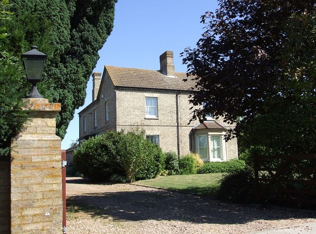
Chalgrave is home to a small population, with the 2011 census reporting around 700 residents. The village itself is characterized by a collection of traditional cottages and houses, giving it a charming and picturesque appearance. The parish also encompasses the hamlets of Tebworth and Wingfield, further adding to its rural character.

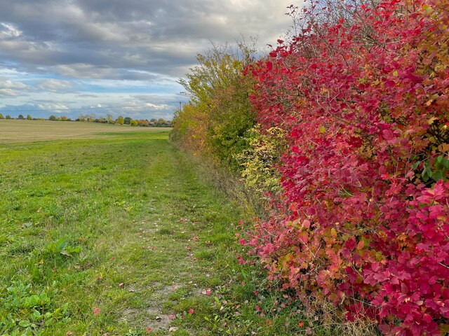
The parish is surrounded by beautiful countryside, with rolling hills and fields, making it an ideal location for those seeking a peaceful and idyllic setting. There are several footpaths and bridleways in the area, allowing residents and visitors to explore the natural beauty of Chalgrave and its surroundings.

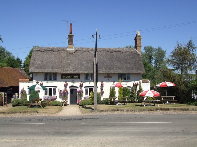
In terms of amenities, Chalgrave has a primary school, St. Mary's Church, and a village hall, which serves as a community hub for various events and activities. The parish is also well-connected, with good road links to nearby towns and cities, including Luton and Milton Keynes.

Overall, Chalgrave offers residents a tranquil and rural lifestyle within easy reach of urban amenities. Its charming architecture, natural beauty, and community spirit make it an attractive place to live or visit for those seeking a peaceful rural retreat.

If you have any feedback on the listing, please let us know in the comments section below.

Chalgrave Images

Images are sourced within 2km of 51.92644/-0.545295 or Grid Reference TL0026. Thanks to Geograph Open Source API. All images are credited.

House building north of Houghton Regis
Pylons by the North Dunstable Bypass
Trees on the Ickniekd Way
Dunstable Rugby Club
Curious sheep on the footpath
Autumnal hedge on the Chiltern Way
Trinity Hall Farmhouse Large black gates bar the way to the main part of the working farm at Trinity Hall, but the farmhouse can be seen here. It is up its own short drive off the busy A5 Watling Street.
Trinity Hall Farmhouse
Large black gates bar the way to the main part of the working farm at Trinity Hall, but the farmhouse can be seen here. It is up its own short drive off the busy A5 Watling Street.
Approaching Tebworth Tebworth village starts at the white gate on the left of the photo. The footpath marked here seems to circumscribe the southern boundary of the village.
Approaching Tebworth
Tebworth village starts at the white gate on the left of the photo. The footpath marked here seems to circumscribe the southern boundary of the village.
Chalgrave Memorial Hall, Tebworth I'm not sure why this village hall is named after Chalgrave when it is situated in the village of Tebworth on the lane to Wingfield !
It looks to be quite a new construction, so perhaps it replaced an earlier hall near to Chalgrave itself (see <a href="https://www.geograph.org.uk/photo/116127">TL0027 : All Saints, Chalgrave : Chequered Stonework</a>)
[Edit - extra information from "sarah"] There never was a Chalgrave village proper; it's the parish name. The settlement/church known as Chalgrave was Saxon East Coton, and became known as Chalgrave for the Manor adjacent to it (which eventually gave its name to the parish). The Memorial Hall is probably named for the Parish, not the village. There'll shortly be a Chalgrave Heritage Trail and set of information boards that (I hope) will explain this and more.
Chalgrave Memorial Hall, Tebworth
I'm not sure why this village hall is named after Chalgrave when it is situated in the village of Tebworth on the lane to Wingfield ! It looks to be quite a new construction, so perhaps it replaced an earlier hall near to Chalgrave itself (see TL0027 : All Saints, Chalgrave : Chequered Stonework) [Edit - extra information from "sarah"] There never was a Chalgrave village proper; it's the parish name. The settlement/church known as Chalgrave was Saxon East Coton, and became known as Chalgrave for the Manor adjacent to it (which eventually gave its name to the parish). The Memorial Hall is probably named for the Parish, not the village. There'll shortly be a Chalgrave Heritage Trail and set of information boards that (I hope) will explain this and more.
Footpath to the north of Tebworth One of the multitude of footpaths that criss-cross to the north of this village. There is a little footbridge to cross before the stile, as there is a ditch which runs alongside the hedgerow here, which may well become a stream in wet weather.
Footpath to the north of Tebworth
One of the multitude of footpaths that criss-cross to the north of this village. There is a little footbridge to cross before the stile, as there is a ditch which runs alongside the hedgerow here, which may well become a stream in wet weather.
Sunny shorn sheep I reckon that these sheep are very pleased to have been shorn of their woolly coats as the temperature when I took this photo was in the mid nineties ºF ( = mid thirties ºC) - absolutely baking. The strands to be seen at the top of the picture are the cables of the National Grid electricity line which crosses the land just south of this point.
Sunny shorn sheep
I reckon that these sheep are very pleased to have been shorn of their woolly coats as the temperature when I took this photo was in the mid nineties ºF ( = mid thirties ºC) - absolutely baking. The strands to be seen at the top of the picture are the cables of the National Grid electricity line which crosses the land just south of this point.
Stream north of Tebworth This little stream crosses beneath the Toddington Road north of Tebworth. It may well usually be more substantial than this trickle because the weather recently has been exceptionally dry. It is a little difficult to follow its course on the map, but I think that it eventually joins up with Clipstone Brook to the west.
Stream north of Tebworth
This little stream crosses beneath the Toddington Road north of Tebworth. It may well usually be more substantial than this trickle because the weather recently has been exceptionally dry. It is a little difficult to follow its course on the map, but I think that it eventually joins up with Clipstone Brook to the west.
Boundary hedge north of Tebworth This hedge and the two trees pictured mark the route of a stream (see <a href="https://www.geograph.org.uk/photo/204810">SP9927 : Stream north of Tebworth</a>) which flows between two fields. On the far side of the hedge is a footpath which hugs the stream's course too.
Boundary hedge north of Tebworth
This hedge and the two trees pictured mark the route of a stream (see SP9927 : Stream north of Tebworth) which flows between two fields. On the far side of the hedge is a footpath which hugs the stream's course too.
Tebworth Village House Several lanes come together in Tebworth and in the centre of the village a little island is formed by small lanes. This house is on the edge of one of the lanes forming the island. The brickwork colour and style reminds me of Victorian railway architecture, but I can see no sign of any abandoned railway line - perhaps they used a railway architect !
Tebworth Village House
Several lanes come together in Tebworth and in the centre of the village a little island is formed by small lanes. This house is on the edge of one of the lanes forming the island. The brickwork colour and style reminds me of Victorian railway architecture, but I can see no sign of any abandoned railway line - perhaps they used a railway architect !
Footpath through fields near the A5 Two footpaths strike off perpendicular to the A5 almost opposite the lane to Tilsworth. They run almost parallel, just a few dozen metres apart, for a good kilometre before joining up for the last few hundred metres into Wingfield. 
This photograph is of a stretch of the more southerly of the two paths.
Footpath through fields near the A5
Two footpaths strike off perpendicular to the A5 almost opposite the lane to Tilsworth. They run almost parallel, just a few dozen metres apart, for a good kilometre before joining up for the last few hundred metres into Wingfield. This photograph is of a stretch of the more southerly of the two paths.
Chalgrave Parish Sign This little sign is at the beginning of the footpath seen in <a href="https://www.geograph.org.uk/photo/325780">SP9925 : Footpath through fields near the A5</a> just as it leaves the A5 Watling Street almost opposite the lane to Tilsworth.
Chalgrave Parish Church, some miles away, can be seen here <a href="https://www.geograph.org.uk/photo/116125">TL0027 : All Saints, Chalgrave</a>.
Chalgrave Parish Sign
This little sign is at the beginning of the footpath seen in SP9925 : Footpath through fields near the A5 just as it leaves the A5 Watling Street almost opposite the lane to Tilsworth. Chalgrave Parish Church, some miles away, can be seen here TL0027 : All Saints, Chalgrave.
Hedgerow beside footpath This view is looking in the opposite direction to <a href="https://www.geograph.org.uk/photo/325780">SP9925 : Footpath through fields near the A5</a> along the hedgerow which borders the footpath (the footpath runs to the right of the hedgerow as seen in this picture). Traffic on the busy A5 (Watling Street) can be seen in the background.
Hedgerow beside footpath
This view is looking in the opposite direction to SP9925 : Footpath through fields near the A5 along the hedgerow which borders the footpath (the footpath runs to the right of the hedgerow as seen in this picture). Traffic on the busy A5 (Watling Street) can be seen in the background.
The Queens Head, Tebworth A Charles Wells village local. Youngs beers now available too but sadly not from Wandsworth.
The Queens Head, Tebworth
A Charles Wells village local. Youngs beers now available too but sadly not from Wandsworth.
Show me another place!

Chalgrave is located at Grid Ref: TL0026 (Lat: 51.92644, Lng: -0.545295)

Unitary Authority: Central Bedfordshire

Police Authority: Bedfordshire

What 3 Words

///ruling.beards.energy. Near Hockliffe, Bedfordshire

Related Wikis

Wingfield, Bedfordshire

Wingfield is a hamlet located in the Central Bedfordshire district of Bedfordshire, England. The settlement is close to Tebworth and Chalgrave, with the...

Chalgrave

Chalgrave is a civil parish in the Central Bedfordshire district of Bedfordshire, England. The hamlets of Tebworth and Wingfield are in the west of the...

Tebworth

Tebworth is a hamlet located in the Central Bedfordshire district of Bedfordshire, England. The settlement is close to Wingfield and Hockliffe, with the...

Church of All Saints, Chalgrave

The Church of All Saints is a Grade I listed church in Chalgrave, Bedfordshire, England. It became a listed building on 3 February 1967. The church, dedicated...

Chalgrave Castle

Chalgrave Castle stood to the south of the large village of Toddington, Bedfordshire. This was a timber motte and bailey castle, constructed in two phases...

Dropshort Marsh

Dropshort Marsh is a 2.7-hectare (6.7-acre) biological Site of Special Scientific Interest in Toddington in Bedfordshire. It was notified under Section...

Thorn, Bedfordshire

Thorn is a hamlet located in the Central Bedfordshire district of Bedfordshire, England. The settlement is located to the north of Bidwell and Houghton...

Fancott

Fancott is a hamlet located in the Central Bedfordshire district of Bedfordshire, England.The settlement forms part of the Toddington civil parish, and...

Nearby Amenities

Located within 500m of 51.92644,-0.545295
Wingfield
Place: hamlet
Source: bing
Lat/Long: 51.9258879/-0.547002
Barrier: stile
Source: gps
Lat/Long: 51.9234832/-0.5491331
Barrier: stile
Source: gps
Lat/Long: 51.9241096/-0.5496518
Barrier: stile
Source: gps
Lat/Long: 51.9251893/-0.5505431
Post Box
Brand: Royal Mail
Brand Wikidata: Q638098
Brand Wikipedia: en:Royal Mail
Collection Times: Mo-Fr 16:30; Sa 10:30
Operator: Royal Mail
Operator Wikidata: Q638098
Post Box Type: lamp
Ref: LU7 20
Source: survey
Lat/Long: 51.9255495/-0.5470722
Barrier: stile
Bicycle: no
Foot: designated
Horse: no
Motor Vehicle: no
Lat/Long: 51.9268815/-0.5419621
Barrier: stile
Bicycle: no
Foot: designated
Horse: no
Motor Vehicle: no
Lat/Long: 51.9276917/-0.5406246
Barrier: stile
Foot: designated
Lat/Long: 51.9301949/-0.5477151
Direction: 160
Generator Method: photovoltaic
Generator Output Electricity: yes
Generator Solar Modules: 17
Generator Source: solar
Generator Type: solar_photovoltaic_panel
Location: roof
Power: generator
Lat/Long: 51.9246757/-0.5473906
Direction: 165
Generator Method: photovoltaic
Generator Output Electricity: yes
Generator Solar Modules: 208
Generator Source: solar
Generator Type: solar_photovoltaic_panel
Power: generator
Tilt: 10
Lat/Long: 51.9252396/-0.5483712
The data included in this document is from www.openstreetmap.org. The data is made available under ODbL.

Have you been to Chalgrave?

Leave your review of Chalgrave below (or comments, questions and feedback).