Burton Leonard

Civil Parish in Yorkshire Harrogate

England

Burton Leonard

Robert Beck bridge This bridge is on the north/south track which runs to and from Farnham to Copgrove. According to the OS database there was a benchmark in this location. Today there is a more substantial bridge for the heavier machinery using the lanes, and no benchmark to be found.
Robert Beck bridge Credit: Mel Towler

Burton Leonard is a civil parish located in the Harrogate district of North Yorkshire, in the United Kingdom. It is situated approximately 8 miles west of the town of Ripon and 12 miles north of Harrogate. The village is surrounded by beautiful open countryside, with rolling hills and picturesque landscapes.

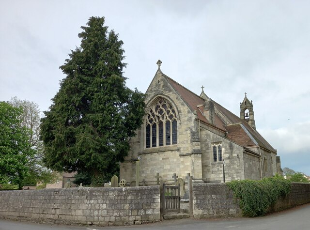
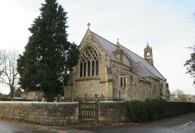
The settlement of Burton Leonard dates back to at least the 12th century and has a rich history. The village is known for its charming traditional architecture, with many buildings constructed from local limestone. The centerpiece of the village is the All Saints' Church, a Grade I listed building that dates back to the 13th century. The church is well-preserved and features intricate stained glass windows and a historic bell tower.

Burton Leonard is a close-knit community with a population of around 700 people. The village has a strong sense of community spirit and hosts various events throughout the year, including a summer fete and a Christmas market. It also has a primary school, a village hall, and a pub, which serves as a social hub for residents and visitors alike.

The surrounding countryside offers numerous opportunities for outdoor activities, including walking, cycling, and horse riding. There are also several nature reserves and wildlife areas nearby, providing a haven for local flora and fauna.

Overall, Burton Leonard is a quintessential Yorkshire village, offering a peaceful and idyllic setting for residents and visitors to enjoy the beauty of the Yorkshire countryside.

If you have any feedback on the listing, please let us know in the comments section below.

Burton Leonard Images

Images are sourced within 2km of 54.071732/-1.49562 or Grid Reference SE3364. Thanks to Geograph Open Source API. All images are credited.
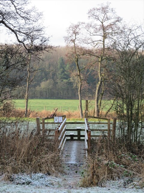
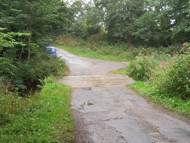
Robert Beck bridge This bridge is on the north/south track which runs to and from Farnham to Copgrove. According to the OS database there was a benchmark in this location. Today there is a more substantial bridge for the heavier machinery using the lanes, and no benchmark to be found.
Robert Beck bridge
This bridge is on the north/south track which runs to and from Farnham to Copgrove. According to the OS database there was a benchmark in this location. Today there is a more substantial bridge for the heavier machinery using the lanes, and no benchmark to be found.
Copgrove, Firlands Farm Firlands Farm is on the south side of the Burton Leonard/Farnham road. On the north facing gable end which is roadside, there is a benchmark cut into the lowest course of stone.
Copgrove, Firlands Farm
Firlands Farm is on the south side of the Burton Leonard/Farnham road. On the north facing gable end which is roadside, there is a benchmark cut into the lowest course of stone.
Copgrove, Firlands Farm A wider angle showing Firlands Farm on the south side of the Burton Leonard/Farnham road. On this north facing gable end, there is a benchmark cut into the lowest course of stone.
Copgrove, Firlands Farm
A wider angle showing Firlands Farm on the south side of the Burton Leonard/Farnham road. On this north facing gable end, there is a benchmark cut into the lowest course of stone.
Burton Leonard, The Toll House The Toll House is on the north side of the Burton Leonard/Copgrove road and is now a private residence. On the second course of stone, on the left corner stone of the house, there is a benchmark.
Burton Leonard, The Toll House
The Toll House is on the north side of the Burton Leonard/Copgrove road and is now a private residence. On the second course of stone, on the left corner stone of the house, there is a benchmark.
Burton Leonard, The Toll House A wider angle showing the Toll House which is on the north side of the Burton Leonard/Copgrove road and is now a private residence. On the second course of stone, on the left corner stone of the house, there is a benchmark. To the right of the wooden gatepost.
Burton Leonard, The Toll House
A wider angle showing the Toll House which is on the north side of the Burton Leonard/Copgrove road and is now a private residence. On the second course of stone, on the left corner stone of the house, there is a benchmark. To the right of the wooden gatepost.
Burton Leonard church The benchmark is cut into the east face of the church.
Burton Leonard church
The benchmark is cut into the east face of the church.
Burton Leonard church There is a benchmark cut into the east face of the church.
Burton Leonard church
There is a benchmark cut into the east face of the church.
Frosty morning, Bishop Monkton Footpath towards the caravan site at Bishop Monkton on a very cold and frosty December day.
Frosty morning, Bishop Monkton
Footpath towards the caravan site at Bishop Monkton on a very cold and frosty December day.
Junction of lanes at Burton Leonard The wider lane to the left is Common Balk Lane and is a dead end for vehicles, whilst to the right is the rather curved Straight Lane which links into the road from Knaresborough to Bishop Monkton.
Junction of lanes at Burton Leonard
The wider lane to the left is Common Balk Lane and is a dead end for vehicles, whilst to the right is the rather curved Straight Lane which links into the road from Knaresborough to Bishop Monkton.
Burton Leonard church, from the NE A Victorian church that doesn't get more than 5 lines of description in the updated Pevsner guide. St Leonard's dates from 1877. This apparently replaced a medieval church, of which nothing remains.
Burton Leonard church, from the NE
A Victorian church that doesn't get more than 5 lines of description in the updated Pevsner guide. St Leonard's dates from 1877. This apparently replaced a medieval church, of which nothing remains.
New bridge over the beck I photographed this beck crossing in 2009, but the bridge is not the same one. The gabion and handrail on this side have both gone, and the current bridge is longer with more rails and stanchions. The bridge doesn't appear to line up exactly with the path as shown on the OS map.
New bridge over the beck
I photographed this beck crossing in 2009, but the bridge is not the same one. The gabion and handrail on this side have both gone, and the current bridge is longer with more rails and stanchions. The bridge doesn't appear to line up exactly with the path as shown on the OS map.
A stream revisited I took a photo here in the autumn of 2009 and commented about springs, but after checking out the first edition 6" map of the area, it looks as though I was mistaken. There are a lot of 'humps and bumps' in this area, as well as odd bits of masonry [as in the foreground of this photo], and it appears that this is the site of a former water mill - 'Burton Mill' which is described as a corn mill. The mill has long gone, and the mill race has been reduced to little more than a meandering ditch, but this must be part of it.
A stream revisited
I took a photo here in the autumn of 2009 and commented about springs, but after checking out the first edition 6" map of the area, it looks as though I was mistaken. There are a lot of 'humps and bumps' in this area, as well as odd bits of masonry [as in the foreground of this photo], and it appears that this is the site of a former water mill - 'Burton Mill' which is described as a corn mill. The mill has long gone, and the mill race has been reduced to little more than a meandering ditch, but this must be part of it.
Mill Lane A grassy track which is now a public footpath leading down to the former site of Burton Mill, of which nothing remains apart from a few earthworks. The name would suggest that this was the site of the corn mill for Burton Leonard village which is a mile or more to the west, and which stands on higher ground away from suitable becks. A mill in this area would also be within the parish, whereas one to the south of the village would be on a boundary with Brearton parish.
Mill Lane
A grassy track which is now a public footpath leading down to the former site of Burton Mill, of which nothing remains apart from a few earthworks. The name would suggest that this was the site of the corn mill for Burton Leonard village which is a mile or more to the west, and which stands on higher ground away from suitable becks. A mill in this area would also be within the parish, whereas one to the south of the village would be on a boundary with Brearton parish.
Burton Leonard Ford This is a second visit to this lovely ford. A link to our previous visit can be viewed at:
<a title="https://www.geograph.org.uk/photo/4341764" href="https://www.geograph.org.uk/photo/4341764">Link</a>
Burton Leonard Ford
This is a second visit to this lovely ford. A link to our previous visit can be viewed at: Link
Well House Farm Ford This ford is found beside Well House at Copgrove.
Well House Farm Ford
This ford is found beside Well House at Copgrove.
St. Mongah's Lane seen from Wath Lane, Copgrove A close-up of the post box can be seen in <a href="https://www.geograph.org.uk/photo/7447173">SE3463 : Post box, St. Mongah's Lane, Copgrove</a>.
St. Mongah's Lane seen from Wath Lane, Copgrove
A close-up of the post box can be seen in SE3463 : Post box, St. Mongah's Lane, Copgrove.
Post box, St. Mongah's Lane, Copgrove This post box can be seen in context in <a href="https://www.geograph.org.uk/photo/7447161">SE3463 : St. Mongah's Lane seen from Wath Lane, Copgrove</a>.
Post box, St. Mongah's Lane, Copgrove
This post box can be seen in context in SE3463 : St. Mongah's Lane seen from Wath Lane, Copgrove.
St. Michael and All Angels Church, Copgrove
Show me another place!

Burton Leonard is located at Grid Ref: SE3364 (Lat: 54.071732, Lng: -1.49562)

Division: West Riding

Administrative County: North Yorkshire

District: Harrogate

Police Authority: North Yorkshire

What 3 Words

///transit.spellings.outlooks. Near Boroughbridge, North Yorkshire

Nearby Locations

Burton Leonard

Related Wikis

Burton Leonard

Burton Leonard is a village and civil parish in the Harrogate district of North Yorkshire, England, and approximately 7 miles (11 km) south from Ripon...

Bishop Monkton

Bishop Monkton is a village and civil parish in the Harrogate district of North Yorkshire, England, about five miles south of Ripon. According to the...

South Stainley

South Stainley is a small village in the Harrogate District, in the county of North Yorkshire, England. Nearby settlements include the city of Ripon, the...

Bishop Monkton Ings

Bishop Monkton Ings is a Site of Special Scientific Interest, or SSSI, situated east of Bishop Monkton village in North Yorkshire, England. It consists...

Nearby Amenities

Located within 500m of 54.071732,-1.49562
Shelter
Lat/Long: 54.0691023/-1.5013637
Post Box
Post Box Type: pillar
Lat/Long: 54.0692542/-1.501102
Power: pole
Lat/Long: 54.0702888/-1.4910518
Power: pole
Lat/Long: 54.070933/-1.4958568
Line Management: branch
Power: pole
Lat/Long: 54.070995/-1.4972317
Line Management: termination
Location Transition: yes
Power: pole
Lat/Long: 54.0712203/-1.4998645
Power: pole
Lat/Long: 54.071421/-1.5030432
Power: pole
Lat/Long: 54.0713151/-1.5014698
Line Management: branch
Power: pole
Lat/Long: 54.0701167/-1.4897864
Power: pole
Lat/Long: 54.0706905/-1.4891933
Power: pole
Lat/Long: 54.0704505/-1.4922749
Power: pole
Lat/Long: 54.0706172/-1.493512
Power: pole
Lat/Long: 54.0707724/-1.4946651
Power: pole
Lat/Long: 54.0710166/-1.4977787
Power: pole
Lat/Long: 54.0712532/-1.4886454
Power: pole
Lat/Long: 54.0717749/-1.4880954
Power: pole
Lat/Long: 54.0710304/-1.4972492
Power: pole
Lat/Long: 54.0717729/-1.4975317
Line Management: termination
Power: pole
Transformer: distribution
Lat/Long: 54.0725099/-1.4977865
Post Office
Burton Leonard Village Store
Addr City: Harrogate
Addr Housenumber: 1
Addr Postcode: HG3 3SJ
Addr Street: Copgrove Road
Addr Suburb: Burton Leonard
Shop: convenience
Lat/Long: 54.0692737/-1.5009867
The data included in this document is from www.openstreetmap.org. The data is made available under ODbL.

Have you been to Burton Leonard?

Leave your review of Burton Leonard below (or comments, questions and feedback).