Budbrooke

Civil Parish in Warwickshire Warwick

England

Budbrooke

Houses on Birmingham Road, Warwick
Houses on Birmingham Road, Warwick Credit: David Howard

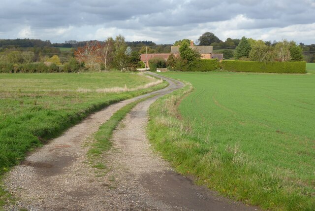
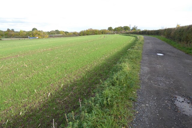
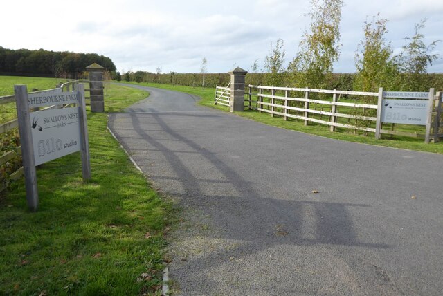
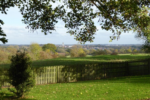
Budbrooke is a civil parish located in the county of Warwickshire, England. It is situated approximately two miles west of the town of Warwick and covers an area of around 1,250 acres. The parish is predominantly rural, with a mix of farmland, open fields, and woodland.

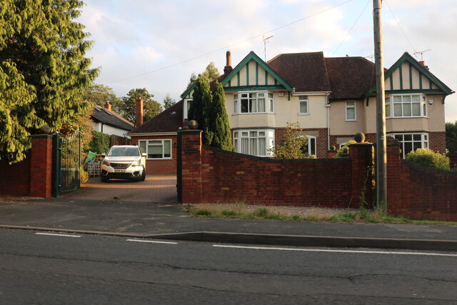
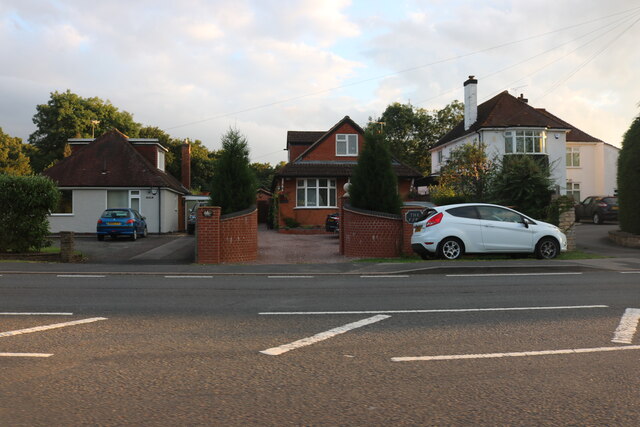
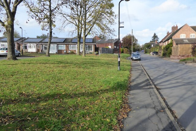
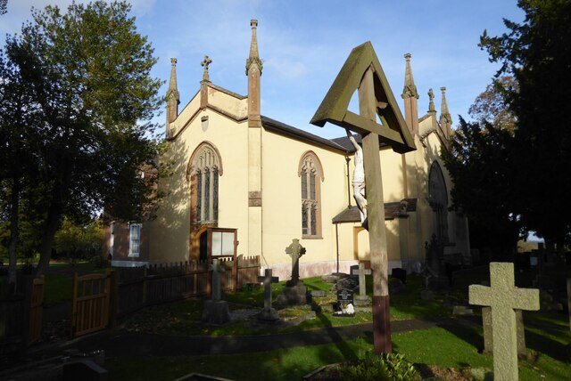
The village of Budbrooke itself is small and quaint, with a population of around 800 people. It is characterized by its traditional English charm, featuring a number of historic buildings, including a 12th-century church, St. Michael's, which is a Grade I listed building. The village also has a primary school, a community center, and a local pub.

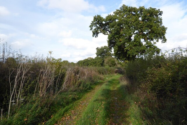
Budbrooke is surrounded by beautiful countryside, making it an ideal location for outdoor enthusiasts. The area offers several walking and cycling routes, allowing visitors to explore the scenic landscapes and enjoy the peaceful surroundings. The nearby Warwick Racecourse is a popular attraction for horse racing enthusiasts, hosting regular events throughout the year.

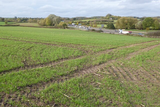
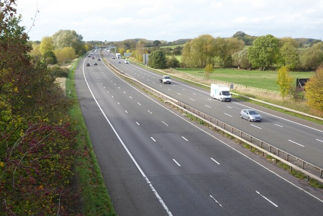
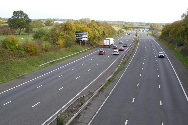
The civil parish is well-connected, with easy access to major road networks, including the M40 motorway, which provides links to Birmingham and London. The nearby town of Warwick offers a range of amenities, including shops, restaurants, and leisure facilities. Additionally, the city of Coventry is just a short drive away, providing further opportunities for shopping, entertainment, and cultural activities.

Overall, Budbrooke is a charming and picturesque civil parish, offering a tranquil retreat for residents and visitors alike, while still providing convenient access to nearby towns and cities.

If you have any feedback on the listing, please let us know in the comments section below.

Budbrooke Images

Images are sourced within 2km of 52.280488/-1.632912 or Grid Reference SP2564. Thanks to Geograph Open Source API. All images are credited.

Houses on Birmingham Road, Warwick
Shell petrol forecourt on Birmingham Road, Hatton
Hatton locks - looking down the flight Looking down part of the flight of Hatton locks with the tower of St Mary's, Warwick directly ahead. See <a href="https://www.geograph.org.uk/photo/7006505">SP2466 : Hatton locks - looking up the flight</a> for the view up the flight.
Hatton locks - looking down the flight
Looking down part of the flight of Hatton locks with the tower of St Mary's, Warwick directly ahead. See SP2466 : Hatton locks - looking up the flight for the view up the flight.
Hatton locks - Middle Lock and side channel This photo was taken from under the 'Middle Lock Lane' bridge over the Grand Union Canal at Hatton, so presumably the lock seen on the left here is the middle (11th) of the flight of 21. To the lock's right, and nearer the camera, is the weir-like side channel. Water rushes over this man-made waterfall when excess water enters the pound above it, but the flow generally lasts only a few moments - a minute or two at most.
See shared descriptions below.
Hatton locks - Middle Lock and side channel
This photo was taken from under the 'Middle Lock Lane' bridge over the Grand Union Canal at Hatton, so presumably the lock seen on the left here is the middle (11th) of the flight of 21. To the lock's right, and nearer the camera, is the weir-like side channel. Water rushes over this man-made waterfall when excess water enters the pound above it, but the flow generally lasts only a few moments - a minute or two at most. See shared descriptions below.
Hatton Locks The flight consists of 21 locks.  They were built in 1799 as part of the Warwick & Birmingham canal which became part of the Grand Union in 1927.

The flight has a total rise of 148 feet (45m) over a length of a little under 2 miles (3.2km) and is notable for its weir-like side channels.  Large pounds associated with each lock ensure a good supply of water.

The locks are all double width (14 feet / 4.3m) allowing two standard narrowboats to pass through side by side, or they can accommodate double-width barges and industrial boats.
Hatton Locks
The flight consists of 21 locks. They were built in 1799 as part of the Warwick & Birmingham canal which became part of the Grand Union in 1927. The flight has a total rise of 148 feet (45m) over a length of a little under 2 miles (3.2km) and is notable for its weir-like side channels. Large pounds associated with each lock ensure a good supply of water. The locks are all double width (14 feet / 4.3m) allowing two standard narrowboats to pass through side by side, or they can accommodate double-width barges and industrial boats.
Track in Hatton Country World The fields are in winter dormancy.
Track in Hatton Country World
The fields are in winter dormancy.
Warwick Parkway station
Track to Hooknell This appears very rural however just beyond this house is the M40 motorway.
Track to Hooknell
This appears very rural however just beyond this house is the M40 motorway.
Shakespeare's Avon Way The Shakespeare's Avon Way long distance path follows this track.  The M40 motorway can be seen beyond the field.
Shakespeare's Avon Way
The Shakespeare's Avon Way long distance path follows this track. The M40 motorway can be seen beyond the field.
The M40 motorway near Warwick View across a field of winter cereals to the M40 motorway near Warwick.
The M40 motorway near Warwick
View across a field of winter cereals to the M40 motorway near Warwick.
Entrance to Sherbourne Farm
The M40 motorway The M40 motorway viewed from a motorway bridge carrying the B4463.
The M40 motorway
The M40 motorway viewed from a motorway bridge carrying the B4463.
The M40 approaching Junction 15 The M40 approaching Junction 15, viewed from the bridge carrying the B4463.
The M40 approaching Junction 15
The M40 approaching Junction 15, viewed from the bridge carrying the B4463.
Route with Public Access A Route with Public Access follows this track near Hampton Lodge, south of Hampton on the Hill.
Route with Public Access
A Route with Public Access follows this track near Hampton Lodge, south of Hampton on the Hill.
Old School Lane Bungalows and houses off Old School Lane in Hampton on the Hill.
Old School Lane
Bungalows and houses off Old School Lane in Hampton on the Hill.
Roman Catholic Church of St Charles Borromeo Roman Catholic Church of St Charles Borromeo in the village of Hampton on the Hill.
Roman Catholic Church of St Charles Borromeo
Roman Catholic Church of St Charles Borromeo in the village of Hampton on the Hill.
View to the town of Warwick View to the town of Warwick from the churchyard of the Roman Catholic church of St Charles Borromeo.
View to the town of Warwick
View to the town of Warwick from the churchyard of the Roman Catholic church of St Charles Borromeo.
Show me another place!

Budbrooke is located at Grid Ref: SP2564 (Lat: 52.280488, Lng: -1.632912)

Administrative County: Warwickshire

District: Warwick

Police Authority: Warwickshire

What 3 Words

///differ.reclaimed.mock. Near Hatton, Warwickshire

Related Wikis

Budbrooke

Budbrooke is a village and civil parish in the Warwick district of Warwickshire, England. It is 3 miles west of Warwick and according to the 2001 census...

Budbrooke Barracks

Budbrooke Barracks was a military installation near Budbrooke in Warwickshire, England. == History == The barracks were built on agricultural land in 1877...

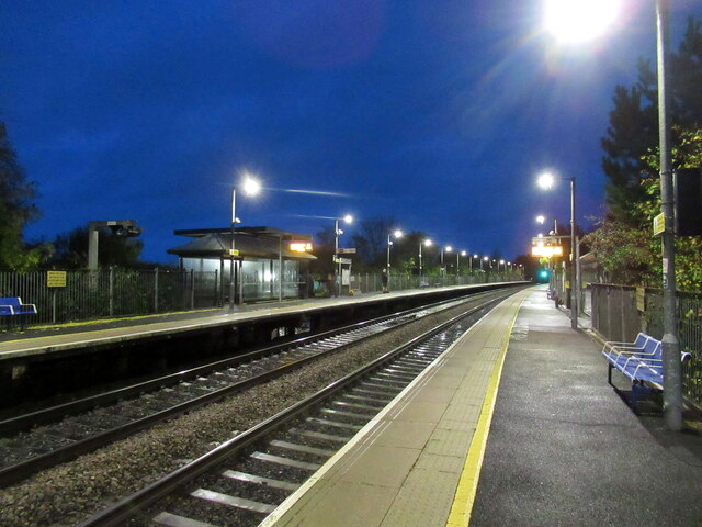
Warwick Parkway railway station

Warwick Parkway is a railway station with park and ride facilities on the western outskirts of Warwick in Warwickshire, England. It also serves the village...

M40 minibus crash

On 18 November 1993, just after midnight, a minibus was involved in a fatal collision with a maintenance vehicle on the M40 motorway near Warwick, England...
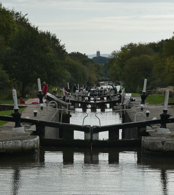
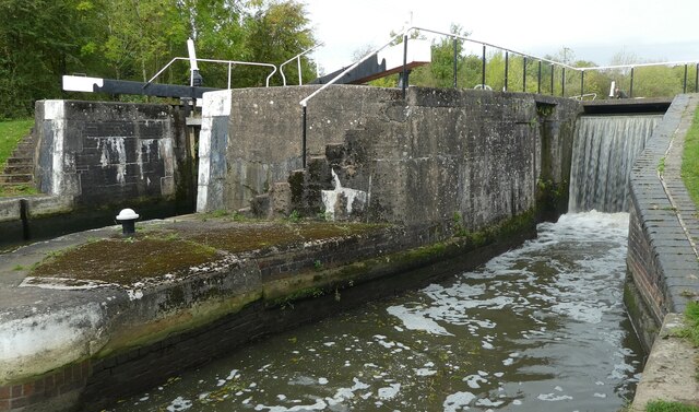
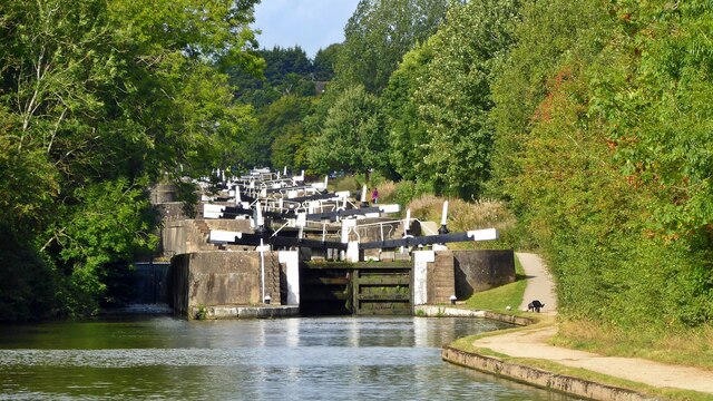
Hatton Locks

The Hatton Locks or Hatton Flight are a flight of 21 locks on the Grand Union Canal in Hatton, Warwickshire, England. The flight spans less than 2 miles...

Racing Club Warwick F.C.

Racing Club Warwick Football Club is a football club based in Warwick, Warwickshire, and competes in the United Counties League Premier Division South...

Warwick Racecourse

Warwick Racecourse is a horse racing course in Warwick, England. It is a National Hunt racing course and has a programme of 25 meetings throughout the...

Saltisford Canal Arm

The Saltisford Canal Arm is a short stretch of canal located in the town of Warwick, Warwickshire, England. Opened in the 1790s, originally it wasn't an...

Nearby Amenities

Located within 500m of 52.280488,-1.632912
Give Way
Direction: backward
Lat/Long: 52.2775048/-1.631806
Bus: yes
Public Transport: stop_position
Lat/Long: 52.2765399/-1.6320057
Bus Stop
Cherry Lane
Bench: no
Bin: no
Bus: yes
Covered: no
Lit: yes
Naptan AtcoCode: 4200F229501
Naptan Bearing: E
Naptan CommonName: Cherry Lane
Naptan Crossing: Cherry Lane
Naptan Indicator: Adj
Naptan NaptanCode: wardgmga
Naptan PlusbusZoneRef: LMNGTNS
Naptan Street: Damson Road
Passenger Information Display: no
Public Transport: platform
Shelter: no
Source: naptan_import
Tactile Paving: no
Lat/Long: 52.2808616/-1.6260804
Bus Stop
Cherry Lane
Bench: no
Bin: no
Bus: yes
Covered: no
Lit: yes
Naptan AtcoCode: 4200F229502
Naptan Bearing: W
Naptan BusStopType: CUS
Naptan CommonName: Cherry Lane
Naptan Crossing: Cherry Lane
Naptan Indicator: Adj
Naptan NaptanCode: wardgmgd
Naptan PlusbusZoneRef: LMNGTNS
Naptan Street: Damson Road
Naptan Verified: no
Passenger Information Display: no
Public Transport: platform
Shelter: no
Source: naptan_import
Tactile Paving: no
Lat/Long: 52.280786/-1.6260982
Bus Stop
Telephone Box
Bus: yes
Covered: no
Naptan AtcoCode: 4200F229601
Naptan Bearing: S
Naptan CommonName: Telephone Box
Naptan Indicator: Nr
Naptan Landmark: Telephone Box
Naptan NaptanCode: wardgmgj
Naptan Street: Woodway
Naptan Verified: no
Passenger Information Display: no
Public Transport: platform
Source: naptan_import
Lat/Long: 52.2777267/-1.6316885
Bus Stop
Village Hall
Bus: yes
Covered: no
Naptan AtcoCode: 4200F229701
Naptan Bearing: N
Naptan BusStopType: CUS
Naptan CommonName: Village Hall
Naptan Indicator: Opp
Naptan NaptanCode: wardgmgm
Naptan Street: Woodway
Passenger Information Display: no
Public Transport: platform
Source: naptan_import
Lat/Long: 52.2765337/-1.6320471
Traffic Calming: choker
Lat/Long: 52.2776389/-1.631792
Traffic Calming: choker
Lat/Long: 52.2764546/-1.6319664
Leisure: playground
Source: Bing;survey
Lat/Long: 52.279807/-1.6285167
Barrier: stile
Material: wood
Stile: stepover
Lat/Long: 52.2821175/-1.6261725
Booth: K6
Covered: booth
Disused Amenity: telephone
Note: phone has been removed 13/04/19
Operator: BT
Source: drive-by survey
Lat/Long: 52.2775756/-1.6316972
Barrier: kissing_gate
Lat/Long: 52.2775693/-1.6316677
Generator Method: photovoltaic
Generator Output Electricity: yes
Generator Source: solar
Generator Type: solar_photovoltaic_panel
Location: roof
Power: generator
Lat/Long: 52.2785812/-1.6321272
Generator Method: photovoltaic
Generator Output Electricity: yes
Generator Source: solar
Generator Type: solar_photovoltaic_panel
Location: roof
Power: generator
Lat/Long: 52.2781544/-1.6322124
Generator Method: photovoltaic
Generator Output Electricity: yes
Generator Source: solar
Generator Type: solar_photovoltaic_panel
Location: roof
Power: generator
Lat/Long: 52.2773396/-1.6314481
Generator Method: photovoltaic
Generator Output Electricity: yes
Generator Source: solar
Generator Type: solar_photovoltaic_panel
Location: roof
Power: generator
Lat/Long: 52.2790912/-1.6281921
Generator Method: photovoltaic
Generator Output Electricity: yes
Generator Source: solar
Generator Type: solar_photovoltaic_panel
Location: roof
Power: generator
Lat/Long: 52.2789282/-1.6300251
Generator Method: photovoltaic
Generator Output Electricity: yes
Generator Source: solar
Generator Type: solar_photovoltaic_panel
Location: roof
Power: generator
Lat/Long: 52.2785926/-1.6322256
Generator Method: photovoltaic
Generator Output Electricity: yes
Generator Source: solar
Generator Type: solar_photovoltaic_panel
Location: roof
Power: generator
Lat/Long: 52.27763/-1.6314528
Generator Method: photovoltaic
Generator Output Electricity: yes
Generator Source: solar
Generator Type: solar_photovoltaic_panel
Location: roof
Power: generator
Lat/Long: 52.2774757/-1.6314353
Generator Method: photovoltaic
Generator Output Electricity: yes
Generator Source: solar
Generator Type: solar_photovoltaic_panel
Location: roof
Power: generator
Lat/Long: 52.2774764/-1.6314902
Generator Method: photovoltaic
Generator Output Electricity: yes
Generator Source: solar
Generator Type: solar_photovoltaic_panel
Location: roof
Power: generator
Lat/Long: 52.27694/-1.6333835
Generator Method: photovoltaic
Generator Output Electricity: yes
Generator Source: solar
Generator Type: solar_photovoltaic_panel
Location: roof
Power: generator
Lat/Long: 52.2770157/-1.6331676
Generator Method: photovoltaic
Generator Output Electricity: yes
Generator Source: solar
Generator Type: solar_photovoltaic_panel
Location: roof
Power: generator
Lat/Long: 52.2767267/-1.6325925
Cherry Lane
Bus: yes
Public Transport: stop_position
Lat/Long: 52.280823/-1.6260955
Bus: yes
Public Transport: stop_position
Lat/Long: 52.2777281/-1.631794
Give Way
Direction: forward
Lat/Long: 52.2808363/-1.6265846
Give Way
Direction: forward
Lat/Long: 52.2807849/-1.6256119
Give Way
Direction: backward
Lat/Long: 52.2811133/-1.6273318
Brand: National Grid
Brand Wikidata: Q1465461
Frequency: 50
Location Transition: yes
Material: wood
Operator: National Grid Electricity Distribution
Operator Old: Western Power Distribution
Operator Wikidata: Q7988183
Owner: National Grid Electricity Distribution (East Midlands) Plc
Owner Wikidata: Q114348127
Power: pole
Ref: 931730
Source: wpd_opendata
Transformer: distribution
Lat/Long: 52.2779064/-1.6357613
Brand: National Grid
Brand Wikidata: Q1465461
Material: wood
Operator: National Grid Electricity Distribution
Operator Old: Western Power Distribution
Operator Wikidata: Q7988183
Owner: National Grid Electricity Distribution (East Midlands) Plc
Owner Wikidata: Q114348127
Power: pole
Source: bing
Lat/Long: 52.2770678/-1.6362092
Barrier: kissing_gate
Lat/Long: 52.2805763/-1.6316823
The data included in this document is from www.openstreetmap.org. The data is made available under ODbL.

Have you been to Budbrooke?

Leave your review of Budbrooke below (or comments, questions and feedback).