Bude-Stratton

Civil Parish in Cornwall

England

Bude-Stratton

Rocks near the Wrangles
Rocks near the Wrangles Credit: Simon Huguet

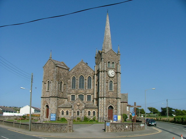
Bude-Stratton is a civil parish located in the county of Cornwall, England. It is situated on the north coast of Cornwall, near the border with Devon. The parish encompasses the town of Bude, which is a popular seaside resort known for its sandy beaches and stunning coastline.

Bude-Stratton covers an area of approximately 46 square kilometers and has a population of around 9,000 people. The town of Bude itself is the largest settlement in the parish, offering a range of amenities and services for both residents and visitors. It has a vibrant town center with a variety of shops, restaurants, and cafes, as well as several accommodation options.

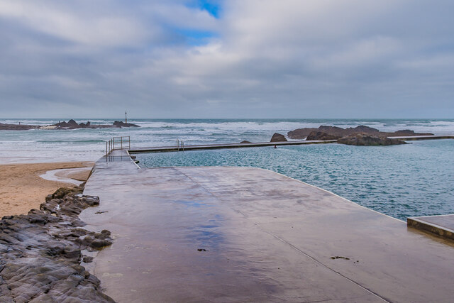
The parish is known for its natural beauty, with breathtaking landscapes and a diverse range of wildlife. The coastline is particularly renowned, with iconic landmarks such as the Bude Sea Pool and the Bude Canal. The area attracts many tourists who come to enjoy the coastal walks, water sports, and picturesque views.

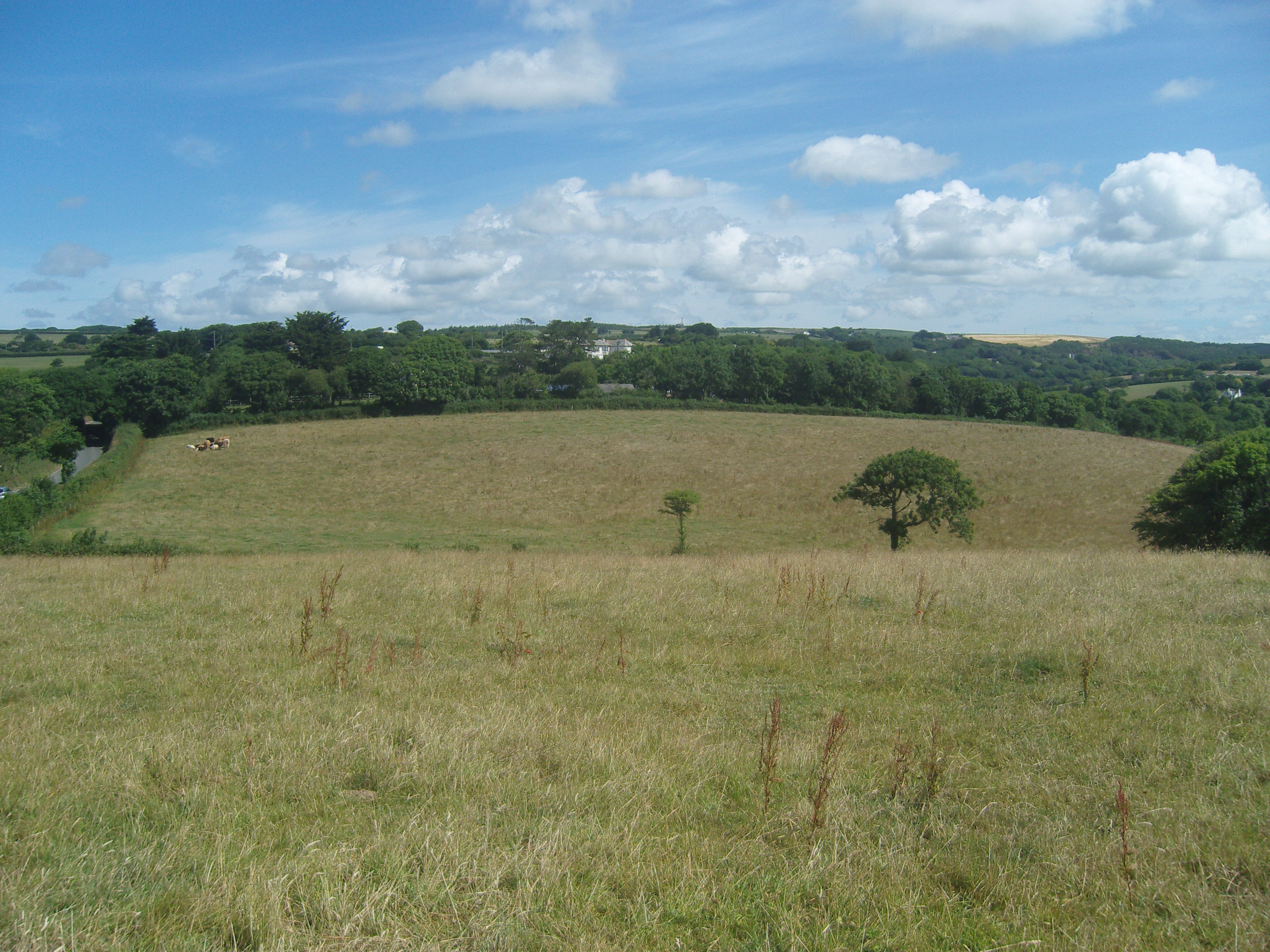
Aside from tourism, Bude-Stratton has a thriving agricultural sector, with several farms and agricultural businesses operating in the area. The parish also has a strong sense of community, with various local events and activities organized throughout the year.

Overall, Bude-Stratton, Cornwall is a picturesque civil parish with a rich natural and cultural heritage. It offers a combination of stunning coastal scenery, a bustling town center, and a strong community spirit, making it an appealing destination for both residents and visitors alike.

If you have any feedback on the listing, please let us know in the comments section below.

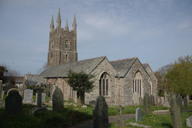
Bude-Stratton Images

Images are sourced within 2km of 50.832029/-4.53079 or Grid Reference SS2106. Thanks to Geograph Open Source API. All images are credited.

Rocks near the Wrangles
Low Tide Strand Looking south towards the entrance to Bude Haven and the rocks beyond.
Low Tide Strand
Looking south towards the entrance to Bude Haven and the rocks beyond.
Beach and rocks west of Barrel Rock at low tide.
Mussels on Barrel Rock The marker on the eponymous Barrel Rock warns sailors of the presence of these rocks at the entrance to Bude Haven.
Mussels on Barrel Rock
The marker on the eponymous Barrel Rock warns sailors of the presence of these rocks at the entrance to Bude Haven.
Bude Canal on an Early Autumn Morning A steaming Bude Canal just after dawn. Taken from The Crescent car park in September 2021.
Bude Canal on an Early Autumn Morning
A steaming Bude Canal just after dawn. Taken from The Crescent car park in September 2021.
Beach huts A row of beach huts above Crooklets Beach.
Beach huts
A row of beach huts above Crooklets Beach.
Beach huts A row of beach huts above Crooklets Beach.
Beach huts
A row of beach huts above Crooklets Beach.
Bude Haven Looking across Bude Haven, with Bude Sea Pool on the left
Bude Haven
Looking across Bude Haven, with Bude Sea Pool on the left
Bude Haven Looking across Bude Haven, with Bude Sea Pool on the left
Bude Haven
Looking across Bude Haven, with Bude Sea Pool on the left
Foam on the breakwater Foam from breaking waves on the breakwater at the mouth of the River Neet.  On the left is the Whale's Back, an exhumed anticline, part of the Bude Formation of layers of sand and mud deposited 300 million years ago on the floor of the tropical "Lake Bude".
Foam on the breakwater
Foam from breaking waves on the breakwater at the mouth of the River Neet. On the left is the Whale's Back, an exhumed anticline, part of the Bude Formation of layers of sand and mud deposited 300 million years ago on the floor of the tropical "Lake Bude".
Whale's Back Rock on a small beach west of the breakwater at the mouth of the River Neet. It is an exhumed anticline, part of the Bude Formation of layers of sand and mud deposited 300 million years ago on the floor of the tropical "Lake Bude".
Whale's Back
Rock on a small beach west of the breakwater at the mouth of the River Neet. It is an exhumed anticline, part of the Bude Formation of layers of sand and mud deposited 300 million years ago on the floor of the tropical "Lake Bude".
Near Chapel Rock Rocks on the seaward side of The Breakwater, near Chapel Rock.
Near Chapel Rock
Rocks on the seaward side of The Breakwater, near Chapel Rock.
The Breakwater Looking along The Breakwater with Chapel Rock in the background.  It was built in 1839-43, replacing a previous one of 1819 destroyed by storms in 1838.  Grade II listed - see <span class="nowrap"><a title="https://historicengland.org.uk/listing/the-list/list-entry/1279104?section=official-listing" rel="nofollow ugc noopener" href="https://historicengland.org.uk/listing/the-list/list-entry/1279104?section=official-listing">Link</a><img style="margin-left:2px;" alt="External link" title="External link - shift click to open in new window" src="https://s1.geograph.org.uk/img/external.png" width="10" height="10"/></span>.
The Breakwater
Looking along The Breakwater with Chapel Rock in the background. It was built in 1839-43, replacing a previous one of 1819 destroyed by storms in 1838. Grade II listed - see LinkExternal link.
Bude Sea Pool A tidal swimming pool adjacent to Summerleaze Beach, created in 1930.  Public funding was withdrawn in 2010 and it was threatened with demolition, but it was taken over by a charity, the Friends of Bude Sea Pool, who restored and developed it over the following few years.
Bude Sea Pool
A tidal swimming pool adjacent to Summerleaze Beach, created in 1930. Public funding was withdrawn in 2010 and it was threatened with demolition, but it was taken over by a charity, the Friends of Bude Sea Pool, who restored and developed it over the following few years.
Show me another place!

Bude-Stratton is located at Grid Ref: SS2106 (Lat: 50.832029, Lng: -4.53079)

Unitary Authority: Cornwall

Police Authority: Devon & Cornwall

What 3 Words

///corrode.theme.shielding. Near Flexbury, Cornwall

Nearby Locations

Bude-Stratton

Related Wikis

Burn Manor

Burn Manor is a house near Stratton in Cornwall, England, UK, now used as the reception and offices for a Seasons time-share resort. == References ==

Bude Town F.C.

Bude Town Football Club is a football club based in Bude, Cornwall, England. They are currently members of the South West Peninsula League Premier Division...

Budehaven Community School

Budehaven Community School is a coeducational foundation secondary school and sixth form, located in Bude in the English county of Cornwall.Previously...

Bude–Stratton

Bude–Stratton (Cornish: Bud–Strasnedh) is a civil parish in Cornwall, England, United Kingdom. The largest settlement in the parish is the seaside town...

Flexbury

Flexbury is a village about 0.8 miles from Bude, in the civil parish of Bude–Stratton, north Cornwall, England. Described as a hamlet in 1887, residential...
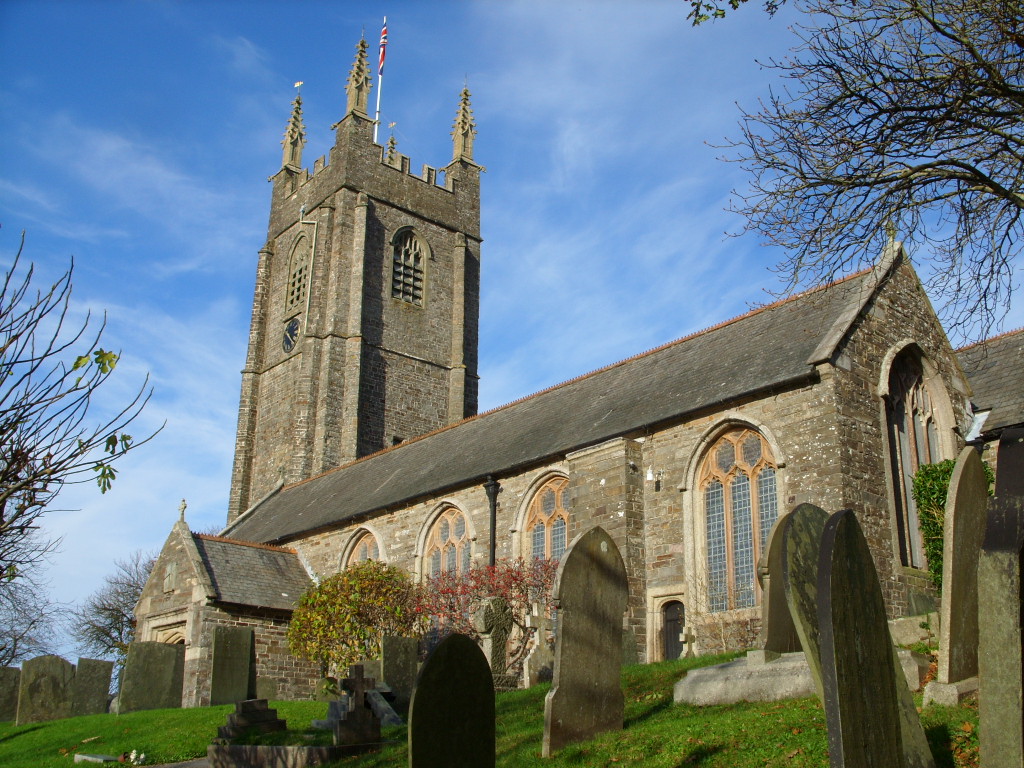
Stratton, Cornwall

Stratton (Cornish: Strasnedh) is a market town and former civil parish, now in the parish of Bude-Stratton, in Cornwall, England, United Kingdom. It is...

Battle of Stratton

The Battle of Stratton, also known as the Battle of Stamford Hill, took place on 16 May 1643, at Stratton in Cornwall, during the First English Civil War...

Poughill

Poughill (pronounced "Pofil" or "Puffil") is a village and former civil parish, now in the parish of Bude-Stratton, in the Cornwall district, in north...

Nearby Amenities

Located within 500m of 50.832029,-4.53079
Bus Stop
Fosters Way
Bench: no
Bin: no
Bus: yes
Lit: yes
Naptan AtcoCode: 0800COA10085
Naptan Bearing: SE
Naptan CommonName: Fosters Way
Naptan Crossing: East Fairholme Road
Naptan NaptanCode: cordpjta
Naptan Street: Fosters Way
Naptan Verified: no
Public Transport: platform
Shelter: no
Source: naptan_import
Tactile Paving: no
Lat/Long: 50.8351923/-4.5334114
Turning Circle
Lat/Long: 50.8296025/-4.5290815
Generator Method: photovoltaic
Generator Output Electricity: yes
Generator Source: solar
Generator Type: solar_photovoltaic_panel
Location: roof
Power: generator
Lat/Long: 50.8284367/-4.5349591
Turning Circle
Lat/Long: 50.8339031/-4.5372333
Generator Method: photovoltaic
Generator Output Electricity: yes
Generator Source: solar
Generator Type: solar_photovoltaic_panel
Location: roof
Power: generator
Lat/Long: 50.8296437/-4.5274025
Generator Method: photovoltaic
Generator Output Electricity: yes
Generator Source: solar
Generator Type: solar_photovoltaic_panel
Location: roof
Power: generator
Lat/Long: 50.8295251/-4.529897
Generator Method: photovoltaic
Generator Output Electricity: yes
Generator Source: solar
Generator Type: solar_photovoltaic_panel
Location: roof
Power: generator
Lat/Long: 50.8295251/-4.5299453
Generator Method: photovoltaic
Generator Output Electricity: yes
Generator Source: solar
Generator Type: solar_photovoltaic_panel
Location: roof
Power: generator
Lat/Long: 50.8280774/-4.5332269
Generator Method: photovoltaic
Generator Output Electricity: yes
Generator Source: solar
Generator Type: solar_photovoltaic_panel
Location: roof
Power: generator
Lat/Long: 50.8288043/-4.5339297
Generator Method: photovoltaic
Generator Output Electricity: yes
Generator Source: solar
Generator Type: solar_photovoltaic_panel
Location: roof
Power: generator
Lat/Long: 50.8287865/-4.5338385
Generator Method: photovoltaic
Generator Output Electricity: yes
Generator Source: solar
Generator Type: solar_photovoltaic_panel
Location: roof
Power: generator
Lat/Long: 50.8284358/-4.531454
Generator Method: photovoltaic
Generator Output Electricity: yes
Generator Source: solar
Generator Type: solar_photovoltaic_panel
Location: roof
Power: generator
Lat/Long: 50.8289635/-4.5280422
Generator Method: photovoltaic
Generator Output Electricity: yes
Generator Source: solar
Generator Type: solar_photovoltaic_panel
Location: roof
Power: generator
Lat/Long: 50.8348665/-4.5361023
Generator Method: photovoltaic
Generator Output Electricity: yes
Generator Source: solar
Generator Type: solar_photovoltaic_panel
Location: roof
Power: generator
Lat/Long: 50.8348877/-4.535661
Generator Method: photovoltaic
Generator Output Electricity: yes
Generator Source: solar
Generator Type: solar_photovoltaic_panel
Location: roof
Power: generator
Lat/Long: 50.8348767/-4.5357174
Generator Method: photovoltaic
Generator Output Electricity: yes
Generator Source: solar
Generator Type: solar_photovoltaic_panel
Location: roof
Power: generator
Lat/Long: 50.834753/-4.5356476
Generator Method: photovoltaic
Generator Output Electricity: yes
Generator Source: solar
Generator Type: solar_photovoltaic_panel
Location: roof
Power: generator
Lat/Long: 50.8347446/-4.5356865
Golf: pin
Lat/Long: 50.8317797/-4.5333398
Golf: pin
Lat/Long: 50.832496/-4.535676
Golf: pin
Lat/Long: 50.832328/-4.5371673
The Venue
Addr Street: Stucley Road
Opening Hours: Mo-Su 10:00-19:00
Tourism: attraction
Website: https://thevenuebude.co.uk
Lat/Long: 50.8279393/-4.5299954
The data included in this document is from www.openstreetmap.org. The data is made available under ODbL.

Have you been to Bude-Stratton?

Leave your review of Bude-Stratton below (or comments, questions and feedback).